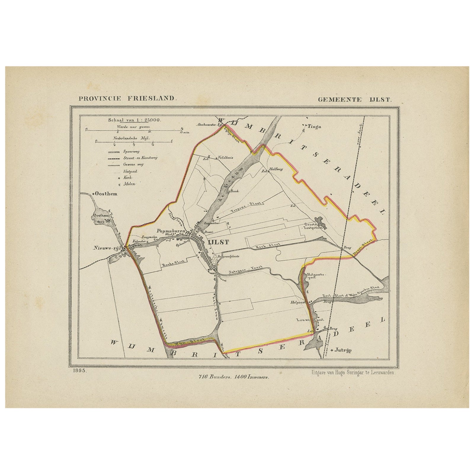
Items Similar to Antique Hand-Colored Map of the Frisian City of IJlst, The Netherlands, 1649


Want more images or videos?
Request additional images or videos from the seller
1 of 5
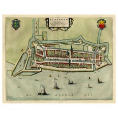
Antique Hand-Colored Map of the Frisian City of IJlst, The Netherlands, 1649
About the Item
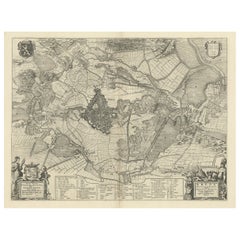
Antique hand-colored map titled 'Ylst'. Original antique map of the city of IJlst, Friesland, the Netherlands.
This map originates from 'Novum Ac Magnum Theatrum Urbium Belgicae Liberae Ac Foederatae' published by J. Blaeu.
Artists and Engravers: Joan Blaeu was a Dutch cartographer born in Alkmaar, the son of cartographer Willem Blaeu. Born circa 1596 and circa 1610 respectively, Joan and Cornelis Blaeu took over their father?s business upon his death in 1638. In the same year Joan Blaeu also assumed his father?s position as the official cartographer to the V.O.C. The Blaeu brothers worked hard to maintain the firm?s position of prominence, but only five years later in 1642, Cornelius Blaeu died, leaving the publishing firm solely in the hands of Joan Blaeu.
Condition: Fair/good, general age-related toning. Small stain in map. Minor wear, Latin text on verso. Originally together on one sheet with Sloten, Workum and Hindeloopen. Please study image carefully.
Date: 1649
We sell original antique maps to collectors, historians, educators and interior decorators all over the world. Our collection includes a wide range of authentic antique maps from the 16th to the 20th centuries. Buying and collecting antique maps is a tradition that goes back hundreds of years. Antique maps have proved a richly rewarding investment over the past decade, thanks to a growing appreciation of their unique historical appeal. Today the decorative qualities of antique maps are widely recognized by interior designers who appreciate their beauty and design flexibility. Depending on the individual map, presentation, and context, a rare or antique map can be modern, traditional, abstract, figurative, serious or whimsical. We offer a wide range of authentic antique maps for any budget.
- Dimensions:Height: 12.21 in (31 cm)Width: 9.65 in (24.5 cm)Depth: 0 in (0.01 mm)
- Materials and Techniques:
- Period:
- Date of Manufacture:1649
- Condition:
- Seller Location:Langweer, NL
- Reference Number:
About the Seller
5.0
Platinum Seller
These expertly vetted sellers are 1stDibs' most experienced sellers and are rated highest by our customers.
Established in 2009
1stDibs seller since 2017
1,932 sales on 1stDibs
Typical response time: <1 hour
- ShippingRetrieving quote...Ships From: Langweer, Netherlands
- Return PolicyA return for this item may be initiated within 14 days of delivery.
More From This SellerView All
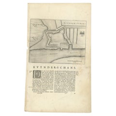
- Antique Map of Kuinderschans, Part of the Frisian Defense Line, Netherlands 1649Located in Langweer, NLAntique Dutch map titled 'Kuynder-Schans'. Old map of the 'Kuinderschans', a rampart to block passage over the Zuiderzeedijk and prevent an attack from the waterside. The buildin...Category
Antique 17th Century Maps
MaterialsPaper
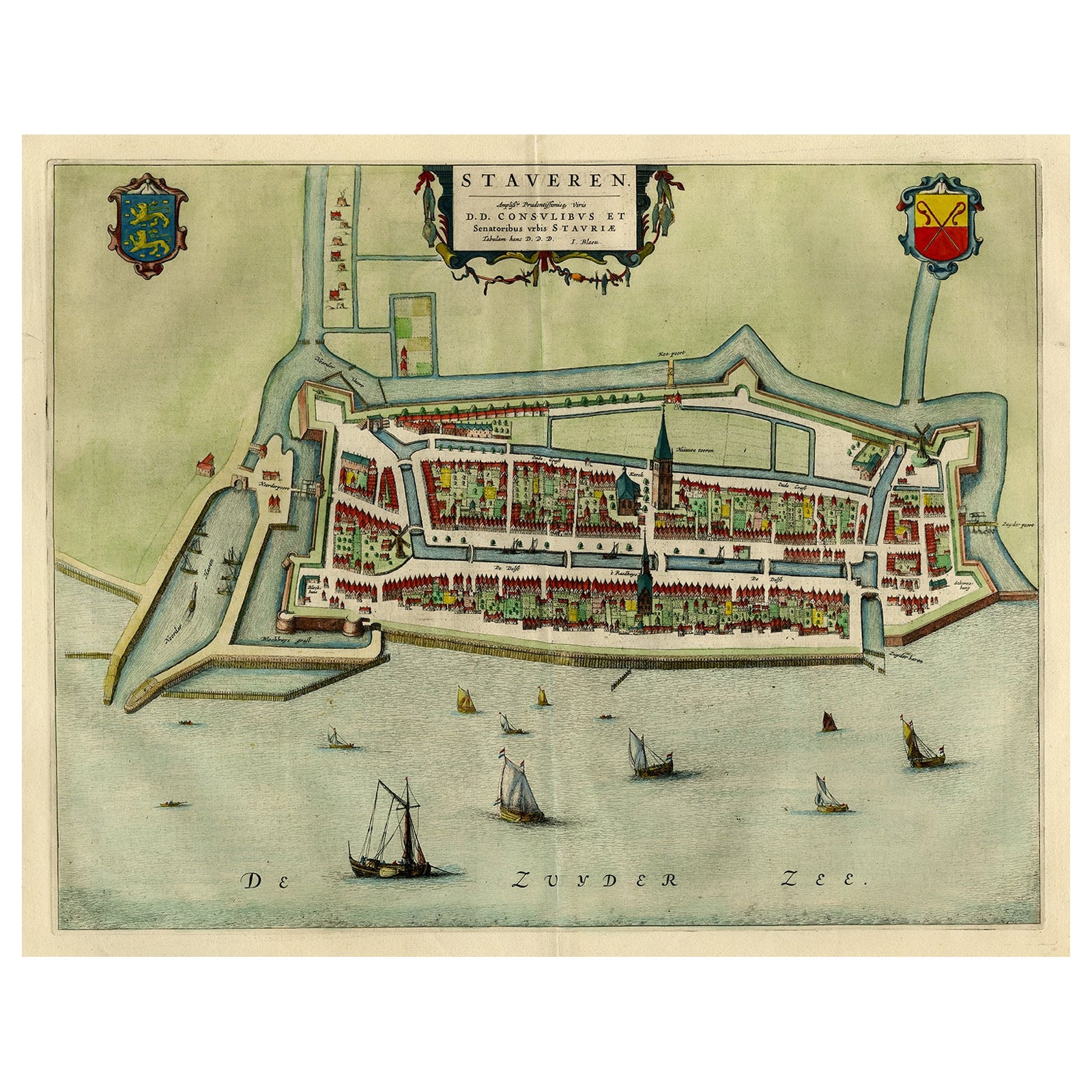
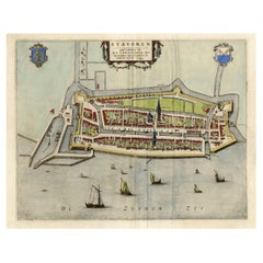
- Original Antique Map of the City of Stavoren, Friesland, The Netherlands, 1649Located in Langweer, NLAntique map titled 'Staveren'. Original antique map of the city of Stavoren, Friesland, The Netherlands. This map originates from 'Toonneel der Steden van de Vereenighde Nederlanden'...Category
Antique 1640s Maps
MaterialsPaper
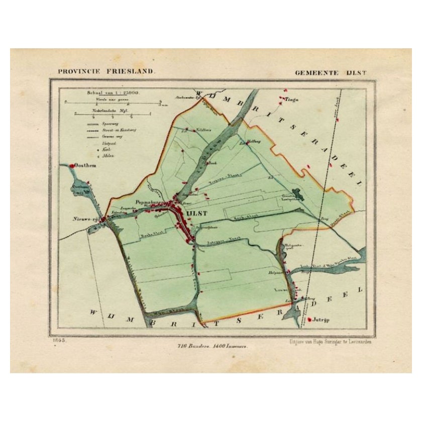
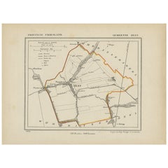
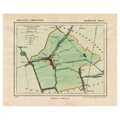
- Antique Map of IJlst, Small Pitoresque City in Friesland, The Netherlands, 1868Located in Langweer, NLAntique map titled 'Provincie Friesland - Gemeente IJlst'. Map of the township of IJlst, Friesland. This map originates from 'Gemeente-Atlas van Nederland' by J. Kuyper. Artists ...Category
Antique 19th Century Maps
MaterialsPaper
- Antique Map of Ijlst , Friesland in the Netherlands, 1865Located in Langweer, NLFriesland: Gemeente IjJlst. These scarse detailed maps of Dutch Towns originate from the 'Gemeente-atlas' of Jacob Kuyper. This atlas of all towns in the Netherlands was published fr...Category
Antique 19th Century Maps
MaterialsPaper
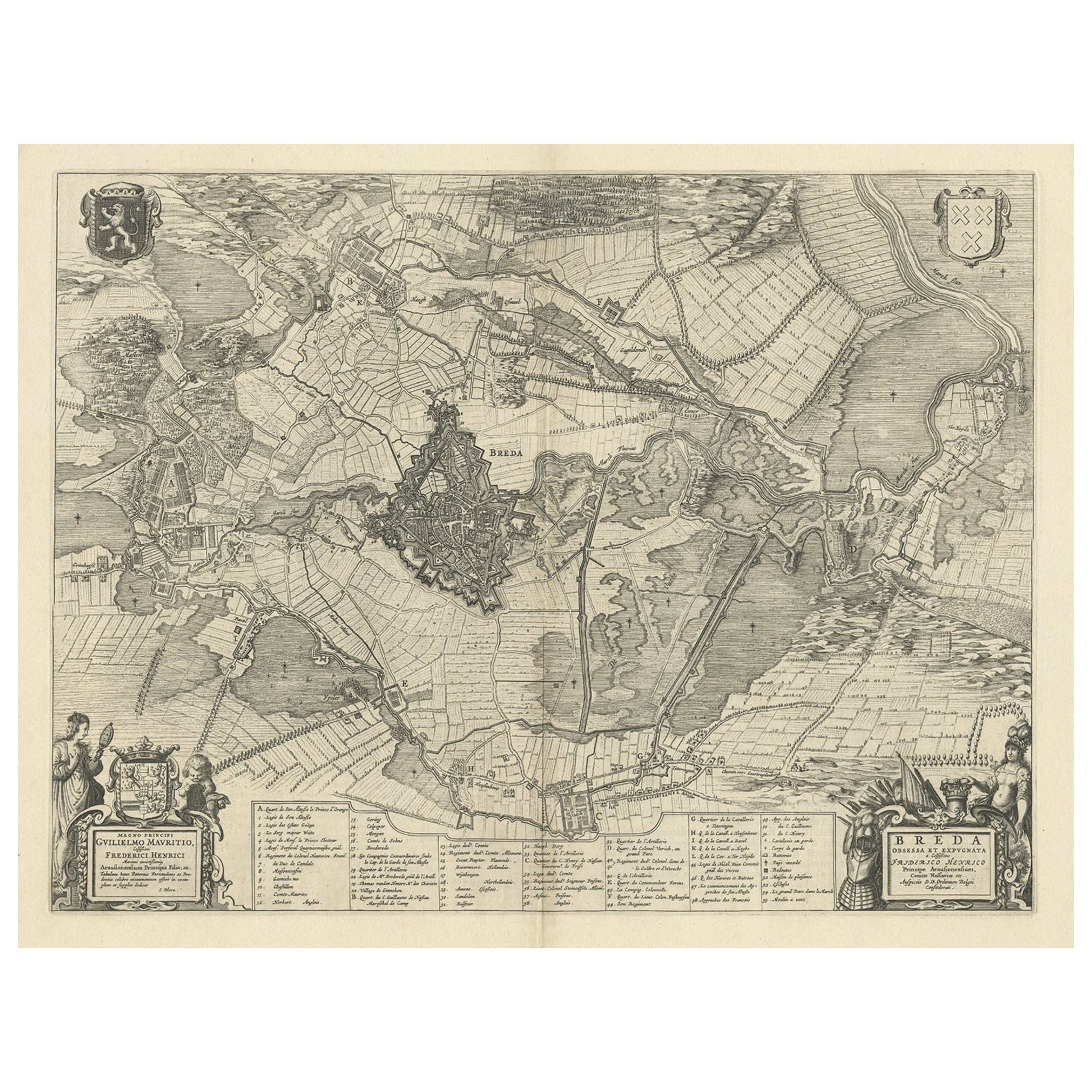
- Antique Map of the Siege of Breda, City in the Netherlands by Blaeu, 1649Located in Langweer, NLAntique map titled 'Breda obsessa et expugnata a Celsissimo Frederico Henrico'. Old map of the city of Breda, the Netherlands. It shows the Siege of Breda in 1637. Originates fro...Category
Antique 17th Century Maps
MaterialsPaper
You May Also Like
- Antique Hand Colored Framed Map of EuropeLocated in West Palm Beach, FLAntique reproduction copied from an edition dated 1595 by Ortelius.Category
Antique Late 19th Century Maps
- Framed 1820s Hand Colored Map of the United StatesLocated in Stamford, CTFramed 1820s hand colored map photos of North America and South America. As found framed in giltwood frame.Category
Antique 1820s American Spanish Colonial Maps
MaterialsGiltwood, Paper, Glass
- Framed 1839 Hand Colored Map of the United StatesLocated in Stamford, CTFramed hand colored map of the United States of America from 1839. Newly framed in a giltwood frame.Category
Antique 1830s American American Classical Maps
MaterialsGiltwood, Paper, Glass
- 1847 “World at One View” Antique Hand-Colored Wall Map of the WorldLocated in Colorado Springs, COThis is a highly desirable hanging wall map of the "World at One View", published in 1847 by Ensign and Thayer, New York. This pictorial map was printed as a broadside and features...Category
Antique 19th Century American Maps
MaterialsPaper
- Colored wall map of the WORLDBy ChambonLocated in ZWIJNDRECHT, NL“Mappe Monde, contenant les Parties Connues du Globe Terrestre” CHAMBON, Gobert-Denis (France, 17.. - 1781) Paris, Longchamps et Janvier, 1754 Size H. 115 x W. 145 cm. Gobert-Denis Chambon made copper engraving after the work of Guillaume De L’Isle, published in 1754 by Jean Janvier and S.G. Longschamps. A huge wall map of the world in two hemispheres printed on two sheets, depicting the Eastern and Western hemispheres supported by two male figures, decorated at the bottom right and left with two celestial hemispheres (boreal and southern) and at the bottom in the middle with an armillary sphere, in addition. This map is most notable for its depiction of the Sea of Japan labeled "Mer de Corée" and of "Mer de L'Ouest" or Sea of the West - a great sea, easily the size of the Mediterranean, to flow from the then-known Strait of Juan de Fuca...Category
Antique Mid-18th Century French French Provincial Maps
MaterialsWood, Paper

- 1864 Map of North America, Antique Hand-Colored Map, by Adolphe Hippolyte DufourLocated in Colorado Springs, COOffered is a map of North America entitled Amerique du Nord from 1864. This rare, separately published wall map was produced by Adolphe Hippolyte Dufour. This map includes vibrant an...Category
Antique 1860s French Maps
MaterialsPaper


Recently Viewed
View AllMore Ways To Browse
Blaeu Maps
Map Blaeu
Cornelius Hollander
Antique Ac
Antique Map Blaeu
16th Century Hand Colored Map
Willem Blaeu
Blaeu World Map
Joan Blaeu
Hindeloopen Furniture
Antique World Globe
Antique World Globes
World Globes Antique
Antique Rollers
Russian Antique Collectables
Framed Map United States
Doctor Office
Edinburgh Antiques