Items Similar to Champagne: The Sparkling Heart of France - A Blaeu Cartographic Engraving, c1650

Want more images or videos?
Request additional images or videos from the seller
1 of 8
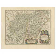
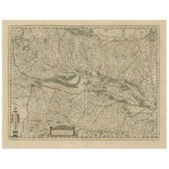
Champagne: The Sparkling Heart of France - A Blaeu Cartographic Engraving, c1650
About the Item
An original hand-colored antique map showing the historical region of Champagne in France, known in Latin as "Campania Comitatus".
Champagne is a region that is world-renowned for the production of the sparkling wine that bears its name. The map includes a decorative cartouche, which was a common feature in maps from this period, often including the title and adding an artistic element to the map.
The detailed engraving work, the stylistic elements of the cartouche, and the meticulous labeling of geographical features are indicative of the high level of craftsmanship associated with 17th-century map-making. This map would have served as an important tool for navigation and territorial understanding in the Champagne region during that time. Champagne's historical significance is not only rooted in its contribution to viticulture but also in its strategic importance in European history.
Maps like these are valuable for their historical context and as artifacts of the cartographic arts. They provide insights into how regions such as Champagne were perceived and represented in the era of their creation.
The maker of the map is indicated on the cartouche, which reads "Amstelodami Apud Guilielmum et Ioannem Blaeu." This means the map was produced in Amsterdam by the Blaeu family, specifically by Willem Blaeu and his son Joan Blaeu. The Blaeu family was a prominent Dutch cartographic family known for their detailed and decorative maps, atlases, and globes during the 17th century. Willem Blaeu founded the family cartography business, and after his passing, his son Joan continued and expanded the enterprise, creating some of the most renowned maps and atlases of that time.
- Dimensions:Height: 20.08 in (51 cm)Width: 23.82 in (60.5 cm)Depth: 0 in (0.02 mm)
- Materials and Techniques:Paper,Engraved
- Period:1650-1659
- Date of Manufacture:circa 1650
- Condition:Condition: Good, given age, general age-related soiling and toning. Folding line as issued. French text on the reverse. Please study scan carefully.
- Seller Location:Langweer, NL
- Reference Number:
About the Seller
5.0
Platinum Seller
These expertly vetted sellers are 1stDibs' most experienced sellers and are rated highest by our customers.
Established in 2009
1stDibs seller since 2017
1,919 sales on 1stDibs
Typical response time: <1 hour
- ShippingRetrieving quote...Ships From: Langweer, Netherlands
- Return PolicyA return for this item may be initiated within 14 days of delivery.
More From This SellerView All
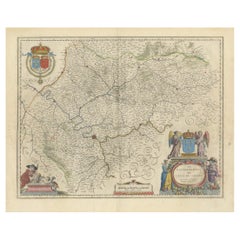
- Burgundy's Viticultural Landscape: A 1640 Cartographic Engraving by Willem BlaeuLocated in Langweer, NLAn hand-colored original antique map with the title "Utriusque Burgundiae tum Ducatus tum Comitatus Descriptio," which translates to "A Description of Both Burgundies, both the Duchy...Category
Antique 1640s Maps
MaterialsPaper
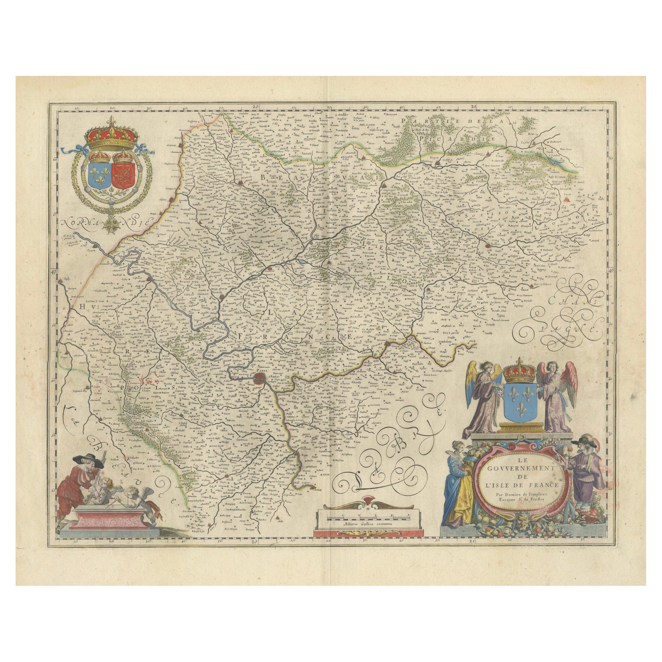
- Mapping the Heart of France: Willem Blaeu's 17th Century Île-de-France, ca.1650Located in Langweer, NLThis original antique map titled "Le Gouvernement de l'Isle de France" represents the Île-de-France region, which historically was one of the provinces of France and contained the ci...Category
Antique 1650s Maps
MaterialsPaper
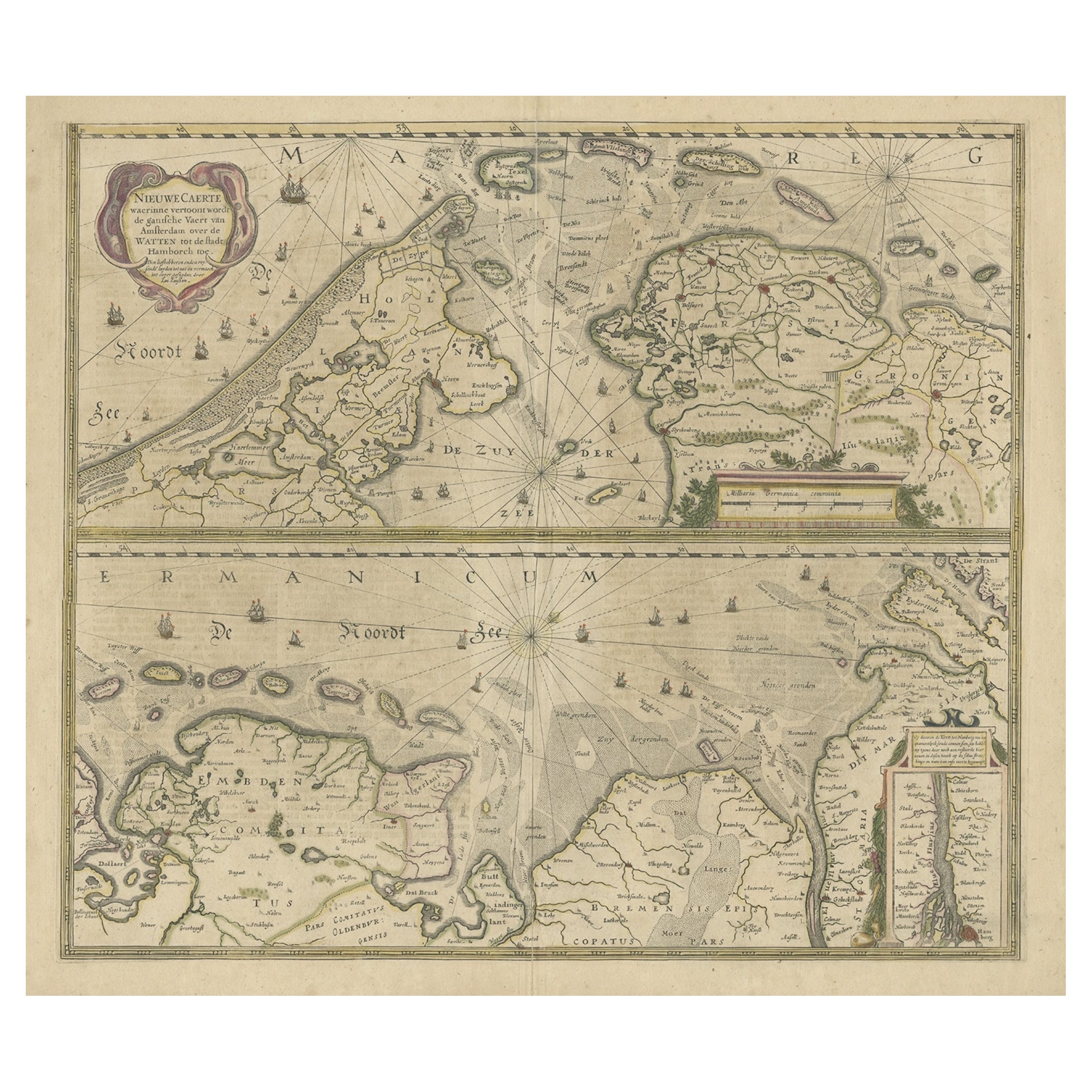
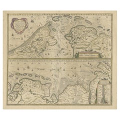
- Two Original Antique Engravings with the Dutch and German North Sea Coast, c1650Located in Langweer, NLAntique map titled 'Nieuwe Caerte waerinne vertoont wordt de gantsche Vaert van Amsterdam over de Watten tot de stadt Hamborch toe'. Two maps with the Dutch and German North Sea ...Category
Antique 1650s Maps
MaterialsPaper
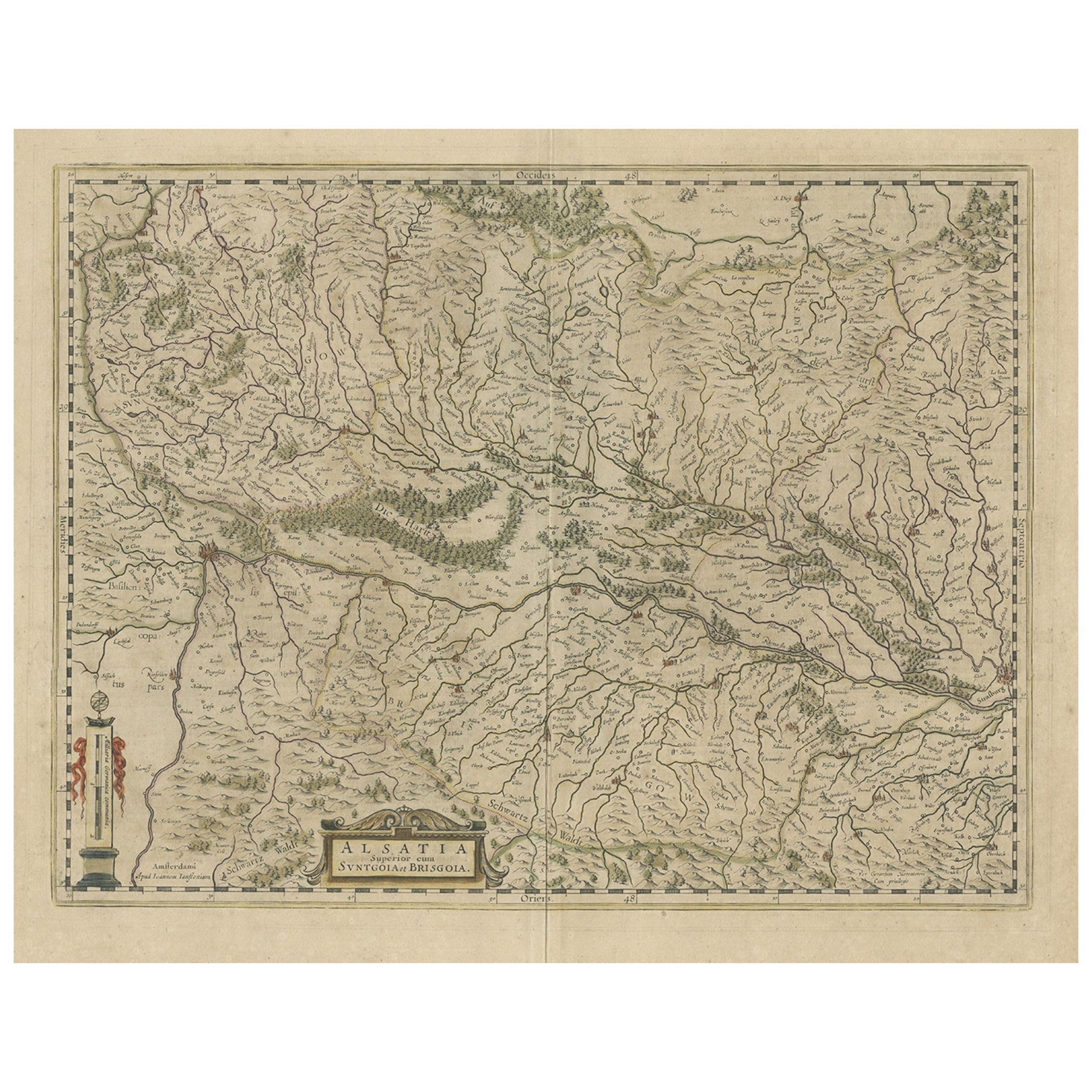
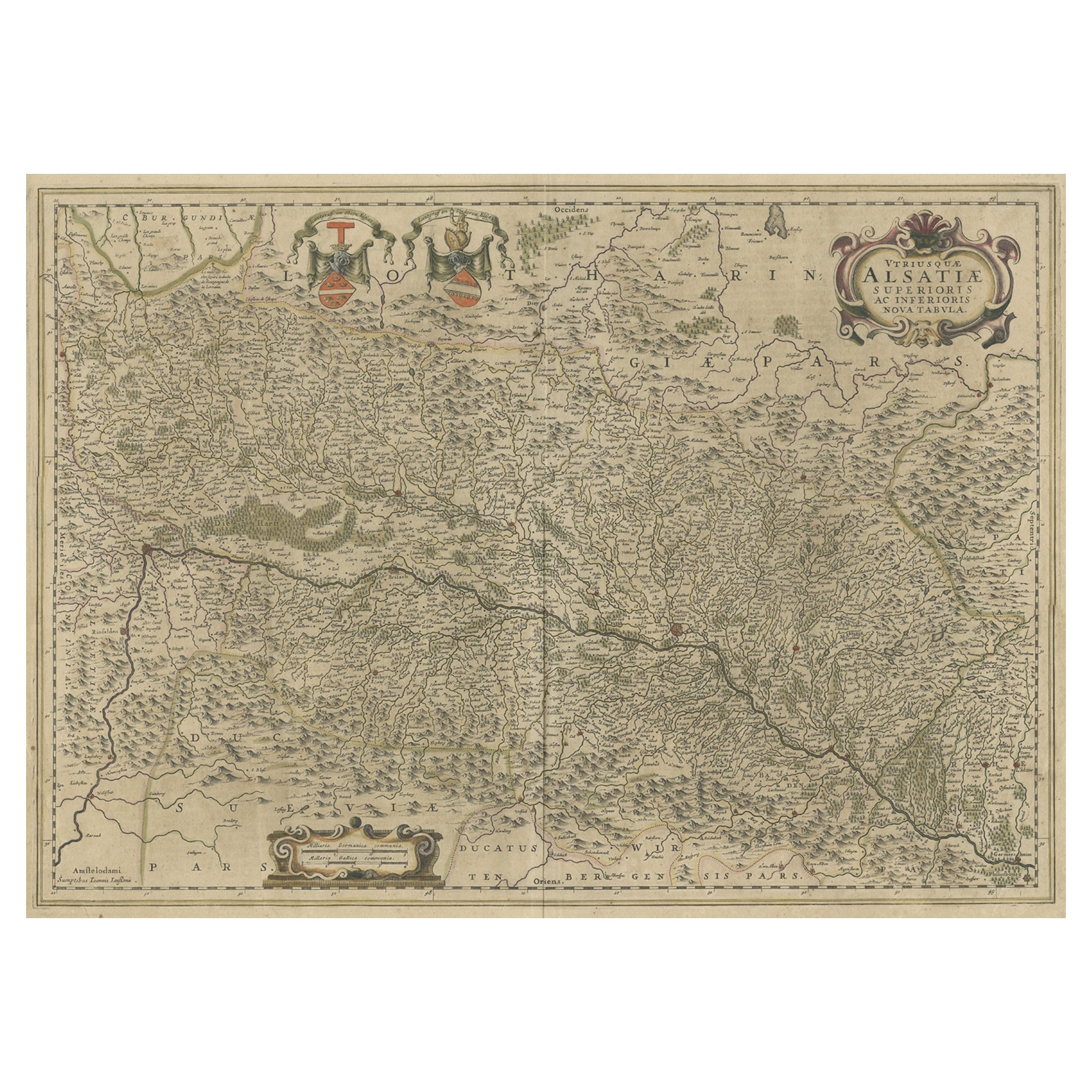
- Old Map of the Alsace 'Elzas' Region with Lotharingen 'Lorraine', France, c1650Located in Langweer, NLAntique map titled 'Alsatia superior cum Suntgoia et Brisgoia'. Old map of the Alsace (or Elzas) region with Lotharingen (Lorraine), Strassburg, Freiburg, Basel etc. Source unkno...Category
Antique 1650s Maps
MaterialsPaper
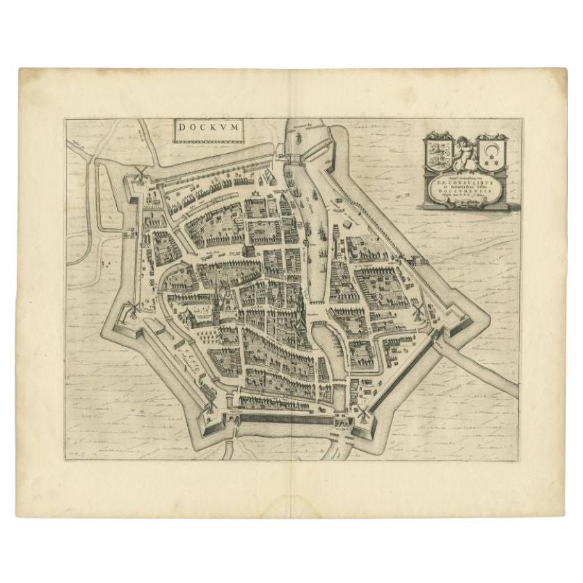
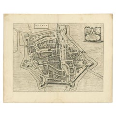
- Antique Map of the City of Dokkum by Blaeu, c.1650Located in Langweer, NLAntique map titled 'Dockum'. Large map of the city of Dokkum, Friesland, The Netherlands. Originates from 'Toneel der Steden', published by Joan Blaeu, Amsterdam. Artists and Engrave...Category
Antique 17th Century Maps
MaterialsPaper
- Map of the Alsace, France Incl the Rhine from Phillipsburg to South Basle, c1650Located in Langweer, NLAntique map titled 'Utriusquae Alsatiae Superioris Ac Inferioris Nova Tabula'. Map of the Alsace region (France) including the Rhine from Phillipsburg to south of Basle. Two deco...Category
Antique 1650s Maps
MaterialsPaper
You May Also Like
- Antique Lithography Map, Isle of Wight, English, Framed, Engraving, CartographyLocated in Hele, Devon, GBThis is an antique lithography map of the Isle of Wight. An English, framed atlas engraving of cartographic interest, dating to the early 19th century and later. Superb lithography ...Category
Antique Early 19th Century British Regency Maps
MaterialsWood
- Antique Lithography Map, Lincolnshire, English, Framed, Engraving, CartographyLocated in Hele, Devon, GBThis is an antique lithography map of Lincolnshire. An English, framed atlas engraving of cartographic interest, dating to the mid 19th century and...Category
Antique Mid-19th Century British Victorian Maps
MaterialsWood
- Antique Lithography Map, Northumberland, English, Framed, Engraving, CartographyLocated in Hele, Devon, GBThis is an antique lithography map of Northumberland. An English, framed atlas engraving of cartographic interest, dating to the mid 19th century a...Category
Antique Mid-19th Century British Victorian Maps
MaterialsWood
- Antique Lithography Map, Worcestershire, English, Framed Engraving, CartographyLocated in Hele, Devon, GBThis is an antique lithography map of Worcestershire. An English, framed atlas engraving of cartographic interest, dating to the early 19th centur...Category
Antique Early 19th Century British Regency Maps
MaterialsWood
- Antique Lithography Map, Bedfordshire, English, Framed Engraving, CartographyLocated in Hele, Devon, GBThis is an antique lithography map of Bedfordshire. An English, framed atlas engraving of cartographic interest, dating to the mid 19th century and...Category
Antique Mid-19th Century British Victorian Maps
MaterialsWood
- Antique Lithography Map, Hertfordshire, English, Framed Engraving, CartographyLocated in Hele, Devon, GBThis is an antique lithography map of Hertfordshire. An English, framed atlas engraving of cartographic interest, dating to the mid 19th century an...Category
Antique Mid-19th Century British Victorian Maps
MaterialsWood


Recently Viewed
View AllMore Ways To Browse
1859 Asia Map
Antique Map Antilles
Antique Alabama Map
Antique Furniture Oklahoma City
J Beringer
Old Sicily Map
Antique Map Of Tuscany
Map Of Washington Dc
Washington Dc Map
Aigue Marine
Furniture Sellers In Israel
Inland Empire
Map Of Native American Tribes
Montana Maps
Op Ocean Pacific
1847 Rio
A Plan City And Castle Of Batavia
Carl Probst