Items Similar to Mapping the Heart of France: Willem Blaeu's 17th Century Île-de-France, ca.1650
Want more images or videos?
Request additional images or videos from the seller
1 of 8
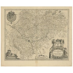
Mapping the Heart of France: Willem Blaeu's 17th Century Île-de-France, ca.1650
About the Item
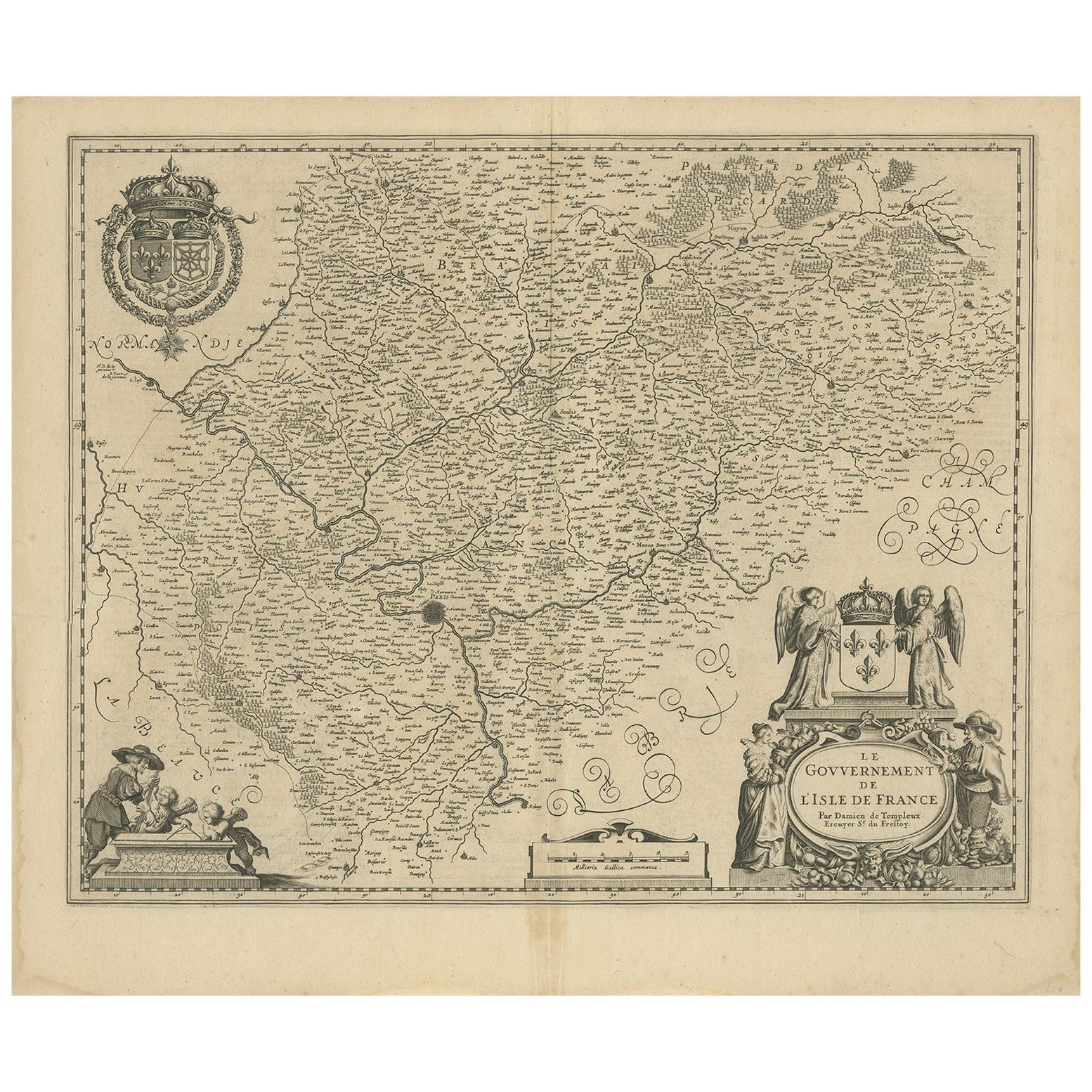
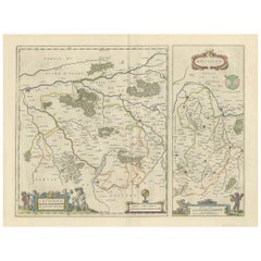
This original antique map titled "Le Gouvernement de l'Isle de France" represents the Île-de-France region, which historically was one of the provinces of France and contained the city of Paris and its surrounding areas. This region was the seat of French royalty and government and served as the cultural and political heart of France.
Île-de-France, or Isle of France, is a central region that historically encompassed a much larger area than the modern administrative region of the same name. It included Paris and its immediate vicinity, extending to include areas that were under the direct influence and control of the kings of France.
It is a historic map from "Theatrum Orbis Terrarum" by Willem Blaeu, based in Amsterdam. "Theatrum Orbis Terrarum" is considered one of the greatest atlases of the 17th century, created during the Golden Age of Dutch cartography.
Willem Blaeu was a renowned Dutch cartographer, atlas maker, and publisher, and his works are known for their accuracy and beautiful decorative elements.
The cartouches, ornate border designs, and the detailed rendering of the coat of arms reflect the high artistic standards of the time and the importance of the Île-de-France region. The map also serves as a historical document, providing insight into the geography and political boundaries of the period.
French text on the reverse.
- Dimensions:Height: 20.08 in (51 cm)Width: 24.02 in (61 cm)Depth: 0 in (0.02 mm)
- Materials and Techniques:Paper,Engraved
- Period:1650-1659
- Date of Manufacture:circa 1650
- Condition:Condition: Good, given age, general age-related soiling and foxing, adding to its patina. Original coloured, with some creasing along the centrefold. French text on the reverse. Please study scan carefully.
- Seller Location:Langweer, NL
- Reference Number:
About the Seller
5.0
Platinum Seller
These expertly vetted sellers are 1stDibs' most experienced sellers and are rated highest by our customers.
Established in 2009
1stDibs seller since 2017
1,916 sales on 1stDibs
Typical response time: <1 hour
- ShippingRetrieving quote...Ships From: Langweer, Netherlands
- Return PolicyA return for this item may be initiated within 14 days of delivery.
More From This SellerView All
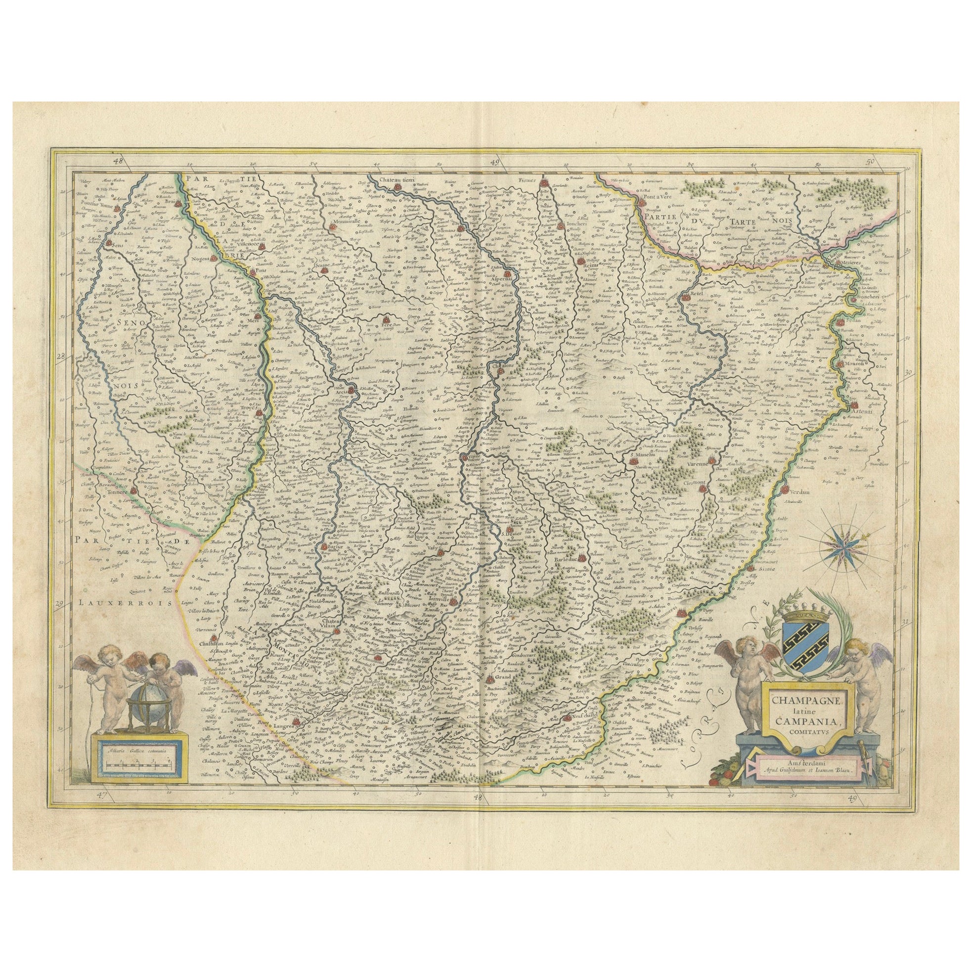
- Champagne: The Sparkling Heart of France - A Blaeu Cartographic Engraving, c1650Located in Langweer, NLAn original hand-colored antique map showing the historical region of Champagne in France, known in Latin as "Campania Comitatus". Champagne is a region that is world-renowned for ...Category
Antique 1650s Maps
MaterialsPaper
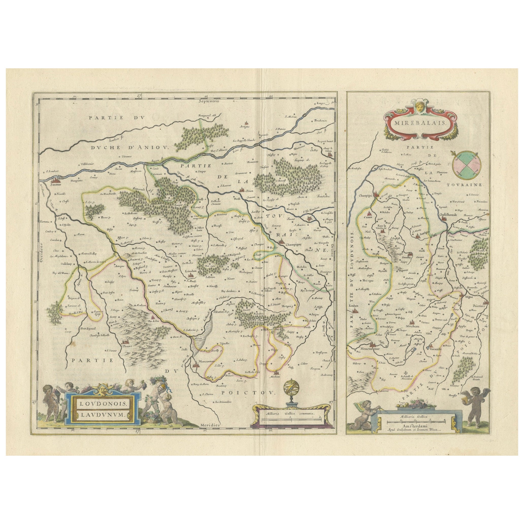
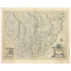
- Loudun and Mirebeau: A Cartographic Masterpiece of 17th Century France by BlaeuLocated in Langweer, NLCartography, 17th century. Willem (1571-1638) and Joan Blaeu (1596-1673), Theatrum Orbis Terrarum sive Atlas Novus..., 1635. Figure: Loudonois. Laudunum (Loudun); Mirebalais (Mirebea...Category
Antique 1650s Maps
MaterialsPaper
- Antique Map of the Region of 'Île de France' by Janssonius, circa 1650By Johannes JanssoniusLocated in Langweer, NLAntique map of France titled 'Le Gouvernement de L'Isle de France'. Paris is represented by a miniature plan of the city, making it distinct from the other towns of the region which ...Category
Antique Mid-17th Century Maps
MaterialsPaper
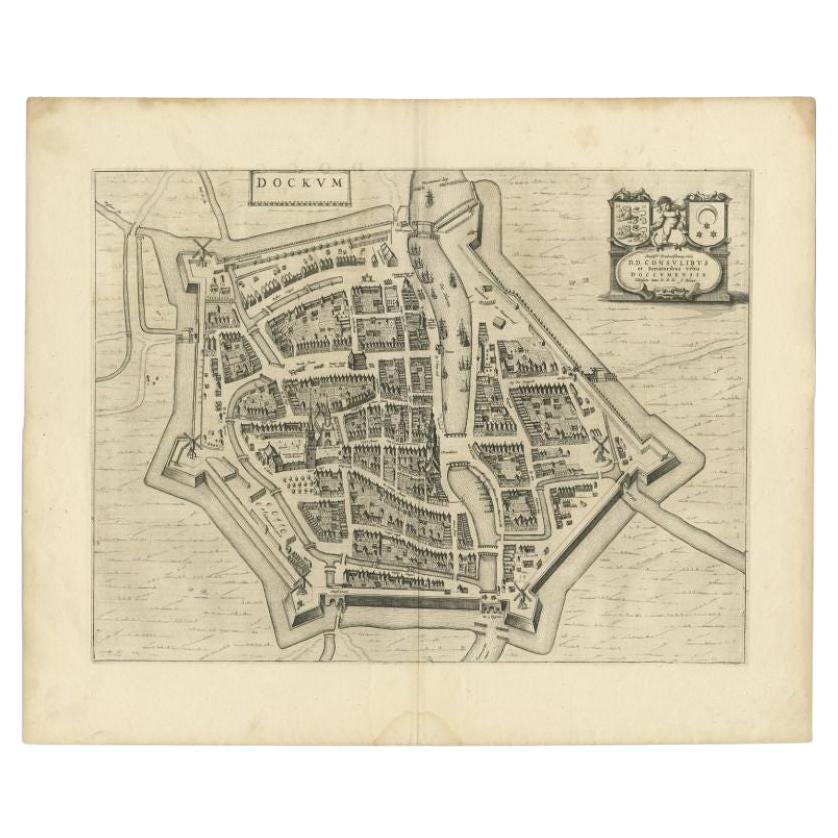
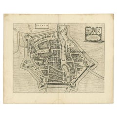
- Antique Map of the City of Dokkum by Blaeu, c.1650Located in Langweer, NLAntique map titled 'Dockum'. Large map of the city of Dokkum, Friesland, The Netherlands. Originates from 'Toneel der Steden', published by Joan Blaeu, Amsterdam. Artists and Engrave...Category
Antique 17th Century Maps
MaterialsPaper
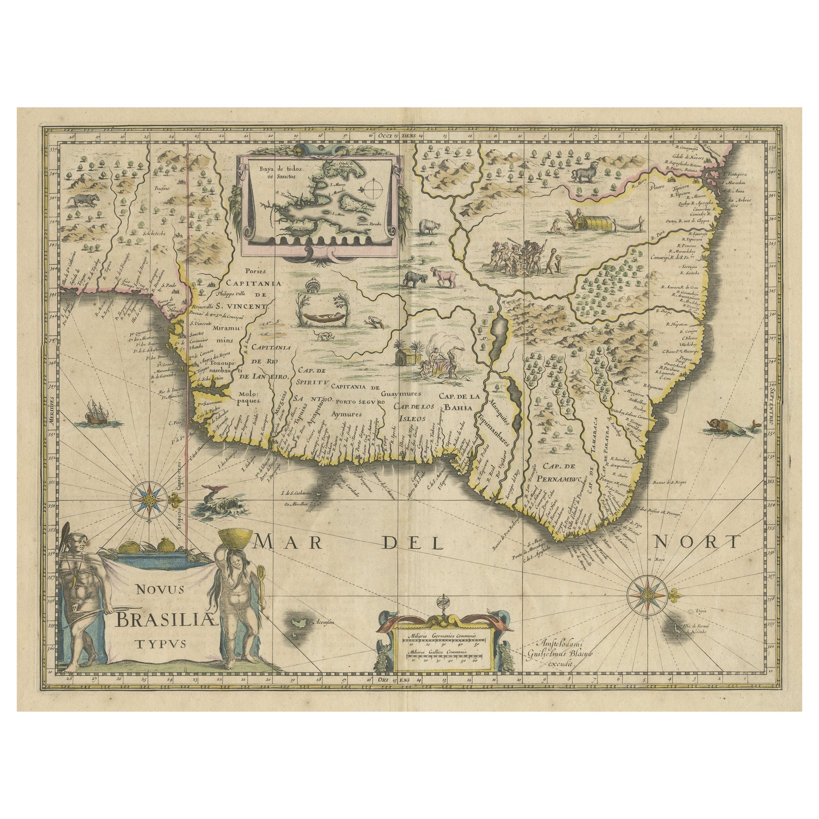
- Old Color Engraving of Blaeu's first Map of Brazil, North Oriented to the RightBy Willem BlaeuLocated in Langweer, NLAntique map titled 'Novus Brasiliae Typus'. Fine old color example of Blaeu's first map of Brazil, with north oriented to the right. Includes inset map of Baya de todos Santos, elaborate cartouche, 2 compass roses and richly embellished vignettes of native Brazilian life and animals. The interior of the map includes vignettes of indigenous animals and native scenes, including cannibalism. Inset within a decorative border is a small map of "Baya de todos Sanctos". In the sea are monsters, a galleon and two compass roses. The large title cartouche features a male and female Brazilian, both of whom are shown naked. Willem Janszoon Blaeu (1571-1638) was a prominent Dutch geographer and publisher. Born the son of a herring merchant, Blaeu chose not fish but mathematics and astronomy for his focus. He studied with the famous Danish astronomer Tycho Brahe...Category
Antique Mid-17th Century Maps
MaterialsPaper
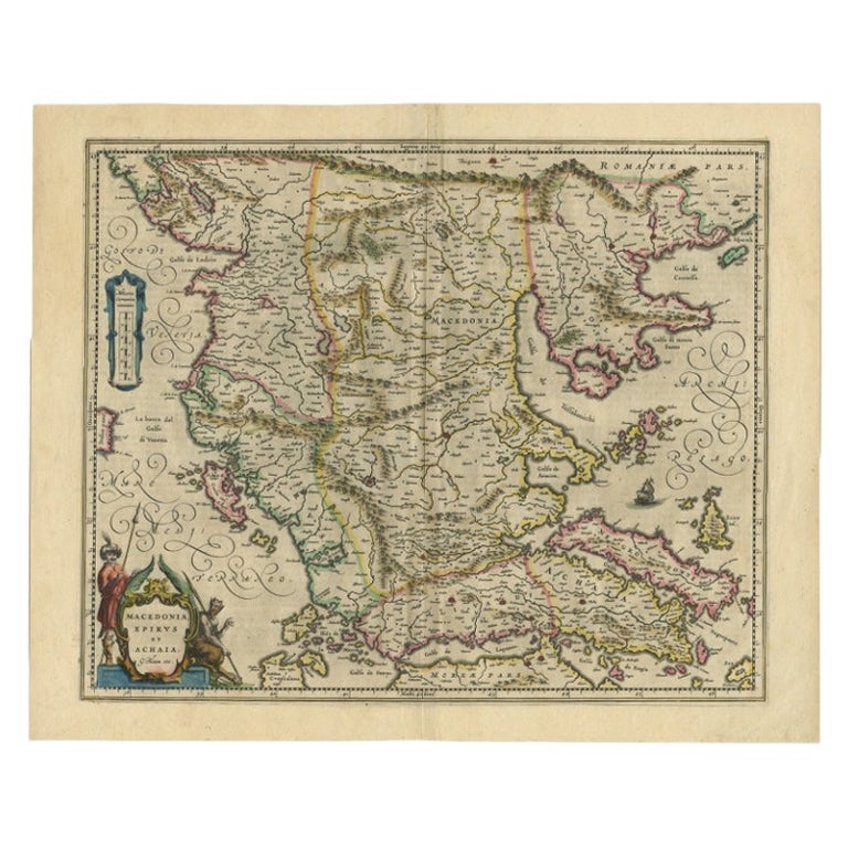
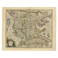
- Antique Map of Macedonia by the Famous Mapmaker Blaeu, c.1650Located in Langweer, NLAntique map titled 'Macedonia, Epirus et Achaia'. Ornated with a nice allegoric cartouche, one ship and a milage scale. Macedonia is shown in the centre of the map. With many detai...Category
Antique 17th Century Maps
MaterialsPaper

You May Also Like
- 17th French Century Iron Figure of The VirginLocated in Stamford, CTWonderful 17th century French Baroque cast iron figure of the Virgin praying. Likely originally part of an outdoor shrine as it has been exposed to the elements. The weathered surfac...Category
Antique Early 17th Century French Baroque Religious Items
MaterialsIron
- 1635 Willem Blaeu Map of Northern France"Comitatvs Bellovacvm" Ric.a08Located in Norton, MA1635 Willem Blaeu map of northern France, entitled. "Comitatvs Bellovacvm Vernacule Beavvais," Colored Ric.a008 “COMITATVS BELLOVACVM…” Amsterdam: W...Category
Antique 17th Century Unknown Maps
MaterialsPaper
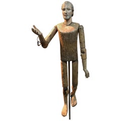
- Italian 17th Century "Mannequin De Presentation"Located in Atlanta, GAA stunning 17th century "Mannequin De Presentation" from Northern Italy. Wonderfully constructed from polychromed wood with a very handsome face, articulating body and sulfur eyes. T...Category
Antique 17th Century Italian Figurative Sculptures
MaterialsWood
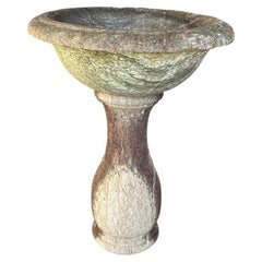
- French 17th Century Baptismal FontLocated in Atlanta, GAA very beautiful 17th century Baptismal Font from the South of France beautifully carved from marble. Minimalist lines give this piece a calming feel. Wil...Category
Antique 17th Century French Garden Ornaments
MaterialsMarble
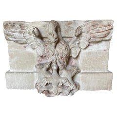
- French 17th Century Stone BlassonLocated in Atlanta, GAAn exquisite 17th century Blasson of a Pelican nurturing its young - representing the Eucharist. Wonderfully carved from Burgundy Stone. A stunning piece.Category
Antique Mid-17th Century French Garden Ornaments
MaterialsStone
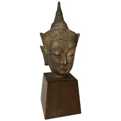
- 17th Century Thai Bronze Bust Of The BuddhaLocated in Stamford, CTA Thai bronze head of the Buddha. Sukothai period, late 16th-early 17th century. His face with serene expression, arched eyebrows above incised eyes a...Category
Antique Early 17th Century Thai Other Figurative Sculptures
MaterialsBronze

Recently Viewed
View AllMore Ways To Browse
1859 Asia Map
Antique Map Antilles
Formosa Vintage Map
Map Zanzibar
Minature Map
Vincenzo Coronelli On Sale
Anguilla Map
Antique Cabbage Cutter
Antique Maps Denver
Antique Maps Washington Dc
Brinkman Co
Britton And Rey Lithograph
Cartier 1730
Christoph Weigel On Sale
Clivia Ducatus Et Ravestein Dominium
Collectible Barbies
Cyclades Map
Devonia Antique