Antique North American Map
13
to
54
244
62
110
105
84
73
63
42
28
27
23
22
21
19
18
12
11
8
7
6
6
6
5
5
5
4
4
3
3
3
3
3
2
2
2
2
2
2
2
1
1
1
1
1
1
1
1
1
1
42
42
20
3
3
Sort By
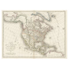
Antique Map of North America, 1821
Located in Langweer, NL
Antique map of America titled 'Carte de l'Amerique septentrionale'. Scarce map of North America
Category
Antique 19th Century Maps
Materials
Paper
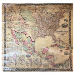
Large Antique 1859 Map of North America
Located in Sag Harbor, NY
population of 1850 North America is included as well as details of all of North and Central America. The size
Category
Antique Mid-19th Century American Maps
Materials
Canvas, Paper
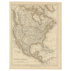
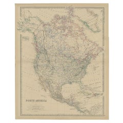
Antique Map of North America by Wyld '1845'
Located in Langweer, NL
Antique map titled 'North America'. Original antique map of North America. This map originates from
Category
Antique Mid-19th Century Maps
Materials
Paper
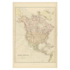
Antique Decorative Coloured Map of North America, 1882
Located in Langweer, NL
This original antique map of North America is from the Blackie & Son Atlas published in 1882. Here
Category
Antique 1880s Maps
Materials
Paper
Antique Map of North America by Lowry '1852'
Located in Langweer, NL
Antique map titled 'North America'. Original map of North America. This map originates from
Category
Antique Mid-19th Century Maps
Materials
Paper
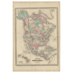
Antique Map of North America by Johnson, '1872'
Located in Langweer, NL
Antique map titled 'Johnson's North America'. Original map of North America, with an inset map of
Category
Antique Late 19th Century Maps
Materials
Paper
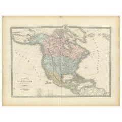
Antique Map of North America by Levasseur '1875'
Located in Langweer, NL
Antique map titled 'Carte générale de l'Amérique Septentrionale'. Large map of North America. This
Category
Antique Late 19th Century Maps
Materials
Paper
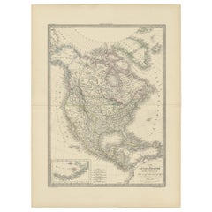
Antique Map of North America by Lapie '1842'
Located in Langweer, NL
Antique map titled 'Carte de l'Amérique septentrionale'. Map of North America, with an inset map of
Category
Antique Mid-19th Century Maps
Materials
Paper
Antique Map of North America by Johnston, 1882
By Alexander Keith Johnston
Located in Langweer, NL
Antique map titled 'North America'.
Old map of North America. This map originates from 'The Royal
Category
Antique 19th Century Maps
Materials
Paper
Antique Map of British North America by Lowry, '1852'
Located in Langweer, NL
Antique map titled 'British North America'. Original map of British North America. This map
Category
Antique Mid-19th Century Maps
Materials
Paper
Antique Map of North America by Dufour 'circa 1834'
Located in Langweer, NL
Antique map titled 'Amérique Septentrionale'. Uncommon map of North America. Published by or after
Category
Antique Mid-19th Century Maps
Materials
Paper
Antique Map of North America by Laarman, c.1860
Located in Langweer, NL
Antique map titled 'Noord Amerika'. Original antique map of North America. Published circa 1860
Category
Antique 19th Century Maps
Materials
Paper
Antique Map of North America Including the West Indies
Located in Langweer, NL
Original antique map titled 'Nord-America'. Old map of North America and the West Indies. Also
Category
Antique Mid-19th Century Maps
Materials
Paper
Antique Map of North America by A & C. Black, 1870
Located in Langweer, NL
Antique map titled 'North America'. Original antique map of North America. This map originates from
Category
Antique Late 19th Century Maps
Materials
Paper
Old Original Antique German Map of North America, ca.1870
Located in Langweer, NL
Antique map titled 'Nord-America'.
Old map of North America. This map originates from 'H
Category
Antique 1870s Maps
Materials
Paper
Antique Map of North and Central America by Migeon '1880'
By J. Migeon
Located in Langweer, NL
Antique map titled 'Amérique Septentrionale'. Old map of North and Central America. With a
Category
Antique Late 19th Century French Maps
Materials
Paper
Antique Map of North and South America by Walker, 1828
Located in Langweer, NL
Antique map titled 'Geographical, Historical and Statistical Map of America'. Two maps on one sheet
Category
Antique 19th Century Maps
Materials
Paper
Decorative Dutch Antique Map of North and South America, 1841
Located in Langweer, NL
Description: Antique map titled 'Amerika'. Small map of North and South America.
This map
Category
Antique 1840s Maps
Materials
Paper
Antique Map of The United States of North America, 1882
Located in Langweer, NL
This is a historical map titled "The United States of North America, Central Part" from the 1882
Category
Antique 1880s Maps
Materials
Paper
1864 Map of North America, Antique Hand-Colored Map, by Adolphe Hippolyte Dufour
Located in Colorado Springs, CO
Offered is a map of North America entitled Amerique du Nord from 1864. This rare, separately
Category
Antique 1860s French Maps
Materials
Paper
H 44.5 in W 33 in D 1.5 in
Antique Map of British North America by W. G. Blackie, 1859
Located in Langweer, NL
Antique map titled 'British North America'. Original antique map of British North America. This map
Category
Antique Mid-19th Century Maps
Materials
Paper
Antique Map of the United States of North America, c.1882
Located in Langweer, NL
Antique map titled 'United States of North America'. Old map of the United States of North America
Category
Antique 1880s Maps
Materials
Paper
Antique Hand-Coloured Map of North and South America, ca.1765
Located in Langweer, NL
Description: Antique map titled 'Nieuwe Kaart van Amerika.' Attractive map of North and South
Category
Antique 1760s Maps
Materials
Paper
Antique Map of South America ‘North’ by A.K. Johnston, 1865
Located in Langweer, NL
Antique map titled 'South America, Northern Sheet'. Depicting Guiana, Ecuador, Brazil, Bolivia the
Category
Antique Mid-19th Century Maps
Materials
Paper
Antique Map of the West Coast of North America & North East Coast of Asia '1772'
Located in Langweer, NL
'. Map of the West Coast of North America and North-East Coast of Asia, based upon Buache's report of the
Category
Antique Late 18th Century Maps
Materials
Paper
H 13.78 in W 18.78 in D 0.02 in
Antique Map of the United States of North America by Johnston '1909'
Located in Langweer, NL
Antique map titled 'United States of North America'. Original antique map of United States of North
Category
Early 20th Century Maps
Materials
Paper
Antique Map of the United States of North America by Wyld '1845'
Located in Langweer, NL
Antique map titled 'Map of The United States of North America'. Original antique map of the United
Category
Antique Mid-19th Century Maps
Materials
Paper
Antique Map of the British Possessions in North America by Wyld '1845'
Located in Langweer, NL
Antique map titled 'Map of The British Possessions in North America'. Original antique map of the
Category
Antique Mid-19th Century Maps
Materials
Paper
H 10.24 in W 14.18 in D 0.02 in
Original Antique Map of North and South America in Attractive Old Coloring
By Isaak Tirion
Located in Langweer, NL
Antique map titled 'Nieuwe Kaart van America'. Beautiful map of America. The fabled Quivira is used
Category
Antique Mid-18th Century Maps
Materials
Paper
H 16.15 in W 19.69 in D 0.02 in
Antique Map of North and South America by Schneider and Weigel, 1818
Located in Langweer, NL
Antique map titled 'America nach Arrowsmiths Weltcharte und dessen Globular Projection (..)'. Map
Category
Antique Early 19th Century Maps
Materials
Paper
Antique Map Dedicated to British Merchants Trading to North America, ca.1746
Located in Langweer, NL
’s appearance. Jefferys dedicated this map to the British merchants trading to North America. Originates from
Category
Antique 1740s Maps
Materials
Paper
H 13.98 in W 19.69 in D 0 in
Antique Map of North America from an Old Dutch School Atlas, 1852
Located in Langweer, NL
Antique map titled 'Noord-Amerika'. Map of North America. This map originates from 'School-Atlas
Category
Antique 19th Century Maps
Materials
Paper
Antique Map of British North America, The Dominion of of Canada, 1882
Located in Langweer, NL
This map is titled "British North America, Dominion of Canada," from the 1882 Blackie Atlas. It
Category
Antique 1880s Maps
Materials
Paper
No Reserve
H 14.97 in W 22.45 in D 0 in
Antique Map with Hand Coloring of North America and the West Indies
Located in Langweer, NL
Original antique map titled 'Nord-America'. Old map of North America and the West Indies.
This
Category
Antique Late 19th Century Maps
Materials
Paper
Free Shipping
H 15.08 in W 18.78 in D 0.02 in
Exploring South America's North: Antique Map from the Royal Atlas of 1909
Located in Langweer, NL
The antique map titled 'South America, Northern Sheet' is a historical cartographic representation
Category
Early 20th Century Maps
Materials
Paper
H 19.49 in W 24.41 in D 0.02 in
Antique Map of The United States of North America, Pacific States, 1882
Located in Langweer, NL
The map is from the same 1882 Blackie Atlas and focuses on the Pacific States of the United States
Category
Antique 1880s Maps
Materials
Paper
No Reserve
H 14.97 in W 11.03 in D 0 in
Antique Map of North America and the West Indies by Stieler, circa 1865
Located in Langweer, NL
Antique map titled 'Nord-America und West-Indien'. Old map of North America and the West Indies
Category
Antique Mid-19th Century Maps
Materials
Paper
H 9.45 in W 12.21 in D 0.02 in
New Map of North America from the Latest Discoveries, 1763
Located in Philadelphia, PA
A fine antique 18th century map of the North American seaboard.
Entitled "A New Map of North
Category
Antique Mid-18th Century English Georgian Maps
Materials
Paper
Antique Map of North America with Vignette of the Statue of Liberty, New York
Located in Langweer, NL
Antique map titled 'Amérique du Nord'. Original antique map of North America. Meticulous
Category
Antique Late 19th Century Maps
Materials
Paper
Free Shipping
H 15.44 in W 20.4 in D 0.02 in
Antique Map of the United States ' North East ' by Johnston '1909'
Located in Langweer, NL
Antique map titled 'United States of North America'. Original antique map of United States of North
Category
Early 20th Century Maps
Materials
Paper
Antique Map of the United States 'North West' by Johnston, '1909'
Located in Langweer, NL
Antique map titled 'United States of North America'. Original antique map of the United States of
Category
Early 20th Century Maps
Materials
Paper
Interesting Original Antique Map of South America, 1822
Located in Langweer, NL
Antique map titled 'South America'.
Map of South America with attractive topography, surrounded
Category
Antique 19th Century Maps
Materials
Paper
Antique Map of South America by Finlayson, 1822
Located in Langweer, NL
Antique map titled 'Geographical, Statistical and Historical Map of the United Provinces of South
Category
Antique 19th Century Maps
Materials
Paper
Antique Map of South America by Buchon, 1825
Located in Langweer, NL
Antique map titled 'Carte de l'Amérique méridionale'. Map of South America with attractive
Category
Antique 19th Century Maps
Materials
Paper
Antique Chicago Illinois National Map Commercial Rollup Classroom Census Map 47"
Located in Dayton, OH
Antique early to mid 20th century double sided hanging map titled the New Commercial and Census Map
Category
Early 20th Century North American Maps
Materials
Paper
H 47 in W 41 in D 0.05 in
Very Attractive Map of North and South America and Western Part of Africa, 1744
Located in Langweer, NL
Antique map titled 'Nieuwe Kaart van America.' Very attractive map of North and South America, the
Category
Antique 18th Century Maps
Materials
Paper
H 16.34 in W 21.26 in D 0 in
Old Map Showing the Tracks of Cook Between North America and Asia's Coast, 1803
Located in Langweer, NL
Description: Antique map titled 'Kaart van de Noord-West kust van Amerika en de Noord-Oost kust van
Category
Antique Early 1800s Maps
Materials
Paper
H 20.87 in W 29.14 in D 0 in
Antique Map of South America Depicting Guayana, c.1780
Located in Langweer, NL
Operations et les Cartes recentes des Ingenieurs-Geographes Francois'. Antique map of South America depicting
Category
Antique 18th Century Maps
Materials
Paper
Antique Sea Chart of North America by Ottens, circa 1745
Located in Langweer, NL
Antique map titled 'Septemtrionaliora Americae a Groenlandia (..)'. Sea chart of the northern
Category
Antique Mid-18th Century Maps
Materials
Paper
Free Shipping
H 21.46 in W 25.99 in D 0.02 in
Antique Map of the Northern Hemisphere and North Pole by Tirion, circa 1754
Located in Langweer, NL
Antique map titled 'Nieuwe Kaart van de Noord Pool na de alderlaatste ondekking int licht gebracht
Category
Antique Mid-18th Century Maps
Materials
Paper
H 12.8 in W 14.77 in D 0.02 in
Antique Map of the North Pole & Sangihe Archipelago by Keizer & de Lat, 1788
Located in Langweer, NL
coastline labeled, Onbekend Land, nearly connecting Asia and North America. A second map that takes up
Category
Antique Late 18th Century Maps
Materials
Paper
H 8.08 in W 11.82 in D 0.02 in
Excellent Antique Map of America with Unusual Northwest Coast of America, c.1754
Located in Langweer, NL
Description: Antique map titled 'Nieuwe Kaart Van het Westelykste Deel Der Weereld, dienende tot
Category
Antique 1750s Maps
Materials
Paper
No Reserve
H 13.98 in W 15.75 in D 0 in
Antique Map of Part of South America by Archer, C.1860
Located in Langweer, NL
Antique map titled 'South America'. This antique map depicts the north-east of South America
Category
Antique 19th Century Maps
Materials
Paper
Authentic Antique Map of the Caribbean, Gulf Coast and Central America, 1787
Located in Langweer, NL
Antique map titled 'Les Isles Antilles et le Golfe du Méxique'. Original old map of the Caribbean
Category
Antique Late 18th Century Maps
Materials
Paper
Free Shipping
H 10.52 in W 16.38 in D 0.02 in
Antique Map of America with California as an Island by Homann '1710'
Located in Langweer, NL
This antique map, titled "Totius Americae Septentrionalis et Meridionalis," represents a
Category
Antique Early 18th Century Maps
Materials
Paper
Finely Engraved Antique Map of Europe with inset of America, c.1745
By Guillaume De L'Isle
Located in Langweer, NL
Antique map titled 'Theatrum Historicum pars Occidentalis.' Finely engraved historical map with a
Category
Antique 18th Century Maps
Materials
Paper
Antique Map of South American, The West Indies & Most of Africa, Ca.1775
Located in Langweer, NL
Antique map titled 'Carte pour Servir a l' Histoire Philosophique et Politique des Etablissemens et
Category
Antique 1770s Maps
Materials
Paper
H 15.04 in W 19.77 in D 0 in
Rare Unusual Antique Map of Asia with a Landbridge from Korea to America, 1717
Located in Langweer, NL
Antique map titled 'L'Asie Suivant les Nouvelles Decouvertes (..).' Interesting and very unusual
Category
Antique 18th Century Maps
Materials
Paper
H 9.65 in W 13.94 in D 0 in
Original Steel Engraved Map of French Colonies in America, 1854
Located in Langweer, NL
Antique map titled 'Colonies Francaises (en Amerique)'. Detailed map bordered by vignettes showing
Category
Antique Mid-19th Century Maps
Materials
Paper
Free Shipping
H 13.12 in W 18.71 in D 0.02 in
Antique Map of Peru by Carey, 1822
Located in Langweer, NL
Antique map titled 'Peru'. Geographical, historical, and statistical map of Peru, surrounded by
Category
Antique 19th Century Maps
Materials
Paper
- 1
Get Updated with New Arrivals
Save "Antique North American Map", and we’ll notify you when there are new listings in this category.
More Ways To Browse
East Coast Australia Charts
Antique Map Of Alabama
Manitoba Map
Plains Cree
Antique Map Nova Scotia
Guyana Antique Map
Isle Royale
Antique Map Of Colombia
Colombia Map Antique
Azores Map
Alabama Antique Map
Alabama Map
Antique Alabama Map
J Beringer
Laurie King
Antique Map Tennessee
Antique Maps Kansas City
Antique Maps Of Tennessee
