Items Similar to 19th Century Large Original Antique Map of Denmark by J. Pinkerton, 1812


Want more images or videos?
Request additional images or videos from the seller
1 of 7
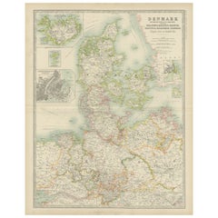
19th Century Large Original Antique Map of Denmark by J. Pinkerton, 1812
About the Item
Highly detailed map of Denmark. One of the best large format English atlas maps of the period.
Pinkerton's maps reflect the fine copperplate engraving work being done in the Britain at the beginning of the 19th century, with remarkable detail and a 3 dimensional feeling.
- Creator:Pinkerton (Artist)
- Dimensions:Height: 28.75 in (73 cm)Width: 21.26 in (54 cm)Depth: 0.02 in (0.5 mm)
- Materials and Techniques:
- Period:
- Date of Manufacture:1812
- Condition:Please study images carefully.
- Seller Location:Langweer, NL
- Reference Number:
About the Seller
5.0
Platinum Seller
These expertly vetted sellers are 1stDibs' most experienced sellers and are rated highest by our customers.
Established in 2009
1stDibs seller since 2017
1,922 sales on 1stDibs
Typical response time: <1 hour
- ShippingRetrieving quote...Ships From: Langweer, Netherlands
- Return PolicyA return for this item may be initiated within 14 days of delivery.
More From This SellerView All
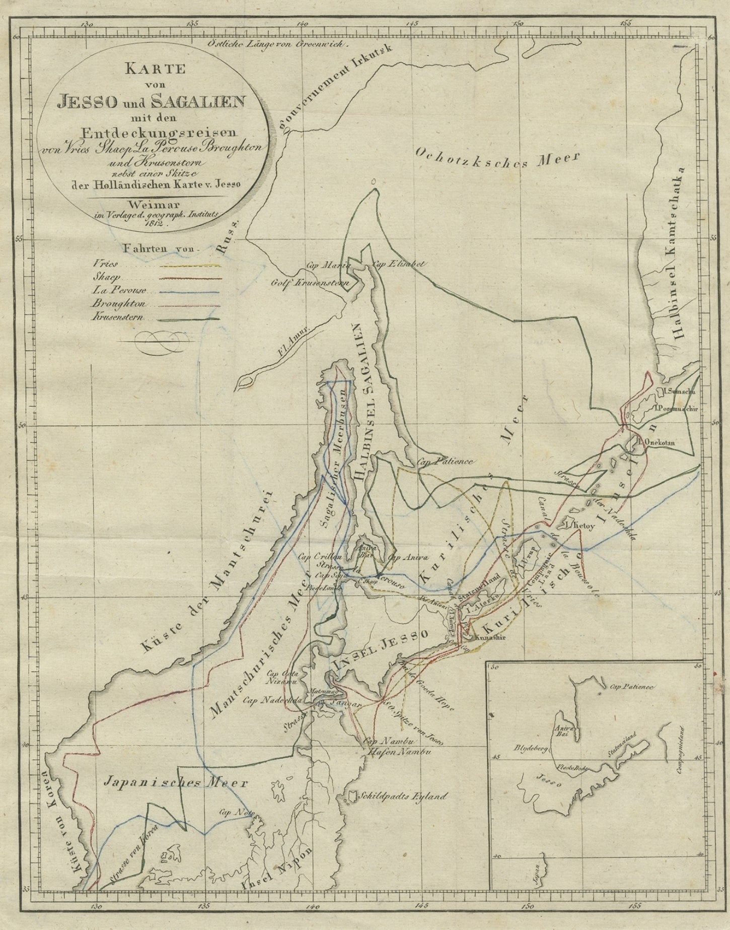
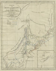
- Antique Map of the Region of Hokkaido, Island of Japan, 1812Located in Langweer, NLAntique map titled 'Karte von Jesso und Sagalien'. Old map of the region of the island of Yesso (Mororan, Hokkaido, Japan). This map originates from Volume 38 of 'Allgemeine geograph...Category
Antique 19th Century Maps
MaterialsPaper
- Original Hand-colored Antique Map of Denmark by S. Neele, 1790Located in Langweer, NLAntique very decorative engraving of Denmark engraved by S. Neele. Published in November 1790 by John Trusler. Tape on verso.Category
Antique Late 18th Century Maps
MaterialsPaper
- Antique Map of Denmark by Lowry, 1852Located in Langweer, NLAntique map titled 'Denmark'. Original map of Denmark. This map originates from 'Lowry's Table Atlas constructed and engraved from the most recent Authorities' by J.W. Lowry. Publish...Category
Antique Mid-19th Century Maps
MaterialsPaper
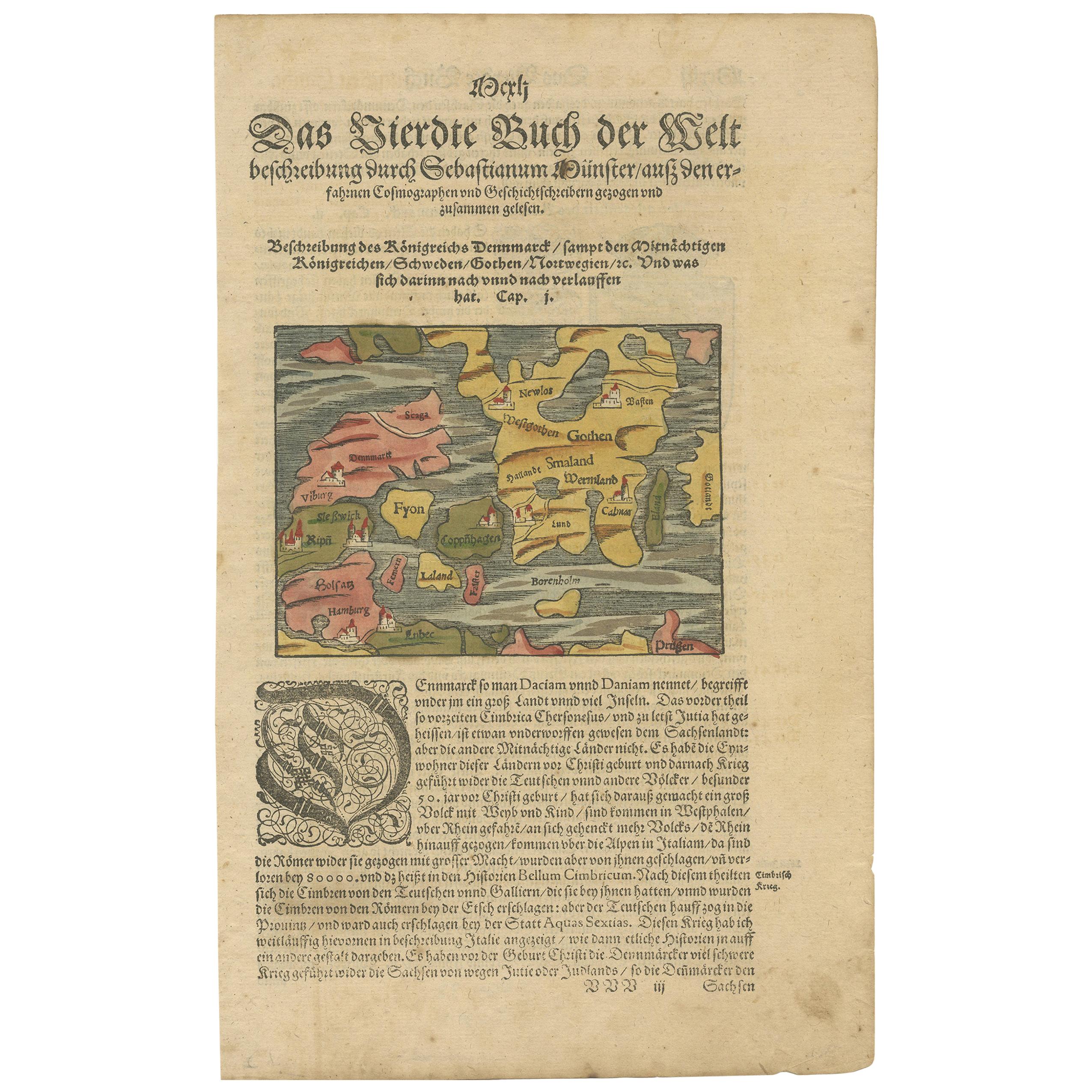
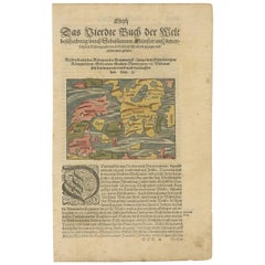
- Antique Map of Denmark by Münster '1588'Located in Langweer, NLAntique map titled 'Beschreibung des Königreichs Dennmarck (..)'. Early map of Denmark. This map originates from 'Cosmographey Oder beschreibung Aller Länder (..)' by Sebastian Münster.Category
Antique 16th Century Maps
MaterialsPaper
- Antique Map of Denmark by Johnston '1909'Located in Langweer, NLAntique map titled 'Denmark'. Original antique map of Denmark. With inset maps of Iceland, Faroe Island, and Copenhagen. This map originates from the ‘Royal Atlas of Modern Geography...Category
Early 20th Century Maps
MaterialsPaper
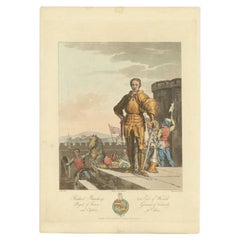
- Original Antique Print of Richard Beauchamp, 5th Earl of Warwick, 1812Located in Langweer, NLAntique print titled 'Richard Beuchamp, H.G. Earl of Warwick'. Old print of Richard Beuchamp, 5th Earl of Warwick, standing on a platform within the walls of a castle, wearing armour, a dagger, and garter on his left leg. Originates from 'Selections of the Ancient Costume...Category
Antique 19th Century Prints
MaterialsPaper


You May Also Like
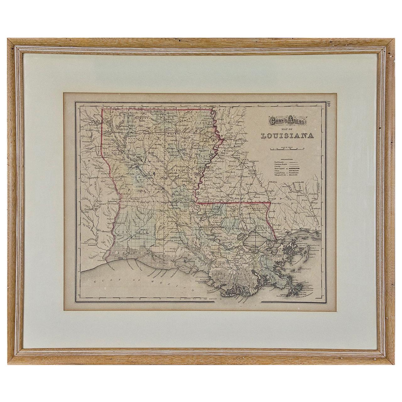
- Louisiana: A Framed 19th Century Map by O. W. GrayBy Gray and CoLocated in Alamo, CAThis framed 19th century map of the Louisiana territory was published in "Gray's Atlas of the United States with General Maps of the World, accompanied by Descriptions Geographical, Historical, Scientific and Statistica" published in 1873 in Philadelphia by O.W. Gray and Son and Stedman, Brown and Lyon. It is a highly detailed map of Louisiana...Category
Antique Mid-19th Century American Other Maps
MaterialsPaper
- America "Amérique Septentrionale": A 19th Century French Map by DelamarcheBy Maison Delamarche 1Located in Alamo, CAThis framed mid 19th century map of North America entitled "Amérique Septentrionale" by Felix Delamarche was published in Paris in 1854 by Quay de l'Horloge du Palais, avec les Carte...Category
Antique Mid-19th Century American Other Maps
MaterialsPaper
- Original Antique Map of Russia By Arrowsmith. 1820Located in St Annes, LancashireGreat map of Russia Drawn under the direction of Arrowsmith Copper-plate engraving Published by Longman, Hurst, Rees, Orme and Brown, 1820 Unframed.Category
Antique 1820s English Maps
MaterialsPaper
- Original Antique Map of Italy. C.1780Located in St Annes, LancashireGreat map of Italy Copper-plate engraving Published C.1780 Unframed.Category
Antique Early 1800s English Georgian Maps
MaterialsPaper

- Original Antique Map of Asia. C.1780Located in St Annes, LancashireGreat map of Asia Copper-plate engraving Published C.1780 Two small worm holes to right side of map Unframed.Category
Antique Early 1800s English Georgian Maps
MaterialsPaper

- Original Antique Map of India. C.1780Located in St Annes, LancashireGreat map of India Copper-plate engraving Published C.1780 Three small worm holes to right side of map and one bottom left corner Unframed.Category
Antique Early 1800s English Georgian Maps
MaterialsPaper


