Antique Ireland Maps

16
to
21
135
31
95
63
53
38
21
20
20
18
11
10
10
9
9
8
6
6
5
4
4
4
3
3
3
3
2
2
2
2
1
1
1
1
1
1
1
1
3
2
2
2
2
Sort By
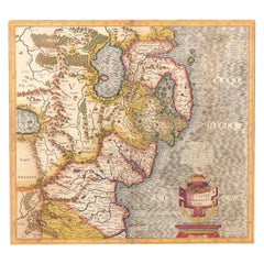
Antique Map of Northern Ireland by Mercator/Hondius, Early 1600's
Located in Langweer, NL
Antique map titled 'Ultoniae Orientalis Pars'. Original antique map of Northern Ireland. Published
Category

16th Century Antique Ireland Maps

Materials

Paper

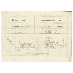
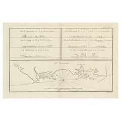
Antique Map of New Ireland, 1774
Located in Langweer, NL
Antique print titled 'Neu Irrland (..)'. Antique map of New Ireland with 7 coastal profiles, Papua
Category

18th Century Antique Ireland Maps

Materials

Paper

Antique Map of New Ireland, 1774
H 10.24 in W 14.18 in D 0 in
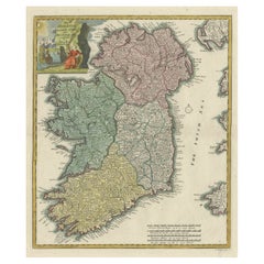
Decorative Hand-Coloured Antique Map of the Four Irish Provinces, Ireland, c1718
Located in Langweer, NL
Title: Regni Hiberniae Accurata Tabula per Hermanum Moll Decorative map of the four Irish
Category

1710s Antique Ireland Maps

Materials

Paper

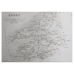
Original Antique Map of Ireland- Kerry. C.1840
Located in St Annes, Lancashire
Great map of Kerry Steel engraving Drawn under the direction of A.Adlard Published by How and
Category

1840s English Antique Ireland Maps

Materials

Paper

Original Antique Map of Ireland- Kerry. C.1840
No Reserve
H 6.25 in W 9.5 in D 0.07 in
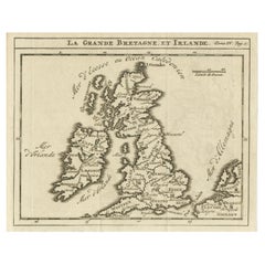
Rare Small Antique Map of Great Britain and Ireland
Located in Langweer, NL
Antique map titled 'La Grande Bretagne et Irlande'. Small antique map of Great Britain and Ireland
Category

Mid-18th Century Antique Ireland Maps

Materials

Paper

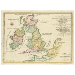
Original Antique Map of England, Ireland, Scotland and Wales
Located in Langweer, NL
Antique map titled 'Les Isles Britanniques, ou sont les Royaumes d Angleterre (..)'. Detailed map
Category

Early 18th Century Antique Ireland Maps

Materials

Paper

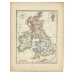
Antique Map of the United Kingdom and Ireland, 1852
Located in Langweer, NL
Antique map titled 'Groot-Brittanje en Ierland'. Map of the United Kingdom and Ireland. This map
Category

19th Century Antique Ireland Maps

Materials

Paper

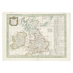
Antique Map of England and Ireland by Lattre, 1789
Located in Langweer, NL
Antique map titled 'Les Royaumes d'Angleterre d'Ecosse et d'Irlande'. Original antique map of
Category

18th Century Antique Ireland Maps

Materials

Paper

Antique Map of New Ireland with 7 Coastal Profiles
Located in Langweer, NL
Antique print titled 'l'Isle St. Jean (..) - Cap St. George (..)'. Antique map of New Ireland, an
Category

Late 18th Century Antique Ireland Maps

Materials

Paper

Large Original Antique Map of Ireland by Sidney Hall, 1847
Located in St Annes, Lancashire
Great map of Ireland Drawn and engraved by Sidney Hall Steel engraving Original colour
Category

1840s Scottish Antique Ireland Maps

Materials

Paper

Antique Map of the United Kingdom and Ireland, circa 1825
Located in Langweer, NL
Antique map titled 'Insula Britannicae'. Old map of the United Kingdom and Ireland originating from
Category

19th Century Antique Ireland Maps

Materials

Paper

Antique Map of the United Kingdom and Ireland, c.1873
Located in Langweer, NL
Antique map titled 'Groot Brittanje en Ierland'. Old map depicting the United Kingdom and Ireland
Category

19th Century Antique Ireland Maps

Materials

Paper

Original Antique Map of Ireland- Tipperary and Waterford. C.1840
Located in St Annes, Lancashire
Great map of Tipperary and Waterford Steel engraving Drawn under the direction of A.Adlard
Category

1840s English Antique Ireland Maps

Materials

Paper

1636 Jansson Map of Ireland Entitled "Comitatus Lageniae, " Ric.a007
Located in Norton, MA
1646 Jansson map entitled "Procinvia connactiae," Ric.a006 Description: The PROVINCE of
Category

17th Century Unknown Antique Ireland Maps

Materials

Paper

Detailed Antique Map of Britain, Wales and the Coast of Ireland
Located in Langweer, NL
and the coast of Ireland with a list of counties. This map originates from 'Nuovo Atlante Di Geografia
Category

Mid-19th Century Antique Ireland Maps

Materials

Paper

1585 Mercator Map of Ireland, Entitled "Irlandiae Regnvm, " Hand Colored Ric0006
Located in Norton, MA
1585 Mercator map of Ireland, entitled "Irlandiae Regnvm." Hand Colored Description
Category

16th Century Dutch Antique Ireland Maps

Materials

Paper

Small Antique Map of England, Wales, Scotland and Ireland with Original Coloring
Located in Langweer, NL
Antique map titled 'Les Royaumes d'Angleterre d'Escosse et d'Irlande (..)'. A lovely, small map of
Category

Early 18th Century Antique Ireland Maps

Materials

Paper

Original Antique Map of the United Kingdom and Ireland, Published in 1875
Located in Langweer, NL
United Kingdom and Ireland. This map originates from 'Atlas de Géographie Moderne Physique et Politique
Category

Late 19th Century Antique Ireland Maps

Materials

Paper

Southeastern Ireland: A 17th Century Hand Colored Map by Mercator and Hondius
By Gerard Mercator
Located in Alamo, CA
A 17th century copperplate hand-colored map entitled "The Second Table of Ireland, Udrone" by
Category

Mid-17th Century Dutch Antique Ireland Maps

Materials

Paper

England, Scotland & Ireland: A Hand Colored Map of Great Britain by Tirion
By Isaak Tirion
Located in Alamo, CA
This is a hand-colored double page copperplate map of Great Britain entitled "Nieuwe Kaart van de
Category

Mid-18th Century Dutch Antique Ireland Maps

Materials

Paper

Large Original Antique Map of the Environs of Cork, Ireland, circa 1880
Located in St Annes, Lancashire
Great map of The Environs of Cork Published circa 1880 Unframed Free shipping.
Category

1880s Scottish Antique Ireland Maps

Materials

Paper

Large Original Antique Map of The Environs of Dublin, Ireland, circa 1880
Located in St Annes, Lancashire
Great map of The Environs of Dublin Published circa 1880 Unframed Free shipping.
Category

1880s Scottish Antique Ireland Maps

Materials

Paper

Antique Map of New Ireland Island in the Bismarck Archipelago, New Guinea, 1772
Located in Langweer, NL
Antique map titled 'Nova Hibernia'. Antique map of New Ireland, an island in the Bismarck
Category

18th Century Antique Ireland Maps

Materials

Paper

Antique Map of Great Britain and Ireland by Brion de la Tour, 1766
Located in Langweer, NL
Antique map titled 'Les Isles Britanniques (..).' Attractive map of Great Britain surrounded by
Category

18th Century Antique Ireland Maps

Materials

Paper

Old Map of the UK & Ireland, Insets of Orkney, Shetland and Faroe Islands, 1786
Located in Langweer, NL
". Hand-colored engraved map with 2 (large) decorative cartouches, inset map of the Orkney, Shetland and
Category

1780s Antique Ireland Maps

Materials

Paper

Antique Map of the Coast of New Ireland, Earlier Part of German New Guinea, 1833
Located in Langweer, NL
. New Ireland, also New Mecklenburg, is the Northeastern Province of Papua New Guinea. Map no. 26 from
Category

19th Century Antique Ireland Maps

Materials

Paper

Original Antique Map of Leicestershire, England
Located in Langweer, NL
Antique map titled 'A Mapp of the Country of Leicester'. Original old map of Leicestershire
Category

Late 17th Century Antique Ireland Maps

Materials

Paper

Antique Map of Britain in Roman Times
Located in Langweer, NL
Antique map titled 'Britannia Romana collected from Ptolemy (..)'. Map of Britain in Roman times
Category

Early 19th Century Antique Ireland Maps

Materials

Paper

Antique Map of Britain in Roman Times
H 17.6 in W 11.07 in D 0.02 in
Antique Map of New Zealand by Arrowsmith '1844'
Located in Langweer, NL
Antique map titled 'Map of the colony of New Zealand from official documents'. A scarce map of New
Category

Mid-19th Century Antique Ireland Maps

Materials

Paper

Miniature Antique Map of Glamorganshire, Wales, c.1646
Located in Langweer, NL
Antique map titled 'Glamorganshire'. Miniature map of Glamorganshire, Wales. Later, this map was
Category

17th Century Antique Ireland Maps

Materials

Paper

Antique Map of the British Isles with Outline Coloring
Located in Langweer, NL
Antique map titled 'Iles Britanniques'. Attractive map of the British Isles. Details England
Category

Mid-19th Century Antique Ireland Maps

Materials

Paper

Map of the British Isles with Historical Kings, 1719
Located in Langweer, NL
This antique map, titled "Les Royaumes d'Angleterre d'Escosse et d'Irlande," offers a detailed view
Category

Early 18th Century Antique Ireland Maps

Materials

Paper

Antique Map of Northwest Europe by Kiepert, c.1870
Located in Langweer, NL
United Kingdom, Ireland, the Netherlands, Germany, Scandinavia and surroundings. This map originates from
Category

19th Century Antique Ireland Maps

Materials

Paper

1633 Map Entitled "Beauvaisis Comitatus Belova Cium, Ric.0002
Located in Norton, MA
. 1591-92 Hiberniae novissima descrzptio: Boazio\\\\\\\\\\\\\\\'s map of Ireland: Engraved by Pieter van
Category

17th Century Dutch Antique Ireland Maps

Materials

Paper

Original Antique Map of the British Isles Surrounded by Text
Located in Langweer, NL
Antique map titled 'Des Isles Britanniques'. Original antique map of the British isles. This map is
Category

Late 18th Century Antique Ireland Maps

Materials

Paper

Antique Map of the British Isles by Lotter, 1764
Located in Langweer, NL
Antique map titled 'Le Grand Bretagne ou les Royaumes d'Angleterre et d'Ecosse'. Old engraved map
Category

18th Century Antique Ireland Maps

Materials

Paper

Road Map, John Ogilby, No 54, London, Yarmouth, Britannia
By John Ogilby
Located in BUNGAY, SUFFOLK
-sixth year, as a publisher of maps and geographical accounts. Ogilby was born outside Dundee, in
Category

1670s English Baroque Antique Ireland Maps

Materials

Paper

Antique Map of the British Isles by H. Chatelain, 1719
By Henri-Abraham Chatelain
Located in Langweer, NL
Beautiful hand colored large format map of the British Isles, with large insets of the Eastern and
Category

Early 18th Century Antique Ireland Maps

Materials

Paper

Large Antique Map England and Wales, with Part of the Coastlines
Located in Langweer, NL
Antique map titled 'A Map of England and Wales (..)'. Large antique map of England and Wales, with
Category

Late 18th Century Antique Ireland Maps

Materials

Paper

Large Original Antique City Plan of Dublin, Ireland, circa 1880
Located in St Annes, Lancashire
Great city plan of Dublin Published circa 1880 Unframed Free shipping. .
Category

1880s Scottish Antique Ireland Maps

Materials

Paper

Antique Map of Saxon England according to the Anglo-Saxon Chronicle
Located in Langweer, NL
Antique map titled 'Saxon England According to the Saxon Chronicle'. Map of Saxon England based
Category

Early 19th Century Antique Ireland Maps

Materials

Paper

Antique Map of the Ancient British Isles by Janssonius 'circa 1640'
Located in Langweer, NL
Antique map titled 'Insularum Britannicarum Acurata Delineatio'. Original antique map of the
Category

Mid-17th Century Antique Ireland Maps

Materials

Paper

1859 Vintage Maps of England and Wales: Blackie's Imperial Geographic Detail
Located in Langweer, NL
The "Antique Map of England & Wales" from 'The Imperial Atlas of Modern Geography', published by W
Category

Mid-19th Century Antique Ireland Maps

Materials

Paper

Antique Map of the British Isles with Walls, Settlements and Other Features
Located in Langweer, NL
Antique map titled 'Insulae Britannicae'. Interesting map of Britain, Scotland, and Ireland. It
Category

Late 18th Century Antique Ireland Maps

Materials

Paper

Antique Map of the British Isles, Insets of the Shetland Islands and Hebrides
Located in Langweer, NL
Antique map titled 'Great Britain and Ireland with ye Judges Circuits'. A scarce map of the British
Category

Late 18th Century Antique Ireland Maps

Materials

Paper

Colorful Detailed Antique Map of The British Islands and `The North Sea, 1882
Located in Langweer, NL
Discover 'The British Islands and The North Sea' Map with Insets of Orkney, Shetland, and Channel
Category

1880s Antique Ireland Maps

Materials

Paper

Antique Map of New Guinea and New Britain by P. Carteret, circa 1773
Located in Langweer, NL
Antique map titled 'A chart of captn Carteret's Discoveries at New Britain'. Philip Carterets map
Category

Late 18th Century Antique Ireland Maps

Materials

Paper

Map Road Strip Britannia Sheet 2 John Ogilby London Aberistwith Islip Bramyard
By John Ogilby
Located in BUNGAY, SUFFOLK
of England and Wales. Strip map Islip to Bramyard, on a scale of approximately one inch to the mile
Category

17th Century English Baroque Antique Ireland Maps

Materials

Paper

Road Map John Ogilby No 75 Kings Lyn Harwich, Britannia Framed Wallhanging
By John Ogilby
Located in BUNGAY, SUFFOLK
, as a publisher of maps and geographical accounts. Ogilby was born outside Dundee, in 1600, the
Category

1670s European Baroque Antique Ireland Maps

Materials

Paper

Map Road John Ogilby Britannia No 74 Ipswich to Norwich Cromer Framed
By John Ogilby
Located in BUNGAY, SUFFOLK
his sixty-sixth year, as a publisher of maps and geographical accounts. Ogilby was born outside
Category

1670s English Baroque Antique Ireland Maps

Materials

Paper

Large Antique Map of the British Isles, with inset of the Orkneys and Shetlands
Located in Langweer, NL
Antique map titled 'A Map of Great Britain and Ireland (..)'. Large antique map of the British
Category

Late 18th Century Antique Ireland Maps

Materials

Paper

Pl. 27 Antique Chart of the US Irish and German Population in 1870, '1874'
Located in Langweer, NL
Antique chart titled 'Maps showing the distribution, within the territory of the United States
Category

Late 19th Century Antique Ireland Maps

Materials

Paper

Antique Map of the British Isles According to the Geography of the Roman Empire
Located in Langweer, NL
Antique map titled 'Insulae Britannicae'. Interesting map of Britain, Scotland, and Ireland. It
Category

Late 18th Century Antique Ireland Maps

Materials

Paper

Map Hanging Wall County of Devon C&J Greenwood 1827 Exeter Cathedral Lundy Isle
Located in BUNGAY, SUFFOLK
C & J GREENWOOD MAP OF THE COUNTY OF DEVON, FROM AN ORIGINAL SURVEY, PUBLISHED 1827, WITH ENGRAVING
Category

1820s English Early Victorian Antique Ireland Maps

Materials

Paper

Road Map No43 London to Kings Lynn, Royston to Downham, John Ogilby, Britannia
By John Ogilby
Located in BUNGAY, SUFFOLK
John Ogilby (British 1600-1676) Cosmographer and Geographick Printer to Charles II. A road map
Category

Late 17th Century British Charles II Antique Ireland Maps

Materials

Paper

Road Map John Ogilby London St David's Britannia No 15 Abingdon Monmouth Framed
By John Ogilby
Located in BUNGAY, SUFFOLK
John Ogilby (British 1600-1676) Cosmographer and Geographick Printer to Charles II. A road map from
Category

1670s English Baroque Antique Ireland Maps

Materials

Paper

Road Map Britannia No 32 the Road from London to Barnstable John Ogilby Framed
By John Ogilby
Located in BUNGAY, SUFFOLK
A road map from Britannia, by John Ogilby Esq., Cosmographer and Geographick Printer to Charles II
Category

Late 17th Century English Charles II Antique Ireland Maps

Materials

Paper

Road Map Britannia No 15 London to St Davids John Ogilby Brown Gilt Frame
By John Ogilby
Located in BUNGAY, SUFFOLK
Lechlade, to Fairford, to Barnsley to Gloucester showing Monmouth as the destination. A road map from
Category

Late 17th Century British Charles II Antique Ireland Maps

Materials

Paper

Large Antique Map of New Guinea and New Britain Showing Capt. Cooks Tract, 1773
Located in Langweer, NL
Antique map titled 'A Chart of Captain Carteret's Discoveries at New Britain, with part of Captain
Category

18th Century Antique Ireland Maps

Materials

Paper

Large 17th Century Hand Colored Map of England and the British Isles by de Wit
By Frederick de Wit
Located in Alamo, CA
A large hand colored 17th century map of England and the British Isles by Frederick de Wit entitled
Category

Late 17th Century Dutch Antique Ireland Maps

Materials

Paper

  • 1
Get Updated with New Arrivals
Save "Antique Ireland Maps", and we’ll notify you when there are new listings in this category.

Antique Ireland Maps For Sale on 1stDibs

At 1stDibs, there are several options of antique ireland maps available for sale. Each of these unique antique ireland maps was constructed with extraordinary care, often using paper, fabric and linen. Antique ireland maps have long been popular, with older editions for sale from the 18th Century and newer versions made as recently as the 20th Century. Isaak Tirion, Gerard Mercator and Nicolaes Visscher II each produced beautiful antique ireland maps that are worth considering.

How Much are Antique Ireland Maps?

Antique ireland maps can differ in price owing to various characteristics — the average selling price at 1stDibs is $425, while the lowest priced sells for $60 and the highest can go for as much as $2,775.

Read More

Pamela Shamshiri Shares the Secrets behind Her First-Ever Book and Its Effortlessly Cool Interiors

The sought-after designer worked with the team at Hoffman Creative to produce a monograph that beautifully showcases some of Studio Shamshiri's most inspiring projects.

Moroccan Artworks and Objects Take Center Stage in an Extraordinary Villa in Tangier

Italian writer and collector Umberto Pasti opens the doors to his remarkable cave of wonders in North Africa.

Montecito Has Drawn Royalty and Celebrities, and These Homes Are Proof of Its Allure

Hollywood A-listers, ex-pat aristocrats and art collectors and style setters of all stripes appreciate the allure of the coastal California hamlet — much on our minds after recent winter floods.

Whaam! Blam! Pow! — a New Book on Pop Art Packs a Punch

Publishing house Assouline and writer Julie Belcove have teamed up to trace the history of the genre, from Roy Lichtenstein, Andy Warhol and Yayoi Kusama to Mickalene Thomas and Jeff Koons.

The Sparkling Legacy of Tiffany & Co. Explained, One Jewel at a Time

A gorgeous new book celebrates — and memorializes — the iconic jeweler’s rich heritage.

What Makes a Gem-Encrusted Chess Set Worth $4 Million?

The world’s most opulent chess set, weighing in at 513 carats, is literally fit for a king and queen.

Tauba Auerbach’s Geometric Pop-Up Book Is Mighty Rare, Thanks to a Hurricane

This sculptural art book has an epic backstory of its own.

Step inside the Storied Mansions of Palm Beach’s Most Effervescent Architect

From Spanish-style courtyards to fanciful fountains, these acclaimed structures abound in surprising and elegant details.