Items Similar to Original Hand-Colored Antique Map of Artois or Artesia, France, ca.1650


Want more images or videos?
Request additional images or videos from the seller
1 of 5
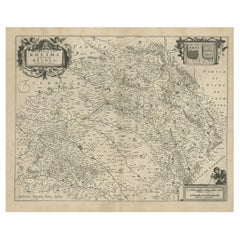
Original Hand-Colored Antique Map of Artois or Artesia, France, ca.1650
About the Item
Antique map titled 'Artesia Comitatus Artois'.
Map of Artois or Artesia, France. Artois is former province located in the northwestern part of France, boarding Belgium (Flanders) on the north and Picardy to the south.
Artists and Engravers: Engraved by J. Janssonius. Johannes Janssonius (Jansson), ( 1588- 1664) Amsterdam was born in Arnhem, the son of Jan Janszoon the Elder,a publisher and bookseller.
- Dimensions:Height: 19.69 in (50 cm)Width: 22.84 in (58 cm)Depth: 0 in (0.02 mm)
- Materials and Techniques:
- Period:1650-1659
- Date of Manufacture:circa 1650
- Condition:Wear consistent with age and use. Condition: Good, age-related toning. Some staining. Original, contemporary hand coloring. Latin text on verso. Please study image carefully.
- Seller Location:Langweer, NL
- Reference Number:
About the Seller
5.0
Platinum Seller
These expertly vetted sellers are 1stDibs' most experienced sellers and are rated highest by our customers.
Established in 2009
1stDibs seller since 2017
1,922 sales on 1stDibs
Typical response time: <1 hour
- ShippingRetrieving quote...Ships From: Langweer, Netherlands
- Return PolicyA return for this item may be initiated within 14 days of delivery.
More From This SellerView All
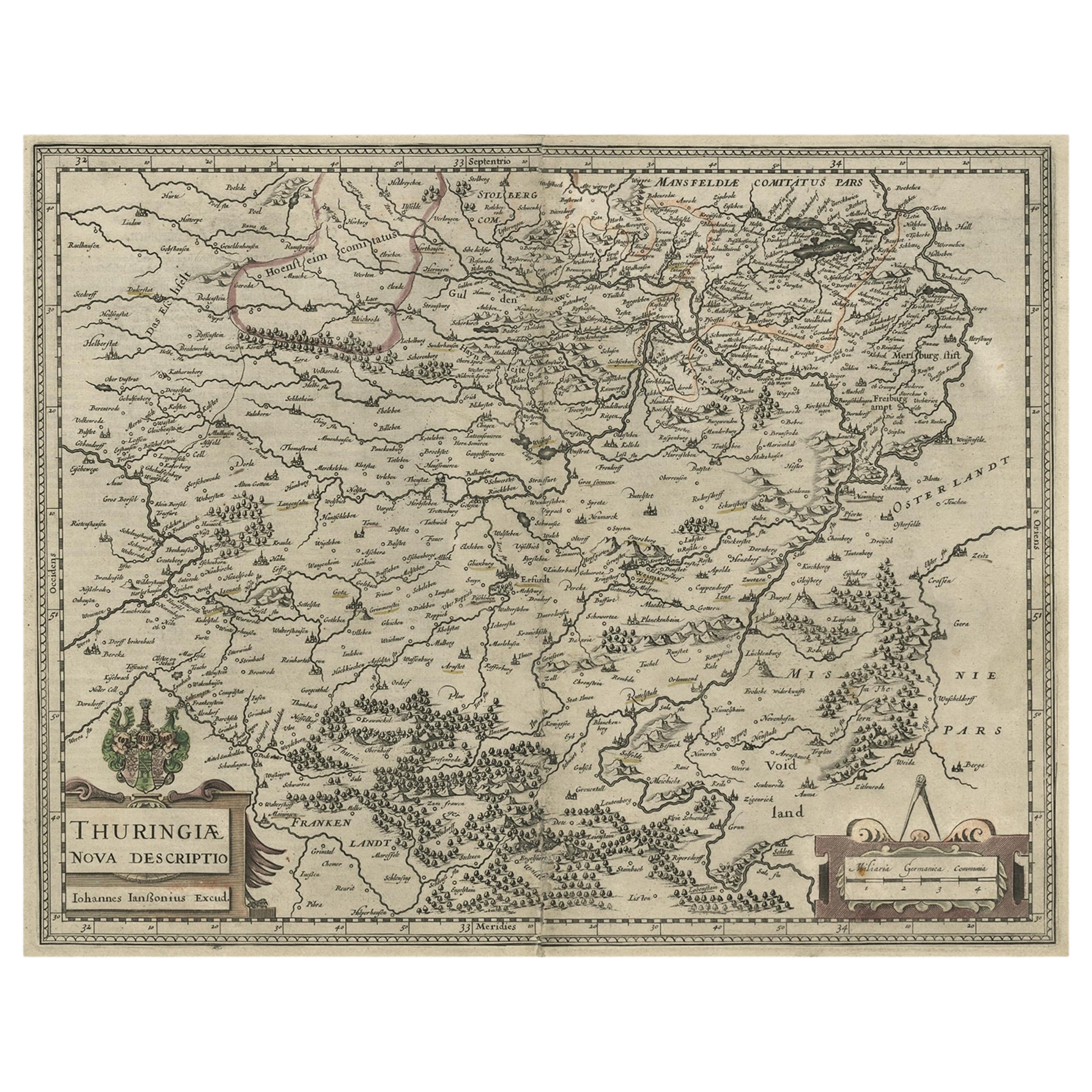
- Detailed Original Antique Map of Thuringia, Germany by J. Janssonius, ca.1650Located in Langweer, NLAntique map titled 'Thuringiae Nova Descriptio.' Detailed map of Thuringia, Germany by J. Janssonius. With one cartouche, coat-of-arms and a mileage scale. With Erfurt in the centre....Category
Antique 1650s Maps
MaterialsPaper
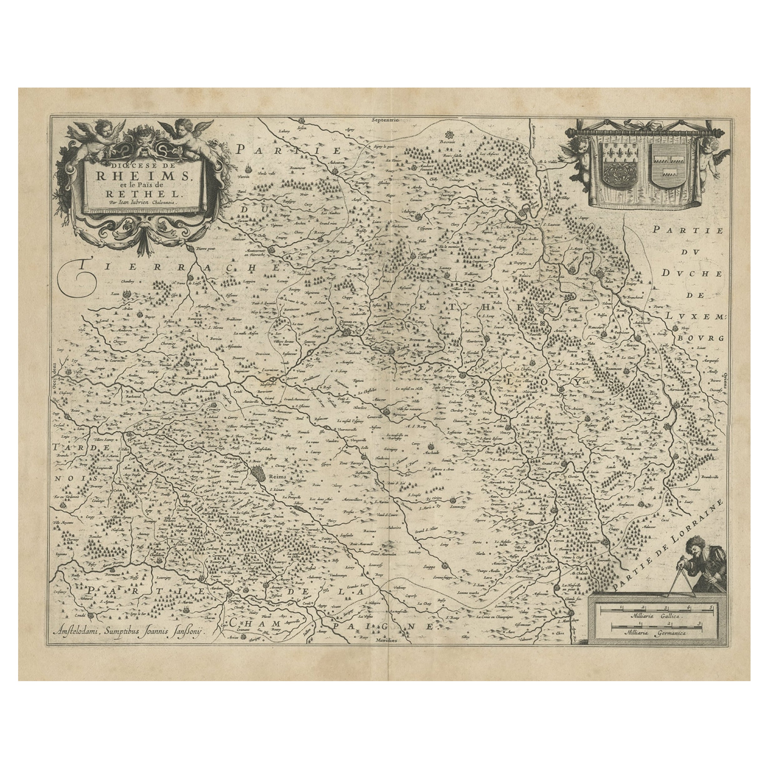
- Antique Map of the Rethelois or Rethel Region in France by Janssonius, ca.1650By Johannes JanssoniusLocated in Langweer, NLAntique map of France titled 'Dioecese de Rheims et le Païs de Rethel'. Detailed map, centered on the River Ayne and the River Velle and sowing Reims, Chalons, Rethel, Sedan, Cha...Category
Antique 17th Century Maps
MaterialsPaper
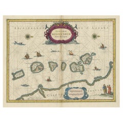
- Beautiful Antique Map of the Moluccas or Spice Islands, Indonesia, ca.1650Located in Langweer, NLAntique map titled 'Insularum Moluccarum Nova Descriptio.' Beautiful map of the Moluccas. The famous Spice Islands, the cornerstone of the Dutc...Category
Antique 1650s Maps
MaterialsPaper
- Antique Map of France by Janssonius, c.1650Located in Langweer, NLAntique map titled 'Gallia Vetus'. Beautiful map of France based on Caesar's De Bello Gallico. In the columns to the left and right important tribes and people are described. Art...Category
Antique 17th Century Maps
MaterialsPaper
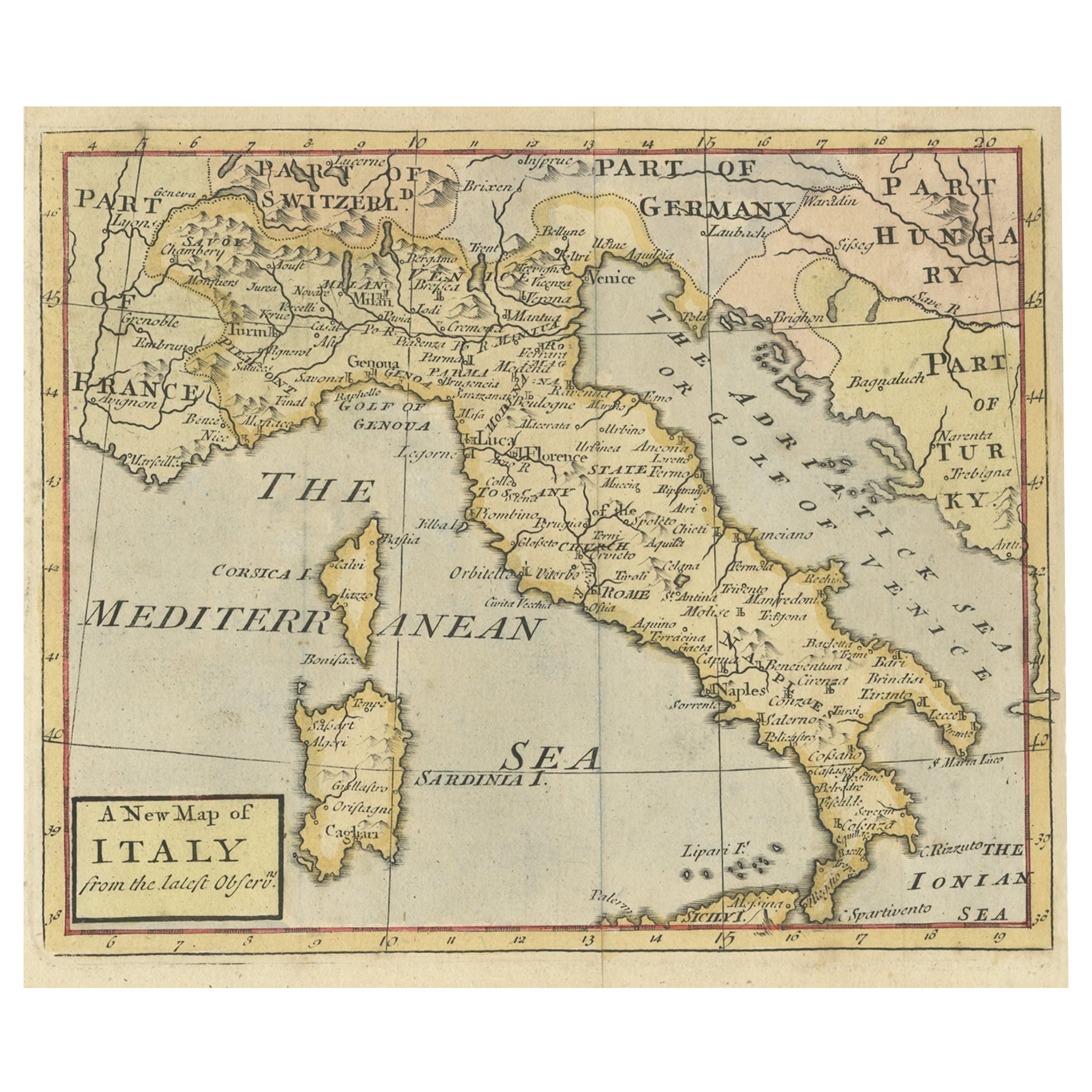
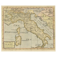
- Nice Decorative Hand-Colored Antique Map of Italy, ca.1745Located in Langweer, NLAntique map Italy titled 'A New Map of Italy from the lastest observations'. Antique map of Italy originating from 'Geography Anatomiz'd: or, The G...Category
Antique 1740s Maps
MaterialsPaper
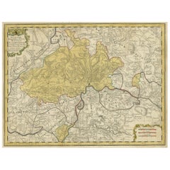
- Original Hand-Colored Antique Regional Map of Switzerland, 1753Located in Langweer, NLAntique map Switzerland titled 'Territorium Reipublicae liberae Helveticae Scaphusiensis (..)'. Regional map of Switzerland. Artists and En...Category
Antique 1750s Maps
MaterialsPaper

You May Also Like
- Original Antique Map of France, Arrowsmith, 1820Located in St Annes, LancashireGreat map of France Drawn under the direction of Arrowsmith. Copper-plate engraving. Published by Longman, Hurst, Rees, Orme and Brown, 1820 Unframed.Category
Antique 1820s English Maps
MaterialsPaper
- Original Antique Map of Italy. C.1780Located in St Annes, LancashireGreat map of Italy Copper-plate engraving Published C.1780 Unframed.Category
Antique Early 1800s English Georgian Maps
MaterialsPaper

- Original Antique Map of Asia. C.1780Located in St Annes, LancashireGreat map of Asia Copper-plate engraving Published C.1780 Two small worm holes to right side of map Unframed.Category
Antique Early 1800s English Georgian Maps
MaterialsPaper

- Original Antique Map of India. C.1780Located in St Annes, LancashireGreat map of India Copper-plate engraving Published C.1780 Three small worm holes to right side of map and one bottom left corner Unframed.Category
Antique Early 1800s English Georgian Maps
MaterialsPaper

- Original Antique Map of France, Sherwood, Neely & Jones, Dated 1809Located in St Annes, LancashireGreat map of France Copper-plate engraving by Cooper Published by Sherwood, Neely & Jones. Dated 1809 Unframed.Category
Antique Early 1800s English Maps
MaterialsPaper
- The Normandy Region of France: A 17th C. Hand-colored Map by Sanson and JaillotBy Nicolas SansonLocated in Alamo, CAThis large hand-colored map entitled "Le Duché et Gouvernement de Normandie divisée en Haute et Basse Normandie en divers Pays; et par evêchez, avec le Gouvernement General du Havre ...Category
Antique 1690s French Maps
MaterialsPaper


