Map Of Us
1
239
192
15
to
21
235
195
445
305
322
76
24
7
5
3
2
2
2
1
16
63
159
207
16
63
66
2
2
1
11
14
14
8
19
5
2
146
141
119
53
43
234
119
116
70
39
42
37
30
11
11
Sort By
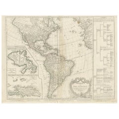
Antique Map of America by Vaugondy, 1778
Located in Langweer, NL
Antique map titled 'Amerique ou Indes Occidentales (..)'. Vaugondy's map of America, pre-dating
Category
Antique Late 18th Century Maps
Materials
Paper
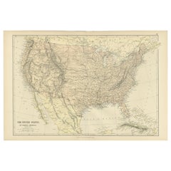
Antique Map of The United States of North America, 1882
Located in Langweer, NL
This is a historical map titled "The United States of North America, Central Part" from the 1882
Category
Antique 1880s Maps
Materials
Paper
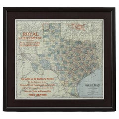
1908 "Map of Texas" by The Kenyon Company
Located in Colorado Springs, CO
map. At the bottom right, the map further invites viewers to: "Go with us to Dalhart, Texas. We run
Category
Antique Early 1900s American Maps
Materials
Paper
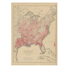
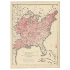
Antique Chart of the US Malarial Deaths, '1874'
Located in Langweer, NL
Antique chart titled 'Map showing the proportion of deaths from malarial diseases to deaths from
Category
Antique Late 19th Century Maps
Materials
Paper
Antique Chart of the US Consumption Deaths, '1874'
Located in Langweer, NL
Antique chart titled 'Map showing the proportion of deaths from consumption to deaths from all
Category
Antique Late 19th Century Maps
Materials
Paper
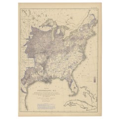
Antique Chart of the US Predominating Sex, 1874
Located in Langweer, NL
Antique chart titled 'Map of predominating sex showing the local excess of males or of females in
Category
Antique Late 19th Century Maps
Materials
Paper
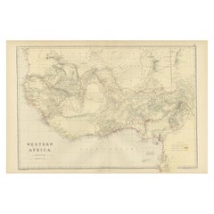
Original Antique Coloured Map of Western Africa, Published in 1882
Located in Langweer, NL
This is a map of Western Africa from the 1882 Blackie & Son atlas. The map details the West African
Category
Antique 1880s Maps
Materials
Paper
No Reserve
H 14.97 in W 22.45 in D 0 in
1859 "Map of the United States of America..." by J. H. Colton
By J.H. Colton
Located in Colorado Springs, CO
Civil War.
The map has an elaborate and decorative pictorial border, with scenes of the “US Capitol
Category
Antique 1850s American Maps
Materials
Paper
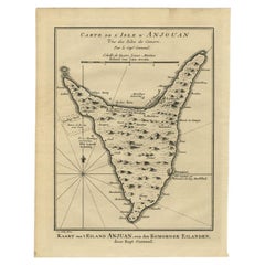
Antique Map of Anjouan or Ndzuani Island, Part of The Comoros, 1749
Located in Langweer, NL
Antique map titled ‘Carte de L’Isle D’Anjouan - Kaart van 't Eiland Anjouan’. Original antique map
Category
Antique 18th Century Maps
Materials
Paper
Pl. 35 Antique Chart of the US Taxation, 1874
Located in Langweer, NL
Antique chart titled 'Map showing the degree of taxation per capita imposed by state, county or
Category
Antique Late 19th Century Maps
Materials
Paper
Pl. 34 Antique Chart of the US Public Indebtedness, 1874
Located in Langweer, NL
Antique chart titled 'Map showing the degree of public indebtedness per capita. Contracted by state
Category
Antique Late 19th Century Maps
Materials
Paper
Original Hand-Colored Antique Map of America by Danckerts, circa 1680
Located in Langweer, NL
pushed far west of its true mouth. The large lake in the Southeastern US first seen on Le Moyne's map is
Category
Antique Late 17th Century Maps
Materials
Paper
H 20.48 in W 24.22 in D 0.02 in
Pl. 40 Antique Chart of the US Birth Rate, 1874
Located in Langweer, NL
Antique chart titled 'Map showing, in five degrees of density, the birth rate prevailing in the
Category
Antique Late 19th Century Maps
Materials
Paper
Pl. 29 Antique Chart of the US Illiteracy in 1870, '1874'
Located in Langweer, NL
Antique chart titled 'Map showing the illiteracy of the aggregate population. Compiled from the
Category
Antique Late 19th Century Maps
Materials
Paper
Antique Chart of the US Adult Male Illiteracy in 1870, '1874'
Located in Langweer, NL
Antique chart titled 'Map showing the illiteracy of the adult white male population. Compiled from
Category
Antique Late 19th Century Maps
Materials
Paper
Pl. 45 Antique Chart of the US Inestinal Diseases Deaths, 1874
Located in Langweer, NL
Antique chart titled 'Map showing the proportion of deaths from intestinal diseases to deaths from
Category
Antique Late 19th Century Maps
Materials
Paper
Antique Chart of the US Foreign Parentage Proportion in 1870, '1874'
Located in Langweer, NL
Antique chart titled 'Map showing the proportion to the aggregate population, of persons having one
Category
Antique Late 19th Century Maps
Materials
Paper
Antique Chart of the US Enteric, Cerebro-Spinal, Typhus Deaths, '1874'
Located in Langweer, NL
Antique chart titled 'Map showing the proportion of deaths from enteric, cerebro-spinal and typhus
Category
Antique Late 19th Century Maps
Materials
Paper
H 21.66 in W 16.15 in D 0.02 in
Antique Chart of the US Population in 1870, published in 1874
Located in Langweer, NL
Antique chart titled 'Map showing, in five degrees of density, the distribution, within the
Category
Antique Late 19th Century Maps
Materials
Paper
Pl. 28 Antique Chart of British American, English (..) US Population, 1874
Located in Langweer, NL
Antique chart titled 'Maps showing the distribution, within the territory of the United States
Category
Antique Late 19th Century Maps
Materials
Paper
H 21.66 in W 16.15 in D 0.02 in
Cartographic Elegance: The Art and Science of 17th-Century Asian Maps, ca.1681
Located in Langweer, NL
antique maps. His engravings, like this map of Asia, serve as historical records that tell us about the
Category
Antique 1680s Maps
Materials
Paper
H 7.49 in W 9.22 in D 0 in
Pl. 36A Antique Chart of US Farms, Agriculture and Crops '1874'
Located in Langweer, NL
.. Chart of US crops, farms and total agricultural production. Originates from 'Statistical Atlas of the
Category
Antique Late 19th Century Maps
Materials
Paper
Pl. 33 Antique Chart of the US Wealth Distribution in 1870 '1874'
Located in Langweer, NL
Antique chart titled 'Map showing the distribution of wealth. Compiled from the tables of "true
Category
Antique Late 19th Century Maps
Materials
Paper
Pl. 17A Antique Chart of the US Population 1860 by Walker, '1874'
Located in Langweer, NL
Antique chart titled 'Map showing in five degrees of density, the distribution, within the
Category
Antique Late 19th Century Maps
Materials
Paper
Pl. 17 Antique Chart of the US Population 1850 by Walker, 1874
Located in Langweer, NL
Antique chart titled 'Map showing in five degrees of density, the distribution, within the
Category
Antique Late 19th Century Maps
Materials
Paper
Pl. 25 Antique Chart of the US Foreign Population in 1870, '1874'
Located in Langweer, NL
Antique chart titled 'Map showing five degrees of density the distribution of the foreign
Category
Antique Late 19th Century Maps
Materials
Paper
Pl. 23 Antique Chart of the US Foreign Parentage in 1870, '1874'
Located in Langweer, NL
Antique chart titled 'Map showing, in five degrees of density, the distribution, within the
Category
Antique Late 19th Century Maps
Materials
Paper
Old Map of the Great Lakes and Upper Mississippi Valley, Northern America, c1780
Located in Langweer, NL
Antique map titled 'Partie Occidentale du Canada'.
A fine example of Rigobert Bonne and
Category
Antique 1780s Maps
Materials
Paper
H 10.32 in W 14.85 in D 0 in
Pl. 36 Antique Chart of US Crops, Wheat, Rice, Tobacco, Hops, Oats '1874'
Located in Langweer, NL
Antique chart titled 'Maps showing the range, and within the range, the degree of cultivation of
Category
Antique Late 19th Century Maps
Materials
Paper
H 21.66 in W 16.15 in D 0.02 in
Pl. 16A Antique Chart of the US Population 1830-1840 by Walker, 1874
Located in Langweer, NL
Antique chart titled 'Map showing, in five degrees of density, the distribution, within the
Category
Antique Late 19th Century Maps
Materials
Paper
Pl. 26 Antique Chart of the US Foreign Population Proportion in 1870, '1874'
Located in Langweer, NL
Antique chart titled 'Map showing the proportion of the foreign to the aggregate population
Category
Antique Late 19th Century Maps
Materials
Paper
H 21.66 in W 16.15 in D 0.02 in
Pl. 22 Antique Chart of the US Colored Population Proportion in 1870, '1874'
Located in Langweer, NL
Antique chart titled 'Map showing the proportion of the colored to the aggregate population
Category
Antique Late 19th Century Maps
Materials
Paper
H 21.66 in W 16.15 in D 0.02 in
Pl. 16 Antique Chart of the US Population 1790-1820 by Walker, '1874'
Located in Langweer, NL
Antique chart titled 'The progress of the nation, 1790-1820. Maps showing in five degrees of
Category
Antique Late 19th Century Maps
Materials
Paper
H 21.66 in W 16.15 in D 0.02 in
Pl. 21 Antique Chart of the US Colored Population Density in 1870, '1874'
Located in Langweer, NL
Antique chart titled 'Map showing in five degrees of density the distribution of the colored
Category
Antique Late 19th Century Maps
Materials
Paper
H 21.66 in W 16.15 in D 0.02 in
Antique Decorative Coloured Map Marocco, Algeria and Tunis, 1882
Located in Langweer, NL
and refueling.
6. **Comparative Analysis**: When viewed alongside modern maps, it allows us to see
Category
Antique 1880s Maps
Materials
Paper
Free Shipping
H 14.97 in W 22.45 in D 0 in
Pl. 27 Antique Chart of the US Irish and German Population in 1870, '1874'
Located in Langweer, NL
Antique chart titled 'Maps showing the distribution, within the territory of the United States
Category
Antique Late 19th Century Maps
Materials
Paper
H 21.66 in W 16.15 in D 0.02 in
Antique Decorative Coloured Map Egypt, Nubia, Abyssinia and more, 1882
Located in Langweer, NL
This image contains two maps, with the left one being labeled "Egypt" and the right one "Nubia
Category
Antique 1880s Maps
Materials
Paper
Free Shipping
H 14.97 in W 22.45 in D 0 in
Two Impressive and Huge Midcentury World Map Wall Globes, Austria, 1950s
Located in Vienna, AT
We proudly offer this outstanding pair of very large wall-mounted modernist globes / world maps
Category
Mid-20th Century Austrian Mid-Century Modern Maps
Materials
Aluminum, Iron
Renaissance Mapping of Sumatra: Featuring Singapore in Münster’s Woodcut, c.1590
Located in Langweer, NL
Description: Antique map titled 'Sumatra ein grosse Insel / so von den alten Geographen Taprobana
Category
Antique 16th Century Maps
Materials
Paper
Free Shipping
H 13.39 in W 16.34 in D 0 in
Old Print of Baltiysk or Pillau, a Seaport Town Near Kaliningrad, Russia, 1652
Located in Langweer, NL
Vistula Lagoon from Gdansk Bay. This print originates from 'Topographia Electorat[us] Brandenburgici et
Category
Antique 1650s Maps
Materials
Paper
H 11.23 in W 14.18 in D 0 in
Vintage US Map American Flag Wall Art
Located in San Diego, CA
Beautiful and original wall art in the shape of the US depicting the American Flag along with all
Category
1990s American Folk Art Picture Frames
Materials
Canvas
Original Vintage WWII Poster De Dollarpoliep The US Dollar Polyp Octopus War Map
Located in London, GB
Dollarpoliep / The Dollar Polyp or The Dollar Octopus - featuring an image of a US dollar sign with octopus
Category
Vintage 1940s Dutch Posters
Materials
Paper
H 17.72 in W 23.23 in D 0.04 in
Original WWII Illustrated Map Poster - Time And Tide Map Of The Atlantic Charter
By "Leslie MacDonald ""Max"" Gill"
Located in London, GB
Original vintage illustrated map poster in Spanish by the notable graphic designer, cartographer
Category
Vintage 1940s British Posters
Materials
Paper
H 44.89 in W 34.85 in D 0.04 in
Map, Exploring The World
Located in New York City, NY
300 stunning maps from all periods and from all around the world, exploring and revealing what maps
Category
21st Century and Contemporary Hong Kong Books
Materials
Paper
Late 20th Century Educational Geographic Map - Continent Of Americas Industry
Located in Hook, Hampshire
Late 20th Century Educational Geographic Map – Continent Of Americas Industry
Late 20th Century
Category
Late 20th Century Czech Posters
Materials
Cotton
H 73.23 in W 51.58 in D 0.4 in
Important Confederate Field Map of Richmond VA 1864 with Provenance
Located in Dallas, TX
'personal' field map for the Battle of the Richmond Peninsula in 1864, at the end of the US Civil War.
It
Category
Antique Mid-19th Century American American Classical Historical Memorabilia
Materials
Canvas, Paper
Large French Paris Metro Map 1960s
Located in North Hollywood, CA
Large French Paris Metro Map 1960s.
A large Vintage French framed map of the Parisian Metro from
Category
Mid-20th Century French Industrial Prints
Materials
Wood, Paper
Vintage Map Wall Chart Countries of North America Rollable Mural Poster
Located in Berghuelen, DE
The vintage pull-down school map illustrates the countries / states of North America. Published by
Category
Late 20th Century German Country Prints
Materials
Canvas, Wood, Paper
H 51.19 in W 39.38 in D 0.79 in
Vintage Mural Map of North Africa Countrycore African Wall Chart Decoration
Located in Berghuelen, DE
The wall map shows North Africa. It was published by Westermann-Schulwandkarten. Used as teaching
Category
Late 20th Century German Country Prints
Materials
Canvas, Wood, Paper
H 61.42 in W 100.01 in D 0.79 in
Late 20th Century Educational Geographic Map - Australasia
Located in Hook, Hampshire
Late 20th Century Educational Geographic Map – Australasia
Late 20th Century Educational Geographic
Category
Late 20th Century Czech Posters
Materials
Cotton
Late 20th Century Educational Geographic Map - Hemispheres
Located in Hook, Hampshire
Late 20th Century Educational Geographic Map – Hemispheres
Late 20th Century Educational Geographic
Category
Late 20th Century Czech Posters
Materials
Cotton
Antique 20th Century Large Scrolled Map Of The World, George Philips c.1918
Located in Royal Tunbridge Wells, Kent
Antique early-20th Century large commercial map of the world by George Philips. This scrolled map
Category
Vintage 1910s British Other Prints
Materials
Wood, Paper
H 47.64 in W 85.04 in D 1.58 in
Bark Map Stool, Set of 3 by Timbur, Represented by Tuleste Factory
By Timbur
Located in New York, NY
consists of pine bark displacement data mapped to a cylindrical form; zero, forty-five and ninety degree
Category
21st Century and Contemporary American Stools
Materials
Pine
Religious Bible Mural Journey of Apostle Paul Rollable Vintage Map Wall Chart
Located in Berghuelen, DE
A colorful picturous map showing the journey of the apostle Paul, published by Becker´s Hamburg
Category
Late 20th Century German Country Prints
Materials
Paper, Canvas, Wood
H 66.15 in W 85.44 in D 0.79 in
Vintage Picture Poster Wall Chart Rollable Large Map Peoples Republic of China
Located in Berghuelen, DE
A vintage wall chart illustrating a map of people's republic of china. Used as teaching material in
Category
Late 20th Century German Country Prints
Materials
Canvas, Wood, Paper
H 63 in W 84.26 in D 0.79 in
Northern Hemisphere of the Earth Rollable Map Vintage Wall Chart World Mural
Located in Berghuelen, DE
A great pull-down map or vintage wall chart illustrating the northern hemisphere of the earth
Category
Mid-20th Century German Country Prints
Materials
Canvas, Wood, Paper
H 70.48 in W 66.93 in D 0.79 in
Vintage Mural Pull Down Wall Chart City Map of Moscow Russia Poster
Located in Berghuelen, DE
with money back guarantee. This qualifies us as your preferred partner for Black Forest and antique art.
Category
Mid-20th Century German Country Prints
Materials
Canvas, Wood, Paper
Late 20th Century Educational Geographic Map - USA Topography
Located in Hook, Hampshire
Late 20th Century Educational Geographic Map – USA Topography
Late 20th Century Educational
Category
Late 20th Century Czech Posters
Materials
Cotton
Late 20th Century Educational Geographic Map - African Climate
Located in Hook, Hampshire
Late 20th Century Educational Geographic Map – African Climate
Late 20th Century Educational
Category
Late 20th Century Czech Posters
Materials
Cotton
Late 20th Century Educational Geographic Map - Worlds Resources
Located in Hook, Hampshire
Late 20th Century Educational Geographic Map – Worlds Resources
Late 20th Century Educational
Category
Late 20th Century Czech Posters
Materials
Cotton
- 1
Get Updated with New Arrivals
Save "Map Of Us", and we’ll notify you when there are new listings in this category.
Map Of Us For Sale on 1stDibs
Choose from an assortment of styles, material and more with respect to the map of us you’re looking for at 1stDibs. Frequently made of paper, every map of us was constructed with great care. A map of us is a generally popular piece of furniture, but those created in styles are sought with frequency. A well-made map of us has long been a part of the offerings for many furniture designers and manufacturers, but those produced by J.H. Colton are consistently popular.
How Much is a Map Of Us?
Prices for a map of us can differ depending upon size, time period and other attributes — at 1stDibs, they begin at $494 and can go as high as $1,112, while the average can fetch as much as $566.
Questions About Map Of Us
- What were hutches used for?1 Answer1stDibs ExpertMay 5, 2023Hutches were used for holding china and glassware in a kitchen. Decorative pieces could historically be placed on the upper shelves and smaller odds and ends could be tucked away in cabinets and drawers below. Today, many people still utilize hutches in this way, but they may also choose to store other items inside. On 1stDibs, shop a range of hutches.
- How do I use a tulipiere?1 Answer1stDibs ExpertApril 5, 2022To use a tulipiere, first add water. This will help to preserve fresh flowers. For silk or dried blooms, skip this step. Then, add flowers stem by stem to the various openings in the vase. On 1stDibs, shop a variety of tulipieres.
- What is Sphene used for?1 Answer1stDibs ExpertApril 5, 2022Sphene is a rare yellow to green-hued gemstone also called titanite. It is used in jewelry and is known for its exceptional dispersion and luster, making it a particularly eye-catching gem. Shop an array of sphene jewelry from top boutiques on 1stDibs.
- What is a nightstand used for?1 Answer1stDibs ExpertAugust 16, 2019
Nightstands are typically used to hold or support items that are used during the night or items you want by your side in the morning or whenever you are laying in bed such as a lamp, a book or a clock.
- What is Ruby used for?1 Answer1stDibs ExpertFebruary 22, 2021A ruby is a common stone used in jewelry. The benefits of wearing a ruby stone includes inducating the feelings of love, warmth, and compassion in the heart.
- What is burl used for?1 Answer1stDibs ExpertApril 5, 2022Burl wood can be used in a number of different ways. The wood is sourced from growths on trees called burls and has an unusual pattern that differs from typical woodgrain. It is suitable for making solid and veneered furniture, gun socks, musical instruments and decorative accents for homes. On 1stDibs, shop a collection of burl wood furniture and decorative objects.
- What is a bodysuit used for?2 Answers1stDibs ExpertApril 5, 2022Bodysuits create a foundation on which to build your outfits. Bodysuits can be worn as an undergarment that provides support and hugs your curves or as a piece itself, layered with any type of bottoms to make a style statement. Shop a collection of vintage and contemporary bodysuits from some of the world’s top boutiques on 1stDibs.1stDibs ExpertApril 5, 2022Bodysuits have a number of different uses, including as foundation garments, underwear or activewear. Christian Dior and Versace are a few of the many fashion houses that have made the bodysuit their own over the years. On 1stDibs, shop a collection of vintage and contemporary bodysuits from some of the world’s top sellers.
- What were cameos used for?1 Answer1stDibs ExpertApril 5, 2022A cameo is a decorative accessory made of hard stone or gemstone, on which portraits or “reliefs” are carved. First seen in ancient Rome, the piece became popular again in the Victorian era, and is still seen in production today. Find a collection of vintage and contemporary cameos from some of the world’s top sellers on 1stDibs.
- What are tankards used for?1 Answer1stDibs ExpertApril 5, 2022Tankards were widely used for drinking ales. They were widely used in Germany, Great Britain and in the Scandinavian countries. Metal tankards generally had a glass bottom, and legend has it, this was designed as a way to avoid conscription. If the drinker saw a coin in the bottom of the glass, they would refuse the drink, thus avoiding conscription. You’ll find a variety of tankards from some of the world’s top sellers on 1stDibs.
- What is a chalice used for?1 Answer1stDibs ExpertAugust 17, 2021A chalice is used for sacramental wine during church services. It is a type of standing cup for formal occasions.
- What is a compote used for?1 Answer1stDibs ExpertOctober 5, 2021A compote is used for serving salads, breads, mashed potatoes, cookies, squares and much more. It is popular as a centerpiece to float candles in. On 1stDibs, there are compotes in silver, sterling silver and more for you to choose from.
- What is a settee used for?1 Answer1stDibs ExpertOctober 19, 2021A settee is a padded seat with a back and armrests (which are often cushioned) that may accommodate two or more people sitting or reclining. Settees aren’t as wide as couches or sofas. A settee is more intimate and offers more sitting room than an armchair. On 1stDibs, find a range of antique and vintage settees.
- What were scuttles used for?1 Answer1stDibs ExpertFebruary 13, 2023Scuttles were used for storing lumps of coal in homes that relied on coal-burning stoves for heat. In addition, people sometimes filled the vessels with ashes from the fireplace or fireplace, so that they could easily throw them away. Shop a collection of antique scuttles on 1stDibs.
- What were gramophones used for?1 Answer1stDibs ExpertMarch 22, 2022Gramophones were used to play recorded music. The Volta Laboratory owned by Thomas Edison and Alexander Graham Bell introduced the predecessor to the device, the graphophone, in the 1880s. Emile Berliner invented the first gramophone in the 1890s. It played small flat discs with spiral grooves. On 1stDibs, find a selection of gramophones.
- What are goblets used for?1 Answer1stDibs ExpertApril 5, 2022Goblets, or chalices, are a multipurpose glass used in fine dining settings. Generally used for serving wine, water or tea, Belgian ales are also served in goblets. On 1stDibs, find a collection of authentic goblets from some of the world’s top sellers.
- What is a T square used for?1 Answer1stDibs ExpertSeptember 28, 2021A T square is a technical apparatus used as a guide for drawing straight lines on a drafting table. It is primarily used by architects, engineers, and builders. It is called a T square as it resembles the letter T.
- What is a tapestry used for?1 Answer1stDibs ExpertFebruary 22, 2021Tapestries is a decorative piece of heavy fabric that's usually hand-woven. It can be used as wall art, to cover furniture, or as an area rug.
- When were washstands used?1 Answer1stDibs ExpertFebruary 13, 2023Washstands were used for personal grooming during the 19th and early 20th centuries. The stand could hold a basin and pitcher for face-washing, tooth-brushing and other tasks. On 1stDibs, find a selection of washstands.
- What is Ukhamba used for?1 Answer1stDibs ExpertApril 5, 2022An ukhamba is a vessel made of clay that is used by the southern African Nguni people for brewing and serving sorghum beer or utshwala. In Zulu culture, ritual beer drinking is part of gatherings and the ukhamba was a part of this tradition. Shop a collection of ukhamba and other vessels from some of the world’s top sellers on 1stDibs.
- What marble is used for?1 Answer1stDibs ExpertFebruary 22, 2021Marble can be used for a handful of different projects. For example, marble is used to create buildings, sculptures, countertops, and can also be found in soil, supplements, and can even be used as a neutralizing acid.
More Ways To Browse
Vintage Vacation Posters
Vintage Vacation Poster
Vintage Us Army Posters
Nice Travel Poster
Mexican Book Ends
Earth Map Vintage
Ceiling Light Mexico
Beige Rolex
Madras India
Vintage Map Of Earth
R T Facts
Arts And Crafts Embroidery
Metric Line
Massimo Vignelli Light
Coleman M
Coffee Tank
Vintage Fishing Illustration
E Lee Collection
