Items Similar to Late 20th Century Educational Geographic Map - Worlds Resources


Want more images or videos?
Request additional images or videos from the seller
1 of 8
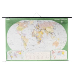
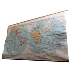
Late 20th Century Educational Geographic Map - Worlds Resources
About the Item
Late 20th Century Educational Geographic Map – Worlds Resources
Late 20th Century Educational Geographic Map – Worlds Resources. Good quality roll up school educational geographic map from the Czech republic. The map is printed on a cotton canvas that has been sealed with a clear lacquer.
WORKSHOP REPORT
Our workshop team inspect every product and carry out any needed repairs to ensure that everything leaves us serviced and maintained ready for many more years of life. All of our vintage products show the rich beauty and history of their life with the knocks and bumps of many years of use and we try to minimise restoration to keep every piece as original as possible.
Date: Late 20th Century
Maker: Industrial Production - Czech
Dimensions: L 1 x W 218 x H 141 cm
- Dimensions:Height: 55.52 in (141 cm)Width: 85.83 in (218 cm)Depth: 0.4 in (1 cm)
- Materials and Techniques:
- Place of Origin:
- Period:
- Date of Manufacture:Late 20th Century
- Condition:Refinished. Wear consistent with age and use.
- Seller Location:Hook, GB
- Reference Number:
About the Seller
4.7
Vetted Seller
These experienced sellers undergo a comprehensive evaluation by our team of in-house experts.
Established in 2017
1stDibs seller since 2019
412 sales on 1stDibs
Typical response time: 1 to 2 days
- ShippingRetrieving quote...Ships From: Hook, United Kingdom
- Return PolicyA return for this item may be initiated within 3 days of delivery.
More From This SellerView All
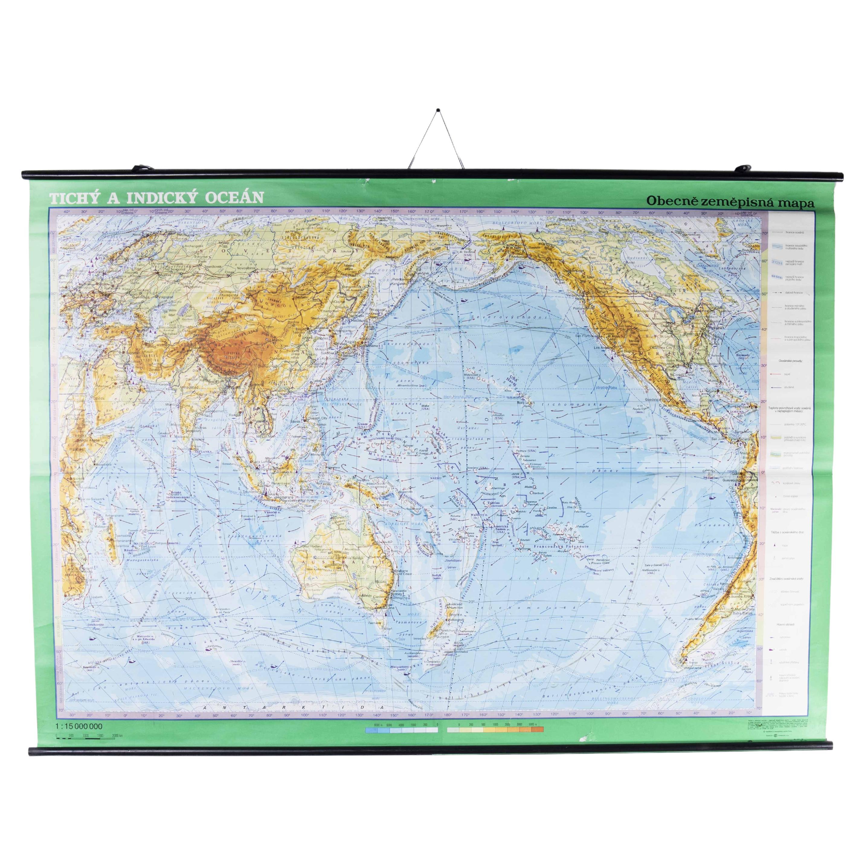
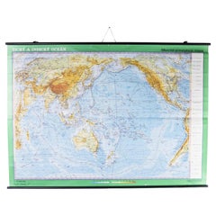
- Late 20th Century Educational Geographic Map - Worlds OceansLocated in Hook, HampshireLate 20th Century Educational Geographic Map – Worlds Oceans Late 20th Century Educational Geographic Map – Worlds Oceans. Good quality roll up school educational geographic map from...Category
Late 20th Century Czech Posters
MaterialsCotton
- Late 20th Century Educational Geographic Map - World AtlasLocated in Hook, HampshireLate 20th Century Educational Geographic Map – World Atlas Late 20th Century Educational Geographic Map – World Atlas . Good quality roll up school educational geographic map from th...Category
Late 20th Century Czech Posters
MaterialsCotton
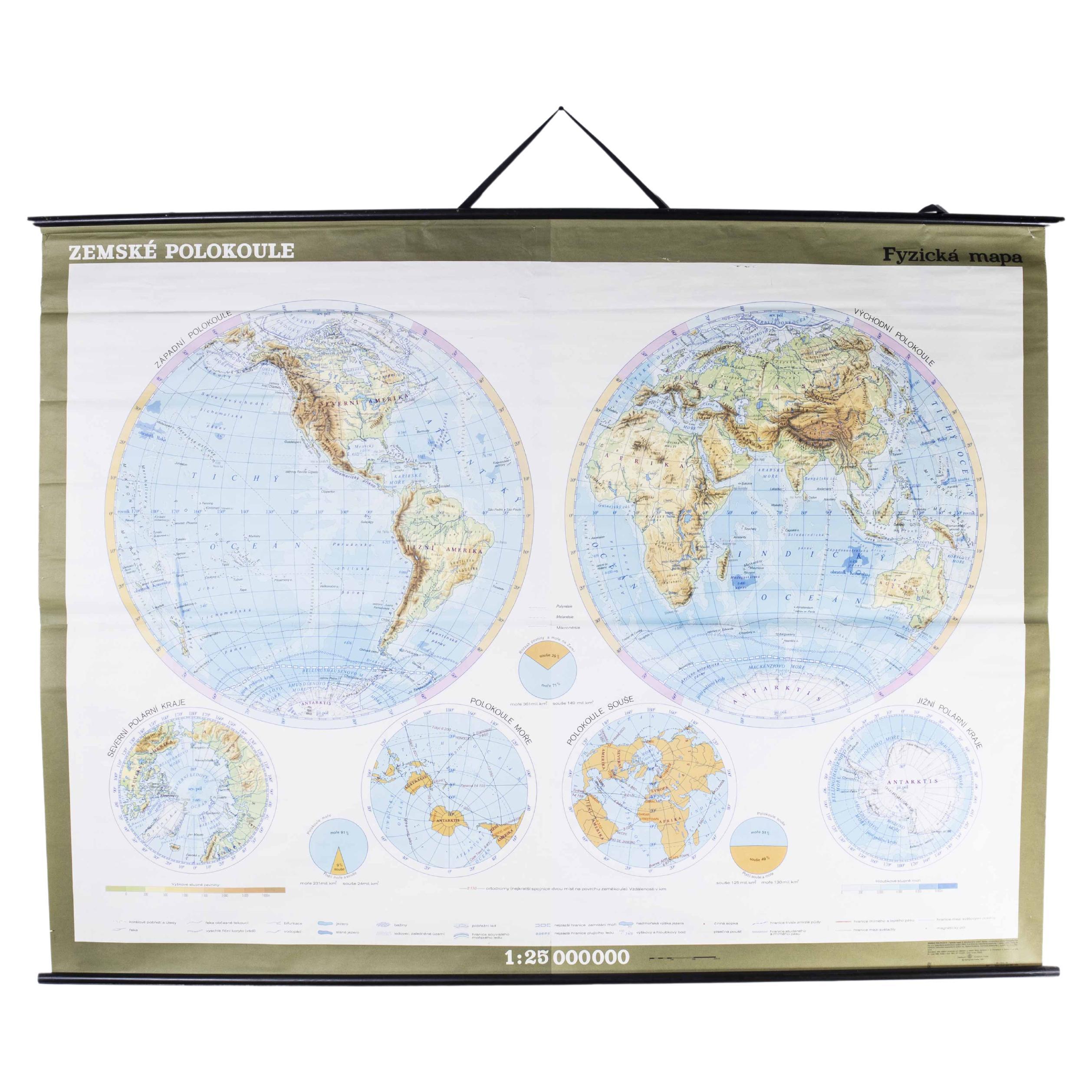
- Late 20th Century Educational Geographic Map - HemispheresLocated in Hook, HampshireLate 20th Century Educational Geographic Map – Hemispheres Late 20th Century Educational Geographic Map – Hemispheres. Good quality roll up school educational geographic map from the...Category
Late 20th Century Czech Posters
MaterialsCotton
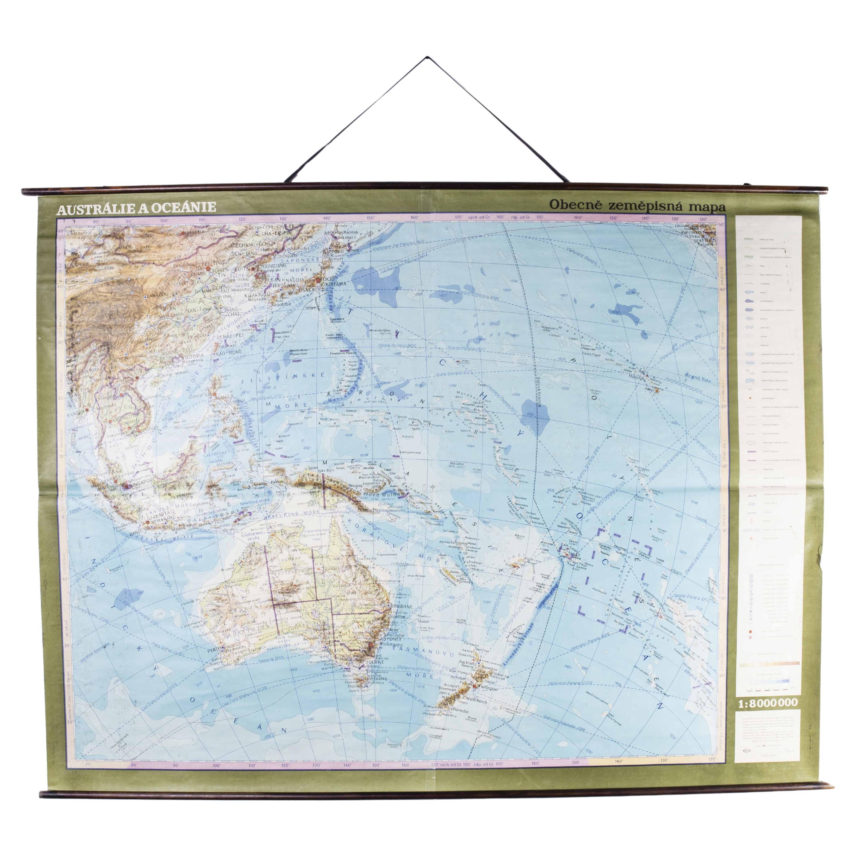
- Late 20th Century Educational Geographic Map - AustralasiaLocated in Hook, HampshireLate 20th Century Educational Geographic Map – Australasia Late 20th Century Educational Geographic Map – Australasia. Good quality roll up school educational geographic map from the...Category
Late 20th Century Czech Posters
MaterialsCotton
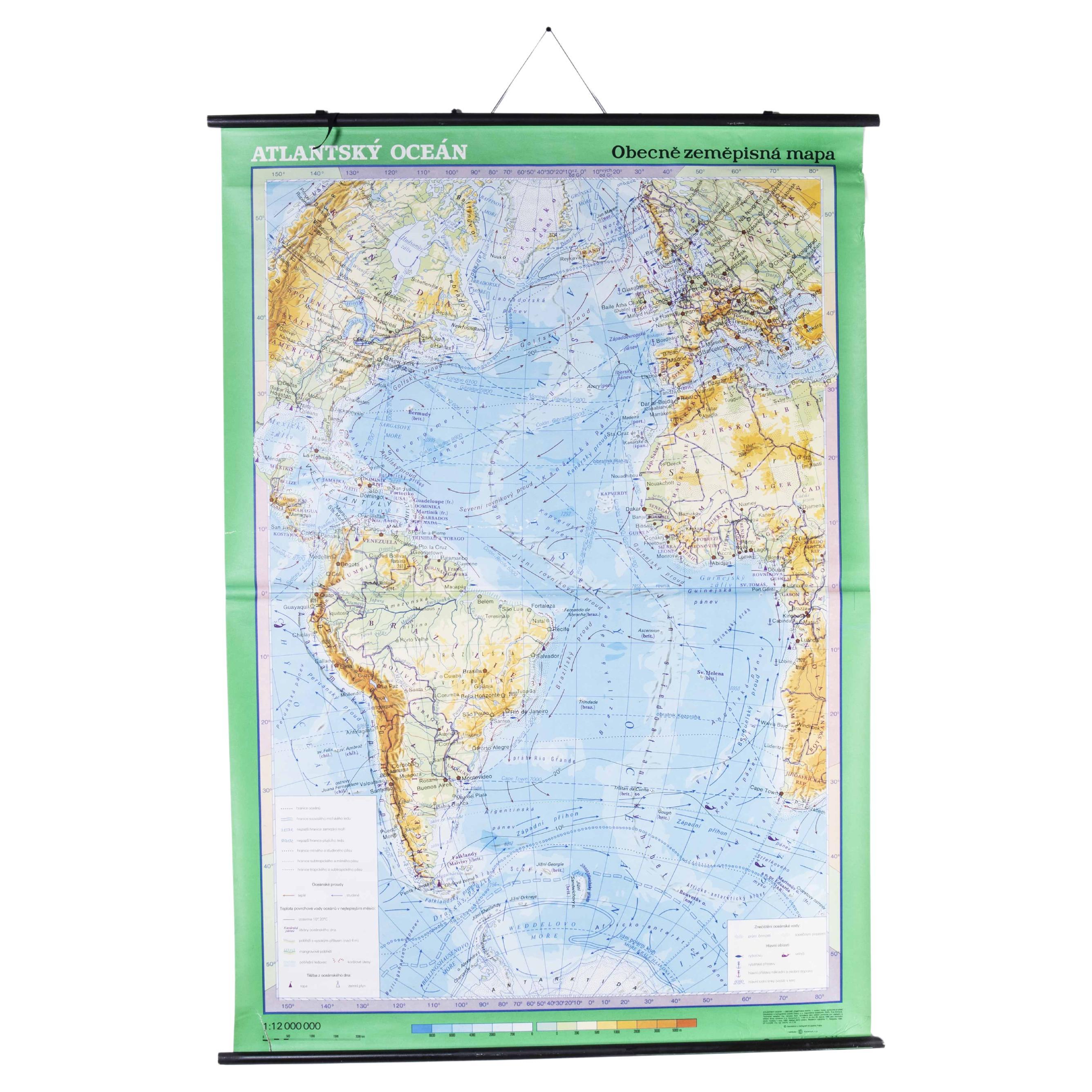
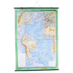
- Late 20th Century Educational Geographic Map - Atlantic CurrentsLocated in Hook, HampshireLate 20th Century Educational Geographic Map – Atlantic Currents Late 20th Century Educational Geographic Map – Atlantic Currents. Good quality roll up school educational geographic ...Category
Late 20th Century Czech Posters
MaterialsCotton
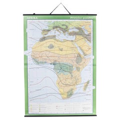
- Late 20th Century Educational Geographic Map - African ClimateLocated in Hook, HampshireLate 20th Century Educational Geographic Map – African Climate Late 20th Century Educational Geographic Map – African Climate. Good quality roll up school educational geographic map ...Category
Late 20th Century Czech Posters
MaterialsCotton


You May Also Like
- Vintage Geographical Map of the World Map, Vallardi Milan, Early 20th CenturyLocated in Cuneo, Italy (CN)Vintage geographical map or planisphere, published by Vallardi publisher for the municipality of Milan, printed at the beginning of the 20th century,...Category
20th Century Italian Prints
MaterialsPaper
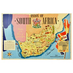
- Original Vintage Poster Union Of South Africa Map Natural & Industrial ResourcesLocated in London, GBOriginal vintage illustrated map poster for the Union of South Africa Her Natural and Industrial Resources featuring colourful images of the main cities including Cape Town, Pretoria...Category
Vintage 1940s British Posters
MaterialsPaper
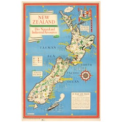
- Original WWII Map of New Zealand - Natural & Industrial Resources in War & PeaceBy "Leslie MacDonald ""Max"" Gill"Located in London, GBOriginal vintage World War Two pictorial map for New Zealand her natural and Industrial resources featuring a great illustration by the notable graphic designer, cartographer and artist MacDonald Gill (Leslie MacDonald Gill aka Max Gill...Category
Vintage 1940s British Posters
MaterialsPaper
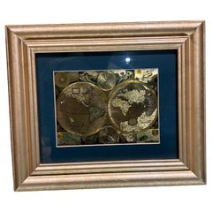
- Late 20th Century Gold Foil World Map Double HemisphereLocated in Chula Vista, CALate 20th Century Gold Foil Ancient World Map Double Hemisphere Gold Foil Old World Framed Map information on reverse of the print. Original vintage ...Category
Late 20th Century English Mid-Century Modern Prints
MaterialsGold
- Vintage Wall Chart of a Landscape and Geographic Map, circa 1955Located in Langweer, NLVintage wall chart titled 'Kaart en Landschap'. This wall chart shows a mountain range and geographic map. Published by J.B. Wolters, circa 1955.Category
Mid-20th Century Prints
MaterialsPaper
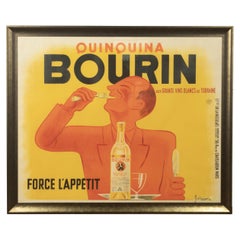
- Original 20th Century French Bourin PosterLocated in Tetbury, GloucestershireJacques and Pierre Bellenger designed this original vintage poster in 1936. This clever image shows that Bourin Quinquina is the perfect versatile beverage that can be enjoyed as an ...Category
Early 20th Century Swedish Posters
MaterialsPaper

Recently Viewed
View AllMore Ways To Browse
Titanic 1997
Jack Nicholson Poster
Retro Blade Runner Poster
The Killing Of A Chinese Bookie
Travel Posters Fez
Vintage Bambi Poster
Vintage Willy Wonka
Vintage Wonka
Wanda Poster
Whisky Poster
African Movie Poster
Alphaville Poster
Armenia Posters
Armenian Poster
Au Plein Air
Audrey Hepburn Fruhstuck Bei Tiffany
Canadian Pacific Steamship
Clash Of The Titans