Items Similar to Pl. 28 Antique Chart of British American, English (..) US Population, 1874

Want more images or videos?
Request additional images or videos from the seller
1 of 5
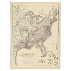
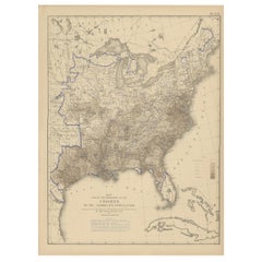
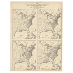
Pl. 28 Antique Chart of British American, English (..) US Population, 1874
About the Item
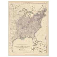
Antique chart titled 'Maps showing the distribution, within the territory of the United States, east of the 100th Meridian, of certain foreign elements of the population. I. according to their number to the square mile, absolute. II. according to their proportion to the aggregate population, relative. Compiled from the returns of population at the ninth census 1870'. Chart of British American, English, Welsh, Swedish, Norwegian population in 1870. Originates from 'Statistical Atlas of the United States based on the results of the ninth census 1870 (..)' by Francis A. Walker.
- Dimensions:Height: 21.66 in (55 cm)Width: 16.15 in (41 cm)Depth: 0.02 in (0.5 mm)
- Materials and Techniques:
- Period:
- Date of Manufacture:1874
- Condition:General age-related toning, minor wear. Blank verso, please study image carefully.
- Seller Location:Langweer, NL
- Reference Number:
About the Seller
5.0
Platinum Seller
These expertly vetted sellers are 1stDibs' most experienced sellers and are rated highest by our customers.
Established in 2009
1stDibs seller since 2017
1,928 sales on 1stDibs
Typical response time: <1 hour
- ShippingRetrieving quote...Ships From: Langweer, Netherlands
- Return PolicyA return for this item may be initiated within 14 days of delivery.
More From This SellerView All
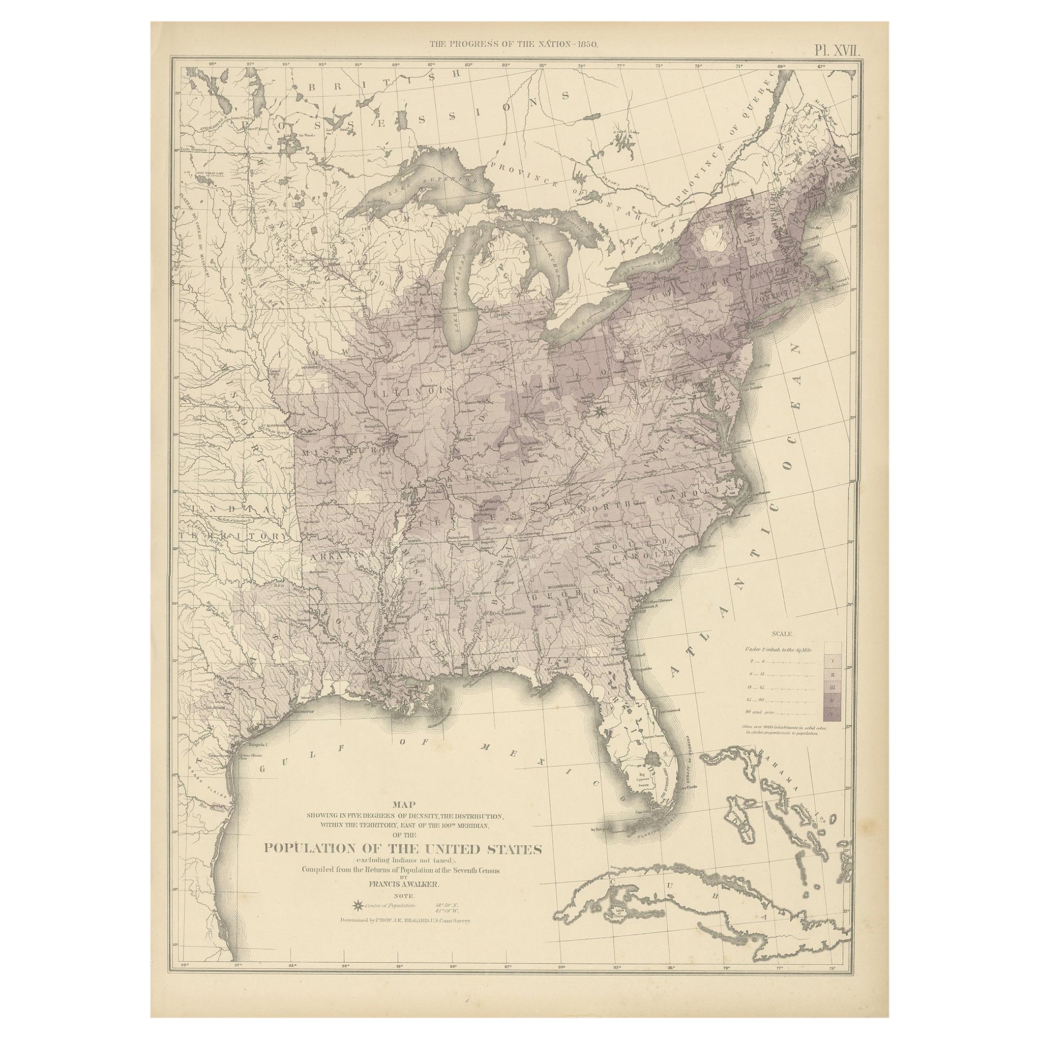
- Pl. 17 Antique Chart of the US Population 1850 by Walker, 1874Located in Langweer, NLAntique chart titled 'Map showing in five degrees of density, the distribution, within the territory east of the 100th Meridian, of the population of the United States, excluding Ind...Category
Antique Late 19th Century Maps
MaterialsPaper
- Pl. 25 Antique Chart of the US Foreign Population in 1870, '1874'Located in Langweer, NLAntique chart titled 'Map showing five degrees of density the distribution of the foreign population within the territory of the United States east of the 100th Meridian. Compiled fr...Category
Antique Late 19th Century Maps
MaterialsPaper
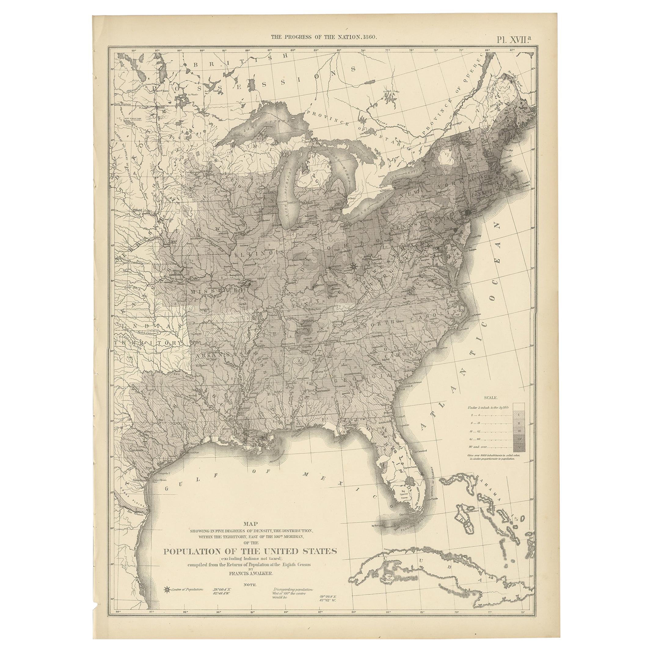
- Pl. 17A Antique Chart of the US Population 1860 by Walker, '1874'Located in Langweer, NLAntique chart titled 'Map showing in five degrees of density, the distribution, within the territory east of the 100th Meridian, of the population of the United States, excluding Ind...Category
Antique Late 19th Century Maps
MaterialsPaper
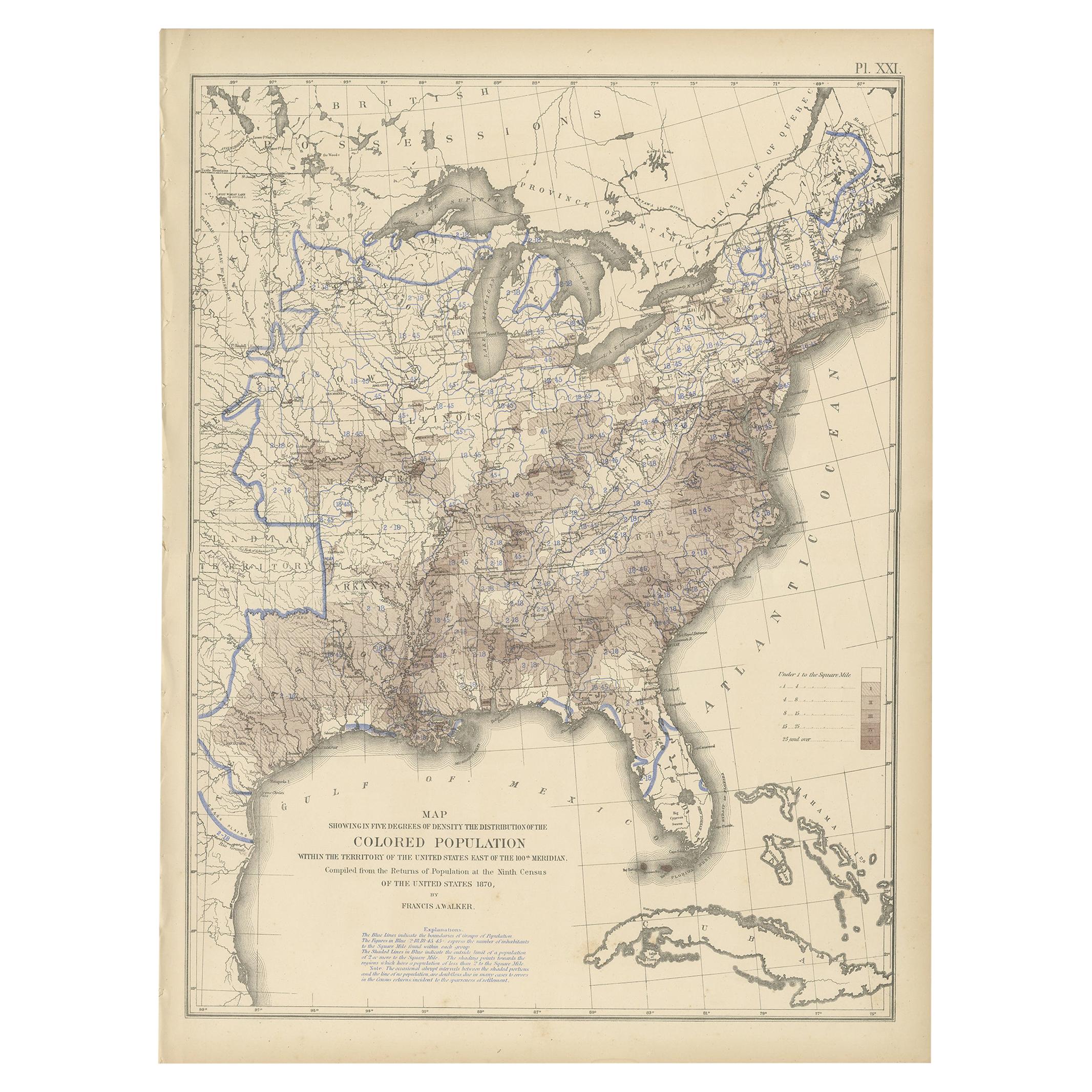
- Pl. 21 Antique Chart of the US Colored Population Density in 1870, '1874'Located in Langweer, NLAntique chart titled 'Map showing in five degrees of density the distribution of the colored population within the territory of the United States east of the 100th Meridian. Compiled...Category
Antique Late 19th Century Maps
MaterialsPaper
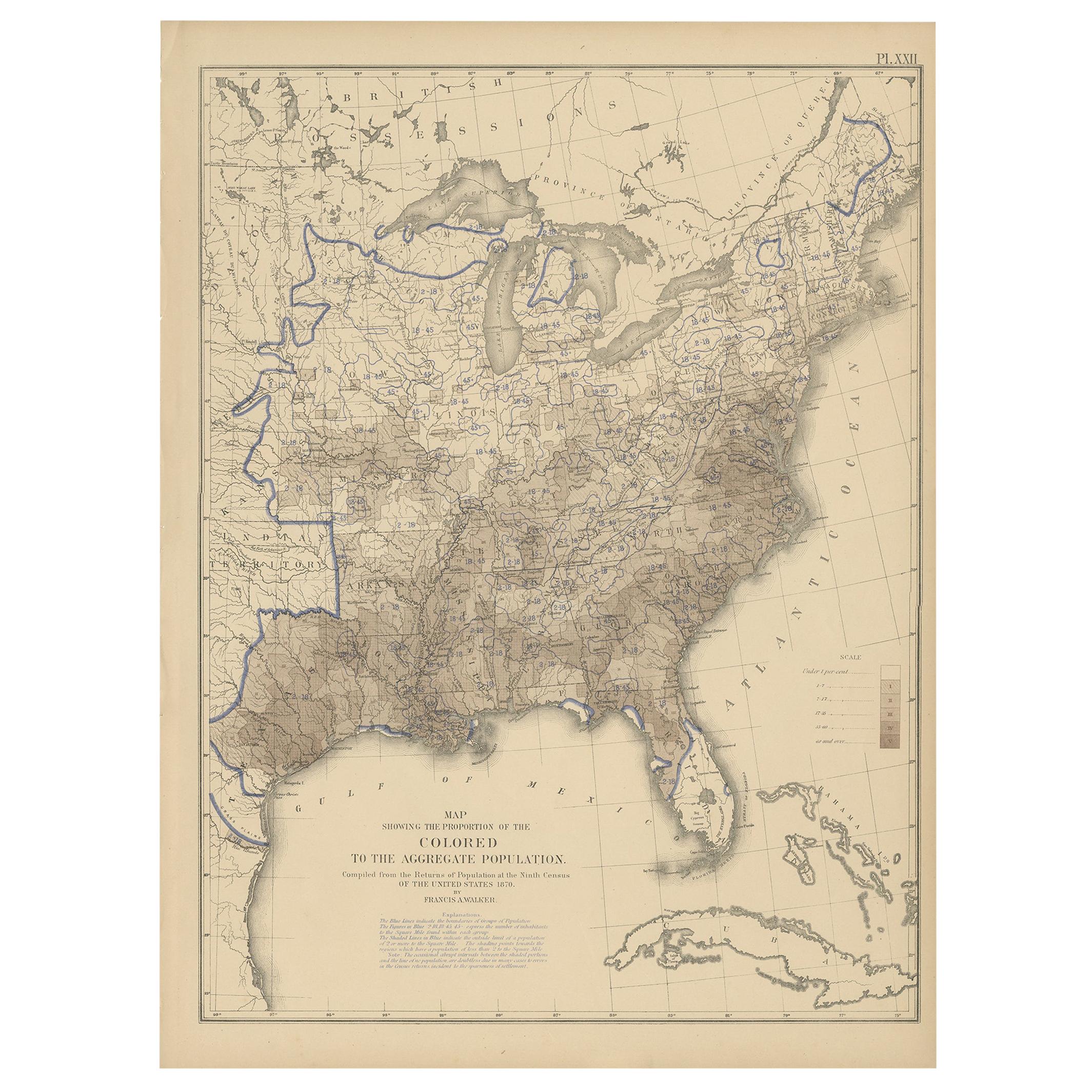
- Pl. 22 Antique Chart of the US Colored Population Proportion in 1870, '1874'Located in Langweer, NLAntique chart titled 'Map showing the proportion of the colored to the aggregate population. Compiled from the returns of population at the ninth census of the United States, 1870'. ...Category
Antique Late 19th Century Maps
MaterialsPaper
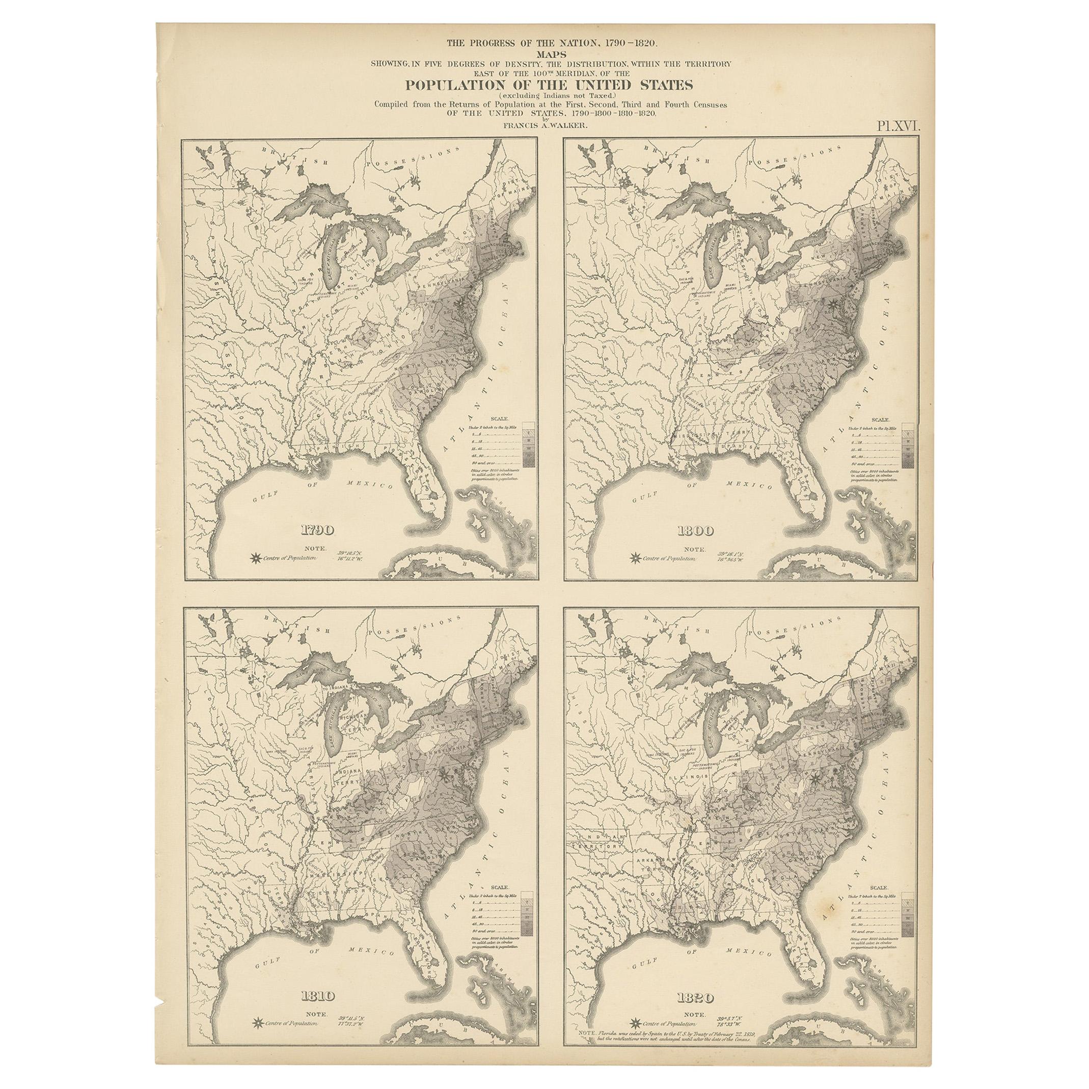
- Pl. 16 Antique Chart of the US Population 1790-1820 by Walker, '1874'Located in Langweer, NLAntique chart titled 'The progress of the nation, 1790-1820. Maps showing in five degrees of density the distribution within the territory east of the 100th meridian of the populatio...Category
Antique Late 19th Century Maps
MaterialsPaper
You May Also Like
- 1918 American Frohse Anatomical Chart, A. J. Nystrom, Max Brodel IllustratorBy A.J. Nystrom & Co, Max BrödelLocated in Buffalo, NYAntique American Frohse Anatomical pull down chart, by A. J. Nystrom, ,revised and augmented by Max Brodel illustrator... Amazing color, patina, age appropriate wear. dated 1918.. Max (Paul Heinrich) Brödel 1870-1941 Brödel, an illustrator and the first director of the Art as Applied to Medicine program at Johns Hopkins...Category
Vintage 1910s American Steampunk Prints
MaterialsWood, Paper
- Antique Anatomical Wall Chart Depicting the Human SkeletonLocated in Berghuelen, DEA rare 19th century anatomical wall chart depicting the human skeleton. On the sides On the sides are detailed description in German language. The wall...Category
Early 20th Century German Victorian Prints
MaterialsPaper
- Antique Foldable Anatomical Wall Chart Depicting Human MusculatureLocated in Berghuelen, DEAntique Foldable Anatomical Wall Chart Depicting Human Musculature The rare 19th century anatomical wall chart depicts the human musculature and inter...Category
Early 20th Century German Victorian Prints
MaterialsWood, Paper
- Large Antique 1859 Map of North AmericaLocated in Sag Harbor, NYThis Map was made by Augustus Mitchell in 1859 It is in amazing condition for being 163 years old. This price is for the rolled up easy to ship version of this piece. I will be Frami...Category
Antique Mid-19th Century American Maps
MaterialsCanvas, Paper

- Original Antique Map of South America. C.1780Located in St Annes, LancashireGreat map of South America Copper-plate engraving Published C.1780 Two small worm holes to left side of map Unframed.Category
Antique Early 1800s English Georgian Maps
MaterialsPaper
- Original Antique Map of South America, circa 1830Located in St Annes, LancashireGreat map of South America Copper plate engraving Published by Butterworth, Livesey & Co., circa 1830 Unframed.Category
Antique Early 1800s English Other Maps
MaterialsPaper


Recently Viewed
View AllMore Ways To Browse
Antique Us
Antique English Collectibles
British Antique Collectables
Antique Chart
Antique Charts
Map Chart
Population Of Antique
19th Norwegian
Norway 19th Century
19th Century Norwegian
Chart Antique
Welsh Base
Antique Maps And Charts
Meridian Furniture
Used Furniture Meridian
Antique Norway
Map Of Us
Antique Britain Map