Items Similar to Pl. 22 Antique Chart of the US Colored Population Proportion in 1870, '1874'

Want more images or videos?
Request additional images or videos from the seller
1 of 5
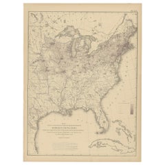
Pl. 22 Antique Chart of the US Colored Population Proportion in 1870, '1874'
About the Item
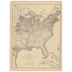
Antique chart titled 'Map showing the proportion of the colored to the aggregate population. Compiled from the returns of population at the ninth census of the United States, 1870'. Chart of the US colored population proportion in 1870. Originates from 'Statistical Atlas of the United States based on the results of the ninth census 1870 (..)' by Francis A. Walker.
- Dimensions:Height: 21.66 in (55 cm)Width: 16.15 in (41 cm)Depth: 0.02 in (0.5 mm)
- Materials and Techniques:
- Period:
- Date of Manufacture:1874
- Condition:General age-related toning, minor wear. Blank verso, please study image carefully.
- Seller Location:Langweer, NL
- Reference Number:
About the Seller
5.0
Platinum Seller
These expertly vetted sellers are 1stDibs' most experienced sellers and are rated highest by our customers.
Established in 2009
1stDibs seller since 2017
1,919 sales on 1stDibs
Typical response time: <1 hour
- ShippingRetrieving quote...Ships From: Langweer, Netherlands
- Return PolicyA return for this item may be initiated within 14 days of delivery.
More From This SellerView All
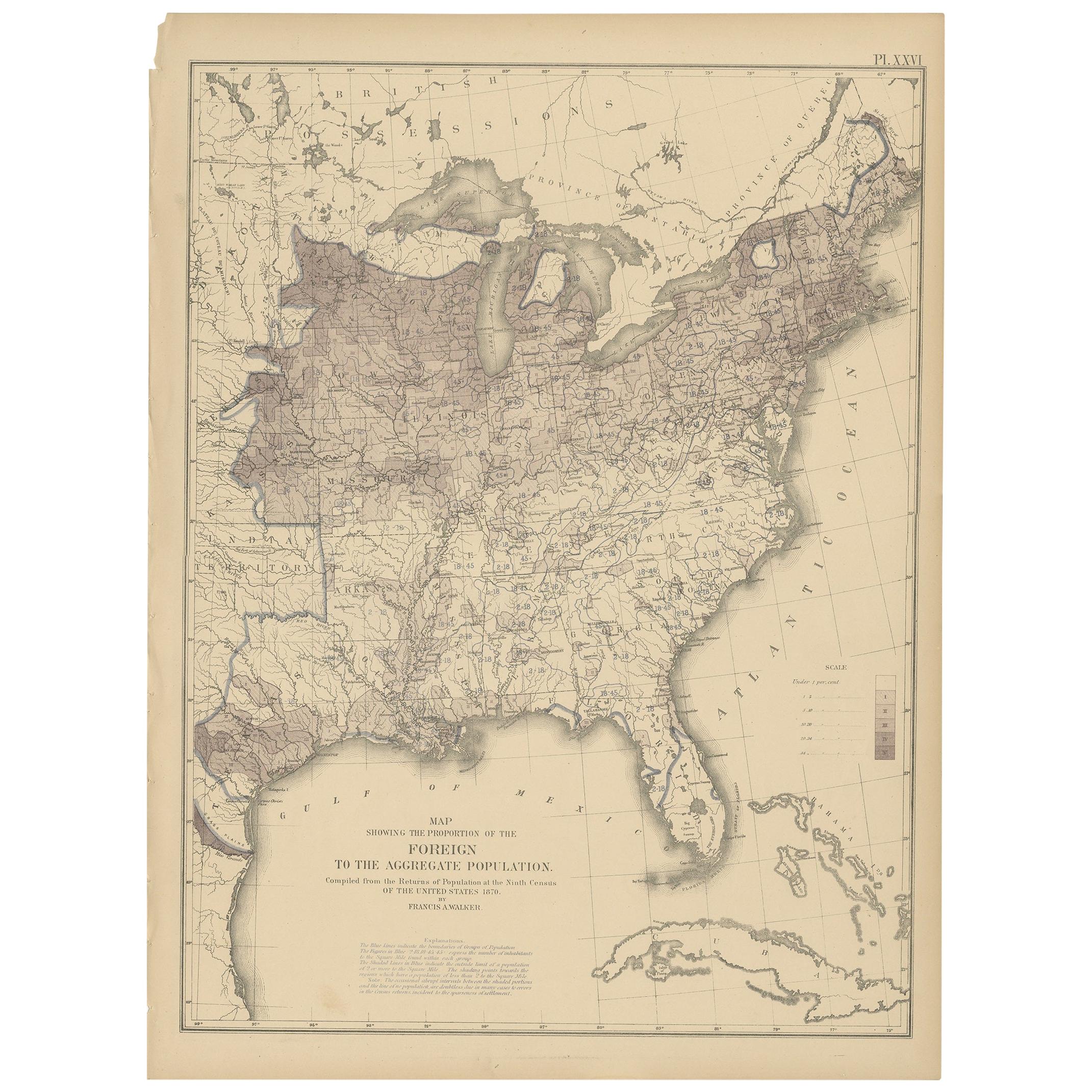
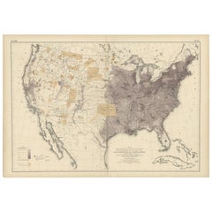
- Pl. 26 Antique Chart of the US Foreign Population Proportion in 1870, '1874'Located in Langweer, NLAntique chart titled 'Map showing the proportion of the foreign to the aggregate population. Compiled from the returns of population at the ninth census of the United States 1870'. C...Category
Antique Late 19th Century Maps
MaterialsPaper
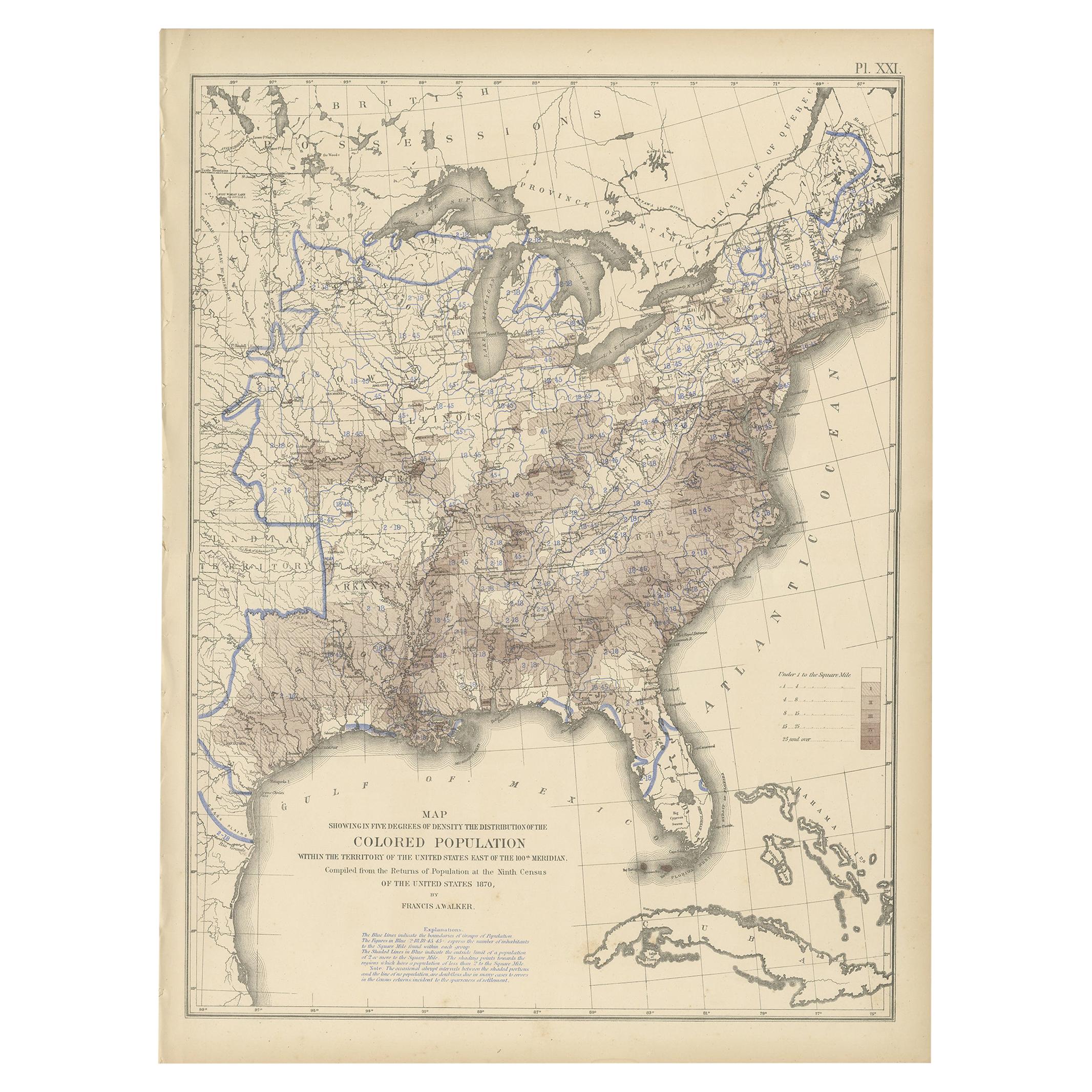
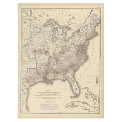
- Pl. 21 Antique Chart of the US Colored Population Density in 1870, '1874'Located in Langweer, NLAntique chart titled 'Map showing in five degrees of density the distribution of the colored population within the territory of the United States east of the 100th Meridian. Compiled...Category
Antique Late 19th Century Maps
MaterialsPaper
- Pl. 25 Antique Chart of the US Foreign Population in 1870, '1874'Located in Langweer, NLAntique chart titled 'Map showing five degrees of density the distribution of the foreign population within the territory of the United States east of the 100th Meridian. Compiled fr...Category
Antique Late 19th Century Maps
MaterialsPaper
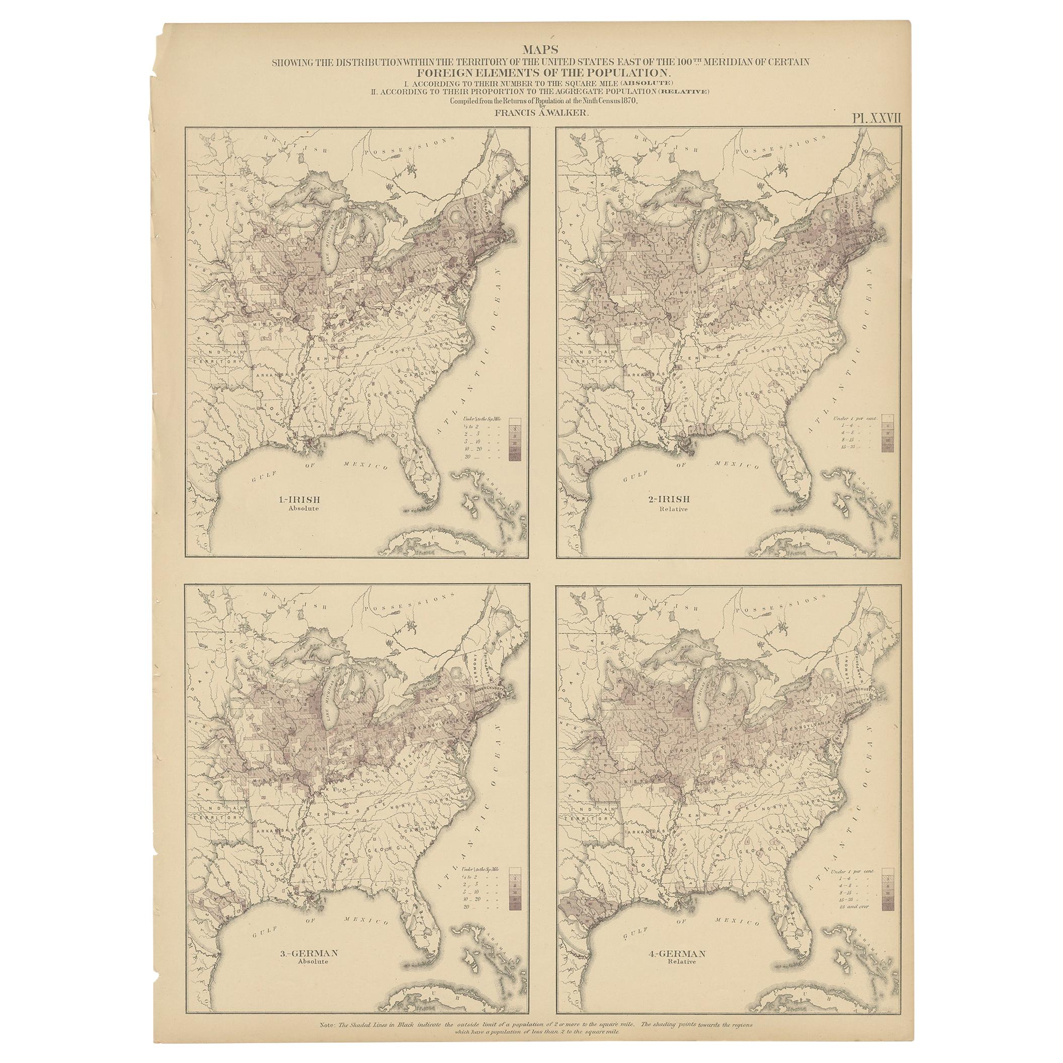
- Pl. 27 Antique Chart of the US Irish and German Population in 1870, '1874'Located in Langweer, NLAntique chart titled 'Maps showing the distribution, within the territory of the United States, east of the 100th Meridian, of certain foreign elements of the population. I. accordin...Category
Antique Late 19th Century Maps
MaterialsPaper
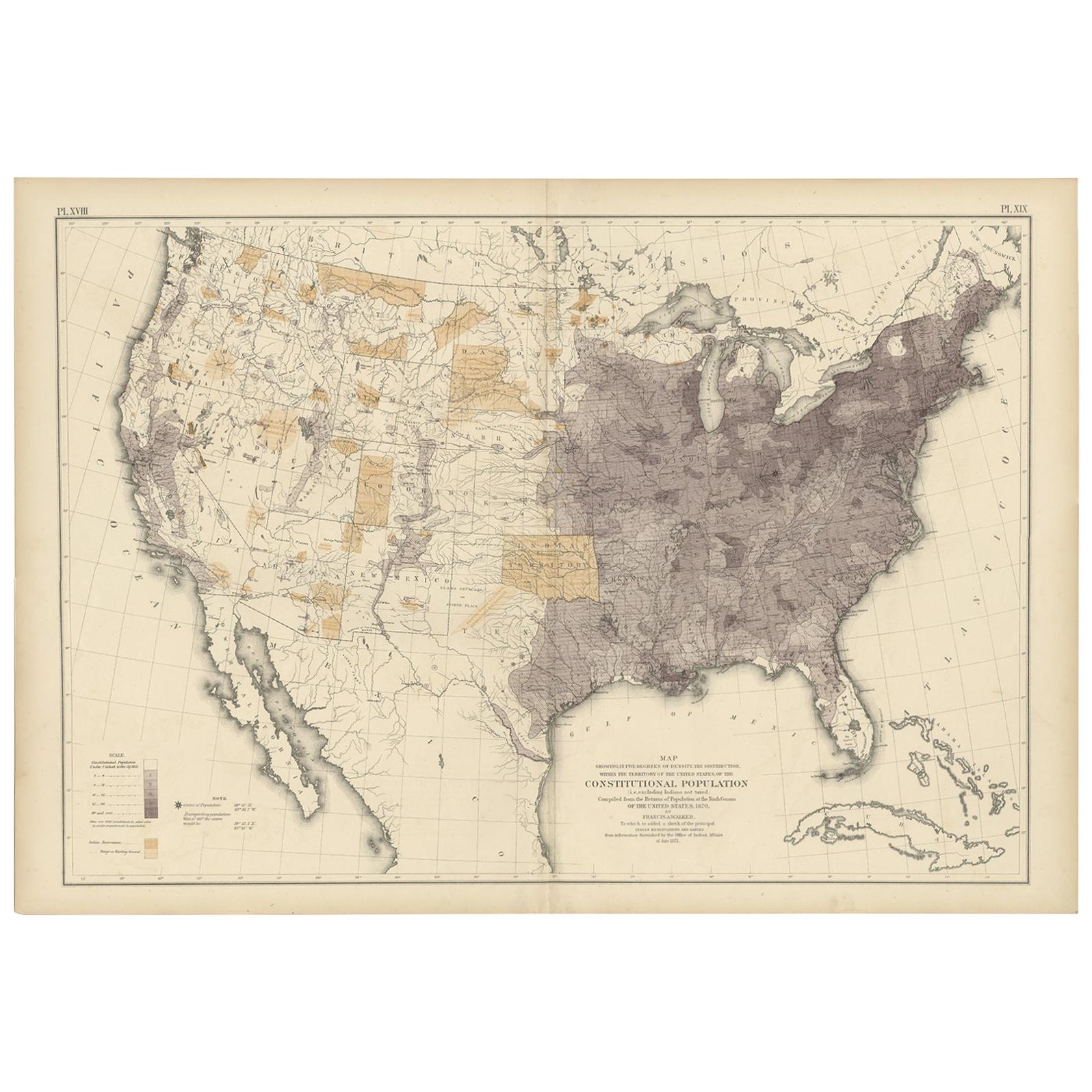
- Antique Chart of the US Population in 1870, published in 1874Located in Langweer, NLAntique chart titled 'Map showing, in five degrees of density, the distribution, within the territory of the United States, of the constitutional population, i.e., excluding Indians ...Category
Antique Late 19th Century Maps
MaterialsPaper
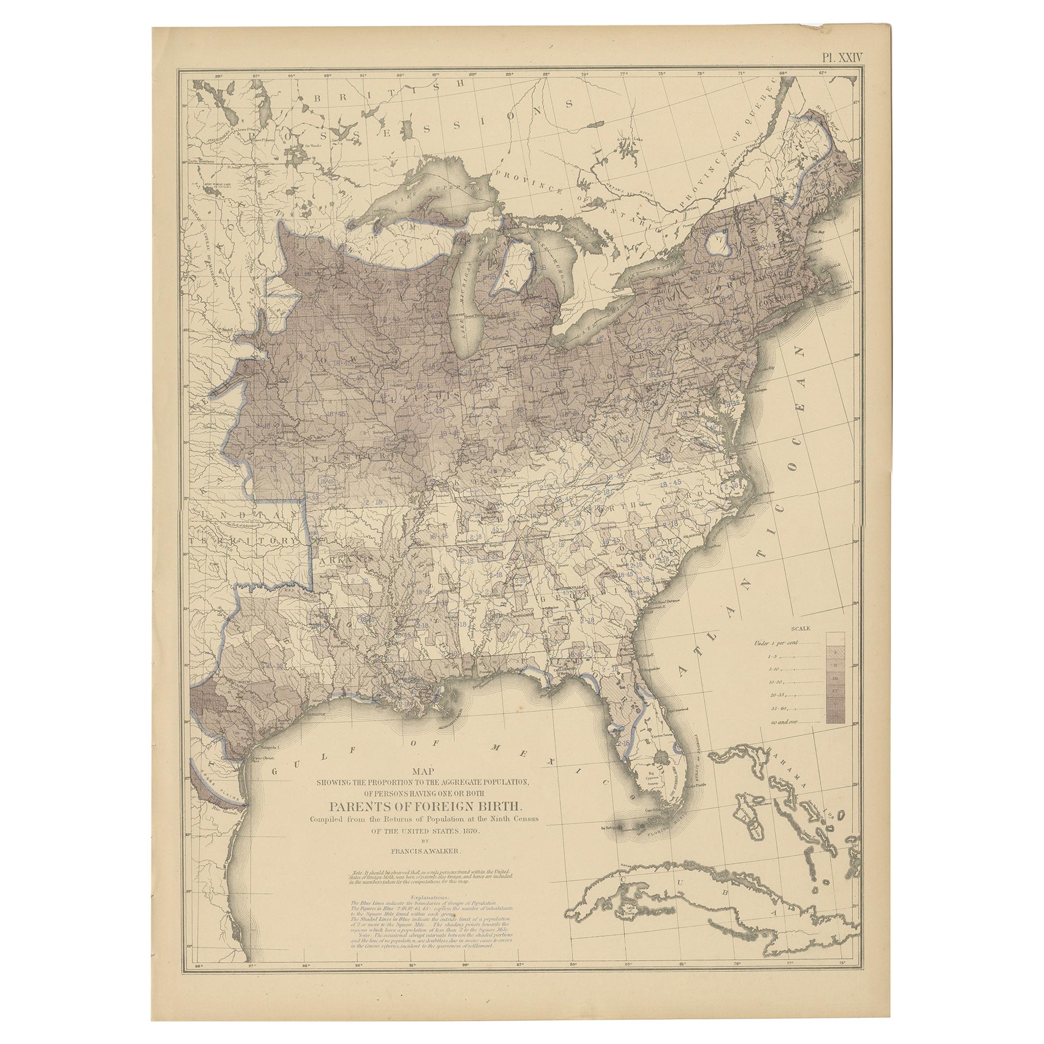
- Antique Chart of the US Foreign Parentage Proportion in 1870, '1874'Located in Langweer, NLAntique chart titled 'Map showing the proportion to the aggregate population, of persons having one or both parents of foreign birth. Compiled from the returns of population at the n...Category
Antique Late 19th Century Maps
MaterialsPaper
You May Also Like
- Antique Anatomical Wall Chart Depicting the Human SkeletonLocated in Berghuelen, DEA rare 19th century anatomical wall chart depicting the human skeleton. On the sides On the sides are detailed description in German language. The wall...Category
Early 20th Century German Victorian Prints
MaterialsPaper
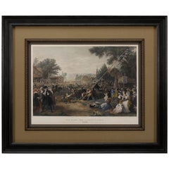
- "Raising the Liberty Pole" Hand-Colored Antique Print, 1875Located in Colorado Springs, COThis nineteenth-century engraving shows a liberty pole being raised in a town square in 1776, while a sign bearing the face of King George III is removed in the background. The rioto...Category
Antique 1870s American Historical Memorabilia
MaterialsPaper
- Set of Twelve Colored Engravings of the Defeat of the Spanish Armada by J. PineLocated in Essex, MABy John Pine considered the foremost heraldic and decorative engraver of his generation. Depicting the defeat of the Spanish by the English Fleet in 1588. These are after a set of tapestries that hung in the House of Commons...Category
Antique 1740s English Prints
MaterialsPaper
- Antique Foldable Anatomical Wall Chart Depicting Human MusculatureLocated in Berghuelen, DEAntique Foldable Anatomical Wall Chart Depicting Human Musculature The rare 19th century anatomical wall chart depicts the human musculature and inter...Category
Early 20th Century German Victorian Prints
MaterialsWood, Paper
- 17th Century Hand Colored Map of the Liege Region in Belgium by VisscherBy Nicolaes Visscher IILocated in Alamo, CAAn original 17th century map entitled "Leodiensis Episcopatus in omnes Subjacentes Provincias distincté divisusVisscher, Leodiensis Episcopatus" by Nicolaes Visscher II, published in Amsterdam in 1688. The map is centered on Liege, Belgium, includes the area between Antwerp, Turnhout, Roermond, Cologne, Trier and Dinant. This attractive map is presented in a cream-colored mat measuring 30" wide x 27.5" high. There is a central fold, as issued. There is minimal spotting in the upper margin and a tiny spot in the right lower margin, which are under the mat. The map is otherwise in excellent condition. The Visscher family were one of the great cartographic families of the 17th century. Begun by Claes Jansz Visscher...Category
Antique Late 17th Century Dutch Maps
MaterialsPaper
- Hand-Colored 18th Century Homann Map of Denmark and Islands in the Baltic SeaBy Johann Baptist HomannLocated in Alamo, CAAn 18th century copper plate hand-colored map entitled "Insulae Danicae in Mari Balthico Sitae utpote Zeelandia, Fionia, Langelandia, Lalandia, Falstria, Fembria Mona" created by Joh...Category
Antique Early 18th Century German Maps
MaterialsPaper