World Map Rare
19
to
186
2,310
140
1,182
976
772
386
250
143
54
41
32
29
26
24
22
20
19
14
11
11
9
9
8
7
7
7
5
4
3
3
3
3
2
2
2
2
2
2
2
2
2
2
1
1
1
1
1
1
1
1
42
42
31
20
18
Sort By
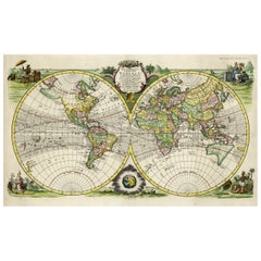
Rare Original Double Hemisphere World Map with Allegorical Figures, 1785
Located in Langweer, NL
hemisphere world map. Four allegorical figures in the corners represent Europe, Asia, Africa and America
Category
Antique 1780s Maps
Materials
Paper
H 17.05 in W 23.23 in D 0 in
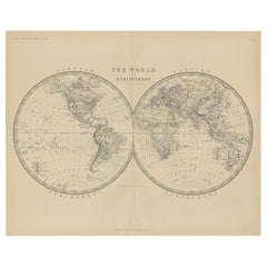
Antique World Map by Johnston, 1882
Located in Langweer, NL
Antique map titled 'The World in Hemispheres'. Old double-hemisphere world map. This map originates
Category
Antique 19th Century Maps
Materials
Paper
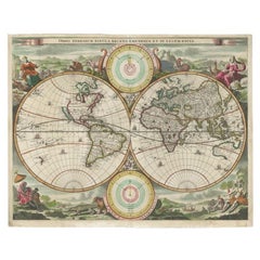
Antique Map of the World by Stoopendaal, c.1714
Located in Langweer, NL
Antique world map titled 'Orbis Terrarum Tabula Recens Emendata et in Lucem Edita'. Decorative
Category
Antique 18th Century Maps
Materials
Paper
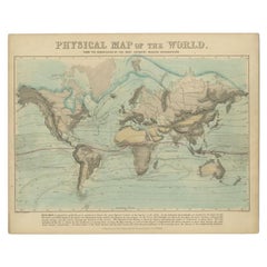
Antique Physical Map of the World by Reynolds, 1849
Located in Langweer, NL
Antique physical map of the world, showing the discoveries of the most eminent modern geographers
Category
Antique 19th Century Maps
Materials
Paper
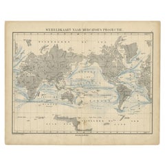
Antique Mercator Projection World Map by Petri, c.1873
Located in Langweer, NL
Antique world map titled 'Wereldkaart naar Mercator's Projectie'. Old map of the world. This map
Category
Antique 19th Century Maps
Materials
Paper
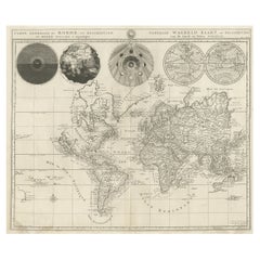
Antique Detailed World Map Drawn on Mercator's Projection, 1700
Located in Langweer, NL
Antique world map titled 'Carte generale du monde, ou description du monde terrestre & Aquatique
Category
Antique 17th Century Maps
Materials
Paper
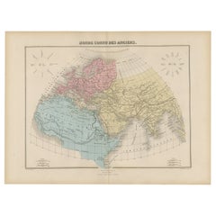
Antique World Map before the Voyages of Christopher Columbus, 1880
Located in Langweer, NL
Antique world map titled 'Monde Connu des Anciens'. Antique map of the World and continents before
Category
Antique 19th Century Maps
Materials
Paper
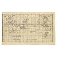
Antique Map of the World on Mercator Projection by Anson, 1749
Located in Langweer, NL
'. Original antique map of the world on Mercator's Projection from a Dutch edition of Anson's voyages. The map
Category
Antique 18th Century Maps
Materials
Paper
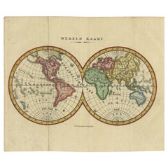
Small Antique World Map in Decorative Old Hand-Colouring, circa 1840
Located in Langweer, NL
Antique map titled 'Wereld Kaart'. Small and very decorative double hemisphere world map. Source
Category
Antique 19th Century Maps
Materials
Paper
Antique Map Showing the Religions Around the World by Johnston '1854'
Located in Langweer, NL
According to Religious Belief'. Rare large-size thematic map on the distribution of religions around the
Category
Antique Mid-19th Century Maps
Materials
Paper
No Reserve
H 21.66 in W 26.38 in D 0.02 in
Map Silk Embroidered Western Eastern Hemisphere New Old World Asia America Afri
Located in BUNGAY, SUFFOLK
A rare, late-18th century, silk, embroidered, double hemisphere, world map, blackwork, sampler
Category
Antique 18th Century British Georgian Maps
Materials
Silk
H 0.4 in W 0.4 in D 0.4 in
Original Engraved Antique Map of the World, Colorful and Decorative, C.1780
By Pierre François Tardieu
Located in Langweer, NL
' - This handsome double hemisphere map presents a view of the physical world with particularly nice detail
Category
Antique 18th Century Maps
Materials
Paper
H 15.6 in W 20.32 in D 0 in
Antique Map of the Old World Projection, Entitled Orbis Terrarum Ad Mentem, 1825
Located in Langweer, NL
Antique map titled 'Orbis Terrarum ad Mentem (..)'. Old map of the world originating from 'Atlas
Category
Antique 19th Century Maps
Materials
Paper
H 8.51 in W 9.77 in D 0 in
Rare Antique Map of Calcutta 'Kolkata' in India, 1893
Located in Langweer, NL
flexibility. Depending on the individual map, presentation, and context, a rare or antique map can be modern
Category
Antique 19th Century Maps
Materials
Paper
Rare Small Antique Map of the Persian Empire, 1692
Located in Langweer, NL
flexibility. Depending on the individual map, presentation, and context, a rare or antique map can be modern
Category
Antique 17th Century Maps
Materials
Paper
Very Decorative Original Antique Map of the World, Published in France in c.1780
By Rigobert Bonne
Located in Langweer, NL
flexibility. Depending on the individual map, presentation, and context, a rare or antique map can be modern
Category
Antique 18th Century Maps
Materials
Paper
H 10.24 in W 17.6 in D 0 in
Rare Antique Map of Friesland in Roman Times, Published 1778
Located in Langweer, NL
Schotanus de Sterringa. Rare map illustrating Friesland (The Netherlands). The North Sea is depicted on top
Category
Antique 18th Century Maps
Materials
Paper
Free Shipping
H 13.86 in W 16.54 in D 0 in
Rare Antique Map of Germany with English Text, c.1690
Located in Langweer, NL
Antique map Germany titled 'Germani by Robt. Morden'. Rare antique map of Germany. Originates from
Category
Antique 17th Century Maps
Materials
Paper
Handcolored Rare Map of Leeuwarden, Capital of Friesland, The Netherlands, 1622
Located in Langweer, NL
Antique map titled 'Leeuwerden de Hooftstadt van Vrieslandt'. Rare and old map of the city of
Category
Antique 17th Century Maps
Materials
Paper
H 16.15 in W 19.69 in D 0 in
Rare Antique Map of Asia with Cartouche Depicting an Elephant, 1753
Located in Langweer, NL
elephant. Map by Daniel de la Feuille. This very rare old antique copperplate engraved print originates
Category
Antique 18th Century Maps
Materials
Paper
Antique Map of Northern Africa from a Rare Dutch Atlas, 1825
Located in Langweer, NL
flexibility. Depending on the individual map, presentation, and context, a rare or antique map can be modern
Category
Antique 19th Century Maps
Materials
Paper
Rare Antique Map of the Region of Freyburg in Germany, 1749
By Schreiber
Located in Langweer, NL
decorators all over the world. Our collection includes a wide range of authentic antique maps from the 16th
Category
Antique 18th Century Maps
Materials
Paper
Rare Antique Map of Yam Suph, Egypt and Red Sea, 1773
Located in Langweer, NL
original antique maps to collectors, historians, educators and interior decorators all over the world. Our
Category
Antique 18th Century Maps
Materials
Paper
Rare Antique Map of the Region of Franekeradeel, The Netherlands 1664
Located in Langweer, NL
flexibility. Depending on the individual map, presentation, and context, a rare or antique map can be modern
Category
Antique 17th Century Maps
Materials
Paper
Rare Original Antique Ptolemy Map of Ceylon, Present Day Sri Lanka
Located in Langweer, NL
inaccurate, it represented the most advanced account of the world's geography at that time. This map depicts
Category
Antique Late 17th Century Maps
Materials
Paper
Rare Authentic Engraved Map of Large Part of Indonesia by Stavorinus, 1779
Located in Langweer, NL
Antique map titled 'Carte de la Navigation de Batavia a Amboina'. Rare chart of Indonesia including
Category
Antique 18th Century Maps
Materials
Paper
H 29.34 in W 9.06 in D 0 in
Rare Handcolored Map of Isle de Juan Fernandes 'Robinson Crusoe Island', Chili
Located in Langweer, NL
Crusoe Island in 1966. This map originates from a German edition of 'Voyage around the World' by Lord
Category
Antique Mid-18th Century Maps
Materials
Paper
Free Shipping
H 8.67 in W 15.36 in D 0.02 in
Very Decorative Rare Antique Map of the Northern Part of Africa, 1702
Located in Langweer, NL
Antique map titled 'Africae Pars Borealis.'
Very decorative antique map of the northern part of
Category
Antique Early 1700s Maps
Materials
Paper
Antique Map Made After a Roman Papyrus Travel Map, Known as Peutinger Map, 1773
Located in Langweer, NL
Old Dutch engraving with title: 'Romeinsche Reis Kaart van K. Peutinger'.
Rare antique map based
Category
Antique 18th Century Maps
Materials
Paper
H 15.56 in W 18.51 in D 0 in
Large and Rare Antique Map of Northern India in Original Coloring, c.1825
Located in Langweer, NL
flexibility. Depending on the individual map, presentation, and context, a rare or antique map can be modern
Category
Antique 19th Century Maps
Materials
Paper
H 21.26 in W 29.34 in D 0 in
Rare Antique Map of Japan with Place Names Given in Dutch Nomenclature, 1726
Located in Langweer, NL
Antique map titled 'Nieuwe Kaart van het Eyland Japan'.
Rare map of Japan, it shows each of the
Category
Antique 18th Century Maps
Materials
Paper
H 23.23 in W 19.69 in D 0 in
Extremely Rare Map of The land of Eso or Hokkaido in Japan, 1725
Located in Langweer, NL
original antique maps to collectors, historians, educators and interior decorators all over the world. Our
Category
Antique 18th Century Maps
Materials
Paper
Rare Engraved Antique Map of India with Elephants in the Cartouche, c.1725
Located in Langweer, NL
original antique maps to collectors, historians, educators and interior decorators all over the world. Our
Category
Antique 18th Century Maps
Materials
Paper
H 19.1 in W 14.57 in D 0 in
Rare Antique Map of Part of Europe and Africa by Scherer, C.1703
Located in Langweer, NL
Antique map with two figures. The upper figures showing part of Europe and Africa. Below a chart
Category
Antique 18th Century Maps
Materials
Paper
Rare Antique Map of the Route from Maiden Bridge to Dulverton, England, c.1720
By Bowen
Located in Langweer, NL
decorators all over the world. Our collection includes a wide range of authentic antique maps from the 16th
Category
Antique 18th Century Maps
Materials
Paper
H 7.68 in W 5.52 in D 0 in
Antique Zoological Map, 1843
Located in Langweer, NL
Two antique world maps on one sheet. The upper map shows the distribution of animals over the world
Category
Antique 19th Century Maps
Materials
Paper
Rare Unusual Antique Map of Asia with a Landbridge from Korea to America, 1717
Located in Langweer, NL
flexibility. Depending on the individual map, presentation, and context, a rare or antique map can be modern
Category
Antique 18th Century Maps
Materials
Paper
H 9.65 in W 13.94 in D 0 in
Antique Map of Greece with an Inset Map of Corfu, 1854
Located in Langweer, NL
orginates from 'General Atlas Of The World: Containing Upwards Of Seventy Maps (..)' by Adam & Charles Black
Category
Antique 19th Century Maps
Materials
Paper
Antique Map of Denmark with an Inset Map of Iceland, 1832
Located in Langweer, NL
interior decorators all over the world. Our collection includes a wide range of authentic antique maps from
Category
Antique 19th Century Maps
Materials
Paper
Antique Map of Eastern Canada with an inset Map of Newfoundland, 1882
Located in Langweer, NL
interior decorators all over the world. Our collection includes a wide range of authentic antique maps from
Category
Antique 19th Century Maps
Materials
Paper
Large Scale Map of Greece with Inset Map of Macedonia, c.1786
Located in Langweer, NL
interior decorators all over the world. Our collection includes a wide range of authentic antique maps from
Category
Antique 18th Century Maps
Materials
Paper
Antique Map of New Jersey
Located in Langweer, NL
Antique map titled 'Colton's New Jersey'. This rare hand colored map of New Jersey is a copper
Category
Antique Mid-19th Century Maps
Materials
Paper
Antique Map of Friesland Also Know as the Peacock Map, C.1580
Located in Langweer, NL
established a business in dealing with books and drawing maps. His first remarkable map was a 8 sheet world
Category
Antique 18th Century Maps
Materials
Paper
Antique Map of China, 1874
Located in Langweer, NL
interior decorators all over the world. Our collection includes a wide range of authentic antique maps from
Category
Antique 19th Century Maps
Materials
Paper
Antique Map of Asia, 1846
Located in Langweer, NL
decorators all over the world. Our collection includes a wide range of authentic antique maps from the 16th
Category
Antique 19th Century Maps
Materials
Paper
Antique Map of Greece with Two Small Inset Maps of Athens, c.1870
Located in Langweer, NL
original antique maps to collectors, historians, educators and interior decorators all over the world. Our
Category
Antique 19th Century Maps
Materials
Paper
Antique Map of France with Inset Map of the Island of Corsica, 1820
Located in Langweer, NL
flexibility. Depending on the individual map, presentation, and context, a rare or antique map can be modern
Category
Antique 19th Century Maps
Materials
Paper
Attractive Antique Map of Italy with Inset of Maps Showing The Regions, c.1870
Located in Langweer, NL
over the world. Our collection includes a wide range of authentic antique maps from the 16th to the
Category
Antique 19th Century Maps
Materials
Paper
H 13.78 in W 17.76 in D 0 in
Antique Map of Asia by with an Inset Map of Turkey in Asia, 1868
Located in Langweer, NL
flexibility. Depending on the individual map, presentation, and context, a rare or antique map can be modern
Category
Antique 19th Century Maps
Materials
Paper
Antique Map of Africa and Arabia with Inset Map of Ethiopia and Eritrea, 1845
Located in Langweer, NL
decorators all over the world. Our collection includes a wide range of authentic antique maps from the 16th
Category
Antique 19th Century Maps
Materials
Paper
H 14.18 in W 17.33 in D 0 in
Antique Map of Denmark with Inset Maps of Iceland, Copenhagen and the Elbe, 1882
Located in Langweer, NL
flexibility. Depending on the individual map, presentation, and context, a rare or antique map can be modern
Category
Antique 19th Century Maps
Materials
Paper
H 24.22 in W 19.53 in D 0 in
Antique Political Map of France, 1880
By J. Migeon
Located in Langweer, NL
original antique maps to collectors, historians, educators and interior decorators all over the world. Our
Category
Antique 19th Century Maps
Materials
Paper
Antique Map of New Zealand, 1895
Located in Langweer, NL
their beauty and design flexibility. Depending on the individual map, presentation, and context, a rare
Category
Antique 19th Century Maps
Materials
Paper
German Antique Map of Oceania, 1895
Located in Langweer, NL
decorators all over the world. Our collection includes a wide range of authentic antique maps from the 16th
Category
Antique 19th Century Maps
Materials
Paper
Antique Map of New Ireland, 1774
Located in Langweer, NL
the world. Our collection includes a wide range of authentic antique maps from the 16th to the 20th
Category
Antique 18th Century Maps
Materials
Paper
Antique Map of Southern Greece, 1892
Located in Langweer, NL
antique maps to collectors, historians, educators and interior decorators all over the world. Our
Category
Antique 19th Century Maps
Materials
Paper
Antique Map of France with an Inset Map of the Island of Corsica, c.1820
Located in Langweer, NL
their beauty and design flexibility. Depending on the individual map, presentation, and context, a rare
Category
Antique 19th Century Maps
Materials
Paper
Antique Map of Greece with an Inset Map of the Upper Danube Region, c.1720
Located in Langweer, NL
antique maps to collectors, historians, educators and interior decorators all over the world. Our
Category
Antique 18th Century Maps
Materials
Paper
H 21.07 in W 25.2 in D 0 in
Antique Zoological Chart of the World, 1854
Located in Langweer, NL
Antique map titled 'Zoological Chart of the World'. Total of six maps and insets. Insets of the
Category
Antique 19th Century Maps
Materials
Paper
Antique Tidal Chart and Botanical Map, 1843
Located in Langweer, NL
Two antique world maps on one sheet. The upper map is a tidal chart of the world and shows the
Category
Antique 19th Century Maps
Materials
Paper
- 1
- ...
Get Updated with New Arrivals
Save "World Map Rare", and we’ll notify you when there are new listings in this category.
World Map Rare For Sale on 1stDibs
At 1stDibs, there are many versions of the ideal world map rare for your home. A world map rare — often made from paper, metal and wood — can elevate any home. There are 1622 variations of the antique or vintage world map rare you’re looking for, while we also have 14 modern editions of this piece to choose from as well. You’ve searched high and low for the perfect world map rare — we have versions that date back to the 18th Century alongside those produced as recently as the 21st Century are available. A world map rare, designed in the modern, Art Deco or mid-century modern style, is generally a popular piece of furniture. Many designers have produced at least one well-made world map rare over the years, but those crafted by Johannes Janssonius, Jacques-Nicolas Bellin and Schreiber are often thought to be among the most beautiful.
How Much is a World Map Rare?
The average selling price for a world map rare at 1stDibs is $284, while they’re typically $40 on the low end and $275,000 for the highest priced.
More Ways To Browse
Maps Balkans
Iceland Map
Otto Petri
John Ogilby
Antique Botanical Chart
Atlantis Antique
Antique Map Florence
Kolkata Antique Furniture
Antique Map Copenhagen
Papua New Guinea Antique Map
Mappemonde Antique
Sampler Map
Larousse Universel
Warwickshire Antique Map
Buckinghamshire Antique Map
Auge En Pierre
Dan Rizzi
Rei K
