Antique Map Of Us
1
to
17
96
60
94
51
38
28
28
21
19
12
10
10
7
7
7
7
5
5
3
3
3
2
2
2
2
2
2
2
2
2
1
1
1
1
1
1
1
1
1
1
1
7
5
4
3
2
Sort By
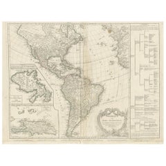
Antique Map of America by Vaugondy, 1778
Located in Langweer, NL
Antique map titled 'Amerique ou Indes Occidentales (..)'. Vaugondy's map of America, pre-dating
Category
Late 18th Century Antique Map Of Us
Materials
Paper
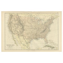
Antique Map of The United States of North America, 1882
Located in Langweer, NL
This is a historical map titled "The United States of North America, Central Part" from the 1882
Category
1880s Antique Map Of Us
Materials
Paper
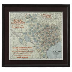
1908 "Map of Texas" by The Kenyon Company
Located in Colorado Springs, CO
map. At the bottom right, the map further invites viewers to: "Go with us to Dalhart, Texas. We run
Category
Early 1900s American Antique Map Of Us
Materials
Paper
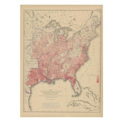
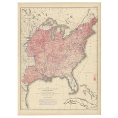
Antique Chart of the US Malarial Deaths, '1874'
Located in Langweer, NL
Antique chart titled 'Map showing the proportion of deaths from malarial diseases to deaths from
Category
Late 19th Century Antique Map Of Us
Materials
Paper
Antique Chart of the US Consumption Deaths, '1874'
Located in Langweer, NL
Antique chart titled 'Map showing the proportion of deaths from consumption to deaths from all
Category
Late 19th Century Antique Map Of Us
Materials
Paper
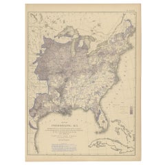
Antique Chart of the US Predominating Sex, 1874
Located in Langweer, NL
Antique chart titled 'Map of predominating sex showing the local excess of males or of females in
Category
Late 19th Century Antique Map Of Us
Materials
Paper
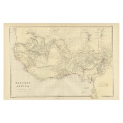
Original Antique Coloured Map of Western Africa, Published in 1882
Located in Langweer, NL
This is a map of Western Africa from the 1882 Blackie & Son atlas. The map details the West African
Category
1880s Antique Map Of Us
Materials
Paper
No Reserve
H 14.97 in W 22.45 in D 0 in
1859 "Map of the United States of America..." by J. H. Colton
By J.H. Colton
Located in Colorado Springs, CO
Civil War.
The map has an elaborate and decorative pictorial border, with scenes of the “US Capitol
Category
1850s American Antique Map Of Us
Materials
Paper
Pl. 35 Antique Chart of the US Taxation, 1874
Located in Langweer, NL
Antique chart titled 'Map showing the degree of taxation per capita imposed by state, county or
Category
Late 19th Century Antique Map Of Us
Materials
Paper
Antique Map of Anjouan or Ndzuani Island, Part of The Comoros, 1749
Located in Langweer, NL
Antique map titled ‘Carte de L’Isle D’Anjouan - Kaart van 't Eiland Anjouan’. Original antique map
Category
18th Century Antique Map Of Us
Materials
Paper
Pl. 34 Antique Chart of the US Public Indebtedness, 1874
Located in Langweer, NL
Antique chart titled 'Map showing the degree of public indebtedness per capita. Contracted by state
Category
Late 19th Century Antique Map Of Us
Materials
Paper
Pl. 40 Antique Chart of the US Birth Rate, 1874
Located in Langweer, NL
Antique chart titled 'Map showing, in five degrees of density, the birth rate prevailing in the
Category
Late 19th Century Antique Map Of Us
Materials
Paper
Original Hand-Colored Antique Map of America by Danckerts, circa 1680
Located in Langweer, NL
pushed far west of its true mouth. The large lake in the Southeastern US first seen on Le Moyne's map is
Category
Late 17th Century Antique Map Of Us
Materials
Paper
H 20.48 in W 24.22 in D 0.02 in
Pl. 29 Antique Chart of the US Illiteracy in 1870, '1874'
Located in Langweer, NL
Antique chart titled 'Map showing the illiteracy of the aggregate population. Compiled from the
Category
Late 19th Century Antique Map Of Us
Materials
Paper
Antique Chart of the US Adult Male Illiteracy in 1870, '1874'
Located in Langweer, NL
Antique chart titled 'Map showing the illiteracy of the adult white male population. Compiled from
Category
Late 19th Century Antique Map Of Us
Materials
Paper
Pl. 45 Antique Chart of the US Inestinal Diseases Deaths, 1874
Located in Langweer, NL
Antique chart titled 'Map showing the proportion of deaths from intestinal diseases to deaths from
Category
Late 19th Century Antique Map Of Us
Materials
Paper
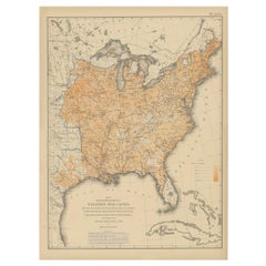
Antique Chart of the US Foreign Parentage Proportion in 1870, '1874'
Located in Langweer, NL
Antique chart titled 'Map showing the proportion to the aggregate population, of persons having one
Category
Late 19th Century Antique Map Of Us
Materials
Paper
Antique Chart of the US Enteric, Cerebro-Spinal, Typhus Deaths, '1874'
Located in Langweer, NL
Antique chart titled 'Map showing the proportion of deaths from enteric, cerebro-spinal and typhus
Category
Late 19th Century Antique Map Of Us
Materials
Paper
H 21.66 in W 16.15 in D 0.02 in
Antique Chart of the US Population in 1870, published in 1874
Located in Langweer, NL
Antique chart titled 'Map showing, in five degrees of density, the distribution, within the
Category
Late 19th Century Antique Map Of Us
Materials
Paper
Pl. 28 Antique Chart of British American, English (..) US Population, 1874
Located in Langweer, NL
Antique chart titled 'Maps showing the distribution, within the territory of the United States
Category
Late 19th Century Antique Map Of Us
Materials
Paper
H 21.66 in W 16.15 in D 0.02 in
Cartographic Elegance: The Art and Science of 17th-Century Asian Maps, ca.1681
Located in Langweer, NL
antique maps. His engravings, like this map of Asia, serve as historical records that tell us about the
Category
1680s Antique Map Of Us
Materials
Paper
H 7.49 in W 9.22 in D 0 in
Pl. 36A Antique Chart of US Farms, Agriculture and Crops '1874'
Located in Langweer, NL
.. Chart of US crops, farms and total agricultural production. Originates from 'Statistical Atlas of the
Category
Late 19th Century Antique Map Of Us
Materials
Paper
Pl. 33 Antique Chart of the US Wealth Distribution in 1870 '1874'
Located in Langweer, NL
Antique chart titled 'Map showing the distribution of wealth. Compiled from the tables of "true
Category
Late 19th Century Antique Map Of Us
Materials
Paper
Pl. 17A Antique Chart of the US Population 1860 by Walker, '1874'
Located in Langweer, NL
Antique chart titled 'Map showing in five degrees of density, the distribution, within the
Category
Late 19th Century Antique Map Of Us
Materials
Paper
Pl. 17 Antique Chart of the US Population 1850 by Walker, 1874
Located in Langweer, NL
Antique chart titled 'Map showing in five degrees of density, the distribution, within the
Category
Late 19th Century Antique Map Of Us
Materials
Paper
Pl. 25 Antique Chart of the US Foreign Population in 1870, '1874'
Located in Langweer, NL
Antique chart titled 'Map showing five degrees of density the distribution of the foreign
Category
Late 19th Century Antique Map Of Us
Materials
Paper
Pl. 23 Antique Chart of the US Foreign Parentage in 1870, '1874'
Located in Langweer, NL
Antique chart titled 'Map showing, in five degrees of density, the distribution, within the
Category
Late 19th Century Antique Map Of Us
Materials
Paper
Old Map of the Great Lakes and Upper Mississippi Valley, Northern America, c1780
Located in Langweer, NL
Antique map titled 'Partie Occidentale du Canada'.
A fine example of Rigobert Bonne and
Category
1780s Antique Map Of Us
Materials
Paper
H 10.32 in W 14.85 in D 0 in
Pl. 36 Antique Chart of US Crops, Wheat, Rice, Tobacco, Hops, Oats '1874'
Located in Langweer, NL
Antique chart titled 'Maps showing the range, and within the range, the degree of cultivation of
Category
Late 19th Century Antique Map Of Us
Materials
Paper
H 21.66 in W 16.15 in D 0.02 in
Pl. 16A Antique Chart of the US Population 1830-1840 by Walker, 1874
Located in Langweer, NL
Antique chart titled 'Map showing, in five degrees of density, the distribution, within the
Category
Late 19th Century Antique Map Of Us
Materials
Paper
Pl. 26 Antique Chart of the US Foreign Population Proportion in 1870, '1874'
Located in Langweer, NL
Antique chart titled 'Map showing the proportion of the foreign to the aggregate population
Category
Late 19th Century Antique Map Of Us
Materials
Paper
H 21.66 in W 16.15 in D 0.02 in
Pl. 22 Antique Chart of the US Colored Population Proportion in 1870, '1874'
Located in Langweer, NL
Antique chart titled 'Map showing the proportion of the colored to the aggregate population
Category
Late 19th Century Antique Map Of Us
Materials
Paper
H 21.66 in W 16.15 in D 0.02 in
Pl. 16 Antique Chart of the US Population 1790-1820 by Walker, '1874'
Located in Langweer, NL
Antique chart titled 'The progress of the nation, 1790-1820. Maps showing in five degrees of
Category
Late 19th Century Antique Map Of Us
Materials
Paper
H 21.66 in W 16.15 in D 0.02 in
Pl. 21 Antique Chart of the US Colored Population Density in 1870, '1874'
Located in Langweer, NL
Antique chart titled 'Map showing in five degrees of density the distribution of the colored
Category
Late 19th Century Antique Map Of Us
Materials
Paper
H 21.66 in W 16.15 in D 0.02 in
Antique Decorative Coloured Map Marocco, Algeria and Tunis, 1882
Located in Langweer, NL
and refueling.
6. **Comparative Analysis**: When viewed alongside modern maps, it allows us to see
Category
1880s Antique Map Of Us
Materials
Paper
Free Shipping
H 14.97 in W 22.45 in D 0 in
Pl. 27 Antique Chart of the US Irish and German Population in 1870, '1874'
Located in Langweer, NL
Antique chart titled 'Maps showing the distribution, within the territory of the United States
Category
Late 19th Century Antique Map Of Us
Materials
Paper
H 21.66 in W 16.15 in D 0.02 in
Antique Decorative Coloured Map Egypt, Nubia, Abyssinia and more, 1882
Located in Langweer, NL
This image contains two maps, with the left one being labeled "Egypt" and the right one "Nubia
Category
1880s Antique Map Of Us
Materials
Paper
Free Shipping
H 14.97 in W 22.45 in D 0 in
Renaissance Mapping of Sumatra: Featuring Singapore in Münster’s Woodcut, c.1590
Located in Langweer, NL
Description: Antique map titled 'Sumatra ein grosse Insel / so von den alten Geographen Taprobana
Category
16th Century Antique Map Of Us
Materials
Paper
Free Shipping
H 13.39 in W 16.34 in D 0 in
Old Print of Baltiysk or Pillau, a Seaport Town Near Kaliningrad, Russia, 1652
Located in Langweer, NL
Vistula Lagoon from Gdansk Bay. This print originates from 'Topographia Electorat[us] Brandenburgici et
Category
1650s Antique Map Of Us
Materials
Paper
H 11.23 in W 14.18 in D 0 in
Map of Northumberland by Joan Blaeu
By Joan (Johannes) Blaeu
Located in London, GB
To see our other original maps, scroll down to "More from this Seller" and below it click on "See
Category
1660s Antique Map Of Us
Materials
Engraving
John Speede Map The Countye of Monmouth
By John Speed
Located in London, GB
To see our other views and maps of England - including London, Oxford and Cambridge, scroll down to
Category
17th Century Realist Antique Map Of Us
Materials
Engraving
Map of Northumberland by Joannem Janssonium 17th century
Located in London, GB
To see our other original maps, scroll down to "More from this Seller" and below it click on "See
Category
1640s Antique Map Of Us
Materials
Engraving
H 16.15 in W 19.69 in
1861 Original vintage map of Paris - Historical cartography
Located in PARIS, FR
its practical function as an urban navigation tool. It is a window on the past, allowing us to
Category
1860s Antique Map Of Us
Materials
Paper, Lithograph
H 33.86 in W 42.92 in
Map of Oxfordshire by Joan Blaeu with college crests
By Joan (Johannes) Blaeu
Located in London, GB
To see our other original maps, scroll down to "More from this Seller" and below it click on "See
Category
1660s Antique Map Of Us
Materials
Engraving
H 14.97 in W 19.69 in
Map of Oxfordshire coloured 18th century engraving by Thomas Kitchin
By Thomas Kitchin
Located in London, GB
To see our other original maps, scroll down to "More from this Seller" and below it click on "See
Category
1760s Antique Map Of Us
Materials
Engraving
Important Confederate Field Map of Richmond VA 1864 with Provenance
Located in Dallas, TX
'personal' field map for the Battle of the Richmond Peninsula in 1864, at the end of the US Civil War.
It
Category
Mid-19th Century American American Classical Antique Map Of Us
Materials
Canvas, Paper
The First Map of Oxford engraving by William Williams after Ralph Agas
Located in London, GB
click on "See all from this Seller" - or send us a message if you cannot find the view you want
Category
1730s Antique Map Of Us
Materials
Engraving
Wonderground Map of London by MacDonald 'Max' Gill c. 1924 original poster
By "Leslie MacDonald ""Max"" Gill"
Located in London, GB
), scroll down to "More from this Seller" and below it click on "See all from this Seller" - or send us a
Category
1920s Modern Antique Map Of Us
Materials
Lithograph
Theories of Planetary Motion: An 18th C. Framed Celestial Map by Doppelmayr
By Johann Gabriel Doppelmayr 1
Located in Alamo, CA
extended for the purchase of multiple maps. Please reach out to us for more details about these striking
Category
Early 18th Century Antique Map Of Us
Materials
Engraving
H 31.25 in W 34.88 in D 1 in
Theories of Planetary Orbits: A Framed 18th C. Celestial Map by Doppelmayr
By Johann Gabriel Doppelmayr 1
Located in Alamo, CA
multiple maps. Please reach out to us for more details about these striking and interesting celestial maps
Category
Early 18th Century Antique Map Of Us
Materials
Engraving
H 31.5 in W 34.94 in D 1 in
Antique 20th Century Large Scrolled Map Of The World, George Philips c.1918
Located in Royal Tunbridge Wells, Kent
Antique early-20th Century large commercial map of the world by George Philips. This scrolled map
Category
1910s British Other Antique Map Of Us
Materials
Wood, Paper
H 47.64 in W 85.04 in D 1.58 in
John Speede Map The Countye Palatine of Chester with that most ancient citie
By John Speed
Located in London, GB
To see our other views and maps of England - including London, Oxford and Cambridge, scroll down to
Category
17th Century Realist Antique Map Of Us
Materials
Engraving
The Orbits of Venus and Mercury: An 18th C. Framed Celestial Map by Doppelmayr
By Johann Gabriel Doppelmayr 1
Located in Alamo, CA
discount will be extended for the purchase of multiple maps. Please reach out to us for more details about
Category
Early 18th Century Antique Map Of Us
Materials
Engraving
H 31.13 in W 34.88 in D 1 in
Vicinity of Flemington
By Julius Bien
Located in Florham Park, NJ
.
Chromolithography.
New York, 1883 - 1889
17 maps. 34” x 25” Paper Size.
A lithographer and map engraver, Bien
Category
Late 19th Century Academic Antique Map Of Us
Materials
Lithograph
South Prospect of Somerset House engraving c. 1753 for Stow's Survey of London
Located in London, GB
To see our other views and maps of England - including London, Oxford and Cambridge, scroll down to
Category
1750s Realist Antique Map Of Us
Materials
Engraving
H 9.45 in Dm 14.57 in
Interior of a Japanese House
By Harry Humphrey Moore
Located in New York, NY
topographical artist and explorer who mapped the Japanese coast in 1855; and the Boston landscapist
Category
Late 19th Century Antique Map Of Us
Materials
Oil, Wood Panel
Prospect of Durham from the River 19th Century Watercolour
Located in London, GB
To see our other views and maps of England - including London, Durham, Oxford and Cambridge, scroll
Category
19th Century Realist Antique Map Of Us
Materials
Watercolor
Dulwich College J Oliphant Engraving 1775 Harrison's History of London
Located in London, GB
To see our other views and maps of England - including London, Oxford and Cambridge, scroll down to
Category
1770s Realist Antique Map Of Us
Materials
Engraving
Southwark Cathedral engraving c. 1753 for Stow's Survey of London
Located in London, GB
To see our other views and maps of England - including London, Oxford and Cambridge, scroll down to
Category
1750s Realist Antique Map Of Us
Materials
Engraving
'Lieutenant Crovers Despatch – Return of Governor Stevens to Fort Benton'
By John Mix Stanley
Located in Milwaukee, WI
: to produce topographical maps, to document flora and fauna, and to document natural resources to
Category
1850s Romantic Antique Map Of Us
Materials
Lithograph
- 1
Get Updated with New Arrivals
Save "Antique Map Of Us", and we’ll notify you when there are new listings in this category.
Antique Map Of Us For Sale on 1stDibs
At 1stDibs, there are many versions of the ideal antique map of us for your home. Frequently made of paper, every antique map of us was constructed with great care. There are many kinds of the antique map of us you’re looking for, from those produced as long ago as the 19th Century to those made as recently as the 19th Century.
How Much is a Antique Map Of Us?
An antique map of us can differ in price owing to various characteristics — the average selling price 1stDibs is $485, while the lowest priced sells for $431 and the highest can go for as much as $969.
Questions About Antique Map Of Us
- 1stDibs ExpertApril 5, 2022All incense burners work roughly the same, whether antique or contemporary. Usually the incense is placed inside the burner and lit, then a lid may be lowered, if there is one. The smoke will then filter out through holes in the lid. Shop a range of antique and modern incense burners on 1stDibs.
- 1stDibs ExpertApril 5, 2022Antique wooden bowls were used in either storing or serving food. Wooden bowls were also preferred for bread making, as the wood held the heat that was generated by the fermenting yeast. You’ll find a variety of antique wooden bowls from some of the world’s top sellers on 1stDibs.
- 1stDibs ExpertMarch 22, 2022How you use an antique cash register depends on the type. Push-button cash registers allow you to punch in the sale price and then push another button to open a drawer. With crank cash registers, you must turn the crank to unlatch the drawer. On 1stDibs, shop a range of antique cash registers.
- 1stDibs ExpertApril 5, 2022Dough bowls, also known as trenchers, were a staple in colonial America for mixing bread and providing a place for the dough to rise before baking. Shop a collection of antique dough bowls from some of the world’s top sellers on 1stDibs.
- 1stDibs ExpertAugust 26, 2020
The more optimal its condition, the more valuable an antique will likely be. If an item is perfectly uniform with no color, this is likely indicative that it is a modern mass-produced reproduction and thus, less valuable. When 1stDibs vets an item, we look for item condition and patina to determine if an item shows signs of age.
More Ways To Browse
Extreme Rolex
19 Th Century Landscapes
American Colonization Society
Jacqueline Kennedy Auction Catalogue
Snow White Watch Vintage
Snow White Vintage Watch
Garrett Price
18 Th Century Cross
Andree Bars
Andree Bars Painter
C Ford Riley
20 Th Century Portrait
Ford Riley
18 Th Century Oil On Canvas
Eames Sea Things
Vintage Maine Maps
Vintage Maine Map
Oil Paintings From 19 Th Century
