Antique Egypt Map

5
to
32
123
29
77
62
48
25
22
14
13
13
13
12
11
8
7
7
6
6
5
5
4
3
3
3
3
3
3
2
2
2
2
2
2
1
1
1
3
2
2
1
1
Sort By
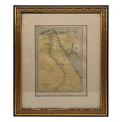
Antique Map of Egypt, John Bartholomew & Sons Ltd C. 1880
Located in Atlanta, GA
Egypt Map - The Edinburgh and Geographical Institute, John Bartholomew & Son LTD, W & R Chambers
Category

19th Century Scottish Antique Egypt Map

Materials

Giltwood, Paper

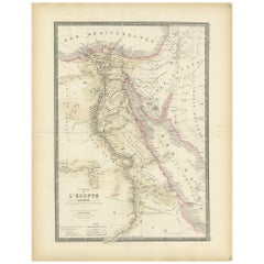
Antique Map of Egypt, '1875'
Located in Langweer, NL
Antique map titled 'Carte des l'Égypte'. Large map of Egypt. This map originates from 'Atlas de
Category

Late 19th Century Antique Egypt Map

Materials

Paper

Antique Map of Egypt, '1875'
H 24.02 in W 18.71 in D 0.02 in
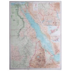
Large Original Vintage Map of Egypt, circa 1920
Located in St Annes, Lancashire
Great map of Egypt Unframed Original color By John Bartholomew and Co. Edinburgh Geographical
Category

1920s British Antique Egypt Map

Materials

Paper

Large Original Antique Map of Egypt, circa 1920
Large Original Vintage Map of Egypt, circa 1920
No Reserve
H 23 in W 18 in D 0.07 in
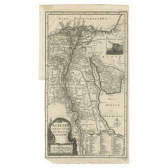
Antique Map of Egypt and the Nile River
Located in Langweer, NL
detailed map of Egypt features hundreds of place names along the Nile. The Sinai Peninsula is shown with a
Category

Mid-18th Century Antique Egypt Map

Materials

Paper

Antique Map of Egypt and the Nile River
H 15.75 in W 8.75 in D 0.2 in
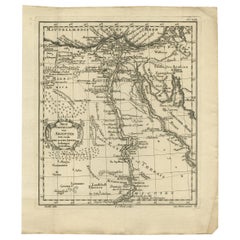
Original Antique Map of Egypt by Van Dùren '1749'
Located in Langweer, NL
rare original antique map of Egypt. This map originates from 'Neue Sammlung der merkwürdigsten
Category

Mid-18th Century Antique Egypt Map

Materials

Paper

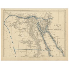
Antique Map of Egypt and Arabia Petraea by Lowry, '1852'
Located in Langweer, NL
Antique map titled 'Egypt and Arabia Petrea'. Original map of Egypt and Arabia Petraea. This map
Category

Mid-19th Century Antique Egypt Map

Materials

Paper

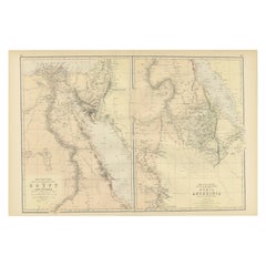
Antique Decorative Coloured Map Egypt, Nubia, Abyssinia and more, 1882
Located in Langweer, NL
This image contains two maps, with the left one being labeled "Egypt" and the right one "Nubia
Category

1880s Antique Egypt Map

Materials

Paper

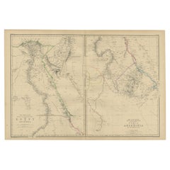
Antique Map of Egypt and Abyssinia by W. G. Blackie, 1859
Located in Langweer, NL
Antique map titled 'Egypt and Abyssinia'. Original antique map of Egypt and part of Nubia and Nubia
Category

Mid-19th Century Antique Egypt Map

Materials

Paper

Rare Antique Map of Yam Suph, Egypt and Red Sea, 1773
Located in Langweer, NL
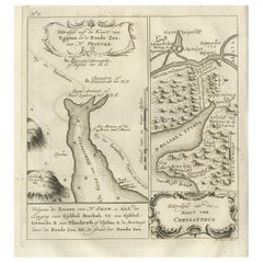
Antique print with two maps titled 'Uittreksel van de Kaart van Egipten en de Roode Zee' and
Category

18th Century Antique Egypt Map

Materials

Paper

Antique Map of Egypt and Palestina by H. Kiepert 'circa 1870'
By Heinrich Kiepert
Located in Langweer, NL
Antique map titled 'Aegyptus, Phoenice et Palestina'. With inset maps of Tyrus, Alexandria and
Category

Late 19th Century Antique Egypt Map

Materials

Paper

Antique Map of Egypt and Arabia Petraea by A & C. Black, 1870
Located in Langweer, NL
Antique map titled 'Egypt and Arabia Petraea'. Original antique map of Egypt and Arabia Petraea
Category

Late 19th Century Antique Egypt Map

Materials

Paper

Antique Map of Egypt, Arabia Petraea and Lower Nubia by Johnston '1909'
Located in Langweer, NL
Antique map titled 'Egypt, Arabia Petraea and Lower Nubia'. Original antique map of Egypt, Arabia
Category

Early 20th Century Antique Egypt Map

Materials

Paper

Three Antique Maps on One Folio: Turkey, Northern Egypt, and Ancient Carthage
Located in Langweer, NL
. 2. **Map of Northern Egypt**: - Geographic Coverage: This section of the map focuses on northern
Category

16th Century Antique Egypt Map

Materials

Paper

Original Antique Map of Egypt in Frame by C. Weigel, circa 1720
Located in Langweer, NL
The map is an antique depiction of ancient Egypt, divided into its regions and nomes, also
Category

Early 18th Century Antique Egypt Map

Materials

Paper

Large Antique Map of Egypt and the Nile Delta by Wyld, 1854
Located in Langweer, NL
Antique map titled 'Lower Egypt and the adjacent desert, with a part of Palestine to which has been
Category

19th Century Antique Egypt Map

Materials

Paper

Antique Map of North Africa showing Egypt, Mauritania and Africa Minor, 1672
Located in Langweer, NL
, showing Egypt, Mauritania and Africa Minor. This map originates from the pocket atlas 'Introductionis in
Category

17th Century Antique Egypt Map

Materials

Paper

Large Antique Map of the Lower Nile Valley Including Egypt and Nubia, 1842
Located in Langweer, NL
Antique map titled 'Carte de l'Égypte, de la Nubie, de l'Abissinie'. Map of Egypt, covering the
Category

19th Century Antique Egypt Map

Materials

Paper

Old Map of the Arabian Peninsula with Parts of Egypt, Sudan, Eritrea & Ethiopia
Located in Langweer, NL
du Globe Terrestre This handsome map of the Arabian Peninsula extends to show parts of Egypt, Sudan
Category

1780s Antique Egypt Map

Materials

Paper

Antique Map of The Nile, Egypt and the Red Sea by Bachiene, 1765
Located in Langweer, NL
of Biblical Egypt and the Red Sea. With title cartouche, compass rose and scale. This map originates
Category

18th Century Antique Egypt Map

Materials

Paper

Antique Map of Ancient Egypt Also Depicting the Nile River and Red Sea, 1845
Located in Langweer, NL
Antique map Egypt titled 'General Karte von Alt Aegypten von A.H. Brué'. Large map of Egypt also
Category

19th Century Antique Egypt Map

Materials

Paper

Antique Map of The Nile, Egypt, Nubia and Abyssinia and Inset of Jerusalem, 1880
Located in Langweer, NL
Antique map titled 'Égypte Moderne'. Old map of Egypt, Nubia and Abyssinia (Ethiopia), Kordofan and
Category

19th Century Antique Egypt Map

Materials

Paper

Antique Map of Egypt and the Nile River with Sphinx, Pyramids, Etc, c.1720
Located in Langweer, NL
Antique map titled 'Aegyptus Hodierna Ex itinerario Celeberrimi (..)'. Original antique map of
Category

18th Century Antique Egypt Map

Materials

Paper

Old Map of Ancient Times covering Egypt Towards Arabia and India to Java, c.1660
Located in Langweer, NL
Description: Antique map titled 'Erythraei Sive Rubri Maris Periplus olim ab arriano descriptus
Category

1660s Antique Egypt Map

Materials

Paper

Antique Map of the Sinai Peninsula, '1895'
Located in Langweer, NL
Antique map titled 'Peninsula of Sinaï'. Lithographed map of the Sinai Peninsula, a peninsula in
Category

Late 19th Century Antique Egypt Map

Materials

Paper

Antique Map of the Sinai Peninsula, '1895'
H 9.85 in W 6.3 in D 0.02 in
Antique Map of the Holy Land, c.1710
Located in Langweer, NL
Antique map titled 'Totius Terrae Sanctae Delineatio'. Map of the Holy Land extending to Egypt and
Category

18th Century Antique Egypt Map

Materials

Paper

Antique Map of the Holy Land, c.1710
H 11.82 in W 8.27 in D 0 in
Antique Map of Cairo and Surroundings by Balbi '1847'
Located in Langweer, NL
Antique map titled 'Le Kaire'. Original antique map of Cairo and surroundings, Egypt. This map
Category

Mid-19th Century Antique Egypt Map

Materials

Paper

Large Decorative Antique Map of the Mediterranean, ca.1770
Located in Langweer, NL
Antique map titled 'Carte de la Mer Mediterranee en Douze Feuilles'. First map out of twelve
Category

1770s Antique Egypt Map

Materials

Paper

Antique Map Travel Children of Israel by Keur, 1748
Located in Langweer, NL
Antique biblical map titled 'Perigrinatie ofte veertigh-Iarige Reyse der Kinderen Israels uyt
Category

Mid-18th Century Dutch Antique Egypt Map

Materials

Paper

Antique Map of the Holy Land by Keur, 1748
Located in Langweer, NL
Antique biblical map titled 'Perigrinatie ofte veertigh-Iarige Reyse der Kinderen Israels uyt
Category

18th Century Antique Egypt Map

Materials

Paper

Rare Antique Map of Calcutta 'Kolkata' in India, 1893
Located in Langweer, NL
Antique map titled 'Calcutta (India)'. Old map of Calcutta/Kolkata, India. On verso, a map of Egypt
Category

19th Century Antique Egypt Map

Materials

Paper

Ancient Realms of Northeast Africa: Arabia, Ethiopia, and Egypt, Published 1880
Located in Langweer, NL
, and Egypt. Features that make this map interesting include: 1. **Geographical Span**: It covers a
Category

1880s Antique Egypt Map

Materials

Paper

Antique Map of Asia Minor, Cyprus, and the Eastern Mediterranean
Located in Langweer, NL
maps (Egypt and Carthage), this print is trimmed. Originates from 'Theatrum Orbis Terrarum' by A
Category

Early 17th Century Antique Egypt Map

Materials

Paper

Authentic Old Map of Arabia with Original Border Coloring, 1745
Located in Langweer, NL
Lat Creator: Keizer, Jacob, active 1706-1750 Map of Arabia with parts of Persia, Egypt and Abyssinia
Category

1740s Antique Egypt Map

Materials

Paper

Authentic Old Map of Persia with Original Border Coloring, 1745
Located in Langweer, NL
Lat Creator: Keizer, Jacob, active 1706-1750 Map of Persia with parts of Persia, Egypt and Abyssinia
Category

1740s Antique Egypt Map

Materials

Paper

Antique Map of the Arabian Peninsula by Bellin 'c.1740'
Located in Langweer, NL
Antique map titled 'Carte de la Coste d'Arabie, Mer Rouge et Golfe de Perse'. Original antique map
Category

Mid-18th Century Antique Egypt Map

Materials

Paper

Antique Map of the Holy Land by Danckerts, c.1710
Located in Langweer, NL
Antique map titled 'Afbeeldinge van de Veertich-Iaarige Reyse der Kinderen Israëls uyt Egypten door
Category

18th Century Antique Egypt Map

Materials

Paper

Religious Antique Map of the Twelve Tribes of Israel, circa 1750
Located in Langweer, NL
Antique map titled 'Palaestina in XII. Tribus (..)'. Large map of the Holy Land, published by the
Category

Mid-18th Century Antique Egypt Map

Materials

Paper

Religious Antique Map of the Twelve Tribes of Israel, circa 1750
Free Shipping
H 20.32 in W 25.04 in D 0.02 in
Interesting Map of Great Britain and Northern Europe with various Illustrations
Located in Langweer, NL
Antique map titled 'Itinera Varia Auctoris'. Very interesting map of Great Britain and Northern
Category

Mid-18th Century Antique Egypt Map

Materials

Paper

Original Antique Map of Abyssinia, Sudan and the Red Sea, 1749
Located in Langweer, NL
Antique map titled 'Nubie, Abissinie et Cote d'Ajan'. Map of Abyssinia, Sudan and the Red Sea by
Category

1740s Antique Egypt Map

Materials

Paper

Antique Map of The Kingdom of Alexander the Great, Published in 1880
Located in Langweer, NL
The map is titled "ALEXANDRI MAGNI REGNUM," which translates to "The Kingdom of Alexander the Great
Category

1880s Antique Egypt Map

Materials

Paper

Original Copper Engraving of a Map of Syria and Lebanon, 1698
Located in Langweer, NL
Antique map titled 'Syriae, sive Soriae, Nova et Accurata Descriptio.' Map of Syria and Lebanon
Category

1690s Antique Egypt Map

Materials

Paper

Original Copper Engraving of a Map of Syria and Lebanon, 1698
Free Shipping
H 12.41 in W 14.45 in D 0 in
Antique Map of the Middle East by Brion de la Tour '1772'
Located in Langweer, NL
Antique map titled 'Carte des Pays et Principaux Lieux (..)'. Original antique map of Middle East
Category

Late 18th Century Antique Egypt Map

Materials

Paper

Detailed Original Antique Map of the Turkish Empire with Arabia, 1778
Located in Langweer, NL
. . . 1753 Detailed map of the Turkish Empire, extending to the Black Sea, Georgia, the Caspian
Category

1770s Antique Egypt Map

Materials

Paper

Empire's Crossroads: An 1882 Map of Turkey in Asia by Blackie & Son
Located in Langweer, NL
importance of Egypt to the Ottoman Empire. This map is a historical document that speaks volumes about the
Category

1880s Antique Egypt Map

Materials

Paper

Antique Map of Africa, Cartouche with Elephant Tusks and Horned Serpent, 1737
Located in Langweer, NL
Antique map of Africa titled 'Africa Secundum Legitimas Projectionis Stereographicae regulas
Category

18th Century Antique Egypt Map

Materials

Paper

"Nova Barbariae Descriptio", a 17th Century Hand-Colored Map of North Africa
By Johannes Janssonius
Located in Alamo, CA
This original attractive 17th century hand-colored map of North Africa entitled "Nova Barbariae
Category

Mid-17th Century Dutch Antique Egypt Map

Materials

Paper

The World in the Assyrian Empire's Era: A Historical Map, Published in 1880
Located in Langweer, NL
This map from the "Spruner-Menke Atlas Antiquus" is titled "ORBIS TERRARVM regni Assyrii tempore
Category

1880s Antique Egypt Map

Materials

Paper

1847 “World at One View” Antique Hand-Colored Wall Map of the World
Located in Colorado Springs, CO
This is a highly desirable hanging wall map of the "World at One View", published in 1847 by Ensign
Category

19th Century American Antique Egypt Map

Materials

Paper

Original Old Composite of Several Maps of the Ancient World on One Sheet, 1880
Located in Langweer, NL
This original antique map is from Karl Spruner von Merz's "Atlas Antiquus", later edited by
Category

1880s Antique Egypt Map

Materials

Paper

Antique Print of the Fortress at the Nile 'Damietta, Egypt' by C. Niebuhr, 1774
Located in Langweer, NL
the estuary of the Nile near Damietta, Egypt'. This print originates from 'Reisebeschreibung nach
Category

Late 18th Century Antique Egypt Map

Materials

Paper

Old Map of Mediterranean Powers: Pompey to Actium (66-31 BC), Published in 1880
Located in Langweer, NL
This is a historical map that depicts the Mediterranean region during a specific timeframe in Roman
Category

1880s Antique Egypt Map

Materials

Paper

Antique Detailed Map of Jerusalem in Israël with Extensive Key and Scale, 1698
Located in Langweer, NL
Antique map titled 'Jerusalem.' Plan of the ancient city of Jerusalem. With extensive key and
Category

17th Century Antique Egypt Map

Materials

Paper

Original Antique Map of the Region Between the Gulf of Lybia and the Red Sea
Located in Langweer, NL
, Egypt. This map originates from 'Philippi Cluveri Introductionis in universam geographiam (..)' by P
Category

Early 18th Century Antique Egypt Map

Materials

Paper

Map of the Holy Land "Carte de la Syrie et de l'Egypte" by Pierre M. Lapie
By Pierre M. Lapie
Located in Alamo, CA
An early 19th century map of ancient Syria and Egypt entitled "Carte de la Syrie et de l'Egypte
Category

Early 19th Century French Antique Egypt Map

Materials

Paper

Empires of Antiquity: The Persian Realm and Beyond Engraved, Published in 1880
Located in Langweer, NL
the east to parts of Greece and Egypt in the west. 2. **Historical Period**: The map likely covers
Category

1880s Antique Egypt Map

Materials

Paper

Panoramic Antique View of Bandar-Abbas 'Formerly Gamron, Persia' in Iran, 1714
Located in Langweer, NL
to Smyrna, Constantinople, Egypt, Jerusalem, Syria, Lebanon, and Turkey. Everywhere he went Le Bruyn
Category

1710s Antique Egypt Map

Materials

Paper

Bonne, Map of Middle East, Persia, Red Sea, Egypt, Nubia Hand Coloured
Located in Norwich, GB
cartographic documents in Paris, Bonne was able to compile maps containing some of the most up-to-date
Category

1780s French Antique Egypt Map

Materials

Paper

Antique Print of Egyptian Objects, 1773
Located in Langweer, NL
Untitled print depicting various Egyptian objects including statues. Originates from the first
Category

18th Century Antique Egypt Map

Materials

Paper

Antique Print of Egyptian Objects, 1773
H 10.44 in W 8.27 in D 0 in
Antique Print of Cairo in Egypt, 1698
Located in Langweer, NL
Untitled antique print with two views of Cairo, Egypt. 78: Palace of Sultan Gori. 79. Tower and
Category

17th Century Antique Egypt Map

Materials

Paper

Antique Print of Cairo in Egypt, 1698
H 12.8 in W 7.88 in D 0 in
Antique Print of Alexandria in Egypt, 1698
Located in Langweer, NL
Antique print with two views of Alexandria, Egypt. This print originates from 'Reizen van Cornelis
Category

17th Century Antique Egypt Map

Materials

Paper

  • 1
Get Updated with New Arrivals
Save "Antique Egypt Map", and we’ll notify you when there are new listings in this category.

Antique Egypt Map For Sale on 1stDibs

At 1stDibs, there are many versions of the ideal antique egypt map for your home. Frequently made of paper, every antique egypt map was constructed with great care. There are many kinds of the antique egypt map you’re looking for, from those produced as long ago as the 18th Century to those made as recently as the 20th Century. Heinrich Kiepert each produced at least one beautiful antique egypt map that is worth considering.

How Much is a Antique Egypt Map?

Prices for an antique egypt map start at $89 and top out at $1,279 with the average selling for $289.

Read More

Pamela Shamshiri Shares the Secrets behind Her First-Ever Book and Its Effortlessly Cool Interiors

The sought-after designer worked with the team at Hoffman Creative to produce a monograph that beautifully showcases some of Studio Shamshiri's most inspiring projects.

Moroccan Artworks and Objects Take Center Stage in an Extraordinary Villa in Tangier

Italian writer and collector Umberto Pasti opens the doors to his remarkable cave of wonders in North Africa.

Montecito Has Drawn Royalty and Celebrities, and These Homes Are Proof of Its Allure

Hollywood A-listers, ex-pat aristocrats and art collectors and style setters of all stripes appreciate the allure of the coastal California hamlet — much on our minds after recent winter floods.

Whaam! Blam! Pow! — a New Book on Pop Art Packs a Punch

Publishing house Assouline and writer Julie Belcove have teamed up to trace the history of the genre, from Roy Lichtenstein, Andy Warhol and Yayoi Kusama to Mickalene Thomas and Jeff Koons.

The Sparkling Legacy of Tiffany & Co. Explained, One Jewel at a Time

A gorgeous new book celebrates — and memorializes — the iconic jeweler’s rich heritage.

What Makes a Gem-Encrusted Chess Set Worth $4 Million?

The world’s most opulent chess set, weighing in at 513 carats, is literally fit for a king and queen.

Tauba Auerbach’s Geometric Pop-Up Book Is Mighty Rare, Thanks to a Hurricane

This sculptural art book has an epic backstory of its own.

Step inside the Storied Mansions of Palm Beach’s Most Effervescent Architect

From Spanish-style courtyards to fanciful fountains, these acclaimed structures abound in surprising and elegant details.