Maps Of Ireland 18th Century
1
to
8
46
9
51
47
19
8
6
3
3
2
2
1
1
1
1
1
1
1
1
2
2
1
1
1
Sort By
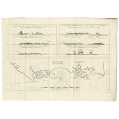
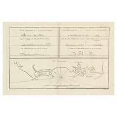
Antique Map of New Ireland, 1774
Located in Langweer, NL
Antique print titled 'Neu Irrland (..)'. Antique map of New Ireland with 7 coastal profiles, Papua
Category
Antique 18th Century Maps
Materials
Paper
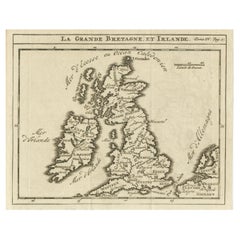
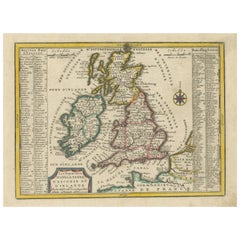
Rare Small Antique Map of Great Britain and Ireland
Located in Langweer, NL
Antique map titled 'La Grande Bretagne et Irlande'. Small antique map of Great Britain and Ireland
Category
Antique Mid-18th Century Maps
Materials
Paper
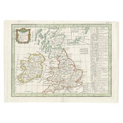
Antique Map of England and Ireland by Lattre, 1789
Located in Langweer, NL
authentic antique maps from the 16th to the 20th centuries. Buying and collecting antique maps is a
Category
Antique 18th Century Maps
Materials
Paper
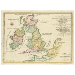
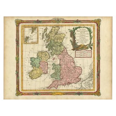
Original Antique Map of England, Ireland, Scotland and Wales
Located in Langweer, NL
Antique map titled 'Les Isles Britanniques, ou sont les Royaumes d Angleterre (..)'. Detailed map
Category
Antique Early 18th Century Maps
Materials
Paper
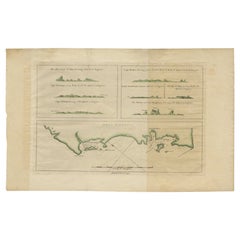
Antique Map of New Ireland with 7 Coastal Profiles
Located in Langweer, NL
Antique print titled 'l'Isle St. Jean (..) - Cap St. George (..)'. Antique map of New Ireland, an
Category
Antique Late 18th Century Maps
Materials
Paper
Small Antique Map of England, Wales, Scotland and Ireland with Original Coloring
Located in Langweer, NL
Antique map titled 'Les Royaumes d'Angleterre d'Escosse et d'Irlande (..)'. A lovely, small map of
Category
Antique Early 18th Century Maps
Materials
Paper
H 7.76 in W 10.04 in D 0.02 in
England, Scotland & Ireland: A Hand Colored Map of Great Britain by Tirion
By Isaak Tirion
Located in Alamo, CA
the map is otherwise in excellent condition.
Isaac Tirion (1705-1765) was an 18th century Dutch
Category
Antique Mid-18th Century Dutch Maps
Materials
Paper
H 17 in W 20.75 in D 0.07 in
Antique Map of New Ireland Island in the Bismarck Archipelago, New Guinea, 1772
Located in Langweer, NL
Antique map titled 'Nova Hibernia'. Antique map of New Ireland, an island in the Bismarck
Category
Antique 18th Century Maps
Materials
Paper
H 17.52 in W 11.03 in D 0 in
Antique Map of Great Britain and Ireland by Brion de la Tour, 1766
Located in Langweer, NL
centuries. Buying and collecting antique maps is a tradition that goes back hundreds of years. Antique maps
Category
Antique 18th Century Maps
Materials
Paper
Map of the British Isles with Historical Kings, 1719
Located in Langweer, NL
This antique map, titled "Les Royaumes d'Angleterre d'Escosse et d'Irlande," offers a detailed view
Category
Antique Early 18th Century Maps
Materials
Paper
Original Antique Map of the British Isles Surrounded by Text
Located in Langweer, NL
divided in to three major regions of the 18th century United Kingdom: England, Ireland, and Scotland. It
Category
Antique Late 18th Century Maps
Materials
Paper
Antique Map of the British Isles by Lotter, 1764
Located in Langweer, NL
Antique map titled 'Le Grand Bretagne ou les Royaumes d'Angleterre et d'Ecosse'. Old engraved map
Category
Antique 18th Century Maps
Materials
Paper
Antique Map of the British Isles by H. Chatelain, 1719
By Henri-Abraham Chatelain
Located in Langweer, NL
monumental 7 volume Atlas Historique, one of the great compilations of the early 18th century.
Category
Antique Early 18th Century Maps
Materials
Paper
Antique Map of the British Isles, Insets of the Shetland Islands and Hebrides
Located in Langweer, NL
Antique map titled 'Great Britain and Ireland with ye Judges Circuits'. A scarce map of the British
Category
Antique Late 18th Century Maps
Materials
Paper
H 16.82 in W 19.45 in D 0.02 in
Large Antique Map England and Wales, with Part of the Coastlines
Located in Langweer, NL
Antique map titled 'A Map of England and Wales (..)'. Large antique map of England and Wales, with
Category
Antique Late 18th Century Maps
Materials
Paper
Large Antique Map of the British Isles, with inset of the Orkneys and Shetlands
Located in Langweer, NL
Antique map titled 'A Map of Great Britain and Ireland (..)'. Large antique map of the British
Category
Antique Late 18th Century Maps
Materials
Paper
H 18.43 in W 24.93 in D 0.02 in
Antique Map of the British Isles According to the Geography of the Roman Empire
Located in Langweer, NL
Antique map titled 'Insulae Britannicae'. Interesting map of Britain, Scotland, and Ireland. It
Category
Antique Late 18th Century Maps
Materials
Paper
H 8.08 in W 10.24 in D 0.02 in
Antique Map of the British Isles with Walls, Settlements and Other Features
Located in Langweer, NL
Antique map titled 'Insulae Britannicae'. Interesting map of Britain, Scotland, and Ireland. It
Category
Antique Late 18th Century Maps
Materials
Paper
H 7.88 in W 9.26 in D 0.02 in
Antique Map of New Guinea and New Britain by P. Carteret, circa 1773
Located in Langweer, NL
Antique map titled 'A chart of captn Carteret's Discoveries at New Britain'. Philip Carterets map
Category
Antique Late 18th Century Maps
Materials
Paper
Large Antique Map of New Guinea and New Britain Showing Capt. Cooks Tract, 1773
Located in Langweer, NL
Antique map titled 'A Chart of Captain Carteret's Discoveries at New Britain, with part of Captain
Category
Antique 18th Century Maps
Materials
Paper
H 27.96 in W 11.42 in D 0 in
Antique Map of the Journey from Zhe-Hol in Tartary to Beijing and Hang-Tchoo Foo
Located in Langweer, NL
18th century the British were eager to open up further trade with the Chinese Empire. Since 1757
Category
Antique Late 18th Century Maps
Materials
Paper
No Reserve
H 26.78 in W 20.08 in D 0.02 in
Antique Detailed Map of Papua New Guinea and the Regions to the West, ca.1780
Located in Langweer, NL
predecessor, Bellin. However, Bonne maps generally abandon such common 18th century decorative features such
Category
Antique 1780s Maps
Materials
Paper
H 11.46 in W 15.24 in D 0 in
Map of Cambridge 18th century engraving by Sutton Nichols
Located in London, GB
beautifully coloured 18th century map engraving of Cambridgeshire. The map was produced by Robert Morden for
Category
18th Century Landscape Prints
Materials
Engraving
Antique Portrait of Henry VIII, King of England, France & Ireland, 1750
By Jacobus Houbraken
Located in Langweer, NL
antique maps from the 16th to the 20th centuries. Buying and collecting antique maps is a tradition that
Category
Antique 18th Century Prints
Materials
Paper
Colored Antique Print of the Islands of Marken, New Ireland and Other Islands
Located in Langweer, NL
showing panoramic views of the islands of Marken, the Groene islands, Sint Jans island and New Ireland, on
Category
Antique Mid-18th Century Prints
Materials
Paper
H 13.19 in W 15.56 in D 0.02 in
Original 1700s Map of Great Britain, England & Wales in 1757 by Thomas Kitchin
Located in Montréal, CA
A New and Accurate Map of that District of Great Britain called England & Wales &c. from the latest
Category
Antique Mid-18th Century British Prints
Materials
Paper
H 16.13 in W 14.63 in D 0.13 in
Voyage to the Cape of Good Hope, First Edition, c1785
Located in valatie, NY
-out map. The author went to the cape with the royal east India company in 1772. He was invited to join
Category
Antique 18th Century Irish Books
Materials
Leather, Paper
Great Britain Scandinavia Northern France Netherland Germany Mural Map
Located in Berghuelen, DE
school life by using pictures was supported in the late 18th century by Johann Bernhard Basedow. In 1774
Category
Vintage 1970s German Country Posters
Materials
Canvas, Wood, Paper
H 81.89 in W 88.19 in D 0.79 in
Antique Portrait of William II, Prince of Orange, 1749
Located in Langweer, NL
Engravers: Pieter Tanje (1706-1761) was an 18th century Dutch engraver from the Northern Netherlands. He
Category
Antique 18th Century Prints
Materials
Paper
Antique Portrait of William II, Prince of Orange, by Tanjé, 1749
Located in Langweer, NL
Engravers: Pieter Tanje (1706-1761) was an 18th century Dutch engraver from the Northern Netherlands. He
Category
Antique 18th Century Prints
Materials
Paper
Portrait of William Pitt, Earl of Chatham: Rare Framed Mezzotint after Brompton
By Edward Fisher
Located in Alamo, CA
Magna Carta, a map of the colonies, including Long Island and Staten Island, and papers entitled "A Plan
Category
Late 18th Century Old Masters Portrait Prints
Materials
Mezzotint
H 31.63 in W 26.63 in D 0.75 in
18th Century Wall Map of North America
By George Willdey
Located in New York, NY
Britain France & Ireland &c. This Map of North America.
Published: London, 1720.
Medium: Engraving
Category
Antique 18th Century and Earlier Prints
Sea chart of Galway Bay and Limerick river in Ireland - Engraving - 18th century
By Alexis Hubert Jaillot
Located in Zeeland, Noord-Brabant
-1780). Publisher: Pieter / Pierre Mortier (1661-1711). The 18th century Dutch map trade could build on
Category
1690s Old Masters More Prints
Materials
Engraving
Carte reduite de Partie de la Mer du Nord comprise entre l'Ecosse, [...].
By Jacques-Nicolas Bellin
Located in Zeeland, Noord-Brabant
decorative sea chart / nautical map / maritime map of the North Sea, also including parts of Ireland, the
Category
Late 18th Century More Prints
Materials
Engraving
Carte generale des costes de l'Europe sur l'ocean [...].
By Alexis Hubert Jaillot
Located in Zeeland, Noord-Brabant
/ Pierre Mortier (1661-1711). The 18th century Dutch map trade could build on their reputation that
Category
Late 17th Century More Prints
Materials
Engraving
H 24.41 in W 36.03 in
Petit Neptune Anglois ou Carte Marine des Cotes d'Angleterre, [...].
By Jean Lattre
Located in Zeeland, Noord-Brabant
predecessor, Bellin. However, Bonne maps generally abandon such common 18th century decorative features such
Category
1780s More Prints
Materials
Engraving
Antique Map of the British Isles by Homann Heirs, c.1749
Located in Langweer, NL
Ireland with Part of Holland, Flanders, France'. Decorative map of the British Isles, includinga large
Category
Antique 18th Century Maps
Materials
Paper
World Map Published in June 1783 by Stackhouse and Engraved by S.J. Neele London
Located in Milan, IT
" by Crosthwaite (along with Ashby and Ellis), "New Map of Ireland, Civil and Ecclesiastical" Daniel
Category
Antique 1780s British Maps
Materials
Glass, Wood, Paper
H 21.26 in W 36.93 in D 0.79 in
William Kip (fl.1598-1610) after Saxton (1540-1610) - 1637 Engraving, Cumbria
Located in Corsham, GB
A map of Cumbria with later hand colouring by William Kip (fl.1598-1610) after Christopher Saxton
Category
18th Century More Prints
Materials
Engraving
Oil Painting Portrait of Lord Edward Grenfell, 1st Baron St Just (1870-1941)
By Oswald Birley
Located in London, GB
exposure to 18th- and 19th century English portraiture, in particular Sir Joshua Reynolds, Thomas
Category
Early 20th Century Victorian Portrait Paintings
Materials
Oil
Antique Map of Ireland by Condet 'circa 1770'
Located in Langweer, NL
Antique map titled 'Nieuwe Kaart van Ierland'. Engraved map of Ireland showing the provinces of
Category
Antique Late 18th Century Maps
Materials
Paper
Antique Map of Ireland by Schenk, circa 1705
Located in Langweer, NL
Antique map titled 'Novissima et accuratissima Regni et Insulae Hiberniae (..)'. Beautiful map of
Category
Antique Early 18th Century Maps
Materials
Paper
Antique Map of Ireland by N. Visscher, circa 1700
By Nicolaes Visscher II
Located in Langweer, NL
Beautiful hand-colored map of Ireland by N. Visscher II. This map originates from 'Atlas Contractus
Category
Antique Early 18th Century Maps
Materials
Paper
Antique Map of England, Scotland and Ireland with Outline Coloring
Located in Langweer, NL
Antique map titled 'Carte des Royaumes d'Angleterre, d'Ecosse et d'Irlande'. Map of England
Category
Antique Late 18th Century Maps
Materials
Paper
Attractive Original Antique Map of Great Britain and Ireland, c.1750
Located in Langweer, NL
Engeland, Schotland en Ierland (..).' Attractive map showing Great Britain and Ireland. With an inset map
Category
Antique 18th Century Maps
Materials
Paper
Antique Map of Great Britain and Ireland by Tirion, circa 1750
By Isaak Tirion
Located in Langweer, NL
Engeland, Schotland en Ierland (…)'. Attractive map showing England and Ireland (United Kingdom). With an
Category
Antique Mid-18th Century Dutch Maps
Materials
Paper
Antique Map of England, Scotland and Ireland by Keizer & de Lat, 1788
Located in Langweer, NL
of England, Scotland and Ireland. This map originates from 'Nieuwe Natuur- Geschied- en Handelkundige
Category
Antique Late 18th Century Maps
Materials
Paper
Antique Map of the Kingdoms England, Scotland and Ireland by R. Bonne, 1780
Located in Langweer, NL
d'Irelande'. (Map of Great Britain, containing the kingdoms of England, Scotland and Ireland). This map shows
Category
Antique Late 18th Century Maps
H 15.28 in W 10.24 in D 0.02 in
Hand-Colored 18th Century Sea Chart of Cork, Ireland by Reverend J. Lindsay
By Reverend J. Lindsay
Located in Alamo, CA
This hand-colored sea chart is entitled "A New and Correct Chart of the Harbour of Corke by the Revd. J. Lindsay, Late of His Majesty's Ship Fougueux", published by W&I Mount T & T P...
Category
Antique Mid-18th Century English Maps
Materials
Paper
H 23 in W 27.75 in D 0.5 in
Antique Map of the Principal Towns, Ports and Harbours in Ireland by Seale, 1745
By R.W. Seale
Located in Langweer, NL
views of the following cities of Ireland: Drogheda, Londonderry, Dublin, Coleraine, Kinsale, Cove, City
Category
Antique Mid-18th Century Maps
H 16.46 in W 20.67 in D 0.02 in
19th Century Map Imperial Court of Austria Habsburgs
Located in London, GB
claims in the Oñate treaty.
The House of Habsburg became extinct in the 18th century. The senior
Category
Antique 1820s Spanish Maps
Silk Needlework Map of England and Wales Signed Anna Brewster Dated 1783
Located in San Francisco, CA
Georgian map sampler is signed and dated in the upper left hand corner, mounted and framed. Brewster was
Category
Antique Late 18th Century English Georgian Maps
Materials
Canvas, Silk
H 24.5 in W 21.5 in D 1.5 in
The Atlantic Ocean, Americas, Africa and Europe: Hand-colored 18th C. Bowen Map
Located in Alamo, CA
This is an original 18th century hand-colored map entitled "A New & Accurate Chart of the The
Category
Mid-18th Century Old Masters Landscape Prints
Materials
Engraving
Vintage Pull Down Map North Sea Countries Northen Europe Great Britain Norway
Located in Berghuelen, DE
A classical school map showing the countries surrounding the North Sea (Great Britain, Ireland
Category
Mid-20th Century German Country Prints
Materials
Canvas, Wood, Paper
H 82.29 in W 87.8 in D 0.79 in
Map of Ireland
By Alain Manesson Mallet
Located in New York, NY
Published in 1685 the map was created by Alain Manesson Mallet. Matted in 2 inch acid-free, 4-ply
Category
18th Century and Earlier Realist More Prints
Materials
Engraving
Get Updated with New Arrivals
Save "Maps Of Ireland 18 Th Century", and we’ll notify you when there are new listings in this category.
Maps Of Ireland 18th Century For Sale on 1stDibs
Choose from an assortment of styles, material and more with respect to the maps of ireland 18th century you’re looking for at 1stDibs. Each maps of ireland 18th century for sale was constructed with extraordinary care, often using paper, animal skin and canvas. You’ve searched high and low for the perfect maps of ireland 18th century — we have versions that date back to the 18th Century alongside those produced as recently as the 20th Century are available. You’ll likely find more than one maps of ireland 18th century that is appealing in its simplicity, but Henri-Abraham Chatelain, Jacobus Houbraken and Isaak Tirion produced versions that are worth a look.
How Much is a Maps Of Ireland 18th Century?
Prices for a maps of ireland 18th century can differ depending upon size, time period and other attributes — at 1stDibs, they begin at $192 and can go as high as $5,975, while the average can fetch as much as $460.
More Ways To Browse
Benjamin Fisher
Maltese Falcon
Peeble Beach
Antique Map Bahamas
Circus Dogs
B Fritz Oil Painting
Yacht Master 11
Fox Fur Coat Mens
Northumberland Map
Porcelain Tennis
Mr John Kelly
Yacht Master 2 2 Tone
2 Tone Yacht Master
Dior 2002 Tank
Robert W Meyers
London Trench Coat Mens
Rush Seats With Final
King George British Gold Sovereign
