Items Similar to Old British Empire Map - Ancient Map by Karl Spruner - 1760 ca.


Want more images or videos?
Request additional images or videos from the seller
1 of 7
Karl Spruner von MerzOld British Empire Map - Ancient Map by Karl Spruner - 1760 ca.1760 ca.
1760 ca.
$333.62
£247.45
€280
CA$456.83
A$507.91
CHF 265.86
MX$6,229.33
NOK 3,385.07
SEK 3,195.90
DKK 2,131.24
Shipping
Retrieving quote...The 1stDibs Promise:
Authenticity Guarantee,
Money-Back Guarantee,
24-Hour Cancellation
About the Item
Old British Empire Map is an artwork realized around 1760 by Karl Spruner.
Original hand-colored print.
Good conditions except for yellowing of paper along the margin, and a little tear on the lower margin.
This important artwork represents Great Britain's sedentary possessions with the indication of their acquisition time, North America until 1783 and India around 1760.
This print is the plate n. IV from Historisch-Geographischer Hand-Atlas printed between 1848-1853.
Karl Spruner von Merz (15 November 1803-1892), or Karl von Spruner as he preferred to be known was a German cartographer and scholar. He spent most of his long life in military service. He joined the Bavarian army, aged 11, in 1814, and was promoted to lieutenant in 1825.He is best known for his historical atlases.
- Creator:Karl Spruner von Merz (1803 - 1892)
- Creation Year:1760 ca.
- Dimensions:Height: 14.38 in (36.5 cm)Width: 17.72 in (45 cm)Depth: 0.08 in (2 mm)
- Medium:
- Movement & Style:
- Period:1760-1769
- Condition:Insurance may be requested by customers as additional service, contact us for more information.
- Gallery Location:Roma, IT
- Reference Number:Seller: M-1032021stDibs: LU65035000991
About the Seller
4.9
Platinum Seller
Premium sellers with a 4.7+ rating and 24-hour response times
1stDibs seller since 2017
7,598 sales on 1stDibs
Typical response time: 2 hours
- ShippingRetrieving quote...Shipping from: Monaco, Monaco
- Return Policy
Authenticity Guarantee
In the unlikely event there’s an issue with an item’s authenticity, contact us within 1 year for a full refund. DetailsMoney-Back Guarantee
If your item is not as described, is damaged in transit, or does not arrive, contact us within 7 days for a full refund. Details24-Hour Cancellation
You have a 24-hour grace period in which to reconsider your purchase, with no questions asked.Vetted Professional Sellers
Our world-class sellers must adhere to strict standards for service and quality, maintaining the integrity of our listings.Price-Match Guarantee
If you find that a seller listed the same item for a lower price elsewhere, we’ll match it.Trusted Global Delivery
Our best-in-class carrier network provides specialized shipping options worldwide, including custom delivery.More From This Seller
View AllMap of Campaign of 1814 - Etching by Pierre François Tardieu - 1837
Located in Roma, IT
Map of Campaign of 1814 is an Etching realized by Pierre François Tardieu in 1837.
Good conditions.
The artwork is realized in a well-balanced composition. the artwork and belongs ...
Category
1830s Modern Figurative Prints
Materials
Lithograph

Map of the World - Original Etching - 1820
Located in Roma, IT
Map of the World is an Original Etching realized by an unknown artist of 19th century in 1820.
Very good condition on two sheets of white paper joine...
Category
1820s Modern Figurative Prints
Materials
Etching

The Americas - Vintage Map - 18th century
Located in Roma, IT
The Americas is a very beautiful vintage map realized in the 18th century by an Italian cartographer.
Very good conditions, on the right side the inscript...
Category
18th Century Figurative Prints
Materials
Paper, Etching

Hemisphere Of The New Continent - Ancient Map by J.G. Heck - 1834.
By Johann Georg Heck
Located in Roma, IT
Hemisphere Of The New Continent is an artwork realized around 1760 by Johann Georg Heck
Original colored print.
Good conditions except for yellowing of paper and tears along the m...
Category
1830s Modern Figurative Prints
Materials
Etching

Hemisphere Of The New Continent - Ancient Map by J.G. Heck - 1834.
By Johann Georg Heck
Located in Roma, IT
Hemisphere Of The New Continent - West is an artwork realized in 1834 by Johann Georg Heck
Original colored print.
Good conditions except for yellowing of the paper and very littl...
Category
1830s Modern Figurative Prints
Materials
Etching
Map of Africa - Original Etching by C. Brue - 1820
Located in Roma, IT
Map of Africa is an original etching realized by C.Brue in 1820.
The print comes from the Series "Atlas Universal" PL. 31.
The state of preservation of the artwork is good except f...
Category
1820s Modern Figurative Prints
Materials
Etching

You May Also Like
Very Decorative Original Antique Map of the World, Published in France in c.1780
By Rigobert Bonne
Located in Langweer, NL
Antique map titled 'L'Ancien Monde Et Le Nouveau en Deux Hemispheres' - Double hemisphere map of the World, showing the contemporary geographical...
Category
Antique 18th Century Maps
Materials
Paper

$734 Sale Price
20% Off
Antique Map of the World on Mercator's Projection, 1788
Located in Langweer, NL
Antique map titled 'Kaart van de Geheele Wereld (..)'. Uncommon small world map on Mercator's projection. Nice detail of the islands throughout the wor...
Category
Antique Late 18th Century Maps
Materials
Paper

$714 Sale Price
20% Off
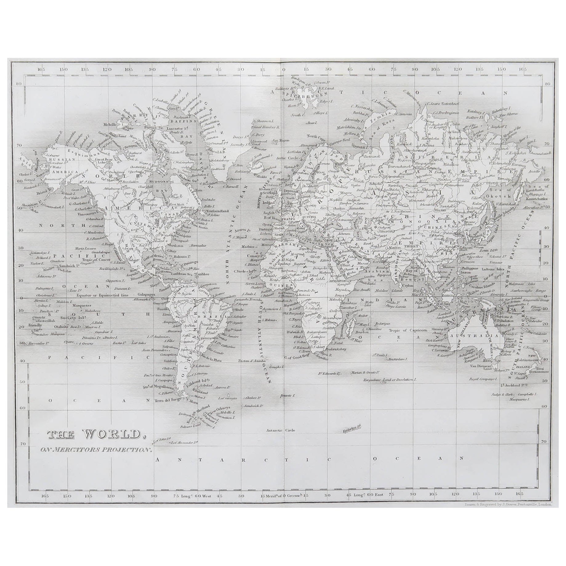
Original Antique Map of The World by Dower, circa 1835
Located in St Annes, Lancashire
Nice map of the World
Drawn and engraved by J.Dower
Published by Orr & Smith. C.1835
Unframed.
Free shipping
Category
Antique 1830s English Maps
Materials
Paper

Very Attractive Antique Map of the World as Planisphere, Shows Cook's Voyages
Located in Langweer, NL
Antique map titled 'Chart of the World, according to Mercators Projection'. This world map shows the various discoveries of Captain James Cook during his 3 voyages between 1768 and 1780, and the English and French Explorers who followed immediately thereafter, including Vancouver and La Perouse. This edition of the map is significantly revised from the editions issued immediately after the official report of Cook's Voyages were integrated into the map, showing better detail in New Zealand, Australia, the Northwest Coast of America and North East coast of Asia, along with Greenland. A new large lake also appears for the first time in the Western part of North America, shortly before the commencement of the Lewis...
Category
Antique Late 18th Century Maps
Materials
Paper

$1,340 Sale Price
25% Off
Free Shipping
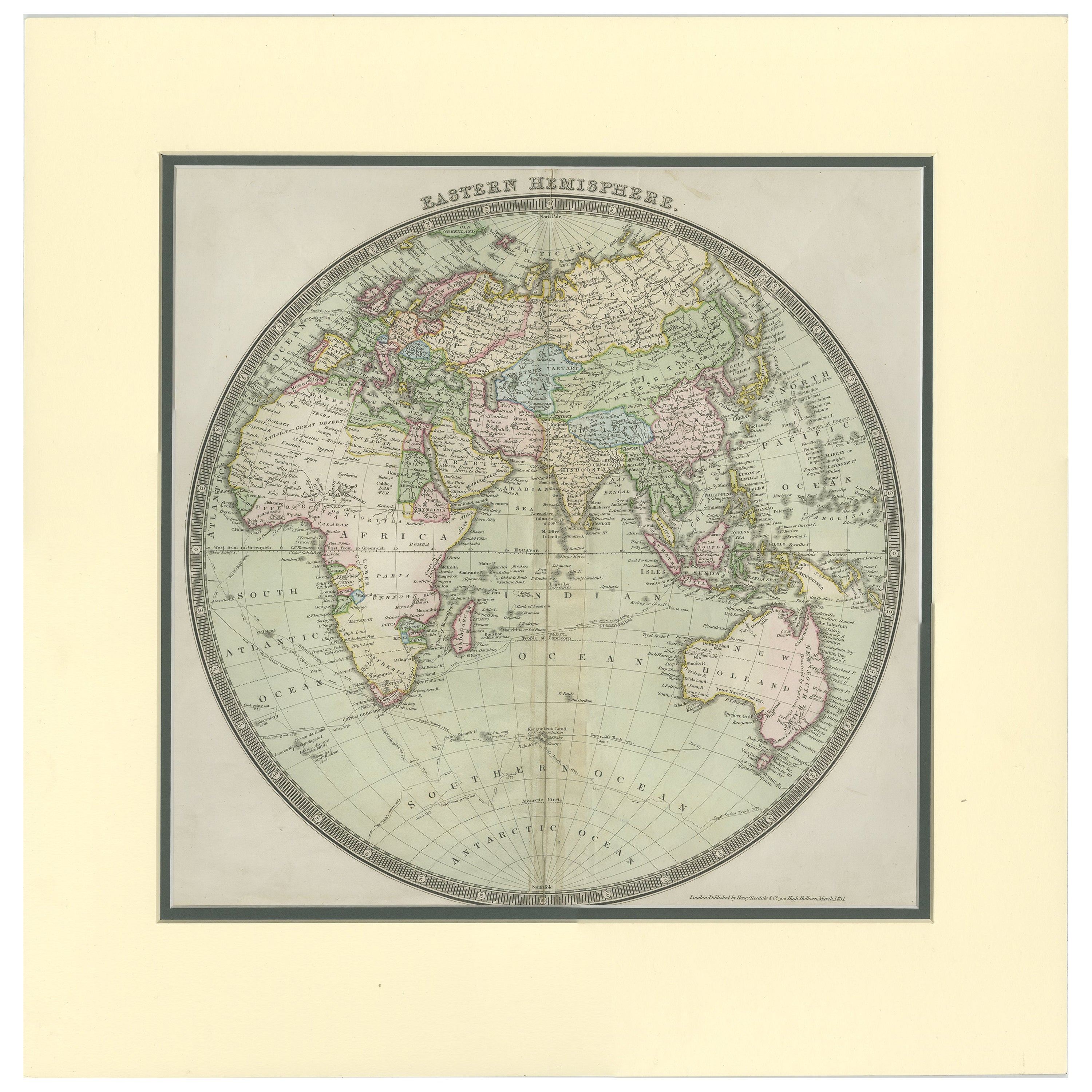
Antique Map of the Eastern Hemisphere by Teesdale, '1831'
Located in Langweer, NL
Antique map titled 'Eastern Hemisphere'. Hemispherical map of eastern hemisphere showing tracks of the navigators James Cook and John Gore. Plate 1 fro...
Category
Antique Mid-19th Century Maps
Materials
Paper
$238 Sale Price
20% Off
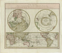
Old World Map Featuring Captain Cook's Exploration Routes and Polar Views, 1787
Located in Langweer, NL
1786 World Map with Polar Projections - "Globo Terrestre" by Giovanni Maria Cassini
This 1786 map titled "Globo Terrestre" by Giovanni Maria Cassini offers a fascinating and detai...
Category
Antique 1860s Maps
Materials
Paper
$1,811 Sale Price
20% Off