Items Similar to Antique Map of the Netherlands in the time of the Domination by the Roman Empire


Want more images or videos?
Request additional images or videos from the seller
1 of 6
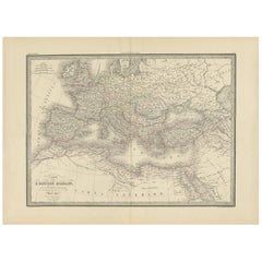
Antique Map of the Netherlands in the time of the Domination by the Roman Empire
About the Item
Original antique map titled 'Carte Ancienne des Pays Bas et des Environs du Temps des Romains'. Copper engraved map of the Netherlands in the time of the domination by the Roman Empire. The map also includes portions of Belgium and Germany. With Renaissance title cartouche showing Roman armor and weapons. Published by P.P. Choffard, 1756.
Pierre-Philippe Choffard (1731-1809) was a French draughtsman and engraver. He started how career by engraving cartouches for other map-makers.
- Dimensions:Height: 12.72 in (32.3 cm)Width: 16.15 in (41 cm)Depth: 0.02 in (0.5 mm)
- Materials and Techniques:
- Period:
- Date of Manufacture:1756
- Condition:Wear consistent with age and use. Age-related toning, shows wear and soiling. Original folding line. Also shows large vertical creasing. Blank verso. Two small pieces of tape on verso. Please study images carefully.
- Seller Location:Langweer, NL
- Reference Number:
About the Seller
5.0
Platinum Seller
These expertly vetted sellers are 1stDibs' most experienced sellers and are rated highest by our customers.
Established in 2009
1stDibs seller since 2017
1,928 sales on 1stDibs
Typical response time: <1 hour
- ShippingRetrieving quote...Ships From: Langweer, Netherlands
- Return PolicyA return for this item may be initiated within 14 days of delivery.
More From This SellerView All
- Antique Map of the Roman Empire by Lapie, 1842Located in Langweer, NLAntique map titled 'Carte de l'Empire Romain'. Map of the Roman Empire. This map originates from 'Atlas universel de géographie ancienne et moderne (..)' by Pierre M. Lapie and Alexa...Category
Antique Mid-19th Century Maps
MaterialsPaper
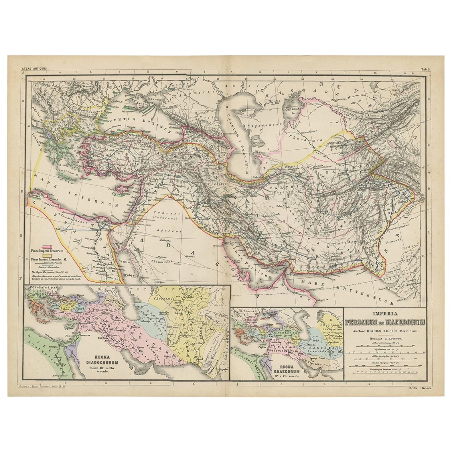
- Antique Map of Part of the Roman Empire by H. Kiepert, circa 1870By Heinrich KiepertLocated in Langweer, NLAntique map titled 'Imperia Persarum et Macedonum'. Depicts part of the Roman Empire, from Greece to Eastern India. This map originates from 'Atlas Antiqus. Zwölf Karten zur Alten Ge...Category
Antique Late 19th Century Maps
MaterialsPaper
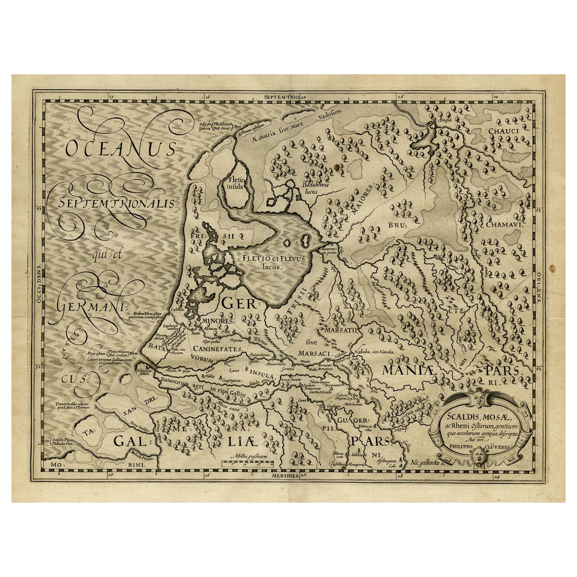
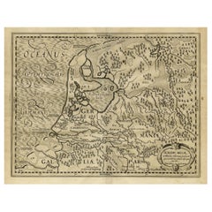
- Antique Latin Map of the Netherlands & Germany, Incl Roman Forts, Etc., 1631Located in Langweer, NLAntique map titled 'Scaldis Mosae, ac Rheni Ostiorum, gentiumque accolarum antiqua descriptio.' A Latin map of the Netherlands and Germany, showing all the major rivers as well a...Category
Antique 1630s Maps
MaterialsPaper
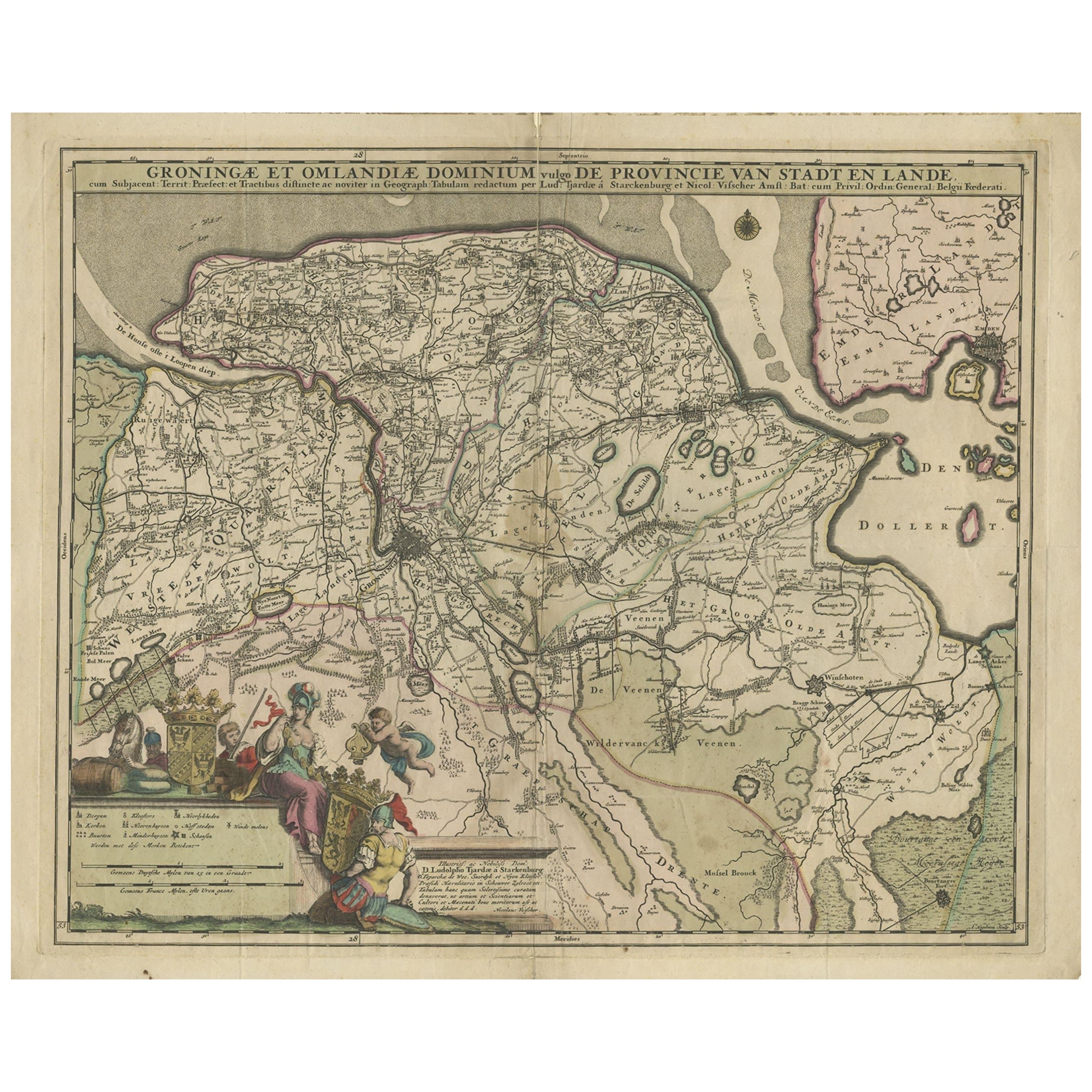
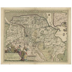
- Antique Map of the Province Groningen in The Netherlands, c.1680Located in Langweer, NLAntique map titled 'Groningae et Omlandiae Dominium vulgo de Provincie van Stadt en Lande'. Old map of the province of Groningen, the Netherlands. This map originates from 'Germani...Category
Antique 17th Century Maps
MaterialsPaper
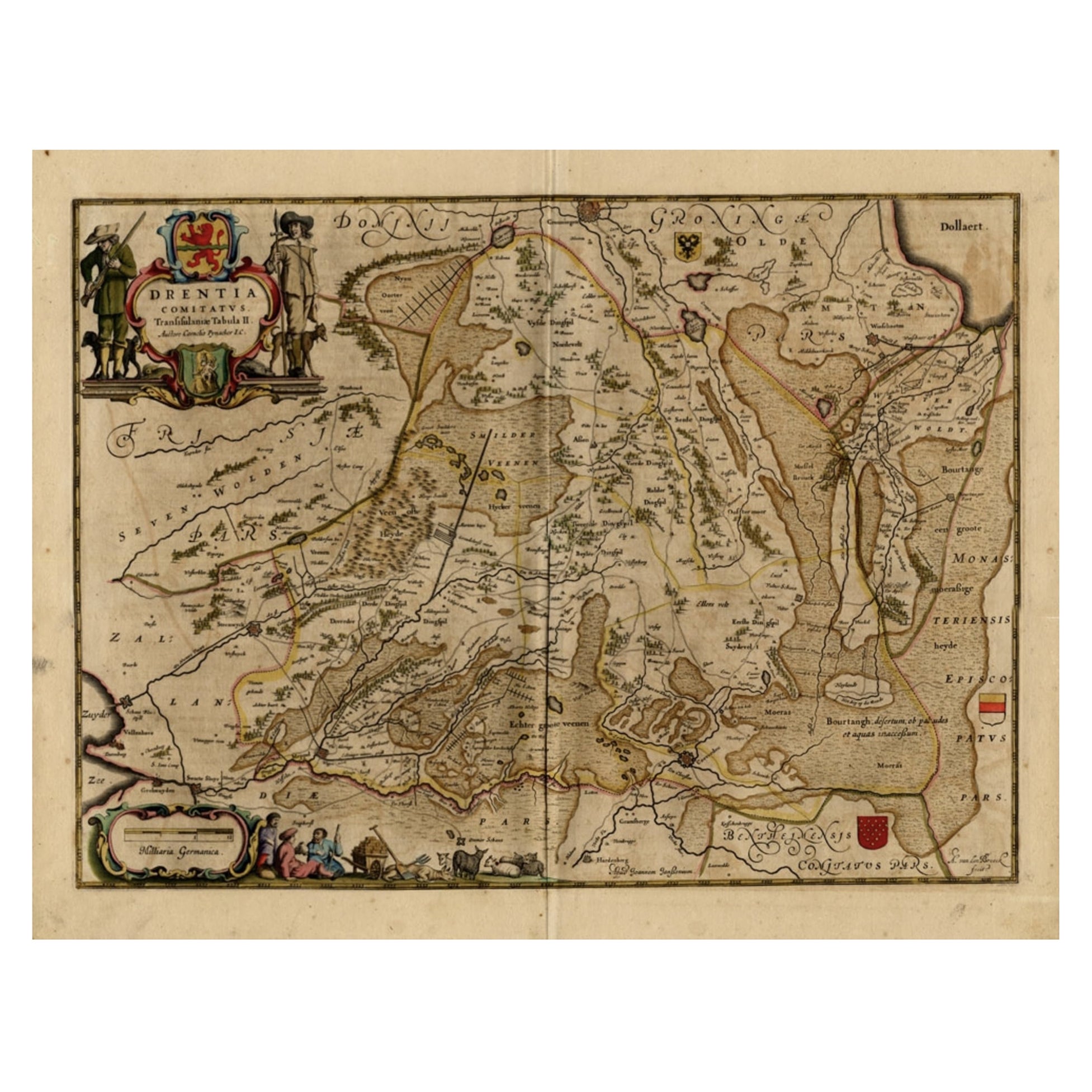
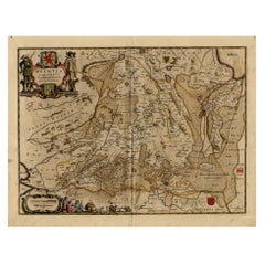
- Antique Map of Drenthe, a Province in The Netherlands, 1658Located in Langweer, NLAntique map titled 'Drentia comitatus (..)'. Copper engraved contemp. hand coloured map of Drenthe, a province in the Netherlands. Large cartouche with coats of arms. This map is mad...Category
Antique 17th Century Maps
MaterialsPaper
- Antique Map of Leeuwarderadeel in Friesland, The Netherlands, 1868Located in Langweer, NLAntique map titled 'Provincie Friesland - Gemeente Leeuwarderadeel'. Map of the township of Leeuwarderadeel including Friesland's Capital Leeuwarden and furthermore: Wirdum, Wytg...Category
Antique 19th Century Maps
MaterialsPaper


You May Also Like
- Original Antique Map of The Netherlands, Engraved by Barlow, Dated 1807Located in St Annes, LancashireGreat map of Netherlands Copper-plate engraving by Barlow Published by Brightly & Kinnersly, Bungay, Suffolk. Dated 1807 Unframed.Category
Antique Early 1800s English Maps
MaterialsPaper
- Original Antique Map of The Netherlands, Sherwood, Neely & Jones, Dated 1809Located in St Annes, LancashireGreat map of The Netherlands Copper-plate engraving by Cooper Published by Sherwood, Neely & Jones. Dated 1809 Unframed.Category
Antique Early 1800s English Maps
MaterialsPaper
- The Holy Land at the Time of Jesus: A 17th Century Dutch Map by VisscherBy Nicolaes Visscher IILocated in Alamo, CAThis detailed Dutch map entitled "Het Beloofe de Landt Canaan door wandelt van onsen Salichmaecker Iesu Christo, nessens syne Apostelen" by Nicolaes Visscher was published in Amsterd...Category
Antique Mid-17th Century Dutch Maps
MaterialsPaper
- Original Antique Map of The World by Thomas Clerk, 1817Located in St Annes, LancashireGreat map of The Eastern and Western Hemispheres On 2 sheets Copper-plate engraving Drawn and engraved by Thomas Clerk, Edinburgh. Published by Mackenzie And Dent, 1817 ...Category
Antique 1810s English Maps
MaterialsPaper
- Map of the Republic of GenoaLocated in New York, NYFramed antique hand-coloured map of the Republic of Genoa including the duchies of Mantua, Modena, and Parma. Europe, late 18th century. Dimension: 25...Category
Antique Late 18th Century European Maps
- Antique Map of Italy by Andriveau-Goujon, 1843By Andriveau-GoujonLocated in New York, NYAntique Map of Italy by Andriveau-Goujon, 1843. Map of Italy in two parts by Andriveau-Goujon for the Library of Prince Carini at Palazzo Carini i...Category
Antique 1840s French Maps
MaterialsLinen, Paper


Recently Viewed
View AllMore Ways To Browse
Engraving Empire
Copper Engraving Germany
Antique Roman Engravings
Antique Roman Armor
Roman Map
Roman Armour
Antique Map German Empire
Antique Romain
Carte Ancienne
Map Of Roman Empire
Roman Empire Map
Victorian Fence
Battle Maps
Russian Antique Plates
Floor Vase Wood
Map Print Set
Mariner Furniture
Antique World Globe Map