Items Similar to Original Antique Map of Peru with Regions Outlined in Color


Want more images or videos?
Request additional images or videos from the seller
1 of 6
Original Antique Map of Peru with Regions Outlined in Color
About the Item
Antique map titled 'Carte du Pérou'. This map of Peru and the surrounding region shows excellent detail of the river systems and mountain ranges in the area.
Published by A. Tardieu, 1821. Ambroise Tardieu (2 March 1788, in Paris – 17 January 1841, in Paris) was an eminent French cartographer and engraver, and is celebrated for his version of John Arrowsmith's 1806 map of the United States. Tardieu came from a family boasting a number of fine engravers, and was trained from an early age by his uncle, Pierre Alexandre Tardieu (1756–1844), a leading French engraver. Showing considerable talent in this field, Ambroise persevered and became a celebrated engraver of portraits. In addition he was appointed as geographical engraver for the French government, for which he received a small stipend. In order to eke out this meagre wage, he began to trade in prints, books and maps. He is remembered for more than 800 portraits engraved through his career, many depicting scientists of the period.
- Dimensions:Height: 11.82 in (30 cm)Width: 17.45 in (44.3 cm)Depth: 0.02 in (0.5 mm)
- Materials and Techniques:
- Period:
- Date of Manufacture:1821
- Condition:Wear consistent with age and use. General age-related toning. Shows some wear and foxing, blank verso. Please study images carefully.
- Seller Location:Langweer, NL
- Reference Number:
About the Seller
5.0
Platinum Seller
These expertly vetted sellers are 1stDibs' most experienced sellers and are rated highest by our customers.
Established in 2009
1stDibs seller since 2017
1,929 sales on 1stDibs
Typical response time: <1 hour
- ShippingRetrieving quote...Ships From: Langweer, Netherlands
- Return PolicyA return for this item may be initiated within 14 days of delivery.
More From This SellerView All
- Original Antique Map of England with Outline ColoringLocated in Langweer, NLAntique map titled 'Angleterre'. Original old map of England with outline coloring. Source unknown, to be determined. Published circa 1830.Category
Antique Mid-19th Century Maps
MaterialsPaper
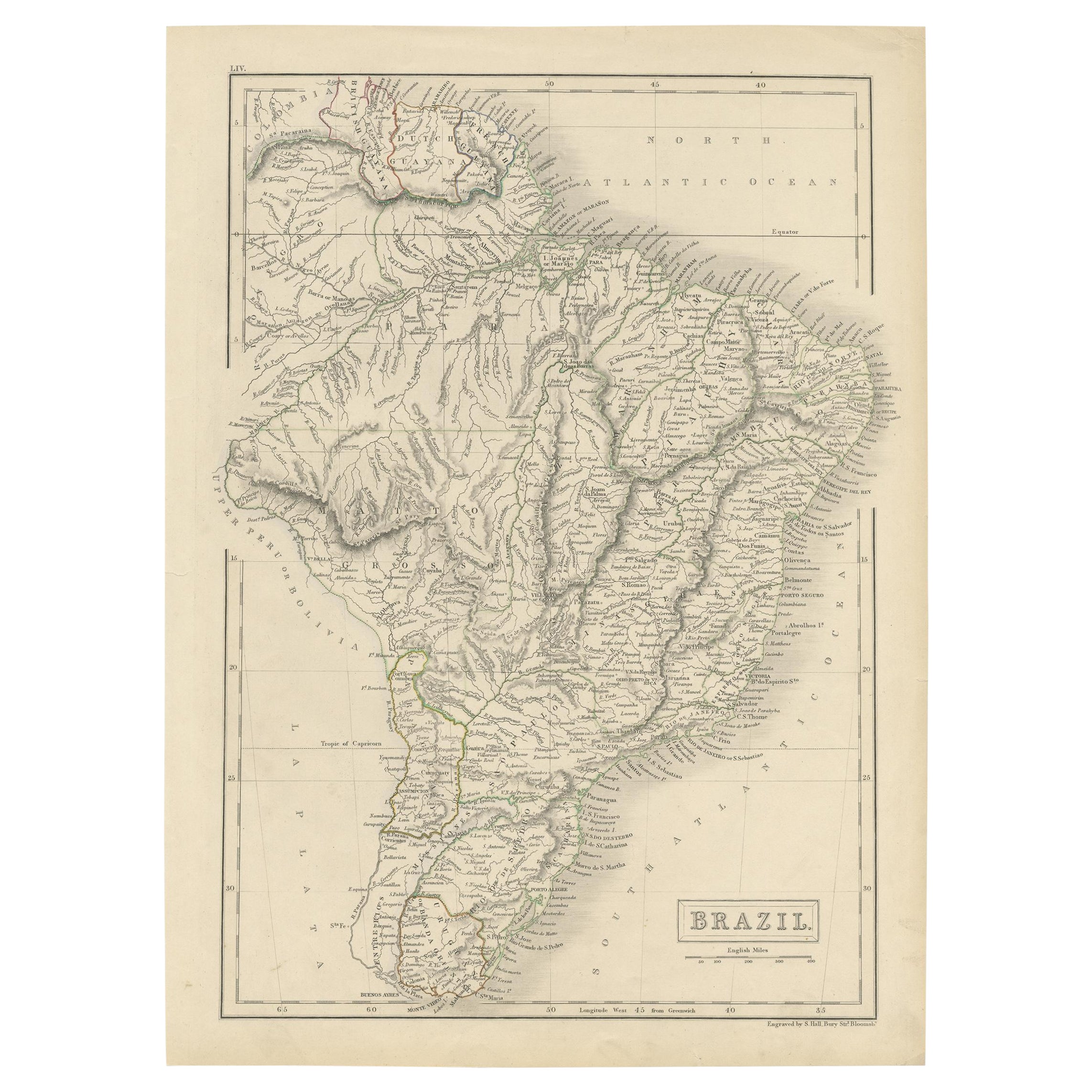
- Antique Map of Brazil with Original Outline Hand-Colouring, c.1844Located in Langweer, NLAntique map titled 'Brazil'. Beautiful map with outline color of Brazil, engraved by S. Hall. Artists and Engravers: Sydney Hall (1788-1831) was one of the most recognised and prolific British map...Category
Antique 19th Century Maps
MaterialsPaper
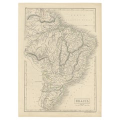
- Original Antique Map of Peru in South America, 1875Located in Langweer, NLAntique map titled 'Carte générale du Pérou'. Large map of Peru. This map originates from 'Atlas de Géographie Moderne Physique et Politique' by A. Levasse...Category
Antique Late 19th Century Maps
MaterialsPaper
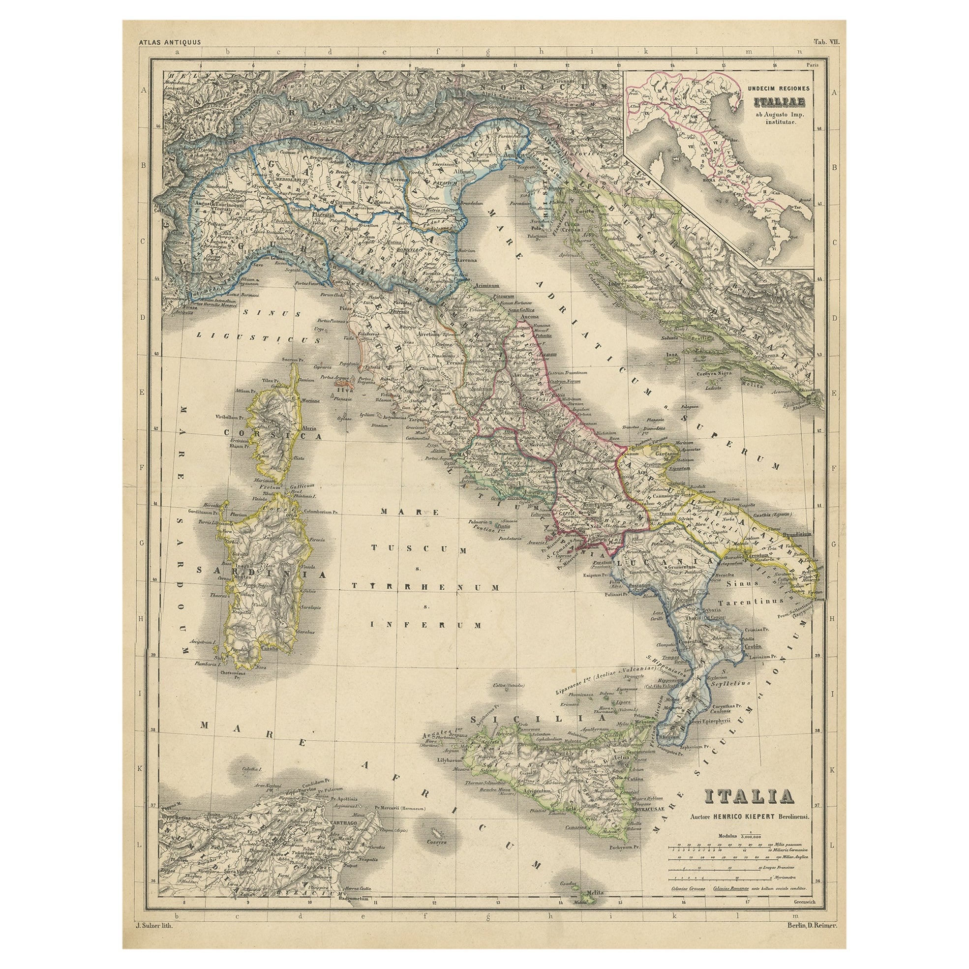
- Attractive Antique Map of Italy with Inset of Maps Showing The Regions, c.1870Located in Langweer, NLAntique map titled 'Italia'. Old map of Italy, with a small inset map depicting the various regions. This map originates from 'Atlas Antiquus, tw...Category
Antique 19th Century Maps
MaterialsPaper
- Antique Map of Champagne and surrounding Regions, FranceLocated in Langweer, NLAntique map titled 'Carte de la Champagne et des Pays Voisins (..)'. Detailed map of Champagne and surrounding regions of Chalons and Soissons, Reims, Vedun, Mouzon, Sean, Charlemont...Category
Antique Mid-18th Century Maps
MaterialsPaper
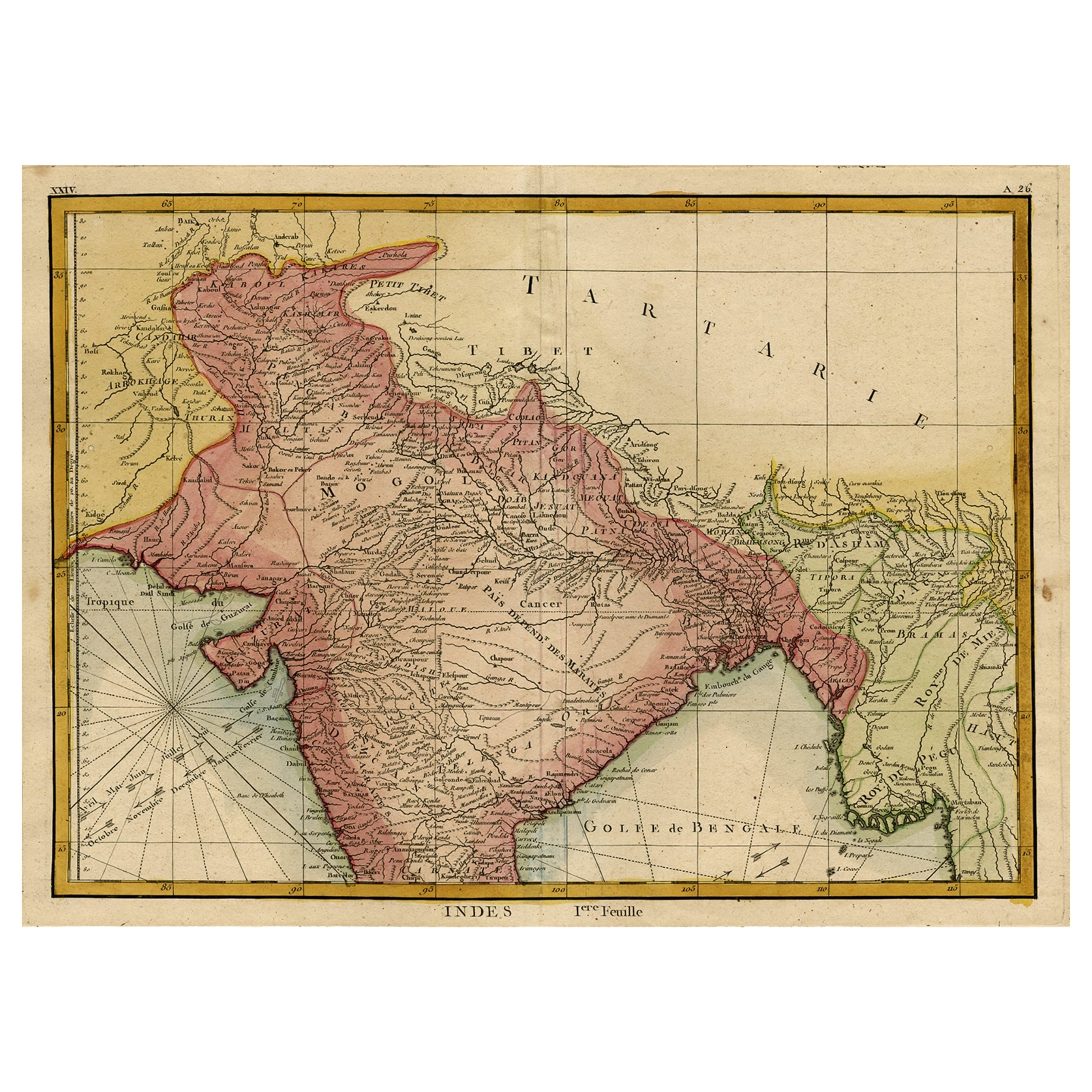
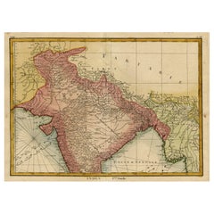
- Original and Colourful Map of Northern India with Surrounding Regions, 1783Located in Langweer, NLAntique map titled 'Indes'. A map of Northern India with surrounding regions. From Lattre's 'Atlas moderne ou collection de cartes sur toutes les parties du globe terrestre...Category
Antique 1780s Maps
MaterialsPaper


You May Also Like
- Original Antique Map of Asia. C.1780Located in St Annes, LancashireGreat map of Asia Copper-plate engraving Published C.1780 Two small worm holes to right side of map Unframed.Category
Antique Early 1800s English Georgian Maps
MaterialsPaper

- Original Antique Map of Italy. C.1780Located in St Annes, LancashireGreat map of Italy Copper-plate engraving Published C.1780 Unframed.Category
Antique Early 1800s English Georgian Maps
MaterialsPaper

- Original Antique Map of India. C.1780Located in St Annes, LancashireGreat map of India Copper-plate engraving Published C.1780 Three small worm holes to right side of map and one bottom left corner Unframed.Category
Antique Early 1800s English Georgian Maps
MaterialsPaper

- Original Antique Map of Italy. Arrowsmith. 1820Located in St Annes, LancashireGreat map of Italy Drawn under the direction of Arrowsmith Copper-plate engraving Published by Longman, Hurst, Rees, Orme and Brown, 1820 Unframed.Category
Antique 1820s English Maps
MaterialsPaper
- Original Antique Map of China, Arrowsmith, 1820Located in St Annes, LancashireGreat map of China Drawn under the direction of Arrowsmith Copper-plate engraving Published by Longman, Hurst, Rees, Orme and Brown, 1820 Unfr...Category
Antique 1820s English Maps
MaterialsPaper
- Original Antique Map of Canada, Arrowsmith, 1820Located in St Annes, LancashireGreat map of Canada. Drawn under the direction of Arrowsmith. Copper-plate engraving. Published by Longman, Hurst, Rees, Orme and Brown, 1820 ...Category
Antique 1820s English Maps
MaterialsPaper


Recently Viewed
View AllMore Ways To Browse
Antique Paper Color
Antique Trade Show
Antique French Train
Antique Portrait Small
Antique Peru
Antique Prints Mountains
Peruvian Antiques
Antique Furniture Peru
19th Century Peruvian
Carte Paris
Train Map
Map Of Peru
Peru Map
Antique Map Peru
Alexandre Antique Prints Maps
Antique Maps Of California
Antique Map Of California
Scottish Coat Of Arms