Items Similar to Antique Map of the Peter the Great Gulf by Reclus, 1881


Want more images or videos?
Request additional images or videos from the seller
1 of 5
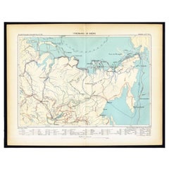
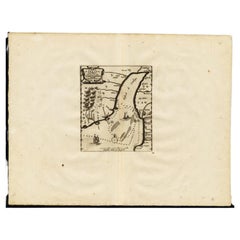
Antique Map of the Peter the Great Gulf by Reclus, 1881
About the Item
Antique map titled 'Le Golfe de Pierre-Le-Grand.' This map shows the Peter The Great Gulf in the Sea of Japan adjoining the coast of Russia's Primorski Krai. This original old antique print / plate originates from: 'Nouvelle Geographie Universelle La Terre et les Hommes VI : L' Asie Russe' by Jacques Elisee Reclus. Published in Paris by Hachette & Cie.. 1881.
Artists and Engravers: Jacques Elisee Reclus was a renowned French geographer. writer and anarchist. He produced his 19-volume masterwork La Nouvelle Geographie universelle. la terre et les hommes ('Universal Geography'). over a period of nearly 20 years (1875 � 1894).
Condition: Good. General age related toning and soiling. Please study image carefully.
Date: 1881
Overall size: 34 x 26.5 cm.
Image size: 29 x 22 cm.
We sell original antique maps to collectors, historians, educators and interior decorators all over the world. Our collection includes a wide range of authentic antique maps from the 16th to the 20th centuries. Buying and collecting antique maps is a tradition that goes back hundreds of years. Antique maps have proved a richly rewarding investment over the past decade, thanks to a growing appreciation of their unique historical appeal. Today the decorative qualities of antique maps are widely recognized by interior designers who appreciate their beauty and design flexibility. Depending on the individual map, presentation, and context, a rare or antique map can be modern, traditional, abstract, figurative, serious or whimsical. We offer a wide range of authentic antique maps for any budget.
- Dimensions:Height: 10.44 in (26.5 cm)Width: 13.39 in (34 cm)Depth: 0 in (0.01 mm)
- Materials and Techniques:
- Period:
- Date of Manufacture:1881
- Condition:
- Seller Location:Langweer, NL
- Reference Number:
About the Seller
5.0
Platinum Seller
These expertly vetted sellers are 1stDibs' most experienced sellers and are rated highest by our customers.
Established in 2009
1stDibs seller since 2017
1,919 sales on 1stDibs
Typical response time: <1 hour
- ShippingRetrieving quote...Ships From: Langweer, Netherlands
- Return PolicyA return for this item may be initiated within 14 days of delivery.
More From This SellerView All
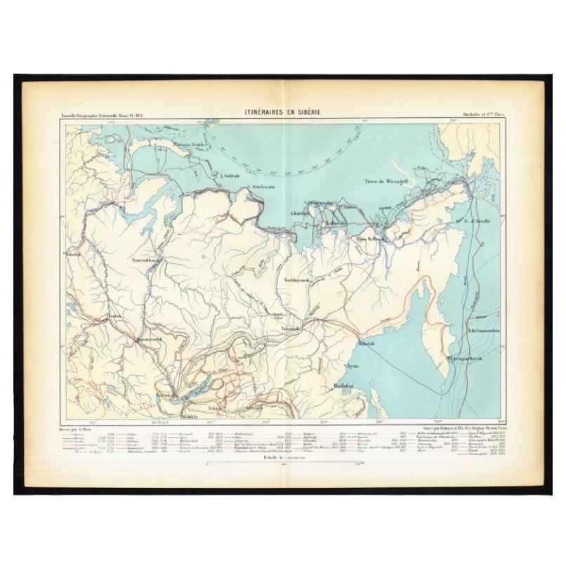
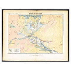
- Antique Map of Siberia by Reclus, 1881Located in Langweer, NLAntique map titled 'Itineraires en Siberie.' This map shows the itineraries of famous explorers in Siberia between 1648 and 1879. This original old antique print / plate originates f...Category
Antique 19th Century Maps
MaterialsPaper
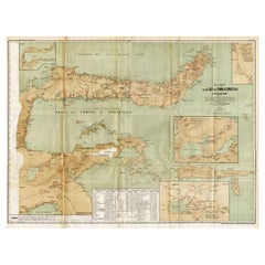
- Antique Map of the Mouth of the Amu Darya River by Reclus, 1881Located in Langweer, NLAntique map titled 'Bouches de L'Amou - Daria'. Original antique map showing the river mouth of the Amu Darya river in Central Asia. This original old antiqu...Category
Antique 19th Century Maps
MaterialsPaper
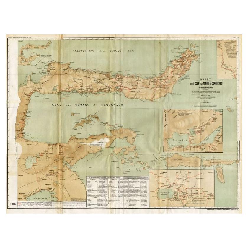
- Antique Map of the Gulf of Tomini by Winkler Prins, 1878Located in Langweer, NLAntique map titled 'Kaart van de Golf van Tomini of Gorontalo.' (Map of the Gulf of Tomini or Gorontalo.) This map shows the Gulf of Tomini near the Island of Sulawesi, Indonesia. Wi...Category
Antique 19th Century Maps
MaterialsPaper
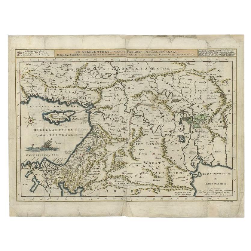
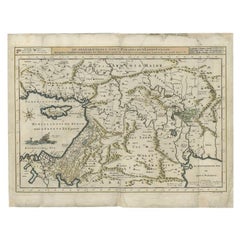
- Antique Map of the Mediterranean and the Persian Gulf by Danckerts, c.1718Located in Langweer, NLAntique map titled 'De Gelegentheyt Van't Paradys en 't Landt Canaan.' Dutch Bible map covering the region between the Mediterranean and the Persian Gulf, f...Category
Antique 18th Century Maps
MaterialsPaper
- Antique Map of the Region Near the Gulf of Zula, 1870Located in Langweer, NLAntique map titled 'Map of the Country between Annesley Bay and the Plain of Salt'. Lithographed map of the region near the Gulf of Zula, also known as Annesley Bay, Baia di Arafali ...Category
Antique Mid-19th Century Maps
MaterialsPaper
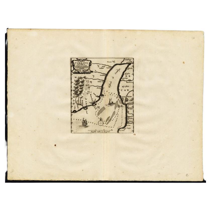
- Antique Map of the Gulf of Cambay, Gujarat, India, 1725By Pieter Van Der AaLocated in Langweer, NLAntique map titled 'Le Golfe de Cambaye at la Rade de Suratt.' (The gulf of Cambay and the coast of Surat, India.) The Gulf of Khambhat, formerly known as the Gulf of Cambay, is an i...Category
Antique 18th Century Maps
MaterialsPaper

You May Also Like
- Original Antique Map of Ancient Greece, Phocis, Gulf of Corinth, 1787Located in St Annes, LancashireGreat map of Ancient Greece. Showing the region of Phocis, including the Gulf of Corinth Drawn by J.D. Barbie Du Bocage Copper plate engraving by P.F Tardieu Original hand c...Category
Antique 1780s French Other Maps
MaterialsPaper
- Framed 1838 Mexico & Gulf of Mexico MapLocated in Stamford, CTFramed 1838 Mexico & Gulf of Mexico map. Printed by Fisher, Son & Co. of London in 1838. As found framed condition. Map has not been examined outside of th...Category
Antique 1830s English American Classical Maps
MaterialsGlass, Wood, Paper
- Great Gardens of Britain by Peter CoatsBy Peter CoatsLocated in valatie, NYGreat Gardens of Britain by Peter Coats. London: Spring Books, 1970. Hardcover with dust jacket. 287 pp. A handsome book on the diversity and quality of British gardens. The book showcases thirty-eight great gardens including natural gardens, wild gardens, formal and historical gardens, terraced gardens, and rhododendron gardens. Included are Newby Hall, Mereworth, Pusey, Sezincote, Powis, Logan, Great Dixter...Category
20th Century English Books
MaterialsPaper
- 1861 Topographical Map of the District of Columbia, by Boschke, Antique MapLocated in Colorado Springs, COPresented is an original map of Albert Boschke's extremely sought-after "Topographical Map of the District of Columbia Surveyed in the Years 1856 ...Category
Antique 1860s American Historical Memorabilia
MaterialsPaper
- Large Original Vintage Map of the Great Lakes, Canada, circa 1920Located in St Annes, LancashireGreat map of The Great Lakes. Unframed. Original color. By John Bartholomew and Co. Edinburgh Geographical Institute Published, circa 1920 ...Category
Vintage 1920s British Maps
MaterialsPaper
- Original Antique Map of The World by Thomas Clerk, 1817Located in St Annes, LancashireGreat map of The Eastern and Western Hemispheres On 2 sheets Copper-plate engraving Drawn and engraved by Thomas Clerk, Edinburgh. Published by Mackenzie And Dent, 1817 ...Category
Antique 1810s English Maps
MaterialsPaper


Recently Viewed
View AllMore Ways To Browse
Collectables From The 19 Century
La Terre
Antique Japanese Decorative Plate
Antique Map Japan
1894 Map
Russian Antique Plates
Asie Antique
Antique Map Of Australia
Antique Australian Map
Antique Australian Maps
Antique Furniture In The Philippines
Antique Map Japan
Large Framed Antique Maps
Antique Filipino
Antique Baltic
Political Map
Map Of Ireland
Ireland Map