Items Similar to Antique Map of the Balkans with Coat of Arms
Want more images or videos?
Request additional images or videos from the seller
1 of 6
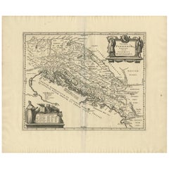
Antique Map of the Balkans with Coat of Arms
About the Item
Antique map titled 'Tavola Nuova di Schiavonia'. Ruscelli's map of the Balkans, with a coat of arms. The mountains are represented, river systems are shown in detail, and cities, towns and ports denoted throughout this 16th century map. A number of islands in the Adriatic Sea are also shown. This map originates from 'Espositione & introduttioni universali di Gir. Ruscelli sopra tutta la Geografia di Tolomeo (..)' published by Girolamo Ruscelli, 1561.
Girolamo Ruscelli (1500-1566) was a cartographer, humanist, and scholar from Tuscany. Ruscelli was a prominent writer and editor in his time, writing about a wide variety of topics including the works of Giovanni Boccaccio and Francesco Petrarch, Italian language, Italian poetry, medicine, alchemy, and militia. One of his most notable works was a translation of Ptolemy’s Geographia which was published posthumously.
- Dimensions:Height: 8.27 in (21 cm)Width: 11.34 in (28.8 cm)Depth: 0.02 in (0.5 mm)
- Materials and Techniques:
- Period:
- Date of Manufacture:1561
- Condition:General age-related toning. Original folding line. Minor wear and soiling. Italian text on verso. Please study image carefully.
- Seller Location:Langweer, NL
- Reference Number:
About the Seller
5.0
Platinum Seller
These expertly vetted sellers are 1stDibs' most experienced sellers and are rated highest by our customers.
Established in 2009
1stDibs seller since 2017
1,922 sales on 1stDibs
Typical response time: <1 hour
- ShippingRetrieving quote...Ships From: Langweer, Netherlands
- Return PolicyA return for this item may be initiated within 14 days of delivery.
More From This SellerView All
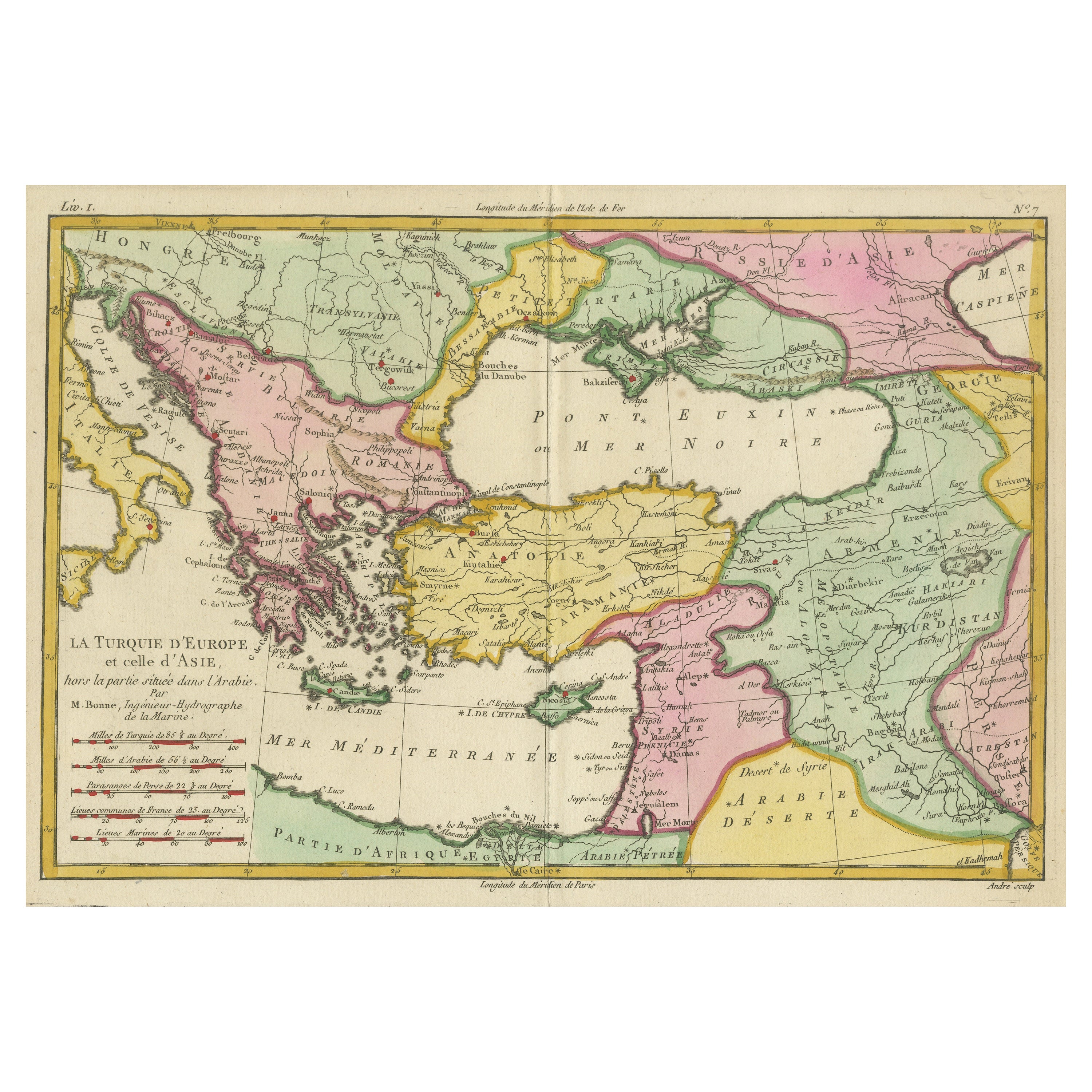
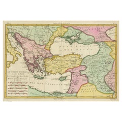
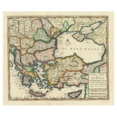
- Antique Map of the Eastern Mediterranean and the BalkansLocated in Langweer, NLAntique map titled 'La Turquie d'Europe et celle d'Asie'. Attractive double page map of the Eastern Mediterranean and the Balkans by R. Bonne. Originates from 'Atlas de Toutes les Pa...Category
Antique Late 18th Century Maps
MaterialsPaper
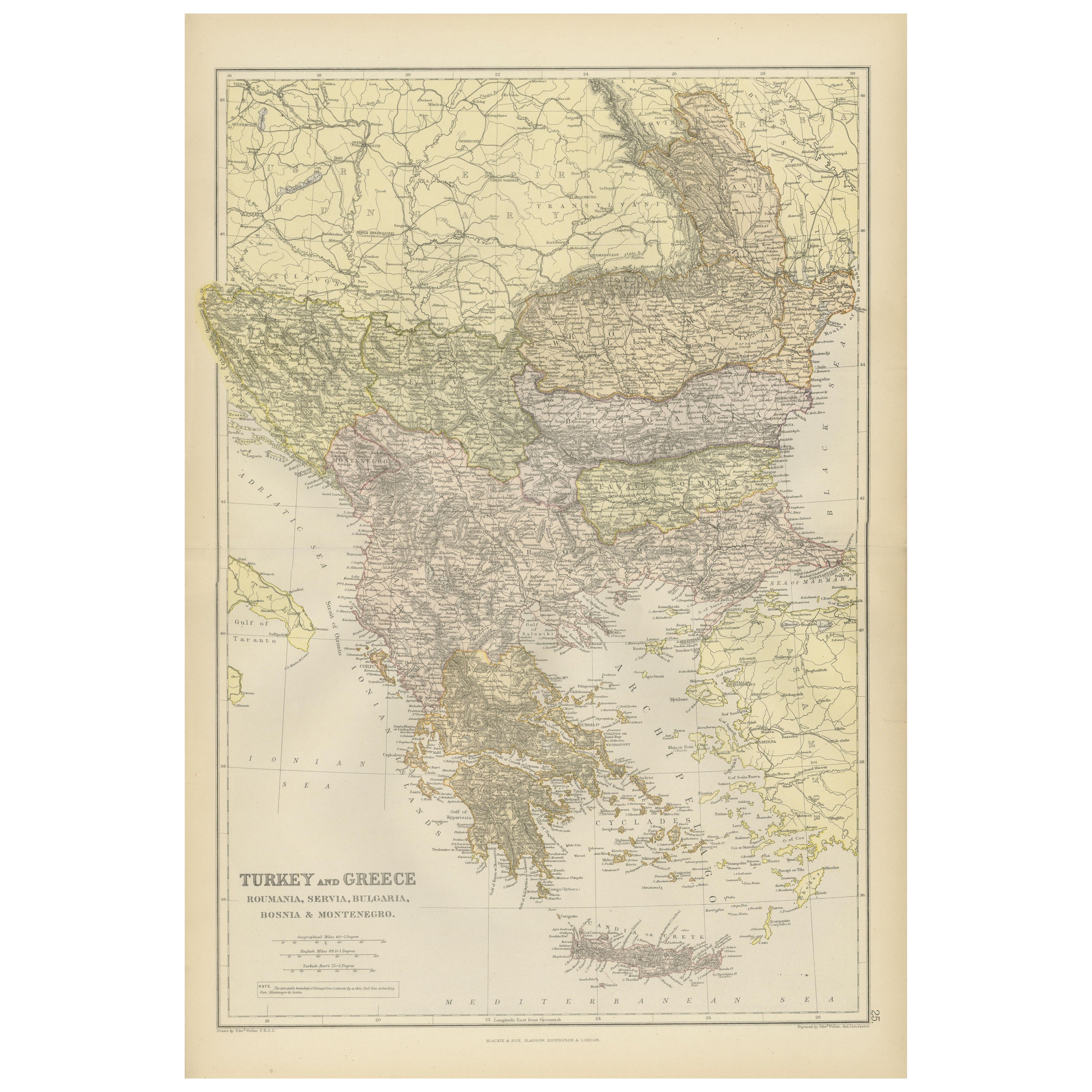
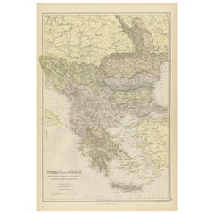
- Balkan Convergence: A Map of Turkey and Greece with the Balkan States, 1882Located in Langweer, NLThis map, "TURKEY AND GREECE including ROUMANIA, SERVIA, BULGARIA, BOSNIA & MONTENEGRO," extracted from Blackie & Son's 1882 atlas, captures the complex political and geographical la...Category
Antique 1880s Maps
MaterialsPaper
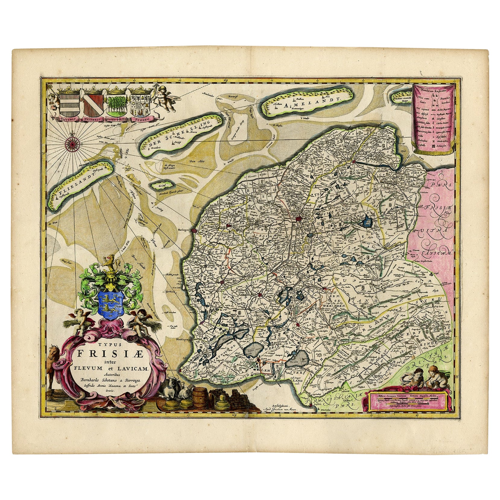
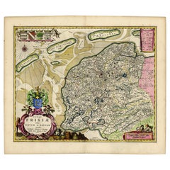
- Antique Map of Friesland with Four Coats of Arms, 1664Located in Langweer, NLAntique map titled 'Typus Frisiae inter Fevum et Lavicam'. Original antique map of the province of Friesland, the Netherlands. Also shows the Wadden islands Vlieland, Terschelling and Ameland and part of Schiermonnikoog. With a decorative cartouche with two putti, livestock and cheese and milk barrels. Four coats...Category
Antique 17th Century Maps
MaterialsPaper
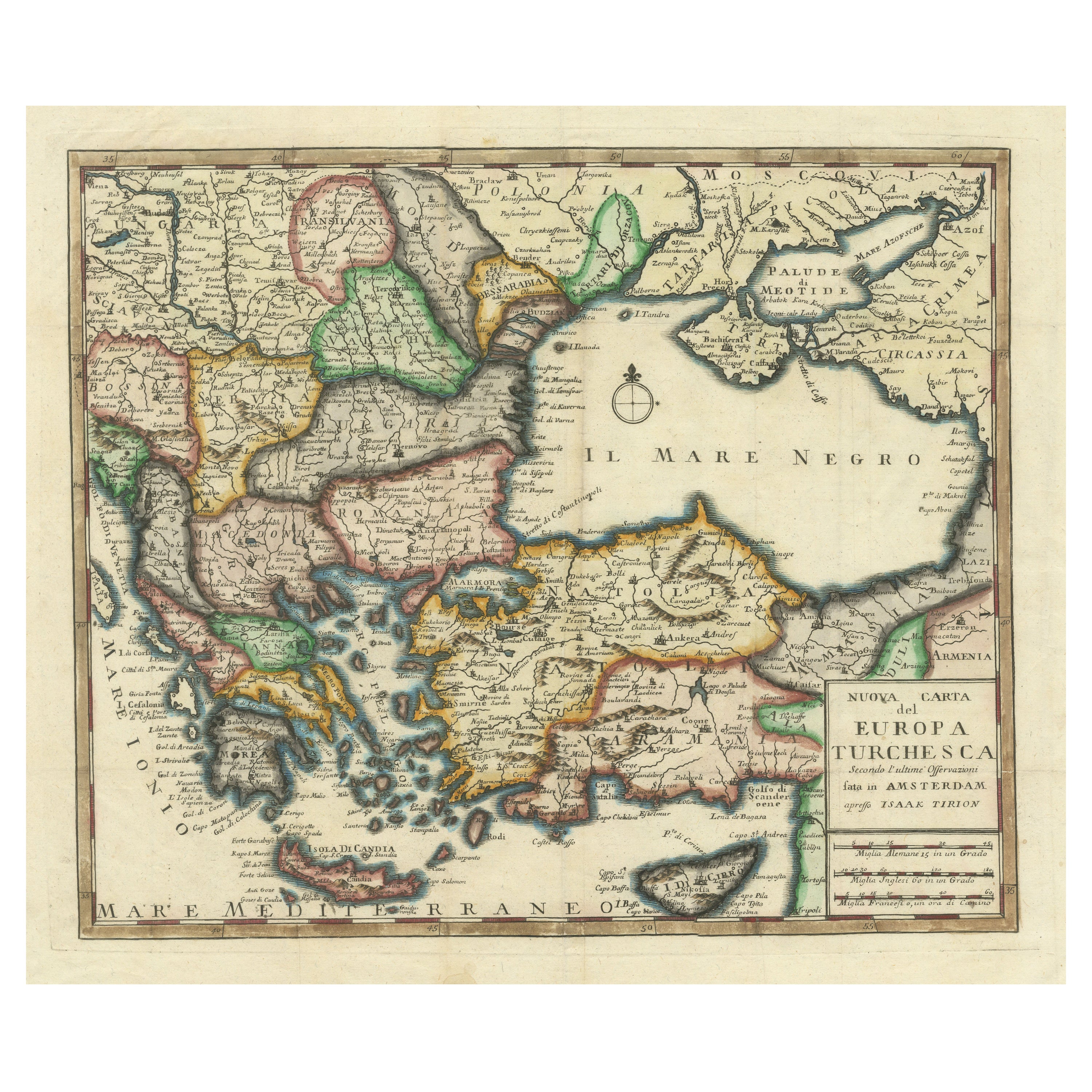
- Detailed Antique Map of the Black Sea, Balkans and Asia MinorLocated in Langweer, NLAntique map titled 'Nuova Carta del Europa Turchesca (..)'. This is an Italian version of Tirion's detailed map of the Black Sea, Balkans, and Asia Minor. It is embellished with a si...Category
Antique Mid-18th Century Maps
MaterialsPaper
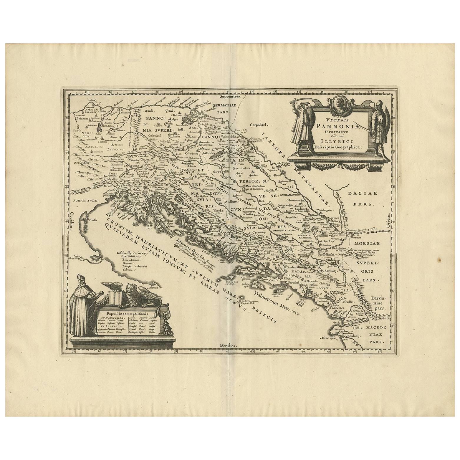
- Antique Map of the Adriatic Sea and the Balkan by J. Janssonius, circa 1650Located in Langweer, NLStriking large-scale map of the Greater Balkans. Decorated with two large-scale cartouches, one showing two swordsman at odds with one another and the other ...Category
Antique Mid-17th Century Maps
MaterialsPaper
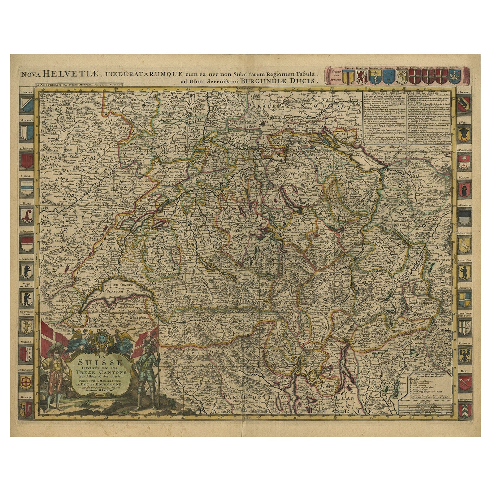
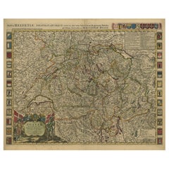
- Beautiful Antique Handcolored Map of Switzerland with 33 Coats of Arms, ca.1705Located in Langweer, NLAntique map Switerzland titled 'La Suisse Divisee en ses Treze Cantons, ses Alliez & ses Sujets (..)'. Beautiful map of Switzerland with 33 coats of arms. The map is dedicated to t...Category
Antique Early 1700s Maps
MaterialsPaper
You May Also Like
- 18th Century Map of the Southern Balkans by Giovanni Maria CassiniBy Giovanni Maria CassiniLocated in Hamilton, Ontario18th century map by Italian engraver Giovanni Maria Cassini (Italy 1745-1824). Map of the Southern Balkans: Rome. Hand colored and copper engraved print done in the year 1788. It in...Category
Antique 18th Century Italian Maps
MaterialsPaper
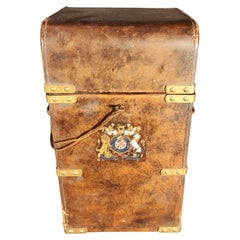
- Antique Box With Coat Of Arms 19th centuryBy Europa AntiquesLocated in Madrid, ESAntique Box With Coat Of Arms 19th century ANTIQUE BOX WITH CREST ELEGANT LEATHER BOX WITH CENTRAL SHIELD.THE INTERIOR IS LINED IN RED.IT HAS ITS ORI...Category
Antique 19th Century French Baroque Historical Memorabilia
MaterialsLeather
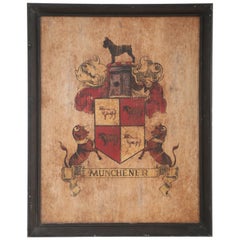
- Munchener Painted Coat of Arms with Giant SchnauzerLocated in New York, NYVintage (20th Century) coat of arms/family crest depicting a black dog atop a red and gold shield of sheep flanked on either side by bulls above a banner reading "Munchener," which c...Category
20th Century Mid-Century Modern Arms, Armor and Weapons
MaterialsAcrylic, Wood
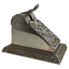
- Antique Austrian Table Cigar Cutter, 1900s with Knightly Coat of Arms EmblemLocated in Nuernberg, DEA beautiful cigar cutter to stand on your table. It is in very good condition to its age, original state, with nice patina. It is fully functional. At the front side a large Knights ...Category
Early 20th Century Austrian Art Nouveau Tobacco Accessories
MaterialsMetal
- 1861 Topographical Map of the District of Columbia, by Boschke, Antique MapLocated in Colorado Springs, COPresented is an original map of Albert Boschke's extremely sought-after "Topographical Map of the District of Columbia Surveyed in the Years 1856 ...Category
Antique 1860s American Historical Memorabilia
MaterialsPaper
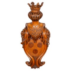
- European Carved Oak Coat Of ArmsLocated in Essex, MAWell carved cartouche with three central roundels under a jousting helmet and crown.Category
Antique Mid-19th Century European Renaissance Revival Arms, Armor and We...
MaterialsOak


Recently Viewed
View AllMore Ways To Browse
Map Of Utah
Royal Picardie
Vintage Maps Of Hawaii
Catalonia Map
Kiels Antiques
William Wyld
Antique Map Of Shanghai
Britton And Rey Lithograph
Collectible Barbies
Marthas Vineyard Map
Vintage Marthas Vineyard Map
Old Antique Map
Map Of The Netherlands
Italian Maps
Antique Old World Maps
Paris Antique Map
Vintage Map World
Vintage Maps World