Items Similar to Beautiful Antique Handcolored Map of Switzerland with 33 Coats of Arms, ca.1705


Want more images or videos?
Request additional images or videos from the seller
1 of 5
Beautiful Antique Handcolored Map of Switzerland with 33 Coats of Arms, ca.1705
About the Item
Antique map Switerzland titled 'La Suisse Divisee en ses Treze Cantons, ses Alliez & ses Sujets (..)'.
Beautiful map of Switzerland with 33 coats of arms. The map is dedicated to the Duke of Burgundy and is further adorned with a title cartouche featuring angels and a soldier in a suit of armor. An alternate title in Latin appears above the map: "Nova Helvetiae, Foederatarumque cum ea, nec non Subditarum Regionum Tabula, ad usum Serenissimi Burgundiae Ducis."
Artists and Engravers: Alexis Hubert Jaillot (1632-1712), was a French sculptor, engraver, publisher and cartographer. Published by P. Mortier, Amsterdam.
- Dimensions:Height: 52.5 in (133.35 cm)Width: 63.5 in (161.29 cm)Depth: 0.002 in (0.06 mm)
- Materials and Techniques:
- Period:1700-1709
- Date of Manufacture:circa 1705
- Condition:Condition: Very good, general age-related toning. Original/contemporary hand coloring, please study image carefully.
- Seller Location:Langweer, NL
- Reference Number:
About the Seller
5.0
Platinum Seller
These expertly vetted sellers are 1stDibs' most experienced sellers and are rated highest by our customers.
Established in 2009
1stDibs seller since 2017
1,932 sales on 1stDibs
Typical response time: <1 hour
- ShippingRetrieving quote...Ships From: Langweer, Netherlands
- Return PolicyA return for this item may be initiated within 14 days of delivery.
More From This SellerView All
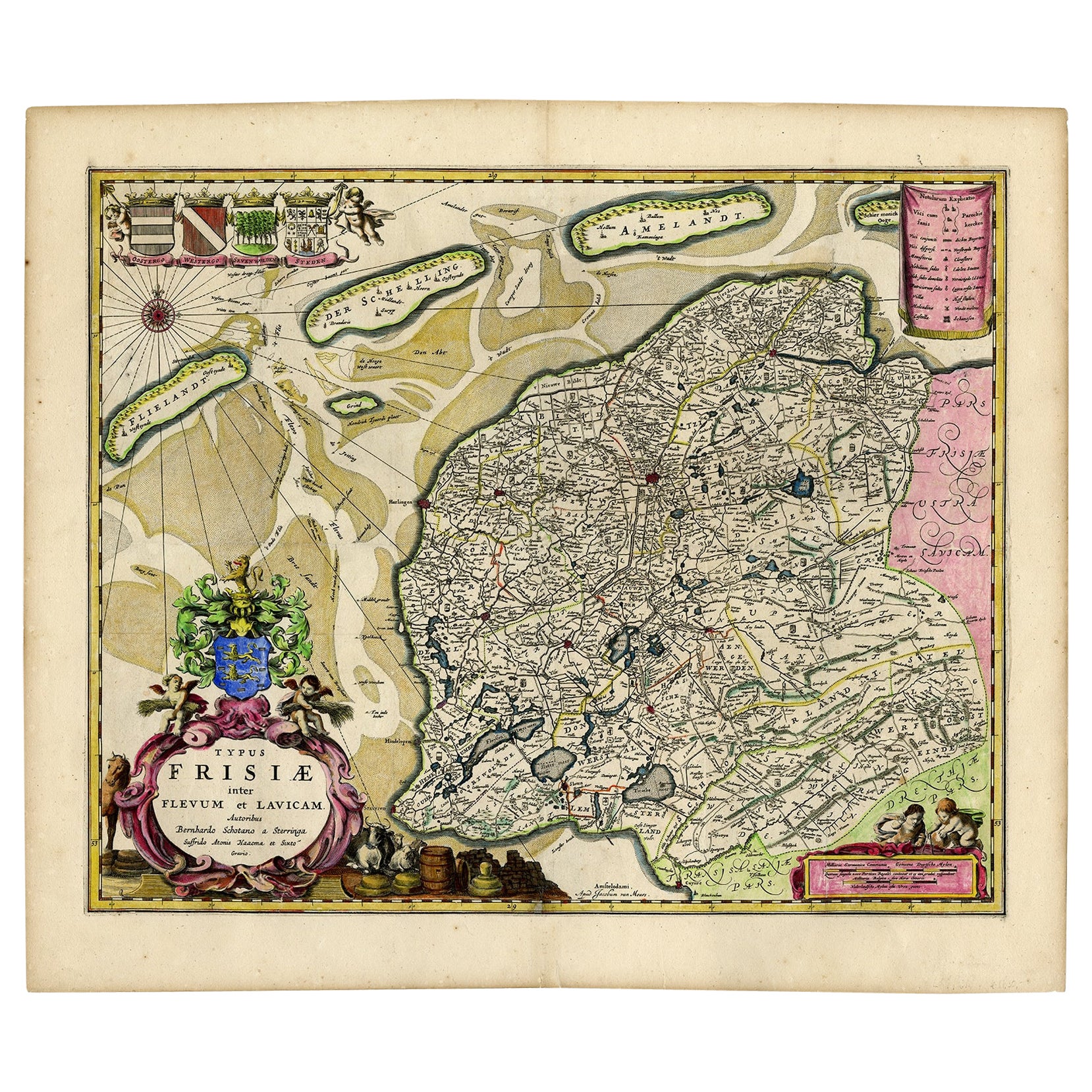
- Antique Map of Friesland with Four Coats of Arms, 1664Located in Langweer, NLAntique map titled 'Typus Frisiae inter Fevum et Lavicam'. Original antique map of the province of Friesland, the Netherlands. Also shows the Wadden islands Vlieland, Terschelling and Ameland and part of Schiermonnikoog. With a decorative cartouche with two putti, livestock and cheese and milk barrels. Four coats...Category
Antique 17th Century Maps
MaterialsPaper
- Antique Map of Russia by N. Sanson, 1705Located in Langweer, NLA strongly engraved map of European Russia showing its political divisions, major topographical features, cities and towns. Extends to the Sea of Azov and the tip of the Caspian Sea ...Category
Antique Early 18th Century Maps
MaterialsPaper
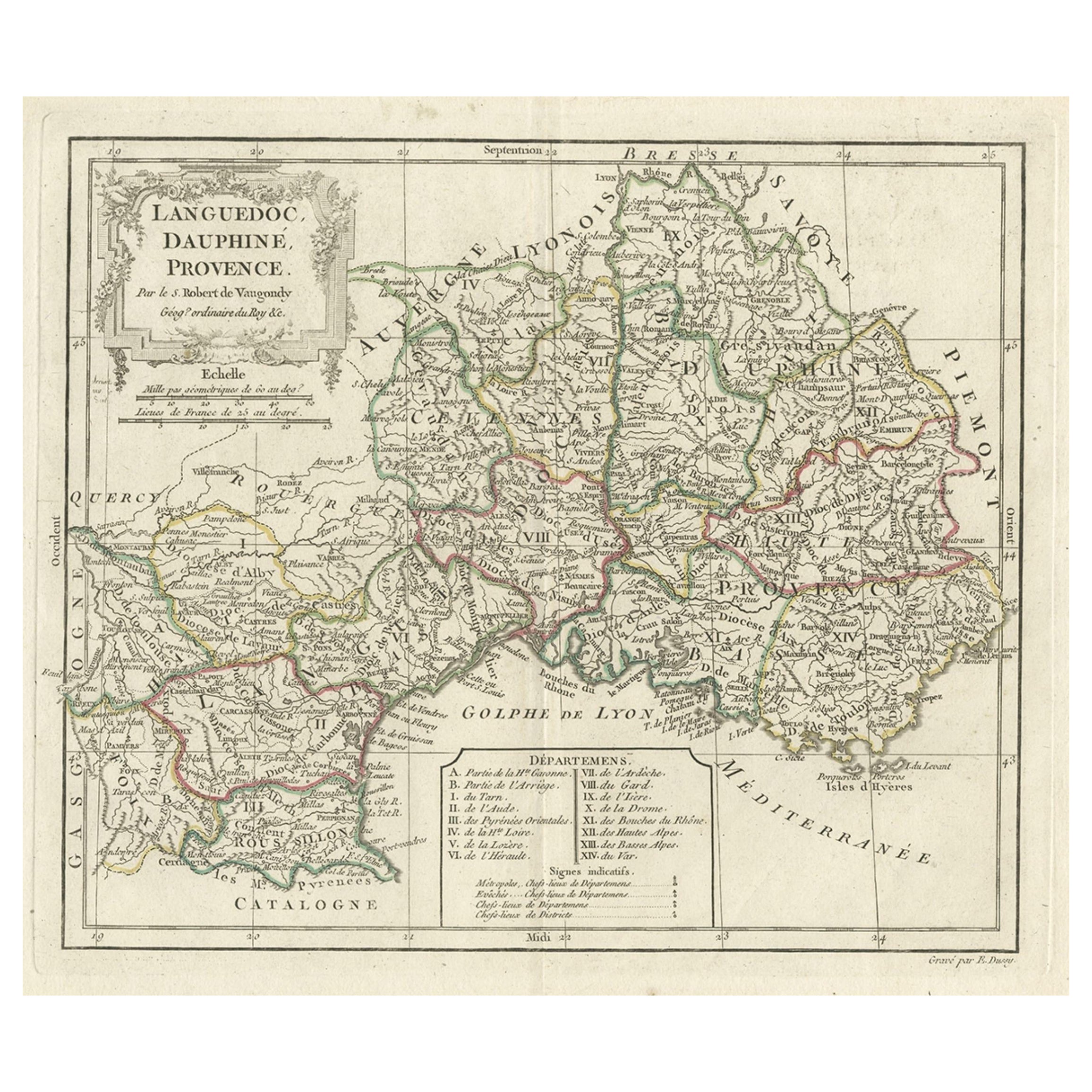
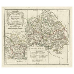
- Beautiful Antique Map of Southeastern France with Decorative Cartouche, ca.1790Located in Langweer, NLAntique map titled 'Languedoc, Dauphiné, Province'. Beautiful antique map of Southeastern France with decorative cartouche. Map includes topographical detail as well as a referen...Category
Antique 1790s Maps
MaterialsPaper
- Antique Map of Asia by Sanson, circa 1705By Nicolas SansonLocated in Langweer, NLDutch edition of Sanson's map of Asia. Shows a large, dramatic version of Terre de Jesso, drawn from the discoveries of the Maarten de Vries expedition of 1643.Category
Antique Early 18th Century Dutch Maps
MaterialsPaper
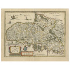
- Old Handcolored Antique Map of Pays De Caux in Normandy, France, ca.1640Located in Langweer, NLAntique map titled 'Le Pais de Caux'. Old map of Pays de Caux, France. Pays de Caux is an area in Normandy occupying the greater part of the French département of Seine Maritime ...Category
Antique 1640s Maps
MaterialsPaper
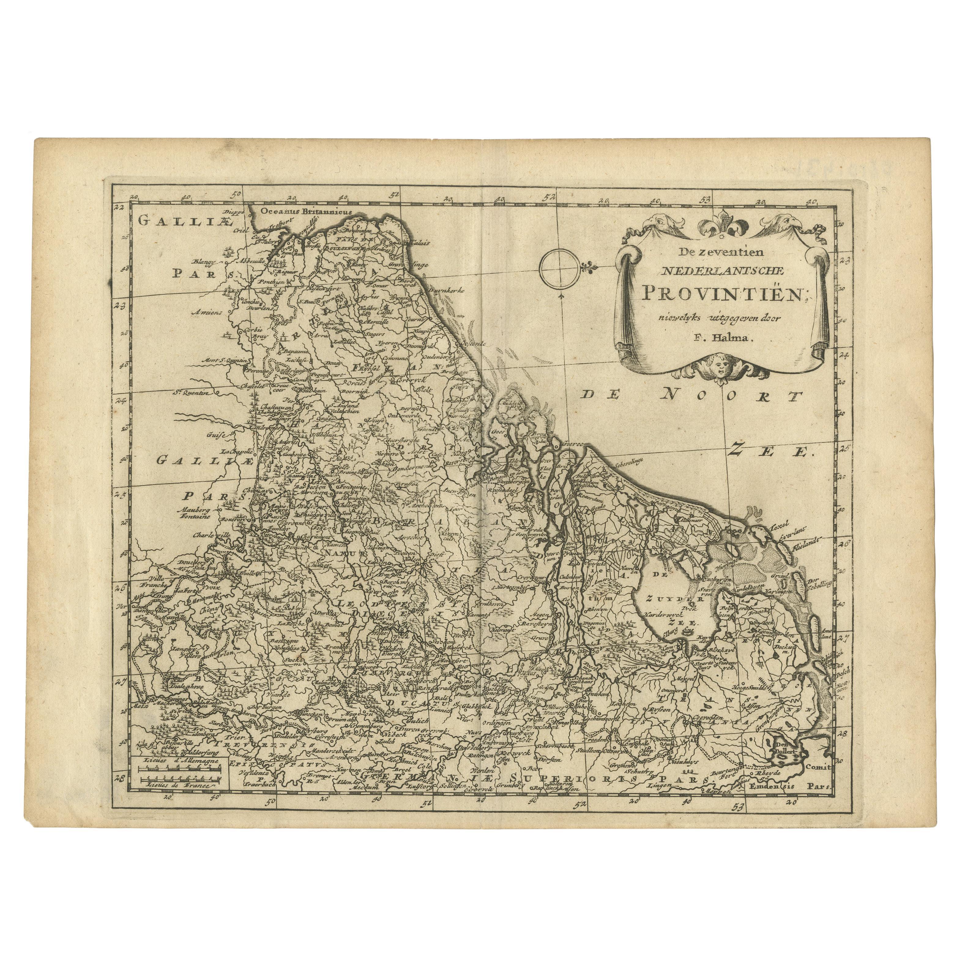
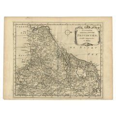
- Antique Map of the Seventeen Provinces by Halma '1705'Located in Langweer, NLAntique map titled 'De zeventien Nederlantsche Provintiën'. Original antique map of the Seventeen Provinces, the Imperial states of the Habsburg Netherlands in the 16th century. This...Category
Antique Early 18th Century Maps
MaterialsPaper


You May Also Like
- Original Antique Map of Switzerland, Engraved By Barlow, Dated 1807Located in St Annes, LancashireGreat map of Switzerland Copper-plate engraving by Barlow Published by Brightly & Kinnersly, Bungay, Suffolk. Dated 1807 Unframed.Category
Antique Early 1800s English Maps
MaterialsPaper
- Antique Map of Principality of MonacoBy Antonio Vallardi EditoreLocated in Alessandria, PiemonteST/619 - "Old Geographical Atlas of Italy - Topographic map of ex-Principality of Monaco" - ediz Vallardi - Milano - A somewhat special edition ---Category
Antique Late 19th Century Italian Other Prints
MaterialsPaper
- Large Antique 1859 Map of North AmericaLocated in Sag Harbor, NYThis Map was made by Augustus Mitchell in 1859 It is in amazing condition for being 163 years old. This price is for the rolled up easy to ship version of this piece. I will be Frami...Category
Antique Mid-19th Century American Maps
MaterialsCanvas, Paper

- Original Antique Map of Italy. Arrowsmith. 1820Located in St Annes, LancashireGreat map of Italy Drawn under the direction of Arrowsmith Copper-plate engraving Published by Longman, Hurst, Rees, Orme and Brown, 1820 Unframed.Category
Antique 1820s English Maps
MaterialsPaper
- Original Antique Map of China, Arrowsmith, 1820Located in St Annes, LancashireGreat map of China Drawn under the direction of Arrowsmith Copper-plate engraving Published by Longman, Hurst, Rees, Orme and Brown, 1820 Unfr...Category
Antique 1820s English Maps
MaterialsPaper
- Original Antique Map of Canada, Arrowsmith, 1820Located in St Annes, LancashireGreat map of Canada. Drawn under the direction of Arrowsmith. Copper-plate engraving. Published by Longman, Hurst, Rees, Orme and Brown, 1820 ...Category
Antique 1820s English Maps
MaterialsPaper


Recently Viewed
View AllMore Ways To Browse
Antique Coats Of Arms
Antique Se
Collectable Angel
Antique Angels Collectibles
Swiss Antiques And Collectables
Ea Brown
Antique Map Switzerland
Amsterdam Coat Of Arms
Mortier Antique
Antique Map Of Switzerland
Burgundy Map
Map Of Burgundy
Antique Map Burgundy
Alexis La
Antique House Plans
Antique Metal Window
Antique Metal Windows
Antique Furniture Rollers