Items Similar to Old Map of British Mediterranean Territories with Images of Historic Sites, 1851

Want more images or videos?
Request additional images or videos from the seller
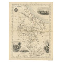
1 of 6
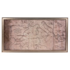
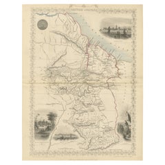
Old Map of British Mediterranean Territories with Images of Historic Sites, 1851
About the Item
John Tallis & Company was a British map-making firm that gained widespread acclaim in the 19th century, particularly known for their detailed and artistically embellished maps. The firm was renowned for including elaborate margins and vignettes that depicted various aspects of the region in question, such as local scenes, people, fauna, and flora.
The map of the British Possessions in the Mediterranean is likely one in a series created for "The British Colonies" by Robert Montgomery Martin. These maps typically showed not just the geography, but also highlighted the extent and reach of the British Empire at the time. They were as much political statements as they were geographical tools, showcasing Britain's global dominance.
This particular map would have detailed the various British-controlled territories in the Mediterranean region. This would include major strategic holdings such as Gibraltar and Malta, among others. The detailed insets and vignettes would depict important landmarks, like the Rock of Gibraltar or the Grand Harbor of Valletta, and perhaps key battles or events, reflecting their historical and strategic importance to British imperial interests.
The countries and regions depicted in this map were crucial naval bases and points of control that allowed the British Empire to exert influence over the Mediterranean Sea, protecting trade routes and maintaining military strength.
The Tallis series of maps are significant historical documents. They serve as a testament to the period's cartographic techniques, as well as the political aspirations and cultural attitudes of the British Empire. Today, these maps are valued for their artistic qualities and as historical records of British imperialism.
The images in more detail:
The images or insets on this map are detailed engravings that depict significant locations within the British possessions in the Mediterranean. Here's a description:
1. **Corfu**: This inset likely shows a view of Corfu, a Greek island in the Ionian Sea. It may depict the coastal landscape along with the architecture and fortifications that were significant during the British administration.
2. **Vathi, Ithaca**: Vathi is the main harbor of Ithaca, an island famously associated with Homer's "Odyssey." The scene might capture the tranquil waterfront and local boats, reflecting the peaceful Mediterranean lifestyle.
3. **Valletta**: This would be an illustration of Valletta, the capital of Malta, highlighting its historic skyline. The fortified city is known for its strategic importance and the Grand Harbour, which could be featured in the engraving.
4. **Gibraltar**: The image here probably presents a view of the Rock of Gibraltar, an overseas territory of the UK. It might show important landmarks like the neutral ground, the bay, and perhaps the Moorish Castle or the Great Siege Tunnels, essential to Gibraltar's military history.
These insets not only add artistic value to the map but also serve as informative windows into the local geographies and histories of these strategic Mediterranean holdings under British control during the 19th century.
- Dimensions:Height: 14.26 in (36.2 cm)Width: 10.71 in (27.2 cm)Depth: 0 in (0.02 mm)
- Materials and Techniques:
- Period:
- Date of Manufacture:1851
- Condition:Good given age. Original fold in middle as published. General age-related toning, please study scan carefully.
- Seller Location:Langweer, NL
- Reference Number:
About the Seller
5.0
Platinum Seller
These expertly vetted sellers are 1stDibs' most experienced sellers and are rated highest by our customers.
Established in 2009
1stDibs seller since 2017
1,928 sales on 1stDibs
Typical response time: <1 hour
- ShippingRetrieving quote...Ships From: Langweer, Netherlands
- Return PolicyA return for this item may be initiated within 14 days of delivery.
More From This SellerView All
- Old Engraved Map of Hungary with Decorative Vignettes, 1851Located in Langweer, NLAntique map titled Hungary. Includes decorative vignettes titled Hungarian Peasants, Pesth and the Fortress of Buda, on the Danube and Hungarian Nobles. Originates from 'The Illustrated Atlas, And Modern History Of The World Geographical, Political, Commercial & Statistical, Edited By R. Montgomery Martin'. Published; John Tallis London, New York, Edinburgh & Dublin. 1851. Drawn and Engraved by J. Rapkin. Artists and Engravers: John Tallis (1817-1876) was a British map publisher. Born in the Midlands, Tallis came to London in the 1840s. Tallis began his London career with a series of remarkable London street views. He began a partnership with a Frederick Tallis, possibly his brother, but their collaboration ended in 1849. For the Great Exhibition of 1851, Tallis published the Illustrated World Atlas, one of the last series of decorative world maps ever produced. The maps were engraved by John Rapkin, a skilled artisan. The maps were later reissued by the London Printing & Publishing Company, who left the Tallis imprint intact, thus ensuring his enduring fame. In 1858, he began publication of the popular Illustrated News of the World...Category
Antique 19th Century Maps
MaterialsPaper
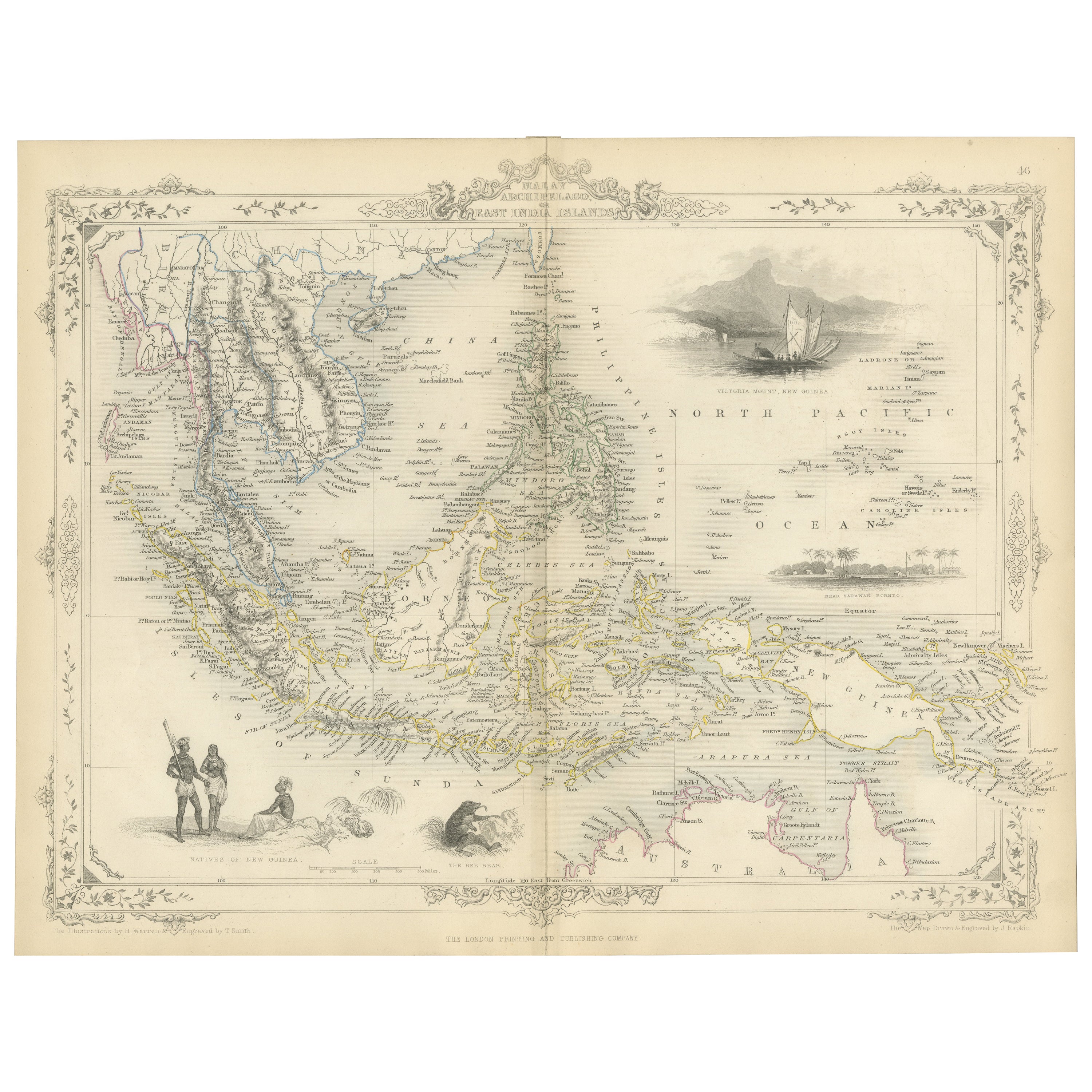
- Antique Map of the Malay Archipelago with Images of Indigenous People, 1851Located in Langweer, NLJohn Tallis & Company, often simply known as Tallis, was renowned for the production of maps and illustrated geographical publications in the mid-19th century. Tallis maps, such as t...Category
Antique 1850s Maps
MaterialsPaper
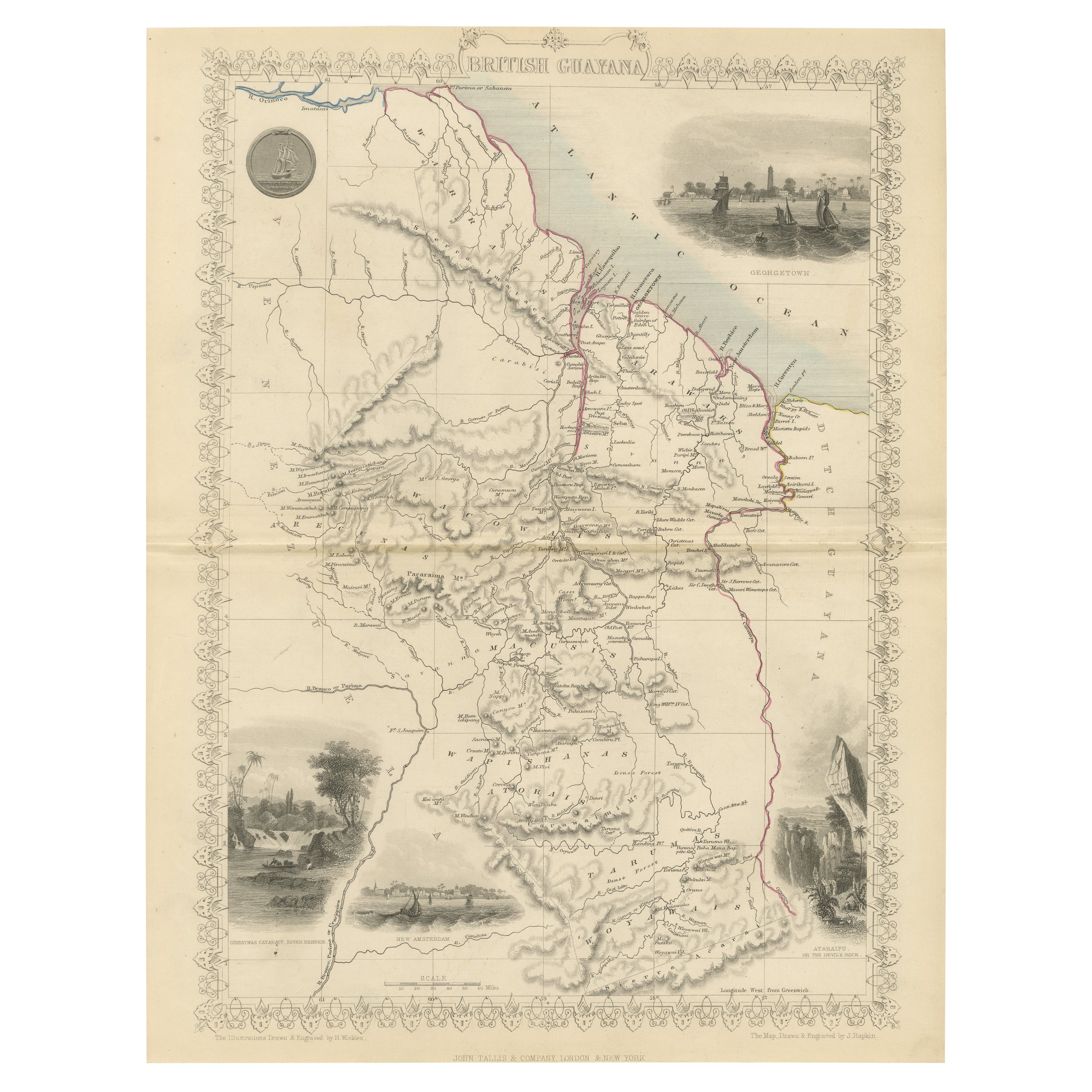
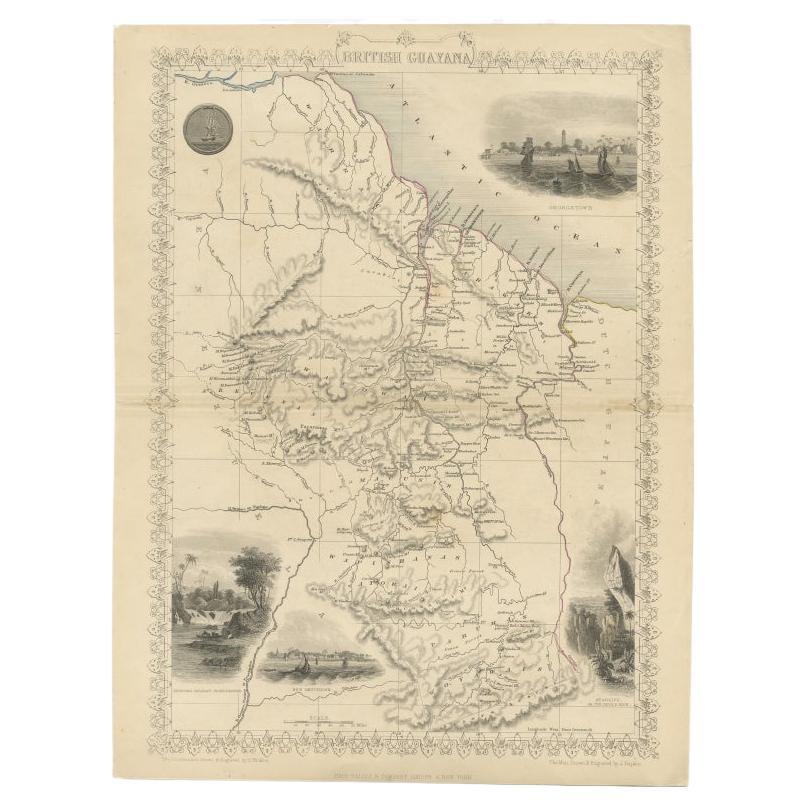
- A Tallis Map of British Guiana with Colonial Vignettes and Other Landmarks, 1851Located in Langweer, NLThis Tallis map of British Guiana (now known as Guyana) is a richly decorated document, much like other maps from the esteemed cartographic publisher John Tallis & Company. The firm,...Category
Antique 1850s Maps
MaterialsPaper
- Antique Map of British Guayana with Insets of Georgetown, Devil's Rock Etc, 1851Located in Langweer, NLAntique map titled ‘British Guayana’. Includes decorative vignettes titled Georgetown, Christmas Cataract River Berbice, New Amsterdam and Ataraipu or the Devil’s Rock. Originates fr...Category
Antique 19th Century Maps
MaterialsPaper
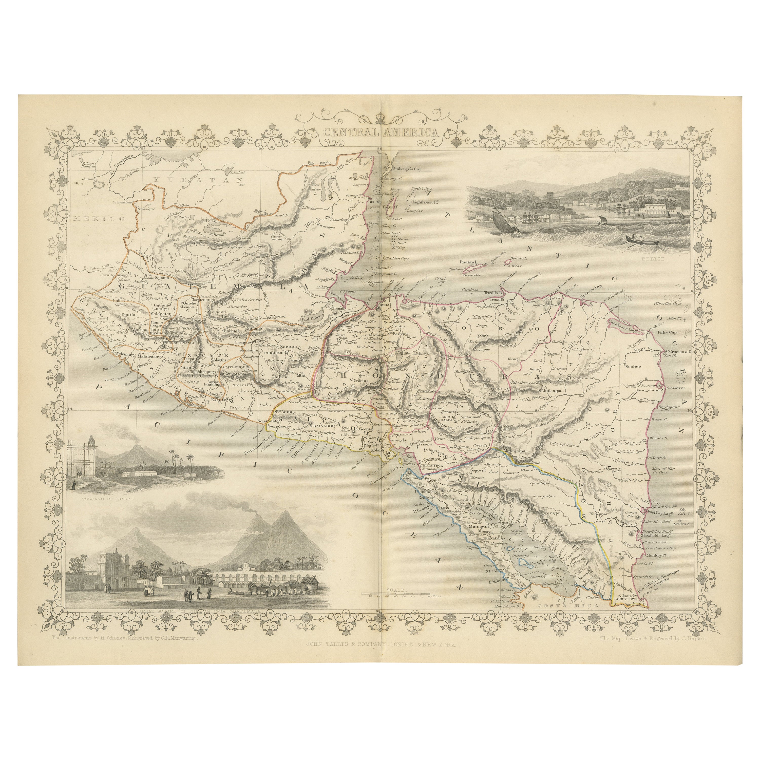
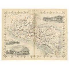
- An Old Illustrated Tallis Map of Central America with Volcanic Vignettes, 1851Located in Langweer, NLThis map of Central America, part of John Tallis & Company's series from "The British Colonies" by Robert Montgomery Martin, is a fine example of mid-19th century cartography and wou...Category
Antique 1850s Maps
MaterialsPaper
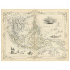
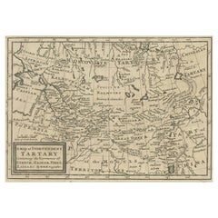
- Old Map of Tartary with Persia, Siberia, the Mogul Territories & China, ca.1717Located in Langweer, NLAntique map titled 'A Map of Independent Tartary, containing the territories of Usbeck, Gasgar, Tibet, Lassa & c'. Old map depicting east of the Caspian Sea with parts of Persia, Siberia, the Mogul territories and on to western China...Category
Antique 1710s Maps
MaterialsPaper

You May Also Like
- Large Framed Map of the MediterraneanLocated in New York, NYLarge map/chart chart of The Mediterranean and the Grecian Archipelago showing Italy, Sardinia, Corsica, part of France, etc. in a black frame.Category
20th Century French Mid-Century Modern Maps
- 1851 Map of "Independent Tartary", Ric. R018Located in Norton, MA1851 Map of Independent Tartary "Russia" Ric.r018 A highly decorative 1851 map of Independent Tartary by John Tallis and John Rapkin. Covers the regions between the Caspian Sea and Lake Bakquash and between Russia and Afghanistan. These include the ancient Silk Route kingdoms of Khiva, Tartaria, Kokand, and Bokhara. Today this region roughly includes Kazakhstan, Uzbekistan, Turkmenistan, Kyrgyzstan, and Tajikistan. This wonderful map offers a wealth of detail for anyone with an interest in the Central Asian portion of the ancient Silk Road. Identifies various caravan routes, deserts, wells, and stopping points, including the cities of Bokhara and Samarkand. Three vignettes by W. Bragg decorate the map, these including an image of Tartars on a Journey, a horseback Bride Chase, and a tartar camp site. Surrounded by a vine motif border. Engraved by J. Rapkin for John Tallis's 1851 Illustrated Atlas . Tartary Antique Map...Category
Antique 19th Century Unknown Maps
MaterialsPaper
- "San Francisco, Upper California” 1851 Antique Map of San FranciscoLocated in Colorado Springs, COThis is a pictorial lettersheet view of the city and harbor of San Francisco. This lithograph was printed on grey wove paper, across a double sheet, by famed lithographers Britton & ...Category
Antique 1850s American Prints
MaterialsPaper
- Old Nautical Map of CorsicaLocated in Alessandria, PiemonteST/556/1 - Old map of Corsica isle, surveyed by Captain Hell, of the French Royal Navy in 1824, engraved and published on 1874, with additions and corre...Category
Antique Early 19th Century English Other Prints
MaterialsPaper
- Old Horizontal Map of EnglandBy TassoLocated in Alessandria, PiemonteST/520 - Old rare Italian map of England, dated 1826-1827 - by Girolamo Tasso, editor in Venise, for the atlas of M.r Le-Sage.Category
Antique Early 19th Century Italian Other Prints
MaterialsPaper
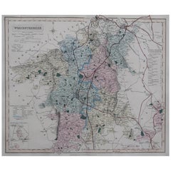
- Original Antique English County Map, Worcestershire, J & C Walker, 1851Located in St Annes, LancashireGreat map of Worcestershire Original colour By J & C Walker Published by Longman, Rees, Orme, Brown & Co. 1851 Unframed.Category
Antique 1850s English Other Maps
MaterialsPaper