Items Similar to Historical Map of Canaan with Insets of Jerusalem and Surrounding Regions, 1880

Want more images or videos?
Request additional images or videos from the seller
1 of 8
Historical Map of Canaan with Insets of Jerusalem and Surrounding Regions, 1880
About the Item
The map titled "CANAAN" depicts the historical region known as Canaan, located in the Levant, which corresponds to modern-day Israel, Palestinian territories, Lebanon, and parts of Syria and Jordan.
Key features include:
1. **Historical Territories**: It details the territories of the ancient Canaanite people and the subsequent Israelite tribes.
2. **Geographical Features**: The map shows the eastern Mediterranean coastline, the Jordan River, the Dead Sea, and other significant topographical features like mountain ranges and valleys.
3. **Inset Maps**: There are inset maps that provide a detailed view of important locations, such as Jerusalem, with key historical and biblical sites marked.
4. **Ancient Cities**: Cities such as Jericho, Hebron, and others are likely indicated, reflecting their importance in ancient times.
5. **Cultural and Political Boundaries**: The boundaries of the map might reflect the political divisions during different periods, such as the time of the Canaanites, the Judges, or the united and divided monarchy of Israel.
6. **Archaeological and Historical Sites**: The map may also mark locations of archaeological significance or areas mentioned in biblical and historical texts.
This map would hold interest for those studying the ancient Near East, biblical history, archaeology, and the historical geography of the region. It represents the area during a period that could range from the late Bronze Age to the Iron Age when Canaan was a hub of various cultural and political activities.
This map is from the "Spruner-Menke Atlas Antiquus," a historical atlas compiled by German cartographer Karl Spruner von Merz and later edited by Theodorus Menke. The atlas is known for its detailed maps of the ancient world, intended for educational and scholarly use, and was published in the late 19th century.
- Dimensions:Height: 15.56 in (39.5 cm)Width: 18.51 in (47 cm)Depth: 0 in (0.02 mm)
- Materials and Techniques:
- Period:
- Date of Manufacture:1880
- Condition:Good, given age. General age-related toning, especially around the edges. vertical folding line as issued. Please study scan carefully.
- Seller Location:Langweer, NL
- Reference Number:
About the Seller
5.0
Platinum Seller
These expertly vetted sellers are 1stDibs' most experienced sellers and are rated highest by our customers.
Established in 2009
1stDibs seller since 2017
1,916 sales on 1stDibs
Typical response time: <1 hour
- ShippingRetrieving quote...Ships From: Langweer, Netherlands
- Return PolicyA return for this item may be initiated within 14 days of delivery.
More From This SellerView All
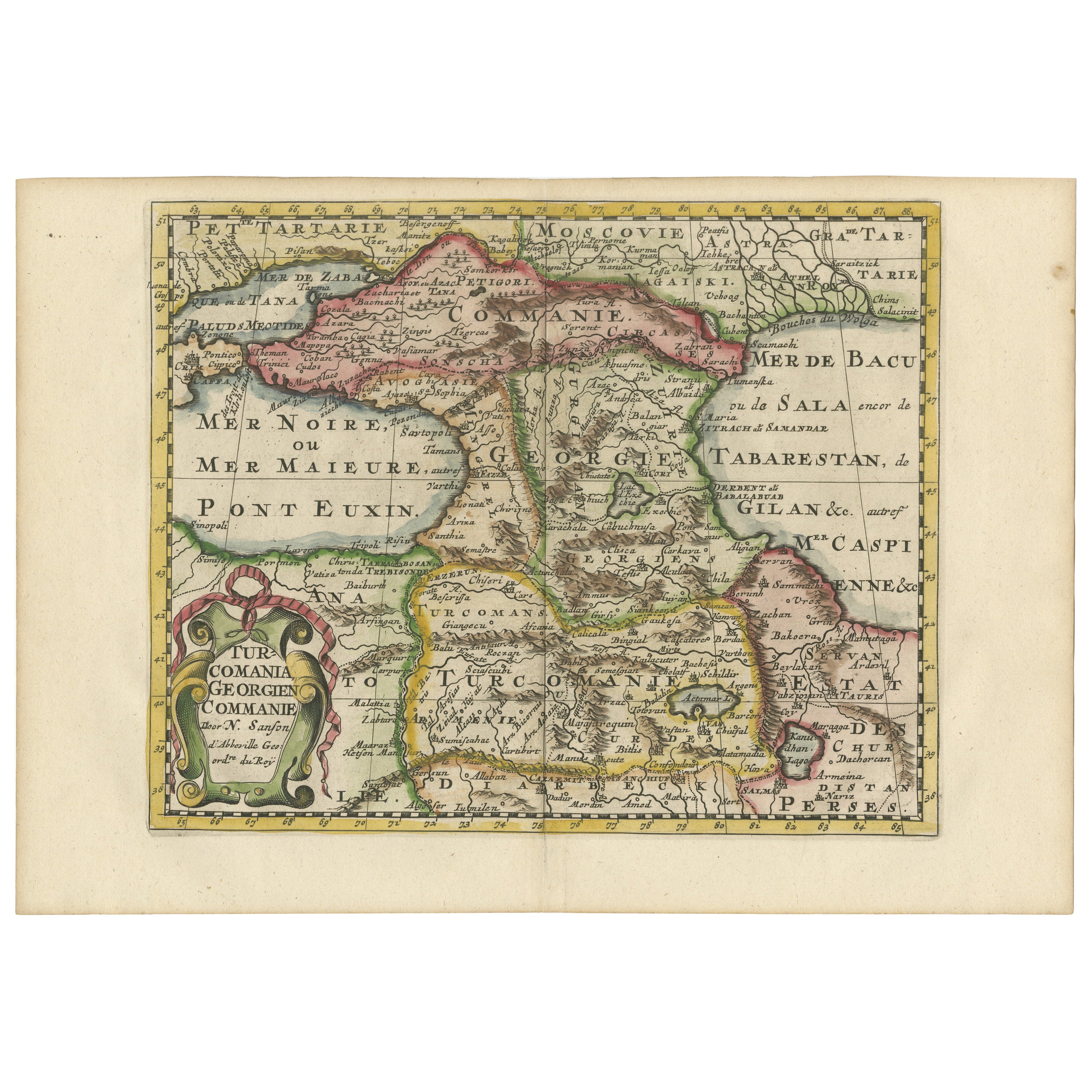
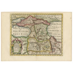
- Historical Map of the Black Sea and Surrounding Regions, 1705Located in Langweer, NLTitle: "Map of Turcomania, Georgia, and Comania" This print presents an intricately detailed map of the Caucasus region, titled “Turcomania, Georgien Commanie,” by the esteemed cart...Category
Antique Early 1700s Maps
MaterialsPaper
- Antique Map of Champagne and surrounding Regions, FranceLocated in Langweer, NLAntique map titled 'Carte de la Champagne et des Pays Voisins (..)'. Detailed map of Champagne and surrounding regions of Chalons and Soissons, Reims, Vedun, Mouzon, Sean, Charlemont...Category
Antique Mid-18th Century Maps
MaterialsPaper
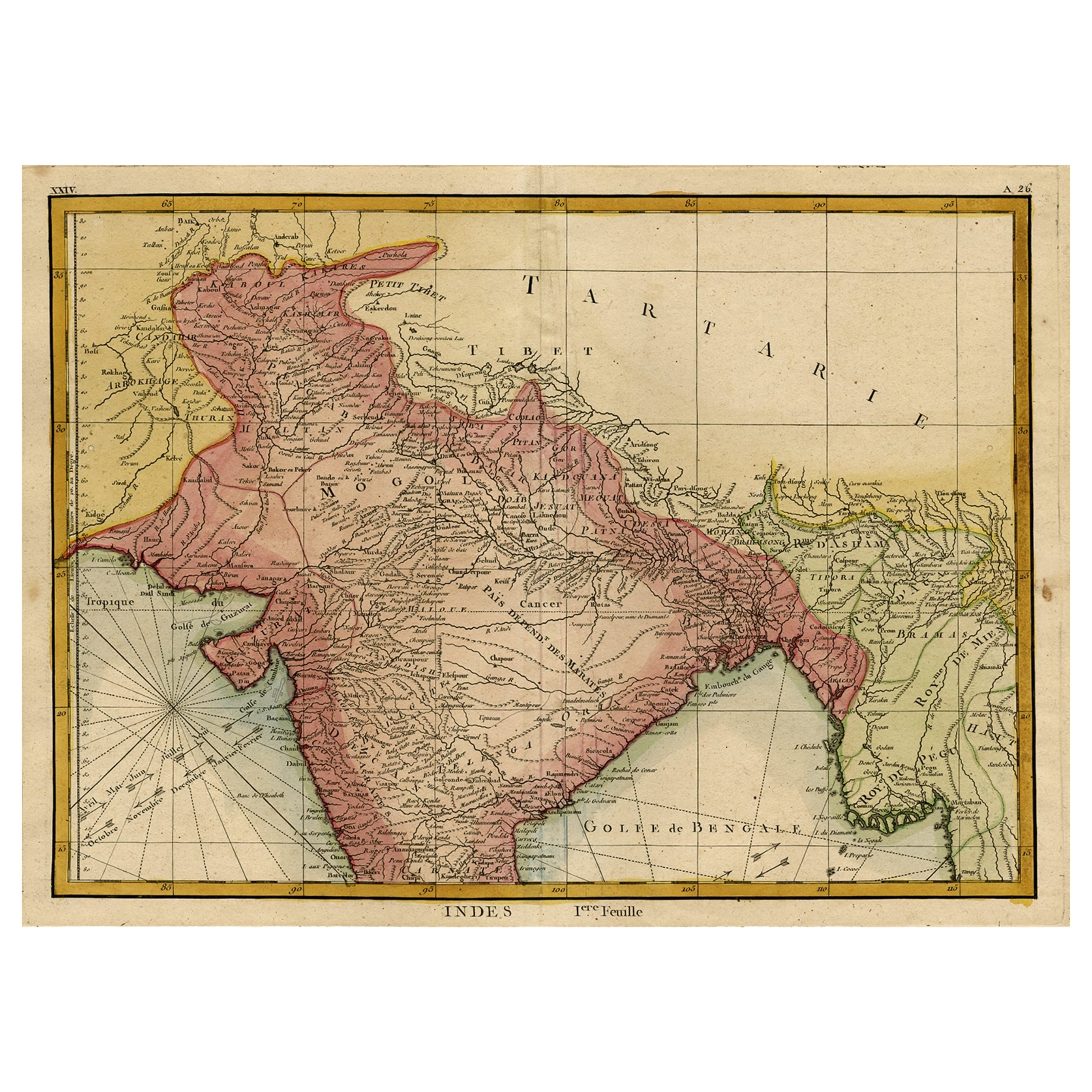
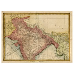
- Original and Colourful Map of Northern India with Surrounding Regions, 1783Located in Langweer, NLAntique map titled 'Indes'. A map of Northern India with surrounding regions. From Lattre's 'Atlas moderne ou collection de cartes sur toutes les parties du globe terrestre...Category
Antique 1780s Maps
MaterialsPaper
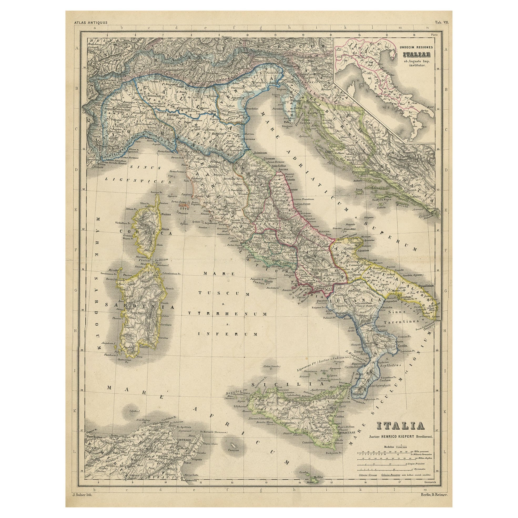
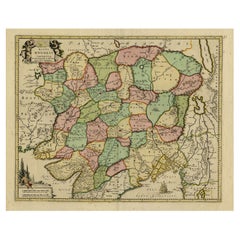
- Attractive Antique Map of Italy with Inset of Maps Showing The Regions, c.1870Located in Langweer, NLAntique map titled 'Italia'. Old map of Italy, with a small inset map depicting the various regions. This map originates from 'Atlas Antiquus, tw...Category
Antique 19th Century Maps
MaterialsPaper
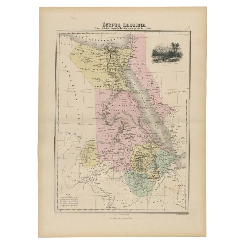
- Antique Map of The Nile, Egypt, Nubia and Abyssinia and Inset of Jerusalem, 1880Located in Langweer, NLAntique map titled 'Égypte Moderne'. Old map of Egypt, Nubia and Abyssinia (Ethiopia), Kordofan and Darfour (parts of Sudan), as well as part of Arabia. With decorative vignette of J...Category
Antique 19th Century Maps
MaterialsPaper
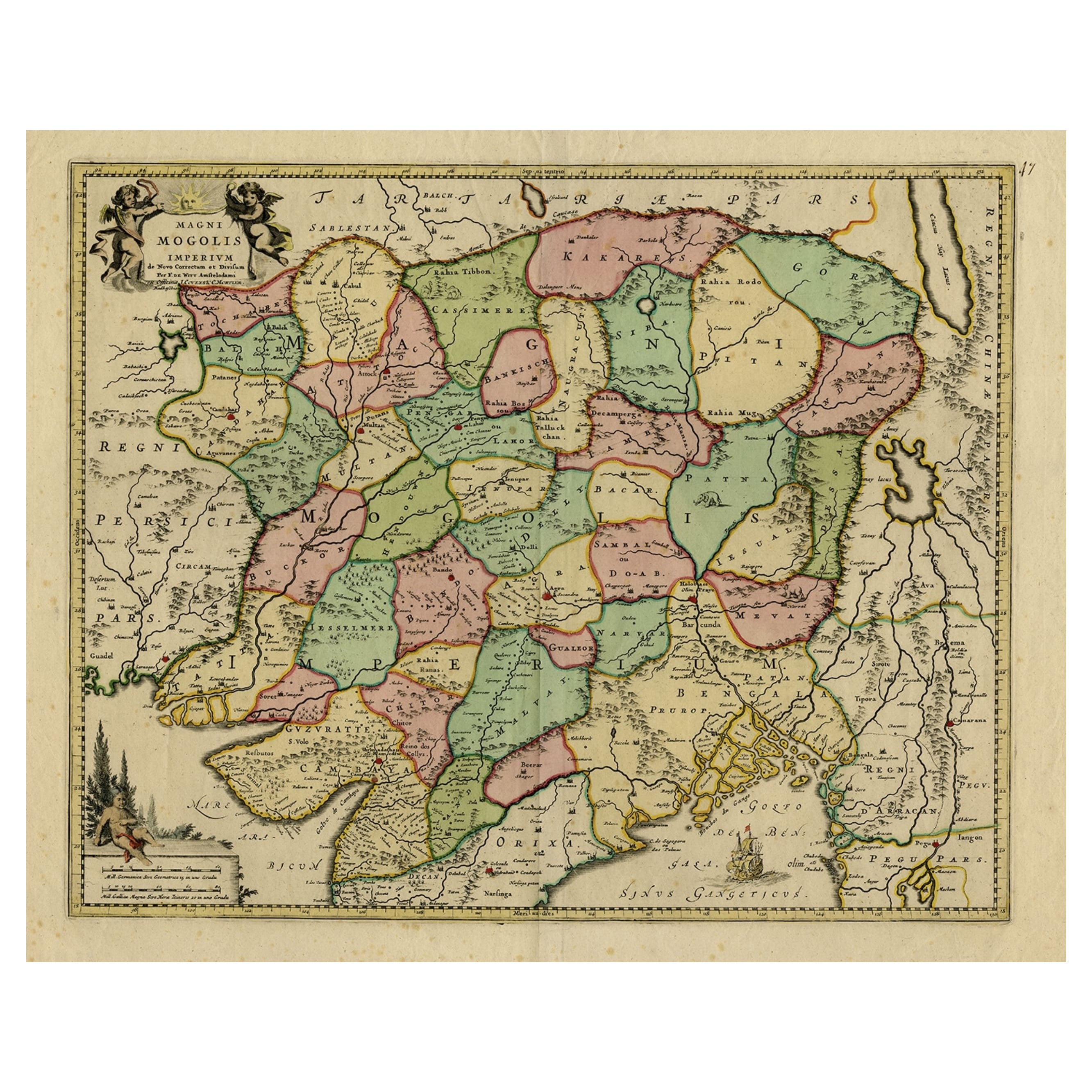
- Map of Northern India & Surrounding Regions, incl Kabul, Candahar & Bhutan, 1710Located in Langweer, NLAntique map titled 'Magni Mogolis Imperium de Novo Correctum et Divisum Per F. de Witt Amstelodami.' Map of Northern India and surrounding regions. This includes Kabul and Candah...Category
Antique 1710s Maps
MaterialsPaper


You May Also Like
- Map of Boston and Surrounding TownsLocated in Norwell, MALater copy of a nineteenth century map of Boston and surrounding towns. Showing parts of Quincy, Milton, Hyde Park, Winthrop and Revere. Showing all of B...Category
Antique 19th Century North American Maps
MaterialsPaper
- Gilt Framed Vintage Wine Regions of France MapLocated in Alton, GBFramed French wine region map 1973. The print has been removed to clean the glass, the frame has minor damage in places but nothing that detracts from ...Category
Vintage 1970s French Posters
MaterialsPaper
- Original Antique Map of Cyprus. Circa 1880Located in St Annes, LancashireGreat map of Cyprus Drawn and Engraved by R.Walker Published W.Mackenzie, London Original colour Unframed.Category
Antique 1880s English Maps
MaterialsPaper
- Map Holy Promise Land Canaan Richard Palmer Richard Blome 1687 Joseph MoxonLocated in BUNGAY, SUFFOLKCanaan comonly called the Holy Land or the Land of Promise, being the Possesion of the Israelites & travelled through by Our Lord & Saviour Iesus Christ and his Apostles. Engraven by Richard Palmer for Richard Blome. 1687 Blome, Richard, 1641-1705. London. 283 x 452 mm. Copperplate. Probably from an English Bible...Category
Antique 17th Century British Baroque Maps
MaterialsPaper
- Persia, Armenia & Adjacent Regions: A 17th Century Hand-colored Map by De WitBy Frederick de WitLocated in Alamo, CAA large 17th century hand colored copperplate engraved map entitled "Novissima nec non Perfectissima Scandinaviae Tabula comprehendens Regnorum Sueciae, Daniae et Norvegiae distincte...Category
Antique Late 17th Century Dutch Maps
MaterialsPaper
- Large Original Antique Map of The Environs of Dublin, Ireland, circa 1880Located in St Annes, LancashireGreat map of The Environs of Dublin Published circa 1880 Unframed Free shipping.Category
Antique 1880s Scottish Maps
MaterialsPaper


