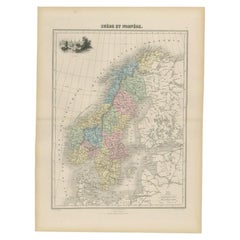
Norway Antique Map
7
to
6
60
9
31
25
20
13
13
11
9
8
8
5
5
5
5
4
3
2
2
2
1
1
1
1
1
1
1
1
1
1
1
4
3
2
2
1
Sort By
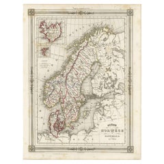
Antique Map of Scandinavia: Norway, Sweden and Denmark
Located in Langweer, NL
Antique map titled 'Suède, Norwège & Danemark'. Attractive map of Scandinavia, with Sweden, Norway
Category
Mid-19th Century Norway Antique Map
Materials
Paper
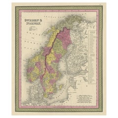
Old Colourful Map of Sweden and Norway, 1846
Located in Langweer, NL
Antique map titled 'Sweden & Norway'. Old map of Sweden and Norway.
This map originates from 'A
Category
1840s Norway Antique Map
Materials
Paper
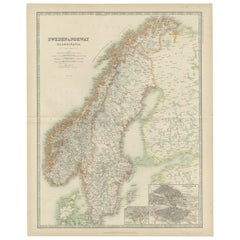
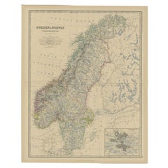
Antique Map of Sweden and Norway by Johnston (1909)
Located in Langweer, NL
Antique map titled 'Sweden and Norway'. Original antique map of Sweden and Norway. With inset maps
Category
Early 20th Century Norway Antique Map
Materials
Paper
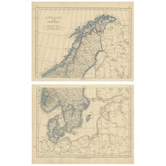
Antique Map of Sweden and Norway by Lowry, '1852'
Located in Langweer, NL
Antique map titled 'Sweden and Norway'. Two individual sheets of Sweden and Norway. This map
Category
Mid-19th Century Norway Antique Map
Materials
Paper
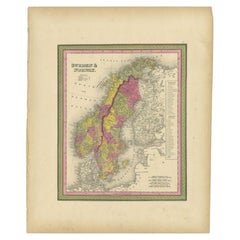
Antique Map of Sweden and Norway by Mitchell, 1846
Located in Langweer, NL
Antique map titled 'Sweden & Norway'. Old map of Sweden and Norway. This map originates from 'A New
Category
19th Century Norway Antique Map
Materials
Paper
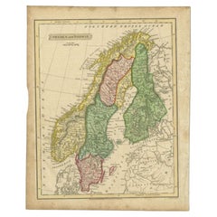
Antique Map of Sweden and Norway by Russell, 1814
Located in Langweer, NL
Antique map Scandinavia titled 'Sweden & Norway'. Antique map of Scandinavia with a focus on Sweden
Category
19th Century Norway Antique Map
Materials
Paper
Antique Map of Sweden and Norway by Johnston, 1882
Located in Langweer, NL
Antique map titled 'Sweden & Norway (Scandinavia)'. Old map of Sweden and Norway, with inset map of
Category
19th Century Norway Antique Map
Materials
Paper
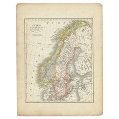
Antique Map of Sweden and Norway by Petri, 1852
Located in Langweer, NL
Antique map titled 'Zweden en Noorwegen'. Map of Sweden and Norway. This map originates from
Category
19th Century Norway Antique Map
Materials
Paper
Antique Map of Sweden and Norway by Migeon, 1880
Located in Langweer, NL
Antique map titled 'Suède et Norvége'. Old map of Sweden and Norway. With decorative vignette of
Category
19th Century Norway Antique Map
Materials
Paper
Antique Map of Southern Norway by Janssonius, c.1650
Located in Langweer, NL
"Antique map titled 'Nova et Accurata Tabula Episcopatuum Stavangriensis et Asloiensis'. Old map of
Category
17th Century Norway Antique Map
Materials
Paper
Large Original Vintage Map of Sweden and Norway circa 1920
Located in St Annes, Lancashire
Great map of Sweden and Norway
Original color. Good condition
Published by Alexander Gross
Category
1920s English Victorian Norway Antique Map
Materials
Paper
Antique Map of Sweden & Norway by A.K. Johnston '1865'
Located in Langweer, NL
Antique map titled 'Sweden & Norway (Scandinavia)'. With an inset map of Stockholm and environments
Category
Mid-19th Century Norway Antique Map
Materials
Paper
Antique Map of Sweden, Norway and Denmark by Johnson, 1872
Located in Langweer, NL
World," by A.J. Johnson, dated 1872. This particular map offers a depiction of Sweden and Norway on one
Category
Late 19th Century Norway Antique Map
Materials
Paper
Antique Map of Sweden and Norway by Petri, c.1873
Located in Langweer, NL
Antique map titled 'Zweden en Noorwegen'. Old map depicting Sweden and Norway. This map originates
Category
19th Century Norway Antique Map
Materials
Paper
Antique Map of Sweden and Norway by W. G. Blackie, 1859
Located in Langweer, NL
Antique map titled 'Sweden and Norway'. Original antique map of Sweden and Norway. This map
Category
Mid-19th Century Norway Antique Map
Materials
Paper
Original Antique Map of Sweden and Norway, Grattan and Gilbert, 1843
Located in St Annes, Lancashire
Great map of Sweden and Norway
Drawn and engraved by Archer
Published by Grattan and Gilbert
Category
1840s English Other Norway Antique Map
Materials
Paper
No Reserve
H 11.75 in W 10.25 in D 0.07 in
Antique Map of Sweden and Norway by H. Moll, circa 1715
Located in Langweer, NL
Beautiful and rare map of Sweden and Norway including English text. This map most likely originates
Category
Early 18th Century Norway Antique Map
Materials
Paper
Antique Map of the Kingdoms of Sweden and Norway by Wyld '1845'
Located in Langweer, NL
Antique map titled 'Kingdoms of Sweden and Norway'. Original antique map of the Kingdoms of Sweden
Category
Mid-19th Century Norway Antique Map
Materials
Paper
Antique Map of the North Sea From the English Channel to Norway & Sweden, 1746
Located in Langweer, NL
Coast of Normandy in France'.
This map depicts the region from the English Channel to Norway and
Category
1740s Norway Antique Map
Materials
Paper
H 20.08 in W 15.75 in D 0 in
Antique Map of the Kingdom of Sweden and Norway by Keizer & de Lat, 1788
Located in Langweer, NL
Kingdom of Sweden and Norway. This map originates from 'Nieuwe Natuur- Geschied- en Handelkundige Zak- en
Category
Late 18th Century Norway Antique Map
Materials
Paper
H 10.63 in W 7.88 in D 0.02 in
Old Map of The Southern Part of Norway, Covering the Region Around Bergen, c1650
Located in Langweer, NL
Antique map titled 'Nova et Accurata Tabula Episcopatuum Stavangriensis et Asloiensis'.
Old map
Category
1650s Norway Antique Map
Materials
Paper
H 15.75 in W 19.49 in D 0 in
Antique Map of Scandinavia by Lapie, 1842
Located in Langweer, NL
Danemark'. Map of Scandinavia including Sweden, Norway and Denmark. With inset maps of Iceland and the
Category
Mid-19th Century Norway Antique Map
Materials
Paper
Antique Map of Scandinavia by T. Jefferys, circa 1750
Located in Langweer, NL
Antique map titled 'Sweden, Denmark, Norway & Finland'. An original mid-18th century copper
Category
Mid-18th Century Norway Antique Map
Materials
Paper
Antique Map of Northern Europe by Bonne, c.1780
Located in Langweer, NL
Antique map titled 'Le Nord de L'Europe, Contenant Le Danemark, La Norwege; La Suede et La Laponie
Category
18th Century Norway Antique Map
Materials
Paper
Antique Map of Scandinavia by Van der Aa 'circa 1710'
Located in Langweer, NL
with two maps on one sheet. The upper map depicts Northern Scandinavia with Norway, Sweden and Finland
Category
Early 18th Century Norway Antique Map
Materials
Paper
Old Sea Chart of Northern Norway, also depicting Part of Lapland & Russia, 1702
Located in Langweer, NL
Antique map titled 'The Coast of Norway and Lapland, from North kyn to the River Kola'.
Sea
Category
Early 1700s Norway Antique Map
Materials
Paper
H 17.33 in W 21.66 in D 0 in
Antique Map of Northern Europe and European Russia, ca.1780
Located in Langweer, NL
Antique map titled 'Le Nord de L'Europe, Contenant Le Danemark, La Norwege; La Suede et La Laponie
Category
1780s Norway Antique Map
Materials
Paper
Interesting Map of Great Britain and Northern Europe with various Illustrations
Located in Langweer, NL
Antique map titled 'Itinera Varia Auctoris'. Very interesting map of Great Britain and Northern
Category
Mid-18th Century Norway Antique Map
Materials
Paper
H 11.23 in W 8.9 in D 0.02 in
Large Antique Map of the City of Bremen and Surroundings, Germany
Located in Langweer, NL
Original antique map titled 'Prospect und Grundris der Keiserl Freyen Reichs und Ansee Stadt Bremen
Category
Early 18th Century Norway Antique Map
Materials
Paper
Antique Map of Scandinavia and the Baltic Region by Valk, circa 1690
Located in Langweer, NL
Antique map titled 'Sueciae Magnae, totius orbis regni antiquissimi (..)'. Map of Scandinavia and
Category
Late 17th Century Norway Antique Map
Materials
Paper
Colorful Detailed Antique Map of The British Islands and `The North Sea, 1882
Located in Langweer, NL
Discover 'The British Islands and The North Sea' Map with Insets of Orkney, Shetland, and Channel
Category
1880s Norway Antique Map
Materials
Paper
H 14.97 in W 22.45 in D 0 in
Persia, Armenia & Adjacent Regions: A 17th Century Hand-colored Map by De Wit
By Frederick de Wit
Located in Alamo, CA
attractive map of Scandinavia, which includes the Baltic Sea, Norway, Sweden, Finland, Denmark and portions
Category
Late 17th Century Dutch Norway Antique Map
Materials
Paper
H 23.5 in W 27 in D 1.325 in
Pl. 28 Antique Chart of British American, English (..) US Population, 1874
Located in Langweer, NL
Antique chart titled 'Maps showing the distribution, within the territory of the United States
Category
Late 19th Century Norway Antique Map
Materials
Paper
H 21.66 in W 16.15 in D 0.02 in
Original Antique Poster Norvege Norway Midnight Sun Stavkirke Church Travel Map
Located in London, GB
Original antique travel poster for Norway with French text The Land of the Midnight Sun / Norvege
Category
1610s Norwegian Norway Antique Map
Materials
Paper
H 38.98 in W 25.6 in D 0.04 in
Original Antique Poster Midnight Sun Norway Travel Gronoy Bolgen Mountain View
Located in London, GB
Original antique travel poster issued by Norwegian State Railways for Norway The Land of the
Category
Early 1900s Norwegian Norway Antique Map
Materials
Paper
H 38.98 in W 25.99 in D 0.04 in
Original Antique Engraving of Christian, 6th King of Norway, 1735
Located in Langweer, NL
Norway, Denmark etc. This print originates from the 7th-volume of 'Hedendaagsche Historie of
Category
18th Century Norway Antique Map
Materials
Paper
Rare Antique Engraving of the City of Stockholm, Norway, ca.1720
Located in Langweer, NL
G. Bodenehr.
Artists and Engravers: Gabriel Bodenehr, a German map maker and member of a famous
Category
18th Century Norway Antique Map
Materials
Paper
Antique Print of a Malayan Houses in Sumatra, Indonesia, 1881
Located in Langweer, NL
.
Artists and Engravers: Carl Alfred Bock (17 September 1849 – 10 August 1932) was a Norwegian government
Category
19th Century Norway Antique Map
Materials
Paper
Original Imray & Son Chart of North Atlantic, 1876
Located in Norwell, MA
Scotia), Europe (England, Ireland, Norway, Denmark, France and Spain), African coast (including Morocco
Category
1870s Norway Antique Map
Materials
Paper
Antique Print of a Tring Dayak Woman from Borneo Island, Indonesia, 1881
Located in Langweer, NL
- 1932) was a Norwegian government official, author, naturalist and explorer.
Technic: Lithograph on
Category
19th Century Norway Antique Map
Materials
Paper
Original Antique Poster Norvege Norway Midnight Sun Stavkirke Church Travel Map
Located in London, GB
Original antique travel poster for Norway with French text The Land of the Midnight Sun / Norvege
Category
Early 1900s Norway Antique Map
Materials
Paper
Original Antique Poster Midnight Sun Norway Travel Gronoy Bolgen Mountain View
Located in London, GB
Original antique travel poster issued by Norwegian State Railways for Norway The Land of the
Category
Early 1900s Norway Antique Map
Materials
Paper
A Chart of Norway.
By Samuel Thornton
Located in Zeeland, Noord-Brabant
A map of the Norwegian coast, from Dronten (Trondheim) south to circa Alesund. The map features two
Category
Early 18th Century Norway Antique Map
Materials
Engraving
Rare 1710 Hand-Colored Map of Europe
By Frederick de Wit
Located in La Jolla, CA
depictions of Elephants in North Africa and rutting Goats in Norway. The inset map on the left shows the
Category
1710s Dutch Northern Renaissance Norway Antique Map
Materials
Paper
The Coast of Norway and Lapland from North Kyn to the River Kola.
By Samuel Thornton
Located in Zeeland, Noord-Brabant
A sea chart of the northern edge of Norway/Lapland and Russia, from the mouth of the Kola river
Category
Early 18th Century Norway Antique Map
Materials
Engraving
A New Generall Chart of the Coast of ye Northern Ocean Vitz Norway, [...].
By Herman Moll
Located in Zeeland, Noord-Brabant
A sea chart of the Barents Sea with the coasts of Norway, Lapland, Russia, Nova Zembla and Svalbard
Category
Late 17th Century Norway Antique Map
Materials
Engraving
Carte generale des costes de l'Europe sur l'ocean [...].
By Alexis Hubert Jaillot
Located in Zeeland, Noord-Brabant
Detroit de Gibraltar.' - (General coastal map of Europe and the oceans from Dronthem in Norway to the
Category
Late 17th Century Norway Antique Map
Materials
Engraving
H 24.41 in W 36.03 in
Carte reduite de Partie de la Mer du Nord comprise entre l'Ecosse, [...].
By Jacques-Nicolas Bellin
Located in Zeeland, Noord-Brabant
Detailed map of parts of the North Sea between Scotland, Danmark, Norway and Iceland.) Highly
Category
Late 18th Century Norway Antique Map
Materials
Engraving
Carte De La Mer De Dannemark Et Des Entrees Dans La Mer Baltique [...].
By Alexis Hubert Jaillot
Located in Zeeland, Noord-Brabant
et Xostes Depuis Norden et Le Cap Der-Neus jusques a Rostock et Valsterbon. ' - Map of Danish seas
Category
Late 17th Century Norway Antique Map
Materials
Engraving
The Coast of Finmarck from Dronten to Tromsound.
By Samuel Thornton
Located in Zeeland, Noord-Brabant
Engraving on hand laid paper.
A sea chart of the Norwegian coast, from Trondheim to Tromso. The
Category
Early 18th Century Norway Antique Map
Materials
Engraving
Arizona Mountains
By Paul Lauritz
Located in Graton, CA
Born in Larvik, Norway, Paul Lauritz became a noted painter based in California of portraits and
Category
Early 20th Century Impressionist Norway Antique Map
Materials
Oil
Norway to Iceland, Framed Nautical Map
Located in Houston, TX
maps are quite unique. You can actually see markings on them from where captains did their course
Category
Early 20th Century Norway Antique Map
Materials
Glass
Antique Map of Sweden and Norway by Tallis, 1851
Located in Langweer, NL
Antique map titled ?Sweden & Norway?. Includes decorative vignettes titled Stockholm, Norwegian
Category
19th Century Norway Antique Map
Materials
Paper
A Hand Colored 17th Century Map of Scandinavia by Frederick de Wit
By Frederick de Wit
Located in Alamo, CA
attractive map of Scandinavia, which includes the Baltic Sea, Norway, Sweden, Finland, Denmark and portions
Category
Late 17th Century Old Masters Norway Antique Map
Materials
Engraving
H 24 in W 26.5 in D 0.13 in
American Revenue Cutter Service Ensign Belonging To Capt. W. H. Bagley
Located in York County, PA
believed to be Laura Barnes Bagley.
(3) A map with hand-drawn notations by Bagley, detailing routes he
Category
1870s American Norway Antique Map
H 53.75 in W 81.25 in D 2.5 in
Original Antique Map of Sweden, Norway & Denmark, Sherwood, Neely, Jones, 1809
Located in St Annes, Lancashire
Great map of Sweden, Norway & Denmark
Copper-plate engraving by Cooper
Published by Sherwood
Category
1810s English Norway Antique Map
Materials
Paper
1 bid
No Reserve
H 16.75 in W 10.5 in D 0.07 in
Antique Map of Sweden and Norway by R. Morden, circa 1699
Located in Langweer, NL
Antique map of Sweden, Norway, Finland and the Baltics by Robert Morden. Robert Morden issued a
Category
Late 17th Century Norway Antique Map
Original Antique Map of Sweden, Denmark and Norway, Arrowsmith. Dated 1810.
Located in St Annes, Lancashire
Great map of Sweden, Denmark and Norway.
Dated 1810
Drawn under the direction of Arrowsmith
Category
1810s English Norway Antique Map
Materials
Paper
1 bid
No Reserve
H 10.5 in W 16 in D 0.07 in
Original Antique Map of Sweden, Norway, Denmark and Finland, circa 1790
Located in St Annes, Lancashire
Super map of Scandinavia
Copper plate engraving by A.Bell
Published, circa 1790.
Unframed.
Category
1790s English Other Norway Antique Map
Materials
Paper
1 bid
No Reserve
H 8.25 in W 11 in D 0.07 in
Large Original Antique Map of Sweden and Norway by Sidney Hall, 1847
Located in St Annes, Lancashire
Great map of Sweden and Norway
Drawn and engraved by Sidney Hall
Steel engraving
Original
Category
1840s Scottish Norway Antique Map
Materials
Paper
1 bid
No Reserve
H 17.25 in W 12.25 in D 0.07 in
- 1
Get Updated with New Arrivals
Save "Norway Antique Map", and we’ll notify you when there are new listings in this category.
Norway Antique Map For Sale on 1stDibs
Find many varieties of an authentic Norway antique map available at 1stDibs. A Norway antique map — often made from paper and glass — can elevate any home. There are many kinds of the Norway antique map you’re looking for, from those produced as long ago as the 18th Century to those made as recently as the 20th Century. Each Norway antique map bearing hallmarks is very popular.
How Much is a Norway Antique Map?
Prices for a Norway antique map start at $50 and top out at $1,599 with the average selling for $276.
More Ways To Browse
Maps Tallis
Antique Navigation Map
S Parker Oil On Canvas
Map Baltics
Antique Map Canvas
Mission Secretary
Night Sky Map
Cape Verde
Early American Secretary Desk
Framed Maps Italy
Wooden Music Box
Finland Map
Antique Correspondence Box
Day Date Bark
Map Of Eastern Europe
Map Of Finland
Map Of Norway
Dutch Sea Battle
