Items Similar to Old Sea Chart of Northern Norway, also depicting Part of Lapland & Russia, 1702
Want more images or videos?
Request additional images or videos from the seller
1 of 5
Old Sea Chart of Northern Norway, also depicting Part of Lapland & Russia, 1702
About the Item
Antique map titled 'The Coast of Norway and Lapland, from North kyn to the River Kola'.
Sea Chart of Northern Norway, also depicting part of Lapland and Russia. The map covers from the Kola river to what the map calls Fishers Island (Rybachy Peninsula) and east toward Kamoyvaer past Vardo. Small inset map depicting Wardhouse Island (Vardoya). This map originates from Thornton's 'Sea Atlas (..)'.
Artists and Engravers: Samuel Thornton was the son the English mapmaker John Thornton, an eminent English mapmaker of the late seventeenth and early eighteenth century.
Condition: Fair, mounted to paper. Some wear and age-related toning, please study image carefully.
- Dimensions:Height: 17.33 in (44 cm)Width: 21.66 in (55 cm)Depth: 0 in (0.02 mm)
- Materials and Techniques:
- Period:1700-1709
- Date of Manufacture:1702
- Condition:Condition: Fair, mounted to paper. Some wear and age-related toning, please study image carefully.
- Seller Location:Langweer, NL
- Reference Number:
About the Seller
5.0
Platinum Seller
These expertly vetted sellers are 1stDibs' most experienced sellers and are rated highest by our customers.
Established in 2009
1stDibs seller since 2017
1,919 sales on 1stDibs
Typical response time: <1 hour
- ShippingRetrieving quote...Ships From: Langweer, Netherlands
- Return PolicyA return for this item may be initiated within 14 days of delivery.
More From This SellerView All
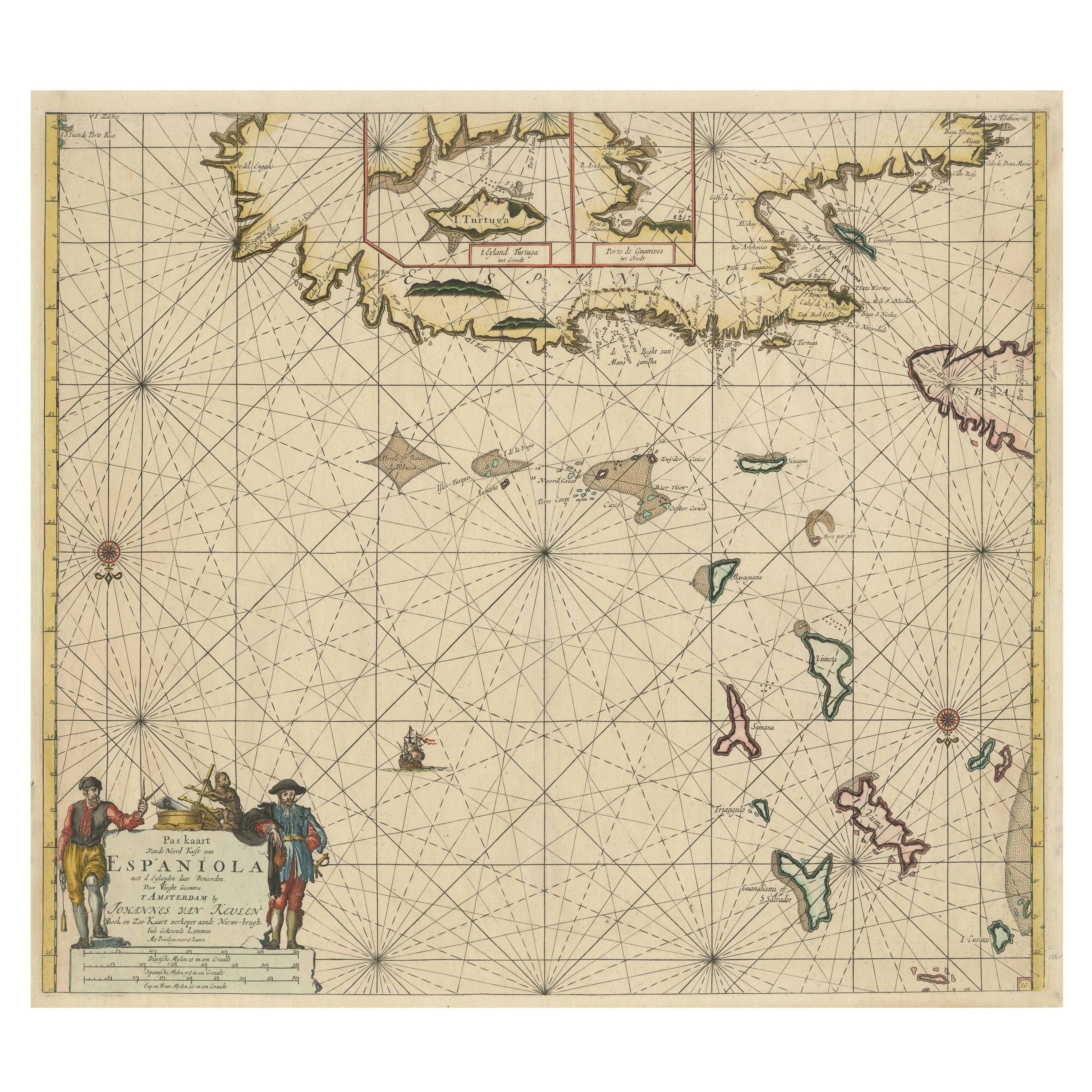
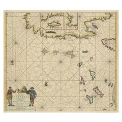
- Original Antique Sea Chart of the Northern Part of Hispaniola, Western CubaLocated in Langweer, NLAntique map titled 'Pas kaart van de Noord Kust van Espaniola (..)'. Beautiful sea chart of the northern part of Hispaniola, western Cuba. The map includes the Turks & Caicos Islands and southern part of the Bahamas. Shows Guanahami or S. Salvador. Guanahani is an island in the Bahamas that was the first land in the New World sighted and visited by Christopher Columbus' first voyage, on October 12, 1492. It is not known precisely which island it was, and several theories have been put forth by historians. Guanahani is the native Taíno name; Columbus called it San Salvador. Originates from 'De Nieuwe Groote Lightende Zee-Fakkel'. Published by J. van Keulen, circa 1684. The Van Keulens were a family of chartmakers and publishers. The firm, In de Gekroonde Lootsman (In the Crowned Pilot), was founded in 1678 by Johannes van Keulen (1654-1715). Van Keulen originally registered his business as a vendor of books and instruments (specifically cross-staffs). In 1680, however, he gained a privilege from the States of Holland and West Friesland for the publication of pilot guides and sea atlases. In that year, van Keulen released his Zee-Atlas (Sea Atlas), which secured him a name in the competitive maritime publishing market. In 1681, he published the first volume of Nieuwe Lichtende Zee-Fakkel (New Shining Sea Torch). This would be the first of an eventual five volumes originally published between 1680 and 1684. A sixth volume was added in 1753. The Zee-Fakkel won van Keulen lasting fame. The atlas had charts compiled by Claes Jansz Vooght and artwork from Jan Luyken...Category
Antique Late 17th Century Maps
MaterialsPaper
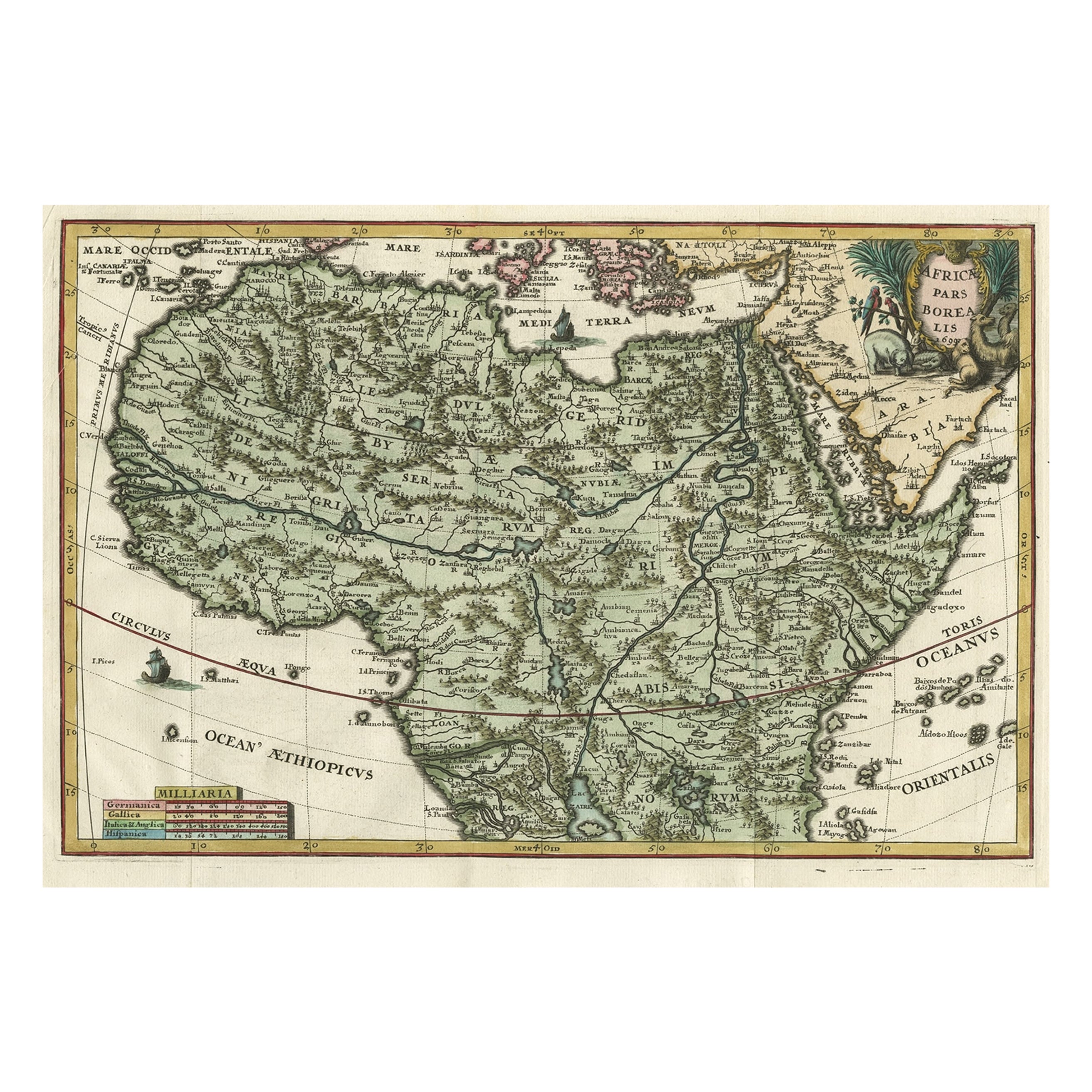
- Very Decorative Rare Antique Map of the Northern Part of Africa, 1702Located in Langweer, NLAntique map titled 'Africae Pars Borealis.' Very decorative antique map of the northern part of Africa by Heinrich Scherer. The map is full of the spurious geography of the perio...Category
Antique Early 1700s Maps
MaterialsPaper
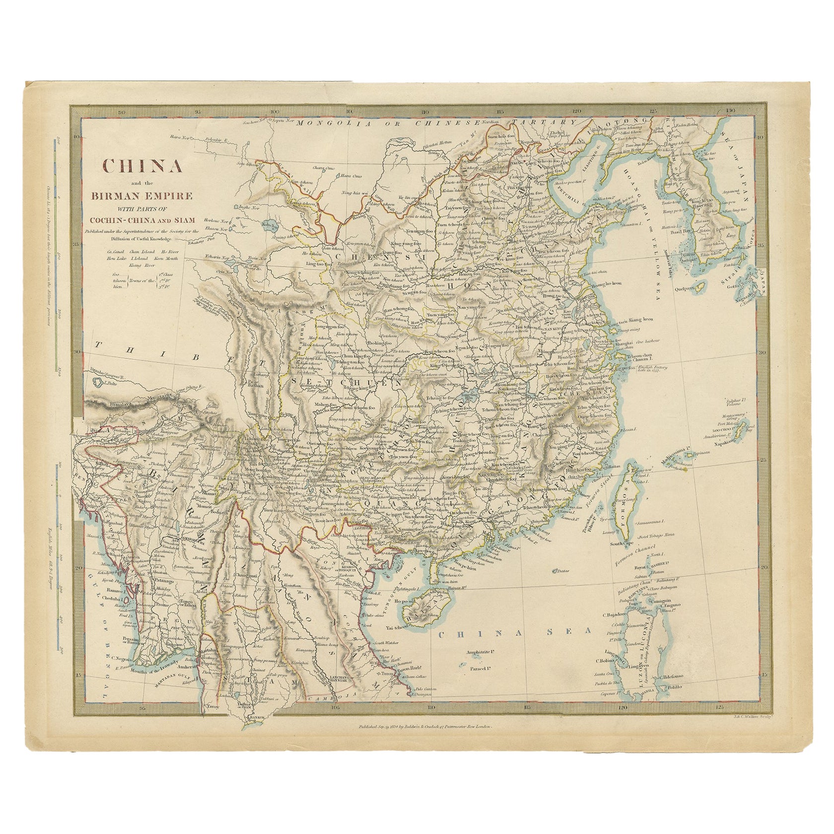
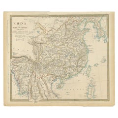
- Antique Map of China, Also Depicting Formosa 'Taiwan' and Part of Korea, c.1840Located in Langweer, NLAntique map titled 'China'. Old map of China, also depicting Formosa (Taiwan) and part of Korea. Source unknown, to be determined. Artists and Engravers: Anonymous. Condition: ...Category
Antique 19th Century Maps
MaterialsPaper
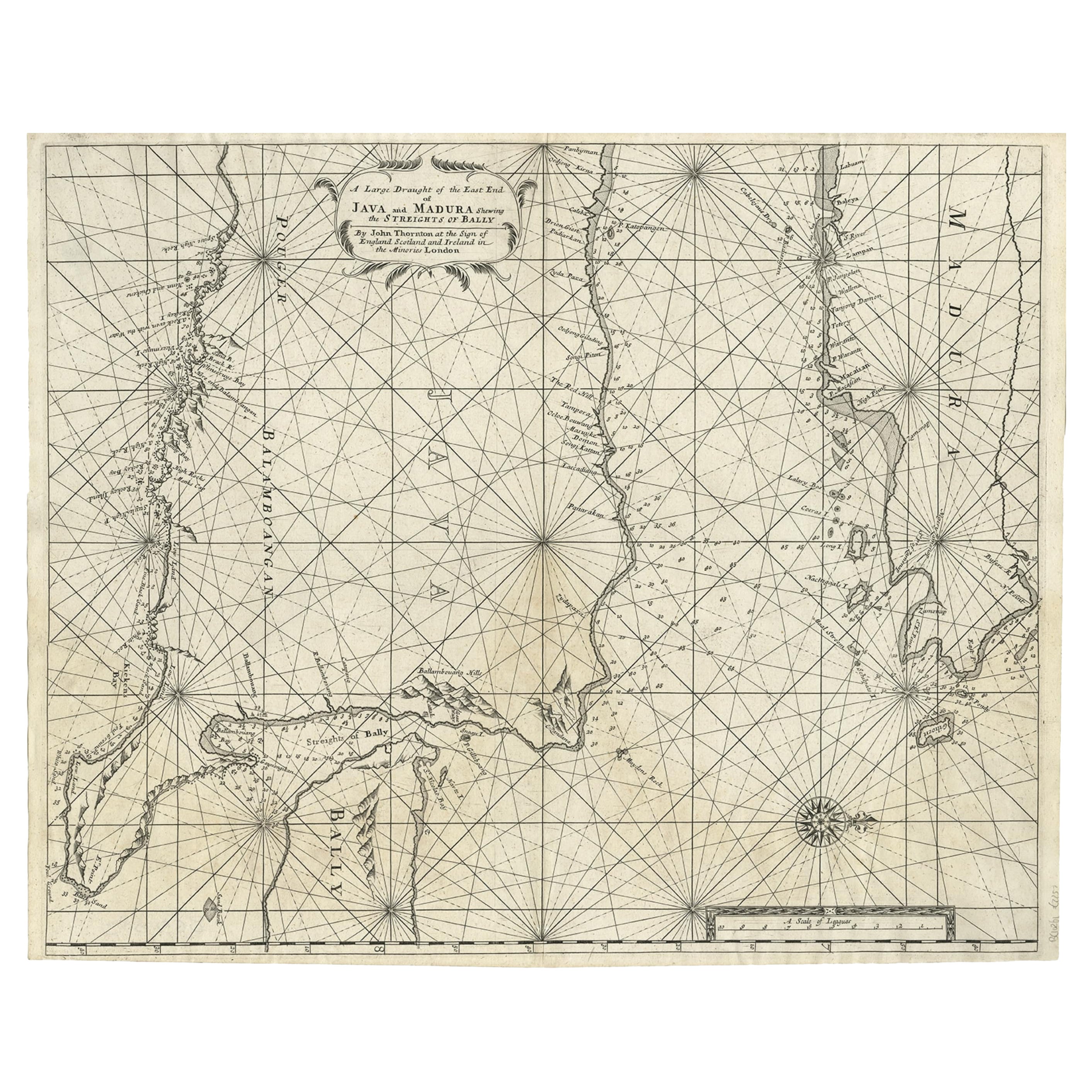
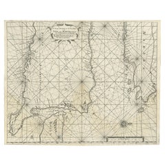
- Rare Old English Sea Chart of Part of Indonesia with Java, Madura and Bali, 1711Located in Langweer, NLAntique map titled 'A Large Draught of the East End of Java and Madura shewing the Streights of Bally.' Rare early example of this working English Sea Chart of part of Indonesia ...Category
Antique 1710s Maps
MaterialsPaper
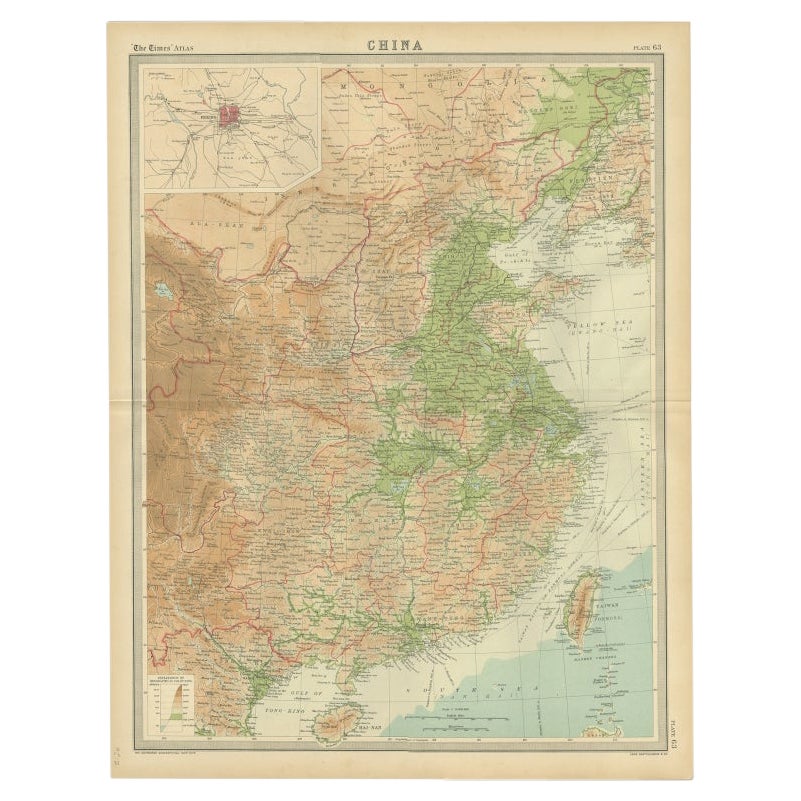
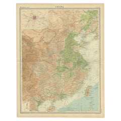
- Original Old Map of Eastern China, Also Depicting Taiwan 'Formosa', 1922Located in Langweer, NLLarge map of China titled 'China - Peking'. Old map of eastern China depicting Kiangsi, Chekiang, Fukien, Kwangtung, Taiwan (Formosa) and surroundings. With inset map of Peking. This...Category
20th Century Maps
MaterialsPaper
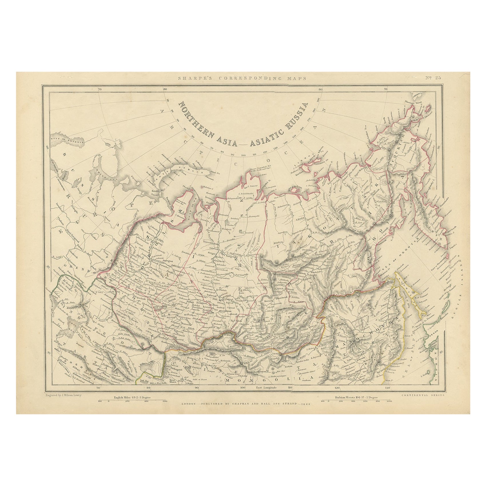
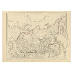
- Northern Asia, Asiatic Russia, Old Map of Russia in Asia, 1849Located in Langweer, NLAntique map titled 'Northern Asia - Asiatic Russia'. Old map of Russia in Asia. This map originates from 'Sharpe's Corresponding Atlas (..)' by J. Sharpe. Artists and Engravers: Published by Chapman and Hall.Category
Antique 1840s Maps
MaterialsPaper

You May Also Like
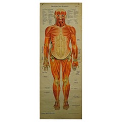
- Foldable Anatomical Wall Chart Depicting Human MusculatureLocated in Berghuelen, DEA rare 19th century anatomical wall chart depicting human musculature and internal organs. With removable multicolored human organs like lung, heart, l...Category
Early 20th Century German Victorian Prints
MaterialsPaper
- Antique Anatomical Wall Chart Depicting the Human SkeletonLocated in Berghuelen, DEA rare 19th century anatomical wall chart depicting the human skeleton. On the sides On the sides are detailed description in German language. The wall...Category
Early 20th Century German Victorian Prints
MaterialsPaper
- Antique Foldable Anatomical Wall Chart Depicting Human MusculatureLocated in Berghuelen, DEAntique Foldable Anatomical Wall Chart Depicting Human Musculature The rare 19th century anatomical wall chart depicts the human musculature and inter...Category
Early 20th Century German Victorian Prints
MaterialsWood, Paper
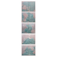
- Set of 5 Large Original Vintage Sea Charts, circa 1920Located in St Annes, Lancashire5 great maps or charts of the oceans I particularly like the color of these maps Unframed Original color By John Bartholomew and Co. Edinburgh Geographical Institute Published, ...Category
Vintage 1920s British Maps
MaterialsPaper
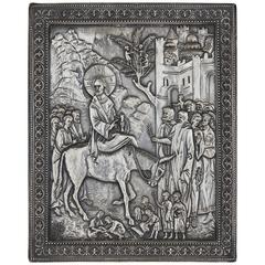
- Russian Silver Icon Depicting Christ Entering JerusalemLocated in London, GBOf rectangular shape, the silver moulded to depict the iconic Biblical scene. This exquisite Russian silver icon, depicting the famous moment of...Category
Antique Late 19th Century Russian Decorative Art
MaterialsSilver
- Anatomical Wall Chart Depicting the Human Lymphatic and Blood VesselsLocated in Berghuelen, DEA rare 19-carat anatomical wall chart depicting the human lymphatic and blood vessels. On the sides with detailed description in German language. Print...Category
Early 20th Century German Victorian Prints
MaterialsPaper