Items Similar to Antique Map of the Area centered on the Rhine River, Germany
Want more images or videos?
Request additional images or videos from the seller
1 of 6
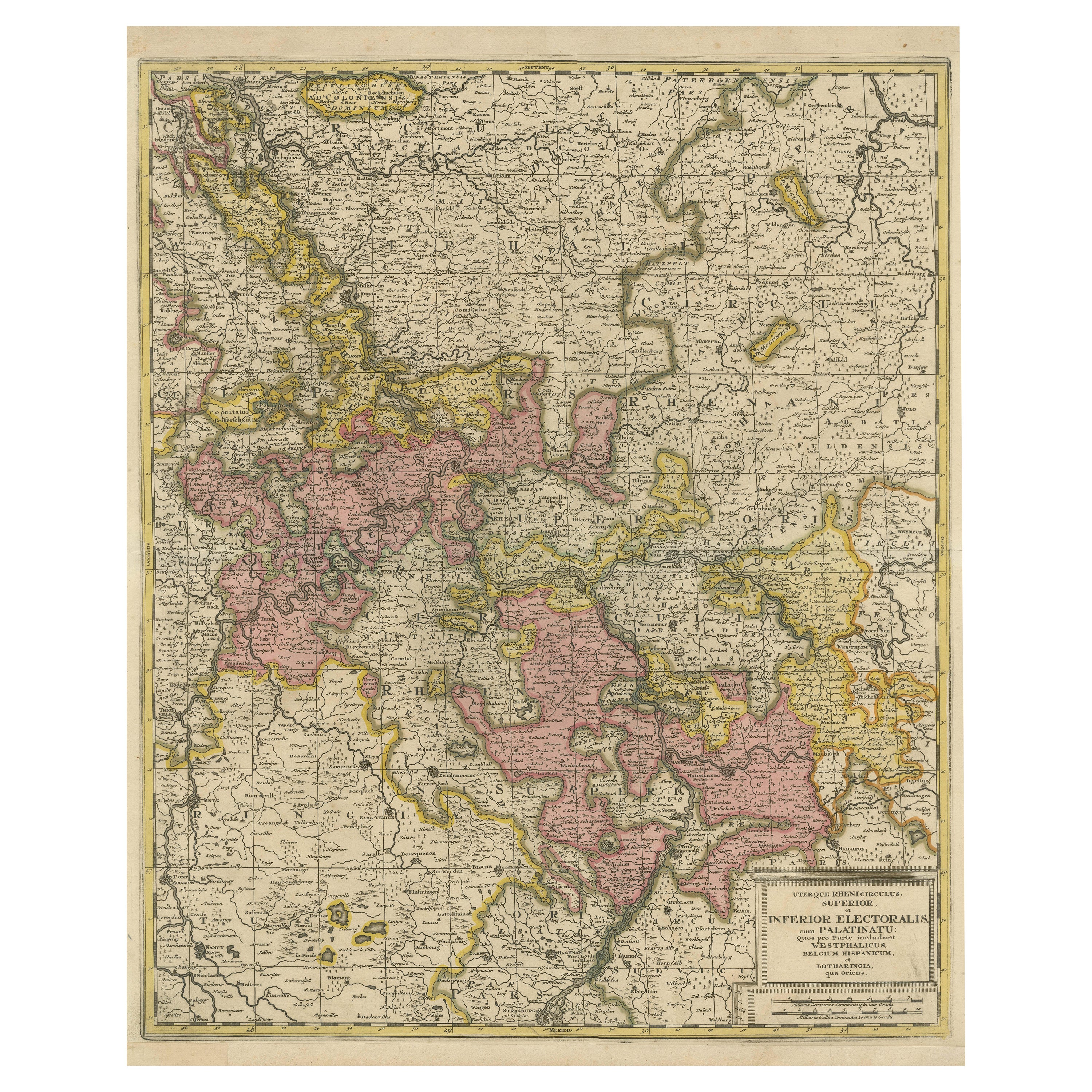
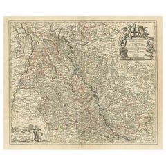
Antique Map of the Area centered on the Rhine River, Germany
About the Item
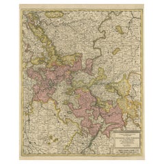
Antique map titled 'Uterque Rheni Circulus Superior (..)'. Fine old color map of the area centered on the Rhine River, from Strassbourg to Wesel and Duisburg, Germany. With cities highlighted in red. The map also covers a large stretch of the Moselle River (from Nancy to Coblentz) and the Main River, from Lohr am Main to Mainz.
Published by Gerard Valk, circa 1700. Valk’s maps are known for their high quality engraving and coloring.
- Dimensions:Height: 25.04 in (63.6 cm)Width: 20.48 in (52 cm)Depth: 0.02 in (0.5 mm)
- Materials and Techniques:
- Period:
- Date of Manufacture:c.1700
- Condition:Original/contemporary hand coloring. Original folding line. General age-related toning. Minor wear and soiling. Blank verso. Please study image carefully.
- Seller Location:Langweer, NL
- Reference Number:
About the Seller
5.0
Platinum Seller
These expertly vetted sellers are 1stDibs' most experienced sellers and are rated highest by our customers.
Established in 2009
1stDibs seller since 2017
1,933 sales on 1stDibs
Typical response time: <1 hour
- ShippingRetrieving quote...Ships From: Langweer, Netherlands
- Return PolicyA return for this item may be initiated within 14 days of delivery.
More From This SellerView All
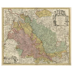
- Antique Map of the Area centered on the Rhine River with original coloringLocated in Langweer, NLAntique map titled 'Uterque Rheni Circulus Superior (..)'. Fine old color map of the area centered on the Rhine River, from Strassbourg to Wesel and Duisburg, Germany. The map also c...Category
Antique Early 18th Century Maps
MaterialsPaper
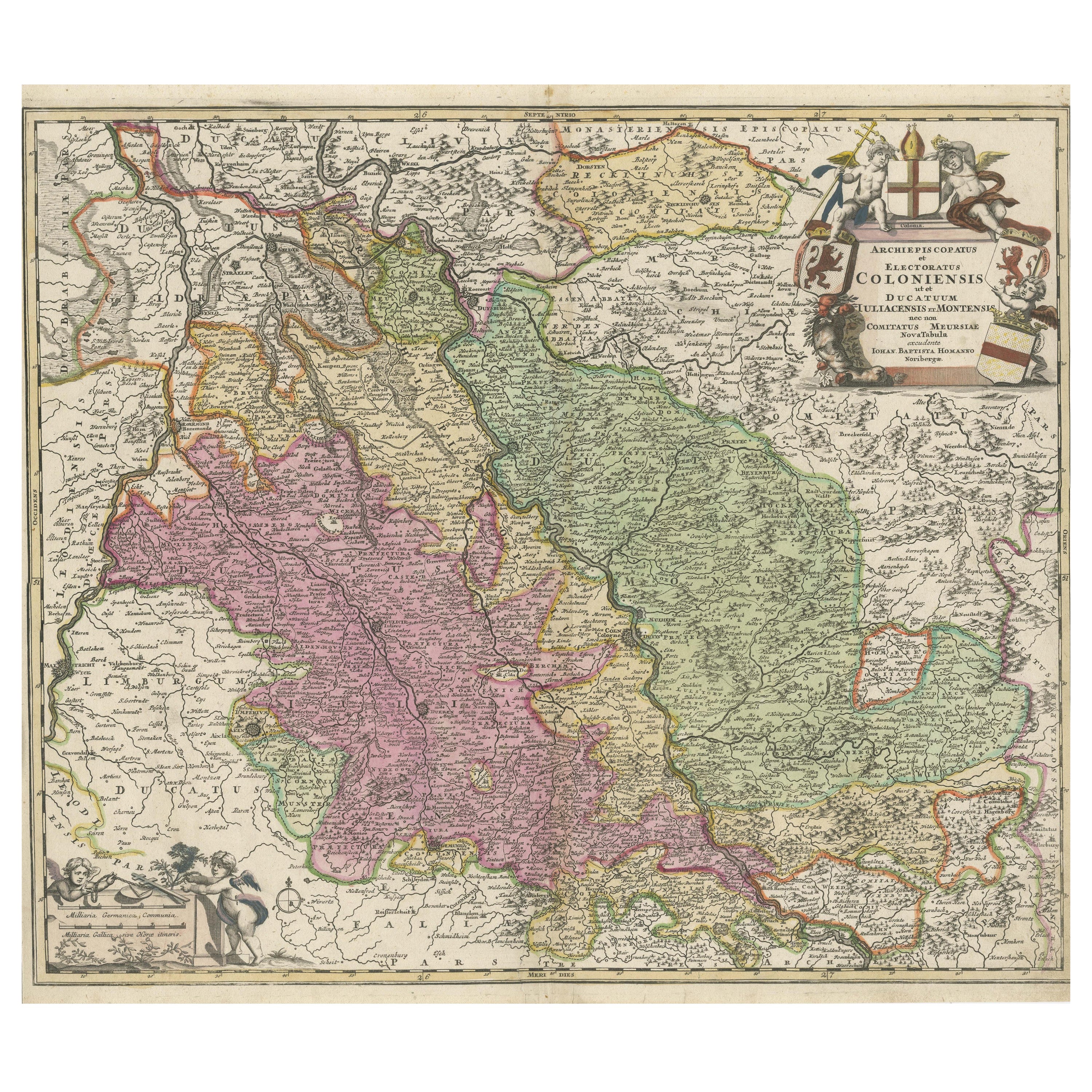
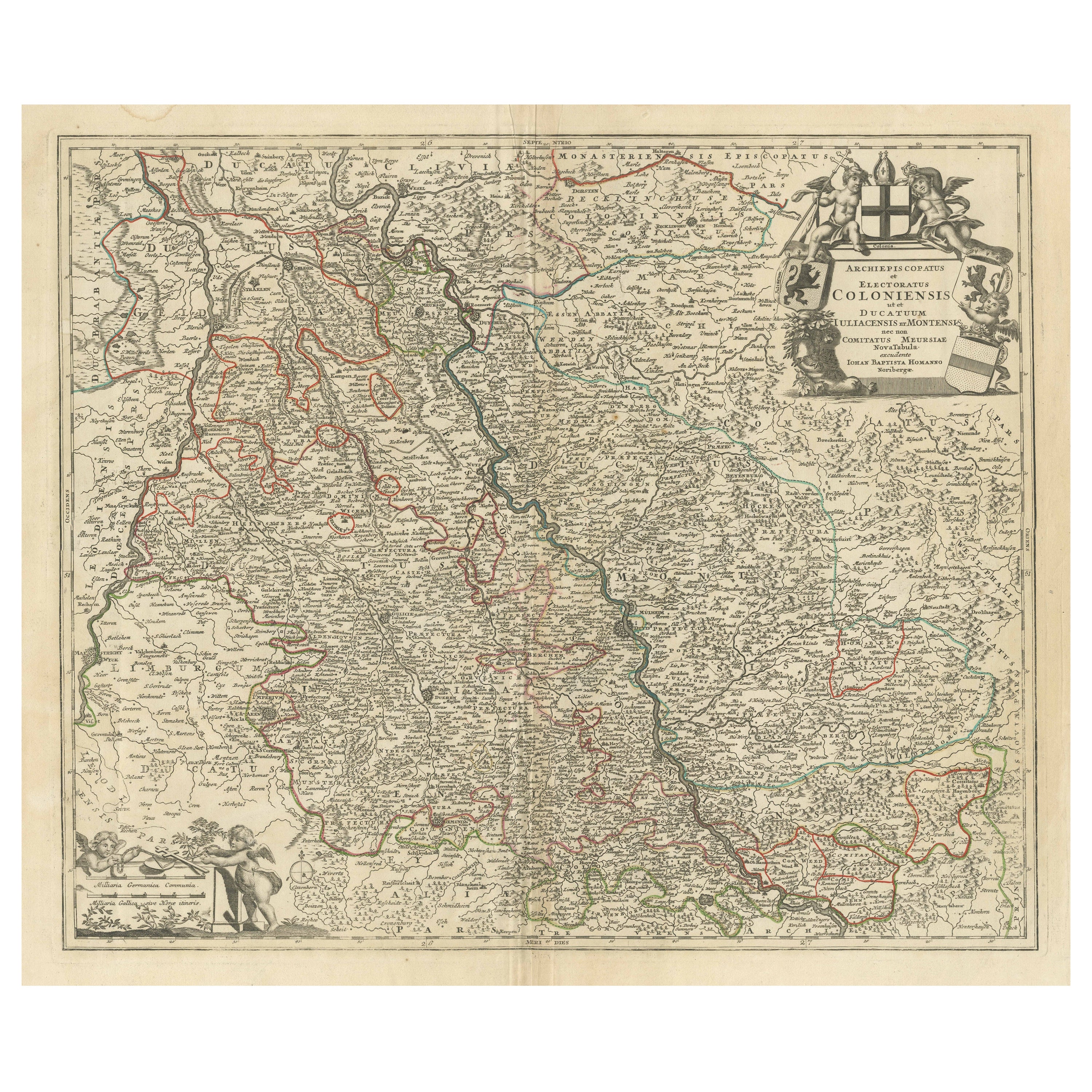
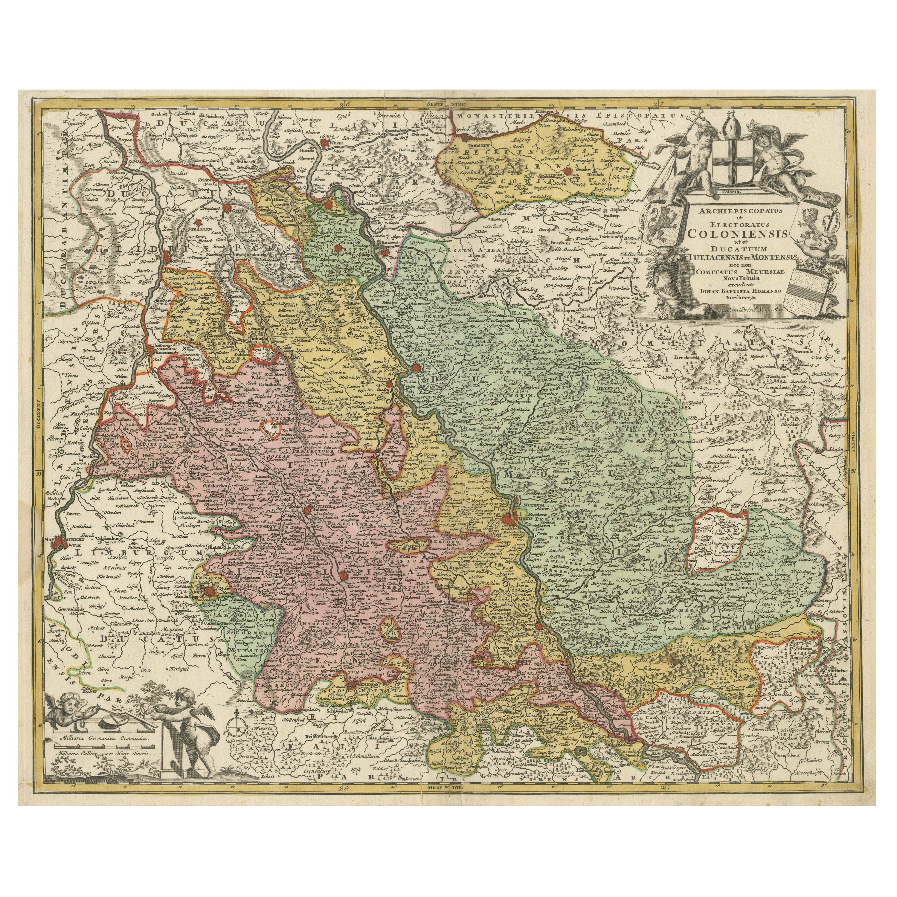
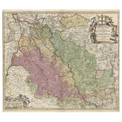
- Antique Map of the Rhine centered on Cologne, GermanyLocated in Langweer, NLAntique map titled 'Archiepsiscopatus et Electoratus Coloniensis (..)'. Original antique map of the Rhine river, centered on Cologne, Germany. The Rhine River cuts across this map fr...Category
Antique Early 18th Century Maps
MaterialsPaper
- Antique Map of the Rhine centered on Cologne, Germany, with outline coloringLocated in Langweer, NLAntique map titled 'Archiepsiscopatus et Electoratus Coloniensis (..)'. Original antique map of the Rhine river, centered on Cologne, Germany. The Rhine River cuts across this map fr...Category
Antique Early 18th Century Maps
MaterialsPaper
- Antique Map of the Rhine centered on Cologne, Germany, with original coloringLocated in Langweer, NLAntique map titled 'Archiepsiscopatus et Electoratus Coloniensis (..)'. Original antique map of the Rhine river, centered on Cologne, Germany. The Rhine River cuts across this map fr...Category
Antique Early 18th Century Maps
MaterialsPaper
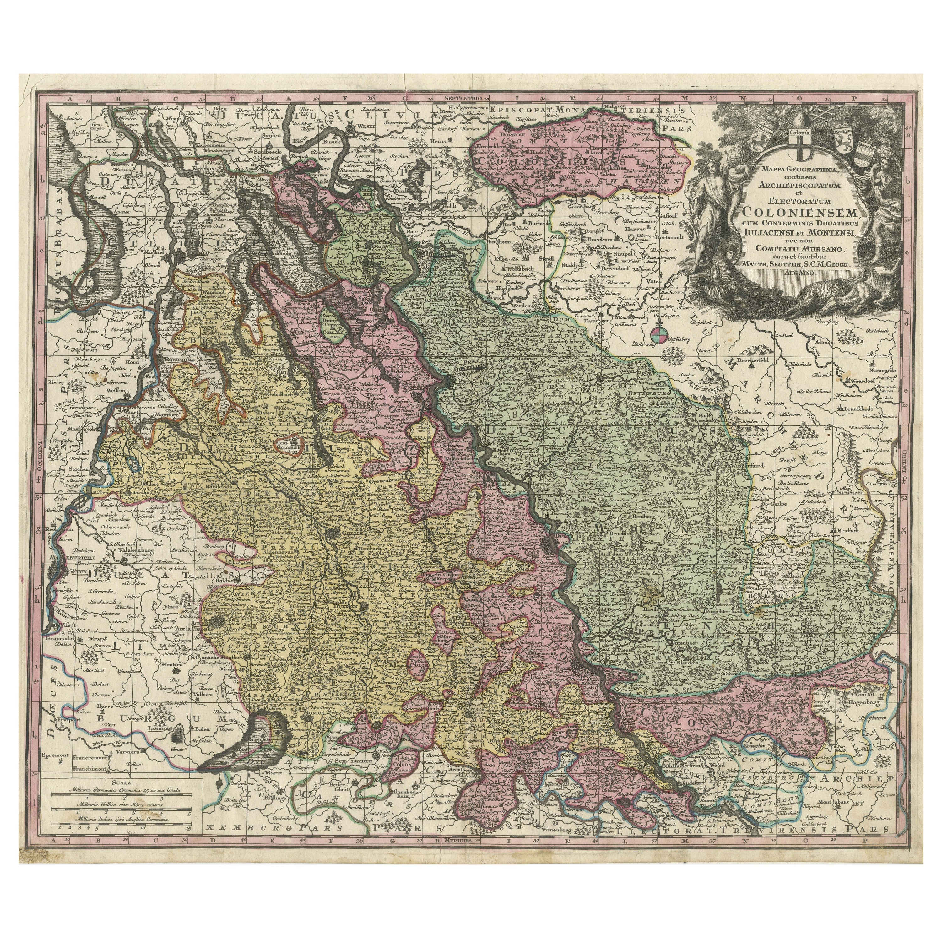
- Antique Map of both sides of the Central Rhine River, GermanyLocated in Langweer, NLAntique map titled 'Mappa Geographica continens Archiepiscopatum et Electoratum Coloniensem (..)'. Decorative map of region on either side of the Central Rhine River, showing Dusseld...Category
Antique Mid-18th Century Maps
MaterialsPaper
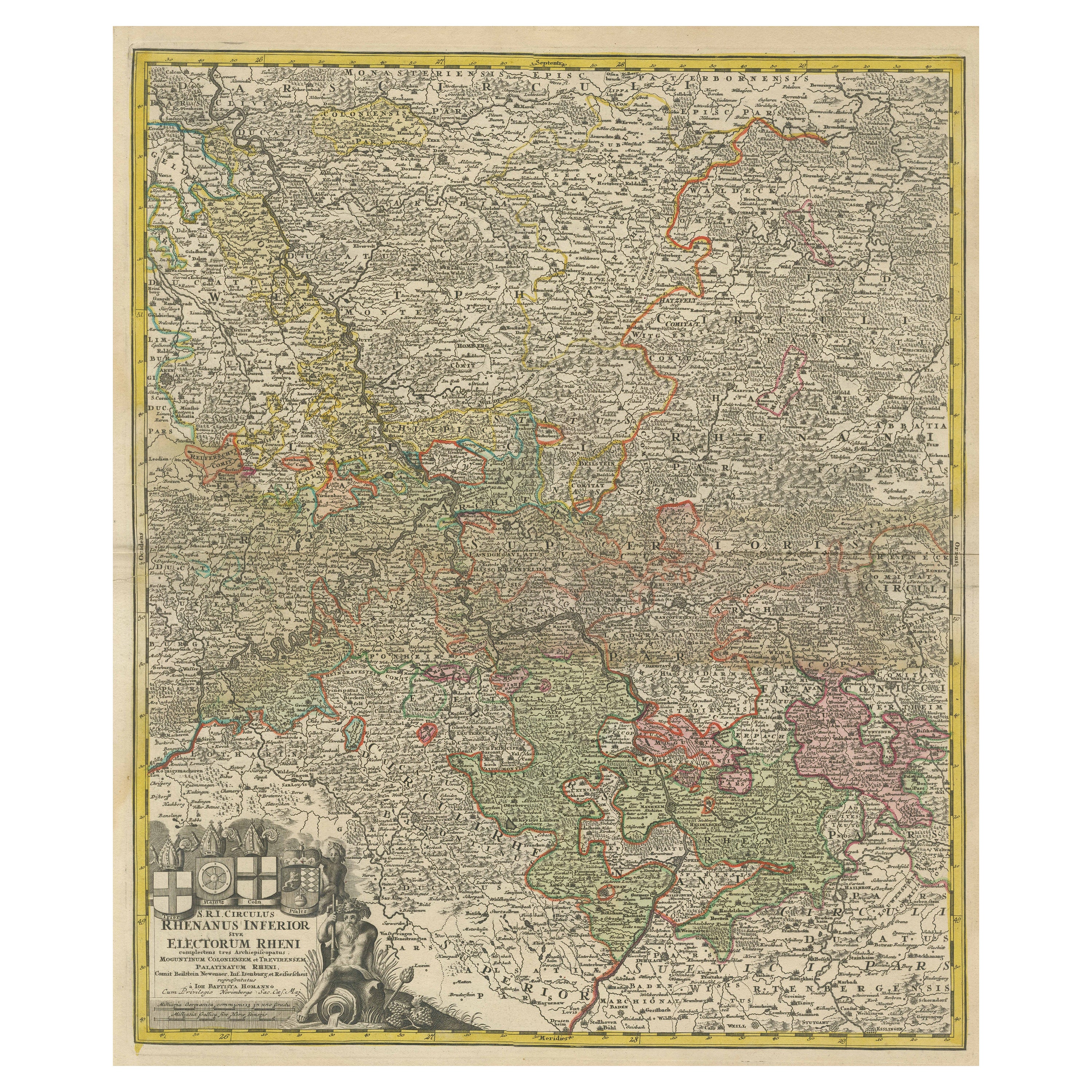
- Detailed Antique Map of the Lower Rhine region, GermanyLocated in Langweer, NLAntique map titled 'S.R.I. Circulus Rhanus Inferior sive Electorum Rheni (..)'. Detailed map of the Lower Rhine region, Germany. The title cartouche in the upper left quadrant featur...Category
Antique Mid-18th Century Maps
MaterialsPaper
You May Also Like
- Germany West of the Rhine: A Hand-colored 18th Century Map by de WitBy Frederick de WitLocated in Alamo, CAThis original 18th century hand-colored map of the county of Moers, Germany entitled "Illustrissimo Celsissmo Principi GUILIELMO HENRICO D.G. Arausionum Principi Domino suo Clementis...Category
Antique Early 18th Century Dutch Maps
MaterialsPaper
- Antique Oarsman's Map of the River Thames, English, Cartography, Published 1912Located in Hele, Devon, GBThis is an antique copy of The Oarsman's and Angler's Map of the River Thames - New Edition. An English, bound map book, published in English by Edward Stanford, London, this new edi...Category
Early 20th Century British Other Books
MaterialsPaper
- Vintage "View of the Center of Paris Taken from the Air" Lithograph MapLocated in San Diego, CAA very stylish "View of the Center of Paris Taken from the Air" lithograph map published by the Paris Ministry of Tourism, circa early 1950s. The piece measures 27" x 43" and shows...Category
20th Century French Mid-Century Modern Prints
MaterialsPaper
- 1861 Topographical Map of the District of Columbia, by Boschke, Antique MapLocated in Colorado Springs, COPresented is an original map of Albert Boschke's extremely sought-after "Topographical Map of the District of Columbia Surveyed in the Years 1856 ...Category
Antique 1860s American Historical Memorabilia
MaterialsPaper
- East German MapBy VEB Hermann HaackLocated in Baltimore, MDA brilliantly colourful map of the Leipzig, Karl Marx Stadt and Dresden area in the former German Democratic Republic by VEB Hermann Haack of Gotha.Category
Vintage 1970s German Maps
- Set of 4 Antique Geographical Maps French-German War 1870-71Located in Casale Monferrato, ITElegant late 19th century set of four antique geographical maps relating to the positioning of the armies in the Franco-German War 1870-71. A...Category
Antique 1890s Italian Maps
MaterialsPaper


Recently Viewed
View AllMore Ways To Browse
Map Of Ural
Rail Road Collectables
Australasia Antique Map
The Grand Mogol
Antique Map Austro Hungarian
Antique Montana Map
Map Of Montana
Mauritius Antique Map
Manchester Antique Map
Georgetown Map
Guatemala Antique Map
Map Montana
Montana Maps
Antique Chesapeake Bay Map
Antique Map Of Chesapeake Bay
J Thayer
Indie Vintage
Paraguay Antique Map