Items Similar to Antique Map of the Rhine centered on Cologne, Germany, with original coloring
Want more images or videos?
Request additional images or videos from the seller
1 of 6
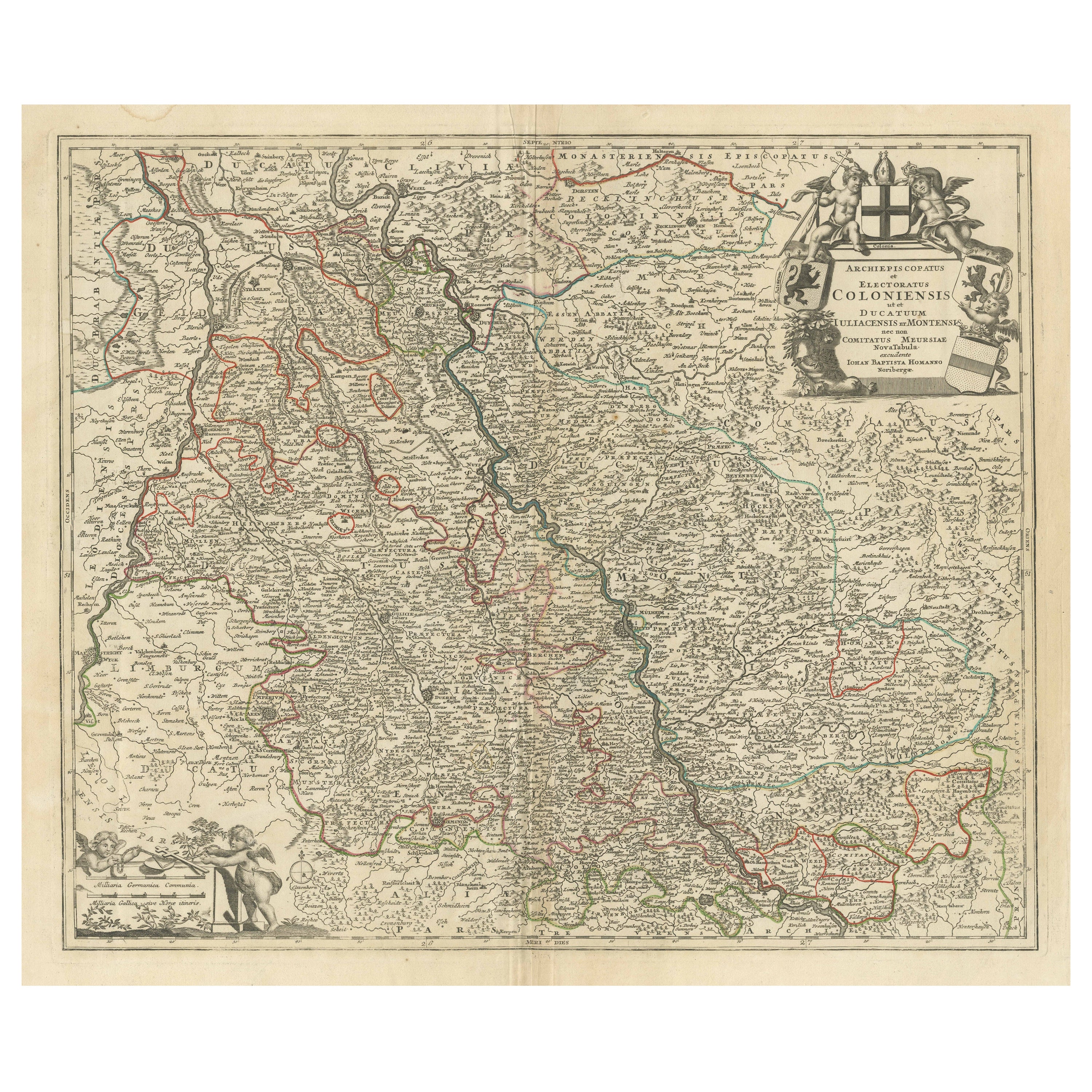
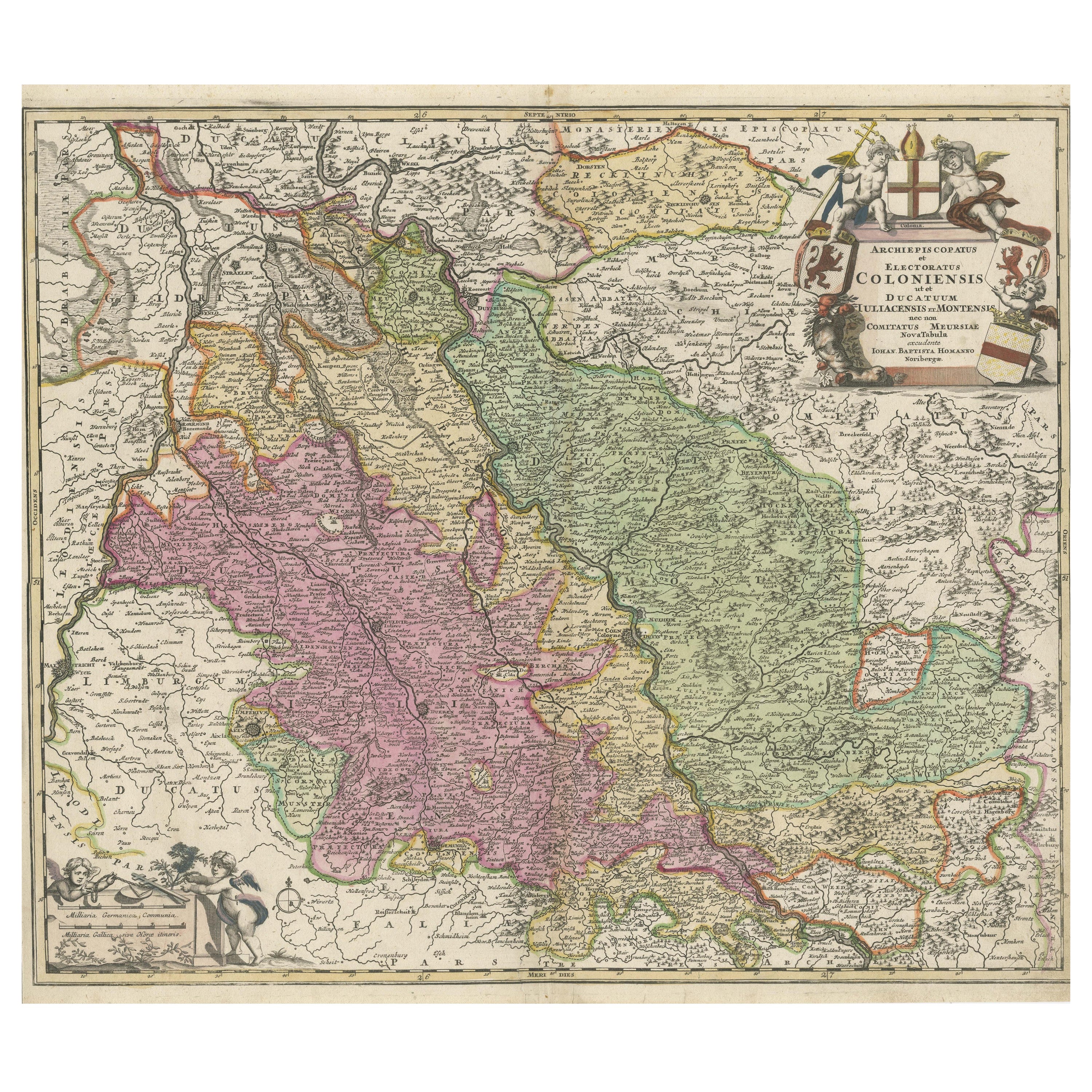
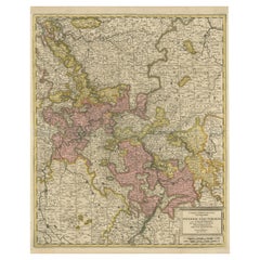
Antique Map of the Rhine centered on Cologne, Germany, with original coloring
About the Item
Antique map titled 'Archiepsiscopatus et Electoratus Coloniensis (..)'. Original antique map of the Rhine river, centered on Cologne, Germany. The Rhine River cuts across this map from south of Bonn, centered on Cologne and north to Wesel. The map extends into The Netherlands and Belgium. Loaded with topographic information, the map names hundreds of cities, towns, rivers and lakes. Putti display coats of arms around the decorative title cartouche. Published by J.B. Homann.
Johann Baptist Homann was born 1664 in Oberkammlach. He founded his business 1702 in Nuremberg, Germany. After a long period of Dutch domination in map publishing, the Homann publishing house became the most important map and atlas producer in Germany. He became a member of the Academy of Science in Berlin just after he published his first atlas in 1707. After his death 1724 in Nuremberg, the company was continued by his son Johann Christoph. The publishing firm was bequeathed to his heirs after his death in 1730 and was traded under the name Homann Heirs until the next century.
- Dimensions:Height: 20.16 in (51.2 cm)Width: 24.14 in (61.3 cm)Depth: 0.02 in (0.5 mm)
- Materials and Techniques:
- Period:
- Date of Manufacture:c.1720
- Condition:Repaired: Small closed tear bottom left near folding line. General age-related toning. Original/contemporary hand coloring. Original folding line. Small closed tear bottom left near folding line. Minor wear and soiling. Blank verso. Please study image carefully.
- Seller Location:Langweer, NL
- Reference Number:
About the Seller
5.0
Platinum Seller
These expertly vetted sellers are 1stDibs' most experienced sellers and are rated highest by our customers.
Established in 2009
1stDibs seller since 2017
1,946 sales on 1stDibs
Typical response time: <1 hour
- ShippingRetrieving quote...Ships From: Langweer, Netherlands
- Return PolicyA return for this item may be initiated within 14 days of delivery.
More From This SellerView All
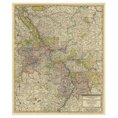
- Antique Map of the Rhine centered on Cologne, Germany, with outline coloringLocated in Langweer, NLAntique map titled 'Archiepsiscopatus et Electoratus Coloniensis (..)'. Original antique map of the Rhine river, centered on Cologne, Germany. The Rhine River cuts across this map fr...Category
Antique Early 18th Century Maps
MaterialsPaper
- Antique Map of the Rhine centered on Cologne, GermanyLocated in Langweer, NLAntique map titled 'Archiepsiscopatus et Electoratus Coloniensis (..)'. Original antique map of the Rhine river, centered on Cologne, Germany. The Rhine River cuts across this map fr...Category
Antique Early 18th Century Maps
MaterialsPaper
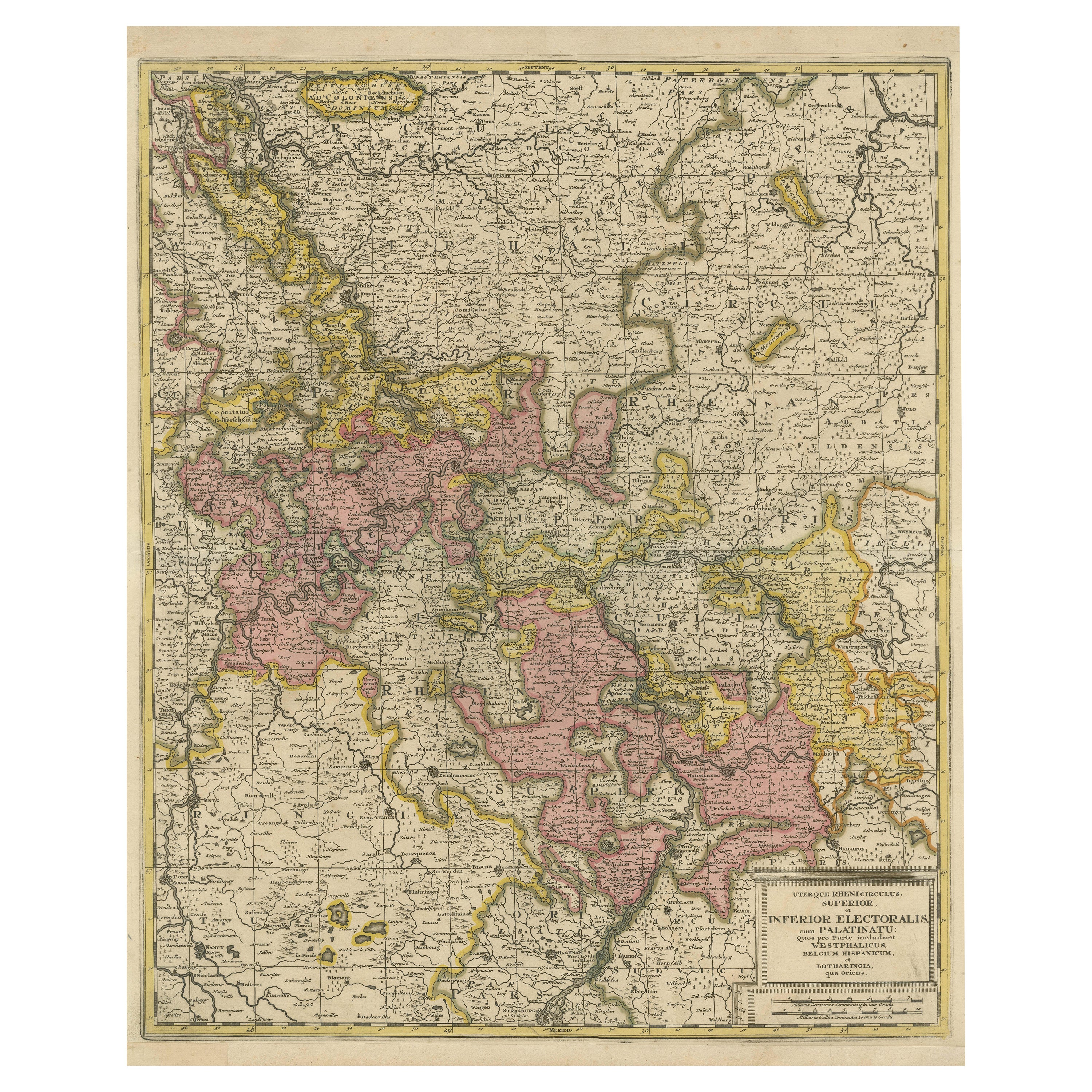
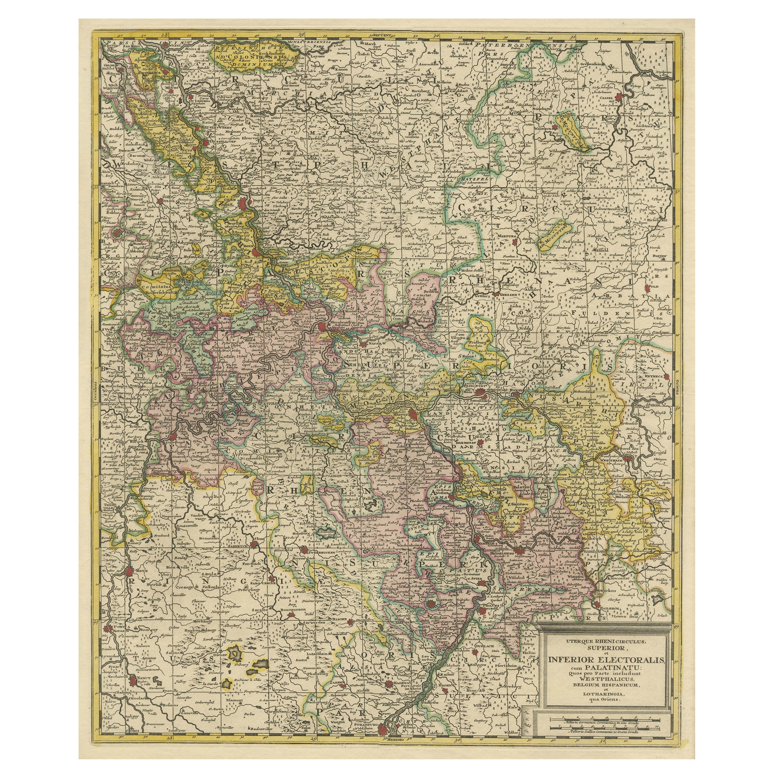
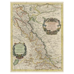
- Antique Map of the Area centered on the Rhine River with original coloringLocated in Langweer, NLAntique map titled 'Uterque Rheni Circulus Superior (..)'. Fine old color map of the area centered on the Rhine River, from Strassbourg to Wesel and Duisburg, Germany. The map also c...Category
Antique Early 18th Century Maps
MaterialsPaper
- Antique Map of the Area centered on the Rhine River, GermanyLocated in Langweer, NLAntique map titled 'Uterque Rheni Circulus Superior (..)'. Fine old color map of the area centered on the Rhine River, from Strassbourg to Wesel and Duisburg, Germany. With cities hi...Category
Antique Early 18th Century Maps
MaterialsPaper
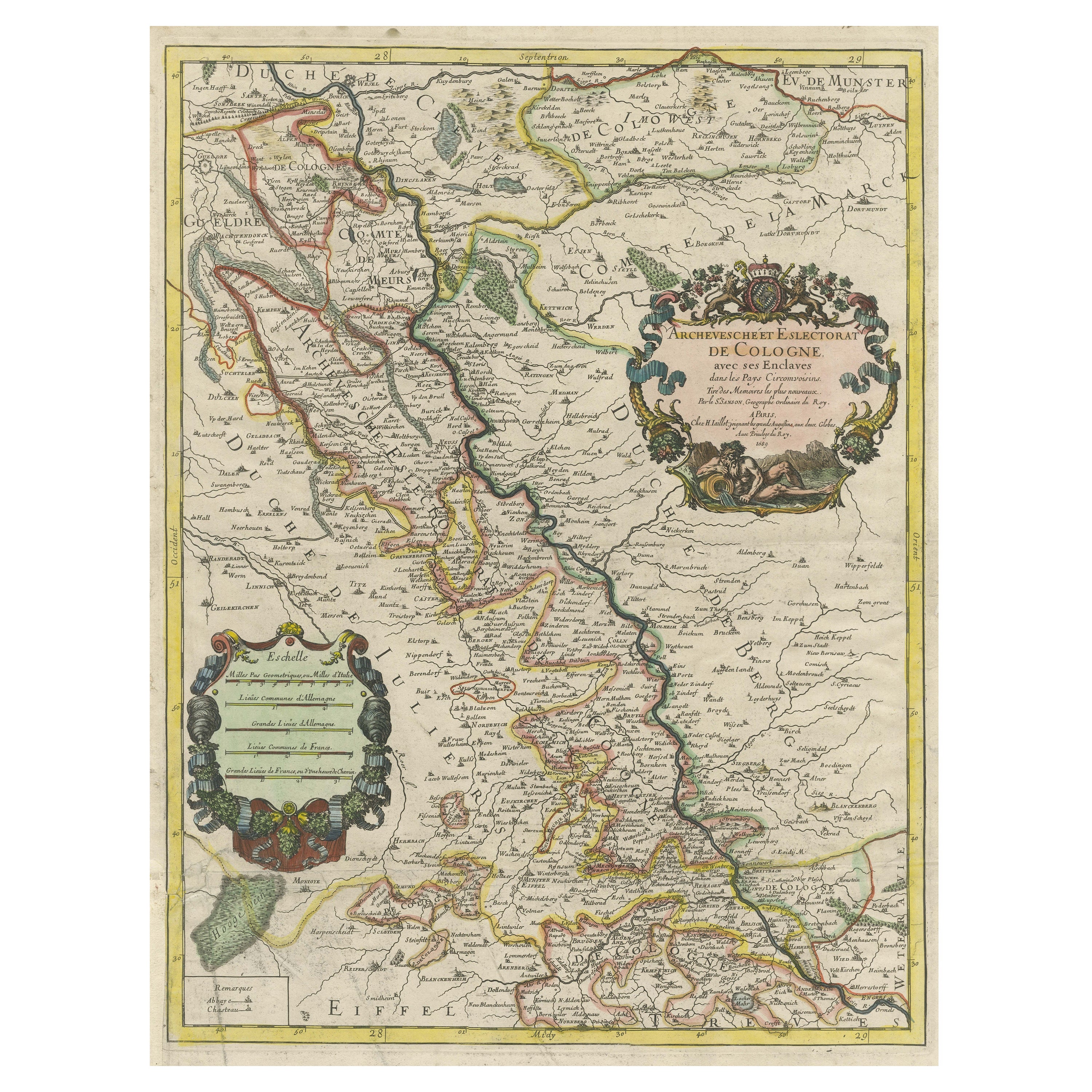
- Antique Map of the Archdiocese of Cologne, GermanyLocated in Langweer, NLAntique map titled 'Archevesche et Eslectorat de Cologne avec ses Enclaves'. Original old map of the Archdiocese of Cologne with the course of the Rhine from Andernach to Wesel with ...Category
Antique Late 17th Century Maps
MaterialsPaper
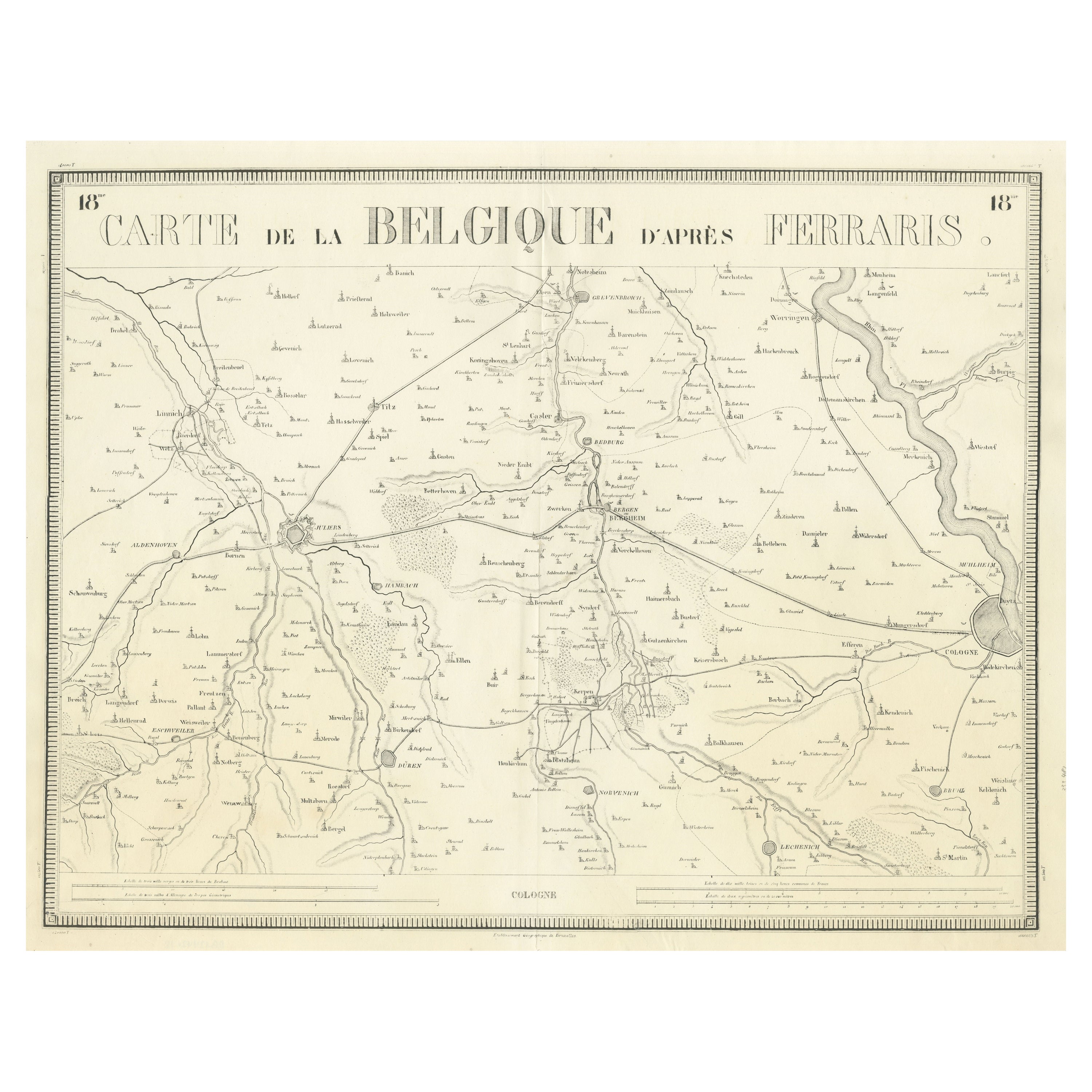
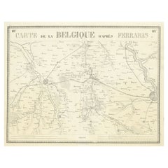
- Antique Map of the Region near Cologne, GermanyLocated in Langweer, NLAntique map titled 'Carte de la Belgique d'après Ferraris'. Original antique map of the region near Cologne, Germany. Cologne is the largest city of the German western state of North...Category
Antique Mid-19th Century Maps
MaterialsPaper
You May Also Like
- Germany West of the Rhine: A Hand-colored 18th Century Map by de WitBy Frederick de WitLocated in Alamo, CAThis original 18th century hand-colored map of the county of Moers, Germany entitled "Illustrissimo Celsissmo Principi GUILIELMO HENRICO D.G. Arausionum Principi Domino suo Clementis...Category
Antique Early 18th Century Dutch Maps
MaterialsPaper
- Large Original Antique Map of The World, Fullarton, C.1870Located in St Annes, LancashireGreat map of the World. Showing both hemispheres From the celebrated Royal Illustrated Atlas Lithograph. Original color. Published by Fullarton, Edinburgh, C.1870 Unframed. Rep...Category
Antique 1870s Scottish Maps
MaterialsPaper
- Original Antique Map of the American State of Washington, 1889Located in St Annes, LancashireGreat map of Washington Drawn and Engraved by W. & A.K. Johnston Published By A & C Black, Edinburgh. Original colour Unframed.Category
Antique 1880s Scottish Victorian Maps
MaterialsPaper
- Original Antique Map of the American State of Nevada, 1889Located in St Annes, LancashireGreat map of Nevada Drawn and Engraved by W. & A.K. Johnston Published By A & C Black, Edinburgh. Original colour Unframed.Category
Antique 1880s Scottish Victorian Maps
MaterialsPaper
- Original Antique Map of the American State of Oregon, 1889Located in St Annes, LancashireGreat map of Oregon Drawn and Engraved by W. & A.K. Johnston Published By A & C Black, Edinburgh. Original colour Unframed.Category
Antique 1880s Scottish Victorian Maps
MaterialsPaper
- Original Antique Map of Italy. C.1780Located in St Annes, LancashireGreat map of Italy Copper-plate engraving Published C.1780 Unframed.Category
Antique Early 1800s English Georgian Maps
MaterialsPaper


Recently Viewed
View AllMore Ways To Browse
Atlas Indu
Staffordshire Antique Map
Staffordshire Map
Antique Furniture Manitoba
Yugoslavia Map
Antique Maps Surrey
Antique Maps Of Puerto Rico
Cheshire Antique Map
Auge En Pierre
Montreal Map
Aigue Marine
Antique Furniture Perth Australia
Antique Maps Perth
Antique Route 66
Moldova Antique Map
Barbados Map
H Chatelain 1719
Nova Hollandia