Items Similar to Antique French Engraving of Mexico with Lots of Details, c.1780
Want more images or videos?
Request additional images or videos from the seller
1 of 5
Antique French Engraving of Mexico with Lots of Details, c.1780
About the Item
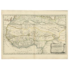
Antique map titled 'Partie Meridionale, de L'Ancien Mexique ou de la Nouvelle Espagne.'
Detailed map of Mexico, the Yucatan and Central America, prepared under the direction of Rigobert Bonne. Shows towns, rivers, mountains, lakes, etc. Detailed map of the region. Source unknown, to be determined.
Artists and Engravers: Rigobert Bonne (1727-1795 ) was one of the most important cartographers of the late 18th century. In 1773 he succeeded Jacques Bellin as Royal Cartographer to France in the office of the Hydrographer at the Depôt de la Marine. Working in his official capacity Bonne compiled some of the most detailed and accurate maps of the period. Bonne's work represents an important step in the evolution of the cartographic ideology away from the decorative work of the 17th and early 18th century towards a more detail oriented and practical aesthetic. With regard to the rendering of terrain Bonne maps bear many stylistic similarities to those of his predecessor, Bellin. However, Bonne maps generally abandon such common 18th century decorative features such as hand coloring, elaborate decorative cartouches, and compass roses. While mostly focusing on coastal regions, the work of Bonne is highly regarded for its detail, historical importance, and overall aesthetic appeal.
Artist: Rigobert Bonne (1727-1795 ) was one of the most important cartographers of the late 18th century. In 1773 he succeeded Jacques Bellin as Royal Cartographer to France in the office of the Hydrographer at the Depôt de la Marine. Working in his official capacity Bonne compiled some of the most detailed and accurate maps of the period. Bonne's work represents an important step in the evolution of the cartographic ideology away from the decorative work of the 17th and early 18th century towards a more detail oriented and practical aesthetic. With regard to the rendering of terrain Bonne maps bear many stylistic similarities to those of his predecessor, Bellin. However, Bonne maps generally abandon such common 18th century decorative features such as hand coloring, elaborate decorative cartouches, and compass roses. While mostly focusing on coastal regions, the work of Bonne is highly regarded for its detail, historical importance, and overall aesthetic appeal.
Condition: Good, given age. Slight discolouration middle fold. Original folds as issued. General age-related toning and/or occasional minor defects from handling. Please study image carefully.
Date: c.1780
Overall size: 38 x 26 cm.
Image size: 31.8 x 22 cm.
- Dimensions:Height: 14.97 in (38 cm)Width: 10.24 in (26 cm)Depth: 0 in (0.01 mm)
- Materials and Techniques:
- Period:
- Date of Manufacture:circa 1780
- Condition:
- Seller Location:Langweer, NL
- Reference Number:
About the Seller
5.0
Platinum Seller
These expertly vetted sellers are 1stDibs' most experienced sellers and are rated highest by our customers.
Established in 2009
1stDibs seller since 2017
1,919 sales on 1stDibs
Typical response time: <1 hour
- ShippingRetrieving quote...Ships From: Langweer, Netherlands
- Return PolicyA return for this item may be initiated within 14 days of delivery.
More From This SellerView All
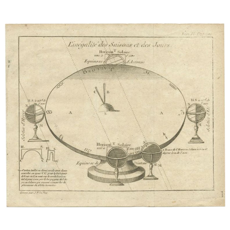
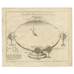
- Antique Original Engraving of Seasons by Le Bas, C.1780Located in Langweer, NLAntique astronomy print titled 'L'inégalité des Saisons et des Jours'. Interesting print explaining why there is an inequality in the length of days and seasons. Source unknown, to b...Category
Antique 18th Century Prints
MaterialsPaper
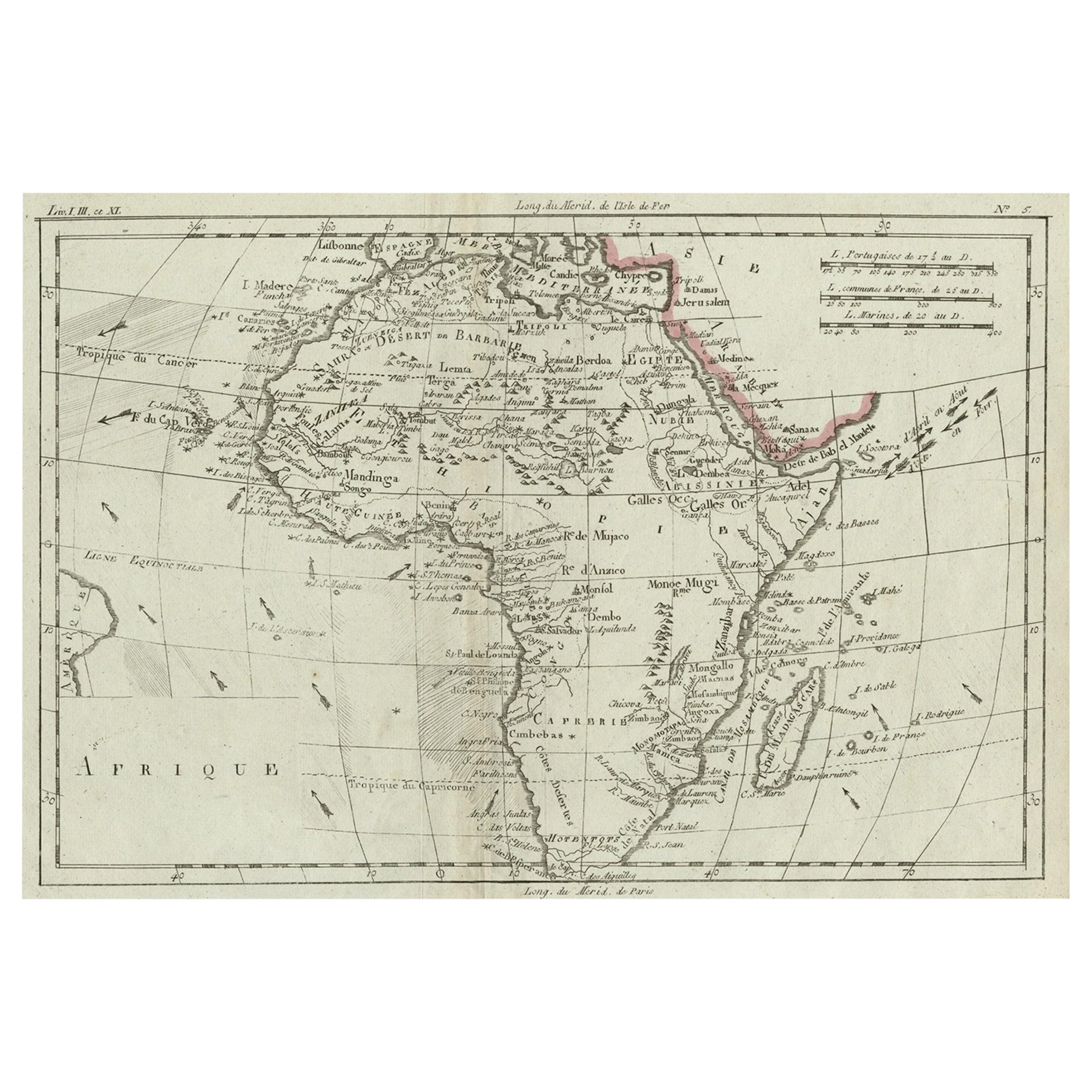
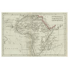
- Antique Map of Africa with Ocean Currents and Other Details, C.1780Located in Langweer, NLAntique map titled 'Afrique.' Detailed map of Africa, showing towns, rivers, some topographical features, ocean currents, ports and political boundaries. Source unknown, to be determ...Category
Antique 18th Century Maps
MaterialsPaper
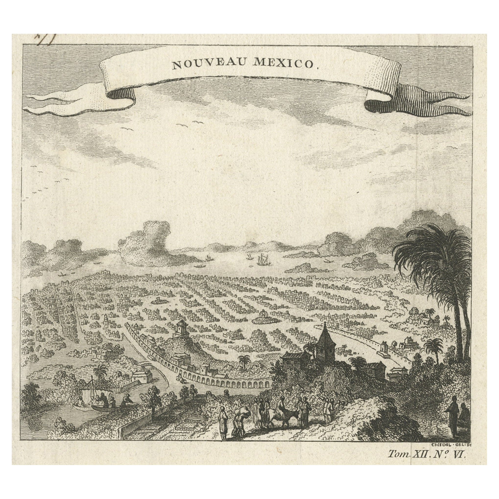
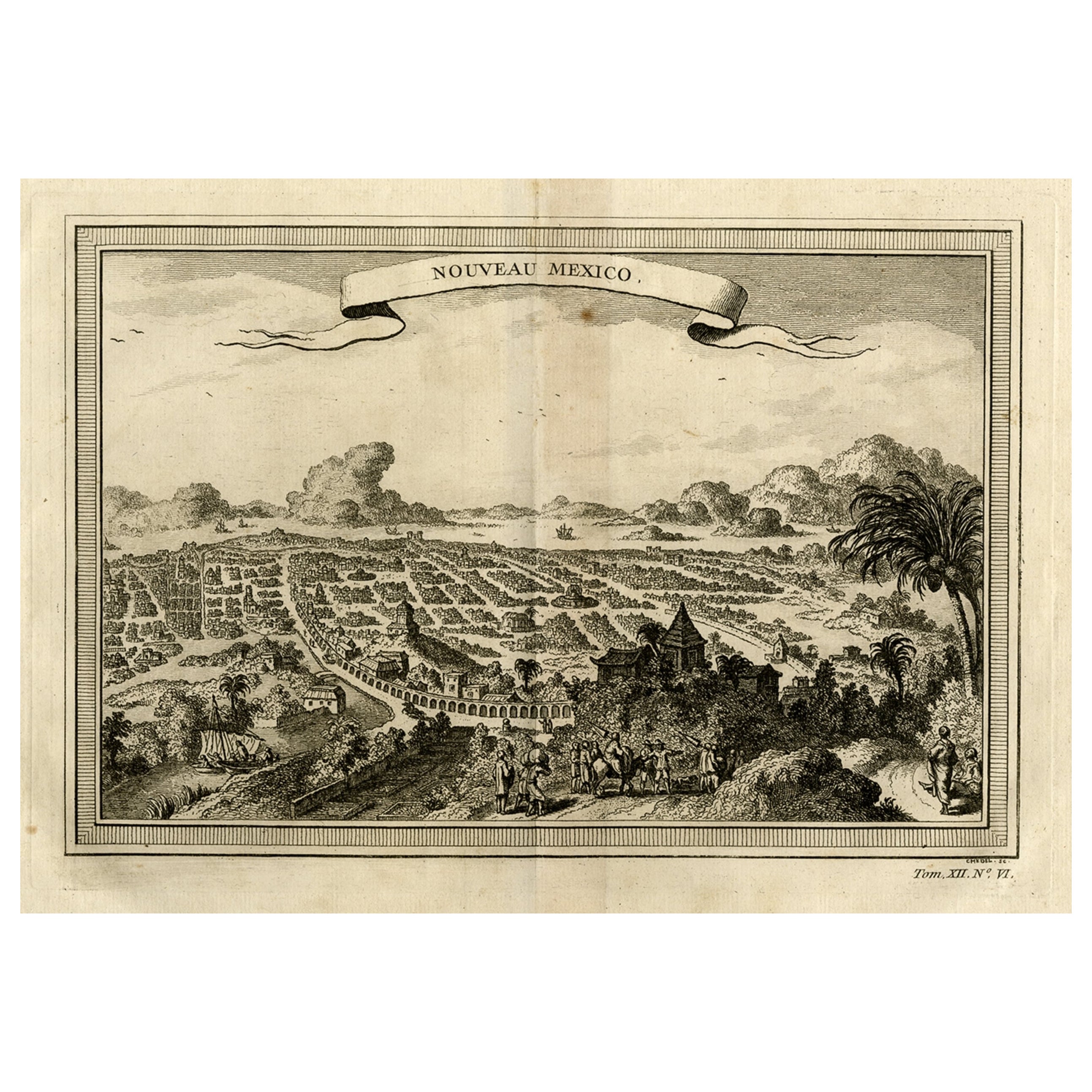
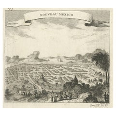
- Antique Copper Engraving with a Panoramic View of Mexico City, ca.1760Located in Langweer, NLDescription: Antique print titled 'Nouveau Mexico'. Copper engraving with a panoramic view of Mexico city. Source unknown, to be determined. Artists and Engravers: Engraved af...Category
Antique 1760s Maps
MaterialsPaper
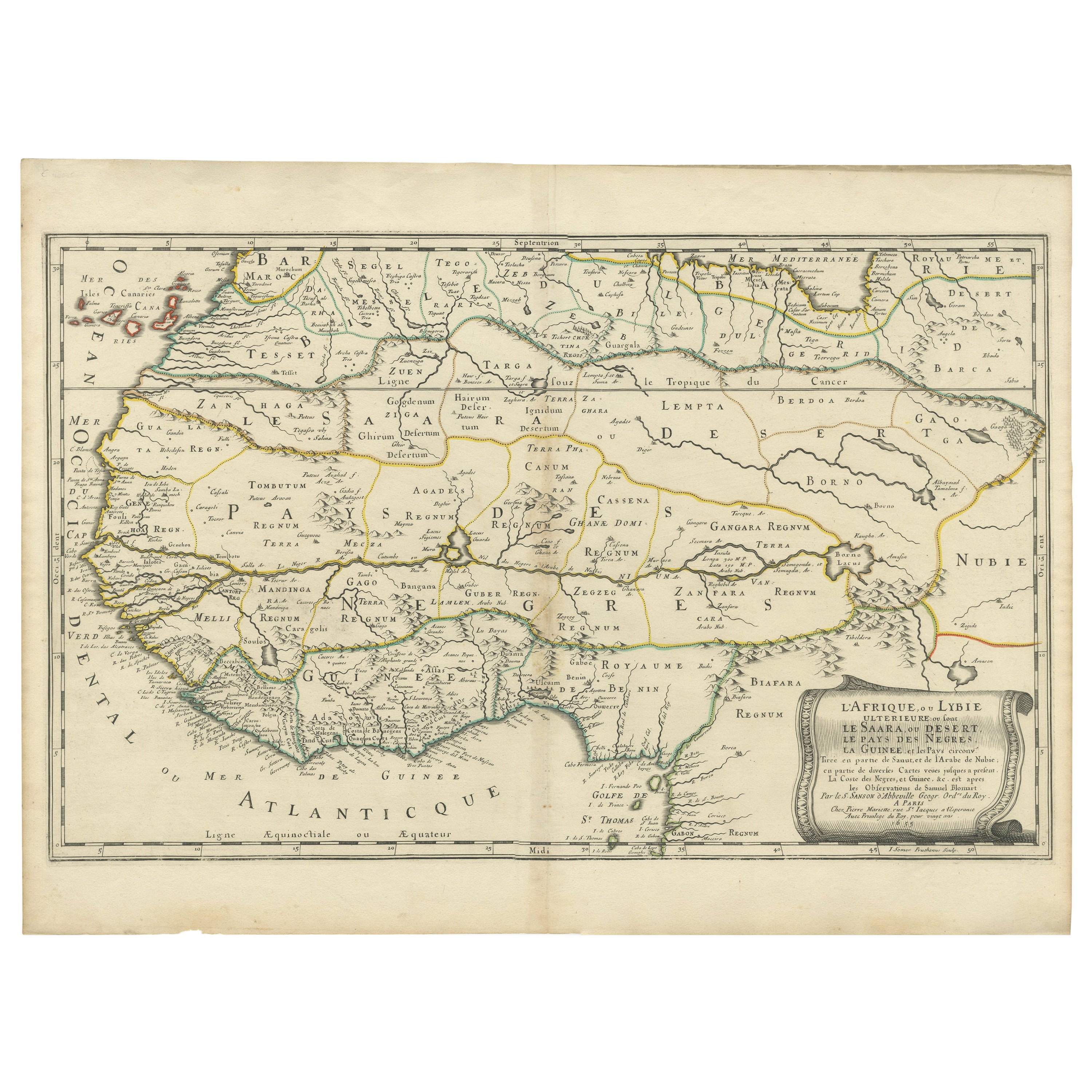
- Attractive Antique Map of Western Africa with Lots of Details on the Coast, 1655Located in Langweer, NLTitle: "L'Afrique, ou Lybie ulterieure ou sont le Saara, ou Desert, le pays des negres, la Guinee, et les Pays circonv. Tirée en partie de Sanut, et de l'Arabe de Nubie; en partie de diverses Cartes veües jusques a present". Handsome map of Western Africa filled with information, much of it spurious, in the Sahara Desert, the Niger River and the coast of Guinea. Of particular interest are several incomplete rivers in the desert regions that appear and then disappear. The map is beautifully engraved with a title cartouche fashioned in the form of an oriental carpet. The map shows a fantastic level of detail near the coastlines, which extends into legend and Ptolemaic myth in the interior of the continent. Detail is particularly extensive in Guinea and the Gold and Ivory Coasts. The Niger River is traced to its Malian lakes. The Mediterranean is barely visible in the northern part of the map. This map incorporates the discoveries made by Samuel Blommaert, who was director of the Dutch West Indies Company, in addition to traveling extensively to Africa and settling the oldest land deed...Category
Antique 1650s Maps
MaterialsPaper
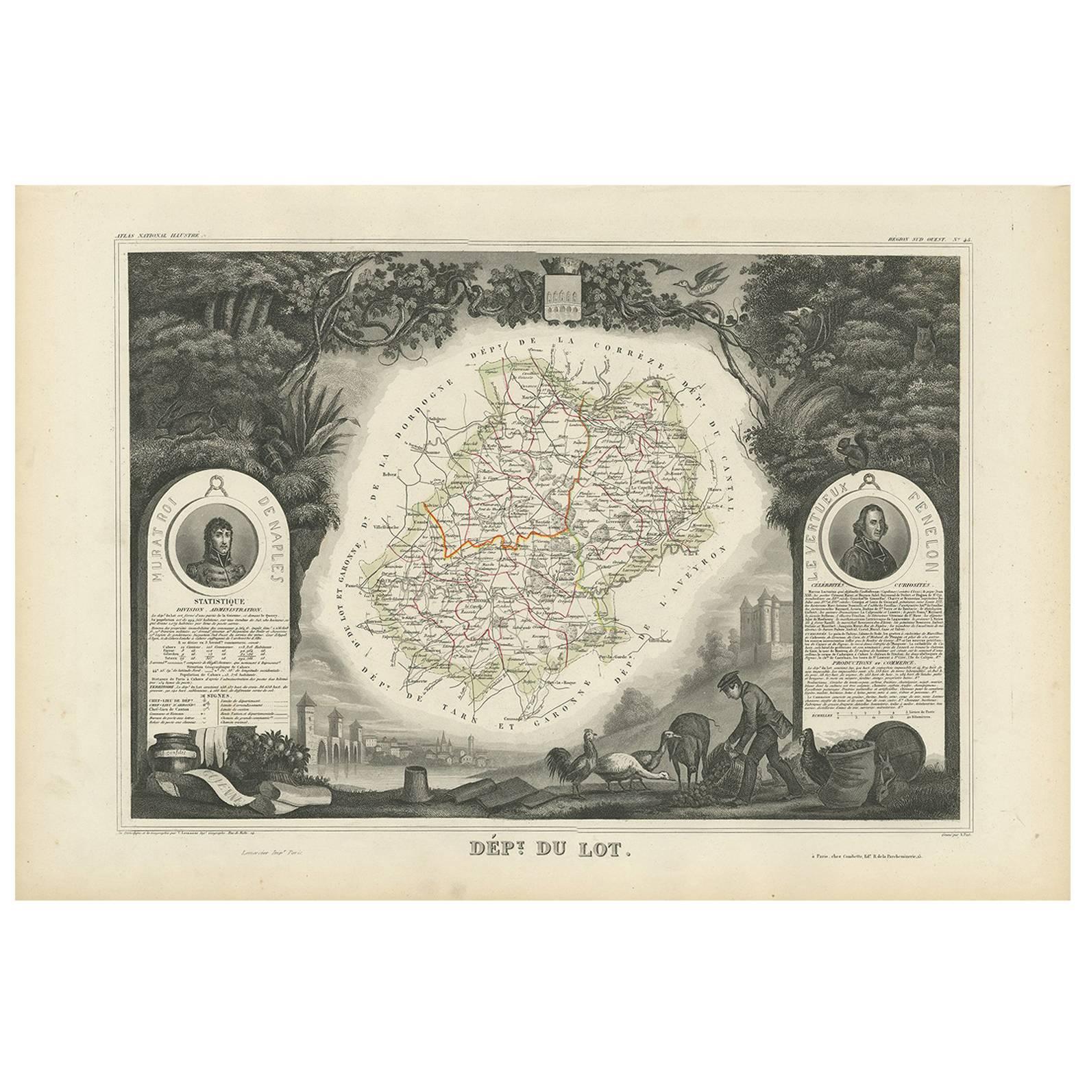
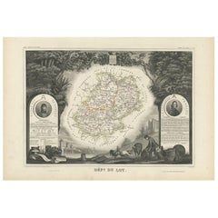
- Antique Map of Lot ‘France’ by V. Levasseur, 1854Located in Langweer, NLAntique map titled 'Dépt. du Lot'. Map of the French department of Lot, France. This area of France is known for its production of Cahors wine, a powerful red wine, often “harsh when...Category
Antique Mid-19th Century Maps
MaterialsPaper
- Copper Engraving with a Panoramic View of Mexico City, 1754Located in Langweer, NLAntique print titled 'Nouveau Mexico'. Copper engraving with a panoramic view of Mexico city. This print originates from 'Histoire générale des voyages, ou nouvelle collection de...Category
Antique 1750s Prints
MaterialsPaper

You May Also Like
- Original Antique Map of Italy. C.1780Located in St Annes, LancashireGreat map of Italy Copper-plate engraving Published C.1780 Unframed.Category
Antique Early 1800s English Georgian Maps
MaterialsPaper

- Original Antique Map of Asia. C.1780Located in St Annes, LancashireGreat map of Asia Copper-plate engraving Published C.1780 Two small worm holes to right side of map Unframed.Category
Antique Early 1800s English Georgian Maps
MaterialsPaper

- Original Antique Map of India. C.1780Located in St Annes, LancashireGreat map of India Copper-plate engraving Published C.1780 Three small worm holes to right side of map and one bottom left corner Unframed.Category
Antique Early 1800s English Georgian Maps
MaterialsPaper

- Original Antique Map of South America. C.1780Located in St Annes, LancashireGreat map of South America Copper-plate engraving Published C.1780 Two small worm holes to left side of map Unframed.Category
Antique Early 1800s English Georgian Maps
MaterialsPaper
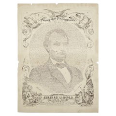
- 1865 Emancipation Proclamation with Abraham Lincoln Portrait, Antique EngravingLocated in Colorado Springs, COPresented is an elaborate engraved broadside presentation of both the preliminary and final Emancipation Proclamations, dated September 22, 1...Category
Antique 1860s American Historical Memorabilia
MaterialsPaper
- 1864 "Proclamation of Emancipation, " Antique Engraving by Charles ShoberLocated in Colorado Springs, COThis 1865 engraving features the Emancipation Proclamation in elaborate calligraphic text, with five patriotic vignettes and a small portrait...Category
Antique 1860s American Historical Memorabilia
MaterialsPaper


Recently Viewed
View AllMore Ways To Browse
Antique Furniture Lot
Rose Engraving
Roses Engravings
18th C American
Mexican C
1795 French
18th C American Furniture
Unknown Circa 1780
Mexican 18th Century
French 17th C Furniture
Late 18th Century Antique American
Mexican 18th Century Furniture
Mexican Map
Mexico Map
Marine Collectibles
Maps Of Mexico
Marine 18th Century
French Map Of America