French Map Of America
4
to
48
333
214
265
149
129
120
96
83
73
67
46
43
42
26
26
25
25
24
23
20
18
17
14
13
11
11
11
10
9
9
8
7
5
5
4
4
4
4
4
4
4
3
3
3
3
2
2
2
1
1
1
1
1
1
1
1
1
42
42
39
16
12
Sort By
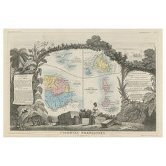
Original Steel Engraved Map of French Colonies in America, 1854
Located in Langweer, NL
local animals, produce and activities of the various French Colonies in America. This map originates
Category
Antique Mid-19th Century Maps
Materials
Paper
Free Shipping
H 13.12 in W 18.71 in D 0.02 in
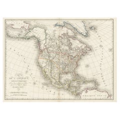
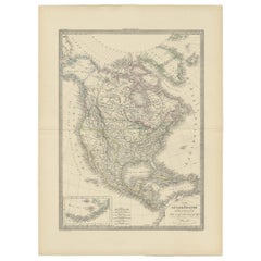
Antique Map of North America, 1821
Located in Langweer, NL
Antique map of America titled 'Carte de l'Amerique septentrionale'. Scarce map of North America
Category
Antique 19th Century Maps
Materials
Paper
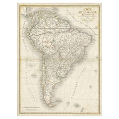
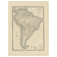
Scarce Antique Map of South America
Located in Langweer, NL
Antique map titled 'Carte de l'Amérique Méridionale'. Scarce map of South America, published in
Category
Antique Early 19th Century Maps
Materials
Paper
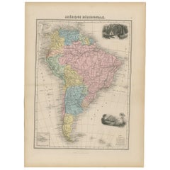
Antique Map of South America by Migeon '1880'
By J. Migeon
Located in Langweer, NL
Antique map titled 'Amérique Méridionale'. Old map of South America. With an inset map of the
Category
Antique Late 19th Century French Maps
Materials
Paper
1864 Map of North America, Antique Hand-Colored Map, by Adolphe Hippolyte Dufour
Located in Colorado Springs, CO
Offered is a map of North America entitled Amerique du Nord from 1864. This rare, separately
Category
Antique 1860s French Maps
Materials
Paper
H 44.5 in W 33 in D 1.5 in
Antique Map of Cayenne and Cassepouri, French Guinea, South America, c.1730
Located in Langweer, NL
Cayenne and Cassepouri, French Guinea, South America, and Martinique in the West Indies. The map of
Category
Antique 18th Century Maps
Materials
Paper
H 16.54 in W 13.59 in D 0 in
Antique Map of North America by Lapie '1842'
Located in Langweer, NL
Antique map titled 'Carte de l'Amérique septentrionale'. Map of North America, with an inset map of
Category
Antique Mid-19th Century Maps
Materials
Paper
Antique Map of South America by Lapie '1842'
Located in Langweer, NL
Antique map titled 'Carte Générale de l'Amérique Meridionale'. Map of South America. This map
Category
Antique Mid-19th Century Maps
Materials
Paper
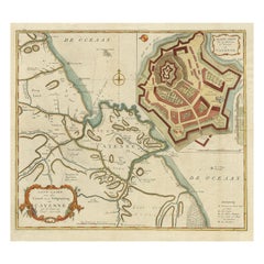
Striking Antique Map of Cayenne in French Guyana, South America, ca.1760
Located in Langweer, NL
Kust van Zuid-Amerika'.
Striking map of the island and settlement of Cayenne in French Guyana, with
Category
Antique 1760s Maps
Materials
Paper
Antique Map of South America by Buchon, 1825
Located in Langweer, NL
Antique map titled 'Carte de l'Amérique méridionale'. Map of South America with attractive
Category
Antique 19th Century Maps
Materials
Paper
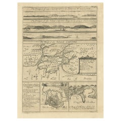
Excellent Antique Map of America with Unusual Northwest Coast of America, c.1754
Located in Langweer, NL
aanwyzing an de Scheepstogten der Nederlanderne Naar West Indie.' Excellent map of America, featuring an
Category
Antique 1750s Maps
Materials
Paper
No Reserve
H 13.98 in W 15.75 in D 0 in
America "Amérique Septentrionale": A 19th Century French Map by Delamarche
By Maison Delamarche 1
Located in Alamo, CA
This framed mid 19th century map of North America entitled "Amérique Septentrionale" by Felix
Category
Antique Mid-19th Century American Other Maps
Materials
Paper
H 20 in W 22.63 in D 0.88 in
Antique Map of North and Central America by Migeon '1880'
By J. Migeon
Located in Langweer, NL
Antique map titled 'Amérique Septentrionale'. Old map of North and Central America. With a
Category
Antique Late 19th Century French Maps
Materials
Paper
Antique Map of South America by V. Levasseur, 1854
By Victor Levasseur
Located in Langweer, NL
Antique map titled 'Amérique Méridionale'. Map shows South America, beautiful surrounded by typical
Category
Antique Mid-19th Century Maps
Materials
Paper
Antique Map of South America Depicting Guayana, c.1780
Located in Langweer, NL
Operations et les Cartes recentes des Ingenieurs-Geographes Francois'. Antique map of South America depicting
Category
Antique 18th Century Maps
Materials
Paper
Antique Map of South America by G. Anson, 1749
Located in Langweer, NL
Antique map titled 'Kaart van het Zuidelykste Gedeelte van Zuider Amerika (..) - Carte de la Partie
Category
Antique Mid-18th Century Dutch Maps
Materials
Paper
Antique Map of the United States of America by Lapie '1842'
Located in Langweer, NL
Antique map titled 'Carte des États-Unis d'Amérique'. Map of the United States of America (USA
Category
Antique Mid-19th Century Maps
Materials
Paper
New Map of North America from the Latest Discoveries, 1763
Located in Philadelphia, PA
A fine antique 18th century map of the North American seaboard.
Entitled "A New Map of North
Category
Antique Mid-18th Century English Georgian Maps
Materials
Paper
Finely Engraved Antique Map of Europe with inset of America, c.1745
By Guillaume De L'Isle
Located in Langweer, NL
Antique map titled 'Theatrum Historicum pars Occidentalis.' Finely engraved historical map with a
Category
Antique 18th Century Maps
Materials
Paper
Antique Map of North America with Vignette of the Statue of Liberty, New York
Located in Langweer, NL
Antique map titled 'Amérique du Nord'. Original antique map of North America. Meticulous
Category
Antique Late 19th Century Maps
Materials
Paper
Free Shipping
H 15.44 in W 20.4 in D 0.02 in
Antique Map of South American, The West Indies & Most of Africa, Ca.1775
Located in Langweer, NL
du Commerce des Europeens dans les deux Indes'.
This map is roughly centered on South America
Category
Antique 1770s Maps
Materials
Paper
H 15.04 in W 19.77 in D 0 in
Authentic Antique Map of the Caribbean, Gulf Coast and Central America, 1787
Located in Langweer, NL
, Gulf Coast and Central America. With inset map of Bermuda. Originates from 'Histoire Philosopgique et
Category
Antique Late 18th Century Maps
Materials
Paper
Free Shipping
H 10.52 in W 16.38 in D 0.02 in
Antique Map of Tracks of Anson's Ships around South America & Cape Horn, 1749
Located in Langweer, NL
Description: Antique map titled 'Kaart van het Zuidelykste Gedeelte van Zuider Amerika (..) - Carte
Category
Antique 1740s Maps
Materials
Paper
No Reserve
H 21.66 in W 19.69 in D 0 in
Early 19th Century Hand Coloured Map of North America by Aaron Arrowsmith
By Aaron Arrowsmith
Located in Hamilton, Ontario
Hand coloured map in French by English cartographer Aaron Arrowsmith (1750–1823) titled "Amerique
Category
Antique Early 19th Century English Maps
Materials
Paper
H 20.5 in W 14.25 in D 0.1 in
Antique Map of America with California as an Island by Homann '1710'
Located in Langweer, NL
Baptist Homann.
**Description**:
This map is a first edition of Johann Baptiste Homann's map of America
Category
Antique Early 18th Century Maps
Materials
Paper
French Geographical, Statistical and Historical Map of Pensylvania, 1825
Located in Langweer, NL
1825 French Map of Pennsylvania, with a List of Prominent Rivers, Descriptions of Mountains, Climate
Category
Antique 1820s Maps
Materials
Paper
H 20.08 in W 25.99 in D 0 in
Map of the Western Coast of South America from Ecuador into Chili, ca.1780
Located in Langweer, NL
Antique map titled 'Carte du Perou avec une partie des pays qui en sont a l'est.'
Map of the
Category
Antique 1780s Maps
Materials
Paper
H 15.16 in W 10.24 in D 0 in
Antique Map of the Northern Part of South America by J. Tallis, circa 1851
Located in Langweer, NL
A decorative and detailed mid-19th century map of the northern part of South America (including
Category
Antique Mid-19th Century Maps
Materials
Paper
H 10.6 in W 14.41 in D 0.02 in
Old Map of the Great Lakes and Upper Mississippi Valley, Northern America, c1780
Located in Langweer, NL
Antique map titled 'Partie Occidentale du Canada'.
A fine example of Rigobert Bonne and
Category
Antique 1780s Maps
Materials
Paper
H 10.32 in W 14.85 in D 0 in
1812 United States Map, by Pierre Tardieu, Antique French Map Depicting the U.S.
By Pierre François Tardieu
Located in Colorado Springs, CO
French and English. This extremely detailed map not only depicts the mountainous regions of the
Category
Antique 1810s French Maps
Materials
Paper
H 43.5 in W 48 in D 2.25 in
Interesting Old Map of the Nw Coast of America and the Ne Coast of Asia, ca.1772
Located in Langweer, NL
. Interesting map of the NW Coast of America and the NE Coast of Asia, based upon Jefferys' map of 1768. Prior
Category
Antique 1770s Maps
Materials
Paper
H 13.78 in W 17.13 in D 0 in
Rare Unusual Antique Map of Asia with a Landbridge from Korea to America, 1717
Located in Langweer, NL
print and map seller, Antoine de Fer [d.1673]. He became an official geographer to both French and
Category
Antique 18th Century Maps
Materials
Paper
H 9.65 in W 13.94 in D 0 in
Antique Map of France with a Nice Cartouche of a Distance Scale, c.1756
Located in Langweer, NL
Antique map titled 'France'. Engraved map of France with a small, decorative title cartouche and
Category
Antique 18th Century Maps
Materials
Paper
Antique Map Dedicated to British Merchants Trading to North America, ca.1746
Located in Langweer, NL
Description: Antique map titled 'A New Chart of the Coast of New England, Nova Scotia, New France
Category
Antique 1740s Maps
Materials
Paper
H 13.98 in W 19.69 in D 0 in
Authentique Map by Pilon of The French Colonies in The West Indies, 1876
Located in Langweer, NL
This map is a significant representation of the French colonies in the West Indies during the late 19th
Category
Antique Late 19th Century Maps
Materials
Paper
H 14.38 in W 16.54 in D 0 in
Very Decorative Original Antique Map of the World, Published in France in c.1780
By Rigobert Bonne
Located in Langweer, NL
Antique map titled 'L'Ancien Monde Et Le Nouveau en Deux Hemispheres' - Double hemisphere map of
Category
Antique 18th Century Maps
Materials
Paper
H 10.24 in W 17.6 in D 0 in
Antique Map of Southeast Asia by Ortelius '1587'
By Abraham Ortelius
Located in Langweer, NL
to the north and south. The map also shows parts of the American northwest, including the cities of
Category
Antique 16th Century Maps
Materials
Paper
Original Antique Map of Malabar, Coromandel 'India' and Ceylon
Located in Langweer, NL
- 1 July 1724) was a German geographer and cartographer, who also made maps of the Americas. He soon
Category
Antique Mid-18th Century Maps
Materials
Paper
Antique Map of Tartary and Northeast Asia, c.1750
Located in Langweer, NL
events in the Americas. His maps and charts were finely engraved and produced, and set a high standard of
Category
Antique 18th Century Maps
Materials
Paper
Antique Map of Tartary and Northeast Asia with Hand Coloring
Located in Langweer, NL
issued maps, particularly reflecting continuing discoveries and political events in the Americas. His
Category
Antique Mid-18th Century Maps
Materials
Paper
Original Antique Map of Pennsylvania Showing Interesting Statistics Etc, 1825
Located in Langweer, NL
topography and more. This map comes from the French edition of Carey & Lea's American Atlas. The French
Category
Antique 1820s Maps
Materials
Paper
H 12 in W 17 in D 0.002 in
Attractive Original Hand-Colored Map of the Swabia Region of Germany, 1799
Located in Langweer, NL
Antique map titled 'A New Map of the Circle of Swabia, from the Latest Authorities'.
Attractive
Category
Antique 1790s Maps
Materials
Paper
H 19.97 in W 23.23 in D 0 in
Captain Cook's Exploration of Tahiti 18th C. Hand-Colored Map by Bellin
By Jacques-Nicolas Bellin
Located in Alamo, CA
America (New France, Acadia, Louisiana) are particularly valuable. He died at Versailles. The map was
Category
Antique Mid-18th Century French Maps
Materials
Paper
H 11.38 in W 17.5 in D 0.13 in
West Coast of Africa, Guinea & Sierra Leone: An 18th Century Map by Bellin
By Jacques-Nicolas Bellin
Located in Alamo, CA
expansive work that mapped China, the East Indies, Asia, the Americas, early voyages to Australia, New
Category
Antique Mid-18th Century French Maps
Materials
Paper
H 10 in W 14.25 in D 0.07 in
Interesting Map of the Atlantic Showing Nelson's and Trade Routes, 1817
By John Thomson
Located in Langweer, NL
, North America, &cc'. Large map of the Atlantic, showing the tracks of the ships trading in North America
Category
Antique 19th Century Maps
Materials
Paper
Free Shipping
H 21.26 in W 27.76 in D 0 in
Antique Map of Asia from the Middle East to the Coast of Alaska, 1816
Located in Langweer, NL
Antique map titled ‘L’Asie‘. This is an original antique map of Asia, by Hérisson, taken from atlas
Category
Antique 19th Century Maps
Materials
Paper
Very Attractive Antique Map of the World as Planisphere, Shows Cook's Voyages
Located in Langweer, NL
Antique map titled 'Chart of the World, according to Mercators Projection'. This world map shows
Category
Antique Late 18th Century Maps
Materials
Paper
No Reserve
H 16.15 in W 20.08 in D 0.02 in
Antique Miniature Map of the Western Hemisphere, with California as an Island
Located in Langweer, NL
Northwest Coast of America and an incomplete New Zealand. This map originates from 'Description de l
Category
Antique Late 17th Century Maps
Materials
Paper
H 8.27 in W 5.6 in D 0.02 in
Antique Map of The Bay of D'Estaing located on the Russian island Sakhalin, 1798
Located in Langweer, NL
Antique map titled 'Plan of La Baie d'Estaing'.
This map shows the bay of D'Estaing located on
Category
Antique 1790s Maps
Materials
Paper
H 16.34 in W 14.38 in D 0 in
Antique Map with Details of Berings' Expedition into Russians' Far East, 1737
Located in Langweer, NL
the western side of the Bering Strait, dividing Asia from North America. As shown on the map, a series
Category
Antique 1730s Maps
Materials
Paper
H 12.96 in W 22.64 in D 0 in
The Illustrated Map of the Var Department from the Atlas National Illustré, 1856
Located in Langweer, NL
French geographer and cartographer known for his richly illustrated maps.
The map of 'Dépt. du Var' from
Category
Antique 1850s Maps
Materials
Paper
H 14.18 in W 20.87 in D 0 in
Engraving of Allegorical Celebrations of the British Victories in America, 1880
Located in Langweer, NL
celebrations of the British victories in America at the conclusion of the French & Indian (Seven Years) War
Category
Antique 1880s Maps
Materials
Paper
Free Shipping
H 16.74 in W 21.93 in D 0 in
California, Alaska and Mexico: 18th Century Hand-Colored Map by de Vaugondy
By Didier Robert de Vaugondy
Located in Alamo, CA
This an 18th century hand-colored map of the western portions of North America entitled "Carte de
Category
Antique 1770s French Maps
Materials
Paper
H 13.75 in W 16.63 in D 0.13 in
Africa: A Large 17th Century Hand-Colored Map by Sanson and Jaillot
By Nicolas Sanson
Located in Alamo, CA
This large original hand-colored copperplate engraved map of Africa entitled "L'Afrique divisee
Category
Antique 1690s French Maps
Materials
Paper
Antique Map the Windward or South Caribbean Islands and Guiana, 1859
Located in Langweer, NL
and single territorial collectivity of France on the northern Atlantic coast of South America in the
Category
Antique Mid-19th Century Maps
Materials
Paper
Antique French Engraving of Mexico with Lots of Details, c.1780
Located in Langweer, NL
.'
Detailed map of Mexico, the Yucatan and Central America, prepared under the direction of Rigobert Bonne
Category
Antique 18th Century Maps
Materials
Paper
Pair Plateau Parfleche Packets
By Plateau Indians
Located in Coeur d'Alene, ID
. Difficult to find a pair. Very nice, rare design.
The term parfleche was first coined by the French fur
Category
Antique Early 1900s American Native American Native American Objects
Materials
Other
Jacques Liozu's 1951 illustrated map of South America
By Jacques Liozu
Located in PARIS, FR
Jacques Liozu's 1951 illustrated map of South America is an exceptional work of cartography that
Category
1950s Prints and Multiples
Materials
Paper, Lithograph
Krevelt, Map, Coast of Brazil, South America, Amazon, Hand Coloured
Located in Norwich, GB
Detailed regional map of the coast of Brazil, from Maracana to Baye de Tous les Saints.
Covers Capitanie
Category
Antique Late 18th Century French Prints
Materials
Paper
one of the earliest large-scale English maps of North America
By John Senex
Located in London, GB
one of the earliest large-scale English maps of North America
SENEX, John.
North America Corrected
Category
1710s Naturalistic More Art
Materials
Watercolor, Engraving
- 1
Get Updated with New Arrivals
Save "French Map Of America", and we’ll notify you when there are new listings in this category.
French Map Of America For Sale on 1stDibs
Find many varieties of an authentic French map of america available at 1stDibs. Each French map of america for sale was constructed with extraordinary care, often using paper, fabric and canvas. Your living room may not be complete without a French map of america — find older editions for sale from the 18th Century and newer versions made as recently as the 20th Century. A French map of america is a generally popular piece of furniture, but those created in styles are sought with frequency. You’ll likely find more than one French map of america that is appealing in its simplicity, but Jacques-Nicolas Bellin and Maison Delamarche produced versions that are worth a look.
How Much is a French Map Of America?
Prices for a French map of america can differ depending upon size, time period and other attributes — at 1stDibs, they begin at $174 and can go as high as $5,500, while the average can fetch as much as $975.
More Ways To Browse
Magna Carta
Black Art Nook
John Mix Stanley
Bill Ross
Agnes Mills
Victorian Vintage Clothes
Victorian Clothes Vintage
Cubist Acrobats
Antique Map North Carolina
Malabar Map
Chicago United Airlines Poster
Map Of Constantinople
Missouri Antique Map
Antique Ephesus
Antique Damper
Antique Wood Nesting Side Tables
C Kern
French Country Side Board
