Items Similar to Antique Map of Brazil, Ecuador, Colombia and Venezuela by Lapie, 1842


Want more images or videos?
Request additional images or videos from the seller
1 of 5
Antique Map of Brazil, Ecuador, Colombia and Venezuela by Lapie, 1842
About the Item
Antique map titled 'Carte de Colombie contenant les Républiques (..)'. Map of northern Brazil, Ecuador, Colombia and Venezuela. This map originates from 'Atlas universel de géographie ancienne et moderne (..)' by Pierre M. Lapie and Alexandre E. Lapie.
Artists and Engravers: Pierre M. Lapie was a French cartographer and engraver. He was the father of cartographer Alexandre Emile Lapie.
Condition: Very good, general age-related toning. Original folding line, blank verso. Please study image carefully.
Date: 1842
Overall size: 68 x 50.5 cm.
Image size: 54.5 x 40 cm.
We sell original antique maps to collectors, historians, educators and interior decorators all over the world. Our collection includes a wide range of authentic antique maps from the 16th to the 20th centuries. Buying and collecting antique maps is a tradition that goes back hundreds of years. Antique maps have proved a richly rewarding investment over the past decade, thanks to a growing appreciation of their unique historical appeal. Today the decorative qualities of antique maps are widely recognized by interior designers who appreciate their beauty and design flexibility. Depending on the individual map, presentation, and context, a rare or antique map can be modern, traditional, abstract, figurative, serious or whimsical. We offer a wide range of authentic antique maps for any budget.
- Dimensions:Height: 19.89 in (50.5 cm)Width: 26.78 in (68 cm)Depth: 0 in (0.01 mm)
- Materials and Techniques:
- Period:
- Date of Manufacture:1842
- Condition:
- Seller Location:Langweer, NL
- Reference Number:
About the Seller
5.0
Platinum Seller
These expertly vetted sellers are 1stDibs' most experienced sellers and are rated highest by our customers.
Established in 2009
1stDibs seller since 2017
1,928 sales on 1stDibs
Typical response time: <1 hour
- ShippingRetrieving quote...Ships From: Langweer, Netherlands
- Return PolicyA return for this item may be initiated within 14 days of delivery.
More From This SellerView All
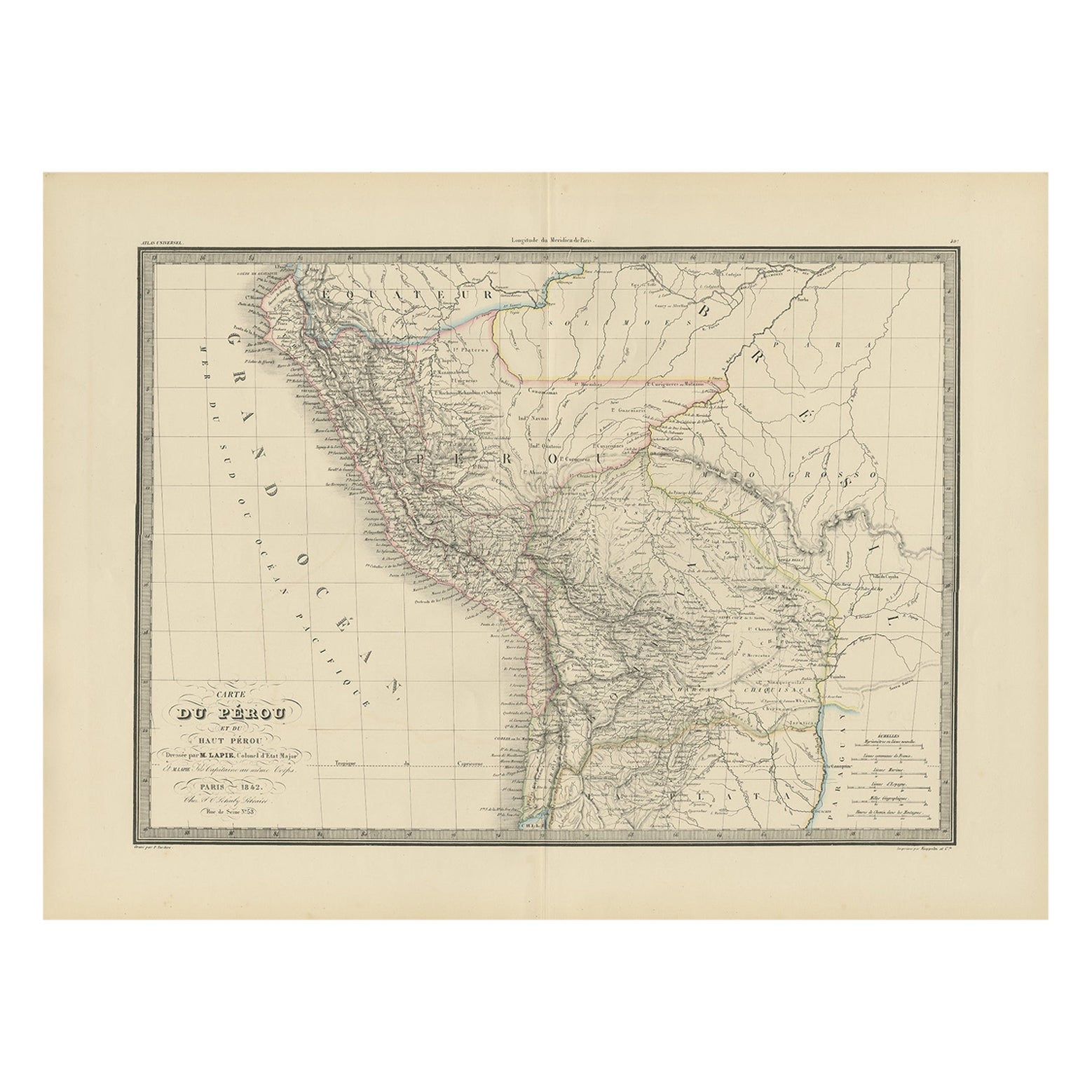
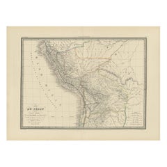
- Antique Map of Peru, Ecuador and Bolivia by Lapie, 1842Located in Langweer, NLAntique map titled 'Carte du Perou et du Haut Perou'. Map of Peru, Ecuador and Bolivia. This map originates from 'Atlas universel de géographie ancienne et...Category
Antique 19th Century Maps
MaterialsPaper
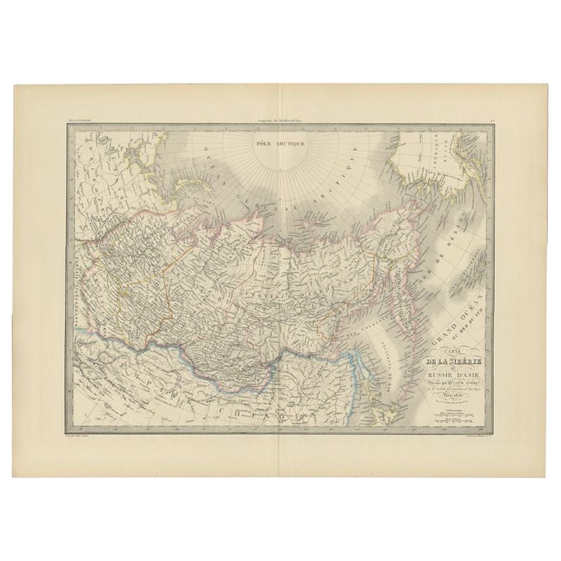
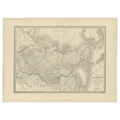
- Antique Map of Siberia by Lapie, 1842Located in Langweer, NLAntique map titled 'Carte de la Sibérie ou Russie d'Asie'. Map of Siberia. This map originates from 'Atlas universel de géographie ancienne et moderne (..)' by Pierre M. Lapie and Al...Category
Antique 19th Century Maps
MaterialsPaper
- Antique Map of Switzerland by Lapie, 1842Located in Langweer, NLAntique map titled 'Carte de la Suisse ou Helvetie'. Map of Switzerland. This map originates from 'Atlas universel de géographie ancienne et moderne...Category
Antique Mid-19th Century Maps
MaterialsPaper
- Antique Map of France by Lapie, 1842Located in Langweer, NLAntique map titled 'Carte de France'. Map of France. This map originates from 'Atlas universel de géographie ancienne et moderne (..)' by Pierre M. Lapie and Alexandre E. Lapie. Pier...Category
Antique Mid-19th Century Maps
MaterialsPaper
- Antique Map of France by Lapie, 1842Located in Langweer, NLAntique map titled 'Carte des Gaules'. Map of France. This map originates from 'Atlas universel de géographie ancienne et moderne (..)' by Pierre M. Lapie and Alexandre E. Lapie. Pie...Category
Antique Mid-19th Century Maps
MaterialsPaper
- Antique Map of Asia by Lapie, 1842Located in Langweer, NLAntique map titled 'Carte de l'Asie'. Map of Asia. This map originates from 'Atlas universel de géographie ancienne et moderne (..)' by Pierre M. Lapie and...Category
Antique Mid-19th Century Maps
MaterialsPaper


You May Also Like
- 1842 Wall Map of the United States by J. H. Young, Published by S. A. MitchellLocated in Colorado Springs, COPresented is an 1842 hanging “Map of the United States,” engraved by J. H. Young and published by Samuel Augustus Mitchell, Philadelphia. This is a beautiful example of the rare 1842...Category
Antique 1840s American Maps
MaterialsPaper
- Moderno, Design for Living in Brazil, Mexico, and Venezuela, 1940-1978By Clara PorsetLocated in New York, NYCatalog of a traveling exhibition opening at the America’s Society in New York in 2015. Published by Santillana. 4to, hardcover, 280 pages, with both full color and b/w illustrations, including a section of plates dedicated to the exhibit. With incisive essays by Gabriela Rangel, Jorge Rivas Perez, Lourdes Blanco, Ana Elena Mallet, Christina L. De Leon, Maria Cecilia Loschiavo Dos Santos, and Luis Canstaneda, along with historical texts by Clara Porset, Lina Bo Bardi and others, plus designer biographies. An important contribution to the understanding of Latin American postwar modernism...Category
2010s Mexican Mid-Century Modern Books
MaterialsPaper
- Map of the Holy Land "Carte de la Syrie et de l'Egypte" by Pierre M. LapieBy Pierre M. LapieLocated in Alamo, CAAn early 19th century map of ancient Syria and Egypt entitled "Carte de la Syrie et de l'Egypte anciennes/dressée par M. Lapie, Colonel d'Etat Major, et...Category
Antique Early 19th Century French Maps
MaterialsPaper
- 1861 Topographical Map of the District of Columbia, by Boschke, Antique MapLocated in Colorado Springs, COPresented is an original map of Albert Boschke's extremely sought-after "Topographical Map of the District of Columbia Surveyed in the Years 1856 ...Category
Antique 1860s American Historical Memorabilia
MaterialsPaper
- Rural and Domestic Life of Germany by Howitt, 1842Located in Dallas, TXPresenting an extremely rare first edition hardback copy of The Rural and Domestic Life of Germany with Characteristic Sketches of its Cities and Scenery, Collected in a General Tour...Category
Antique Mid-19th Century English Country Books
MaterialsPaper
- 1907 Map of Colorado, Antique Topographical Map, by Louis NellLocated in Colorado Springs, COThis highly detailed pocket map is a topographical map of the state of Colorado by Louis Nell from 1907. The map "has been complied from all availabl...Category
Antique Early 1900s American Maps
MaterialsPaper