Items Similar to Antique Map of the Low Countries and Surroundings in Europe, 1685


Want more images or videos?
Request additional images or videos from the seller
1 of 7
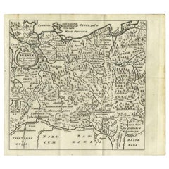
Antique Map of the Low Countries and Surroundings in Europe, 1685
About the Item
Antique map titled 'Germaniae Cisrhenanae ut ineter I Caesaris et Traiani Suit imperia Scaldis Item Mose ac Rheni.' Miniature map of the Low Countries and part of Germany and France. From the pocket atlas 'Introductionis in Universam Geographiam tam Veterem quam novam .. Acessit P. Bertii (Bertius) Brevarium Orbis Terrarum', by Ph. Cluverius (Cluver).
Artists and Engravers: Philipp Cluver (1580 - 1622), early modern German geographer and historian.
Condition: Good, given age. Narrow right margin. Original folds as issued. General age-related toning and/or occasional minor defects from handling. Please study image carefully.
Date: 1685
Overall size: 12.8 x 13 cm.
Image size: 12.3 x 11.8 cm.
We sell original antique maps to collectors, historians, educators and interior decorators all over the world. Our collection includes a wide range of authentic antique maps from the 16th to the 20th centuries. Buying and collecting antique maps is a tradition that goes back hundreds of years. Antique maps have proved a richly rewarding investment over the past decade, thanks to a growing appreciation of their unique historical appeal. Today the decorative qualities of antique maps are widely recognized by interior designers who appreciate their beauty and design flexibility. Depending on the individual map, presentation, and context, a rare or antique map can be modern, traditional, abstract, figurative, serious or whimsical. We offer a wide range of authentic antique maps for any budget
- Creator:Philipp Clüver (Artist)
- Dimensions:Height: 5.12 in (13 cm)Width: 5.04 in (12.8 cm)Depth: 0 in (0.01 mm)
- Materials and Techniques:
- Period:
- Date of Manufacture:1685
- Condition:Condition: Good, given age. Narrow right margin. Original folds as issued. General age-related toning and/or occasional minor defects from handling. Please study image carefully.
- Seller Location:Langweer, NL
- Reference Number:
About the Seller
5.0
Platinum Seller
These expertly vetted sellers are 1stDibs' most experienced sellers and are rated highest by our customers.
Established in 2009
1stDibs seller since 2017
1,919 sales on 1stDibs
Typical response time: <1 hour
- ShippingRetrieving quote...Ships From: Langweer, Netherlands
- Return PolicyA return for this item may be initiated within 14 days of delivery.
More From This SellerView All
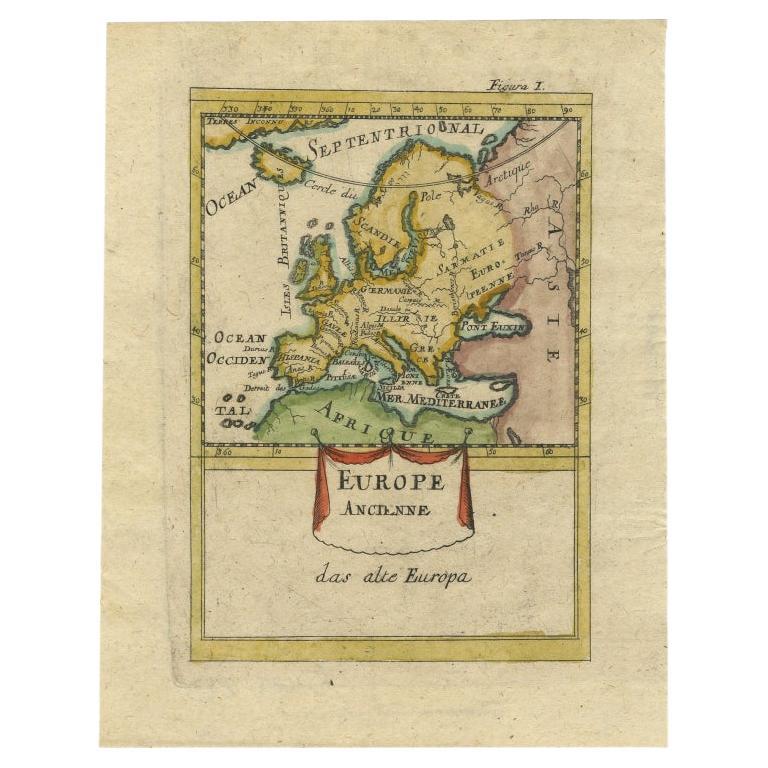
- Antique Hand-Coloured Miniature Map of Ancient Europe, c.1685Located in Langweer, NLAntique map of Europe titled 'Europe Ancienne, Das alte Europa'. Hand-coloured miniature map with much detail. German subtitle. Artists and Engravers: Alain Manneson Mallet (1630-...Category
Antique 17th Century Maps
MaterialsPaper
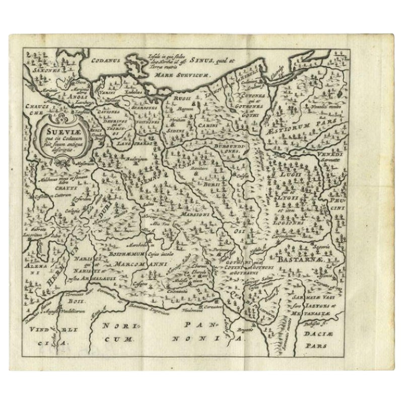
- Antique Map of Swabia, 1685Located in Langweer, NLAntique map titled 'Sueviae quae cis Codanum fuit finum Antiqua defcriptio.' Miniature map of Swabia, a medieval Duchy in south-west Germany, that also included part of Poland, from ...Category
Antique 17th Century Maps
MaterialsPaper
- Antique Map of Afghanistan and Surroundings, '1845'Located in Langweer, NLAntique map titled 'Map of Persia and Caubul'. Original antique map of Afghanistan and surroundings. This map originates from 'An Atlas of the World, Comprehending Separate Maps of...Category
Antique Mid-19th Century Maps
MaterialsPaper
- Antique Map of Belgium and Surroundings, 1692Located in Langweer, NLAntique map titled 'Provincie Meridionali de Paesi Bassi Intese sotto nome di Fiandra overo Li Paesi Bassi Cattolici con li confini di Francia di Allemagna et di Hollanda'. Uncommon map of Belgium...Category
Antique 17th Century Maps
MaterialsPaper
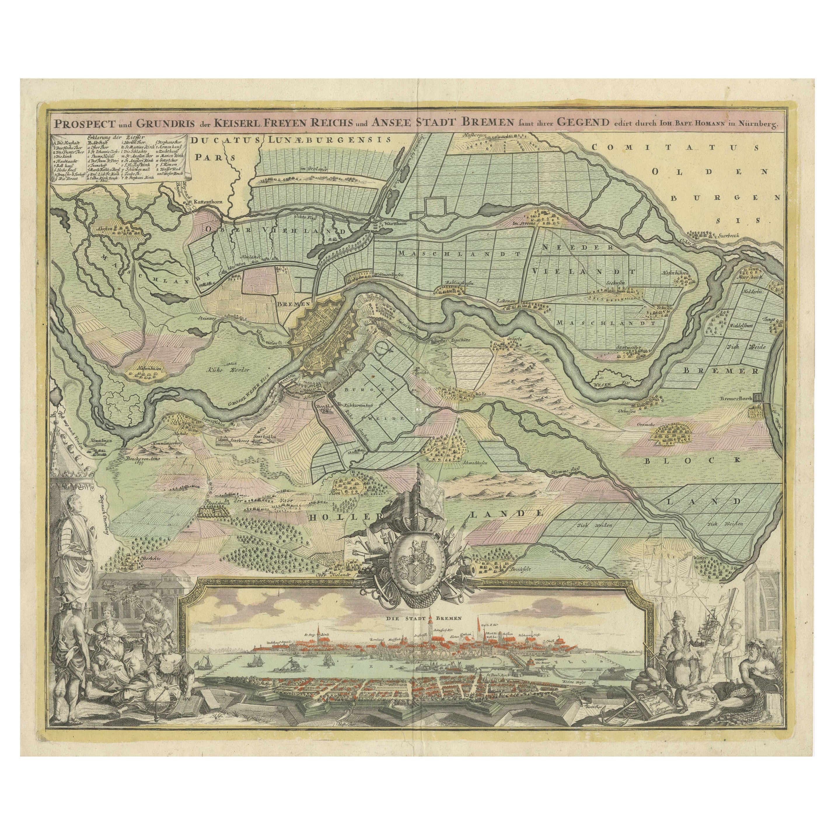
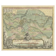
- Large Antique Map of the City of Bremen and Surroundings, GermanyLocated in Langweer, NLOriginal antique map titled 'Prospect und Grundris der Keiserl Freyen Reichs und Ansee Stadt Bremen (..)'. This is a superb chart of the city of Bremen and the surrounding small vill...Category
Antique Early 18th Century Maps
MaterialsPaper
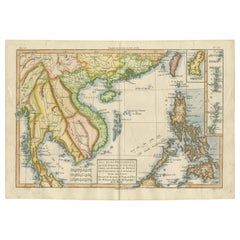
- Antique Map of the Philippines, Taiwan and Surroundings by Bonne '1780'Located in Langweer, NLAntique map titled 'Les Isles Philippines, celle de Formose, le Sud de la Chine, les Royaumes de Tunkin, de Cochinchine, de Cambode, de Siam des Laos, avec partie de Pegu et D'Ava'. ...Category
Antique Late 18th Century Maps
MaterialsPaper


You May Also Like
- Original Antique Map of Europe, Arrowsmith, 1820Located in St Annes, LancashireGreat map of Europe Drawn under the direction of Arrowsmith. Copper-plate engraving. Published by Longman, Hurst, Rees, Orme and Brown, 1820 ...Category
Antique 1820s English Maps
MaterialsPaper
- Map of the Republic of GenoaLocated in New York, NYFramed antique hand-coloured map of the Republic of Genoa including the duchies of Mantua, Modena, and Parma. Europe, late 18th century. Dimension: 25...Category
Antique Late 18th Century European Maps
- Antique Map of Principality of MonacoBy Antonio Vallardi EditoreLocated in Alessandria, PiemonteST/619 - "Old Geographical Atlas of Italy - Topographic map of ex-Principality of Monaco" - ediz Vallardi - Milano - A somewhat special edition ---Category
Antique Late 19th Century Italian Other Prints
MaterialsPaper
- Original Antique Map of The World by Thomas Clerk, 1817Located in St Annes, LancashireGreat map of The Eastern and Western Hemispheres On 2 sheets Copper-plate engraving Drawn and engraved by Thomas Clerk, Edinburgh. Published by Mackenzie And Dent, 1817 ...Category
Antique 1810s English Maps
MaterialsPaper
- Antique 18th Century Map of the Province of Pensilvania 'Pennsylvania State'Located in Philadelphia, PAA fine antique of the colony of Pennsylvania. Noted at the top of the sheet as a 'Map of the province of Pensilvania'. This undated and anonymous map is thought to be from the Gentleman's Magazine, London, circa 1775, although the general appearance could date it to the 1760's. The southern boundary reflects the Mason-Dixon survey (1768), the western boundary is placed just west of Pittsburgh, and the northern boundary is not marked. The map has a number of reference points that likely refer to companion text and appear to be connected to boundaries. The western and southern boundaries are marked Q, R, S, for example. A diagonal line runs from the Susquehanna R to the Lake Erie P. A broken line marked by many letters A, B, N, O, etc., appears in the east. There are no latitude or longitude markings, blank verso. Framed in a shaped contemporary gilt wooden frame and matted under a cream colored matte. Bearing an old Graham Arader Gallery...Category
Antique 18th Century British American Colonial Maps
MaterialsPaper
- Map "Estuary- Mouth of the Thames"Located in Alessandria, PiemonteST/426 - Antique French Map of the estuary of the Thames, map dated 1769 - "Mape of the entrance of the Thames. Designed by filing of Navy cards fo...Category
Antique Mid-18th Century French Other Prints
MaterialsPaper


Recently Viewed
View AllMore Ways To Browse
Antique In Europe
Low And Wide
Antique Country Items
Low Country Furniture
Country French Provence
17th Century French Items
Antique Ac
Miniature Map
Pocket Map
Map Of European Countries
Map Of France Miniature
Pediment Metal
Russian Antique Book
Antique Furniture In Philippines
Antique Nursery
Antique In The Philippines
Medieval Plate
Antique Depot