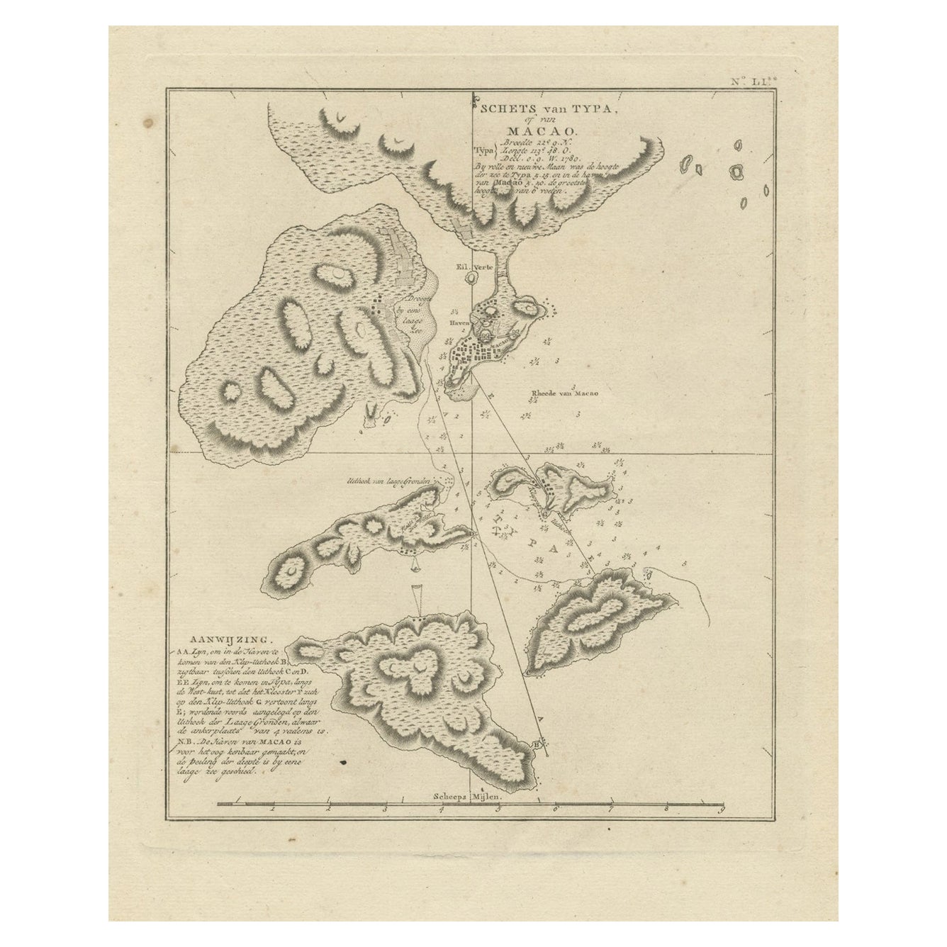
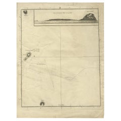
Antique Map of the Environs of Macao by Cook, c.1784
View Similar Items


Want more images or videos?
Request additional images or videos from the seller
1 of 5
Antique Map of the Environs of Macao by Cook, c.1784
About the Item
- Creator:James Cook (Author)
- Dimensions:Height: 13 in (33 cm)Width: 9.06 in (23 cm)Depth: 0 in (0.01 mm)
- Materials and Techniques:
- Period:
- Date of Manufacture:circa 1784
- Condition:
- Seller Location:Langweer, NL
- Reference Number:Seller: BGJC-1411stDibs: LU3054327793652
About the Seller
5.0
Platinum Seller
These expertly vetted sellers are 1stDibs' most experienced sellers and are rated highest by our customers.
Established in 2009
1stDibs seller since 2017
1,946 sales on 1stDibs
More From This SellerView All
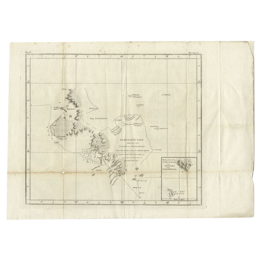
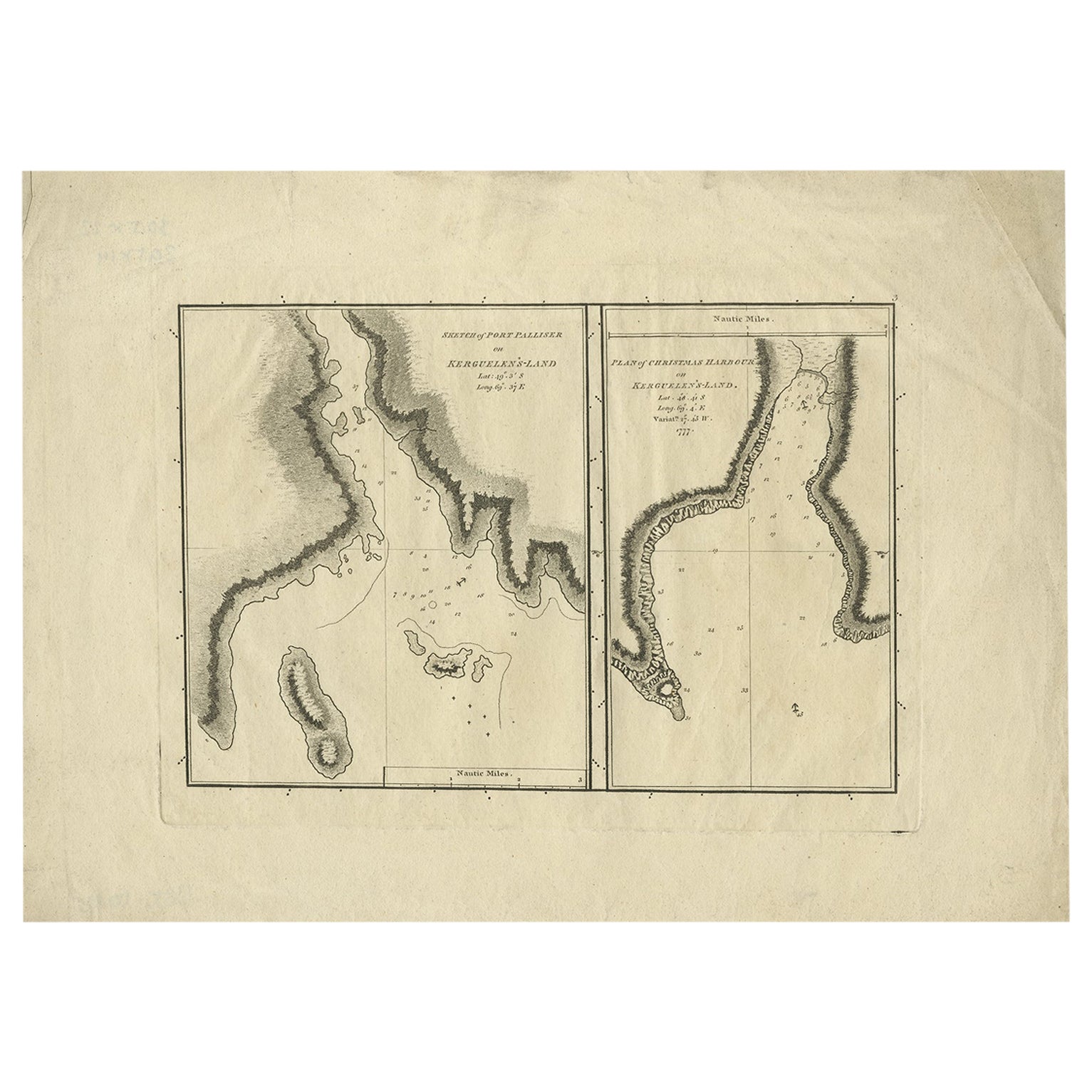
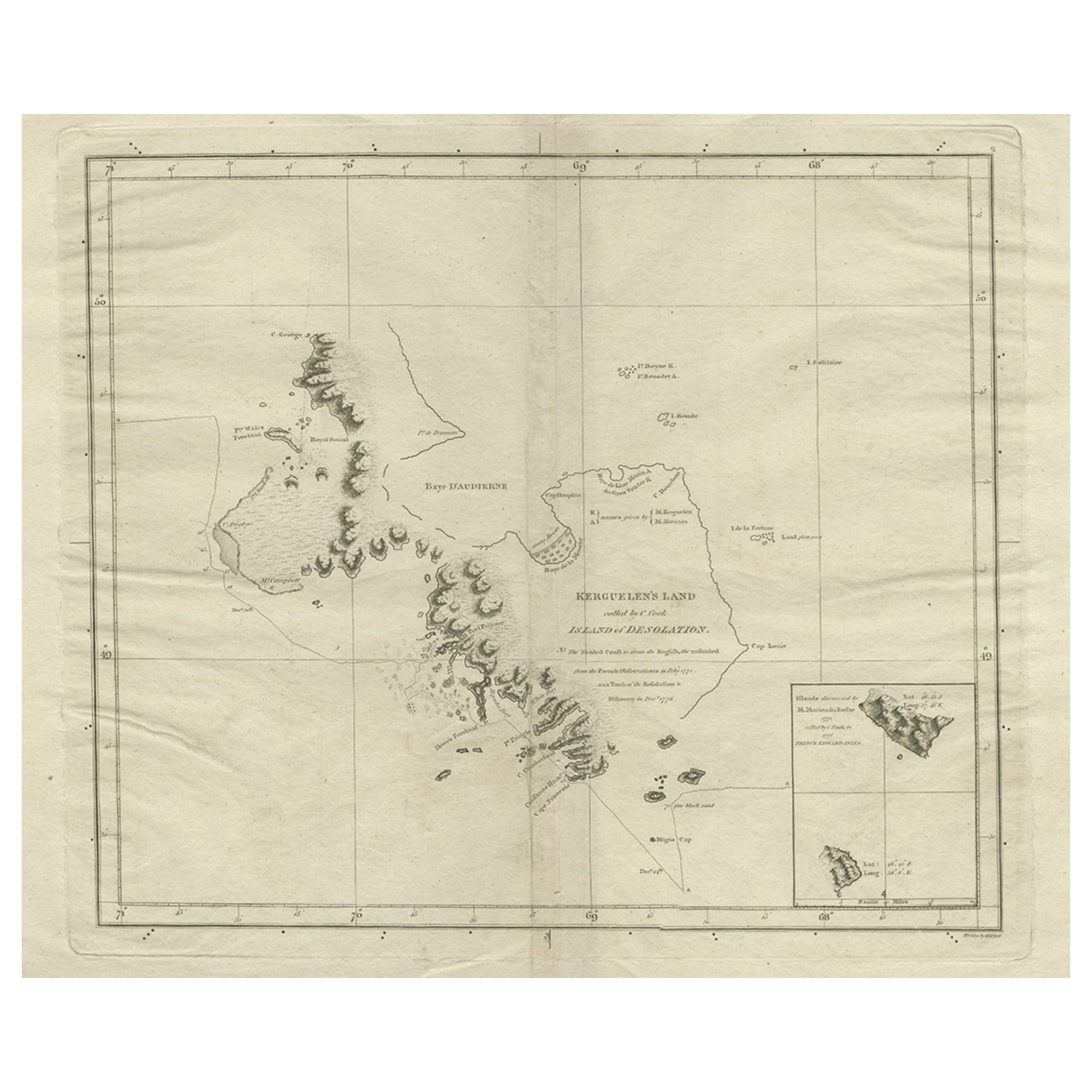
- Antique Map of Kerguelens Island Coast by Cook, 1784By James CookLocated in Langweer, NLAntique print titled 'Kerguelen's Land (..)'. Antique map of Kerguelens island coast, known today as the Desolation islands. Originates from 'A Voyage to the Pacific Ocean: Undertaken, by the Command of His Majesty, for Making Discoveries in the Northern Hemisphere (..)' published in Dublin. Artists and Engravers: James Cook...Category
Antique 18th Century Prints
MaterialsPaper
 $296 Sale Price25% Off
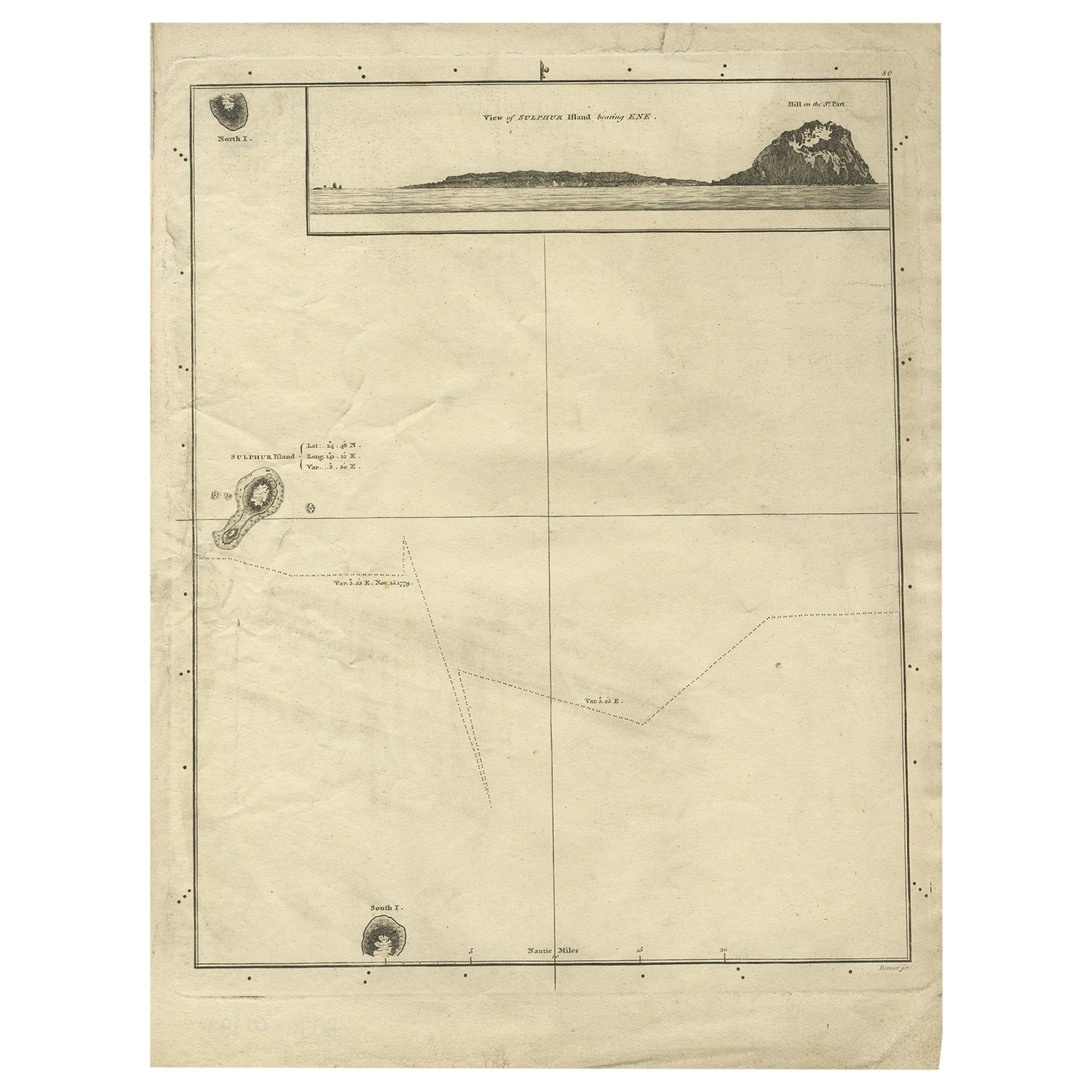
 - Antique Map of Suffren Island by Cook, 1784Located in Langweer, NLAntique map titled 'View of Sulphur Island (..)'. Antique map and view of Suffren Island. Originates from an edition of Cook's Voyages. Artists and Engravers: Published by Nicol, ...Category
Antique 18th Century Maps
MaterialsPaper
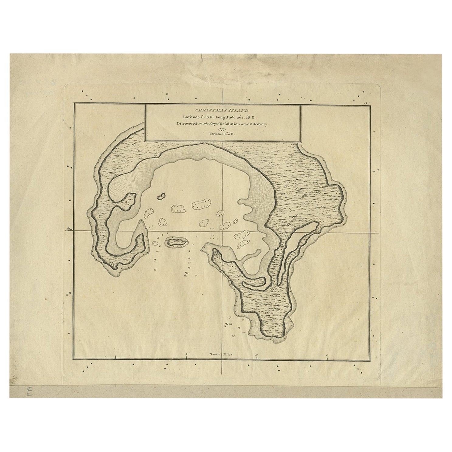
- Antique Map of Christmas Island by Cook, 1784Located in Langweer, NLAntique map Kiribati titled 'Christmas Island (..)'. Antique map of Christmas Island, also known as Kiritimati. Originates from an edition of Cook's Voyages. Artists and Engravers...Category
Antique 18th Century Maps
MaterialsPaper
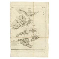
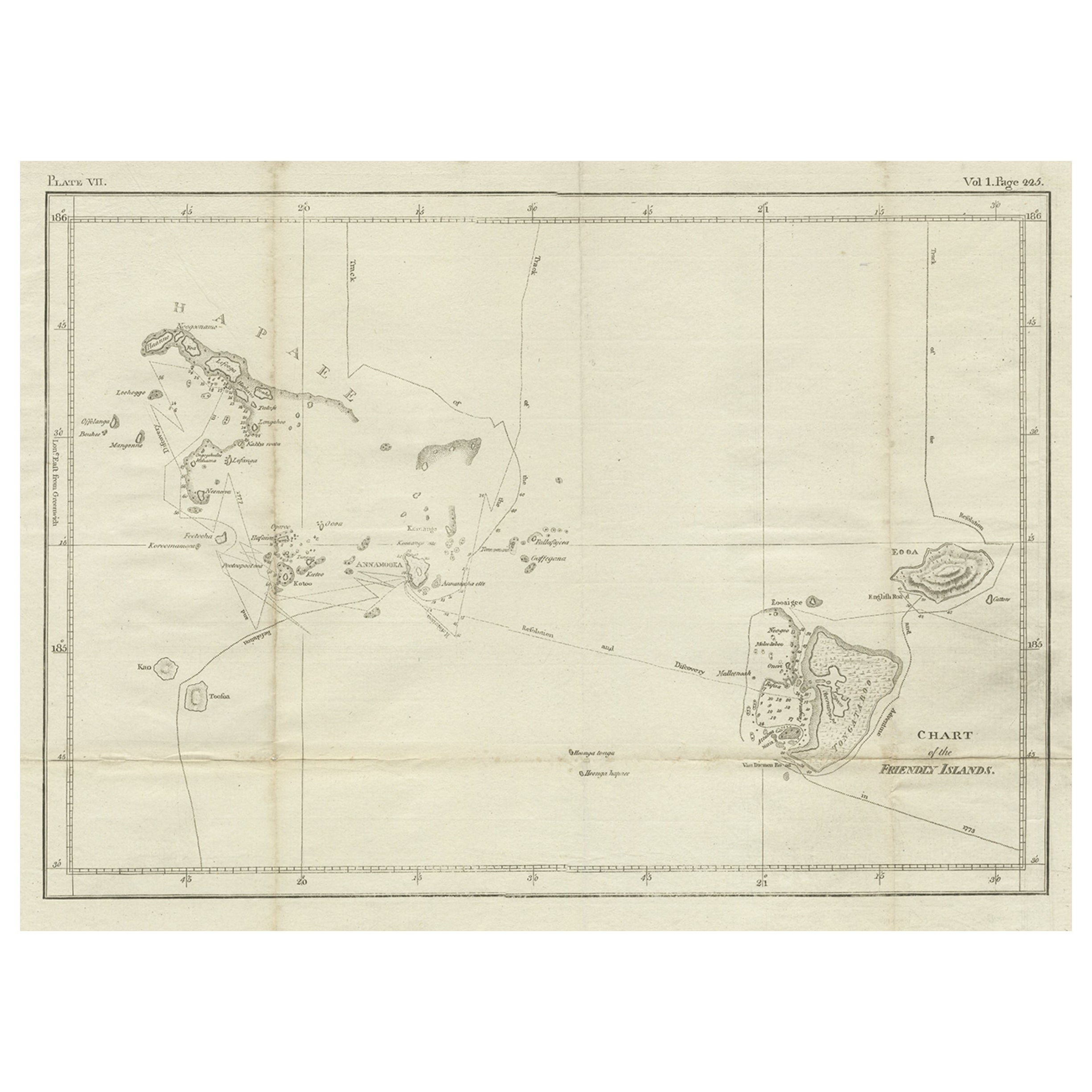
- Antique Chart of the Friendly Islands or Nowadays Tonga, by Cook, 1784By James CookLocated in Langweer, NLAntique print titled 'Chart of the Friendly Islands'. Antique map of the Friendly Islands depicting Rotterdam or Anamocka, Middelburg or Eaoowe and Amsterdam or Tongatabu. Originates...Category
Antique 18th Century Prints
MaterialsPaper
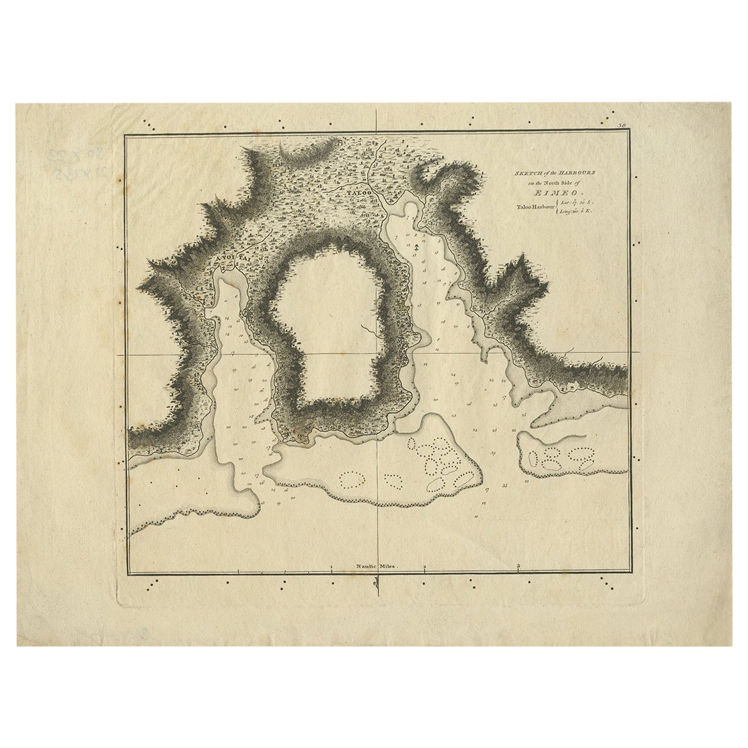
- Antique Map of the Harbour of Taloo by J. Cook, 1803By James CookLocated in Langweer, NLAntique map French Polynesia titled 'Schets van de Havenen aan de Noord Zijde van Eimeo'. Plan of the harbour of Taloo in the Island of Moorea, one of the Society Islands, French Polynesia. Originates from 'Reize rondom de Waereld door James Cook...Category
Antique Early 19th Century Dutch Maps
MaterialsPaper
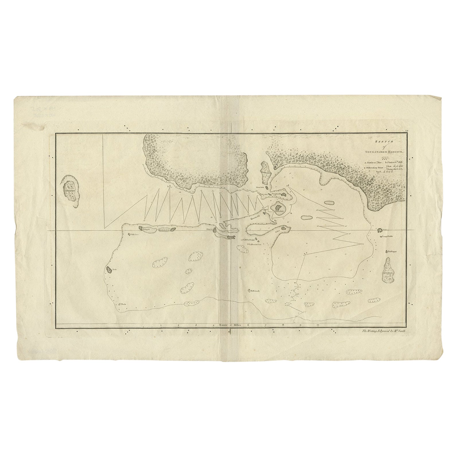
- Original Antique Map of the Harbour of Tongatabu by Cook, 1784Located in Langweer, NLAntique map titled 'Sketch of Tongataboo Harbour (..)'. Antique map of the harbour of Tongatabu, one of the Tonga Islands. Originates from an edition of Cook's Voyages. Artists an...Category
Antique 18th Century Maps
MaterialsPaper

You May Also Like
- Antique Map of Paris, "Carte Routiere des Environs de Paris" 1841Located in Colorado Springs, COThis beautiful hand-colored road map of Paris was published in 1841. The map shows Paris and the surrounding area in a folding pocket map. Organized and detailed for travelers, this ...Category
Antique 1840s French Maps
MaterialsPaper
- 1861 Topographical Map of the District of Columbia, by Boschke, Antique MapLocated in Colorado Springs, COPresented is an original map of Albert Boschke's extremely sought-after "Topographical Map of the District of Columbia Surveyed in the Years 1856 ...Category
Antique 1860s American Historical Memorabilia
MaterialsPaper
- Captain Cook's Exploration of Tahiti 18th C. Hand-Colored Map by BellinBy Jacques-Nicolas BellinLocated in Alamo, CAThis beautiful 18th century hand-colored copper plate engraved map is entitled "Carte de l'Isle de Taiti, par le Lieutenant J. Cook" was created by Jacques Nicolas Bellin and publish...Category
Antique Mid-18th Century French Maps
MaterialsPaper
- Original Antique Map of The World by Thomas Clerk, 1817Located in St Annes, LancashireGreat map of The Eastern and Western Hemispheres On 2 sheets Copper-plate engraving Drawn and engraved by Thomas Clerk, Edinburgh. Published by Mackenzie And Dent, 1817 ...Category
Antique 1810s English Maps
MaterialsPaper
- 1907 Map of Colorado, Antique Topographical Map, by Louis NellLocated in Colorado Springs, COThis highly detailed pocket map is a topographical map of the state of Colorado by Louis Nell from 1907. The map "has been complied from all availabl...Category
Antique Early 1900s American Maps
MaterialsPaper
- Original Antique Map of The Netherlands, Engraved by Barlow, Dated 1807Located in St Annes, LancashireGreat map of Netherlands Copper-plate engraving by Barlow Published by Brightly & Kinnersly, Bungay, Suffolk. Dated 1807 Unframed.Category
Antique Early 1800s English Maps
MaterialsPaper


Recently Viewed
View AllMore Ways To Browse
List Of Interior Designers
Collection Of Sketches
Antique Cook
World Map Wall
1784 Furniture
Captain Antique
Antique Wall World Map
Antique Wall Maps Of The World
18th Century Sketch
Harrison Antique Furniture
Hawaiian Collectibles
H Cook
Antique Britain Map
Antique Map Britain
Harrisons Antiques
Small Sc
Pirate Furniture
William Cook