Antique Maps Of Maryland

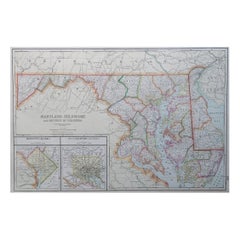
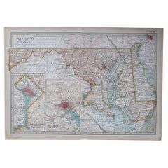
Large Original Antique Map of Maryland, Delaware & DC, USA, C.1900
Located in St Annes, Lancashire
Fabulous map of Maryland, Delaware And District of Columbia Original color Engraved and printed
Category

1890s American Antique Maps Of Maryland

Materials

Paper

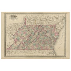
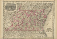
Antique Map of Virginia, Delaware, Maryland & West Virginia by Johnson, 1872
Located in Langweer, NL
Antique map titled 'Johnson's Viriginia (..). Original map of Virginia, Delaware, Maryland and West
Category

Late 19th Century Antique Maps Of Maryland

Materials

Paper

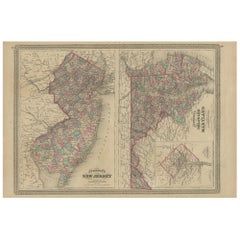
Antique Map of New Jersey, Delaware and Maryland by Johnson, 1872
Located in Langweer, NL
and Maryland. With inset map of the district of Columbia. This map originates from 'Johnson's New
Category

Late 19th Century Antique Maps Of Maryland

Materials

Paper

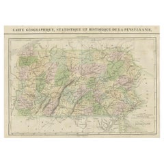
French Geographical, Statistical and Historical Map of Pensylvania, 1825
Located in Langweer, NL
Maryland, Delaware, New York and New jersey. Printed on the same page as the map is geographical
Category

1820s Antique Maps Of Maryland

Materials

Paper

1812 United States Map, by Pierre Tardieu, Antique French Map Depicting the U.S.
By Pierre François Tardieu
Located in Colorado Springs, CO
format maps from the period. It features a view of the East Coast of the U.S. from Maryland to just below
Category

1810s French Antique Maps Of Maryland

Materials

Paper

1856 U.S. Coast Survey Map of Chesapeake Bay and Delaware Bay
Located in Colorado Springs, CO
from 1856. The map depicts the region from Susquehanna, Maryland to the northern Outer Banks in North
Category

1850s American Antique Maps Of Maryland

Materials

Paper

Civil War Panorama of the Seat of War by John Bachmann, Antique Print circa 1864
Located in Colorado Springs, CO
Panorama of the seat of war. Bird's-eye View of Virginia, Maryland, Delaware and the District of
Category

1860s American Antique Maps Of Maryland

Materials

Paper

Plan for the City of Washington by Andrew Ellicott, Antique Print, 19th Century
Located in Colorado Springs, CO
Territory of Columbia, ceded by the States of Virginia and Maryland to the United States of America and by
Category

Late 19th Century American Antique Maps Of Maryland

Materials

Paper

Pair of Sterling Repousse Candelabras
By Kirk & Son
Located in Brooklyn, NY
. Kirk & Son of Baltimore, Maryland. Each candelabra has three-branches, a total of six lights. Around
Category

1910s American Antique Maps Of Maryland

Materials

Sterling Silver

"Portrait of an Italian Fencer, " John Frederick Kensett, Hudson River School
By John Frederick Kensett
Located in New York, NY
engraver of labels, banknotes and maps and was employed part of that time by the American Bank Note Company
Category

1840s Hudson River School Antique Maps Of Maryland

Materials

Watercolor, Paper

A truly delightful miniature terrestrial pocket globe
By Nathaniel Mills
Located in ZWIJNDRECHT, NL
turning overhead. In line with its counterpart, the terrestrial globe, celestial globes are mapped by a
Category

Mid-18th Century British Dutch Colonial Antique Maps Of Maryland

Materials

Other

People Also Browsed

Solid Oak Dovetail Record Crate
By Blake Tovin, Matt Richmond
Located in Nyack, NY
As avid record collectors we all have albums we want close at hand. Whether storing new finds or favourite titles that are in heavy rotation, our dovetail record crate is the perfect...
Category

2010s American Modern Antique Maps Of Maryland

Materials

Brass

Antique Solid Oak Dovetail Record Crate
Solid Oak Dovetail Record Crate
H 11 in W 14.25 in D 16.25 in
Solid Walnut Dovetail Record Crate
By Blake Tovin, Matt Richmond
Located in Nyack, NY
As avid record collectors we all have albums we want close at hand. Whether storing new finds or favorite titles that are in heavy rotation, our dovetail record crate is the perfect ...
Category

2010s American Modern Antique Maps Of Maryland

Materials

Brass

Antique Solid Walnut Dovetail Record Crate
Solid Walnut Dovetail Record Crate
H 11 in W 14.25 in D 16.25 in
Homes and Gardens in Old Virginia
Located in valatie, NY
Homes and Gardens in Old Virginia. Richmond: Garrett and Massie, Incorporated, 1932. 2nd Ed hardcover with no dust jacket. 367 pp. The 1st edition was a guide book by the editors of ...
Category

20th Century American Antique Maps Of Maryland

Materials

Paper

Homes and Gardens in Old Virginia
H 9.75 in W 6.75 in D 1 in
Original Vintage 1977 Iconic Star Wars Movie Poster By The Hildebrandt Brothers
By Hildebrandt Brothers
Located in London, GB
Original vintage movie poster for the first film in the iconic Star Wars saga by George Lucas starring Mark Hamill as Luke Skywalker, Harrison Ford as Han Solo, Carrie Fisher as Prin...
Category

1970s American Antique Maps Of Maryland

Materials

Paper

Original Vintage Movie Poster for the Australian Release of Godzilla Vs. Gigan
Located in London, GB
Original vintage movie poster for the Australian release of the Japanese science fiction film Godzilla vs. Gigan "The Entire World Gripped by Terror!" (the 12th film in the Godzilla ...
Category

1970s Australian Antique Maps Of Maryland

Materials

Paper

Jean Cocteau - Marine Mountains - Original Lithograph
By Jean Cocteau
Located in Collonge Bellerive, Geneve, CH
Jean Cocteau - Marine Mountains - Original Lithograph Dimensions: 38 x 28 cm Edition: 200 In Rives From: COCTEAU. — VERDET (André). Montagnes marines. S. l. (Paris), Les Messagers du...
Category

1960s Modern Antique Maps Of Maryland

Materials

Lithograph

Panoramic Mural Hand Painted Wallpaper on Scenic Paper, Accept Custom Size
Located in Wuxi, 32
If you love the look of De Gournay wallpaper but not the price, this is for you. The colorways in this sections present our latest colorways, which can be applied to any designs a...
Category

21st Century and Contemporary Chinese Antique Maps Of Maryland

Materials

Paper

1988 Roy Lichtenstein - American Music Festival Original Vintage Poster
By Roy Lichtenstein
Located in Winchester, GB
This stunning rare design was created for the 1988 American Music Festival, celebrating the 40th anniversary of the New York City Ballet. Featuring typically bold colours and thick l...
Category

1980s American Antique Maps Of Maryland

Materials

Paper

Italian 19th Century Canopy Bed with Silver Friezes and Upholstered Purple Silk
Located in Firenze, IT
One of a kind canopy bed or day bed made up of two scrolled silver columns and upholsterd with an Italian vintage pure silk brocade. Sourced in a private residence in Venice this 19...
Category

19th Century Italian Baroque Revival Antique Maps Of Maryland

Materials

Silver

1968 The Beatles by Richard Avedon - Set of 4 Original Vintage Posters
By Richard Avedon
Located in Winchester, GB
Some of the most iconic and sought after images of modern music and art. In 1967, the Beatles and their manager reached out to American photographer Richard Avedon to help create the...
Category

1960s American Antique Maps Of Maryland

Materials

Linen, Paper

Mexican Day of the Dead Ceramic Skull Hand-made Folk Art Sculpture, Edition 1/30
By Omar Hernández
Located in Queretaro, Queretaro
You can almost smell the spicy aroma of the chilies in this skull. Mexican artist, Omar Hernández creates a vivid representation of the ingredient that forever changed the flavor of ...
Category

21st Century and Contemporary Mexican Organic Modern Antique Maps Of Maryland

Materials

Ceramic, Clay

Beautiful Framed Silver Sacred Heart Ex Voto Monogramed, Antique European, 1910s
Located in Nuernberg, DE
Framed and donated in the 1970s this vintage ex voto is a real beautiful collectible. I do not know what it is made of, thin and light filigree silver or silver plated metal. It is h...
Category

Mid-20th Century Italian Art Nouveau Antique Maps Of Maryland

Materials

Silver Plate, Sheet Metal

EK Ic /// Bauhaus Abstract Geometric Josef Albers Minimalism Yellow Screenprint
By Josef Albers
Located in Saint Augustine, FL
Artist: Josef Albers (German-American, 1888-1976) Title: "EK Ic" Portfolio: Homage to the Square: Edition Keller Ia-Ik *Monogram signed and dated by Albers in pencil lower right Year...
Category

1970s Abstract Geometric Antique Maps Of Maryland

Materials

Screen

Poor Cow Polish Film Poster, Jan Mlodozeniec, 1969
By Jan Mlodozeniec
Located in Bath, Somerset
The Polish film poster for Ken Loach's gritty 1960s Classic movie Poor Cow. Mlodozeniec's brightly colored mini skirt artwork against the black drop is striking. Actual vintage p...
Category

20th Century Polish Antique Maps Of Maryland

Materials

Paper

Midnight Cowboy Czech Film Poster, Zdenek Ziegler, 1973
By Zdenek Ziegler
Located in Bath, Somerset
Very rare original-year-of-release poster for the classic 1960s Dustin Hoffman and Jon Voight film Midnight Cowboy. Wonderful artwork by Zdenek Ziegler. Actual vintage movie poste...
Category

20th Century Czech Antique Maps Of Maryland

Materials

Paper

I'm Witnessing a Forest Fire-Oil Painting, Fictional Penguin Classic Book Cover
By Don Pollack
Located in Chicago, IL
Using song lyrics combined with Penguin classic book covers, Don Pollack opens us up to a discussion of the current state of our environment in this oil painting entitled "I'm Witnes...
Category

21st Century and Contemporary Contemporary Antique Maps Of Maryland

Materials

Canvas, Oil

Recent Sales

Washington D.C. Map, 1795
By John Russell
Located in Houston, TX
This map is based on the 1792 plan published by Andrew Ellicott. This is one of nine maps published
Category

1790s Great Britain (UK) Antique Maps Of Maryland

Antique Washington D.C. Map, 1795
H 25 in W 30 in D 1.5 in
6, 19th Century hand-colored maps printed by Anthony Finley of Philadelphia 1824
Located in San Antonio, TX
nascent American cartographic world. Maps in series: Maryland, Vermont, Maine, Massachusetts, Ohio and
Category

Early 19th Century Academic Antique Maps Of Maryland

Materials

Lithograph, Pastel

Fortress Monroe, Old Point Comfort and Hygeia Hotel, VA
Located in New York, NY
) was an artist and lithographer whose business E. Sachse & Co. in Baltimore, Maryland, published prints
Category

1860s Realist Antique Maps Of Maryland

Materials

Lithograph

A Rare And Important Tall Case Clock By Jacob Hoster, Hanover Pa
By Jacob Hostetter
Located in Sharon, MA
, circa 1815. The case from the Baltimore, Maryland area. This impressive tall case clock has a rare
Category

19th Century American Antique Maps Of Maryland

Antique Map of Washington DC, Roose's Companion and Guide Map, 1885
Located in Colorado Springs, CO
A fairly uncommon map of Washington D.C., dating to 1885, created by William S. Roose. With the
Category

1880s American Antique Maps Of Maryland

Materials

Paper

1900 Plan of the City of Washington Antique Map
Located in Colorado Springs, CO
Maryland to the United States of America..." This 1900s reprint depicts the original plan of Washington
Category

Early 20th Century American Antique Maps Of Maryland

Materials

Paper

Map Plan of the City of Washington in the Territory of Columbia
Located in Colorado Springs, CO
Plan (Map) of the City of Washington in the Territory of Columbia Published 1796, in the American
Category

Late 18th Century American Antique Maps Of Maryland

Moll's Famous "Beaver Map"
Located in San Francisco, CA
MOLL, Herman. A New and Exact Map of the Dominions of the King of Great Britain... Containing
Category

18th Century and Earlier English Antique Maps Of Maryland

1852 Plan of the City of Washington, After Andrew Ellicott, Antique Map
Located in Colorado Springs, CO
Issued in "Maps of the District of Columbia and City of Washington", this is a fine 19th century re
Category

1850s American Antique Maps Of Maryland

Materials

Paper

Antique Map of Virginia, Showing the Location of Civil War Battle Fields, 1902
Located in Colorado Springs, CO
Presented is an original map from 1902 showing the locations of battlefields across Virginia and
Category

Early 1900s American Antique Maps Of Maryland

Materials

Paper

Antique Civil War Map of Virginia, "Seat of War in Virginia Sheet 2" 1862
Located in Colorado Springs, CO
Virginia between the Maryland border to just south of Harrisonburg and Fairfax. A British published map
Category

1860s British Antique Maps Of Maryland

Materials

Paper

Antique Civil War Map of Virginia, "Seat of War in Virginia Sheet 3" 1862
Located in Colorado Springs, CO
three maps of the Virginia and Maryland area. The series was produced in response to the British demand
Category

1860s British Antique Maps Of Maryland

Materials

Paper

1856 Washington DC Map by Bohn
Located in Colorado Springs, CO
This map was published inside Bohn's 'Hand-Book of Washington". Published in 1856, the "Hand-Book
Category

1850s American Antique Maps Of Maryland

1856 Washington DC Map by Bohn
H 22.5 in W 26.75 in D 1.5 in
“Washington, the Beautiful Capital of the Nation” Bird's-Eye View Map, 1923
Located in Colorado Springs, CO
This is a fabulous bird's-eye map that shows Washington D.C. in amazing detail. Every building is
Category

1920s Antique Maps Of Maryland

1921 Washington, D.C Bird's Eye View, by William Olsen, Vintage Map
Located in Colorado Springs, CO
looking north into rural areas of the District and Maryland. Many important buildings and monuments are
Category

1920s American Antique Maps Of Maryland

Materials

Paper

William Winterbotham's View of the American United States, First Editions, 1795
Located in Colorado Springs, CO
and Maryland. G. Map of the State of Kentucky. H. Plan of Lystra in Nelson County, Kentucky. I. Plan
Category

1790s British Antique Maps Of Maryland

Materials

Paper

"Southern Gentleman" Unusal White Subject. Known for his African American
By William Aiken Walker
Located in San Antonio, TX
preparing maps for the Confederacy. From 1876 to 1905, Walker regarded New Orleans as his home. There he
Category

1870s Realist Antique Maps Of Maryland

Materials

Oil

Original Antique Map of Maryland & Delaware, circa 1890
Located in St Annes, Lancashire
Great map of Maryland & Delaware Original color. Published, circa 1890 A couple of minor
Category

1890s English Other Antique Maps Of Maryland

Materials

Paper

Original Antique Map of Maryland & Delaware, circa 1890
Free Shipping
H 16.5 in W 11.75 in D 0.07 in
Large Original Antique Map of Maryland, USA, 1894
By Rand McNally & Co.
Located in St Annes, Lancashire
Fabulous map of Maryland, D.C and Delaware Original color By Rand, McNally & Co. Published
Category

1890s American Antique Maps Of Maryland

Materials

Paper

Large Original Antique Map of Maryland, USA, 1894
1 bid
No Reserve
H 20.5 in W 13.5 in D 0.07 in
Original Antique Map of Maryland & Delaware by Rand McNally, circa 1900
By Rand McNally & Co.
Located in St Annes, Lancashire
Fabulous monochrome map with red outline color Original color By Rand, McNally & Co
Category

Early 1900s American Edwardian Antique Maps Of Maryland

Materials

Paper

Original Antique Map of The American State of Maryland, 1889
Located in St Annes, Lancashire
Great map of Maryland Drawn and Engraved by W. & A.K. Johnston Published By A & C Black
Category

1880s Scottish Victorian Antique Maps Of Maryland

Materials

Paper

1893 Antique Map Showing the Location of the Natural Oyster Grounds of Maryland
Located in Colorado Springs, CO
This map is an 1893 map of Maryland, a chart focused on the oyster fishing beds of the Chesapeake
Category

1890s American Antique Maps Of Maryland

Materials

Paper

1829 Map of Virginia and Maryland by Anthony Finley
Located in Colorado Springs, CO
Maryland and Virginia from 1829. Originally drawn by D.H. Vance and engraved by J.H. Young, this map was
Category

1820s American Antique Maps Of Maryland

Materials

Paper

Old French Map with Details of New England, Lake Erie, Virginia, Maryland, 1780
Located in Langweer, NL
Description: Antique map titled 'Carte De La Partie Nord, Des Etats Unis, de l' Amerique
Category

1780s Antique Maps Of Maryland

Materials

Paper

Civil War Map: Gettysburg and Antietam
Located in New York, NY
Confederate Armies. This plate: XXVIII. Maryland Campaign, September 3-20, 1862; Deserted House or Kelly's
Category

1890s Antique Maps Of Maryland

Materials

Paper

After Henri Matisse - Blue Nude
By (after) Henri Matisse
Located in Collonge Bellerive, Geneve, CH
times. The coming of the railway had put Bohain on the industrial map, but people still traveled
Category

1920s Abstract Impressionist Antique Maps Of Maryland

Materials

Lithograph

Vegetables
By (after) Henri Matisse
Located in Collonge Bellerive, Geneve, CH
on the industrial map, but people still traveled everywhere on foot or horseback. Matisse’s father
Category

1920s Modern Antique Maps Of Maryland

Materials

Lithograph

Vegetables
Vegetables
H 31.5 in W 23.63 in D 0.04 in
Henri Matisse - The Saint Michel Bridge - Original Etching
By Henri Matisse
Located in Collonge Bellerive, Geneve, CH
on the industrial map, but people still traveled everywhere on foot or horseback. Matisse’s father
Category

1920s Modern Antique Maps Of Maryland

Materials

Etching

1895 Map of Delaware and Maryland
By John Anderson
Located in New York, NY
This detailed map of Maryland and Delaware shows rail lines, rivers, mountains, counties and
Category

1890s Realist Antique Maps Of Maryland

Materials

Lithograph

1895 Map of Delaware and Maryland
H 13.5 in W 16 in D 0.63 in
18th-C. Map of Maryland & Delaware
By Thomas Kitchin
Located in New York, NY
Beautifully hand-colored engraved map of Maryland with the Delaware Counties and the Southern Part
Category

1750s Realist Antique Maps Of Maryland

Materials

Engraving

1757 Map of Maryland, Delaware Counties and the Southern part of New Jersey
By Thomas Kitchin
Located in New York, NY
Original 1757 map depicting Maryland, Delaware Counties and the southern part of New Jersey. The
Category

1750s Realist Antique Maps Of Maryland

Materials

Engraving

1895 Map of Delaware and Maryland
By John Anderson
Located in New York, NY
This detailed map of Maryland and Delaware shows rail lines, rivers, mountains, counties and
Category

1890s Realist Antique Maps Of Maryland

Materials

Lithograph

1895 Map of Delaware and Maryland
H 13.5 in W 16 in D 0.63 in
1799 Map of "The States of Delaware and Maryland"
By John Anderson
Located in New York, NY
Rare, hand colored, 1799 John Payne map "The States of Maryland and Delaware, from the Latest
Category

1790s Realist Antique Maps Of Maryland

Materials

Engraving

Virginie (Virginia)
By Alain Manesson Mallet
Located in New York, NY
Original engraving map of Virginia published by French cartographer Alain Mallet, who compiled and
Category

17th Century Realist Antique Maps Of Maryland

Materials

Engraving

Get Updated with New Arrivals
Save "Antique Maps Of Maryland", and we’ll notify you when there are new listings in this category.

Antique Maps Of Maryland For Sale on 1stDibs

With a vast inventory of beautiful furniture at 1stDibs, we’ve got just the antique maps of maryland you’re looking for. An antique maps of maryland — often made from paper — can elevate any home. Whether you’re looking for an older or newer antique maps of maryland, there are earlier versions available from the 18th Century and newer variations made as recently as the 20th Century. When you’re browsing for the right antique maps of maryland, those designed in Victorian styles are of considerable interest. Many designers have produced at least one well-made antique maps of maryland over the years, but those crafted by Rand McNally & Co. are often thought to be among the most beautiful.

How Much is a Antique Maps Of Maryland?

The average selling price for an antique maps of maryland at 1stDibs is $545, while they’re typically $25 on the low end and $5,500 for the highest priced.