Items Similar to Antique Map of Fort Saint Louis and Santiago de Cuba, 1748

Want more images or videos?
Request additional images or videos from the seller
1 of 5
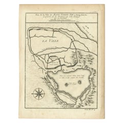
Antique Map of Fort Saint Louis and Santiago de Cuba, 1748
About the Item
Antique map titled 'A plan of the town, fort and harbour of St Louis in the Isle of Hispaniola, or St Domingo / A plan of the town and bay of St. Jago, in the Isle if Cuba'. Two woodcut maps on one sheet, illustrating Admiral Sir Charles Knowles’ successful attack on Fort Saint Louis de Sud during the War of the Austrian Succession (King George’s War) and his abortive assault on Santiago de Cuba, both preceding the controversial Battle of Havana.
Artists and Engravers: Published in 'The London Magazine'
Condition: Good, general age-related toning. English text on verso. Please study image carefully.
Date: 1748
Overall size: 12.5 x 20 cm.
Image size: 10 x 17 cm.
- Dimensions:Height: 7.88 in (20 cm)Width: 4.93 in (12.5 cm)Depth: 0 in (0.01 mm)
- Materials and Techniques:
- Period:
- Date of Manufacture:1748
- Condition:
- Seller Location:Langweer, NL
- Reference Number:
About the Seller
5.0
Platinum Seller
These expertly vetted sellers are 1stDibs' most experienced sellers and are rated highest by our customers.
Established in 2009
1stDibs seller since 2017
1,928 sales on 1stDibs
Typical response time: <1 hour
- ShippingRetrieving quote...Ships From: Langweer, Netherlands
- Return PolicyA return for this item may be initiated within 14 days of delivery.
More From This SellerView All
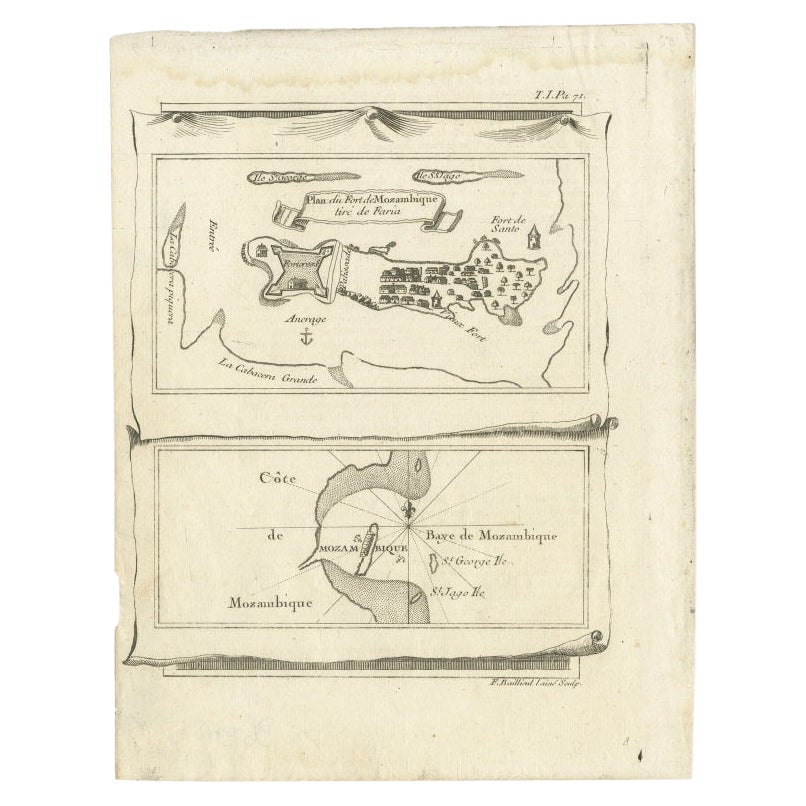
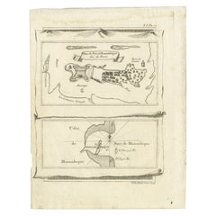
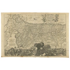
- Antique Map of Mozambique Bay and a Map Fort de Mozambique, c.1759Located in Langweer, NLTwo antique maps on one sheet. The upper antique map is titled 'Plan du Fort de Mozambique tiré de Faria' and depicts the island of Mozambique with its fort, settlement, harbor and i...Category
Antique 18th Century Maps
MaterialsPaper
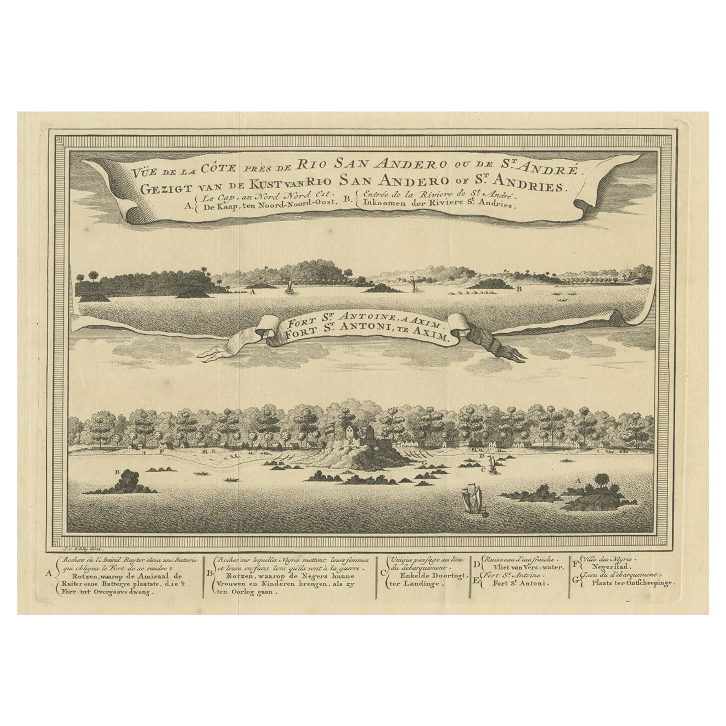
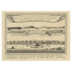
- Antique Print of a Fort on the Ivory Coast and Axim, Africa, 1748By Jakob van der SchleyLocated in Langweer, NLAntique print titled 'Vue de la Cote pres de Rio San Andero - Gezigt van de Kust van Rio San Andero' and 'Fort St. Antoine a Axim - Fort St. Antoni, te Axim'. View of the Ivory coast...Category
Antique 18th Century Prints
MaterialsPaper
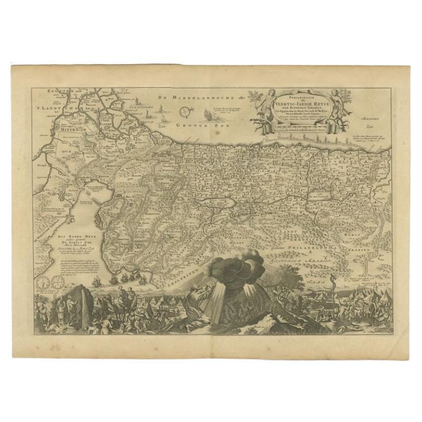
- Antique Map of the Holy Land by Keur, 1748Located in Langweer, NLAntique Map Holy Land titled 'De Gelegentheyd van t'Paradys ende t'Landt Canaan, Mitsgaders d'eerst bewoonde Landen der Patriarchen'. Includes five decorative vignettes, including No...Category
Antique 18th Century Maps
MaterialsPaper
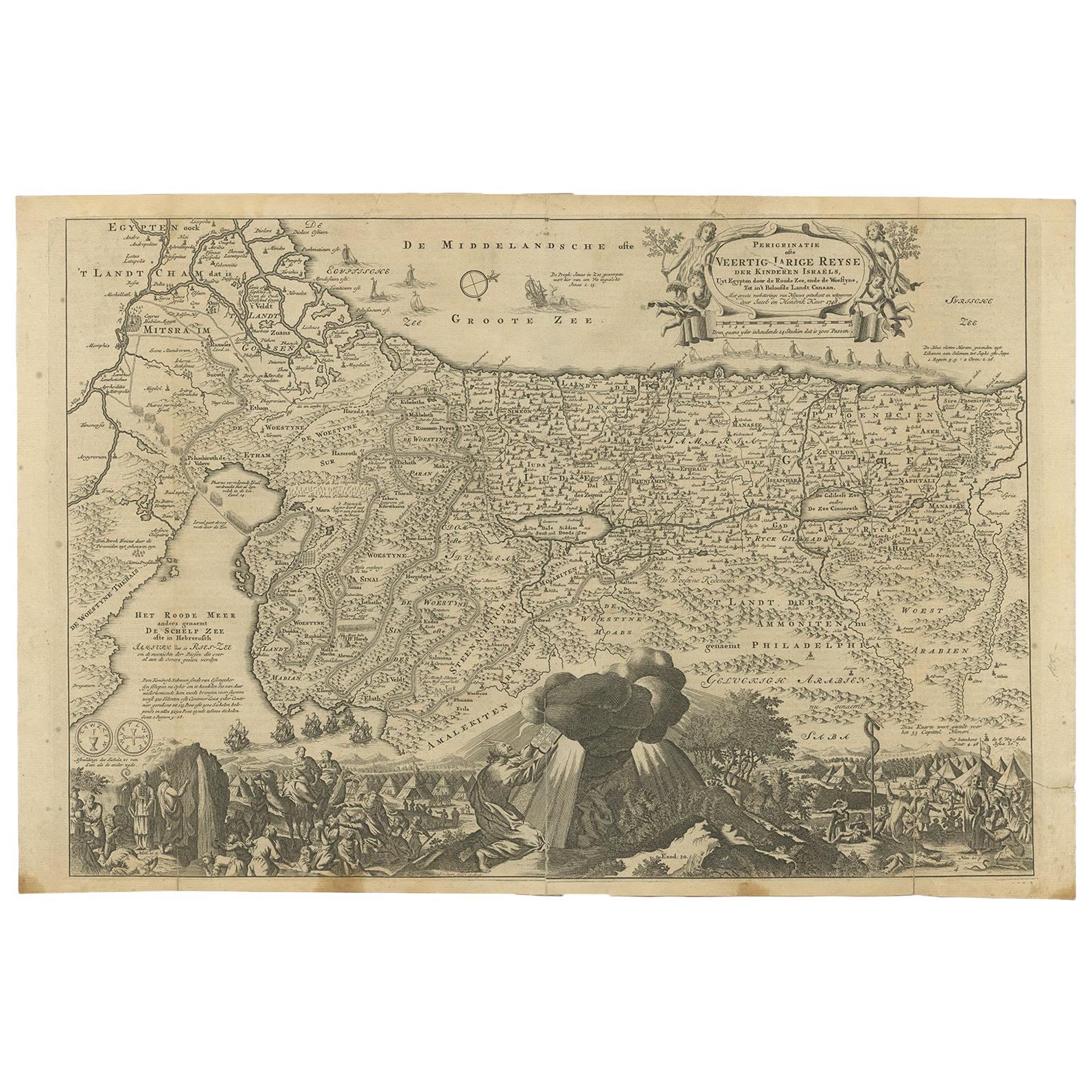
- Antique Map of the Holy Land by Keur, 1748Located in Langweer, NLAntique biblical map titled 'Perigrinatie ofte veertigh-Iarige Reyse der Kinderen Israels uyt Egypten door de Roode Zee ende de Woestyne tot in 't Beloof...Category
Antique 18th Century Maps
MaterialsPaper
- Antique Map Travel Children of Israel by Keur, 1748Located in Langweer, NLAntique biblical map titled 'Perigrinatie ofte veertigh-Iarige Reyse der Kinderen Israels uyt Egypten door de Roode Zee ende de Woestyne tot in 't Beloof...Category
Antique Mid-18th Century Dutch Maps
MaterialsPaper
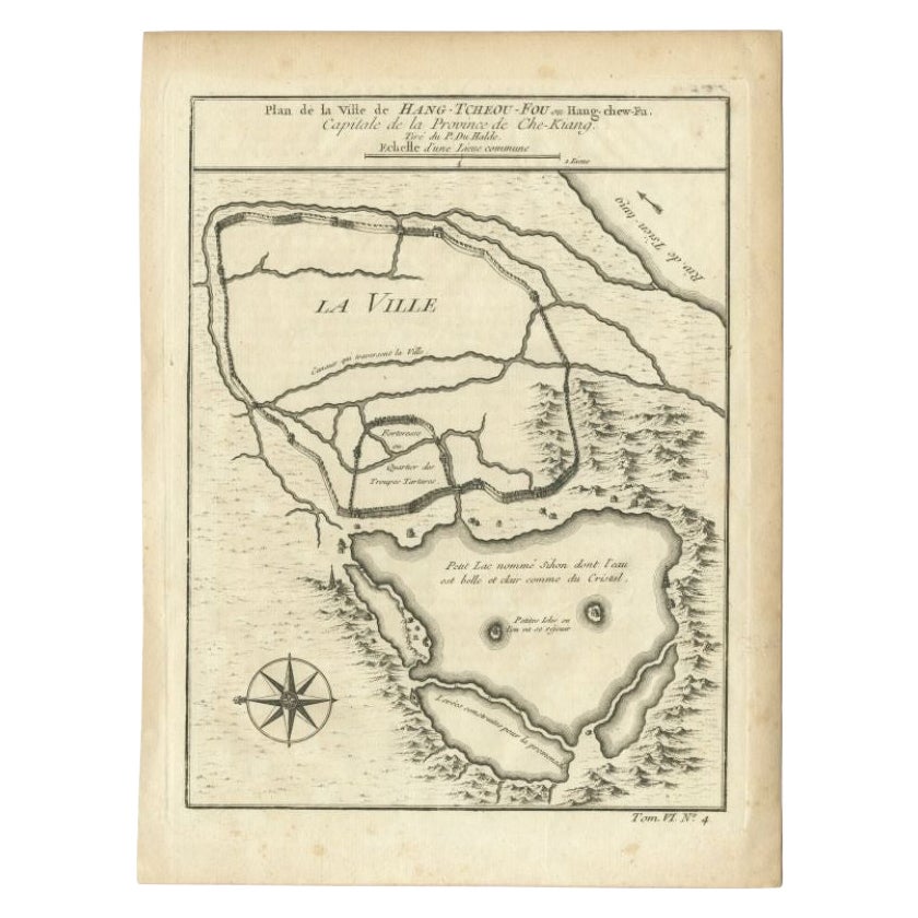
- Antique Map of the City of Hangzhou by Bellin, 1748By Jacques-Nicolas BellinLocated in Langweer, NLAntique map titled 'Plan de la ville de Hang-Tcheou-Fou ou Hang-Chew-Fu Capitale de la Province de Che-Kiang’. This original print shows a map of the city of Hangzhou, capital of the...Category
Antique 18th Century Maps
MaterialsPaper

You May Also Like
- 1907 Map of Colorado, Antique Topographical Map, by Louis NellLocated in Colorado Springs, COThis highly detailed pocket map is a topographical map of the state of Colorado by Louis Nell from 1907. The map "has been complied from all availabl...Category
Antique Early 1900s American Maps
MaterialsPaper
- Santiago de Compostela Traditional Memorabilia FigureLocated in Barcelona, BarcelonaSantiago de Compostela memorabilia metallic figure. Made Spain, circa 1950. In original condition, with minor wear consistent with age and...Category
Vintage 1950s Spanish Modern Religious Items
MaterialsMetal
- 1854 Map of Massachusetts, Connecticut and Rhode Island, Antique Wall MapLocated in Colorado Springs, COThis striking wall map was published in 1854 by Ensign, Bridgman & Fanning and has both full original hand-coloring and original hardware. This impression is both informative and highly decorative. The states are divided into counties, outlined in red, green, and black, and subdivided into towns. Roads, canals, and railroad lines are prominently depicted, although they are not all labeled. The mapmakers also marked lighthouses, banks, churches, and prominent buildings, with a key at right. The map is an informative and comprehensive overview of the infrastructural development of New England prior to the Civil War. Physical geographies depicted include elevation, conveyed with hachure marks, rivers and lakes. The impression features an inset map of Boston...Category
Antique 19th Century American Maps
MaterialsPaper
- Antique Map of Principality of MonacoBy Antonio Vallardi EditoreLocated in Alessandria, PiemonteST/619 - "Old Geographical Atlas of Italy - Topographic map of ex-Principality of Monaco" - ediz Vallardi - Milano - A somewhat special edition ---Category
Antique Late 19th Century Italian Other Prints
MaterialsPaper
- Antique Map of Paris, "Carte Routiere des Environs de Paris" 1841Located in Colorado Springs, COThis beautiful hand-colored road map of Paris was published in 1841. The map shows Paris and the surrounding area in a folding pocket map. Organized and detailed for travelers, this ...Category
Antique 1840s French Maps
MaterialsPaper
- Geographical Antique Map of Principality of MonacoBy Bruno SantiniLocated in Alessandria, PiemonteST/609 - Interesting antique color map of Monaco Principality in French language : "Carte qui contient le Principauté de Piémont, le Monferrat et la comté de...Category
Antique Late 18th Century Italian Other Maps
MaterialsPaper