Items Similar to Pair of Road Maps of England by John Ogilby

Want more images or videos?
Request additional images or videos from the seller
1 of 16
Pair of Road Maps of England by John Ogilby
About the Item
The first road maps of England. London to Holyhead and London to Carlisle. Nicely framed and matted. These are plates removed from a book. These are first editions printed in the late 17th century.
- Dimensions:Height: 23 in (58.42 cm)Width: 27.5 in (69.85 cm)Depth: 1.25 in (3.18 cm)
- Sold As:Set of 2
- Materials and Techniques:
- Place of Origin:
- Period:1690-1699
- Date of Manufacture:1700
- Condition:Print dimensions: 17.38 W x 12.88 H.
- Seller Location:Essex, MA
- Reference Number:1stDibs: LU838128303892
About the Seller
4.9
Gold Seller
These expertly vetted sellers are highly rated and consistently exceed customer expectations.
Established in 1985
1stDibs seller since 2007
813 sales on 1stDibs
Typical response time: 2 hours
Associations
The Art and Antique Dealers League of America
- ShippingRetrieving quote...Ships From: Essex, MA
- Return PolicyA return for this item may be initiated within 14 days of delivery.
More From This SellerView All
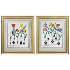
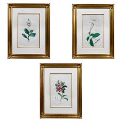
- Pair of Framed Hand Colored Engravings of Tulips by Basilius BeslerBy Basilius BeslerLocated in Essex, MAEach with crisp vivid colors of the most desirable tulip series.Category
Antique Mid-17th Century European Prints
MaterialsPaper
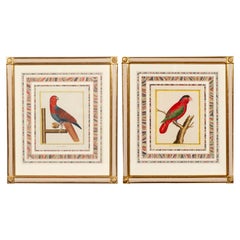
- Pair Of Framed Martinet ParrotsLocated in Essex, MAExquisitely framed. Water gilded frames. Hand colored birds. Marbled matting.Category
Antique 18th Century European Prints
MaterialsGiltwood, Paper
- Set Of Three Framed Botanicals Of Flowers By Hendrik SchwegmanLocated in Essex, MANicely framed. From the estate of John Dingman.Category
Antique Mid-19th Century Dutch Prints
MaterialsGlass, Giltwood, Paper
- Set of Twelve Colored Engravings of the Defeat of the Spanish Armada by J. PineLocated in Essex, MABy John Pine considered the foremost heraldic and decorative engraver of his generation. Depicting the defeat of the Spanish by the English Fleet in 1588. These are after a set of tapestries that hung in the House of Commons...Category
Antique 1740s English Prints
MaterialsPaper
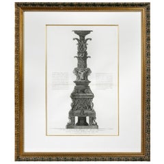
- Framed Engraving of a Candelabrum by Francisco PiranesiLocated in Essex, MANicely framed and matted with a wonderful classical engraving with notations and title.Category
Antique 18th Century Italian Classical Roman Prints
MaterialsPaper
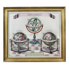
- Framed Engraving By Matthaus Seutter Of Sphaerae ArtificialesLocated in Essex, MACartographer from Germany 1678-1757. Hand colored. Gilt wood frame. Estate of William Hodgins.Category
Antique Early 1700s German Prints
MaterialsPaper

You May Also Like
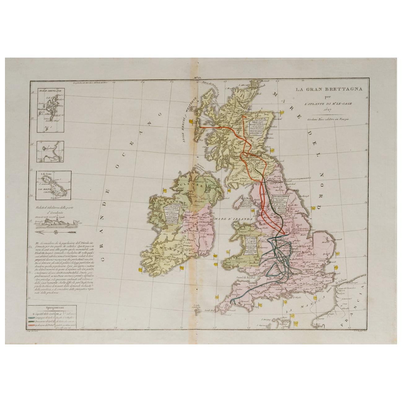
- Old Horizontal Map of EnglandBy TassoLocated in Alessandria, PiemonteST/520 - Old rare Italian map of England, dated 1826-1827 - by Girolamo Tasso, editor in Venise, for the atlas of M.r Le-Sage.Category
Antique Early 19th Century Italian Other Prints
MaterialsPaper
- Antique Map of England & Wales by Wyld '1845'Located in Langweer, NLAntique map titled 'England & Wales'. Original antique map of England & Wales. This map originates from 'An Atlas of the World, Comprehending Se...Category
Antique Mid-19th Century Maps
MaterialsPaper
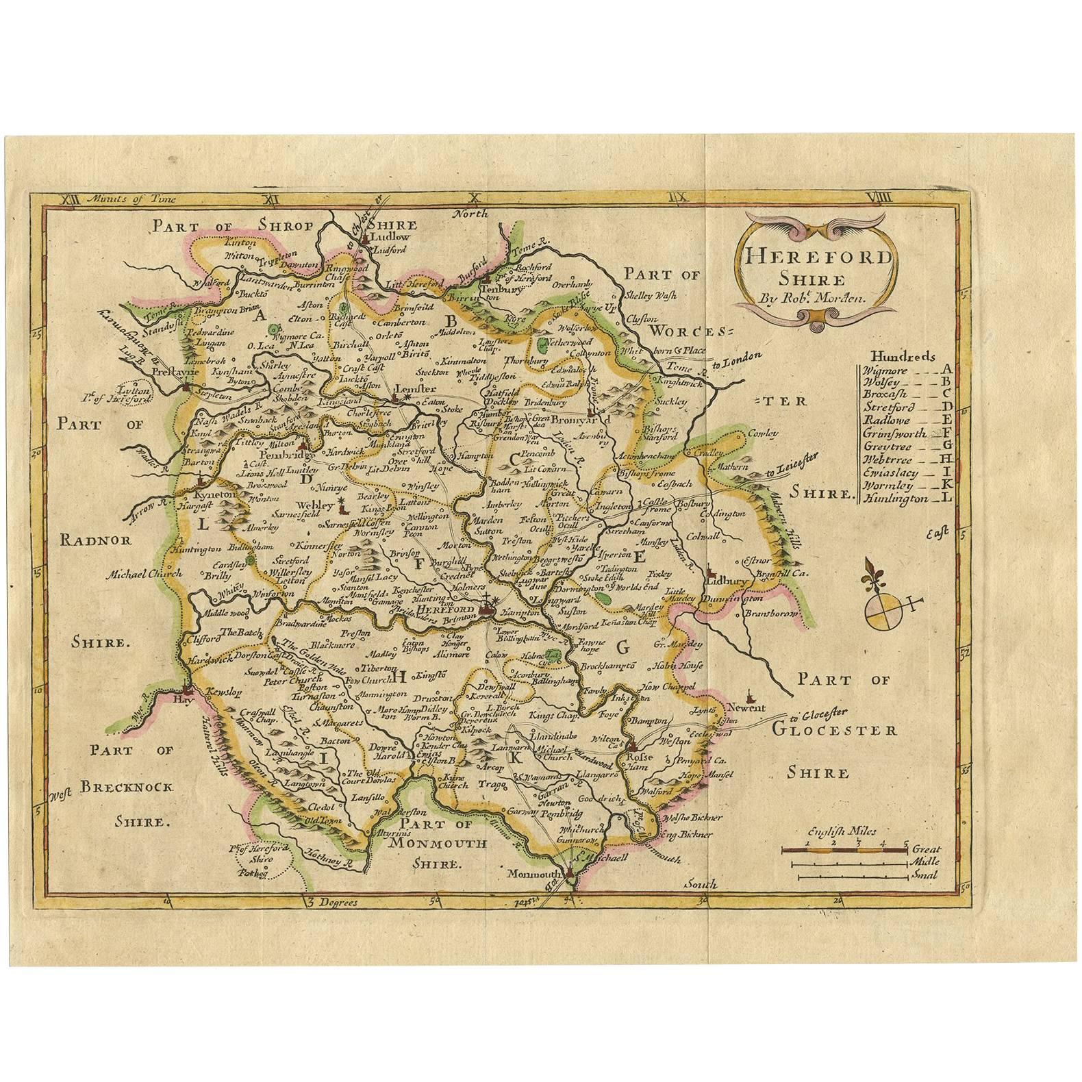
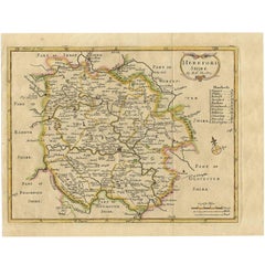
- Antique Map of Herefordshire 'England' by R. Morden, 1708Located in Langweer, NLThis antique County map of Herefordshire by Robert Morden was first published in 1701 in a work entitled 'The New Description and State of England'...Category
Antique Early 18th Century Maps
MaterialsPaper
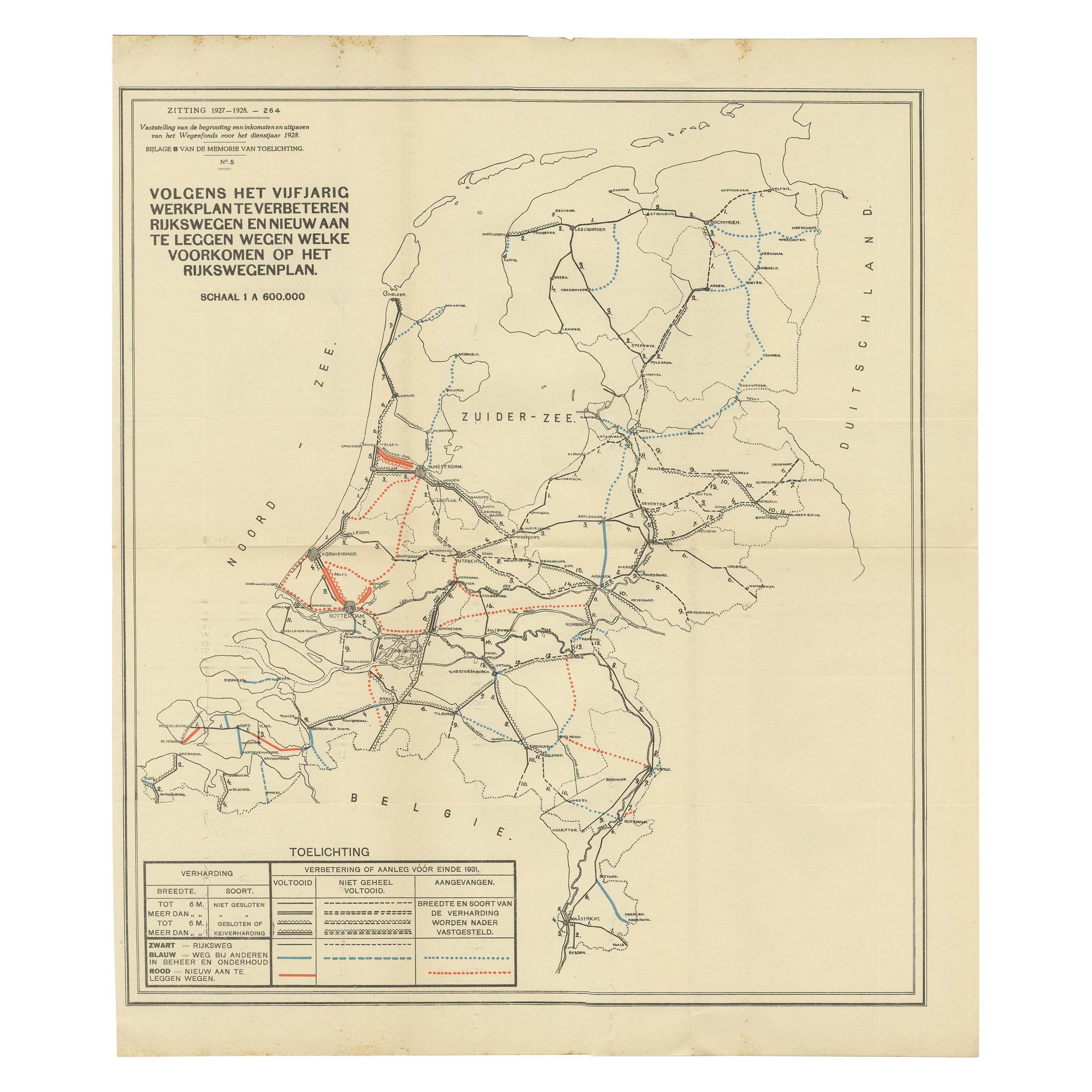
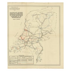
- Vintage Road Map of the Netherlands '1928'Located in Langweer, NLVintage map titled 'Volgens het vijfjarig Werkplan te verbeteren Rijkswegen en nieuw aan te leggen wegen welke voorkomen op het Rijkswegenplan'. Map of the Netherlands...Category
20th Century Maps
MaterialsPaper
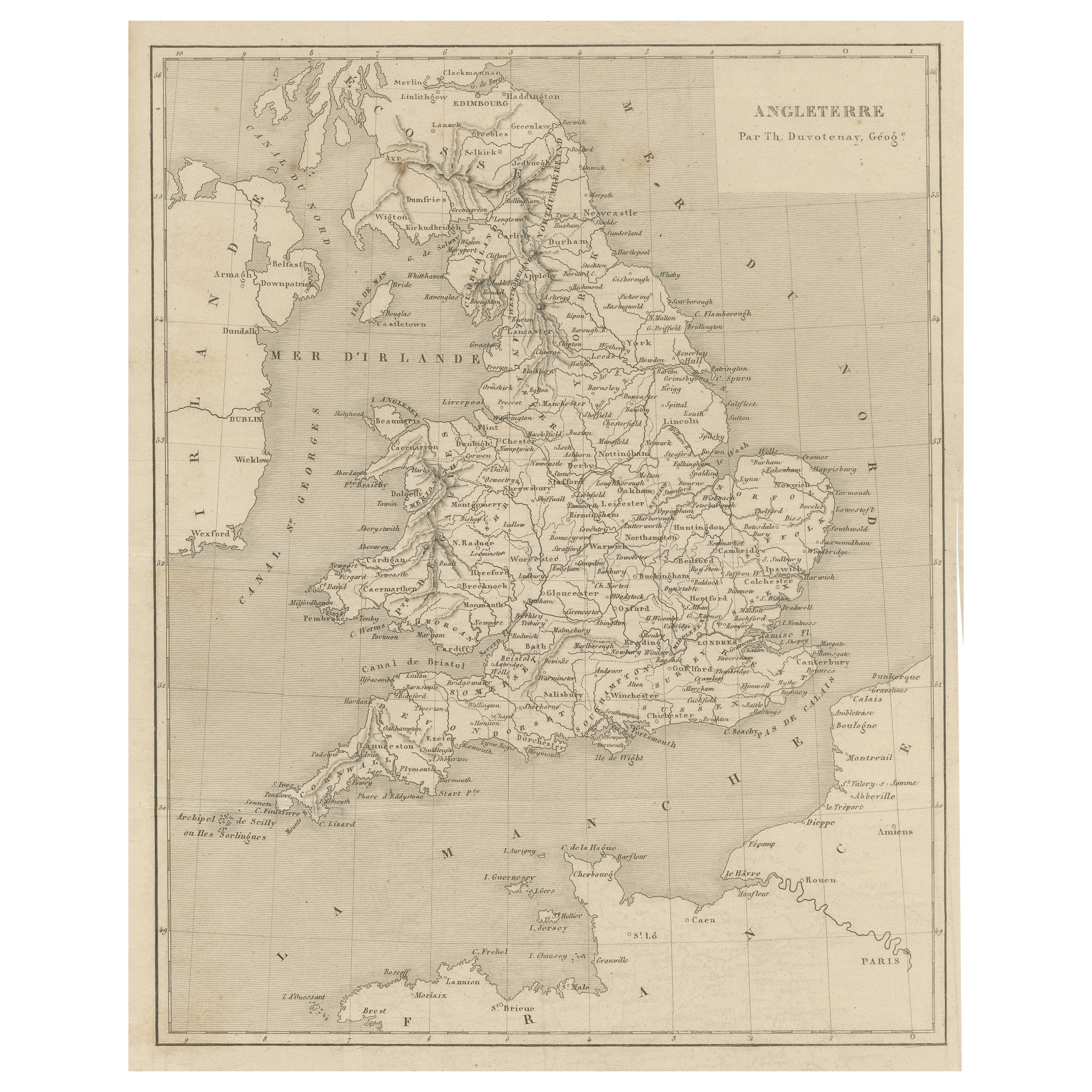
- Steel Engraved Antique Map of EnglandLocated in Langweer, NLAntique map titled 'Angleterre'. Original antique map of England. Engraved by Th. Duvotenay. Originates from 'Complement de L'Encyclopedie Mode...Category
Antique Late 19th Century Maps
MaterialsPaper
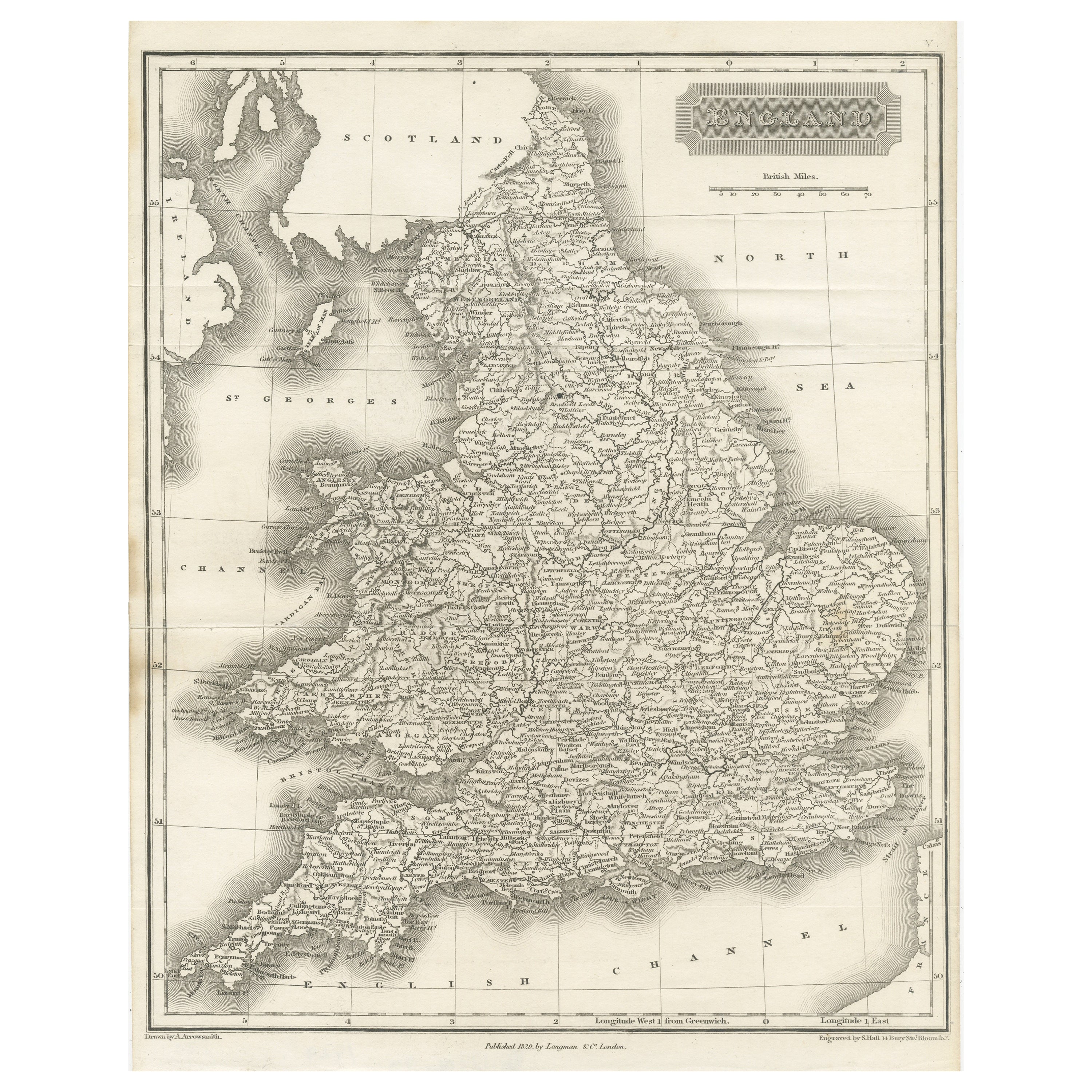
- Small Steel Engraved Map of EnglandLocated in Langweer, NLAntique map titled 'England'. Original steel engraved map of England. Drawn by A. Arrowsmith, engraved by S. Hall. Published 1829 by Longman & Co, London.Category
Antique Mid-19th Century Maps
MaterialsPaper


Recently Viewed
View AllMore Ways To Browse
Book 1700
Carlisle Antique
Antique Furniture Carlisle
John Ogilby
Pair Of Black Chests
Small Antique Display Cabinets
Antique Display Cabinet Small
Small Antique Display Cabinet
Antique Small Display Cabinet
Antique Shop Display
Antique Pieces India
Antique Black Beads
Hand Painted Italian Cabinet
Counter With Storage
Rounded Edge Cabinets
Velvet A Vintage Collection
Antique Colored Cabinets
Drawers Antique White