Antique Maine Map
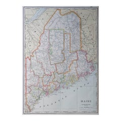
Large Original Antique Map of Maine, USA, C.1900
Located in St Annes, Lancashire
Fabulous map of Maine
Original color
Engraved and printed by the George F. Cram Company
Category
1890s American Antique Maine Map
Materials
Paper
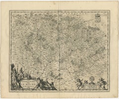
Antique Map of the Maine Region by Janssonius, 1657
By Johannes Janssonius
Located in Langweer, NL
Maine, France. This map originates from 'Atlas Novus, Sive Theatrum Orbis Orbis Terrarum: In quo Galliae
Category
17th Century Antique Maine Map
Materials
Paper
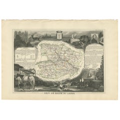
Antique Map of Maine et Loire ‘France’ by V. Levasseur, 1854
Located in Langweer, NL
Antique map titled 'Dépt. de Maine et Loire'. Map of the French department of Maine et Loire
Category
Mid-19th Century Antique Maine Map
Materials
Paper
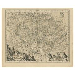
Antique Map of the Region of Maine by Janssonius, circa 1650
By Johannes Janssonius
Located in Langweer, NL
Antique map of France titled 'Diocese du Mans vulgo le Mains'. Decorative map of the region of
Category
Mid-17th Century Antique Maine Map
Materials
Paper
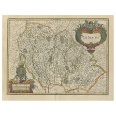
Antique Map of the French Province Maine, Showing Le Mans, Alencon Etc., Ca1640
Located in Langweer, NL
Antique map titled 'Le Maine'.
Old map of the province of Maine, France. It shows the cities of
Category
1640s Antique Maine Map
Materials
Paper
H 19.49 in W 23.04 in D 0 in
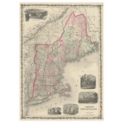
Large Antique Map of New England with decorative Vignettes
Located in Langweer, NL
Antique map titled 'Johnson's New England'. Large map of New England, comprising the states
Category
Mid-19th Century Antique Maine Map
Materials
Paper
Antique Map of New England and Part of Canada by Vaugondy 'circa 1755'
Located in Langweer, NL
Antique map titled 'Partie de l'Amérique septent qui comprend la nouvelle France ou le Canada
Category
Mid-18th Century Antique Maine Map
Materials
Paper
No Reserve
H 20.08 in W 25.99 in D 0.02 in
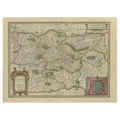
Antique Map of the Region of Le Mans 'France' by Blaeu, circa 1640
By Willem Blaeu
Located in Langweer, NL
Antique map titled 'Cenomanorum Galliae regionis typus vulgo le Mans'. This lovely map of the
Category
Mid-17th Century Antique Maine Map
Materials
Paper
Free Shipping
H 20.08 in W 23.23 in D 0.02 in
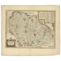
Old Original Handcoloured Map of the Former Province of Perche, France, ca.1640
Located in Langweer, NL
Antique map titled 'Perchensis Comitatus - La Perche compte'.
Old map of the former province of
Category
1640s Antique Maine Map
Materials
Paper
H 14.77 in W 23.04 in D 0 in
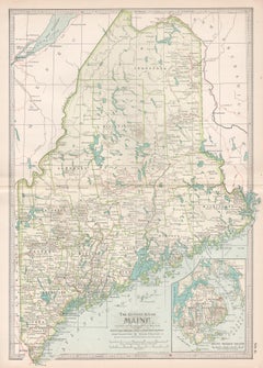
Maine. USA Century Atlas state antique vintage map
Located in Melbourne, Victoria
'The Century Atlas. Maine'
Original antique map, 1903.
Central fold as issued. Map name and
Category
Early 20th Century Victorian Antique Maine Map
Materials
Lithograph
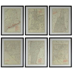
Set of 6 Original Vintage Maps of American States, circa 1900
Located in St Annes, Lancashire
Wonderful set of 6 vintage maps.
Random American states including Maine, Utah, New Hampshire
Category
Early 1900s American Edwardian Antique Maine Map
Materials
Paper
Satyr and Pan, Life Magazine Cover
By B. Cory Kilvert
Located in Fort Washington, PA
London, devising techniques for camouflage. He also developed an interest in map making and created
Category
1920s Other Art Style Antique Maine Map
Materials
Oil, Board
Kellogg's Corn Flakes Advertisement
By B. Cory Kilvert
Located in Fort Washington, PA
for camouflage. He also developed an interest in map making and created several mural-sized pictorial
Category
1910s Other Art Style Antique Maine Map
Materials
Board, Gouache, Watercolor
C. 1625 After Antoine de Pluvinel, "Henry IV, Mounted", Hand Colored Engraving
Located in Morristown, NJ
.
Provenance:
Lombard Antiquarian Maps & Prints, Cape Elizabeth, Maine.
Category
Early 17th Century French Baroque Antique Maine Map
Materials
Plexiglass, Boxwood, Paint, Paper
H 22.5 in W 25.5 in D 0.5 in
Baron Rais d'Eisenberg, Hand-Colored Equestrian Engraving c. 1747, "Le Brillant"
By Eisenberg
Located in Morristown, NJ
examined out of frame.
Provenance:
Lombard Antiquarian Maps & Prints, Cape Elizabeth, Maine
Category
1740s German Rococo Antique Maine Map
Materials
Plexiglass, Wood, Paint, Paper
H 16.5 in W 19.25 in D 0.5 in
Map of Palestine or Judea, Illustrating the History of the New Testament
By Rev. Nathan B. Rogers
Located in New York, NY
of meticulous research by a minister working in isolation in rural Maine. The map shows New Testament
Category
19th Century Antique Maine Map
Materials
Canvas, Paper, Ink, Pen
People Also Browsed
Set of Twelve Sèvres Azure Blue Plates in Their Original Case, circa 1840
By Manufacture Nationale de Sèvres
Located in Brighton, West Sussex
A rare and decorative set of twelve Sèvres Azure blue plates in their original leather fitted case.
French, circa 1840.
Each plate with Sèvres mark to the reverse and Château ...
Category
Mid-19th Century French Antique Maine Map
Materials
Porcelain
H 9.06 in W 19.69 in D 10.63 in
Rare Set of 12 Oval Antique Silver Plated Serving Dishes - Made Circa 1910
Located in London, London
Made circa 1910, this very handsome set of 12, Antique Silver Plate Serving Dishes, are plain in style, oval in shape, and feature reed borders to each.
Finding original sets of se...
Category
1910s English Edwardian Antique Maine Map
Materials
Silver Plate
H 4.73 in W 20.08 in D 14.97 in
Early 19th Century Federal Fireplace Mantel Found in Maine
Located in Hopewell, NJ
Crafted in the Federal style with a striking paneled frieze and light cream paint finish, this antique fireplace mantel brings elegance, and also adds some Arts and Crafts era touche...
Category
19th Century North American Federal Antique Maine Map
Materials
Wood
Life Size Swan Decoy
Located in Coeur d'Alene, ID
Swan decoy from Havre de Grace, Maryland. Original paint.
Period: Mid-20th century
Origin: Maine, United States
Size: 32” x 10” x 17’
Family Owned & Operated
Cisco’s Gallery deals ...
Category
Mid-20th Century American Antique Maine Map
Materials
Wood
19th Century Black-Grey Italian Arte Povera Pine Chest, Antique Tuscan Cupboard
Located in West Palm Beach, FL
A black-grey, antique Italian single chest, commode in the Arte Povera technique, made of hand crafted painted Pinewood in good condition. The Tuscan cabinet, cupboard is composed wi...
Category
Late 19th Century Italian Antique Maine Map
Materials
Metal
H 33 in W 40 in D 21.5 in
Duck Decoy Table Lamp
Located in West Palm Beach, FL
This stylish and chic hand-carved wood duck decoy lamp will make a subtle statement with its form and use of materials. The piece was created by Cornwall Wood Products in Paris, Mai...
Category
Mid-20th Century American Rustic Antique Maine Map
Materials
Brass
19th Century Sponge Ware Serving/Mixing Bowl
Located in Los Angeles, CA
19th century salt glaze sponge ware mixing or serving bowl in pottery and in mint condition. Great size for shelf or table. This was found in Maine.
Category
19th Century American Antique Maine Map
Materials
Pottery
1959 France - Desnoyer Original Vintage Poster
Located in Winchester, GB
Featuring beautiful artwork from the French painter Francois Desnoyer, depicting the celebrations on the streets and river celebrating France on what is presumably Bastille Day. The ...
Category
1950s French Antique Maine Map
Materials
Paper
Nelson's Guide to the City of New York and its Neighbourhood, 1858
Located in Langweer, NL
"Nelson's Guide to the City of New York and its Neighbourhood," published in 1858 by T. Nelson in London and New York, serves as an invaluable resource for exploring the historical a...
Category
1850s Antique Maine Map
Materials
Paper
New England Quilt Oak Leaf Pattern Circa 1900
Located in Hudson, NY
Striking and beautiful New England quilt with oakleaf pattern. Investor investive condition with a highly modernist design pattern. Found in Maine, this quilt made from pumpkin orang...
Category
Early 1900s American Folk Art Antique Maine Map
Materials
Cotton
Extraordinary Passamaquoddy (Maine) Native American Sewing Basket, Dated 1891
Located in York County, PA
PASSAMAQUODDY(MAINE) NATIVE AMERICAN SEWING BASKET WITH AN EXTRAORDINARILY EXUBERANT DESIGN,DATED 1891 WITH A PENCILED INSCRIPTION:
This is perhaps the most elaborate American India...
Category
1890s American Native American Antique Maine Map
Materials
Wood
H 10.75 in W 16 in D 16 in
19th Century Original Painted N.E. Windsor Rocking Chair
Located in Los Angeles, CA
This wonderful 19th century original paint decorated windsor rocking chair is in great condition. The stencil is gilded paint on a mustard painted ground. This rocking chair was foun...
Category
Mid-19th Century American Country Antique Maine Map
Materials
Wood
American 19th Century Original Oil on Canvas Portrait of Edward W. Blaisdell
Located in Wells, ME
American original oil painting on canvas in contemporary gold frame. This is a portrait of Edward W. Blaisdell (1845-1924) a prominent architect who worked primarily on the coast of...
Category
Late 19th Century American American Classical Antique Maine Map
Materials
Canvas, Wood, Paint
H 36 in W 30.5 in D 2 in
American Empire Chest of Drawers with Mirror in Mahogany, Maine, circa 1830
Located in Miami, FL
An American Empire chest in mahogany with four drawers with original turned knobs, and with original vanity mirror with square tapering columns. Chest rests on lion's paw feet with a...
Category
1830s American American Empire Antique Maine Map
Materials
Mahogany
H 74 in W 44.25 in D 21.5 in
Pair Late 19th C.Louis XV style Carved & Painted Wood, Marble Topped Guéridon
Located in Hudson, NY
The pair of tables was made in France between 1890 and 1900. Designed in the Louis XV style the pair has extensive hand-carved decorative elements including acanthus leaves, fluting ...
Category
Late 19th Century French Louis XV Antique Maine Map
Materials
Marble
1856 U.S. Coast Survey Map of Chesapeake Bay and Delaware Bay
Located in Colorado Springs, CO
Presented is U.S. Coast Survey nautical chart or maritime map of Chesapeake Bay and Delaware Bay from 1856. The map depicts the region from Susquehanna, Maryland to the northern Oute...
Category
1850s American Antique Maine Map
Materials
Paper
Recent Sales
6, 19th Century hand-colored maps printed by Anthony Finley of Philadelphia 1824
Located in San Antonio, TX
nascent American cartographic world.
Maps in series: Maryland, Vermont, Maine, Massachusetts, Ohio and
Category
Early 19th Century Academic Antique Maine Map
Materials
Lithograph, Pastel
H 13 in W 10.38 in D 0.07 in
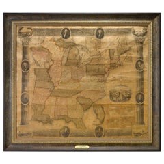
1839 Antique Ornamental Map of the United States, by William Chapin
Located in Colorado Springs, CO
This is a wonderfully "ornamental" hand-colored wall map of the United States from 1839, the first
Category
19th Century American Antique Maine Map
Materials
Paper
American Revenue Cutter Service Ensign Belonging To Capt. W. H. Bagley
Located in York County, PA
, MAINE), A RARE AND FANTASTICALLY VISUAL EXAMPLE, MADE CA 1870-80:
United States Revenue Cutter
Category
1870s American Antique Maine Map
H 53.75 in W 81.25 in D 2.5 in
American Revenue Cutter Service Ensign (Flag) Belonging to Cpt. William Bagley
Located in York County, PA
. 1838, Durham, Maine), a rare and fantastically visual example, made circa 1870-1880:
United States
Category
1870s American Antique Maine Map
H 53.75 in W 81.25 in D 2.5 in
Antique Map of Maine by Johnson, 1872
Located in Langweer, NL
Antique map titled 'Johnson's Maine'. Original map of Maine. This print originates from 'Johnson's
Category
Late 19th Century Antique Maine Map
Materials
Paper
Original Antique Map of Maine, circa 1890
Located in St Annes, Lancashire
Great map of Maine
Original color.
Published: circa 1890
Repairs to few minor edge tears
Category
1890s English Other Antique Maine Map
Materials
Paper
1887 Maine Wall Map with Original Hanging Hardware
Located in Colorado Springs, CO
This is an 1887 Wall Map of the State of Maine by Colby & Stuart. This highly detailed Map of Maine
Category
19th Century American Antique Maine Map
Large Original Antique Map of Maine, USA, 1894
By Rand McNally & Co.
Located in St Annes, Lancashire
Fabulous map of Maine
Original color
By Rand, McNally & Co.
Published, 1894
Unframed
Category
1890s American Antique Maine Map
Materials
Paper
Original Antique Map of The American State of Maine, 1889
Located in St Annes, Lancashire
Great map of Maine
Drawn and Engraved by W. & A.K. Johnston
Published By A & C Black
Category
1880s Scottish Victorian Antique Maine Map
Materials
Paper
Antique Map of Maine et Loire ‘France’ by V. Levasseur, 1854
Located in Langweer, NL
Antique map titled 'Dépt. de Maine et Loire'. Map of the French department of Maine et Loire
Category
Mid-19th Century Antique Maine Map
Maine. USA Century Atlas state antique vintage map
Located in Melbourne, Victoria
'The Century Atlas. Maine'
Original antique map, 1903.
Central fold as issued. Map name and
Category
Early 20th Century Victorian Antique Maine Map
Materials
Lithograph
Maine et Loire, France. Antique map of French department, 1856
By Victor Levasseur
Located in Melbourne, Victoria
'Dept. de Maine et Loire Steel', engraving with original outline hand-colouring., 1856, from
Category
19th Century Naturalistic Antique Maine Map
Materials
Engraving
"Prouts Neck, Maine"
By Jesse Leach France
Located in Southampton, NY
. Condition: Very good. Circa 1910. View of Prouts Neck coastline in Maine. Original period frame. Overall
Category
1910s Post-Impressionist Antique Maine Map
Materials
Oil, Board
1805 Map of the United States
Located in Missouri, MO
. This is a finely detailed and engraved map credited in the inscription to Aaron Arrowsmith and printed
Category
Early 1800s Antique Maine Map
Materials
Etching
1889 Sea Chart Map of Delaware Bay by George Eldridge, Chart No. 11
Located in Colorado Springs, CO
block plans, among them Philadelphia, Wilmington, Delaware City, and Greenwich.
The map was published
Category
1880s Antique Maine Map
Materials
Paper
Portrait by William Joseph Weaver, Anglo-American
Located in Litchfield, CT
" x 19 15/16"; 31 ½" x 25 ¼" framed.
Provenance: Private Collection, Maine to 2014; Jeffrey Tillou
Category
Early 19th Century American American Classical Antique Maine Map
Get Updated with New Arrivals
Save "Antique Maine Map", and we’ll notify you when there are new listings in this category.
Antique Maine Map For Sale on 1stDibs
With a vast inventory of beautiful furniture at 1stDibs, we’ve got just the antique maine map you’re looking for. Frequently made of paper, every antique maine map was constructed with great care. You’ve searched high and low for the perfect antique maine map — we have versions that date back to the 18th Century alongside those produced as recently as the 19th Century are available. When you’re browsing for the right antique maine map, those designed in Victorian styles are of considerable interest. Many designers have produced at least one well-made antique maine map over the years, but those crafted by Johannes Janssonius are often thought to be among the most beautiful.
How Much is a Antique Maine Map?
The average selling price for an antique maine map at 1stDibs is $231, while they’re typically $25 on the low end and $2,000 for the highest priced.
