Items Similar to 1889 Sea Chart Map of Delaware Bay by George Eldridge, Chart No. 11


Want more images or videos?
Request additional images or videos from the seller
1 of 5
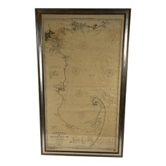
1889 Sea Chart Map of Delaware Bay by George Eldridge, Chart No. 11
About the Item
Presented is an original Eldridge's Chart No. 11, Delaware Bay and River, from The United States Coast and George Eldridge's Surveys, published in 1889. The sea chart shows the Delaware Bay from its mouth up to just north of Philadelphia.
The sea chart is dense with hydrographical information, including soundings, shoals, lighthouses, buoys, compass roses, and shoals. It also offers sailing directions and notes on tides and currents. Dotted lines on the chart give sailors the distance and sailing directions between ports and numerous buoys or other intersections. Some towns and cities appear inland as block plans, among them Philadelphia, Wilmington, Delaware City, and Greenwich.
The map was published by S. Thaxter & Son, whose stamp appears on the chart, dated 1889. Another vintage stamp, for Charles A. Harriman, a dealer of charts and other nautical goods based in Maine, is located in an unengraved area at top.
Large-scale nautical charts are generally rare on the market today due to the fact that they were used in a damp, rough environment and generally discarded as updated versions became available.
- Dimensions:Height: 53.25 in (135.26 cm)Width: 35.5 in (90.17 cm)Depth: 1.5 in (3.81 cm)
- Materials and Techniques:
- Period:
- Date of Manufacture:1889
- Condition:Additions or alterations made to the original: Map is presented framed in a custom-built, wooden black and antiqued silver frame. Wear consistent with age and use. Minor fading. Map is in good condition overall, despite some rippling to paper, overall toning, and scattered foxing, all due to past use. Select areas of damp-staining. Map has been backed onto new archival linen, for stability.
- Seller Location:Colorado Springs, CO
- Reference Number:Seller: M1361stDibs: LU909729678062
About the Seller
4.9
Platinum Seller
These expertly vetted sellers are 1stDibs' most experienced sellers and are rated highest by our customers.
Established in 2010
1stDibs seller since 2011
400 sales on 1stDibs
Typical response time: <1 hour
- ShippingRetrieving quote...Ships From: Colorado Springs, CO
- Return PolicyA return for this item may be initiated within 10 days of delivery.
More From This SellerView All
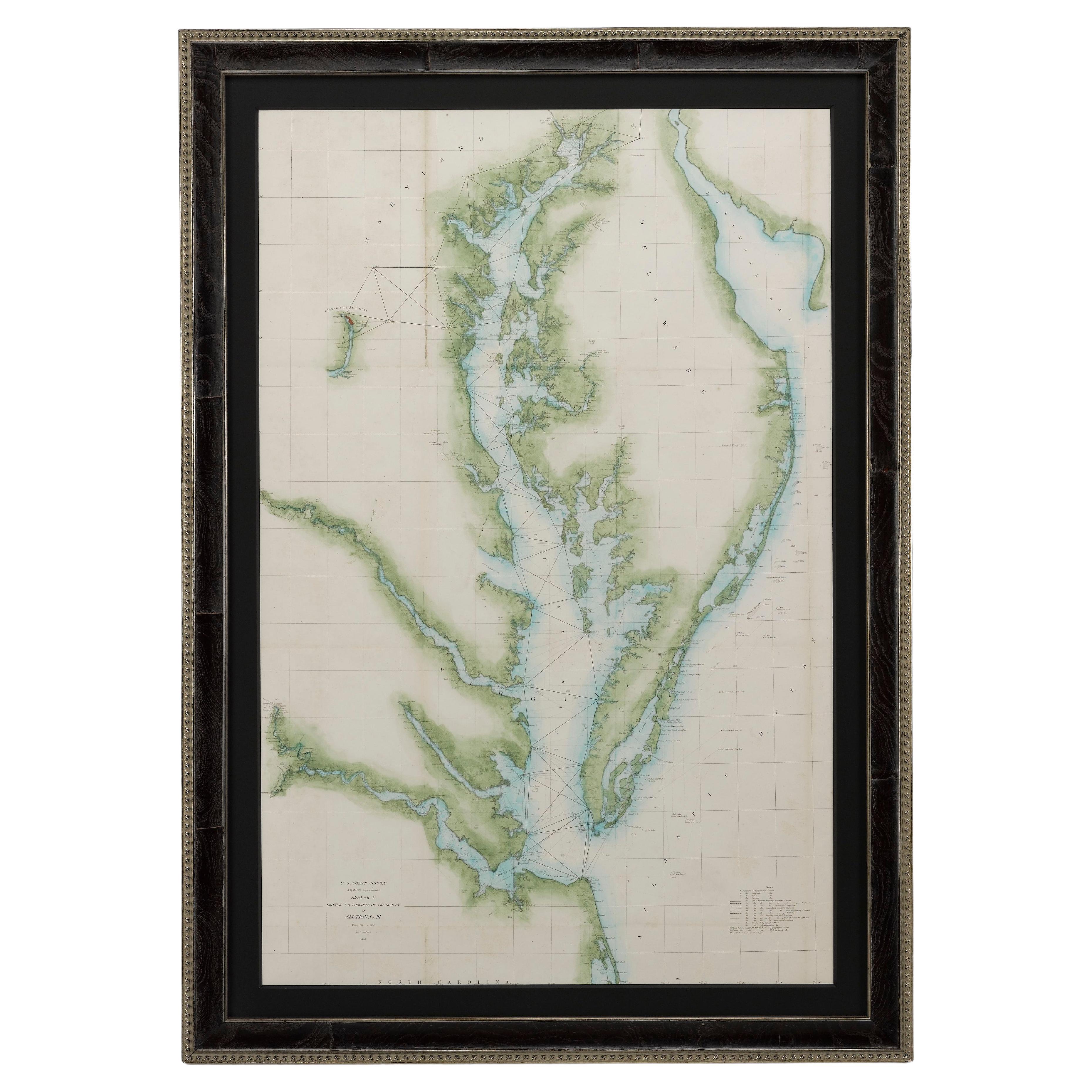
- 1856 U.S. Coast Survey Map of Chesapeake Bay and Delaware BayLocated in Colorado Springs, COPresented is U.S. Coast Survey nautical chart or maritime map of Chesapeake Bay and Delaware Bay from 1856. The map depicts the region from Susquehanna, Maryland to the northern Oute...Category
Antique 1850s American Maps
MaterialsPaper
- 1907 Map of Colorado, Antique Topographical Map, by Louis NellLocated in Colorado Springs, COThis highly detailed pocket map is a topographical map of the state of Colorado by Louis Nell from 1907. The map "has been complied from all availabl...Category
Antique Early 1900s American Maps
MaterialsPaper
- 1861 Topographical Map of the District of Columbia, by Boschke, Antique MapLocated in Colorado Springs, COPresented is an original map of Albert Boschke's extremely sought-after "Topographical Map of the District of Columbia Surveyed in the Years 1856 ...Category
Antique 1860s American Historical Memorabilia
MaterialsPaper
- "Clason's Guide Map of Montana" by The Clason Map Company, Circa 1920sLocated in Colorado Springs, COPresented is “Clason's Guide Map of Montana,” published in the early 1920s by the Clason Map Company. Issued as a folding map, this map identifies county boundaries, county seats, Na...Category
Vintage 1920s American Art Deco Maps
MaterialsPaper
- 1864 Map of North America, Antique Hand-Colored Map, by Adolphe Hippolyte DufourLocated in Colorado Springs, COOffered is a map of North America entitled Amerique du Nord from 1864. This rare, separately published wall map was produced by Adolphe Hippolyte Dufour. This map includes vibrant an...Category
Antique 1860s French Maps
MaterialsPaper
- 1908 "Map of Texas" by The Kenyon CompanyLocated in Colorado Springs, COPresented is an antique map of the state of Texas, printed as a pocket map in 1908 by The Kenyon Company. The state map is brightly colored by county, with principal cities and towns listed. The congressional districts are numbered and boldly outlined in red. Rivers, roads, and railroads all appear prominently on this fantastic map...Category
Antique Early 1900s American Maps
MaterialsPaper


You May Also Like
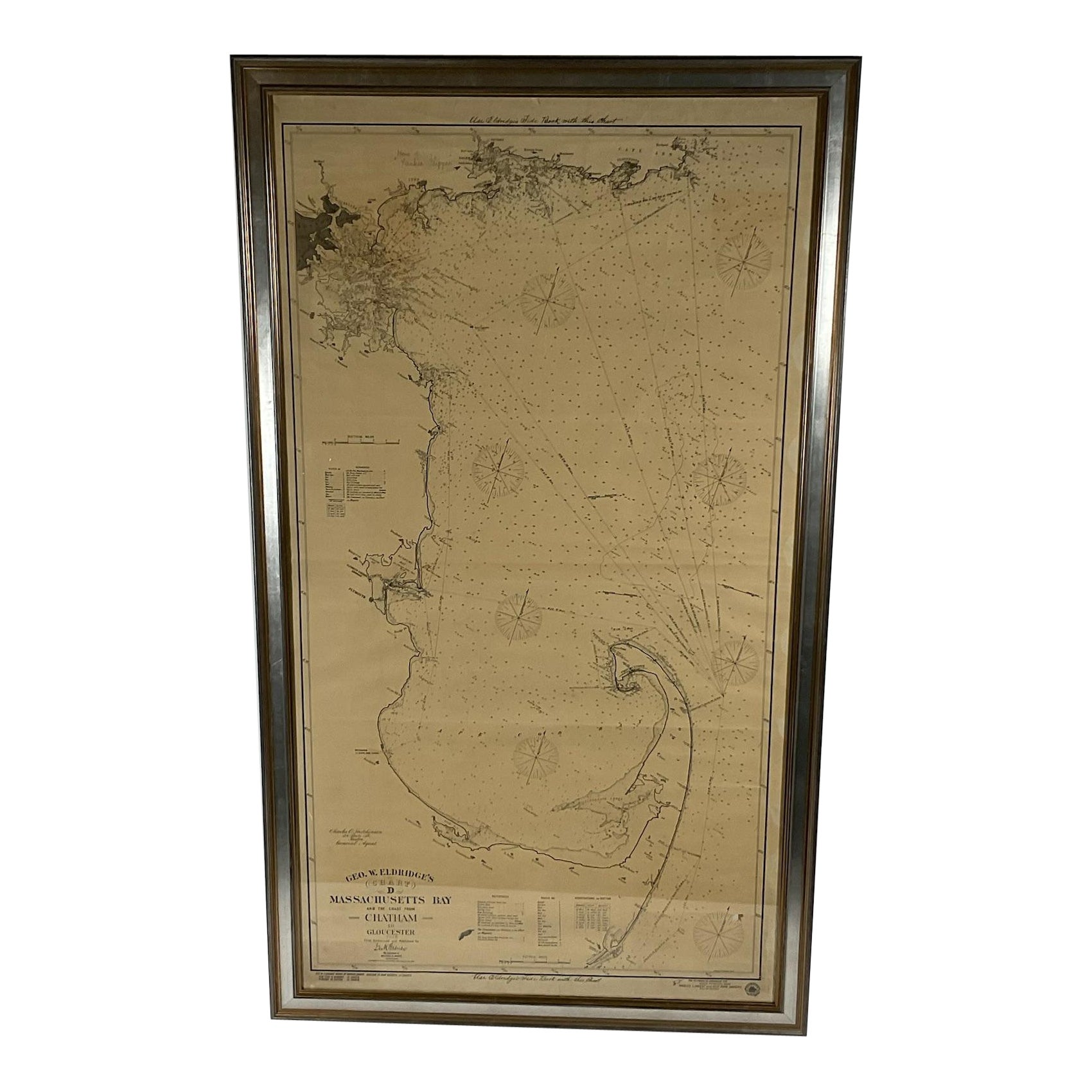
- 1918 George Eldridge Chart of Massachusetts BayLocated in Norwell, MARare early twentieth century chart of Cape Cod bay by George Eldridge showing Massachusetts Bay, and the coast from Chatham to Gloucester 1918. Signed George Eldridge. This great ch...Category
Vintage 1910s North American Maps
MaterialsPaper
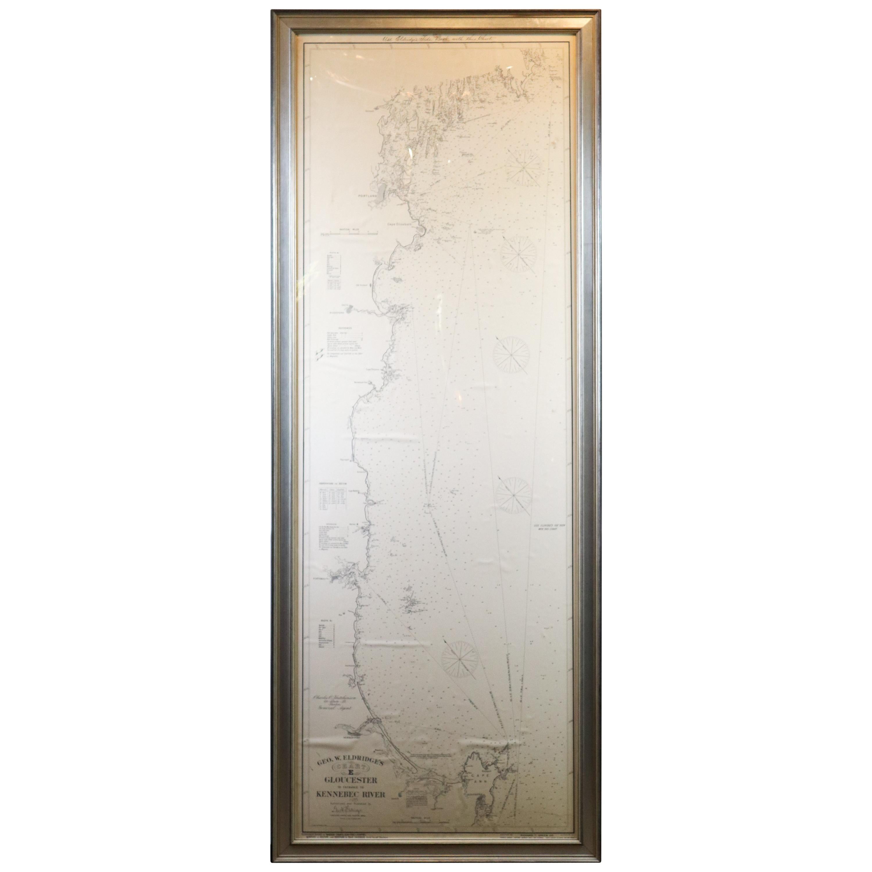
- Original 1910 George Eldridge ChartLocated in Norwell, MAOriginal framed 1910 George Eldridge chart "E" showing Gloucester to the Kennebec river. Showing the coast of Maine in great detail. Towns include Bath, Camden, Portland, the Coastal...Category
20th Century Unknown Maps
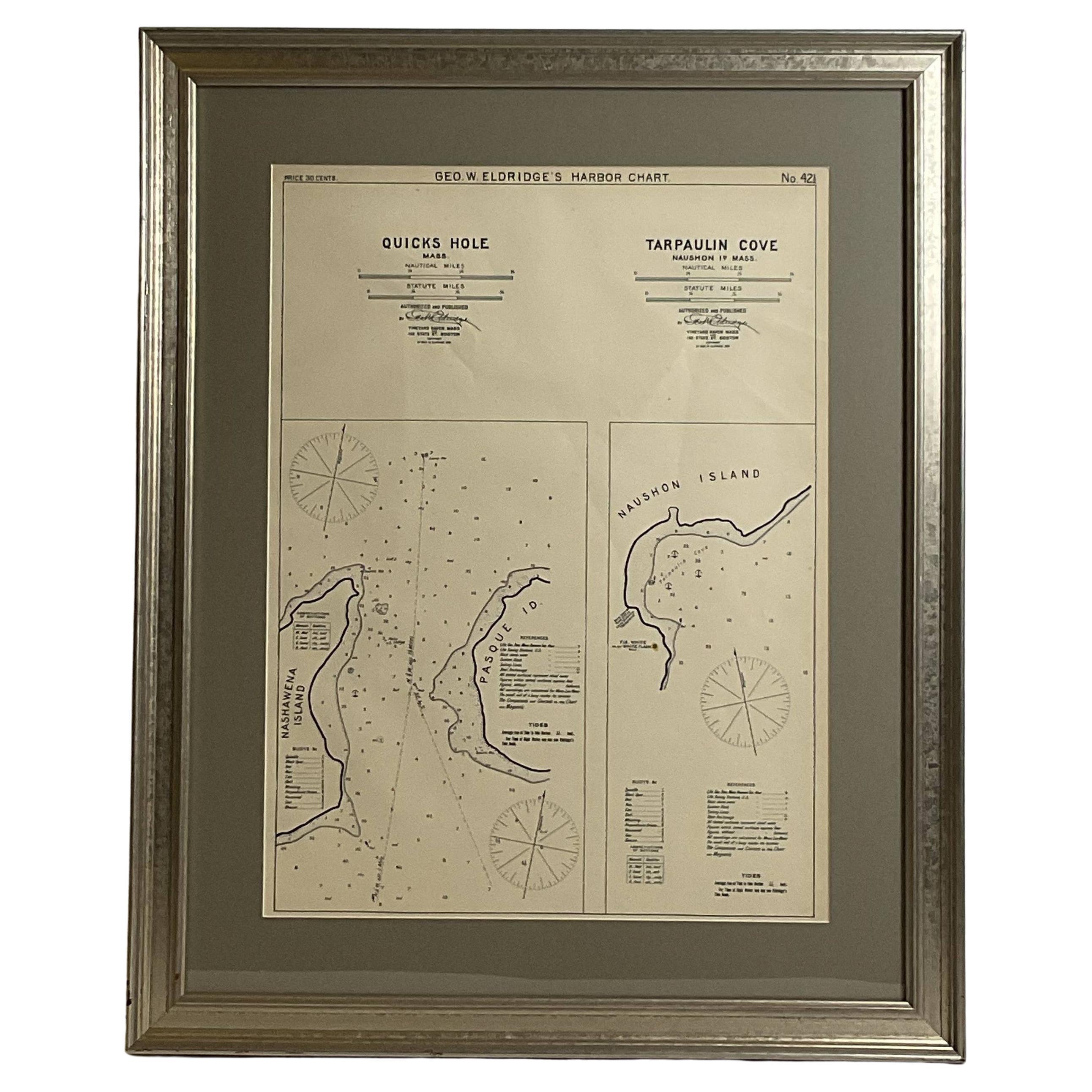
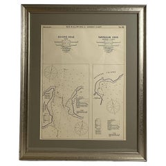
- Mariners Chart of Quicks Hole and Tarpaulin Cove by George Eldridge 1901Located in Norwell, MANautical chart showing the harbor and local waters of Naushon Island Quick Holes. The chart display depths buoys, lightness, etc., The chart shows the cove in Naushon with ships stor...Category
Antique Early 1900s North American Maps
MaterialsPaper
- 1898 Chart of Boston BayLocated in Norwell, MAOriginal 1898 chart showing Massachusetts Bay with the coast from Cape Ann to Cape Cod. This is a U.S. Navy Geodetic survey chart. All towns are noted along the coast. Framed with gl...Category
Antique 1890s Nautical Objects
MaterialsPaper
- Original Antique Map of Missouri, 1889Located in St Annes, LancashireGreat map of Missouri Drawn and Engraved by W. & A.K. Johnston Published By A & C Black, Edinburgh. Original colour Unframed.Category
Antique 1880s Scottish Victorian Maps
MaterialsPaper

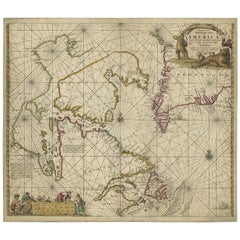
- Antique Sea Chart of Hudson Bay and Arctic Canada by Van Keulen, circa 1681Located in Langweer, NLAntique map titled 'Pascaarte vande Noorderzee Custen van America (..)'. Sea chart of Hudson Bay and Arctic Canada. Compass roses, loxodromic lines, and ships decorate the oceans and...Category
Antique Late 17th Century Maps
MaterialsPaper

Recently Viewed
View AllMore Ways To Browse
Used Charts
Furniture From Maine
Antique Chart
Antique Charts
Original Vintage Maps
Bay Area Used Furniture
Antique Furniture Maine
Maine Antique Furniture
Bay Area Furniture
Antique Market Scale
Vintage Antique Scale
Antique Vintage Scales
Antique And Vintage Scales
Delaware Furniture
Large Vintage Maps
Vintage Sailor
Lighthouse Antique
Antique Lighthouse