Items Similar to Copper Engraved Grenada Map by John Thompson Published in 1810
Want more images or videos?
Request additional images or videos from the seller
1 of 6
Copper Engraved Grenada Map by John Thompson Published in 1810
About the Item
John Thomson's original antique map of Grenada, dating back to 1810 and hailing from Edinburgh, stands as a testament to meticulous cartography. This historical piece, adorned with original outline coloring, embodies a significant contribution to the category of Maps West Indies Whole.
Crafted with precision, the map delineates the intricate details of Grenada, capturing the essence of the island during that period. Thomson's expertise shines through in the map's accuracy, presenting geographical features, coastal boundaries, and settlements with meticulous attention.
The use of original outline coloring enriches the map, enhancing the visual appeal while distinguishing various elements across the island. As a part of the broader category of Maps West Indies Whole, this particular map embodies a comprehensive depiction of Grenada within the context of the West Indies.
Thomson's cartographic mastery, evident in this 1810 rendition, reflects an era of exploration and geographical understanding. This antique map of Grenada, originating from Edinburgh, remains a valuable historical artifact, offering insights into the geography and cartographic techniques prevalent during the early 19th century in the West Indies.
Grenada's history weaves a tapestry of indigenous roots, European colonization, and struggles for independence. Initially inhabited by the Kalinago people, European exploration in the late 15th century led to Spanish colonization in the early 16th century. However, ongoing conflicts between European powers resulted in the French seizing control in 1650, establishing sugar plantations and importing enslaved Africans.
The island's strategic importance led to a tug-of-war between the French and British. Grenada changed hands multiple times throughout the 18th century, finally becoming a British colony in 1783 under the Treaty of Versailles. The impact of slavery and the plantation economy shaped Grenada's society and economy.
In 1974, Grenada gained independence from Britain, entering a period of political turbulence. The 1979 revolution led by Maurice Bishop brought hopes for change but was marred by internal strife. In 1983, a power struggle culminated in a U.S.-led military intervention.
Today, Grenada thrives as an independent nation in the Caribbean, known for its stunning landscapes, vibrant culture, and nutmeg production. Its history reflects a complex interplay of indigenous heritage, colonial influences, struggles for self-determination, and efforts to forge a modern identity amid diverse challenges.
- Dimensions:Height: 9.85 in (25 cm)Width: 11.62 in (29.5 cm)Depth: 0.01 in (0.2 mm)
- Materials and Techniques:Paper,Engraved
- Period:
- Date of Manufacture:1810
- Condition:Additions or alterations made to the original: Extended margins on the bottom and right side, support with tape on the reverse. Repaired: One tear repaired in lower left corner with tape on the reverse. Good. A scuffy area in La Grande Baye, but not disturbing. Overal aged related toning. Still an attractive and decorative map with original colors.
- Seller Location:Langweer, NL
- Reference Number:
About the Seller
5.0
Platinum Seller
These expertly vetted sellers are 1stDibs' most experienced sellers and are rated highest by our customers.
Established in 2009
1stDibs seller since 2017
1,919 sales on 1stDibs
Typical response time: <1 hour
- ShippingRetrieving quote...Ships From: Langweer, Netherlands
- Return PolicyA return for this item may be initiated within 14 days of delivery.
More From This SellerView All
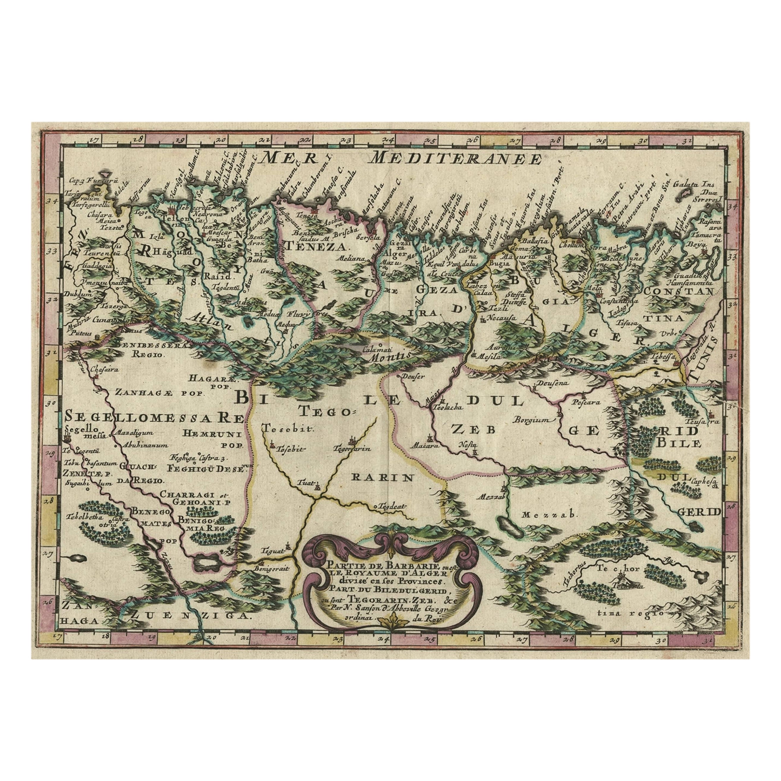
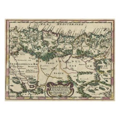
- Copper-Engraved Map Showing the Algerian Coast of North Africa, Published 1683Located in Langweer, NLAntique map titled 'Partie de Barbarie, ou est le Royaume d'Alger (..)'. Copper-engraved map showing the Algerian coast of North Africa. Published 1683. Artists and Engravers:...Category
Antique 1680s Maps
MaterialsPaper
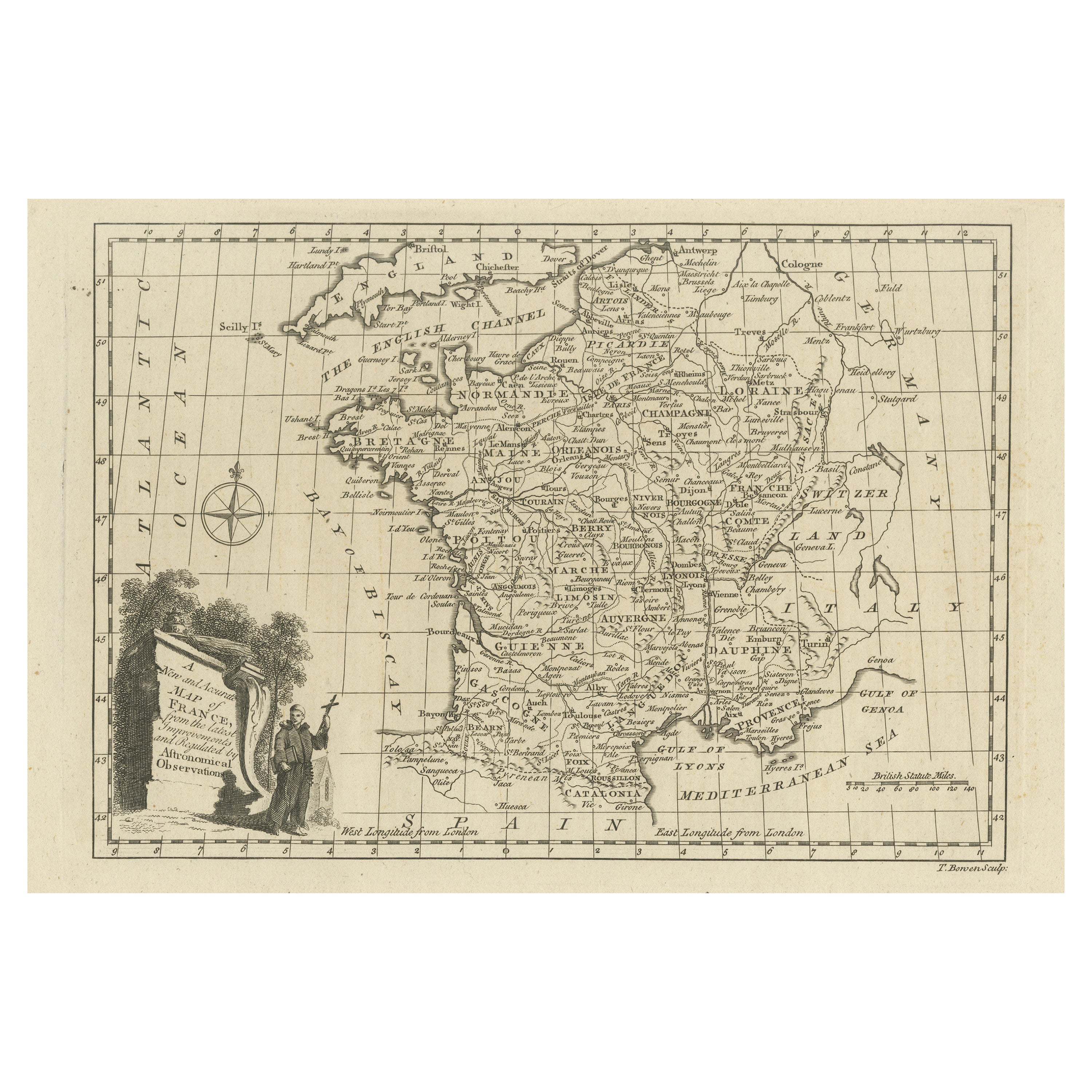
- Original Copper Engraved Map of FranceLocated in Langweer, NLAntique map titled 'New and Accurate Map of France from the latest improvements'. Original copper engraved map of France. Engraved by T. Bowen, published circa 1771.Category
Antique Late 18th Century Maps
MaterialsPaper
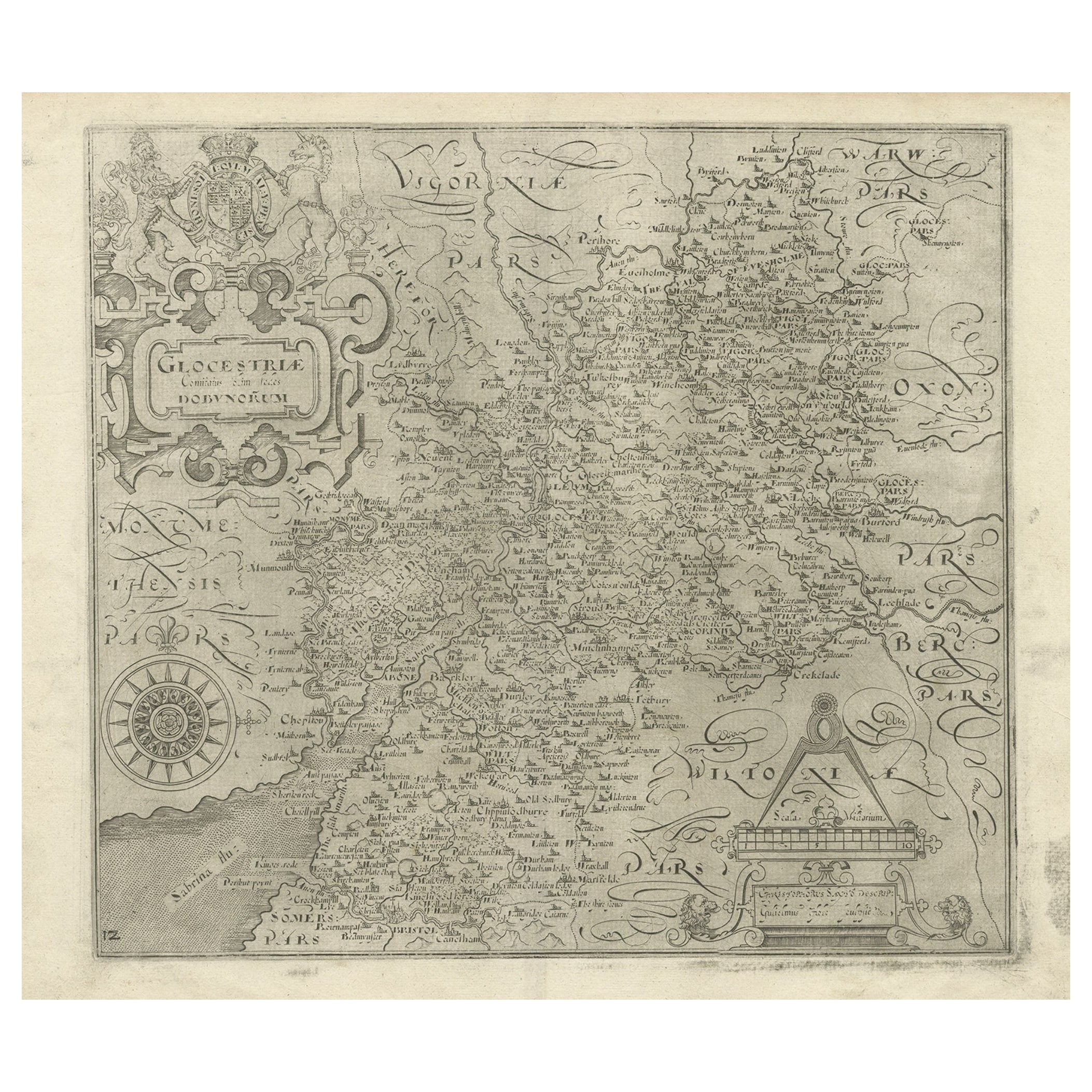
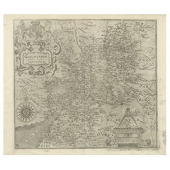
- Antique Copper Engraved Map of Gloucestershire in England, 1637Located in Langweer, NLAntique map titled 'Glocestriae comitatus olim sedes Dobunorum'. Map of Gloucestershire, England. This map originates from Camden?s 'Britannia' ...Category
Antique 17th Century Maps
MaterialsPaper
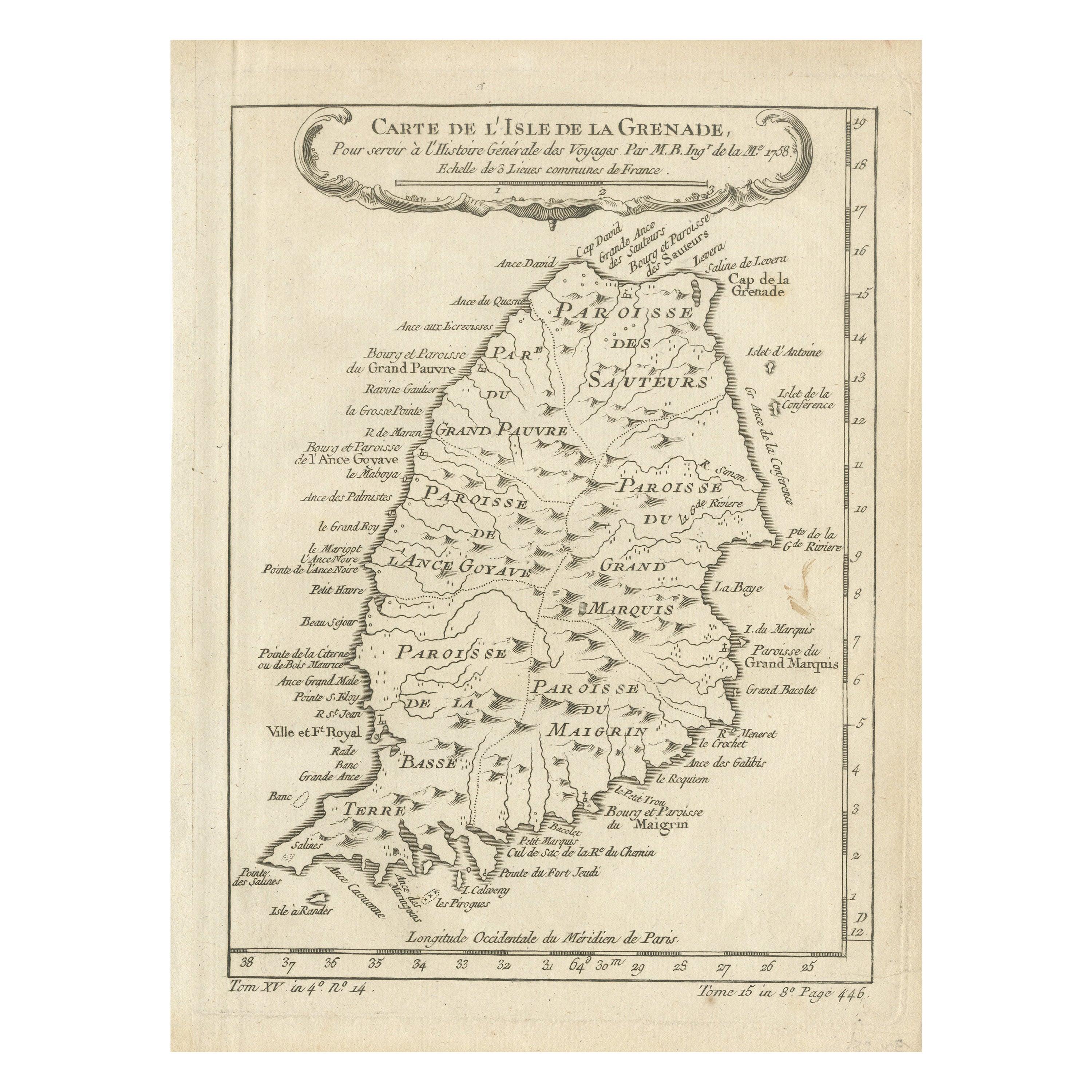
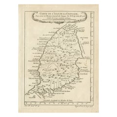
- Antique Map of Grenada, West Indies, 1758Located in Langweer, NL"Exquisite 1758 Map: 'CARTE DE L'ISLE DE LA GRENADE' This alluring map presents a detailed depiction of the Island of Grenada, boasting remarkable intricacy for its time. Notably, i...Category
Antique 1750s Maps
MaterialsPaper
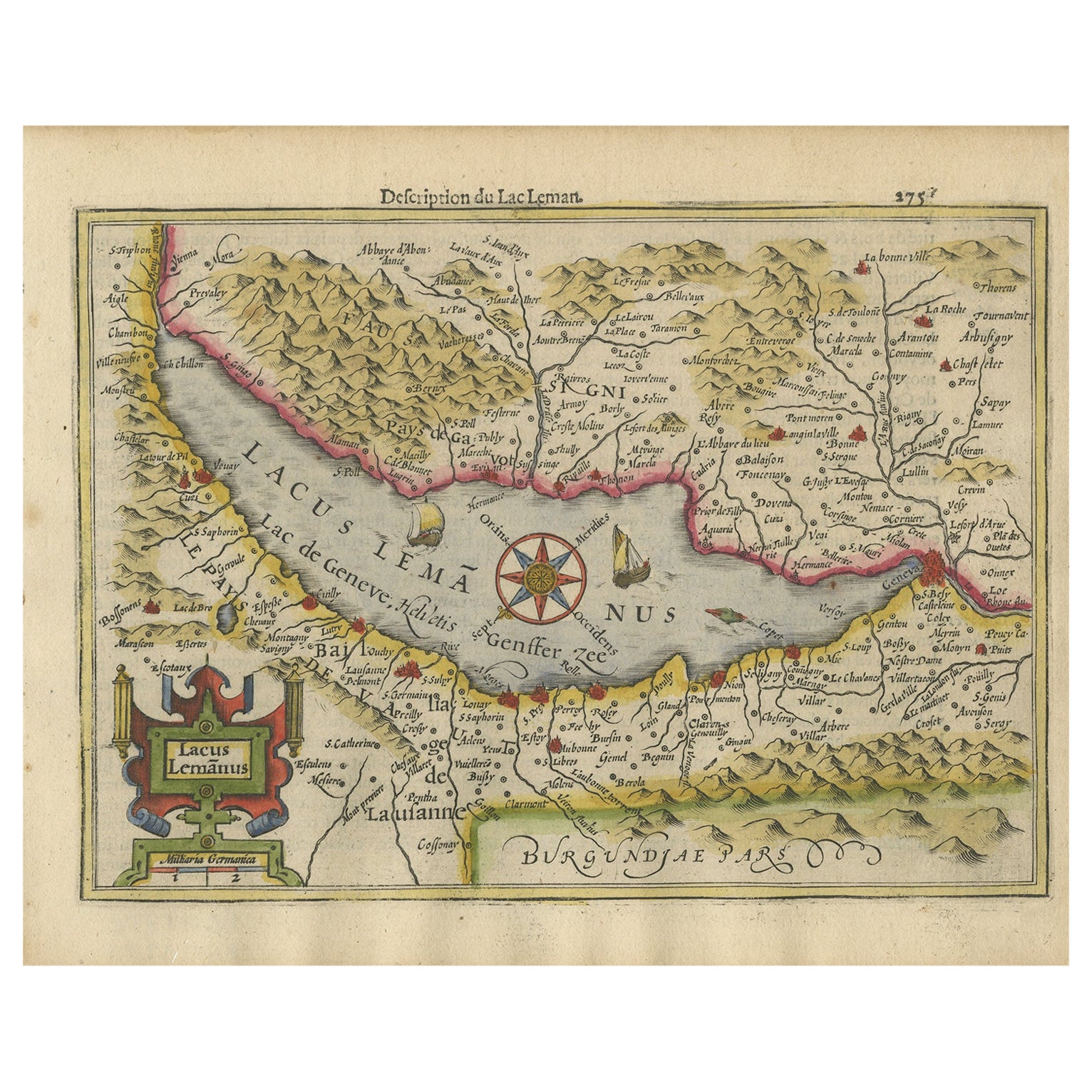
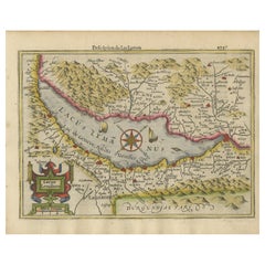
- Beautiful Original Copper Engraved Map of Lake Geneva in Switzerland, 1613Located in Langweer, NLDescription: Antique map titled 'Lacus Lemanus'. Old map of Lake Geneva with good detail of surrounding towns and villages. Decorated with a large compass rose with two sailing boats and a sea monster in the lake. Originates from 'Atlas Minor'. Artists and Engravers: Henricus Hondius...Category
Antique 1610s Maps
MaterialsPaper
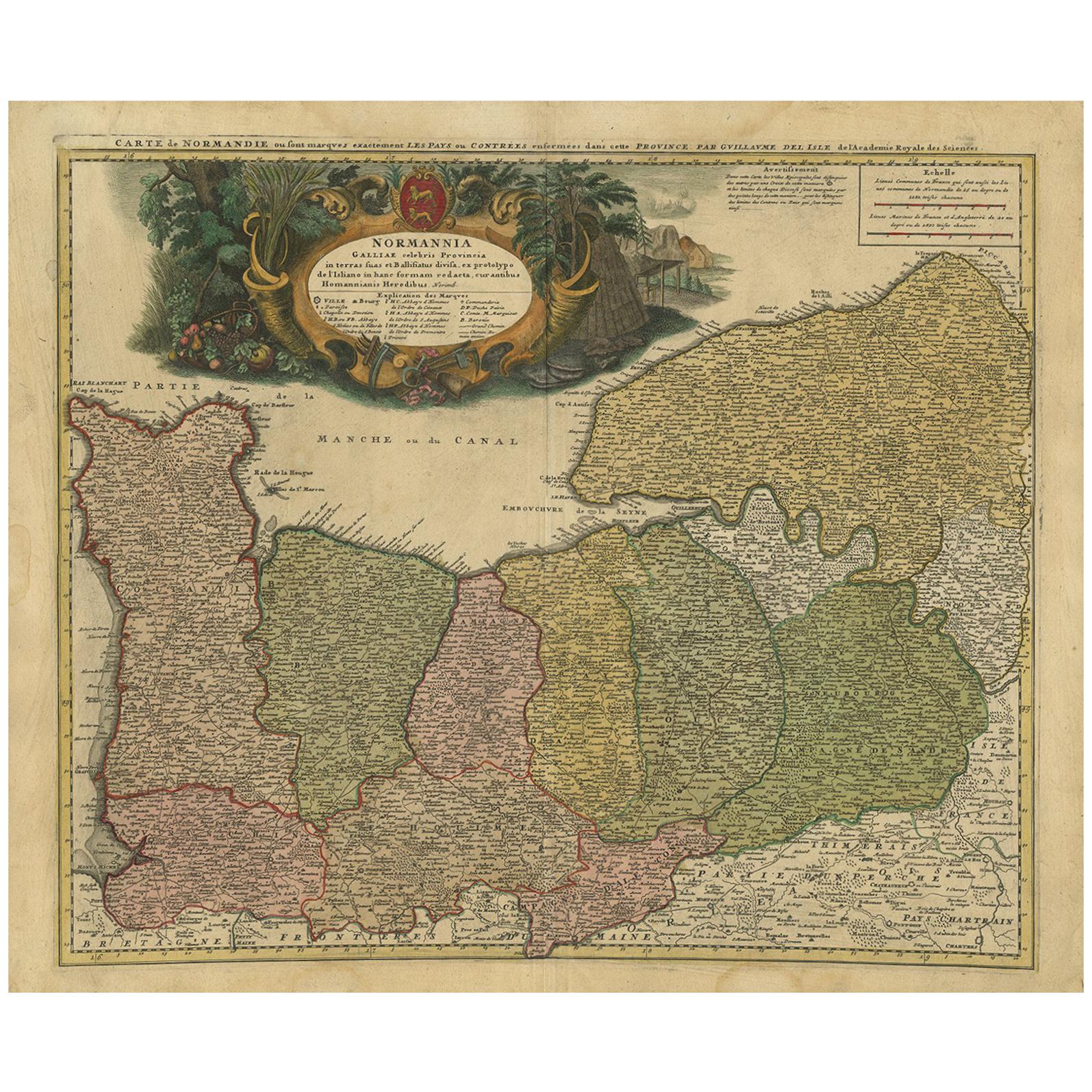
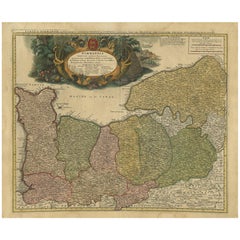
- Antique Map Normandy 'France' by Homann Heirs, Published in c.1740By Homann HeirsLocated in Langweer, NLAntique map France titled 'Normannia Galliae celebris Provincia in terras suas Ballisiatus (..)'. Decorative regional map of Normandy, France, circa ...Category
Antique Mid-18th Century German Maps
MaterialsPaper

You May Also Like
- Map Lancashire 1793 John Cary engraver 37cm 14 1/2" highLocated in BUNGAY, SUFFOLKMap of Lancashire by John Cary engraver published 1st Jan 1793 by J Cary Engraver & Mapseller Strand in original black and gold classic map frameCategory
Antique 18th Century English Georgian Maps
MaterialsPaper
- Map Holy Land La Terre Sainte Engraved van Loon Published N de Fer 1703 FrenchLocated in BUNGAY, SUFFOLKLa Terre Sainte, The Holy Land, Tiree Des Memoires De M.De.La Rue. Par N. de Fer. Geographe de Sa Majeste Catoliq et de Monseigneur le Dauphin. Avec Privil du Roi 1703 Detailed map of the Holy Land from Nicholas de Fer's L'Atlas Curieux ou le Monde. East is oriented at the top. MAKER Nicolas de Fer 1646-1720 The French cartographer and engraver, Nicolas de Fer, was a master at creating maps that were works of art. The maps that he published were printed during the Baroque period when the decorative arts were characterized by ornate detail. De Fer’s detailed maps and atlases were valued more for their decorative content than their geographical accuracy. Nicolas de Fer was born in 1646. His father, Antoine de Fer, owned a mapmaking firm. At the age of twelve, Nicolas was apprenticed to a Parisian engraver named Louis Spirinx. The family business was starting to decline when his father died in 1673. Nicolas de Fer’s mother, Genevieve, took over the business after the death of her husband. In 1687 the business was passed on to Nicolas and the profits increased after he took over the firm. Nicolas de Fer was a prolific cartographer who produced atlases and hundreds of single maps. He eventually became the official geographer to King Louis XIV of France and King Philip V...Category
Antique Early 1700s French Louis XIV Maps
MaterialsPaper
- French Framed Copper Engraved Hand Colored Map of Carolina & Georgia, Circa 1757Located in Hollywood, SCFrench copper engraved hand colored map of Carolina & Georgia matted under glass with a painted frame, mid-18th centuryCategory
Antique 1750s French Louis XV Maps
MaterialsGlass, Wood, Paint, Paper
- 1842 Wall Map of the United States by J. H. Young, Published by S. A. MitchellLocated in Colorado Springs, COPresented is an 1842 hanging “Map of the United States,” engraved by J. H. Young and published by Samuel Augustus Mitchell, Philadelphia. This is a beautiful example of the rare 1842...Category
Antique 1840s American Maps
MaterialsPaper
- 1840 Map of the City of Washington Published by William M. MorrisonLocated in Colorado Springs, COThis map, printed in 1840, is a detailed representation of Washington, D.C. in the mid-19th century. The map shows block numbers, wards, and government buildings as well as details o...Category
Antique 1840s American Federal Maps
MaterialsPaper
- Original Antique Map of Switzerland, Engraved By Barlow, Dated 1807Located in St Annes, LancashireGreat map of Switzerland Copper-plate engraving by Barlow Published by Brightly & Kinnersly, Bungay, Suffolk. Dated 1807 Unframed.Category
Antique Early 1800s English Maps
MaterialsPaper


Recently Viewed
View AllMore Ways To Browse
Antique Compass France
John Speed Isle Of Wight Maps
Compass France
Isle Of Wight Maps
Old French Map
Ancient Map Of Israel
John Tallis Map
Austria Hungary Map
Kiribati Islands Map
Map Of Kiribati Islands
Montana Maps
Oman Map
Palliser Furniture
Barbados Map
Map Of Barbados
Britton And Rey Lithograph
Christoph Weigel On Sale
Clivia Ducatus Et Ravestein Dominium