Items Similar to Chart of the Coast of Cochinchina' and 'Plan of Pulo Condor', Vietnam, 1778
Want more images or videos?
Request additional images or videos from the seller
1 of 5
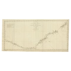
Chart of the Coast of Cochinchina' and 'Plan of Pulo Condor', Vietnam, 1778
About the Item
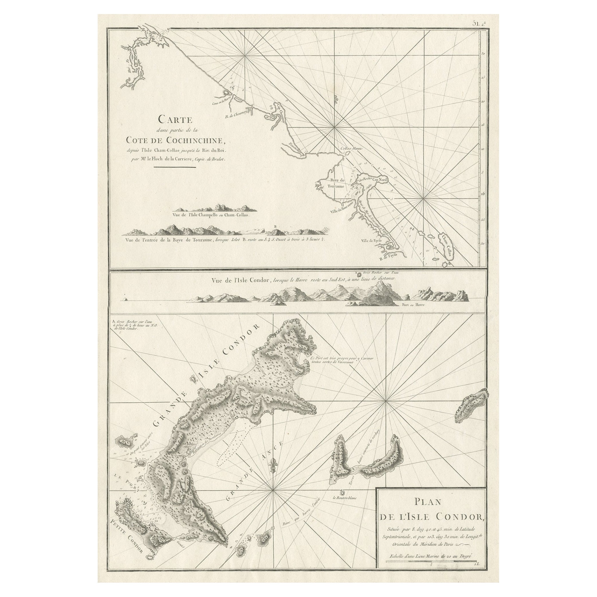
Antique map titled 'A Chart of a part of the Coast of Cochinchina' and 'Plan of Pulo Condor'.
Two maps on one sheet. The upper map shows part of the coast of Cochinchina from Cham Collao Island to the King's River. Cochinchina or Quinam is a region encompassing the southern third of current Vietnam whose principal city is Saigon. The lower map shows the Côn Ð?o Islands, an archipelago of Bà R?a–Vung Tàu Province, in the Southeast region of Vietnam, and a district of this province.
Artists and Engravers: Printed for R. Sayer & J. Bennett.
- Dimensions:Height: 21.26 in (54 cm)Width: 14.97 in (38 cm)Depth: 0 in (0.02 mm)
- Materials and Techniques:
- Period:1770-1779
- Date of Manufacture:1778
- Condition:Repaired: Small repair right margin. Condition: Good, age-related toning. Small repair right margin. Please study image carefully.
- Seller Location:Langweer, NL
- Reference Number:
About the Seller
5.0
Platinum Seller
These expertly vetted sellers are 1stDibs' most experienced sellers and are rated highest by our customers.
Established in 2009
1stDibs seller since 2017
1,922 sales on 1stDibs
Typical response time: <1 hour
- ShippingRetrieving quote...Ships From: Langweer, Netherlands
- Return PolicyA return for this item may be initiated within 14 days of delivery.
More From This SellerView All
- Old Sea Charts of Tourane Bay & the Con Dao Islands 'Pulo Condor', Vietnam, 1780Located in Langweer, NLDescription: Two maps on one sheet titled 'Carte d'une partie de la Cote de Cochinchine [and] Plan de l'Isle Condor'. Sea charts of the coast of Vietnam around the Tourane Bay an...Category
Antique 1780s Maps
MaterialsPaper
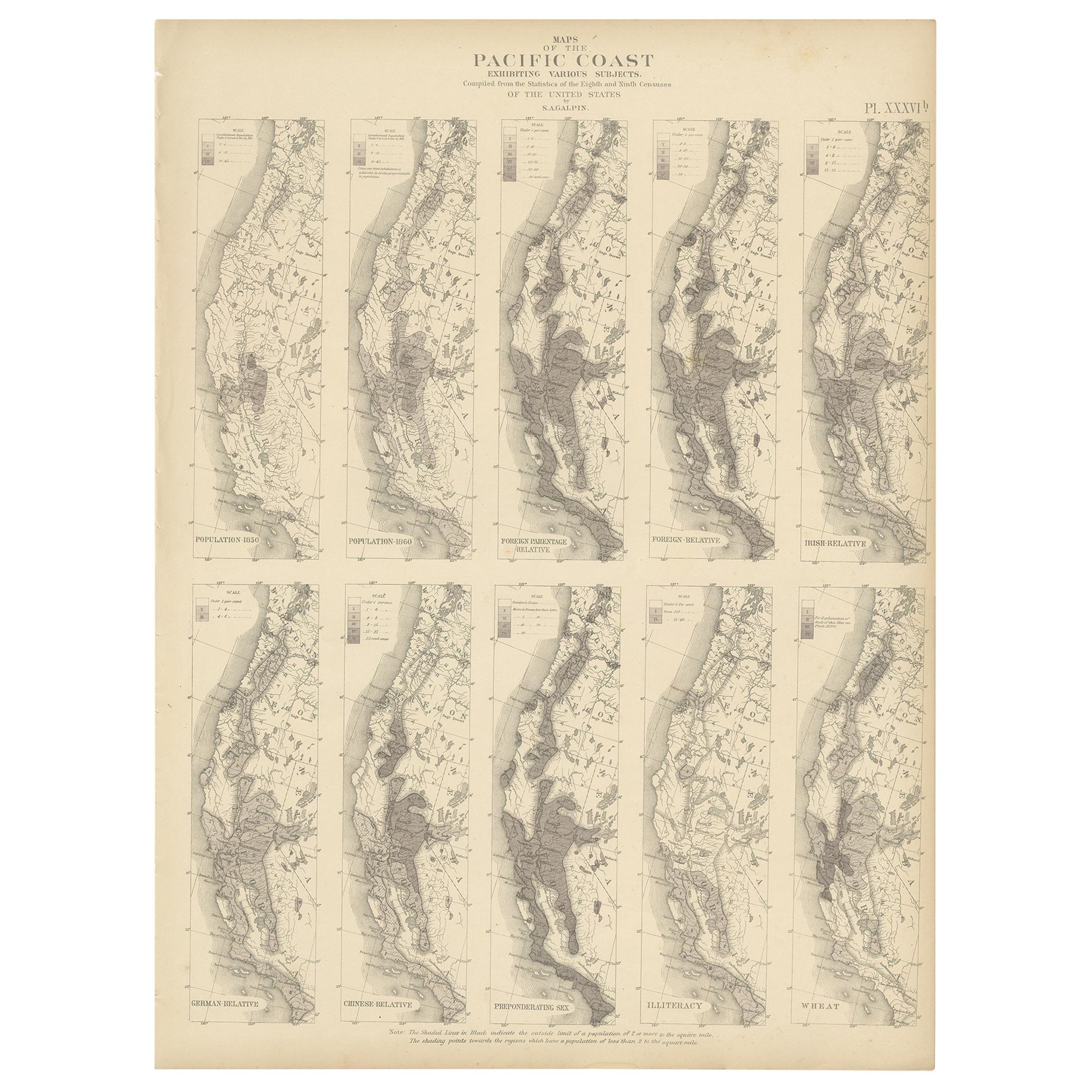
- Antique Chart of the Pacific Coast '1874'Located in Langweer, NLAntique chart titled 'Maps of the Pacific Coast exhibiting various subjects. Compiled from the statistics of the eight and ninth census of the United Sta...Category
Antique Late 19th Century Maps
MaterialsPaper
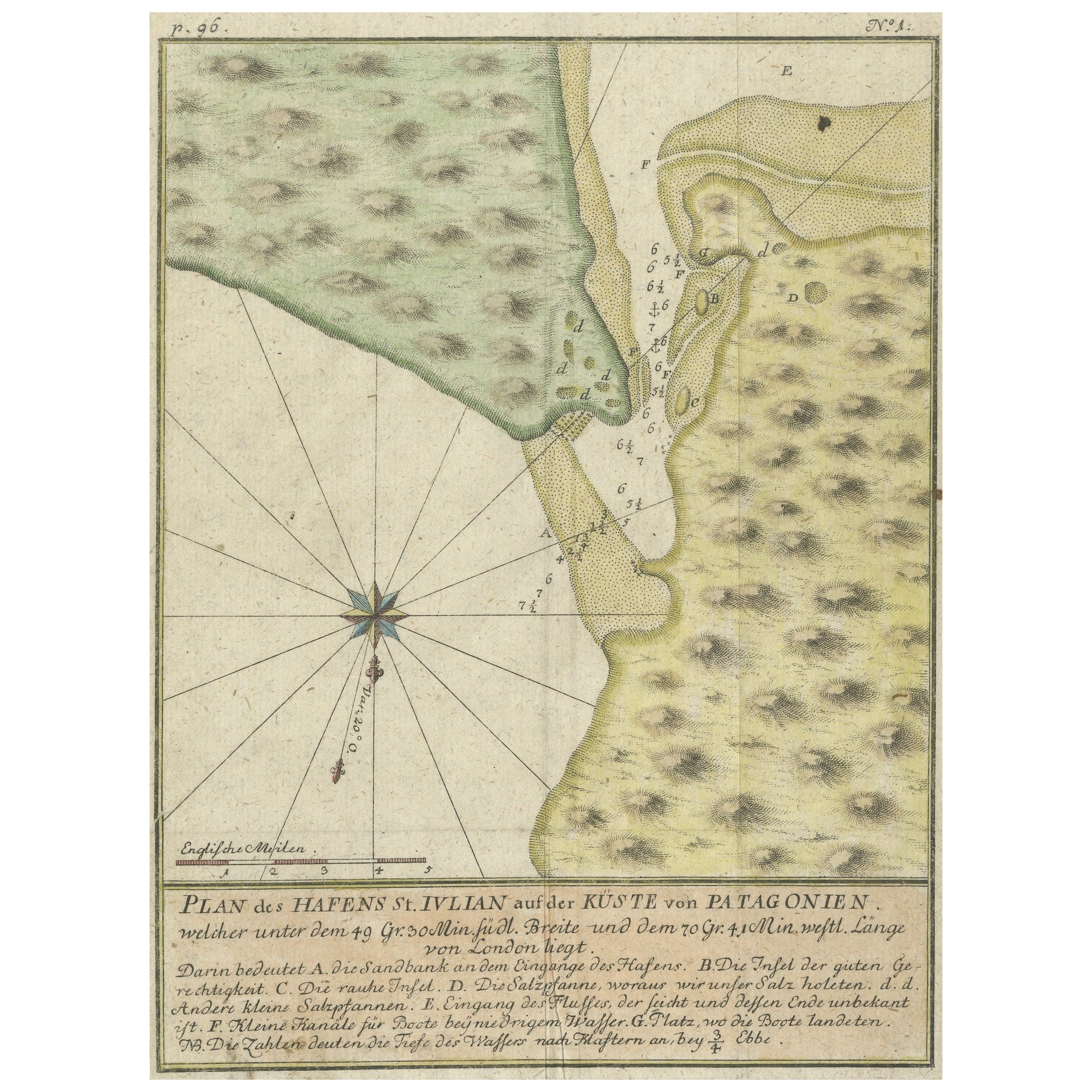
- Antique Plan of Plan of St. Julian's Harbour on the Coast of PatagoniaLocated in Langweer, NLAntique map titled 'Plan des Hafens St. Iulian auf der Küste von Patagonien'. Plan of St. Julian's Harbour on the Coast of Patagonia. This map originates from a German edition of 'Voyage around the World...Category
Antique Mid-18th Century Maps
MaterialsPaper
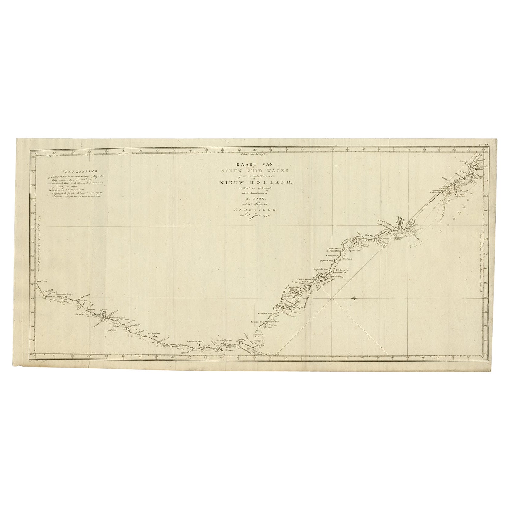
- Old Map of Cook's Discovery and Charting of the East Coast of Australia, 1803Located in Langweer, NLAntique map titled 'Kaart van Nieuw Zuid Wales of de Oostlyke Kust van Nieuw Holland ontdekt en onderzogt door den Luitenant J. Cook met het Schip de Endeavour in het Jaar 1770'. ...Category
Antique Early 1800s Maps
MaterialsPaper
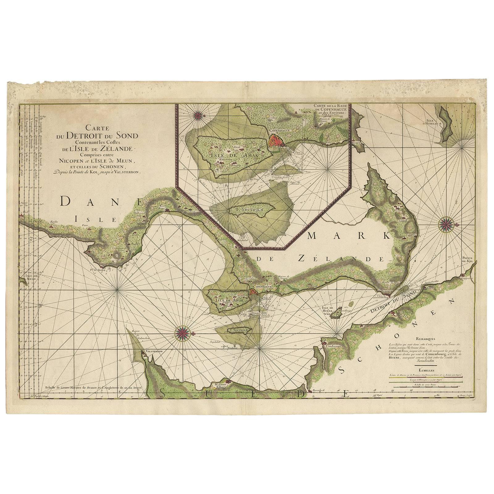
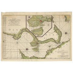
- Antique Sea Chart of the coasts of Denmark and Sweden by C.A. Berey, 1720Located in Langweer, NLThis beautiful large sea chart depicts the Oresund, which forms the border between Skane, Sweden and Sjaelland, Denmark. The chart is filled with navigational details and topographical information along the coastline. A large inset focuses on the area around Copenhagen and the islands of Amager and Saltholm. Two large compass...Category
Antique Early 18th Century Maps
MaterialsPaper
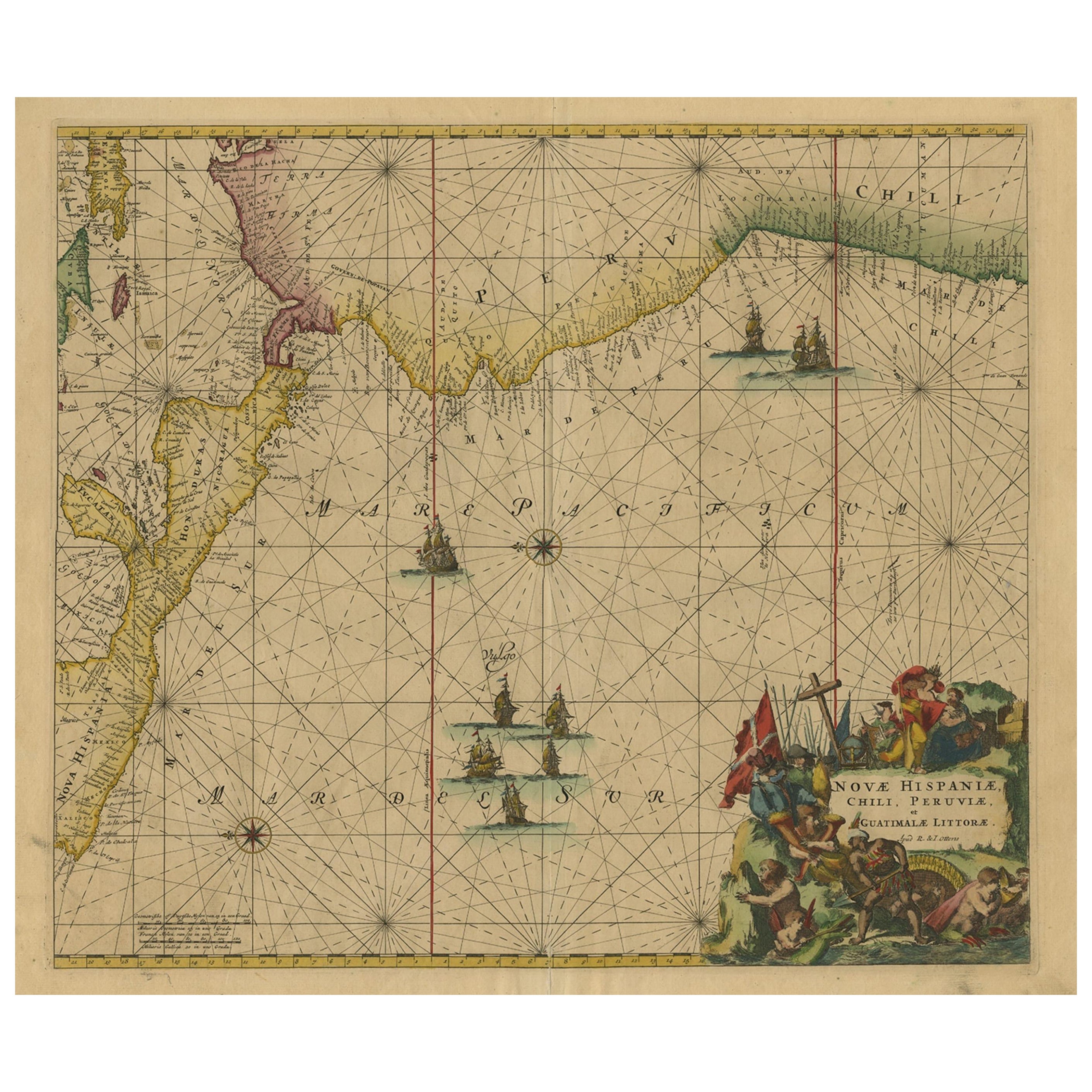
- Sea Chart of Central America and the Northwest Coast of South America, ca.1745Located in Langweer, NLAntique map titled 'Novae Hispaniae, Chili, Peruviae et Guatamala Littorae.' Sea chart of Central America and the northwest coast of South America, oriented to the east, by Reini...Category
Antique 1740s Maps
MaterialsPaper

You May Also Like
- Chart of the East Coast of EnglandLocated in Norwell, MAChart of the East Coast of England, from Dungeness to Flamborough, including the entrances to the Thames River. Drawn by hydrographer J.W. Norie in 1841. Includes Kent, Essex and Suf...Category
Antique 1840s English Nautical Objects
MaterialsPaper
- Anatomical Wall Chart Depicting the Human Lymphatic and Blood VesselsLocated in Berghuelen, DEA rare 19-carat anatomical wall chart depicting the human lymphatic and blood vessels. On the sides with detailed description in German language. Print...Category
Early 20th Century German Victorian Prints
MaterialsPaper
- Antique Anatomical Wall Chart Depicting the Human SkeletonLocated in Berghuelen, DEA rare 19th century anatomical wall chart depicting the human skeleton. On the sides On the sides are detailed description in German language. The wall...Category
Early 20th Century German Victorian Prints
MaterialsPaper
- Genito-Urinary Anatomical Chart Fritz FrohseBy Nystrom / Frohse Art, Fritz FrohseLocated in Philadelphia, PAGenito-Urinary Anatomical Chart by Fritz Frohse. Dated 1922. Paper mounted on canvas. Shows wear but still presents very well!Category
Vintage 1920s German American Classical Prints
MaterialsCanvas, Paper
- Catalogue of Engraved Views, Plans, Etc., Of New York City, 1st EdLocated in valatie, NYA catalogue of engraved views, plans, etc., Of New York City, (The Collection of Percy R. Pyne II). Privately Printed by The De Vinne Press, New York, 1912. Limited to 100 copies. Gr...Category
Early 20th Century American Books
MaterialsPaper
- Original Antique Map / City Plan of Brussels by Tallis, circa 1850Located in St Annes, LancashireGreat map of Brussels. Steel engraving. Published by London Printing & Publishing Co. (Formerly Tallis), C.1850 Free shipping.Category
Antique 1850s English Maps
MaterialsPaper


