Items Similar to Antique Plan of Plan of St. Julian's Harbour on the Coast of Patagonia


Want more images or videos?
Request additional images or videos from the seller
1 of 8
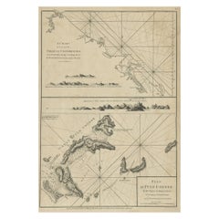
Antique Plan of Plan of St. Julian's Harbour on the Coast of Patagonia
About the Item
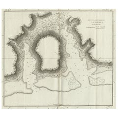
Antique map titled 'Plan des Hafens St. Iulian auf der Küste von Patagonien'. Plan of St. Julian's Harbour on the Coast of Patagonia. This map originates from a German edition of 'Voyage around the World' by Lord George Anson. Published 1763.
- Dimensions:Height: 8.86 in (22.5 cm)Width: 7.68 in (19.5 cm)Depth: 0.02 in (0.5 mm)
- Materials and Techniques:
- Period:
- Date of Manufacture:1763
- Condition:Wear consistent with age and use. General age-related toning. Thin paper, partly trimmed. Original folding lines. Few small tears, slightly affecting image. Blank verso, please study images carefully.
- Seller Location:Langweer, NL
- Reference Number:Seller: BG-12934-41stDibs: LU3054331065422
About the Seller
5.0
Platinum Seller
These expertly vetted sellers are 1stDibs' most experienced sellers and are rated highest by our customers.
Established in 2009
1stDibs seller since 2017
1,929 sales on 1stDibs
Typical response time: <1 hour
- ShippingRetrieving quote...Ships From: Langweer, Netherlands
- Return PolicyA return for this item may be initiated within 14 days of delivery.
Auctions on 1stDibs
Our timed auctions are an opportunity to bid on extraordinary design. We do not charge a Buyer's Premium and shipping is facilitated by 1stDibs and/or the seller. Plus, all auction purchases are covered by our comprehensive Buyer Protection. Learn More
More From This SellerView All
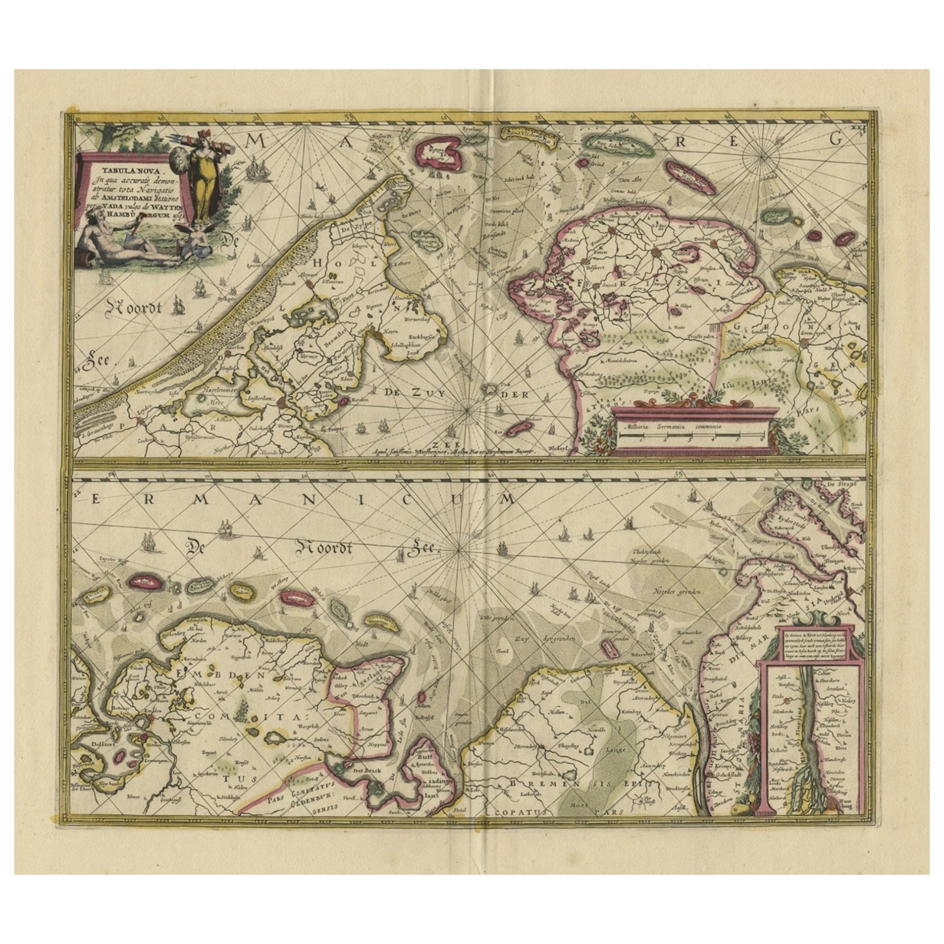
- Antique Print with Views of Cape Blanco on the Patagonia / Argentina Coast, 1749Located in Langweer, NLAntique print titled 'Kaap Blanco aan de kust van Patagonia (..)' and 'Kaap Blanco strekkende Zuid ten Westen.' Coastal views of Cape Blanco on the Patagonia / Argentina coast with t...Category
Antique 18th Century Prints
MaterialsPaper
- Antique Plan of the Harbour of Taloo by Cook, c.1781Located in Langweer, NLAntique map titled 'Sketch of the Harbours on the North Side of Eimeo (..)'. Plan of the harbour of Taloo in the Island of Moorea, one of the Society Islands, French Polynesia. Origi...Category
Antique 18th Century Maps
MaterialsPaper
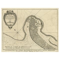
- Antique Plan of Fort Dauphin on Madagascar of the East Coast of Africa, 1756Located in Langweer, NLAntique map titled 'Plan du Fort Dauphin (..) - Grondtekening van 't Fort Dauphin'. Plan of Fort Dauphin on the island of Madagascar of the east coast of Africa. This print origi...Category
Antique 1750s Maps
MaterialsPaper
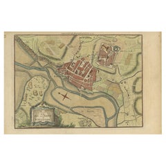
- Antique Plan of the Town and Harbour of Boulogne-sur-Mer by Barrow 'c.1760'Located in Langweer, NLAntique map titled 'Plan of the Town and Harbour of Boulogne'. Original antique plan of the town and harbour of Boulogne-sur-Mer, France. This map originates from John Barrow...Category
Antique Mid-18th Century Maps
MaterialsPaper
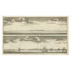
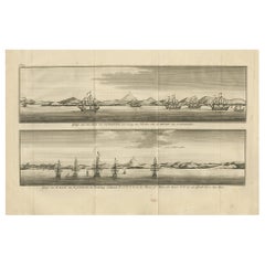
- Antique Print with Views of St. Julian, Patagonia, 1749Located in Langweer, NLAntique print titled 'Gezigt van het land van Patagonia een weining ten noorden van de Haven van St. Juliaan.' and 'Gezigt van de Baay van St. Juliaan, de Woudsberg strekkende W.Z.W....Category
Antique Mid-18th Century Prints
MaterialsPaper
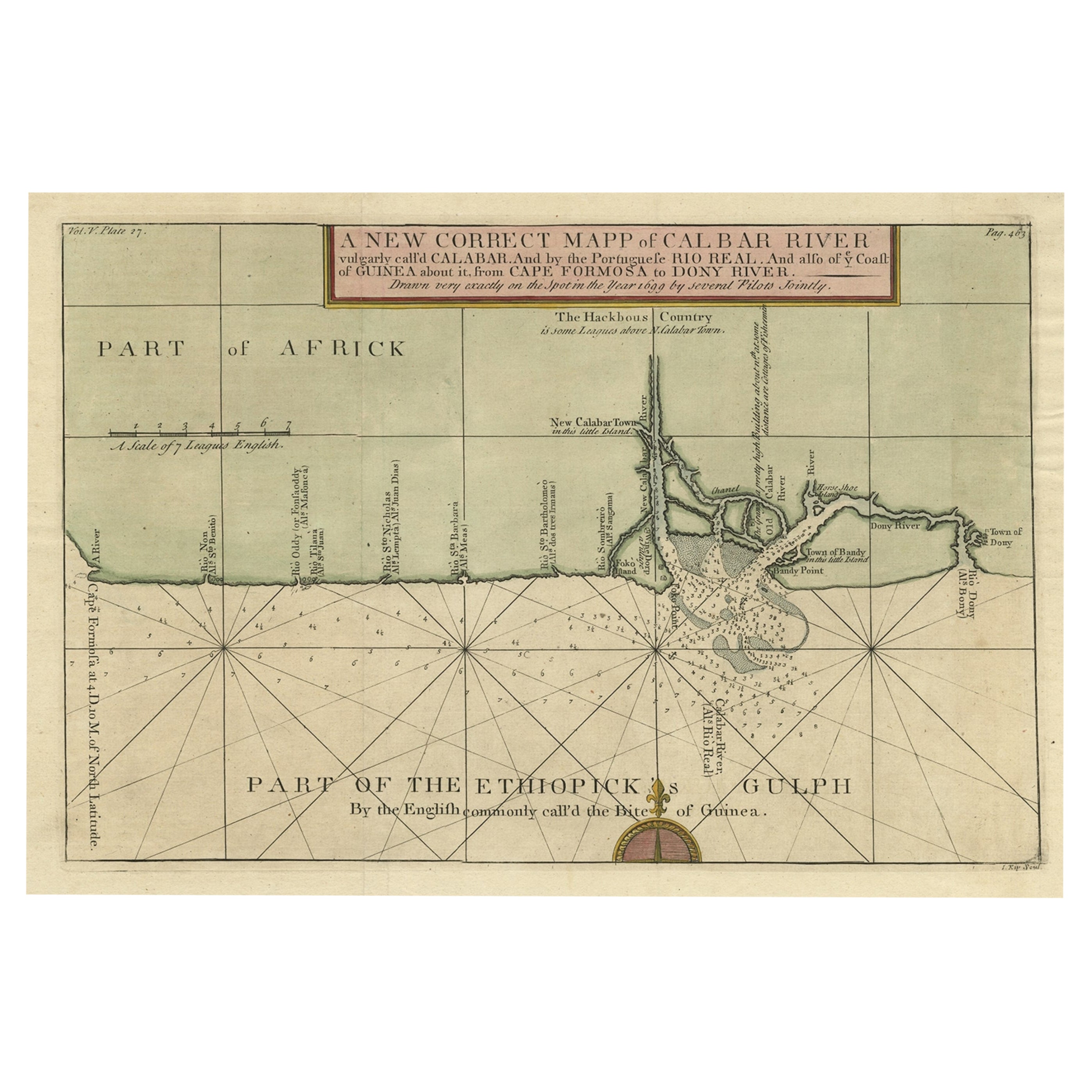
- Chart of the Coast of Cochinchina' and 'Plan of Pulo Condor', Vietnam, 1778Located in Langweer, NLAntique map titled 'A Chart of a part of the Coast of Cochinchina' and 'Plan of Pulo Condor'. Two maps on one sheet. The upper map shows part of the coast of Cochinchina from Cha...Category
Antique 1770s Maps
MaterialsPaper
You May Also Like
- Catalogue of Engraved Views, Plans, Etc., Of New York City, 1st EdLocated in valatie, NYA catalogue of engraved views, plans, etc., Of New York City, (The Collection of Percy R. Pyne II). Privately Printed by The De Vinne Press, New York, 1912. Limited to 100 copies. Gr...Category
Early 20th Century American Books
MaterialsPaper
- Lithographic print on paper, depicting the atlas of the hand, France 1850 ca.Located in Milan, ITAn anatomical lithographic print on paper, depicting the anatomical atlas of the hand. Black lacquered fir wood frame with golden ramin wood batting. N. H. Ja...Category
Antique Mid-19th Century French Prints
MaterialsGlass, Wood, Paper
- “On the Moors” or "Dogging" Signed by Heywood Hardy, Antique Print, 1894By Heywood HardyLocated in Colorado Springs, COPresented is an 1894 signed first edition goupil-gravure print by Heywood Hardy (1842-1933). The engraving was printed in Paris and published by Boussod Valadon & Co. Publishers, the successors to Goupil & Co. Designed as a companion to After the Drive, Hardy’s On the Moors (Dogging) depicts three hunters and their two dogs hunting ducks. The youngest of the three men is shooting his gun as the dogs excitedly wait to chase after the bird. This print is one of only 75 artist’s proofs and has been signed by the artist in pencil at the lower left corner of the print’s margin. Hunting has a long history in England and is considered a very traditional activity even today. One of the most popular forms of hunting is called “wildfowling” and targets wild geese and ducks. Often conducted on coastal marshes, wildfowling is typically a solitary or small group sport unlike the grand group fox and pheasant hunts...Category
Antique 1890s French Prints
MaterialsPaper
- 1844 French Antique Nautical Portolano of Golfe De St. Drely by Antoine RouxBy Antoine RouxLocated in Milan, ITAntique portolano, nautical map of Golfe De St. Drely engraved on a copper plate by Antoine Roux, Marseille France 1844, from his work Recueil des principaux plans des ports et de Ra...Category
Antique 1840s French Nautical Objects
MaterialsPaper
- Antique 18th Century Map of the Province of Pensilvania 'Pennsylvania State'Located in Philadelphia, PAA fine antique of the colony of Pennsylvania. Noted at the top of the sheet as a 'Map of the province of Pensilvania'. This undated and anonymous map is thought to be from the Gentleman's Magazine, London, circa 1775, although the general appearance could date it to the 1760's. The southern boundary reflects the Mason-Dixon survey (1768), the western boundary is placed just west of Pittsburgh, and the northern boundary is not marked. The map has a number of reference points that likely refer to companion text and appear to be connected to boundaries. The western and southern boundaries are marked Q, R, S, for example. A diagonal line runs from the Susquehanna R to the Lake Erie P. A broken line marked by many letters A, B, N, O, etc., appears in the east. There are no latitude or longitude markings, blank verso. Framed in a shaped contemporary gilt wooden frame and matted under a cream colored matte. Bearing an old Graham Arader Gallery...Category
Antique 18th Century British American Colonial Maps
MaterialsPaper
- Shuhga Images of Spring Essay on Erotic Elements in Japanese Art, 1st EdLocated in valatie, NYShuhga: Images of spring: Essay on Erotic Elements in Japanese Art By Charles Grosbois. Nagel, Geneva; Paris; Hamburg, 1964. 1st Ed hardcover with dust jacket. A fascinating work cl...Category
Vintage 1960s Books
MaterialsPaper


Recently Viewed
View AllMore Ways To Browse
Antique Voyage
Voyage Antique
St German
Patagonia Map
Victorian Fence
Battle Maps
Russian Antique Plates
Floor Vase Wood
Mariner Furniture
Map Print Set
Antique World Globe Map
Antique Blackwood
Antique Furniture Missouri
Roman Map
Antique Indian Maps
Antique Marine Maps
Antique Africa Maps And Atlases Africa Maps
Antique Maps California