Items Similar to Sea Chart of Central America and the Northwest Coast of South America, ca.1745


Want more images or videos?
Request additional images or videos from the seller
1 of 5
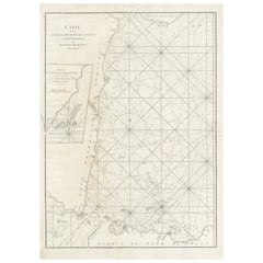
Sea Chart of Central America and the Northwest Coast of South America, ca.1745
About the Item
Antique map titled 'Novae Hispaniae, Chili, Peruviae et Guatamala Littorae.'
Sea chart of Central America and the northwest coast of South America, oriented to the east, by Reinier & Joshua Ottens (after Frederick de Wit - 1675) in 1745 ('Atlas van de Zeevaart'). The map shows all or parts of the coasts of Peru, Chili, Honduras, Costa Rica and Mexico as well as the western Caribbean and the Galapagos Islands. Source unknown, to be determined.
Artists and Engravers: Reinier and Joshua Ottens (both 1704-1765) are publishers, cartographers and map engravers from the Netherlands. The family business was founded by their father Joachim, but most productive during the time of Reiner and Joshua.
- Dimensions:Height: 21.66 in (55 cm)Width: 25.99 in (66 cm)Depth: 0 in (0.02 mm)
- Materials and Techniques:
- Period:1740-1749
- Date of Manufacture:circa 1745
- Condition:Wear consistent with age and use. Condition: Good, given age. Minor paper separation top and bottom middle fold. Some crinkles and creases. Edges with an occasional tiny tear. A few minor spots. Original middle fold as issued. General age-related toning. Minor defects from handling.
- Seller Location:Langweer, NL
- Reference Number:
About the Seller
5.0
Platinum Seller
These expertly vetted sellers are 1stDibs' most experienced sellers and are rated highest by our customers.
Established in 2009
1stDibs seller since 2017
1,916 sales on 1stDibs
Typical response time: <1 hour
- ShippingRetrieving quote...Ships From: Langweer, Netherlands
- Return PolicyA return for this item may be initiated within 14 days of delivery.
More From This SellerView All
- Antique Sea Chart of the Shetland Islands, Scotland, ca.1745Located in Langweer, NLAntique map of Scotland titled 'Nieuwe Paskaard van Hitland met de daar omleggende eylanden na de nieuwe aftekening gemaakt by den Lofwaarden en onvermoeyden Hit en Zeeman Ian Bruyst...Category
Antique 1740s Maps
MaterialsPaper
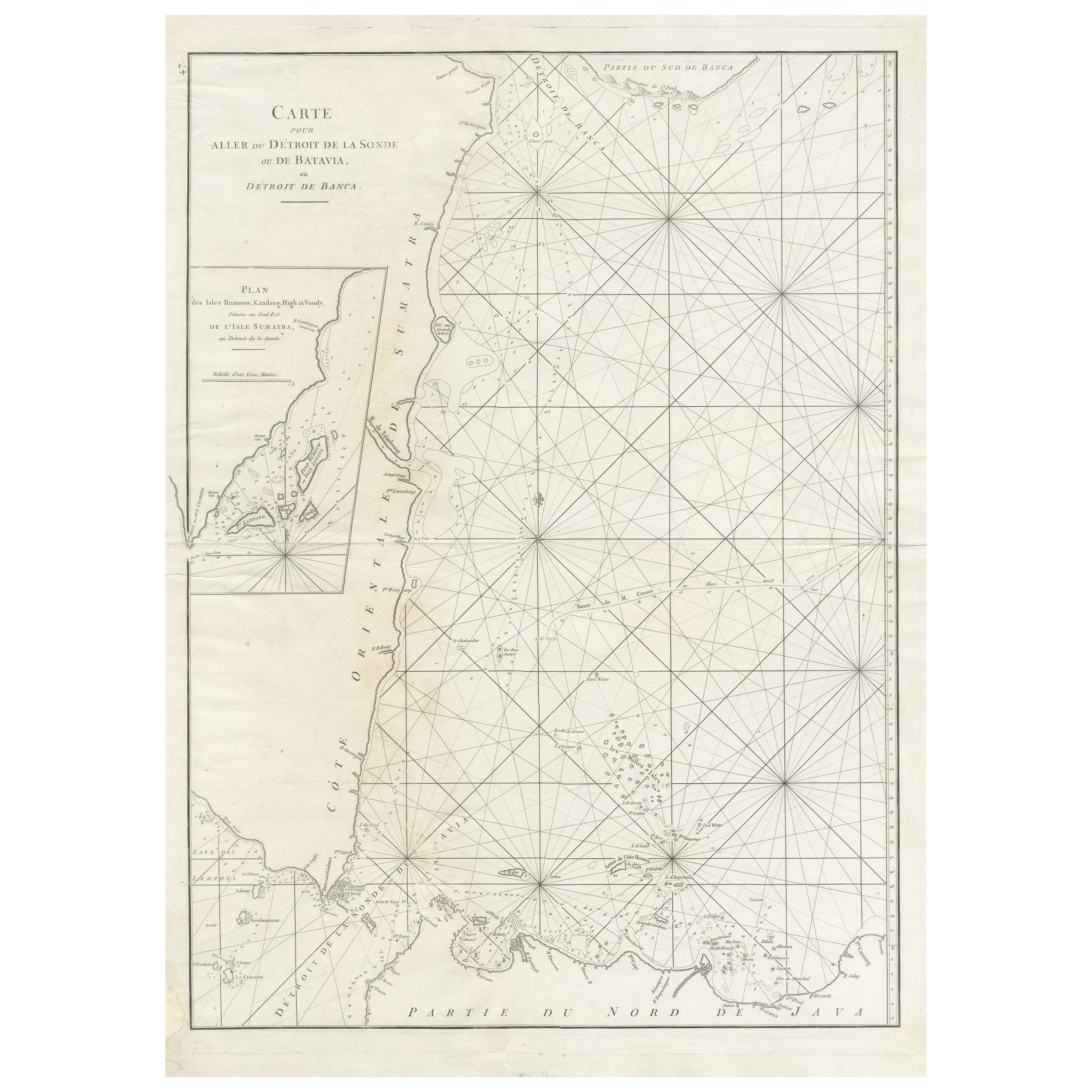
- Large Antique Sea Chart of the South-Eastern Coast of Sumatra, IndonesiaLocated in Langweer, NLAntique map titled 'Carte pour aller du Détroit de la Sonde ou de Batavia, au Détroit de Banca'. This uncommon sea chart shows northern Java and eastern Sumatra along with an inset of the small islands in the Detroit Sound. The handsome chart provides detailed navigational information, including the route of Julien Crozet in April 1772, who led a French expedition to the South Pacific after the voyage's commander, Marion De Fresne, and 26 crew members were killed (and allegedly eaten) by a Maori tribe in the Bay of Islands off the coast of New Zealand. With title upper left corner and small inset map of the small isles nearby the south-eastern coast of Sumatra. J. B. d'Apres de Mannevillette, from his atlas "Neptune orientale". French sailor...Category
Antique Late 18th Century Maps
MaterialsPaper
- Antique Sea Chart of North America by Ottens, circa 1745Located in Langweer, NLAntique map titled 'Septemtrionaliora Americae a Groenlandia (..)'. Sea chart of the northern waters of North America, including the coast of Labrador and pa...Category
Antique Mid-18th Century Maps
MaterialsPaper
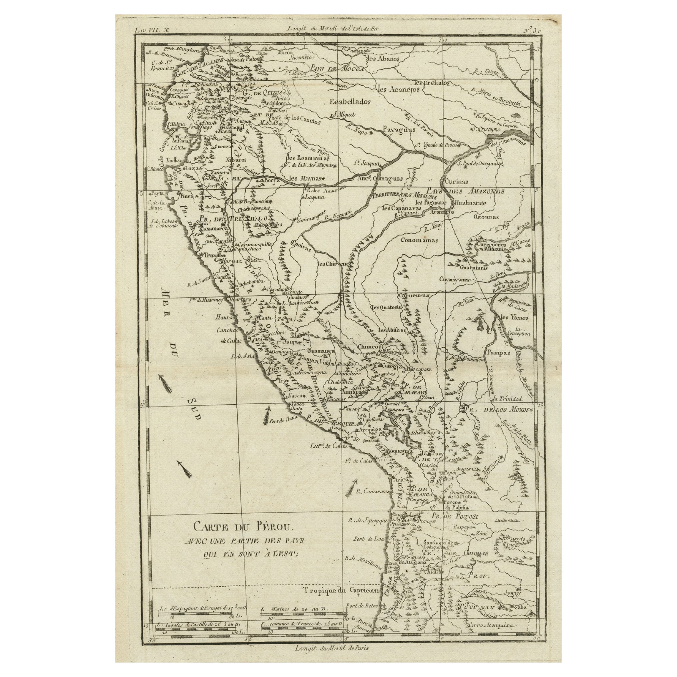
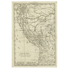
- Map of the Western Coast of South America from Ecuador into Chili, ca.1780Located in Langweer, NLAntique map titled 'Carte du Perou avec une partie des pays qui en sont a l'est.' Map of the western coast of South America extending from Ecuador, through Peru and present-day B...Category
Antique 1780s Maps
MaterialsPaper
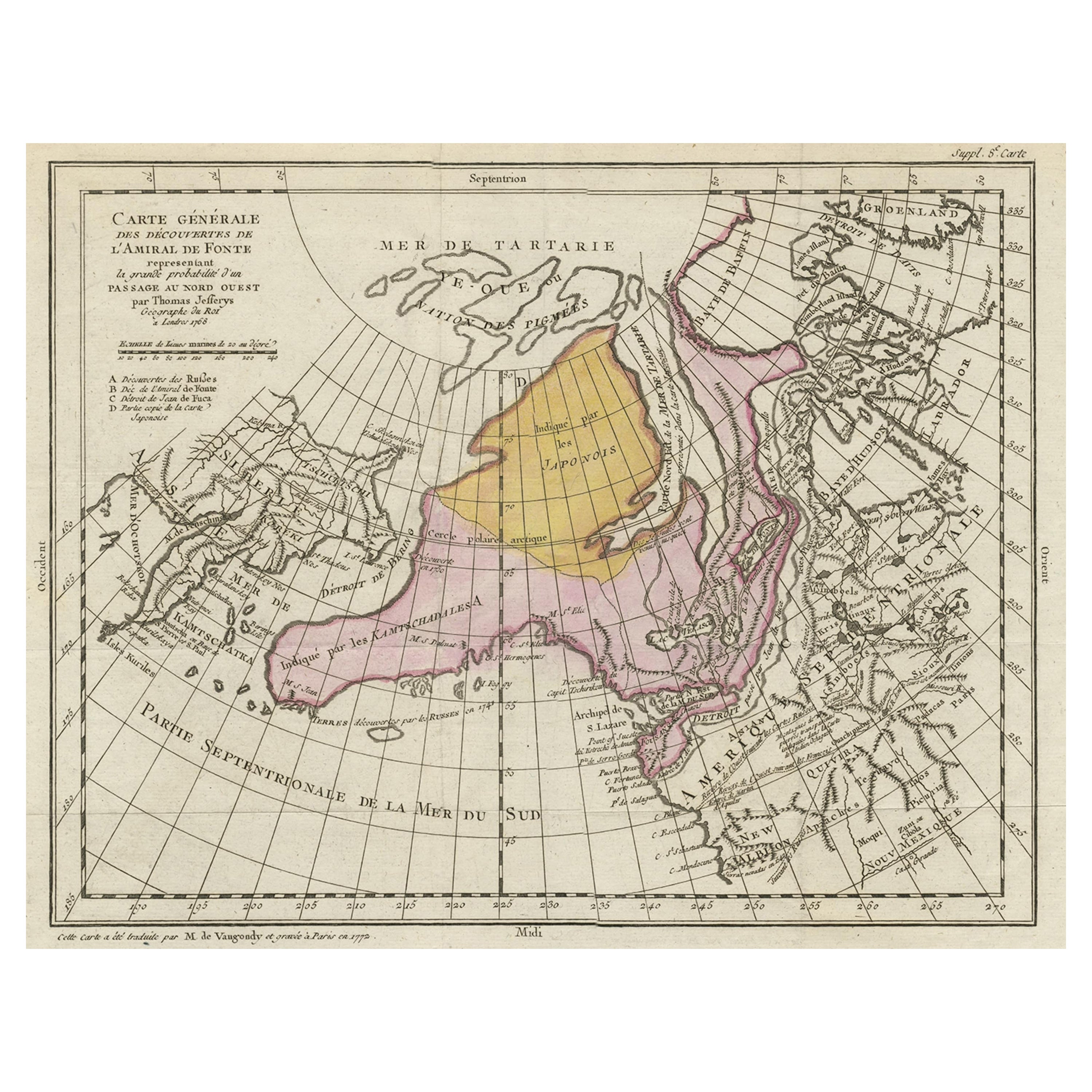
- Interesting Old Map of the Nw Coast of America and the Ne Coast of Asia, ca.1772Located in Langweer, NLAntique map titled 'Carte Generale des Decouvertes de l'Amiral de Fonte (..)'. Original antique map of the discoveries of Admiral de Fonte, showing the possibility of a north-west passage. Interesting map of the NW Coast...Category
Antique 1770s Maps
MaterialsPaper
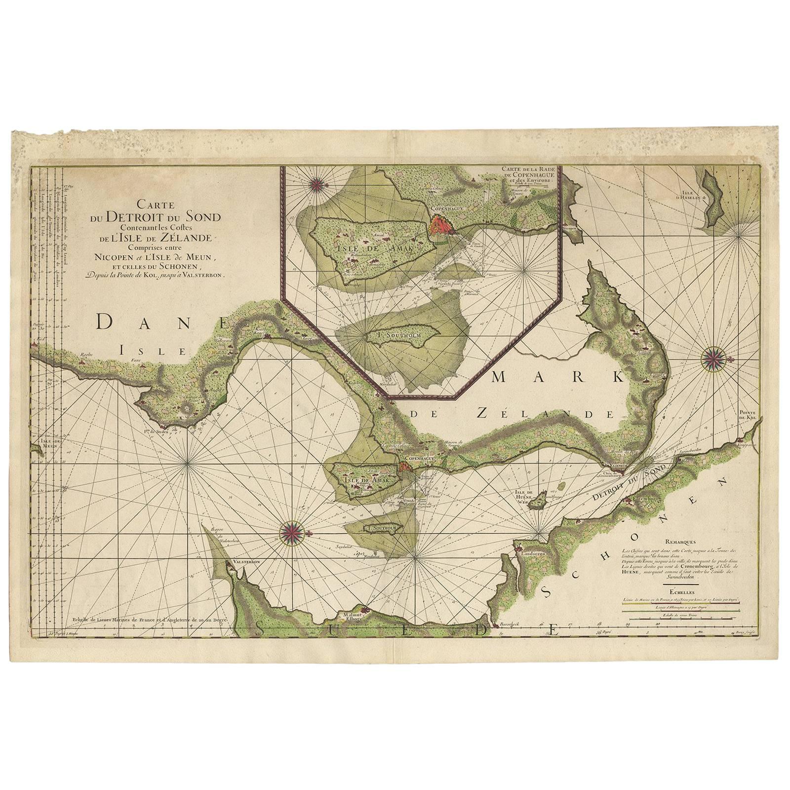
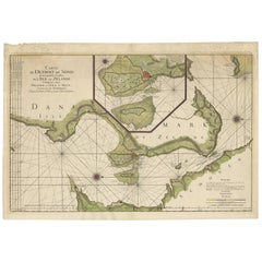
- Antique Sea Chart of the coasts of Denmark and Sweden by C.A. Berey, 1720Located in Langweer, NLThis beautiful large sea chart depicts the Oresund, which forms the border between Skane, Sweden and Sjaelland, Denmark. The chart is filled with navigational details and topographical information along the coastline. A large inset focuses on the area around Copenhagen and the islands of Amager and Saltholm. Two large compass...Category
Antique Early 18th Century Maps
MaterialsPaper


You May Also Like
- Original Antique Map of South America. C.1780Located in St Annes, LancashireGreat map of South America Copper-plate engraving Published C.1780 Two small worm holes to left side of map Unframed.Category
Antique Early 1800s English Georgian Maps
MaterialsPaper
- Original Antique Map of Central America / Florida, Arrowsmith, 1820Located in St Annes, LancashireGreat map of Central America. Drawn under the direction of Arrowsmith. Copper-plate engraving. Published by Longman, Hurst, Rees, Orme and Brown, 1820 Unframed.Category
Antique 1820s English Maps
MaterialsPaper
- Original Antique Map of South America, circa 1830Located in St Annes, LancashireGreat map of South America Copper plate engraving Published by Butterworth, Livesey & Co., circa 1830 Unframed.Category
Antique Early 1800s English Other Maps
MaterialsPaper
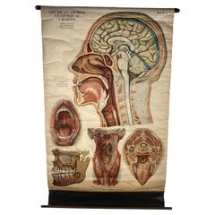
- 1918 American Frohse Anatomical Chart, A. J. Nystrom, Max Brodel IllustratorBy A.J. Nystrom & Co, Max BrödelLocated in Buffalo, NYAntique American Frohse Anatomical pull down chart, by A. J. Nystrom, ,revised and augmented by Max Brodel illustrator... Amazing color, patina, age appropriate wear. dated 1918.. Max (Paul Heinrich) Brödel 1870-1941 Brödel, an illustrator and the first director of the Art as Applied to Medicine program at Johns Hopkins...Category
Vintage 1910s American Steampunk Prints
MaterialsWood, Paper
- Anatomical Wall Chart Depicting the Human Lymphatic and Blood VesselsLocated in Berghuelen, DEA rare 19-carat anatomical wall chart depicting the human lymphatic and blood vessels. On the sides with detailed description in German language. Print...Category
Early 20th Century German Victorian Prints
MaterialsPaper
- Original Antique Map of South America by Thomas Clerk, 1817Located in St Annes, LancashireGreat map of South America Copper-plate engraving Drawn and engraved by Thomas Clerk, Edinburgh. Published by Mackenzie And Dent, 1817 Unframed.Category
Antique 1810s English Maps
MaterialsPaper


Recently Viewed
View AllMore Ways To Browse
Antique Furniture Northwest
Islands Of Caribbean
Map South America
Map Of South America
Mexican Map
Mexico Map
Maps Of Mexico
Antique Caribbean
South Western Antiques
Antique Caribbean Furniture
Antique Peru
Map Of Orient
Orient Map
Peruvian Antiques
Antique Furniture Peru
South America Antique Map
Antique Map South America
Antique Maps South America