Jacques-Nicolas Bellin Furniture
French, 1703-1772
Jacques Nicolas Bellin (1703 –1772) was a French hydrographer (official cartographer) and a geographer. While still a teenager he became the chief cartographer to the French Navy and later to the king of France. Bellin created a large number of maps for Antoine François Prévost's (L'Abbe Prevost) 'Histoire Generale des Voyages', which was a 25 volume publication focused on 17th and 18th century exploration.It was published in French, Dutch and German. He also contributed maps and articles to the 35-volume Encyclopédie edited by Denis Diderot and Jean le Rond d'Alembert. He was part of the group called Philosophes, which included many of the great intellectuals of the Age of Enlightenment, including Voltaire, Rousseau and Montesquieu. Bellin died at Versailles in 1772.to
21
23
4
27
1
27
27
7
5
27
27
27
28
8,652
3,917
2,531
2,229
Creator: Jacques-Nicolas Bellin
West Coast of Africa, Guinea & Sierra Leone: An 18th Century Map by Bellin
By Jacques-Nicolas Bellin
Located in Alamo, CA
Jacques Bellin's copper-plate map entitled "Partie de la Coste de Guinee Dupuis la Riviere de Sierra Leona Jusquau Cap das Palmas", depicting the coast of Guinea and Sierra Leone in ...
Category
Mid-18th Century French Antique Jacques-Nicolas Bellin Furniture
Materials
Paper
Antique Map of Virginia & the Chesapeake Bay by Jacques-Nicolas Bellin, c. 1750
By Jacques-Nicolas Bellin
Located in Philadelphia, PA
A fine antique 18th century French map of North America.
By Jacques-Nicolas Bellin.
On laid paper with polychrome highlights.
Depicting Virginia, the Chesapeake Bay, and the nearb...
Category
18th Century French Baroque Antique Jacques-Nicolas Bellin Furniture
Materials
Paper
Antique Map of Cities of the Jiangsu Region in China, c.1760
By Jacques-Nicolas Bellin
Located in Langweer, NL
Antique map titled 'Plan de l' Enceinte de la Ville de Nan-King ou Kyang-Ning-Fou et plan de la ville de Su-Tcheou-Fou.' A map of the city of Nanking or Nanjing and a second map show...
Category
18th Century Antique Jacques-Nicolas Bellin Furniture
Materials
Paper
$191 Sale Price
20% Off
Antique Map of Guadelupe in the Caribbean, 1759
By Jacques-Nicolas Bellin
Located in Langweer, NL
Antique map titled 'Carte De L'Isle De La Guadeloupe'. Detailed map of Guadalupe, Mari-Galante and the Isles de Saintes. Produced by Nichlas Bellin for Prevost d'Exiles influential t...
Category
Mid-18th Century French Antique Jacques-Nicolas Bellin Furniture
Materials
Paper
Antique Map of Celebes 'Sulawesi', Island in Indonesia, 1754
By Jacques-Nicolas Bellin
Located in Langweer, NL
Antique map titled 'Carte De L'Isle Celebes ou Macassar'. Detailed copper engraved map of Celebes (Sulawesi, Indonesia), showing Makassar, which was the most important trading city o...
Category
18th Century Antique Jacques-Nicolas Bellin Furniture
Materials
Paper
$138 Sale Price
20% Off
Antique Map of Celebes 'Sulawesi', Island in Indonesia, c.1750
By Jacques-Nicolas Bellin
Located in Langweer, NL
Antique map titled 'Carte De L'Isle Celebes ou Macassar'. Detailed copper engraved map of Celebes (Sulawesi, Indonesia), showing Makassar, which was the most important trading city o...
Category
18th Century Antique Jacques-Nicolas Bellin Furniture
Materials
Paper
$172 Sale Price
20% Off
Antique Map of Tartary and Northeast Asia by Bellin, circa 1750
By Jacques-Nicolas Bellin
Located in Langweer, NL
Antique map titled 'Carte de la Tartarie Occidentale'. Map of Tartary and northeast Asia, from Lake Baykal, Partie du Siberia in the north, Pays des Kalkas at the center, as well as ...
Category
Mid-18th Century European Antique Jacques-Nicolas Bellin Furniture
Materials
Paper
$133 Sale Price
20% Off
Antique Colored Engraving of Madras 'Chennai' and Fort St. George in India, 1751
By Jacques-Nicolas Bellin
Located in Langweer, NL
Antique print titled 'Plan de Madras et du Fort St. Georges'. Plan of the city of Madras (or Chennai), the capital of the state of Tamil Nadu, India. Also shows a plan of Fort St. Ge...
Category
18th Century Antique Jacques-Nicolas Bellin Furniture
Materials
Paper
$344 Sale Price
20% Off
Antique Map of the Maluku Islands by Bellin, c.1750
By Jacques-Nicolas Bellin
Located in Langweer, NL
Antique map titled 'Carte Particuliere des Isles Moluques'. This map depicts the islands of Herij, Ternate, Tidor, Pottebackers, Timor, Machian and Bachian. The Moluccan islands were...
Category
18th Century Antique Jacques-Nicolas Bellin Furniture
Materials
Paper
$119 Sale Price
20% Off
Antique Map of Saldanha Bay 'Near Cape Town, South Africa' by Bellin, 1750
By Jacques-Nicolas Bellin
Located in Langweer, NL
Antique map titled ‘Carte De La Baye De Saldana ou Saldane Dressee sur les Remarques des Navigateurs’. Detailed plan of Saldanha Bay, northwest of Cape Town, South Africa. This map o...
Category
18th Century Antique Jacques-Nicolas Bellin Furniture
Materials
Paper
Antique Map of the Coast of China by Bellin, 1752
By Jacques-Nicolas Bellin
Located in Langweer, NL
Antique map titled 'Carte des Costes de Cochinchine, Tunquin et Partie de celles de Chine'. Detailed map of the region from the Cambodia River to Macao, along the coast of China.
...
Category
18th Century Antique Jacques-Nicolas Bellin Furniture
Materials
Paper
$105 Sale Price
20% Off
Captain Cook's Exploration of Tahiti 18th C. Hand-Colored Map by Bellin
By Jacques-Nicolas Bellin
Located in Alamo, CA
This beautiful 18th century hand-colored copper plate engraved map is entitled "Carte de l'Isle de Taiti, par le Lieutenant J. Cook" was created by Jacques Nicolas Bellin and publish...
Category
Mid-18th Century French Antique Jacques-Nicolas Bellin Furniture
Materials
Paper
Antique Map of Celebes 'Sulawesi, Indonesia' by Bellin, ciarca 1755
By Jacques-Nicolas Bellin
Located in Langweer, NL
Antique map titled 'Carte de l'Isle Celebes ou Macassar'. Map of Celebes (Sulawesi, Indonesia), showing Makassar, which was the most important trading city of eastern Indonesia in th...
Category
Mid-18th Century European Antique Jacques-Nicolas Bellin Furniture
Materials
Paper
$143 Sale Price
20% Off
Antique Map of Two Cities in the Province of Shanxi or Chensi, China, 1748
By Jacques-Nicolas Bellin
Located in Langweer, NL
Antique map China titled ‘Villes de la Province de Chensi’. Interesting set of two local town plans of ""Si-Ngan-Fu: Capitale."" and ""Tchang Lan, Ou...
Category
18th Century Antique Jacques-Nicolas Bellin Furniture
Materials
Paper
$296 Sale Price
20% Off
Antique Print of the Island of Gorée by Bellin, c.1748
By Jacques-Nicolas Bellin
Located in Langweer, NL
Antique print Africa titled 'Vue de la Rade de l'Ile de Gorée'. Antique print depicting the island of Gorée, Senegal.
Artists and Engravers: ...
Category
18th Century Antique Jacques-Nicolas Bellin Furniture
Materials
Paper
$69 Sale Price
20% Off
Antique Map of the City of Hangzhou by Bellin, 1748
By Jacques-Nicolas Bellin
Located in Langweer, NL
Antique map titled 'Plan de la ville de Hang-Tcheou-Fou ou Hang-Chew-Fu Capitale de la Province de Che-Kiang’. This original print shows a map of the city of Hangzhou, capital of the...
Category
18th Century Antique Jacques-Nicolas Bellin Furniture
Materials
Paper
$324 Sale Price
20% Off
Antique Map of the Mouth of the Chiang River by Bellin, 1764
By Jacques-Nicolas Bellin
Located in Langweer, NL
Antique map titled ‘Carte de la Baye d'Hocsieu et des Entrees de la Riviere de Chang, Dans la Province de Fokyen en Chine’. This impressive map or sea chart d...
Category
18th Century Antique Jacques-Nicolas Bellin Furniture
Materials
Paper
$238 Sale Price
20% Off
Antique Print of Amsterdam and St. Paul Island by Bellin '1753'
By Jacques-Nicolas Bellin
Located in Langweer, NL
Antique print titled 'Isle d'Amsterdam, Isle St. Paul'. Two images on one sheet depicting Amsterdam and St. Paul island. The Dutch captain Anthonie van Diemen named it island Nieuw Amsterdam...
Category
Mid-18th Century Antique Jacques-Nicolas Bellin Furniture
Materials
Paper
$90 Sale Price
20% Off
Antique Map of Eastern Siberia Extending to Kamtchatka, Russia, 1764
By Jacques-Nicolas Bellin
Located in Langweer, NL
Antique map titled 'Suite De La Carte De La Siberie Et le Pays de Kamtchatka'. Detailed map the Eastern portion of Siberia, extending to Kamtchatka. Shows the Russian voyage of 1648 in the NE Passage region. Includes a decorative title cartouche. Originates from Prevost d'Exiles influential travel book, 'L'Histoire Generale des Voyages'.
Artists and Engravers: Jacques-Nicolas Bellin (1703-1772) was among the most important mapmakers of the eighteenth century. In 1721, at age 18, he was appointed hydrographer (chief cartographer) to the French Navy. In August 1741, he became the first Ingénieur de la Marine of the Depot des cartes...
Category
18th Century Antique Jacques-Nicolas Bellin Furniture
Materials
Paper
$210 Sale Price
20% Off
Antique Map of Three Cities of China's Hubei and Hunan Provinces by Bellin
By Jacques-Nicolas Bellin
Located in Langweer, NL
Antique print titled 'Plans de Quelques villes de la province de Hou-Quang.' Three bird's-eye view plans of walled cities in what are now China's Hubei (Hou-Quang) and Hunan Province...
Category
Mid-18th Century Antique Jacques-Nicolas Bellin Furniture
Materials
Paper
$157 Sale Price
20% Off
St. Christophe 'St. Kitts' Island: An 18th Century Hand-colored Map by Bellin
By Jacques-Nicolas Bellin
Located in Alamo, CA
Jacques Bellin's copper-plate map of the Caribbean island of Saint Kitts entitled "Carte De De l'Isle St. Christophe Pour servir á l'Histoire Genle. des V...
Category
Mid-18th Century French Antique Jacques-Nicolas Bellin Furniture
Materials
Paper
Antique Print of Fort St. Louis Near the Senegal River, circa 1747
By Jacques-Nicolas Bellin
Located in Langweer, NL
Antique print titled 'Plan du Fort St. Louis dans l'Isle de Sanaga ou du Senegal'. Old print with a plan of Fort St. Louis near the Senegal River. This print orginates from 'Histoire...
Category
18th Century Antique Jacques-Nicolas Bellin Furniture
Materials
Paper
$277 Sale Price
20% Off
Antique Map of the Coast of Southern Brazil by Bellin, c.1755
By Jacques-Nicolas Bellin
Located in Langweer, NL
Antique map titled ‘Suite de Bresil’. Map of the coast of southern Brazil, with Lagoa Mirim, and Uruguay (here named as Paraguay). This print originates from 'Histoire générale des V...
Category
18th Century Antique Jacques-Nicolas Bellin Furniture
Materials
Paper
$93 Sale Price
20% Off
Antique Map of Cities in the Hubei and Hunan Provinces of China, 1755
By Jacques-Nicolas Bellin
Located in Langweer, NL
Antique print titled 'Plans de Quelques villes de la province de Hou-Quang.' Three bird's-eye view plans of walled cities in what are now China's Hubei (Hou-Quang) and Hunan Province...
Category
18th Century Antique Jacques-Nicolas Bellin Furniture
Materials
Paper
$277 Sale Price
20% Off
Antique Map of Cities of the Province of Shanxi in China, 1749
By Jacques-Nicolas Bellin
Located in Langweer, NL
Antique print titled: 'Lan-Tcheou ou Lan-Chew dan la province Chensi; Can Tcheou ou Kan-Chew dan la province de Chensi; Tchin-Ywe-Fou ou Chin-Ywen-Fu dans la province de Koei-Tcheou ...
Category
18th Century Antique Jacques-Nicolas Bellin Furniture
Materials
Paper
$238 Sale Price
20% Off
Antique Map of Kamchatka by Bellin, '1757'
By Jacques-Nicolas Bellin
Located in Langweer, NL
Antique map titled 'Carte du Kamtchatka'. Antique map of the Kamchatka Peninsula. The map includes the island of Ouiakous Atch ou Anfinogen, Schoumctchou, and Sirinki ou Dilkon. Orig...
Category
Mid-18th Century Antique Jacques-Nicolas Bellin Furniture
Materials
Paper
$267 Sale Price
20% Off
Antique Map of Si-Ngan-fu and Tchang Lan 'China' by Bellin '1748'
By Jacques-Nicolas Bellin
Located in Langweer, NL
Antique map China titled ‘Villes de la Province de Chensi’. Interesting set of two local town plans of "Si-Ngan-Fu: Capitale, Hoofdstad." and "Tchang...
Category
Mid-18th Century Antique Jacques-Nicolas Bellin Furniture
Materials
Paper
$143 Sale Price
20% Off
Related Items
East Indonesian Rare Exotic Butterflies Taxidermy Display Celebes Islands
Located in Nottingham, GB
East Indonesian Exotic Butterflies Taxidermy Display Celebes Islands
Good condition
Free international shipping.
Category
20th Century Jacques-Nicolas Bellin Furniture
Materials
Glass, Wood
$1,783
H 15.36 in W 13.39 in D 2.37 in
Antique Map of Principality of Monaco
By Antonio Vallardi Editore
Located in Alessandria, Piemonte
ST/619 - "Old Geographical Atlas of Italy - Topographic map of ex-Principality of Monaco" -
ediz Vallardi - Milano -
A somewhat special edition ---
Category
Late 19th Century Italian Other Antique Jacques-Nicolas Bellin Furniture
Materials
Paper
Original Antique Map of Ancient Greece, Achaia, Corinth, 1786
Located in St Annes, Lancashire
Great map of Ancient Greece. Showing the region of Thessaly, including Mount Olympus
Drawn by J.D. Barbie Du Bocage
Copper plate engraving by P.F Tardieu
Original hand color...
Category
1780s French Other Antique Jacques-Nicolas Bellin Furniture
Materials
Paper
Original Antique Map of the American State of Connecticut & Rhode Island, 1903
Located in St Annes, Lancashire
Antique map of Connecticut and Rhode Island
Published By A & C Black. 1903
Original colour
Good condition
Unframed.
Free shipping
Category
Early 1900s English Antique Jacques-Nicolas Bellin Furniture
Materials
Paper
$49
H 11.5 in W 16.25 in D 0.07 in
Large Original Antique Map of The World, Fullarton, C.1870
Located in St Annes, Lancashire
Great map of the World. Showing both hemispheres
From the celebrated Royal Illustrated Atlas
Lithograph. Original color.
Published by Fullarton, Edinburgh, C.1870
Unframed.
Rep...
Category
1870s Scottish Antique Jacques-Nicolas Bellin Furniture
Materials
Paper
Original Antique Map of The Philippines. C.1900
Located in St Annes, Lancashire
Fabulous map of The Philippines
Original color.
Engraved and printed by the George F. Cram Company, Indianapolis.
Published, C.1900.
Unframed.
Free shipping.
Category
1890s American Antique Jacques-Nicolas Bellin Furniture
Materials
Paper
Large Original Antique Map of Ireland. C.1900
Located in St Annes, Lancashire
Fabulous map of Ireland
Original color.
Engraved and printed by the George F. Cram Company, Indianapolis.
Published, C.1900.
Unframed.
Free shipping.
Category
1890s American Antique Jacques-Nicolas Bellin Furniture
Materials
Paper
Map of the Republic of Genoa
Located in New York, NY
Framed antique hand-coloured map of the Republic of Genoa including the duchies of Mantua, Modena, and Parma.
Europe, late 18th century.
Dimension: 25...
Category
Late 18th Century European Antique Jacques-Nicolas Bellin Furniture
Original Antique Map of Spain and Portugal, circa 1790
Located in St Annes, Lancashire
Super map of Spain and Portugal
Copper plate engraving by A. Bell
Published, circa 1790.
Unframed.
Category
1790s English Other Antique Jacques-Nicolas Bellin Furniture
Materials
Paper
Framed Mid-19th Century Wall Map of Long Island, the Hamptons
Located in Sag Harbor, NY
A Framed museum quality find. This large wall map dates to the mid-1800s. Detailed inset maps of, Sag Harbor, East Hampton, Amagansett, Shelter Island and most villages in Long Island. It also has agriculture stats for 1855. Detailed prints of homes on Scuttle Hole in Bridgehampton as well as several other detailed prints. Lists of businesses, distance tables and railroad schedules and stops. The total amount of detailed information about Suffolk County Long Island is staggering. A unique rare New York map...
Category
Mid-19th Century American Antique Jacques-Nicolas Bellin Furniture
Materials
Linen, Paper
$7,100 Sale Price
20% Off
H 51.5 in W 63 in D 1 in
Original Antique Map of Ancient Greece- Boeotia, Thebes, 1787
Located in St Annes, Lancashire
Great map of Ancient Greece. Showing the region of Boeotia, including Thebes
Drawn by J.D. Barbie Du Bocage
Copper plate engraving by P.F T...
Category
1780s French Other Antique Jacques-Nicolas Bellin Furniture
Materials
Paper
Original Antique Map of Europe, Arrowsmith, 1820
Located in St Annes, Lancashire
Great map of Europe
Drawn under the direction of Arrowsmith.
Copper-plate engraving.
Published by Longman, Hurst, Rees, Orme and Brown, 1820
...
Category
1820s English Antique Jacques-Nicolas Bellin Furniture
Materials
Paper
Previously Available Items
Antique Print of the Island Brulante or Manam Motu Volcano, New Guinea, 1759
By Jacques-Nicolas Bellin
Located in Langweer, NL
Antique print titled 'Isle Brulante'. Old print of the volcano Island Brulante in the Indian Ocean near New Guinea, seen by William Dampiers on his voy...
Category
18th Century Antique Jacques-Nicolas Bellin Furniture
Materials
Paper
H 10.08 in W 7.17 in D 0 in
Gulf of Mexico, Florida, C. America, Cuba, etc.: 18th C. Hand-colored Bellin Map
By Jacques-Nicolas Bellin
Located in Alamo, CA
This beautiful 18th century hand-colored map entitled "Carte du Golphe du Mexique et des Isles de L'Amerique" is by Jacques Nicolas Bellin, published in The Hague, Netherlands by Ant...
Category
Mid-18th Century French Antique Jacques-Nicolas Bellin Furniture
Materials
Paper
H 12.63 in W 18 in D 0.13 in
Antique Map of Celebes 'Sulawesi', Indonesia, 1757
By Jacques-Nicolas Bellin
Located in Langweer, NL
Antique map titled 'Carte De L'Isle Celebes ou Macassar'. Detailed copper engraved map of Celebes (Sulawesi, Indonesia), showing Makassar, which was the most important trading city o...
Category
18th Century Antique Jacques-Nicolas Bellin Furniture
Materials
Paper
Bellin 18th Century Hand Colored Map of St. Christophe (St. Kitts)
By Jacques-Nicolas Bellin
Located in Alamo, CA
Jacques Bellin's hand colored copper plate map of the Caribbean island of Saint Kitts entitled "Carte de de L'isle St. Christophe", published in Paris in 1780 in Prevost's "L'Histoir...
Category
Mid-18th Century French Antique Jacques-Nicolas Bellin Furniture
Materials
Paper
Bellin 18th Century Hand Colored Map of "L'isle de Sainte Lucie" 'St. Lucia'
By Jacques-Nicolas Bellin
Located in Alamo, CA
Jacques Bellin's map of the Caribbean island of Saint Lucia entitled "Carte de L'isle de Sainte Lucie", published in Paris in 1764.
The West Indies island of Saint Lucia is part o...
Category
Mid-18th Century French Antique Jacques-Nicolas Bellin Furniture
Materials
Paper
H 13.13 in W 17 in D 0.75 in
Antique Map of the Petit-Goave Region of Haiti by J.N. Bellin, 1764
By Jacques-Nicolas Bellin
Located in Langweer, NL
Antique map titled 'Plan de la Rade et Ville du Petit Goave'. Beautiful hand-colored map of the Petit-Goave region of Haiti from Bellin's "Le Petit Atlas Maritime, ou Recueil de Cart...
Category
Mid-18th Century Antique Jacques-Nicolas Bellin Furniture
Materials
Paper
Jacques-nicolas Bellin furniture for sale on 1stDibs.
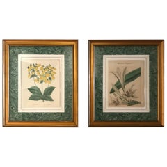
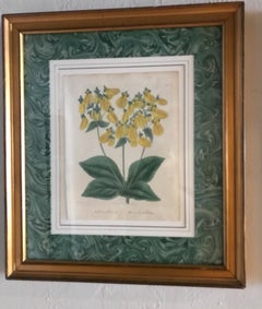
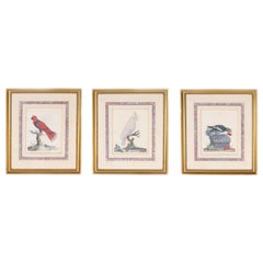
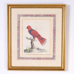
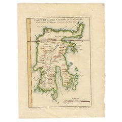
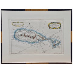
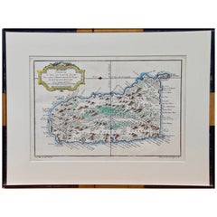
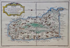
Jacques-Nicolas Bellin furniture are available for sale on 1stDibs. These distinctive items are frequently made of paper and are designed with extraordinary care. There are many options to choose from in our collection of Jacques-Nicolas Bellin furniture, although beige editions of this piece are particularly popular. Many of the original furniture by Jacques-Nicolas Bellin were created in the Georgian style in europe during the 18th century and earlier. If you’re looking for additional options, many customers also consider furniture by Isaak Tirion, Bernard Picart, and James Cook. Prices for Jacques-Nicolas Bellin furniture can differ depending upon size, time period and other attributes — on 1stDibs, these items begin at $66 and can go as high as $775, while a piece like these, on average, fetch $216.