Items Similar to Antique Map of the Iberian Peninsula with two decorative Cartouches
Want more images or videos?
Request additional images or videos from the seller
1 of 6
Antique Map of the Iberian Peninsula with two decorative Cartouches
About the Item
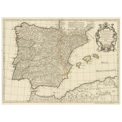
Antique map titled 'Hispaniae et Portugalliae Regna'. Original old map of the Iberian peninsula showing Spain, Portugal and the Balearic Islands. Two beautiful cartouches with several putti and coat of arms. Published by N. Visscher, circa 1680.
The Visscher family were art and map dealers in Amsterdam during the 17th century. Funded by C. J. Visscher (1587-1652), the business was continued by his son and grandson both named Nicolas. Nicolas Visscher I was born 1618 in Wenns, Austria. He died 1679 in Linz. After the death of Nicolas II, his widow passed the business to Pieter Schenk.
- Dimensions:Height: 20.36 in (51.7 cm)Width: 24.57 in (62.4 cm)Depth: 0.02 in (0.5 mm)
- Materials and Techniques:
- Period:Late 17th Century
- Date of Manufacture:c.1680
- Condition:Repaired: Original folding line, with existing splits and repairs. Age-related toning. Later hand coloring. Shows wear and creasing, also affecting image. Small tears in margins. Blank verso. Please study image carefully.
- Seller Location:Langweer, NL
- Reference Number:
About the Seller
5.0
Platinum Seller
These expertly vetted sellers are 1stDibs' most experienced sellers and are rated highest by our customers.
Established in 2009
1stDibs seller since 2017
1,928 sales on 1stDibs
Typical response time: <1 hour
- ShippingRetrieving quote...Ships From: Langweer, Netherlands
- Return PolicyA return for this item may be initiated within 14 days of delivery.
More From This SellerView All
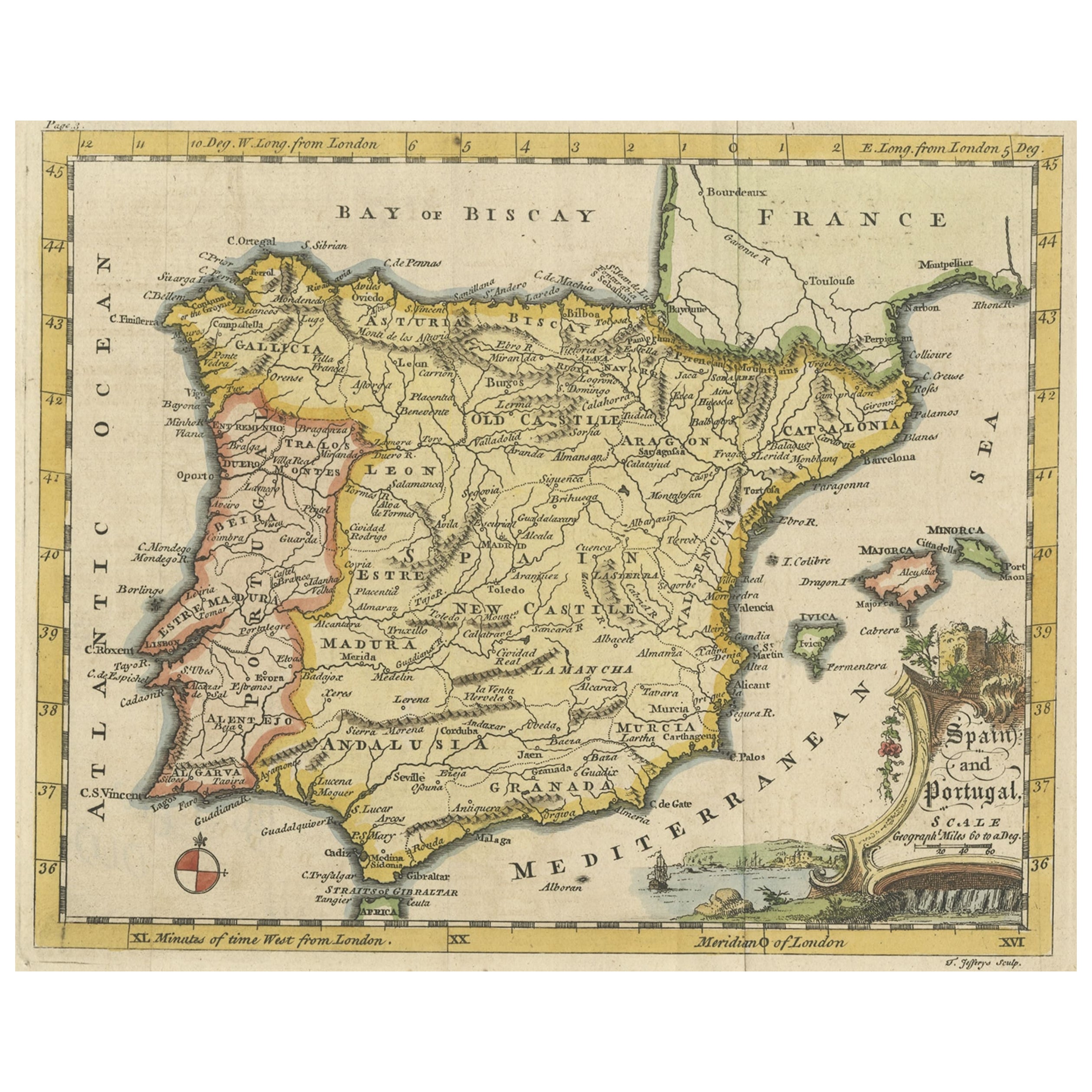
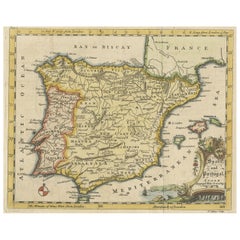
- Antique Map of Spain & Portugal 'Iberian Peninsula', Decorative Cartouche, c1755Located in Langweer, NLAntique map titled 'Spain and Portugal'. Small, detailed antique map of Spain and Portugal (Iberian Peninsula). Decorative title cartouche. Artists and Engravers: Thomas Jeff...Category
Antique 1750s Maps
MaterialsPaper
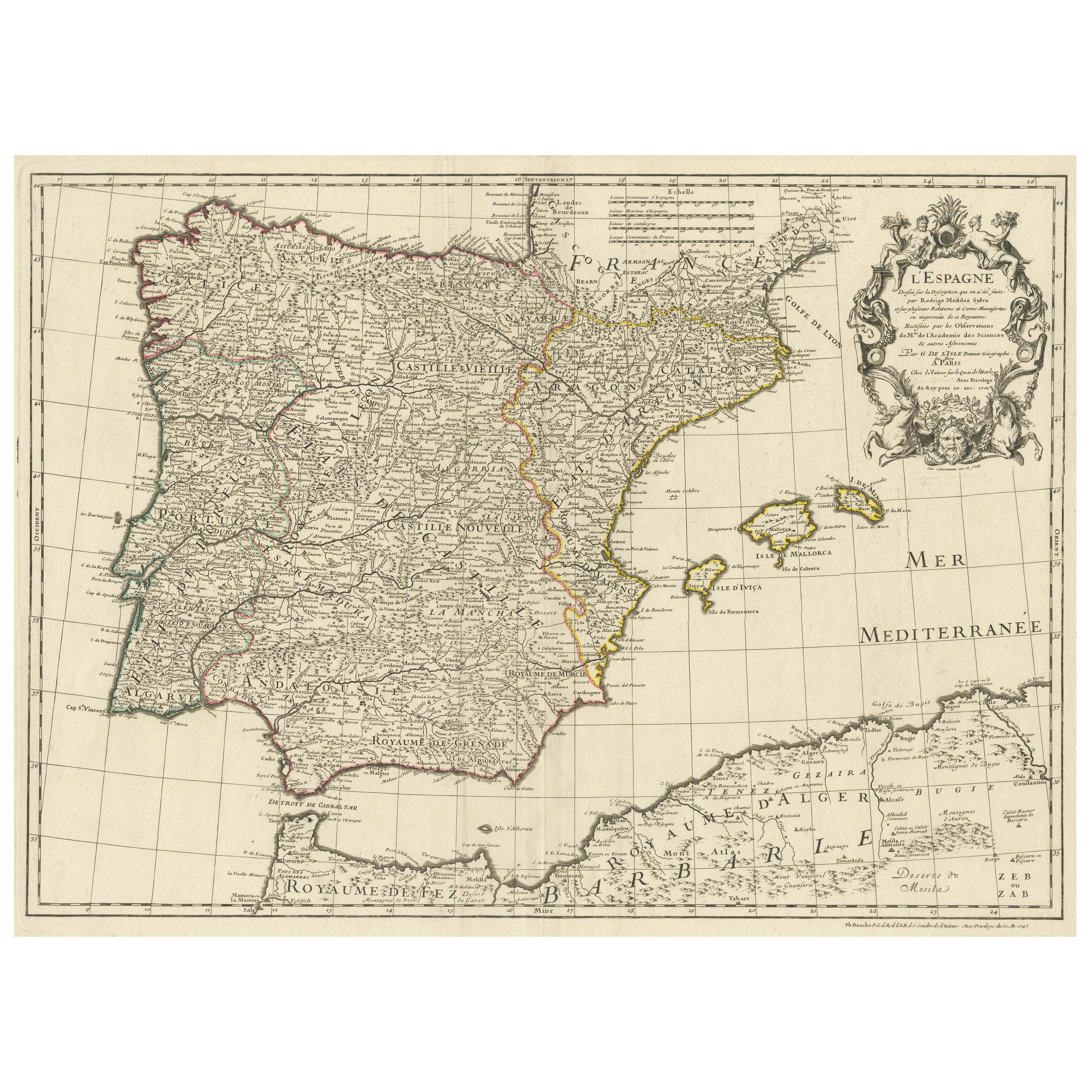
- Large Decorative Map of the Iberian PeninsulaLocated in Langweer, NLAntique map titled 'L'Espagne (..)'. Large map of the Iberian Peninsula, including the Balearic Islands and part of the north coast of Africa. The map is based on the cartography of ...Category
Antique Mid-18th Century Maps
MaterialsPaper
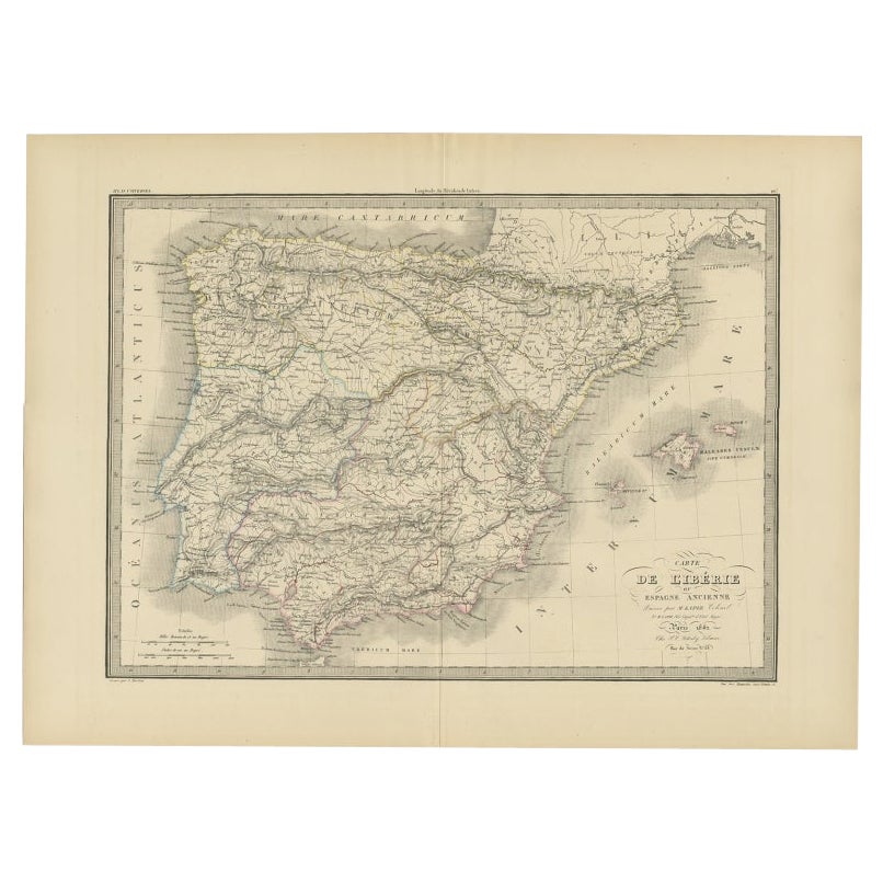
- Antique Map of Iberia or the Iberian Peninsula with Portugal and Spain, 1842Located in Langweer, NLAntique map titled 'Carte de l'Ibérie ou Espagne Ancienne'. Map of Iberia, or the Iberian Peninsula. This map originates from 'Atlas universel de géographie ancienne et moderne (..)'...Category
Antique 19th Century Maps
MaterialsPaper
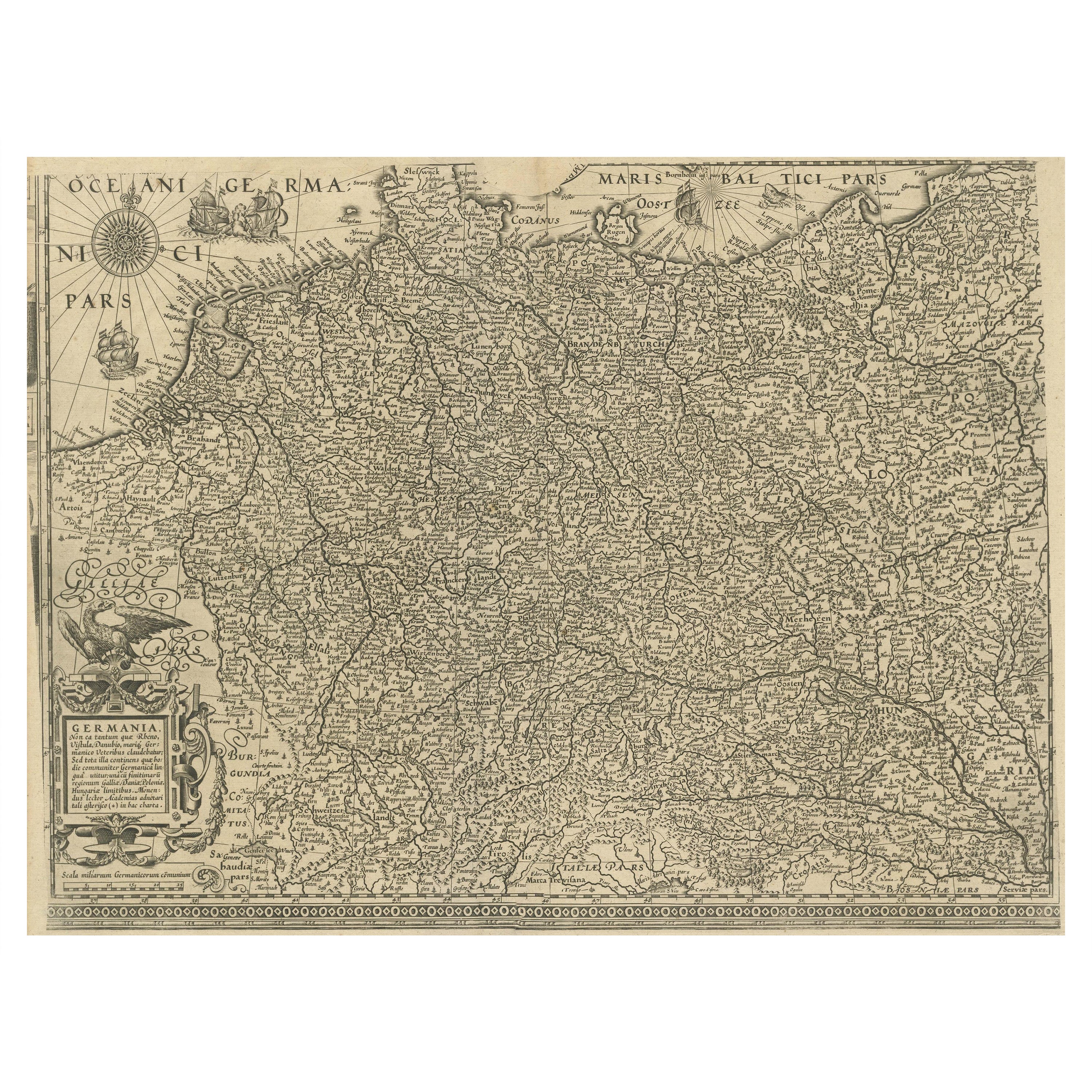
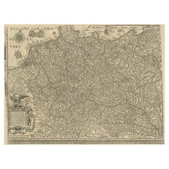
- Antique Map of the German Empire with decorative Title CartoucheLocated in Langweer, NLAntique map titled 'Germania, Non ea tantum quae Rheno, Vistula, Danubio, mariqz Germanico Veteribus claudebatur; Sed tota illa continens quae hodie communiter Germanica lingua utitu...Category
Antique Early 17th Century Maps
MaterialsPaper
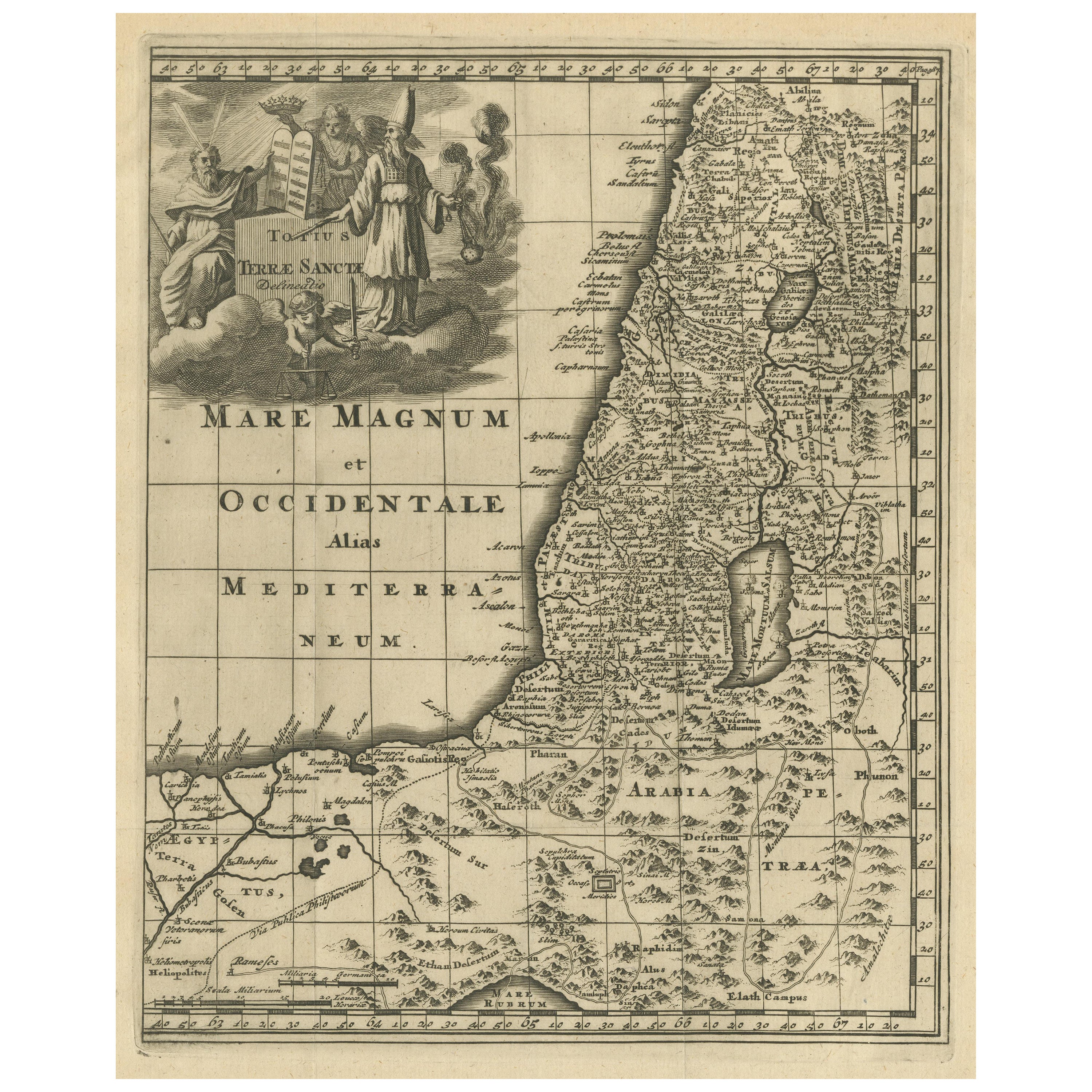
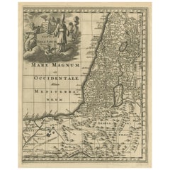
- Original Antique Map of the Holy Land with Decorative CartoucheLocated in Langweer, NLAntique map titled 'Totius Terrae Sanctae'. Original old map of the Holy Land, with a large decorative cartouche. The term "Holy Land" usually refers to a territory roughly correspon...Category
Antique Late 17th Century Maps
MaterialsPaper
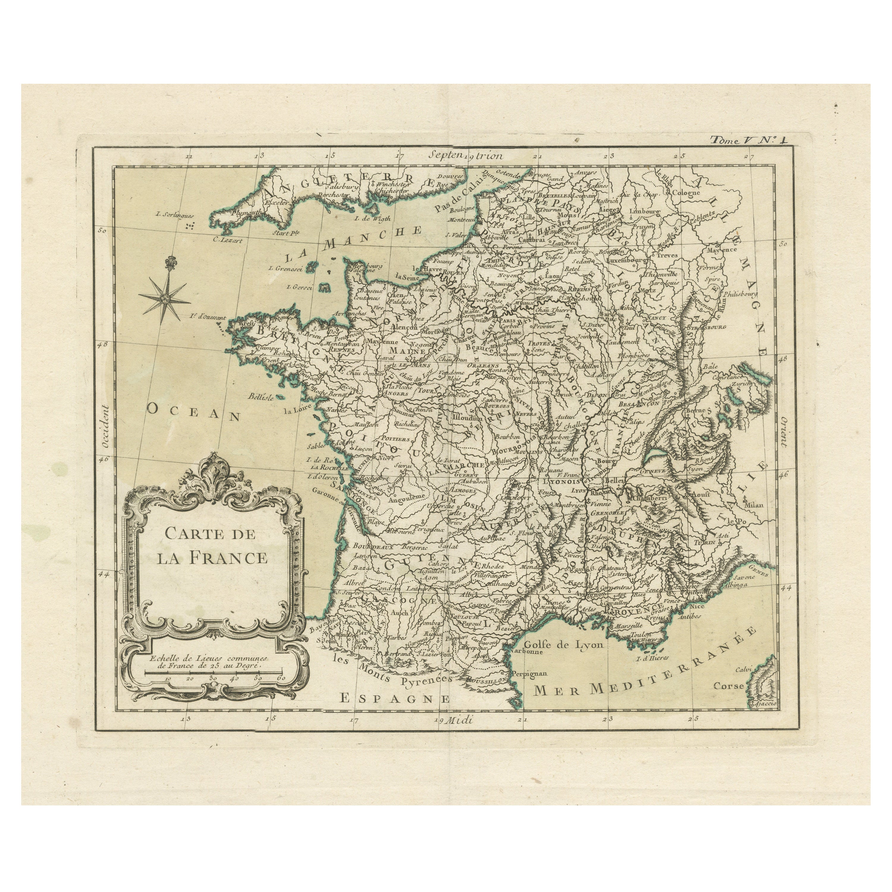
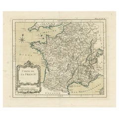
- Antique Map of France with Decorative Title CartoucheLocated in Langweer, NLAntique map titled 'Carte de la France'. Original old map of France. This map originates from 'Le Petit Atlas Maritime Recueil De Cartes et Plans Des Quatre Parties Du Monde (..) by ...Category
Antique Mid-18th Century Maps
MaterialsPaper

You May Also Like
- Original Antique Decorative Map of Japan, Fullarton, C.1870Located in St Annes, LancashireGreat map of Japan Wonderful figural border From the celebrated Royal Illustrated Atlas Lithograph. Original color. Published by Fullarton, Edinburgh, C.1870 Unframed...Category
Antique 1870s Scottish Maps
MaterialsPaper
- Original Antique Decorative Map of Iceland & Faroe, Fullarton, C.1870Located in St Annes, LancashireGreat map of Iceland and The Faroe Islands Wonderful figural border From the celebrated Royal Illustrated Atlas Lithograph. Original color. Published by Fullarton, Edinb...Category
Antique 1870s Scottish Maps
MaterialsPaper
- 1861 Topographical Map of the District of Columbia, by Boschke, Antique MapLocated in Colorado Springs, COPresented is an original map of Albert Boschke's extremely sought-after "Topographical Map of the District of Columbia Surveyed in the Years 1856 ...Category
Antique 1860s American Historical Memorabilia
MaterialsPaper
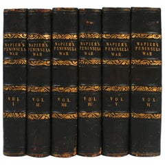
- History of the War in the Peninsula by W.F.P. Napier with Lord Elgin ProvenanceBy W.F.P. Napier, C.B.Located in valatie, NYA complete set of "History of the War in the Peninsula" by W.F.P. Napier, in 6 volumes, numbered 1-6. London: Thomas & William Boone all volumes are published in different years from 1828-1840 and are all 1st Ed's. 3/4 leather and marbled board hard covers. The history of the war in the Iberian Peninsula and in the South of France, from 1807 to the 1846 written by W.F.P. Napier, C.B., Colonel H.P. Forty-Third Regiment, and a member of the Royal Swedish Academy of Military Sciences. The wars describe the military conflict between Napoleon's Empire and Bourbon Spain. The United Kingdom of Great Britain and Ireland allied with the Kingdom of Portugal, for control of the Iberian Peninsula during the Napoleonic wars. The volumes have illustrated fold out maps portraying various battles. The set was owned originally by Colonel Thomas Bruce (Lord Elgin) the 7th Earl of Elgin. He sold the "Elgin Marbles" taken from the Parthenon to the British government in 1816. The books were later owned by George Woods...Category
Antique Early 19th Century English Books
MaterialsPaper
- Original Antique Decorative Map of South America-West Coast, Fullarton, C.1870Located in St Annes, LancashireGreat map of Chili, Peru and part of Bolivia Wonderful figural border From the celebrated Royal Illustrated Atlas Lithograph. Original color. Published by Fullarton, Edi...Category
Antique 1870s Scottish Maps
MaterialsPaper
- Original Antique Map of the American State of Pennsylvania, 1889Located in St Annes, LancashireGreat map of Pennsylvania Drawn and Engraved by W. & A.K. Johnston Published By A & C Black, Edinburgh. Original colour Unframed. Repair to a minor tear on bottom edge.Category
Antique 1880s Scottish Victorian Maps
MaterialsPaper


Recently Viewed
View AllMore Ways To Browse
Antique Map Of Sri Lanka
Globes Antique Terrestre
Antique Map New Orleans
Antique Maps Of New Orleans
Antique Maps Yorkshire
Shetland Map
Antique Map Iceland
Antique Map Of Iceland
Iraq Map
Taiwan Antique Map
Antique Illinois Map
Cuban Map
Map Of Cuba
Vietnam Map
Kansas Map
Map Of Puerto Rico
Nova Scotia Map
Bahamas Map