Items Similar to Antique Map of Sloten, IJlst, Workum & Hindeloopen by Blaeu, 1652

Want more images or videos?
Request additional images or videos from the seller
1 of 5
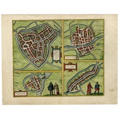
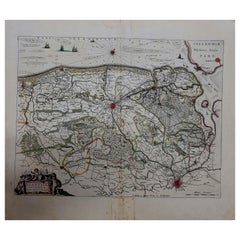
Antique Map of Sloten, IJlst, Workum & Hindeloopen by Blaeu, 1652
About the Item
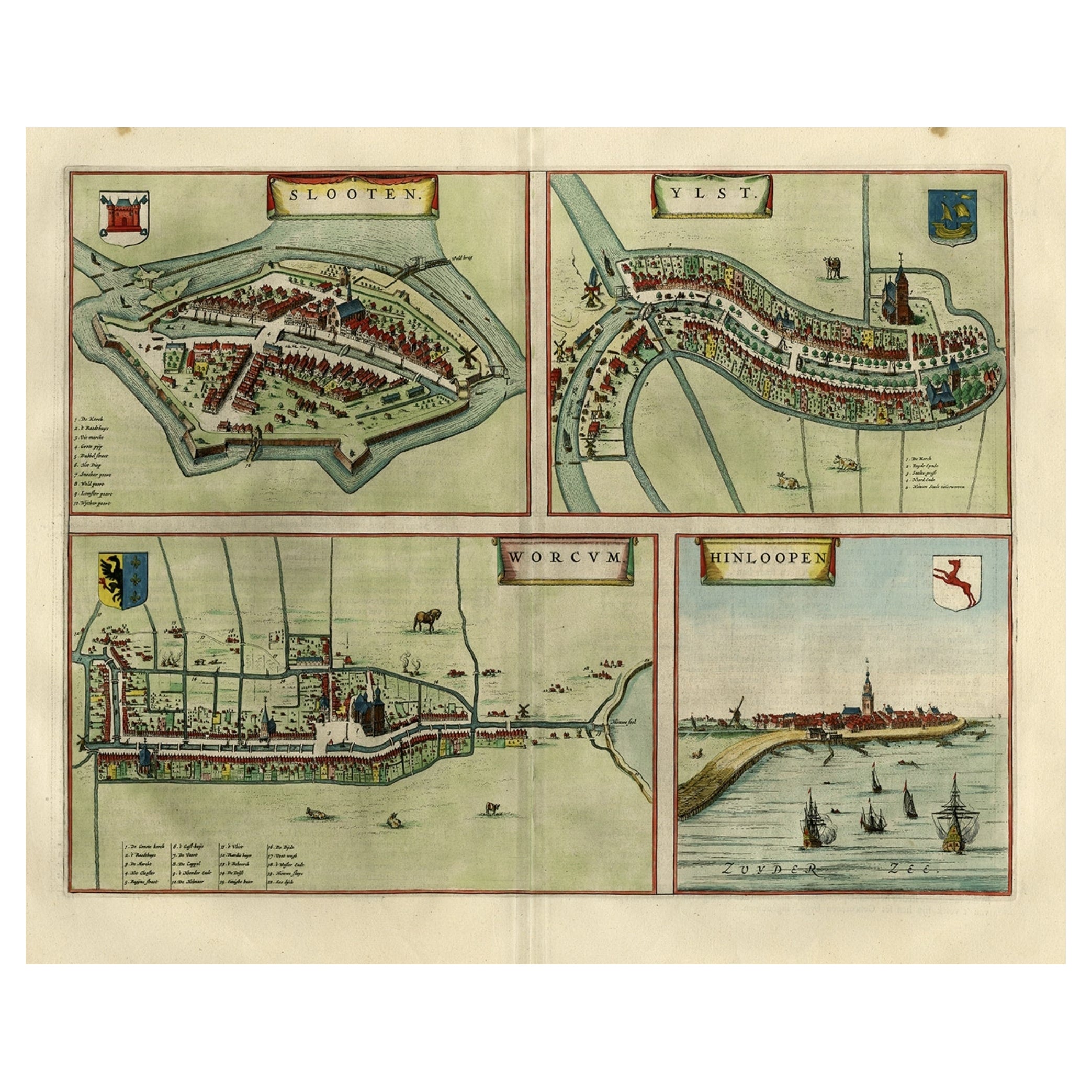
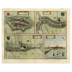
Antique map titled: 'Sloten - Ylst - Worcum - Hinloopen.' - Three plans and a bird's eye view on one sheet. The plans show the Frisian cities Sloten, IJlst, Workum and the view shows Hindeloopen. This map originates from the town atlas 'Toneel der Steden', published by Joan Blaeu, Amsterdam. Latin tekst on verso. Artists and Engravers: Joan Blaeu (23 September 1596 - 28 May 1673) was a Dutch cartographer. He was born in Alkmaar, the son of cartographer Willem Blaeu. In 1620 he became a doctor of law but he joined the work of his father. In 1635 they published the Atlas Novus (full title: Theatrum orbis terrarum, sive, Atlas novus) in two volumes. Joan and his brother Cornelius took over the studio after their father died in 1638. Joan became the official cartographer of the Dutch East India Company. Around 1649 Joan Blaeu published a collection of Dutch city maps named Tooneel der Steeden (Views of Cities). In 1651 he was voted into the Amsterdam council. In 1654 Joan published the first atlas of Scotland, devised by Timothy Pont. In 1662 he reissued the atlas with 11 volumes, and one for oceans. It was also known as Atlas Maior. A cosmology was planned as their next project, but a fire destroyed the studio completely in 1672. Joan Blaeu died in Amsterdam the following year.
Artist: Joan Blaeu (23 September 1596 - 28 May 1673) was a Dutch cartographer. He was born in Alkmaar, the son of cartographer Willem Blaeu. In 1620 he became a doctor of law but he joined the work of his father. In 1635 they published the Atlas Novus (full title: Theatrum orbis terrarum, sive, Atlas novus) in two volumes. Joan and his brother Cornelius took over the studio after their father died in 1638. Joan became the official cartographer of the Dutch East India Company. Around 1649 Joan Blaeu published a collection of Dutch city maps named Tooneel der Steeden (Views of Cities). In 1651 he was voted into the Amsterdam council. In 1654 Joan published the first atlas of Scotland, devised by Timothy Pont. In 1662 he reissued the atlas with 11 volumes, and one for oceans. It was also known as Atlas Maior. A cosmology was planned as their next project, but a fire destroyed the studio completely in 1672. Joan Blaeu died in Amsterdam the following year.
Condition: Excellent. Please study image carefully.
Date: 1652
Overall size: 58.2 x 47.2 cm.
Image size: 0.001 x 50.4 x 39 cm.
Antique prints have long been appreciated for both their aesthetic and investment value. They were the product of engraved, etched or lithographed plates. These plates were handmade out of wood or metal, which required an incredible level of skill, patience and craftsmanship. Whether you have a house with Victorian furniture or more contemporary decor an old engraving can enhance your living space. We offer a wide range of authentic antique prints for any budget.
- Dimensions:Height: 18.59 in (47.2 cm)Width: 22.92 in (58.2 cm)Depth: 0 in (0.01 mm)
- Materials and Techniques:
- Period:
- Date of Manufacture:1652
- Condition:
- Seller Location:Langweer, NL
- Reference Number:
About the Seller
5.0
Platinum Seller
These expertly vetted sellers are 1stDibs' most experienced sellers and are rated highest by our customers.
Established in 2009
1stDibs seller since 2017
1,933 sales on 1stDibs
Typical response time: <1 hour
- ShippingRetrieving quote...Ships From: Langweer, Netherlands
- Return PolicyA return for this item may be initiated within 14 days of delivery.
More From This SellerView All
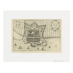
- Antique Map of Frisian Cities Sloten, Ylst, Workum and Hindelopen by Blaeu, 1652Located in Langweer, NLAntique print titled 'Slooten - Ylst - Worcum - Hinloopen'. Three plans and a bird's eye view on one sheet. The plans show the Frisian cities Sloten, IJlst, Workum and the view shows...Category
Antique 1650s Maps
MaterialsPaper
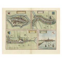
- Antique Print of Sloten, IJlst, Workum and Hindeloopen in The Netherlands, 1680Located in Langweer, NL"Antique print titled 'Slooten, Worcum, Ylst and Hindeloope'. Bird's eye views of Sloten, IJlst, Workum and Hindeloopen, Friesland, the Netherlands. This original antique print origi...Category
Antique 17th Century Prints
MaterialsPaper
- Antique Print of Sloten, IJlst, Workum and Hindeloopen in The Netherlands, 1680Located in Langweer, NLAntique print titled 'Slooten, Worcum, Ylst and Hindeloope'. Bird's eye views of Sloten, IJlst, Workum and Hindeloopen, Friesland, the Netherlands. This original antique print origin...Category
Antique 17th Century Prints
MaterialsPaper
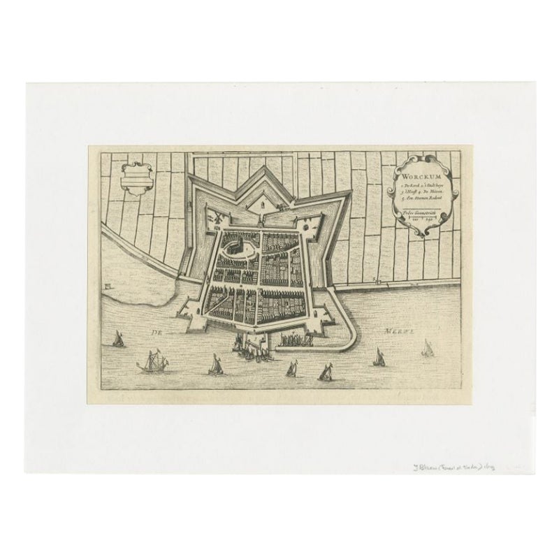
- Antique Map of the City of Workum by Blaeu, 1649Located in Langweer, NLAntique map titled 'Worckum'. Old map of the city of Workum, Friesland. Originates from J. Blaeu's 'Town Book'. Artists and Engravers: Joan Blaeu (23 September 1596 - 28 May 1673...Category
Antique 17th Century Maps
MaterialsPaper
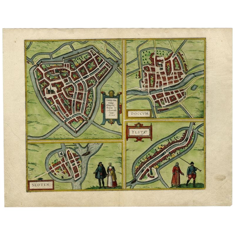
- Antique Map of Sneek, Dokkum, Sloten and IJlst by Hogenberg, c.1572Located in Langweer, NLAntique map titled 'Provincie Friesland - Gemeente Sloten'. Map of the township of Sloten, Friesland. This map originates from 'Gemeente-Atlas van Nederland' by J. Kuyper. Artists an...Category
Antique 19th Century Maps
MaterialsPaper
- Engravings of the Frisian Cities of Sloten, IJlst, Workum and Hindelopen, c.1650Located in Langweer, NLAntique print titled 'Slooten - Ylst - Worcum - Hinloopen'. Three plans and a bird's eye view on one sheet. The plans show the Frisian cities Sloten, IJlst, Workum and the view shows...Category
Antique 17th Century Prints
MaterialsPaper
You May Also Like
- 1635 Willem Blaeu Map of Northern France"Comitatvs Bellovacvm" Ric.a08Located in Norton, MA1635 Willem Blaeu map of northern France, entitled. "Comitatvs Bellovacvm Vernacule Beavvais," Colored Ric.a008 “COMITATVS BELLOVACVM…” Amsterdam: W...Category
Antique 17th Century Unknown Maps
MaterialsPaper
- World Map Silver Leaf Print Based on Original Willem Blaeu Wall Map 1571-1638Located in GBWe are delighted to offer for sale this lovely Antique style pictorial plan map of the globe based on the original Willem Blaeu 1571-1638 engraved in silver leaf foil This is a v...Category
20th Century English Campaign Maps
MaterialsSilver Leaf
- 1643 Willem&Joan Blaeu Map NW Flanders "Flandriae Teutonicae Pars PrientaliorLocated in Norton, MA1643 Willem and Joan Blaeu map of northwest Flanders, entitled "Flandriae Teutonicae Pars Prientalior," Ric0012 " Authentic" - Map of the northwest Fl...Category
Antique 17th Century Dutch Maps
MaterialsPaper
- 1654 Joan Blaeu Map the Sutherland, Scotland, Entitled "Southerlandia, "Ric0007Located in Norton, MA1654 Joan Blaeu map of the Sutherland, Scotland, entitled "Southerlandia," Hand Colored Ric0007 Description: Lovely map centered on Sedan and D...Category
Antique 17th Century Dutch Maps
MaterialsPaper
- 1571-1638 Willem Blaeu map entitled, "Ilcadorino, " Hand Colored Ric0009Located in Norton, MAWillem Blaeu map entitled, "Ilcadorino,". Hand colored. Description: large, unusual, and nice antique copper engraved map of Ilcadorino, by Willem BL...Category
Antique 16th Century Dutch Maps
MaterialsPaper
- 1861 Topographical Map of the District of Columbia, by Boschke, Antique MapLocated in Colorado Springs, COPresented is an original map of Albert Boschke's extremely sought-after "Topographical Map of the District of Columbia Surveyed in the Years 1856 ...Category
Antique 1860s American Historical Memorabilia
MaterialsPaper


Recently Viewed
View AllMore Ways To Browse
Antique Fire Collectibles
Dutch East India Company
Dutch East India
Antique Scottish Maps
Antique Map Of Scotland
Antique Maps Scotland
Antique Scotland Map
Scotland Antique Map
Antique Map Scotland
Map Of Scotland
17th Century Scotland
Lithograph City Maps
City Map Lithograph
Antique Ocean Map
Blaeu Maps
Map Blaeu
Antique Doctors Office Furniture
Atlas Furniture Company