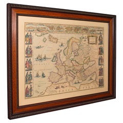
Wooden Map
4
to
44
406
332
363
342
226
220
103
69
60
53
49
41
37
29
25
23
20
18
15
15
14
12
12
12
11
8
7
7
7
7
6
5
5
5
4
3
3
2
2
1
1
1
1
1
1
1
1
1
1
108
45
42
42
16
Sort By
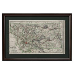
"Clason's Guide Map of Montana" by The Clason Map Company, Circa 1920s
Located in Colorado Springs, CO
red ink or wax crayon.
Map is archivally framed in a new, custom wooden frame with acid-free mats and
Category
Vintage 1920s American Art Deco Maps
Materials
Paper
H 23.13 in W 33.88 in D 1.5 in
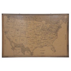
Vintage Framed United States Map
Located in New York, NY
Vintage aged paper map of the United States mounted on particle board and framed in a simple wooden
Category
20th Century American Mid-Century Modern Maps
Materials
Wood, Paper
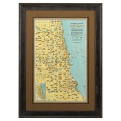
Pictorial Map of Chicago, circa 1926
Located in Colorado Springs, CO
This is a colorful folding pocket map of the city of Chicago, published by The Clason Map Co
Category
Vintage 1920s American Maps
Materials
Paper
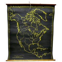
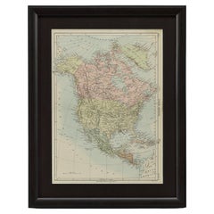
University Chart “Black Map of North America
Located in Chillerton, Isle of Wight
University Chart “Black Map of North America
W&A K Johnston’s Charts of Physical Maps By G W
Category
Early 20th Century Industrial Maps
Materials
Linen
1875 "North America" Map by J. Bartholomew
Located in Colorado Springs, CO
Presented is an original 1875 map of “North America.” The map was issued in Volume 1 of the Ninth
Category
Antique 1870s Scottish Maps
Materials
Paper
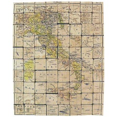
Puzzle Atlas with Maps, Italy, circa 1900
Located in Milan, IT
80 little wooden cubes covered with printed paper that depending on which side they form the maps
Category
Early 20th Century Italian Maps
Materials
Wood, Paper
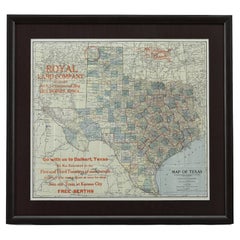
1908 "Map of Texas" by The Kenyon Company
Located in Colorado Springs, CO
Presented is an antique map of the state of Texas, printed as a pocket map in 1908 by The Kenyon
Category
Antique Early 1900s American Maps
Materials
Paper
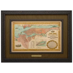
1855 "New-York City & County Map" by Charles Magnus
By Charles Magnus
Located in Colorado Springs, CO
This is a beautiful hand-colored map titled “New York City & County Map with Vicinity entire
Category
Antique 1850s American Maps
Materials
Paper
Vintage Reproduction 17th Century Map of Europe, American, Cartography, Blaeuw
Located in Hele, Devon, GB
, attractive wooden frame with beaded detail
After the original from 1630, the map shows 17th century Europe
Category
Late 20th Century Central American Mid-Century Modern Maps
Materials
Glass, Wood, Paper
H 30.32 in W 38.39 in D 1.38 in
1866 Ensign & Bridgman's Rail Road Map of the United States
Located in Colorado Springs, CO
Presented is an 1866 issue of “Ensign & Bridgeman’s Rail Road Map of the United States, showing
Category
Antique 1860s American Late Victorian Maps
Materials
Paper
Topographical and Infrastructure Map of the Province of Valencia, 1901
Located in Langweer, NL
A historical map of the province of Valencia, dated 1901. The map includes intricate details such
Category
Antique Early 1900s Maps
Materials
Paper
Free Shipping
H 20.08 in W 14.77 in D 0 in
Vintage Swedish School Map of Vastergötland, Made in Sweden 1920
Located in Los Angeles, CA
Vintage Swedish School Map of Vastergötland, Made in Sweden 1920
Västergötland also known as
Category
Vintage 1920s Swedish Maps
Materials
Linen, Wood, Paper
New Map of North America from the Latest Discoveries, 1763
Located in Philadelphia, PA
A fine antique 18th century map of the North American seaboard.
Entitled "A New Map of North
Category
Antique Mid-18th Century English Georgian Maps
Materials
Paper
Set of 4 Antique Geographical Maps French-German War 1870-71
Located in Casale Monferrato, IT
Elegant late 19th century set of four antique geographical maps relating to the positioning of the
Category
Antique 1890s Italian Maps
Materials
Paper
Vintage Swedish School Map of Europe, Large, Made in Sweden, 1905
Located in Los Angeles, CA
map is so unique and a great example of why these are so collectible.
Wooden poles at the top and
Category
Antique Early 1900s Swedish Maps
Materials
Linen, Wood, Paper
"The United States from the Latest Authorities" Antique Wall Map, 1835
Located in Colorado Springs, CO
.
Condition:
Map presented on early wooden rollers, backed on modern canvas. Map has various restorations
Category
Antique 1830s American Maps
Materials
Paper
1915 "San Francisco City and County" Hanging Map by W. Bashford Smith
Located in Colorado Springs, CO
outer margins.
Map has been artfully mounted, hanging, inside a custom wooden frame, with linen mats
Category
Vintage 1910s American Art Deco Maps
Materials
Wood, Paper
Antique 18th Century Map of the Province of Pensilvania 'Pennsylvania State'
Located in Philadelphia, PA
A fine antique of the colony of Pennsylvania.
Noted at the top of the sheet as a 'Map of the
Category
Antique 18th Century British American Colonial Maps
Materials
Paper
H 10.25 in W 13.25 in D 0.5 in
Vintage Swedish Topographic School Map of European Alps, Made in Sweden 1922
Located in Los Angeles, CA
Swedish school map is so unique and a great example of why these are so collectible.
Wooden poles at
Category
Vintage 1920s Swedish Maps
Materials
Linen, Wood, Paper
1859 "Colton's New Map of the State of Texas..." by Johnson & Browning
Located in Colorado Springs, CO
Presented is "Colton's New Map of the State of Texas Compiled from De Cordova's Large Map
Category
Antique 1850s American Maps
Materials
Paper
H 27.75 in W 38.5 in D 1.38 in
Map Road Strip Britannia Sheet 2 John Ogilby London Aberistwith Islip Bramyard
By John Ogilby
Located in BUNGAY, SUFFOLK
of England and Wales.
Strip map Islip to Bramyard, on a scale of approximately one inch to the mile
Category
Antique 17th Century English Baroque Maps
Materials
Paper
H 14.38 in W 19.3 in D 0.79 in
1863 "Lloyd's New Map of the United States, the Canadas, and New Brunswick"
Located in Colorado Springs, CO
backed with linen. Presented on wooden rollers, as issued. Map is sold unframed, as-is. Unframed
Category
Antique 1860s American Maps
Materials
Linen, Wood, Paper
H 37 in W 49.5 in D 1 in
1873 "Map of the States of California and Nevada" by Chas. Drayton Gibbes
Located in Colorado Springs, CO
Presented is Warren Holt and Charles Drayton Gibbes' 1873 “Map of California and Nevada.” This map
Category
Antique 1870s American Maps
Materials
Paper
1837 Mitchell's "Tourist's Pocket Map of the State of Virginia" by J.H. Young
Located in Colorado Springs, CO
This is J. H. Young's pocket map of the Virginia, which shows county development current to 1835
Category
Antique 1830s American Maps
Materials
Paper
H 24.25 in W 25.75 in D 1.75 in
1948 "A Hysterical Map of Yellowstone National Park" by Jolly Lindgren, 2nd Ed.
Located in Colorado Springs, CO
Presented is a second edition printing of Jolly Lindgren’s “Hysterical Map of Yellowstone National
Category
Vintage 1940s American Maps
Materials
Paper
H 20 in W 20 in D 0.75 in
1842 Wall Map of the United States by J. H. Young, Published by S. A. Mitchell
Located in Colorado Springs, CO
Presented is an 1842 hanging “Map of the United States,” engraved by J. H. Young and published by
Category
Antique 1840s American Maps
Materials
Paper
H 45 in W 38 in D 1 in
Antique Kittinger 8-inch Terrestrial World Globe on a Mahogany Wooden Stand
By Kittinger Furniture Company
Located in Philadelphia, PA
collaboration with the publishers W. & A.K. Johnston, Ltd. of Edinburgh, Scotland).
On a turned mahogany wooden
Category
Early 20th Century Maps
Materials
Mahogany, Gesso, Wood, Paper
H 18 in W 11.5 in D 11.5 in
1889 "The Pacific States and Territories"
Located in Colorado Springs, CO
Presented is an uncommon 1889 map of the western United States, titled “The Pacific States and
Category
Antique 1880s American Maps
Materials
Paper
1879 "United States of America, Western Part" by O. J. Stuart
Located in Colorado Springs, CO
This colorful original map, titled “United States of America, Western Part,” was issued in Volume
Category
Antique 1870s American Maps
Materials
Paper
Large University Chart “Africa Physical ” by Bacon
Located in Chillerton, Isle of Wight
W Bacon,
This is a Physical map of Africa, it is lithograph set on Linen mounted on wooden rods
Category
Early 20th Century Beaux Arts Maps
Materials
Linen
1912 "Panoramic View of New York City and Vicinity" by Jacob Ruppert
Located in Colorado Springs, CO
This is an attractive and very scarce map of New York, published by the Yorkville brewer Jacob
Category
Vintage 1910s American Maps
Materials
Paper
1960s Canvas Wall School Chart with Sheep by Jung-Koch-Quentell
By Jung Koch Quentell 1
Located in Antwerp, BE
the animal in it's natural environment as well as some anatomical details.
This Pull down map theme
Category
Mid-20th Century German Mid-Century Modern Maps
Materials
Wood, Canvas, Paper
Miniature Terrestrial Globe Newton & Son London, Post 1833, Ante 1858
By Newton and Son
Located in Milano, IT
, bronze and wood
It measures: sphere diameter 2.95 in (7.6 cm); diameter of the wooden base 6.02 in (15.3
Category
Antique 1840s English Early Victorian Maps
Materials
Bronze
Pair of Miniature Globes Lane’s on Tripod Bases, London post 1833, ante 1858
By Lane's
Located in Milano, IT
They measure:
Height 9.44 in (24 cm);
Sphere diameter 2.75 in (7 cm);
Diameter of the wooden base
Category
Antique 1840s English Early Victorian Maps
Materials
Paper, Wood
Antique 19th Century Miniature French Edition Globe by C. Abel-Klinger
By C. Abel-Klinger
Located in Philadelphia, PA
A fine antique French Edition miniature globe.
By C. Abel-Klinger.
On a turned wooden stand
Category
Antique 19th Century German Neoclassical Maps
Materials
Paper
Antique Panoramic View of the Town of Malacca, Malaysia, 1726
Located in Langweer, NL
assault in 1641. The covered wooden bridge on high stilts over the River Malacca joins the fortified old
Category
Antique 1720s Maps
Materials
Paper
Vintage Print Map of Jerusalem With Wooden Frame
Located in Seattle, WA
Historic Print of Original Oil Painting by Fr. & R. Stegmiller of Jerusalem in 1928. Primarily Red and Yellow Tones as Pictured. Vintage Condition Consistent with Age as Pictured.
D...
Category
Vintage 1970s Mid-Century Modern Paintings
Materials
Wood
English Mahogany Wooden Folio Stand, Map and Document Holder, circa 1820
Located in Hamilton, Ontario
Regency era mahogany wood folio stand rack, map, poster, document holder used in a library, office
Category
Antique Early 19th Century English Regency Magazine Racks and Stands
Materials
Wood
History Maps
Located in Deddington, GB
History Maps by Maria Pierides [2020]
original
Oil, oil stick collage, pastel and wax on cradled
Category
21st Century and Contemporary Abstract Expressionist Abstract Paintings
Materials
Mixed Media, Canvas
Vintage Geographical Map of the World Map, Vallardi Milan, Early 20th Century
Located in Cuneo, Italy (CN)
Vintage geographical map or planisphere, published by Vallardi publisher for the municipality of
Category
20th Century Italian Prints
Materials
Paper
H 66.93 in W 118.12 in D 3.94 in
Large French Paris Metro Map 1960s
Located in North Hollywood, CA
den.
The map was glued on a board with no glass and has a wooden frame.
DIMENSIONS: Height: 30.5 in
Category
Mid-20th Century French Industrial Prints
Materials
Wood, Paper
Maps, Painting, Acrylic on Canvas
By Tracy Burke
Located in Yardley, PA
wooden stretcher frame. Edges are staple-free and painted to compliment the artwork. No framing necessary
Category
2010s Abstract Abstract Paintings
Materials
Acrylic
Vintage School Map of Czechoslovakia, 1960s
Located in Zohor, SK
This is a great vintage school map produced in Czechoslovakia by Skolske pomucky n.p., which was a
Category
Vintage 1960s Slovak Mid-Century Modern Posters
Materials
Paper
Antique New York Wall Map by Westermann
By Westermann
Located in Stockbridge, GB
Antique New York Map By Westermann
A rare early school pull down wall map of New York. The map
Category
Mid-20th Century British Schoolhouse Posters
Materials
Canvas, Wood
Catesby Map Table by David Duncan Studio
By David Duncan
Located in New York, NY
stretcher with a round center. The inset wooden top features a high resolution facsimile map of Carolina
Category
21st Century and Contemporary American Coffee and Cocktail Tables
Materials
Brass
Vintage School Map Of Czech State, Czechoslovakia 1960s
Located in Zohor, SK
elementary school students. The map is made of paper on plastic with black wooden slats on bottom and top
Category
Vintage 1960s Czech Mid-Century Modern Prints
Materials
Wood, Paper
Large University Chart “Physical Map of Ireland” by Bacon
Located in Chillerton, Isle of Wight
Large University Chart “Physical Map of Ireland” by Bacon
W&A K Johnston’s Charts of Physical
Category
Early 20th Century International Style Posters
Materials
Linen
Large University Chart “Physical Map of Africa” by Bacon
Located in Chillerton, Isle of Wight
Large university chart “Physical Map of Africa” by Bacon
W&A K Johnston’s Charts of Physical
Category
Early 20th Century Folk Art Posters
Materials
Linen
French Nesting Tables in Wood with Maps Tops, 1940s
Located in Barcelona, ES
World Maps Themed set of three wooden nesting tables, France, 1940s.
This set has black patinated
Category
Mid-20th Century French Mid-Century Modern Nesting Tables and Stacking T...
Materials
Wood
Antique Vintage Australia Wall Map By W & A K Johnston
By W. & A.K. Johnston
Located in Stockbridge, GB
. The map has a wooden hanging pole at the top and bottom. The map is manufactured by the renown
Category
Mid-20th Century British Schoolhouse Posters
Materials
Canvas, Wood
Large European 1930's Nautical Map Reader Magnifying Glass
Located in Haddonfield, NJ
This European set of two nautical magnifying glass map-readers are quite unusual and rarely found
Category
Vintage 1930s German Industrial Nautical Objects
Materials
Metal
1950s German Wooden and Glass Globe
Located in High Point, NC
Embark on a journey through time and geography with this 1950s German Wooden and Glass Globe
Category
Mid-20th Century German Figurative Sculptures
Materials
Glass, Wood
Large University Chart “Political Map of North America” by Bacon
Located in Chillerton, Isle of Wight
Large University chart “Political Map of North America” by Bacon
W&A K Johnston’s Charts of
Category
Early 20th Century American Empire Posters
Materials
Linen
Large University Chart “Political Map of North America” by Bacon
Located in Chillerton, Isle of Wight
Large University Chart “Political Map of North America” by Bacon
W&A K Johnston’s Charts of
Category
Early 20th Century American Empire Posters
Materials
Linen
New Revised North America Map with Mythical Figures and Animals
Located in Houston, TX
Chez Pierre Mortier and the Creator was Guillaume de I'Isle. The map is framed in a gold wooden frame
Category
Early 1700s Naturalistic Landscape Prints
Materials
Engraving
Zero Bark Map Stool by Timbur, Represented by Tuleste Factory
By Timbur
Located in New York, NY
These wooden stools are digitally fabricated by artist Ezra Ardolino at Timbur LLC.
The process
Category
21st Century and Contemporary American Stools
Materials
Pine
Ninety Bark Map Stool by Timbur, Represented by Tuleste Factory
By Timbur
Located in New York, NY
These wooden stools are digitally fabricated by artist Ezra Ardolino at Timbur LLC.
The process
Category
21st Century and Contemporary Stools
Materials
Pine
Early Folk Art American Two Sided Framed Military Drawing with Map
Located in Savannah, GA
dignitary drawn on one side and a perspective drawing and a map of islands on the other.
The perspective
Category
Antique Late 18th Century American Folk Art Political and Patriotic Memo...
Materials
Glass, Wood, Paper
Maria Pierides, History Maps, Original Abstract Painting, Mixed Media Art
Located in Deddington, GB
History Maps by Maria Pierides [2020]
Original
Oil, oil stick collage, pastel and wax on cradled
Category
21st Century and Contemporary Abstract Abstract Paintings
Materials
Pastel, Mixed Media, Wax, Oil, Panel
Free Shipping
H 9.45 in W 9.45 in D 1.97 in
19th Century Swedish Wooden Drop Leaf Table
Located in High Point, NC
A wooden table created in 19th century Sweden. Reminiscent of a more simple time, this charming
Category
Antique 19th Century Swedish Country Drop-leaf and Pembroke Tables
Materials
Wood
- 1
- ...
Get Updated with New Arrivals
Save "Wooden Map", and we’ll notify you when there are new listings in this category.
Wooden Map For Sale on 1stDibs
With a vast inventory of beautiful furniture at 1stDibs, we’ve got just the wooden map you’re looking for. Each wooden map for sale was constructed with extraordinary care, often using paper, wood and metal. If you’re shopping for a wooden map, we have 96 options in-stock, while there are 18 modern editions to choose from as well. You’ve searched high and low for the perfect wooden map — we have versions that date back to the 18th Century alongside those produced as recently as the 21st Century are available. When you’re browsing for the right wooden map, those designed in mid-century modern, industrial and Victorian styles are of considerable interest. You’ll likely find more than one wooden map that is appealing in its simplicity, but Morrison Thomas, Timbur and Antonio Vallardi Editore produced versions that are worth a look.
How Much is a Wooden Map?
Prices for a wooden map can differ depending upon size, time period and other attributes — at 1stDibs, they begin at $80 and can go as high as $75,000, while the average can fetch as much as $1,758.
More Ways To Browse
Pierre Morquin
Antique Maps Michigan
George Sherman
Antique Map Of Michigan
Antique Minnesota Map
Antique Maps Scandinavia
Franz West Chain Table
Antique Montana Maps
Antique Furniture Oklahoma City
Irish Canterbury
Rail Road Collectables
St Lazarus
Coach Burgundy
Antique Miniature Globe
Irish Canterbury Furniture
Antique Montana Map
Arthur Leipzig
Small Retro Treasure Chest
