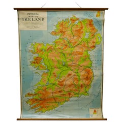
Large University Chart “Physical Map of Ireland” by Bacon
View Similar Items


Want more images or videos?
Request additional images or videos from the seller
1 of 6
Large University Chart “Physical Map of Ireland” by Bacon
$1,204.70List Price
About the Item
- Dimensions:Height: 41 in (104.14 cm)Diameter: 6 in (15.24 cm)
- Style:International Style (In the Style Of)
- Materials and Techniques:
- Period:
- Date of Manufacture:1920
- Condition:
- Seller Location:Godshill, GB
- Reference Number:Seller: GB1261stDibs: LU2498320976232
About the Seller
4.9
Gold Seller
Premium sellers maintaining a 4.3+ rating and 24-hour response times
Established in 1980
1stDibs seller since 2017
873 sales on 1stDibs
Authenticity Guarantee
In the unlikely event there’s an issue with an item’s authenticity, contact us within 1 year for a full refund. DetailsMoney-Back Guarantee
If your item is not as described, is damaged in transit, or does not arrive, contact us within 7 days for a full refund. Details24-Hour Cancellation
You have a 24-hour grace period in which to reconsider your purchase, with no questions asked.Vetted Professional Sellers
Our world-class sellers must adhere to strict standards for service and quality, maintaining the integrity of our listings.Price-Match Guarantee
If you find that a seller listed the same item for a lower price elsewhere, we’ll match it.Trusted Global Delivery
Our best-in-class carrier network provides specialized shipping options worldwide, including custom delivery.More From This Seller
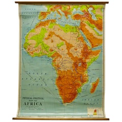
View AllLarge University Chart “Physical Map of Africa” by Bacon
Located in Godshill, Isle of Wight
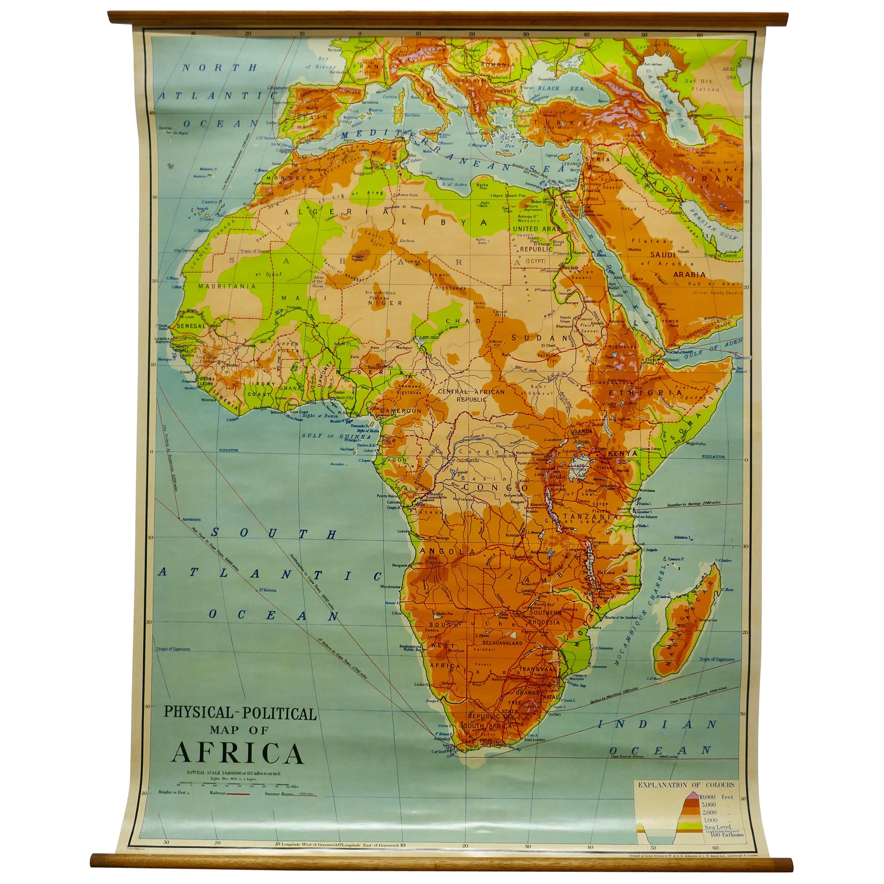
Large university chart “Physical Map of Africa” by Bacon
W&A K Johnston’s Charts of Physical Maps By G W Bacon,
This is colorful Physical map of North America, it is large lithograph set...
Category
Early 20th Century Folk Art Posters
Materials
Linen

W&A K Johnston’s Charts of Physical Maps by G W Bacon
Located in Godshill, Isle of Wight
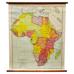
Large University chart “Africa Physical Political” by Bacon
W&A K Johnston’s charts of physical maps by G W Bacon,
This is a Physical Political map...
Category
Early 20th Century Rustic Posters
Materials
Linen
Large University Chart “Political Map of North America” by Bacon
Located in Godshill, Isle of Wight
Large University Chart “Political Map of North America” by Bacon
W&A K Johnston’s Charts of Physical Maps By G W Bacon,
This is colourful Physical map ...
Category
Early 20th Century American Empire Posters
Materials
Linen

Large University Chart “Political Map of North America” by Bacon
Located in Godshill, Isle of Wight
Large University chart “Political Map of North America” by Bacon
W&A K Johnston’s Charts of Political Maps by G W Bacon,
This is colorful Physical ...
Category
Early 20th Century American Empire Posters
Materials
Linen

Large University Chart “Africa Physical ” by Bacon
Located in Godshill, Isle of Wight
Large University chart “Africa Physical ” by Bacon
W&A K Johnston’s charts of physical maps by G W Bacon,
This is a Physical map of Africa, it is lithograph set on Linen mounte...
Category
Early 20th Century Beaux Arts Maps
Materials
Linen
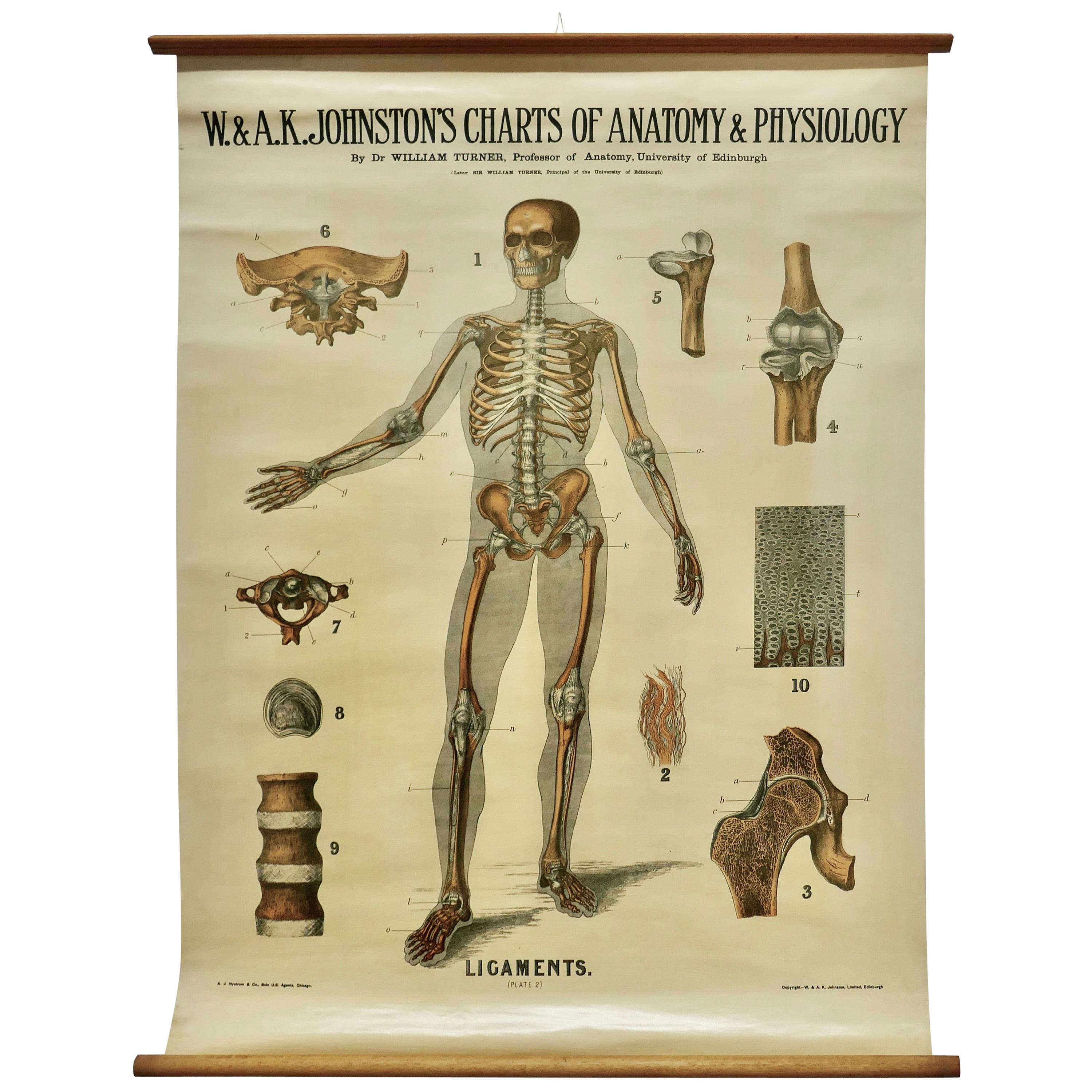
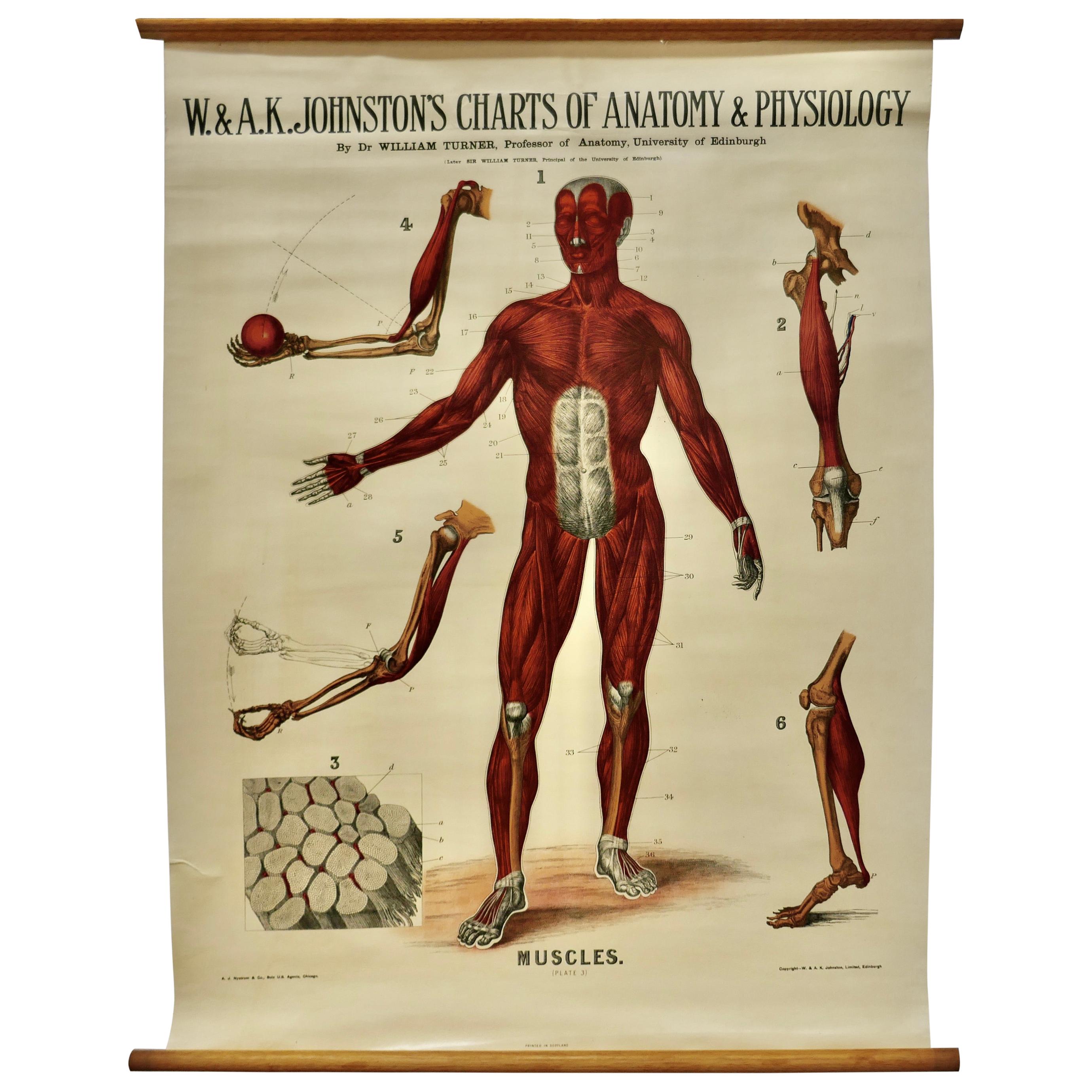
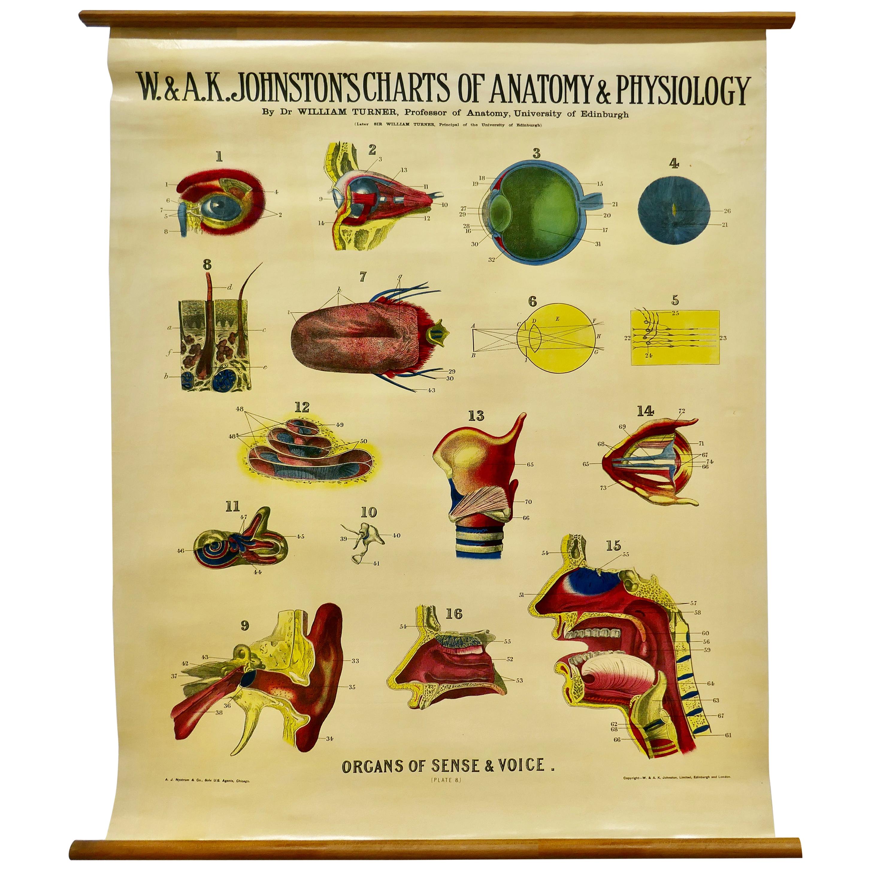
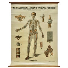
Large University Anatomical Chart “Ligamnets” by Turner
Located in Godshill, Isle of Wight
Large University Anatomical chart “Ligamnets” by Turner
W&A K Johnston’s Charts of Anatomy and Physiology By Dr William Turner, Professor of Anatomy University of Edinburgh/A J Nystrom & Co US Agents Chicago
This is Plate 2, Ligaments, by Turner, it is large lithograph set...
Category
Early 20th Century International Style Posters
Materials
Linen
You May Also Like
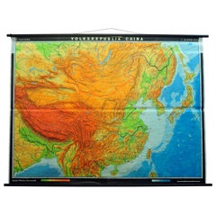
Vintage Picture Poster Wall Chart Rollable Large Map Peoples Republic of China
Located in Berghuelen, DE
A vintage wall chart illustrating a map of people's republic of china. Used as teaching material in German schools. Colorful print on paper reinforce...
Category
Late 20th Century German Country Prints
Materials
Canvas, Wood, Paper
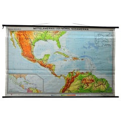
Large Rollable Map Central America Northern South America Wall Chart Poster
Located in Berghuelen, DE
A fantastic pull-down wall chart depicting a map of Central America and Northern South America. Used as teaching material in German schools. Colorful print on paper reinforced with c...
Category
Mid-20th Century German Country Prints
Materials
Canvas, Wood, Paper
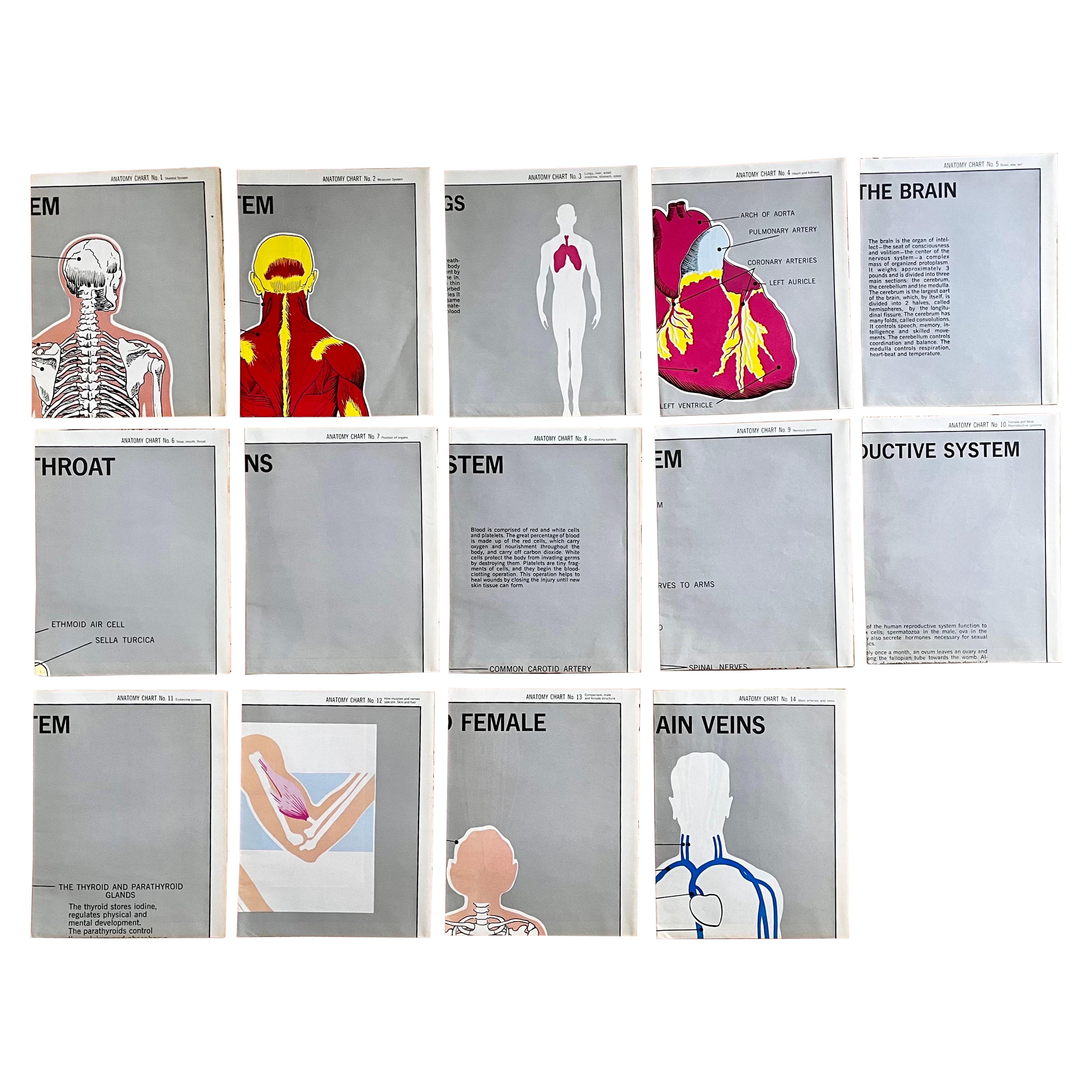
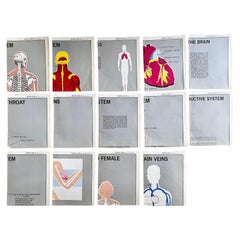
Set of (14) Vintage Anatomy Charts by American Map Co. - sold individually
Located in Philadelphia, PA
Set of (14) Vintage Anatomy Charts
American Map Co. - Circa 1950.
14 Total Charts - Sold Individually -( 14 available )
( discounted to buy as a set )
29" x 37" unfolded
9.5" x 12...
Category
Mid-20th Century American Mid-Century Modern Posters
Materials
Paper
Istanbul Mosque University the Golden Horn Turkey Vintage Rollable Wall Chart
Located in Berghuelen, DE
A classical rollable close up showing the wonderful cityscape of Istanbul: Suleiman mosque, university, the Golden Horn, Turkey. Used as teaching material in German schools. Colorful...
Category
Vintage 1970s German Country Prints
Materials
Canvas, Wood, Paper

$266 Sale Price
30% Off
Vintage Wall Chart of a Landscape and Geographic Map, circa 1955
Located in Langweer, NL
Vintage wall chart titled 'Kaart en Landschap'. This wall chart shows a mountain range and geographic map. Published by J.B. Wolters, circa 1955.
Category
Mid-20th Century Prints
Materials
Paper

$572 Sale Price
20% Off
Set of Five Large 1970s Acupuncture Charts
Located in Los Angeles, CA
Great set of acupuncture charts from the 1970s. Extremely detailed and thorough diagrams showing every part of the human anatomy. Charts in good vintage condition. Floating on black ...
Category
Vintage 1970s American Contemporary Art
Materials
Wood, Paper
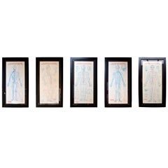
$1,500 Sale Price / set
55% Off
Recently Viewed
View AllMore Ways To Browse
Vintage Isle Of Man Posters
1950s Ski Poster
Antique Advertising Lithographs
Australian Movie Poster
Croatia Vintage Poster
Godard Film Poster
Jean Luc Godard Poster
Orangina Villemot
Panther Poster
Rabbit Poster
Vintage Campari Poster
World War I Recruiting Poster
3 Sheet Movie Poster
Barcelona Travel Poster
Vintage Posters Cassandre
Vintage Projector Screen
Vintage Wwi Posters
Batman Poster