Map Of Itsly
40
to
236
1,641
1,385
1,211
867
701
662
489
387
350
264
202
185
178
144
90
86
83
83
81
76
72
66
64
64
61
56
55
49
48
44
44
36
28
26
25
25
24
23
23
14
13
13
12
11
11
10
10
10
10
9
9
9
8
7
7
7
6
6
4
4
3
2
1
1
161
79
75
52
42
Sort By
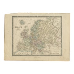
Antique Map of Europe by Wyld '1845'
Located in Langweer, NL
the World, Comprehending Separate Maps of its Various Countries, constructed and drawn from the latest
Category
Antique Mid-19th Century Maps
Materials
Paper
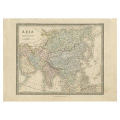
Antique Map of Asia by Wyld '1845'
Located in Langweer, NL
World, Comprehending Separate Maps of its Various Countries, constructed and drawn from the latest
Category
Antique Mid-19th Century Maps
Materials
Paper
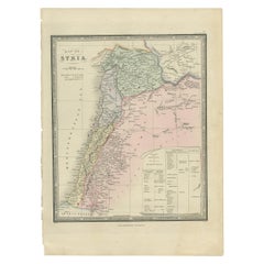
Antique Map of Syria by Wyld '1845'
Located in Langweer, NL
Atlas of the World, Comprehending Separate Maps of its
Various Countries, constructed and drawn from
Category
Antique Mid-19th Century Maps
Materials
Paper
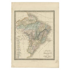
Antique Map of Brazil by Wyld, '1845'
Located in Langweer, NL
Atlas of the World, Comprehending Separate Maps of its Various Countries, constructed and drawn from the
Category
Antique Mid-19th Century Maps
Materials
Paper
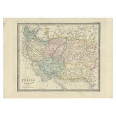
Antique Map of Afghanistan and Surroundings, '1845'
Located in Langweer, NL
.
This map originates from 'An Atlas of the World, Comprehending Separate Maps of its Various Countries
Category
Antique Mid-19th Century Maps
Materials
Paper
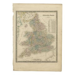
Antique Map of England & Wales by Wyld '1845'
Located in Langweer, NL
from 'An Atlas of the World, Comprehending Separate Maps of its Various Countries, constructed and
Category
Antique Mid-19th Century Maps
Materials
Paper
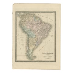
Antique Map of South America by Wyld, '1845'
Located in Langweer, NL
'An Atlas of the World, Comprehending Separate Maps of its Various Countries, constructed and drawn
Category
Antique Mid-19th Century Maps
Materials
Paper
Antique Map of North America by Wyld '1845'
Located in Langweer, NL
'An Atlas of the World, Comprehending Separate Maps of its Various Countries, constructed and drawn
Category
Antique Mid-19th Century Maps
Materials
Paper
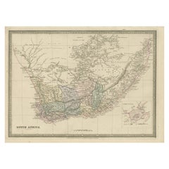
Antique Map of South Africa by Wyld '1845'
Located in Langweer, NL
old map originates from 'An Atlas of the World, Comprehending Separate Maps of its Various Countries
Category
Antique Mid-19th Century Maps
Materials
Paper
Antique Map of the Kingdom of Denmark by Wyld '1845'
Located in Langweer, NL
originates from 'An Atlas of the World, Comprehending Separate Maps of its Various Countries, constructed and
Category
Antique Mid-19th Century Maps
Materials
Paper
Antique Map of the Eastern Hemisphere by Wyld '1845'
Located in Langweer, NL
originates from 'An Atlas of the World, Comprehending Separate Maps of its Various Countries, constructed and
Category
Antique Mid-19th Century Maps
Materials
Paper
Antique Map of the Western Hemisphere by Wyld '1845'
Located in Langweer, NL
originates from 'An Atlas of the World, Comprehending Separate Maps of its Various Countries, constructed and
Category
Antique Mid-19th Century Maps
Materials
Paper
Antique Map of France in Departments by Wyld '1845'
Located in Langweer, NL
from 'An Atlas of the World, Comprehending Separate Maps of its Various Countries, constructed and
Category
Antique Mid-19th Century Maps
Materials
Paper
Antique Map of Turkey in Europe by Wyld, '1845'
Located in Langweer, NL
originates from 'An Atlas of the World, Comprehending Separate Maps of its Various Countries, constructed and
Category
Antique Mid-19th Century Maps
Materials
Paper
Antique Map of Russia in Asia by Wyld, '1845'
Located in Langweer, NL
from 'An Atlas of the World, Comprehending Separate Maps of its Various Countries, constructed and
Category
Antique Mid-19th Century Maps
Materials
Paper
Antique Map of the World, Mercator Projection, by Wyld, '1845'
Located in Langweer, NL
originates from 'An Atlas of the World, Comprehending Separate Maps of its Various Countries, constructed and
Category
Antique Mid-19th Century Maps
Materials
Paper
Antique Map of Turkey in Asia by Wyld '1845'
Located in Langweer, NL
originates from 'An Atlas of the World, Comprehending Separate Maps of its Various Countries, constructed and
Category
Antique Mid-19th Century Maps
Materials
Paper
Antique Map of the East Indies by Wyld '1845'
Located in Langweer, NL
map originates from 'An Atlas of the World, Comprehending Separate Maps of its Various Countries
Category
Antique Mid-19th Century Maps
Materials
Paper
Antique Map of China and Japan by Wyld '1845'
Located in Langweer, NL
. This map originates from 'An Atlas of the World, Comprehending Separate Maps of its Various Countries
Category
Antique Mid-19th Century Maps
Materials
Paper
Antique Map of the Kingdom of the Netherlands by Wyld '1845'
Located in Langweer, NL
Separate Maps of its Various Countries, constructed and drawn from the latest Astronomical and Geographical
Category
Antique Mid-19th Century Maps
Materials
Paper
Antique Map of the Burmese Empire by Wyld, '1845'
Located in Langweer, NL
Antique map titled 'Map of Burman Empire, Siam, Cochin China and Ton-King'. Original antique map of
Category
Antique Mid-19th Century Maps
Materials
Paper
Antique Map of the Kingdoms of Spain and Portugal by Wyld '1845'
Located in Langweer, NL
and Portugal. This map originates from 'An Atlas of the World, Comprehending Separate Maps of its
Category
Antique Mid-19th Century Maps
Materials
Paper
Antique Map of the Kingdoms of Sweden and Norway by Wyld '1845'
Located in Langweer, NL
and Norway. This map originates from 'An Atlas of the World, Comprehending Separate Maps of its
Category
Antique Mid-19th Century Maps
Materials
Paper
Antique Map of New South Wales 'Australia' by Wyld '1845'
Located in Langweer, NL
Wales, Australia. This map originates from 'An Atlas of the World, Comprehending Separate Maps of its
Category
Antique Mid-19th Century Maps
Materials
Paper
Antique Map of the United States of North America by Wyld '1845'
Located in Langweer, NL
Antique map titled 'Map of The United States of North America'. Original antique map of the United
Category
Antique Mid-19th Century Maps
Materials
Paper
Antique Map of Russia in Europe and Poland by Wyld '1845'
Located in Langweer, NL
and Poland. This map originates from 'An Atlas of the World, Comprehending Separate Maps of its
Category
Antique Mid-19th Century Maps
Materials
Paper
Antique Map of the West Indies by Wyld '1845'
Located in Langweer, NL
World, Comprehending Separate Maps of its Various Countries, constructed and drawn from the latest
Category
Antique Mid-19th Century Maps
Materials
Paper
Antique Map of the Eastern Hemisphere by Teesdale, '1831'
Located in Langweer, NL
separate maps of its various countries and states, and exhibiting their boundaries & divisions, also the
Category
Antique Mid-19th Century Maps
Materials
Paper
Antique Map of the Islands in the Pacific Ocean by Wyld, '1845'
Located in Langweer, NL
Pacific Ocean. This map originates from 'An Atlas of the World, Comprehending Separate Maps of its Various
Category
Antique Mid-19th Century Maps
Materials
Paper
Antique Map of Germany with the Empire of Austria by Wyld '1845'
Located in Langweer, NL
originates from 'An Atlas of the World, Comprehending Separate Maps of its Various Countries, constructed and
Category
Antique Mid-19th Century Maps
Materials
Paper
Antique Map of the British Possessions in North America by Wyld '1845'
Located in Langweer, NL
Separate Maps of its Various Countries, constructed and drawn from the latest Astronomical and Geographical
Category
Antique Mid-19th Century Maps
Materials
Paper
H 10.24 in W 14.18 in D 0.02 in
Antique Map of Asia Showing Its Political Divisions, 1874
Located in Langweer, NL
Antique map titled 'Map of Asia showing its Gt. Political Divisions and also the various routes of
Category
Antique 19th Century Maps
Materials
Paper
Antique Map of Friesland During Its Widest Spread, 1718
Located in Langweer, NL
Antique map Friesland titled 'Summaria descriptio Fresiae Universae (..)'. Old map of Friesland
Category
Antique 18th Century Maps
Materials
Paper
Swiss Splendor: Antique Map of Switzerland and Its Cantons, 1852
Located in Langweer, NL
The antique map titled 'Carte de la Suisse' is an attractive map of Switzerland. Here are the key
Category
Antique Mid-19th Century Maps
Materials
Paper
Antique Map of Greece and Its Colonies, with Frame Style Border
Located in Langweer, NL
Antique map titled 'La Grèce'. Attractive map of Greece and its Colonies. The map covers from the
Category
Antique Mid-19th Century Maps
Materials
Paper
Map of Philadelphia with a Historical Tribute to its Volunteer Fire Companies
Located in Langweer, NL
This elaborate map of Philadelphia in Pennsylvania served as a historical tribute to the city's
Category
Vintage 1930s Maps
Materials
Paper
Free Shipping
H 21.42 in W 29.89 in D 0 in
Imperium Romanum: A Detailed Map of the Roman Empire in its Zenith, 1880
Located in Langweer, NL
at the height of its power. The main map encompasses the vast expanse of the Roman territories
Category
Antique 1880s Maps
Materials
Paper
Free Shipping
H 15.56 in W 18.51 in D 0 in
Antique Map of Alkmaar, City Know for Its Cheese Market, Netherlands, circa 1740
Located in Langweer, NL
Antique map titled 'Alkmaar'. Old map of the city of Alkmaar, the Netherlands. This map originates
Category
Antique 18th Century Maps
Materials
Paper
H 7.49 in W 10.04 in D 0 in
Rare Detailed Antique Map of Prague and Its North West Environs, ca.1760
Located in Langweer, NL
Description: original antique map of the environs of North West Prague. This map originates from
Category
Antique 1760s Maps
Materials
Paper
H 10.44 in W 14.97 in D 0 in
Antique Map of Germany with Its Bordering Kingdoms and Provinces by N. Visscher
Located in Langweer, NL
Antique map covering the central part of Europe with Germany in the centre and the Netherlands in
Category
Antique Late 17th Century Maps
Materials
Paper
H 20.79 in W 24.81 in D 0.02 in
Antique Map of Wisconsin with Inset Geological Map of Wisconsin
Located in Langweer, NL
Antique map titled 'Wisconsin'. Original antique map of Wisconsin, United States. With inset
Category
Antique Late 19th Century Maps
Materials
Paper
Antique Map of Oregon
Located in Langweer, NL
Antique map titled 'Oregon'. Original antique map of Oregon, United States. This print originates
Category
Antique Late 19th Century Maps
Materials
Paper
Antique Map of Nebraska
Located in Langweer, NL
Antique map titled 'Nebraska'. Original antique map of Nebraska, United States. This print
Category
Antique Late 19th Century Maps
Materials
Paper
Antique Map of Alabama
Located in Langweer, NL
Antique map titled 'Alabama'. Original antique map of Alabama, United States. This print originates
Category
Antique Late 19th Century Maps
Materials
Paper
Antique Map of Vermont
Located in Langweer, NL
Antique map titled 'Vermont'. Original antique map of Vermont, United States. This print originates
Category
Antique Late 19th Century Maps
Materials
Paper
Antique Map of Arkansas
Located in Langweer, NL
Antique map titled 'Arkansas'. Original antique map of Arkansas, United States. This print
Category
Antique Late 19th Century Maps
Materials
Paper
Antique Map of Iowa
Located in Langweer, NL
Antique map titled 'Iowa'. Original antique map of Iowa, United States. This print originates from
Category
Antique Late 19th Century Maps
Materials
Paper
Antique Map of Kentucky
Located in Langweer, NL
Antique map titled 'Kentucky'. Original antique map of Kentucky, United States. This print
Category
Antique Late 19th Century Maps
Materials
Paper
Antique Map of Virginia, with Inset Map of the South Western Continuation
Located in Langweer, NL
Antique map titled 'Virginia'. Original antique map of Virginia, United States. With inset map of
Category
Antique Late 19th Century Maps
Materials
Paper
H 8.27 in W 10.63 in D 0.02 in
Antique Map of North Carolina, with inset map of the western part
Located in Langweer, NL
Antique map titled 'North Carolina'. Original antique map of North Carolina, United States. With
Category
Antique Late 19th Century Maps
Materials
Paper
Antique Map of Ohio, with Inset Maps of Cleveland, Columbus and Cincinnati
Located in Langweer, NL
Antique map titled 'Ohio'. Original antique map of Ohio, United States. With inset maps of
Category
Antique Late 19th Century Maps
Materials
Paper
H 8.27 in W 10.63 in D 0.02 in
Antique Map of Virginia, with Inset Map of the Northern Part of West Viriginia
Located in Langweer, NL
Antique map titled 'West Virginia'. Original antique map of Virginia, United States. With inset map
Category
Antique Late 19th Century Maps
Materials
Paper
H 8.27 in W 10.63 in D 0.02 in
Antique Map of Alaska '1904'
Located in Langweer, NL
Navigation Use**: With its detailed topographic information, the map would have served important functions
Category
Early 20th Century Maps
Materials
Paper
Antique Map of New Hampshire
Located in Langweer, NL
Antique map titled 'New Hampshire'. Original antique map of New Hampshire, United States. This
Category
Antique Late 19th Century Maps
Materials
Paper
Antique Map of Scotland With an Inset Map of the Shetland Islands, 1854
Located in Langweer, NL
: Large Antique map titled 'Scotland with its Islands, drawn from the Topographical surveys by James Wyld
Category
Antique 1850s Maps
Materials
Paper
1854 Map of Massachusetts, Connecticut and Rhode Island, Antique Wall Map
Located in Colorado Springs, CO
mounted onto archival linen. Additionally, the map is attached to its original hanging hardware and is
Category
Antique 19th Century American Maps
Materials
Paper
H 38.13 in W 45 in D 3.5 in
18th Century Antique Map of the Virgin Islands and Caribbean Inset Maps
Located in Langweer, NL
covering various regions of the world.
The map, with its insets of islands such as St. Kitts, Antigua
Category
Antique Late 18th Century Maps
Materials
Paper
Free Shipping
H 12.68 in W 18 in D 0.02 in
"Clason's Guide Map of Montana" by The Clason Map Company, Circa 1920s
Located in Colorado Springs, CO
Presented is “Clason's Guide Map of Montana,” published in the early 1920s by the Clason Map
Category
Vintage 1920s American Art Deco Maps
Materials
Paper
H 23.13 in W 33.88 in D 1.5 in
Original Antique Map of Switzerland, 1882
Located in Langweer, NL
era, waiting to grace your home or office walls. Bring home this antique map today and let its
Category
Antique 1880s Maps
Materials
Paper
Colored wall map of the WORLD
By Chambon
Located in ZWIJNDRECHT, NL
map is most notable for its depiction of the Sea of Japan labeled "Mer de Corée" and of "Mer de
Category
Antique Mid-18th Century French French Provincial Maps
Materials
Wood, Paper
- 1
- ...
Get Updated with New Arrivals
Save "Map Of Itsly", and we’ll notify you when there are new listings in this category.
Map Of Itsly For Sale on 1stDibs
At 1stDibs, there are many versions of the ideal map of itsly for your home. Frequently made of paper, fabric and linen, every map of itsly was constructed with great care. There are many kinds of the map of itsly you’re looking for, from those produced as long ago as the 18th Century to those made as recently as the 20th Century. A map of itsly, designed in the Mid-Century Modern style, is generally a popular piece of furniture. You’ll likely find more than one map of itsly that is appealing in its simplicity, but Raul de la Torre produced versions that are worth a look.
How Much is a Map Of Itsly?
A map of itsly can differ in price owing to various characteristics — the average selling price 1stDibs is $504, while the lowest priced sells for $94 and the highest can go for as much as $2,552.
More Ways To Browse
Guyana Antique Map
Antique Maps Rhode Island
Ukraine Antique Map
Congo Antique Map
Antique Map Of Colombia
Antique Mormon
Uruguay Antique Map
Victor Levasseur On Sale
Colombia Map Antique
Map Of Iowa
Antique Iowa Map
Antique Vermont Maps
Wisconsin Map
Idaho Map
Antique Map Of New Hampshire
Antique Alabama Map
Antique Wisconsin Maps
Alabama Map
