Items Similar to Antique Map of Friesland During Its Widest Spread, 1718


Want more images or videos?
Request additional images or videos from the seller
1 of 5
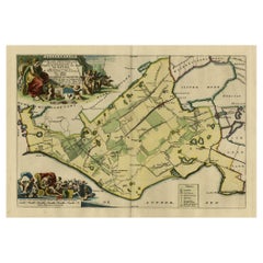
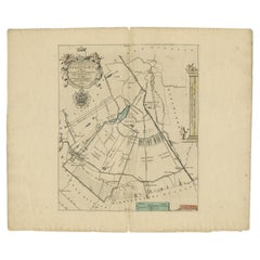
Antique Map of Friesland During Its Widest Spread, 1718
About the Item
Antique map Friesland titled 'Summaria descriptio Fresiae Universae (..)'. Old map of Friesland, the Netherlands. Depicts the general delineation of Friesland during its widest spread after the Franks left and the Saxens came. Originates from 'Uitbeelding van de Heerlijkheid van Friesland' by Bernardus Schotanus à Sterringa. This atlas is considered the best atlas of Friesland, the Netherlands. Artists and Engravers: Published by F. Halma, Leeuwarden.
Artist: Published by F. Halma, Leeuwarden.
Condition: Good, general age-related toning. Shows some wear and spotting, blank verso. Please study image carefully.
Date: 1718
Overall size: 0.001 x 66 x 55 cm.
Image size: 41 x 32 cm.
We sell original antique maps to collectors, historians, educators and interior decorators all over the world. Our collection includes a wide range of authentic antique maps from the 16th to the 20th centuries. Buying and collecting antique maps is a tradition that goes back hundreds of years. Antique maps have proved a richly rewarding investment over the past decade, thanks to a growing appreciation of their unique historical appeal. Today the decorative qualities of antique maps are widely recognized by interior designers who appreciate their beauty and design flexibility. Depending on the individual map, presentation, and context, a rare or antique map can be modern, traditional, abstract, figurative, serious or whimsical. We offer a wide range of authentic antique maps for any budget.
- Dimensions:Height: 21.66 in (55 cm)Width: 25.99 in (66 cm)Depth: 0 in (0.01 mm)
- Materials and Techniques:
- Period:
- Date of Manufacture:1718
- Condition:
- Seller Location:Langweer, NL
- Reference Number:
About the Seller
5.0
Platinum Seller
These expertly vetted sellers are 1stDibs' most experienced sellers and are rated highest by our customers.
Established in 2009
1stDibs seller since 2017
1,933 sales on 1stDibs
Typical response time: <1 hour
- ShippingRetrieving quote...Ships From: Langweer, Netherlands
- Return PolicyA return for this item may be initiated within 14 days of delivery.
More From This SellerView All
- Antique Map of Gaasterland in Friesland, the Netherlands, 1718Located in Langweer, NLAntique map titled 'Gaasterland. De zevende Grietenije van de Zevenwolden (..)'. Original antique map of Gaasterland, Friesland, the Netherlands. Originates from 'Uitbeelding van de ...Category
Antique 18th Century Maps
MaterialsPaper
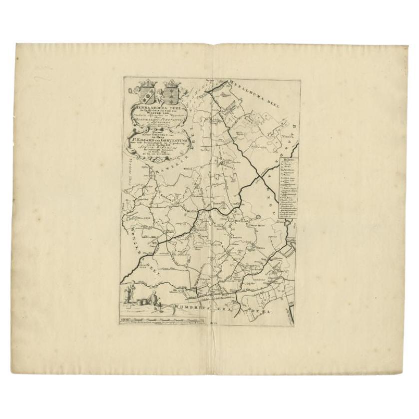
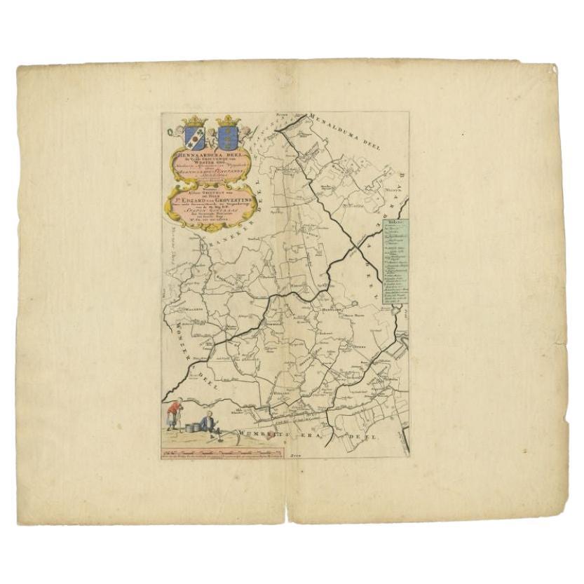
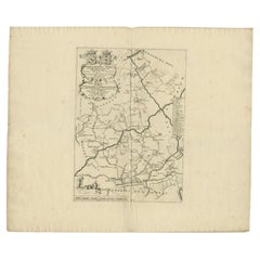
- Antique Map of the Hennaarderadeel Township 'Friesland' by Halma, 1718Located in Langweer, NLAntique map Friesland titled 'Hennaardera Deel de Vyfde Grietenije van Wester Goo (..)'. Old map of Friesland, the Netherlands. This map depicts the region of...Category
Antique 18th Century Maps
MaterialsPaper
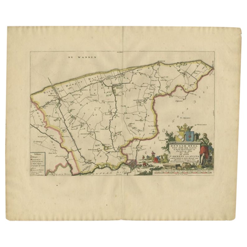
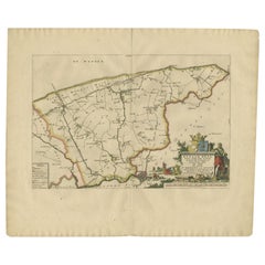
- Antique Map of the Dongeradeel Township 'Friesland' by Halma, 1718Located in Langweer, NLAntique map Friesland titled 'Donger Deel West Zyde der Pasens (..)'. Old map of Friesland, the Netherlands. This map depicts the region of Dongeradeel and includes cities and villag...Category
Antique 18th Century Maps
MaterialsPaper
- Antique Map of the Hennaarderadeel Township 'Friesland' by Halma, 1718Located in Langweer, NLAntique map of Friesland titled 'Hennaardera Deel de Vyfde Grietenije van Wester Goo (..)'. Old map of Friesland, the Netherlands. This map depicts the region...Category
Antique 18th Century Maps
MaterialsPaper
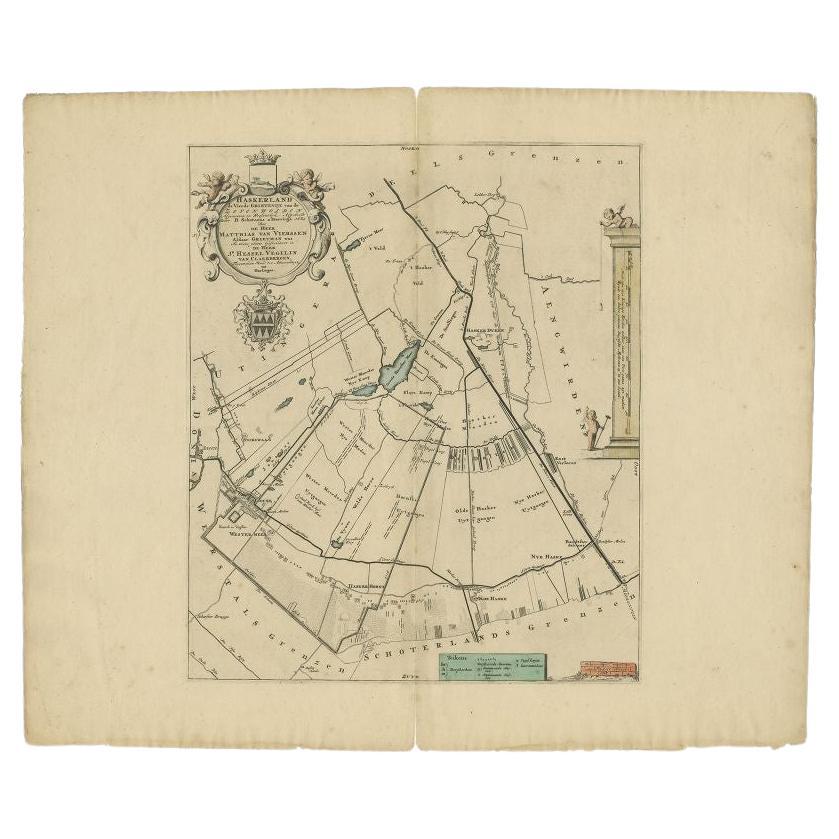
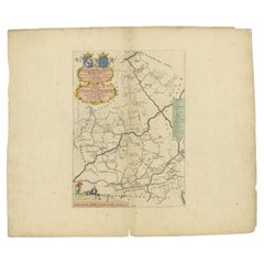
- Antique Map of the Haskerland Township 'Friesland' by Halma, 1718Located in Langweer, NLAntique map Friesland titled 'Haskerland, de vierde Grietenije van de Zevenwolden (..)'. Old map of Friesland, the Netherlands. This map depicts the region of Haskerland and includes...Category
Antique 18th Century Maps
MaterialsPaper

You May Also Like
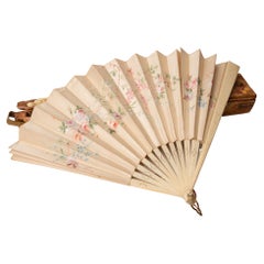
- Antique Fan in Its Antique BoxLocated in Alessandria, PiemonteHand painted antique fan in a special old wooden box decorated thirty years ago with decoupage by an Italian artist. The fan is perfect. From my private ...Category
Early 20th Century Italian Other Models and Miniatures
MaterialsSilk
- Antique Map of Principality of MonacoBy Antonio Vallardi EditoreLocated in Alessandria, PiemonteST/619 - "Old Geographical Atlas of Italy - Topographic map of ex-Principality of Monaco" - ediz Vallardi - Milano - A somewhat special edition ---Category
Antique Late 19th Century Italian Other Prints
MaterialsPaper
- 1718 Ides & Witsen Map "Route D'amsterdam a Moscow Et De La Ispahan Et GamronLocated in Norton, MA1718 Ides & Witsen map, entitled "Route D'Amsterdam A Moscow Et De La Ispahan Et Gamron," Ric.b005 Subject: Eastern Europe and Central Asia Period: 1718 (published) Publicati...Category
Antique Early 18th Century Dutch Maps
MaterialsPaper
- Geographical Antique Map of Principality of MonacoBy Bruno SantiniLocated in Alessandria, PiemonteST/609 - Interesting antique color map of Monaco Principality in French language : "Carte qui contient le Principauté de Piémont, le Monferrat et la comté de...Category
Antique Late 18th Century Italian Other Maps
MaterialsPaper
- 1861 Topographical Map of the District of Columbia, by Boschke, Antique MapLocated in Colorado Springs, COPresented is an original map of Albert Boschke's extremely sought-after "Topographical Map of the District of Columbia Surveyed in the Years 1856 ...Category
Antique 1860s American Historical Memorabilia
MaterialsPaper
- 1907 Map of Colorado, Antique Topographical Map, by Louis NellLocated in Colorado Springs, COThis highly detailed pocket map is a topographical map of the state of Colorado by Louis Nell from 1907. The map "has been complied from all availabl...Category
Antique Early 1900s American Maps
MaterialsPaper


Recently Viewed
View AllMore Ways To Browse
Netherlands 16th Century
Antique Furniture In Texas
Antique Maps Of England
Antique Map Of England
Antique Furniture North East
Natural History Curiosities
Antique United States Maps
Antique Map United States
Antique United States Map
United States Map Antique
Antique Western Collectibles
Antique Railroad
Railroad Antique
Antique Maps Of United States
Antique Collectible Bears
United States Map Vintage
United States Vintage Map
Amsterdam Map