Items Similar to Rare and Interesting Small Antique Woodcut Map of the Mediterranean


Want more images or videos?
Request additional images or videos from the seller
1 of 6
Rare and Interesting Small Antique Woodcut Map of the Mediterranean
About the Item
Very rare untitled antique woodcut map showing the region of the missionary journeys of Apostle Paul. It shows the Mediterranean with Greece, Asia Minor (Turkey), Northern Africa, Southern Italy and surroundings. With small legend including six islands (Samos and others). With descriptive text below the map.
This map originates from 'The Bishop's Bible' published in 1568. The Bishops' Bible is an English edition of the Bible which was produced under the authority of the established Church of England in 1568. It was substantially revised in 1572, and the 1602 edition was prescribed as the base text for the King James Version that was completed in 1611.
- Dimensions:Height: 5.63 in (14.3 cm)Width: 6.78 in (17.2 cm)Depth: 0.02 in (0.5 mm)
- Materials and Techniques:
- Period:
- Date of Manufacture:1568
- Condition:Image trimmed. General age-related toning. Minor wear. English text on verso. Please study image carefully.
- Seller Location:Langweer, NL
- Reference Number:
About the Seller
5.0
Platinum Seller
These expertly vetted sellers are 1stDibs' most experienced sellers and are rated highest by our customers.
Established in 2009
1stDibs seller since 2017
1,922 sales on 1stDibs
Typical response time: <1 hour
- ShippingRetrieving quote...Ships From: Langweer, Netherlands
- Return PolicyA return for this item may be initiated within 14 days of delivery.
More From This SellerView All
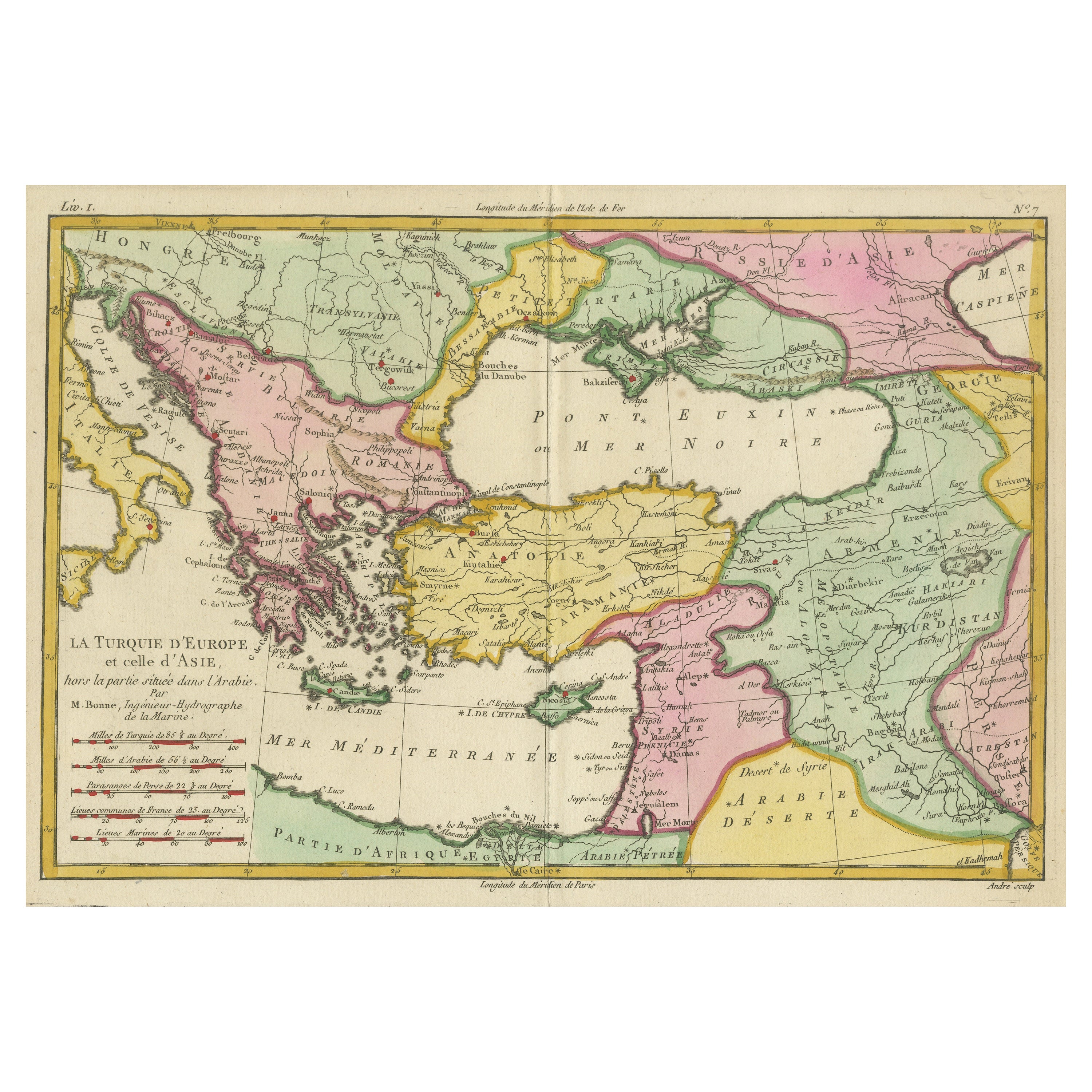
- Antique Map of the Eastern Mediterranean and the BalkansLocated in Langweer, NLAntique map titled 'La Turquie d'Europe et celle d'Asie'. Attractive double page map of the Eastern Mediterranean and the Balkans by R. Bonne. Originates from 'Atlas de Toutes les Pa...Category
Antique Late 18th Century Maps
MaterialsPaper
- Antique Map of the Eastern Mediterranean, C.1710Located in Langweer, NLAntique map Middle East titled 'De Beschryving van de Reysen Pauli en van de Andere Apostelen'. Antique map of the Eastern Mediterranean with det...Category
Antique 18th Century Maps
MaterialsPaper
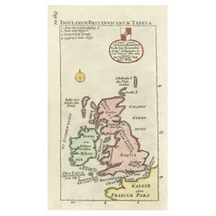
- Interesting Small Map of the British Isles with Hand ColoringLocated in Langweer, NLAntique map titled 'Insularum Britannicarum Tabula'. Interesting small map of the British Isles by Wells. This map originates from 'Oikumenes Periegesis, sive, Dionysii Geographia em...Category
Antique Early 18th Century Maps
MaterialsPaper
- Antique Map of Asia Minor, Cyprus, and the Eastern MediterraneanLocated in Langweer, NLAntique map titled 'Natoliae quae olim Asia Minor nova descriptio'. Original antique map of Asia Minor, Cyprus, and the eastern Mediterranean. Originally published on one sheet toget...Category
Antique Early 17th Century Maps
MaterialsPaper
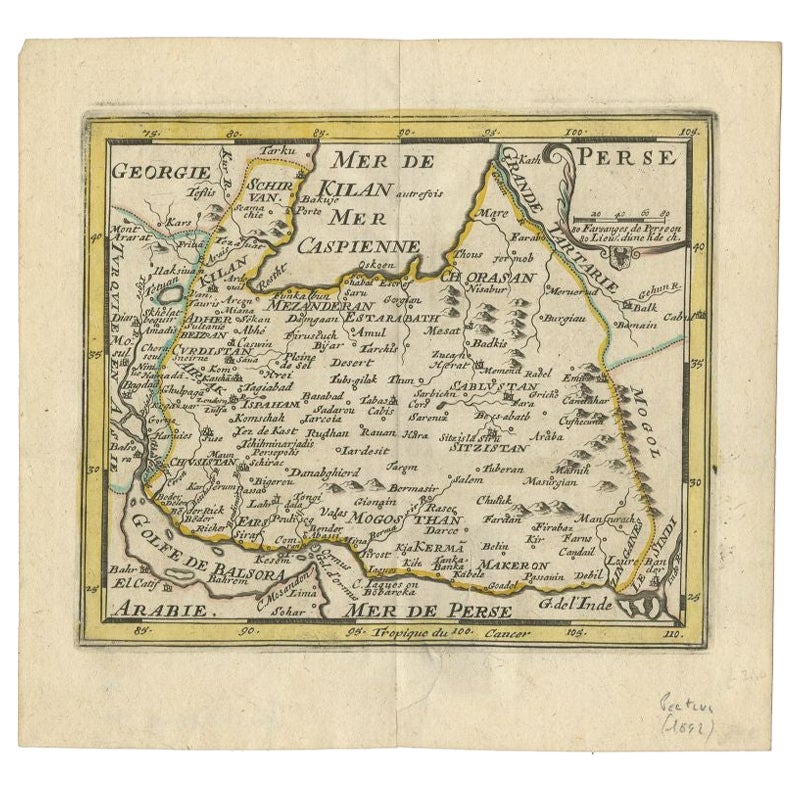
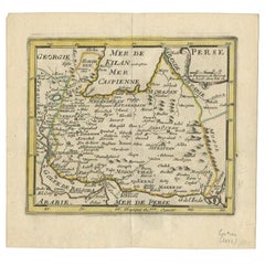
- Rare Small Antique Map of the Persian Empire, 1692Located in Langweer, NLAntique map titled 'Perse'. Small engraved map of the Persian Empire, decorated with a simple cartouche and armorial shield. This map originates from 'L'Atlas en Abrege, ou Nouvelle ...Category
Antique 17th Century Maps
MaterialsPaper
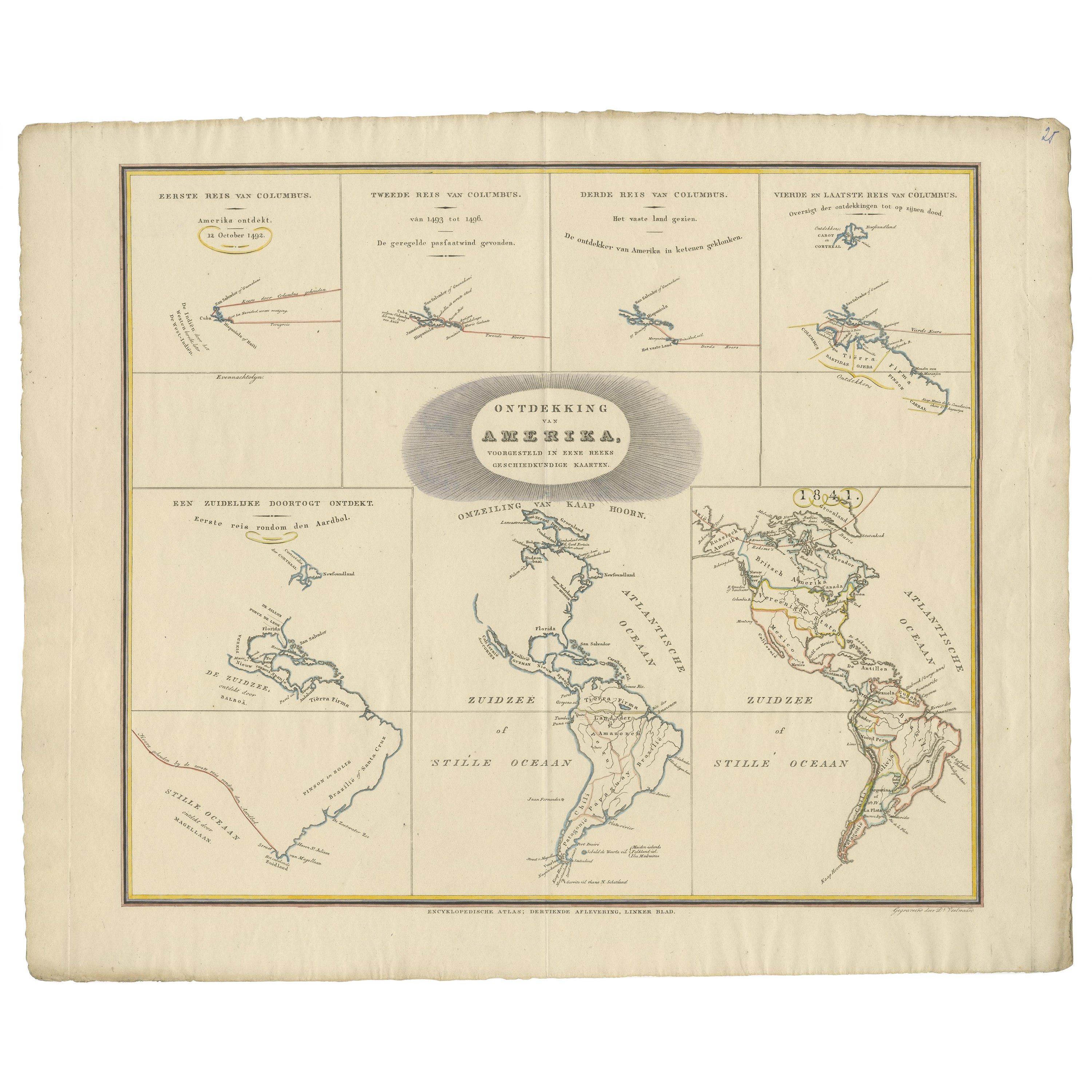
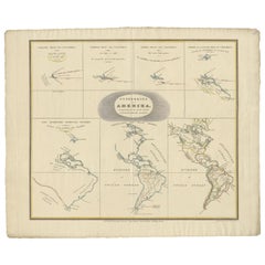
- Interesting Antique Map of the Development of the Mapping of the America's, 1841Located in Langweer, NLTitle: "De ontdekking van Amerika. Voorgesteld in eene reeks geschiedkundige kaarten". Collection of hand-colored engraved maps by D. VEELWAARD on 1 sheet, "Dertiende aflevering,...Category
Antique 1840s Maps
MaterialsPaper


You May Also Like
- Large Framed Map of the MediterraneanLocated in New York, NYLarge map/chart chart of The Mediterranean and the Grecian Archipelago showing Italy, Sardinia, Corsica, part of France, etc. in a black frame.Category
20th Century French Mid-Century Modern Maps
- Super Rare Antique French Map of Chine and the Chinese Empire, 1780Located in Amsterdam, Noord HollandSuper Rare Antique French Map of Chine and the Chinese Empire, 1780 Very nice map of Asia. 1780 Made by Bonne. Additional information: Type: Map ...Category
Antique 18th Century European Maps
MaterialsPaper
- 1861 Topographical Map of the District of Columbia, by Boschke, Antique MapLocated in Colorado Springs, COPresented is an original map of Albert Boschke's extremely sought-after "Topographical Map of the District of Columbia Surveyed in the Years 1856 ...Category
Antique 1860s American Historical Memorabilia
MaterialsPaper
- 1854 Map of Massachusetts, Connecticut and Rhode Island, Antique Wall MapLocated in Colorado Springs, COThis striking wall map was published in 1854 by Ensign, Bridgman & Fanning and has both full original hand-coloring and original hardware. This impression is both informative and highly decorative. The states are divided into counties, outlined in red, green, and black, and subdivided into towns. Roads, canals, and railroad lines are prominently depicted, although they are not all labeled. The mapmakers also marked lighthouses, banks, churches, and prominent buildings, with a key at right. The map is an informative and comprehensive overview of the infrastructural development of New England prior to the Civil War. Physical geographies depicted include elevation, conveyed with hachure marks, rivers and lakes. The impression features an inset map of Boston...Category
Antique 19th Century American Maps
MaterialsPaper
- Original Antique Map of the American State of Pennsylvania, 1889Located in St Annes, LancashireGreat map of Pennsylvania Drawn and Engraved by W. & A.K. Johnston Published By A & C Black, Edinburgh. Original colour Unframed. Repair to a minor tear on bottom edge.Category
Antique 1880s Scottish Victorian Maps
MaterialsPaper
- Original Antique Map of the American State of Washington, 1889Located in St Annes, LancashireGreat map of Washington Drawn and Engraved by W. & A.K. Johnston Published By A & C Black, Edinburgh. Original colour Unframed.Category
Antique 1880s Scottish Victorian Maps
MaterialsPaper


Recently Viewed
View AllMore Ways To Browse
Italian Maps
Antique English Island
Yorkshire Ridings Map
Pero India
Willem Jacobus Albert
Ottoman Map
Vintage Map Holder
Gambia Antique Map
Huge Vintage Map
Victor Levasseur On Sale
Gilded Stand 1600
Saudi Arabia Antique Map
Nova Totius
Antique Maps Of Kentucky
Antique Map Dordogne
Dc Map
Maps Rochester
Antique Maps Of West Virginia