17th Century Italy Map
6
to
24
138
21
150
127
38
23
19
17
16
8
4
3
2
2
2
2
2
1
1
1
1
1
1
1
1
1
1
1
1
27
10
6
5
3
Sort By
17th Century Nicolas Visscher Map of Southeastern Europe
Located in Hamilton, Ontario
, Visscher's maps are fundamental illustrations of the reasons for Dutch supremacy in mapmaking during the 17th
Category
Antique 17th Century Dutch Maps
Materials
Paper
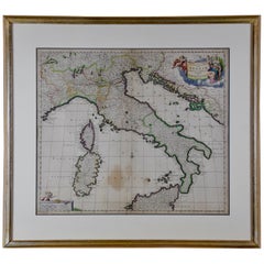
Italy, Sicily, Sardinia, Corsica and Dalmatian Coast: A 17th Century Dutch Map
By Theodorus Danckerts
Located in Alamo, CA
This hand colored 17th century Dutch map entitled "Novissima et Accuratissima totius Italiae
Category
Antique Late 17th Century Dutch Maps
Materials
Paper
H 18.13 in W 31.25 in D 1.38 in
"Nova Barbariae Descriptio", a 17th Century Hand-Colored Map of North Africa
By Johannes Janssonius
Located in Alamo, CA
This original attractive 17th century hand-colored map of North Africa entitled "Nova Barbariae
Category
Antique Mid-17th Century Dutch Maps
Materials
Paper
H 22.38 in W 29 in D 0.13 in
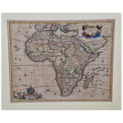
"Africae Accurata", a Hand-Colored 17th Century Map of Africa by Visscher
By Nicolaes Visscher II
Located in Alamo, CA
An 18th century hand-colored map of Africa entitled "Africae Accurata Tabula ex officina" by
Category
Antique Late 17th Century Dutch Maps
Materials
Paper
H 23.75 in W 28.13 in D 0.13 in
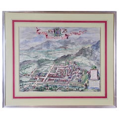
Dutch Map and City Plan of La Roche-sur-Foron, France, 17th Century Hand Colored
By Coenraet Decker
Located in Alamo, CA
(1599-1673) Theatrum Civitatum et Admirandorum Italiae (Town Book of Italy), depicting city views of
Category
Antique Late 17th Century Dutch Maps
Materials
Paper
H 27.75 in W 32.5 in D 0.07 in
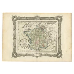
Antique Map of France at the Beginning of the 17th Century by Zannoni, 1765
By G. A. Rizzi-zannoni
Located in Langweer, NL
Antique map France titled 'Carte pour servir à intelligence de l'Histoire de France
Category
Antique 18th Century Maps
Materials
Paper
H 11.03 in W 15.75 in D 0 in
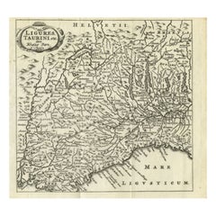
Antique Map of Northwest Italy by Cluver, 1685
Located in Langweer, NL
Antique map titled 'Ligures, Taurini, etc.' Miniature map of northwest Italy. From the pocket atlas
Category
Antique 17th Century Maps
Materials
Paper
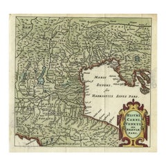
Antique Map of Northern Italy by Cluver, 1685
Located in Langweer, NL
Antique map titled 'Histri, Carni, Veneti item Rhaetiae Pars.' Charming miniature map of northern
Category
Antique 17th Century Maps
Materials
Paper
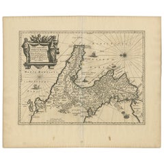
Antique Map of Southern Italy by Janssonius, C.1650
Located in Langweer, NL
primum de prica aerugine est abstersa (..)'. Beautiful map of Southern Italy, viewed from south to north
Category
Antique 17th Century Maps
Materials
Paper
Antique Map of Northern Italy by F. de Wit, 1690
Located in Langweer, NL
A very decorative map centered on Genua, and including the towns of Milan, Torino, Parma, Cremona
Category
Antique Late 17th Century Maps
Materials
Paper
Original Italian Antique Map of Asia Minor and Cyprus and Neighboring Regions
Located in Langweer, NL
century it was the best-known printing house in Rome.
For his maps, Giovanni worked with Giacomo
Category
Antique Late 17th Century Maps
Materials
Paper
H 19.02 in W 24.22 in D 0.02 in
Antique Map of the Region of Pavia, Lodi, Novara, Tortona & Alessandria, Italy
Located in Langweer, NL
Stato di Milano'. Original old map of the region of Pavia, Lodi, Novara, Tortona and Alessandria, Italy
Category
Antique Early 17th Century Maps
Materials
Paper
H 16.42 in W 21.54 in D 0.02 in
Antique Map of Piedmonte and Savoie 'Italy' by N. Visscher, circa 1683
Located in Langweer, NL
Antique map titled 'Regiae Celsitudinis Sabaudicae Status consistens in Sabaudiae ac Montisferrati
Category
Antique Late 17th Century Maps
Materials
Paper
H 20.79 in W 25.2 in D 0.02 in
Old Detailed Trade Route and Shipping Map from Italy to the Low Countries, c1671
Located in Langweer, NL
Antique map of Italy titled 'Carta Nova accurata del Passagio et strada dalli Peis Bassi per via de
Category
Antique 17th Century Maps
Materials
Paper
H 24.81 in W 20.08 in D 0 in
Antique Map of Italy, Corsica, Sardinia and Sicily, ca.1780
Located in Langweer, NL
Description: Antique map titled 'L'Italie.'
Map of Italy, Corsica, Sardinia and Sicily. Highly
Category
Antique 1780s Maps
Materials
Paper
Antique Map of the Area Around Venice in Italy by H. Hondius, circa 1606
By Jodocus Hondius, Gerard Mercator
Located in Langweer, NL
Attractive and early map of the area around Venice, Italy. With South-Tirol in the North, areas of
Category
Antique Early 17th Century Maps
Materials
Paper
H 16.93 in W 21.26 in D 0.02 in
Antique Map of Friesland by Guicciardini, 1613
Located in Langweer, NL
20th centuries. Buying and collecting antique maps is a tradition that goes back hundreds of years
Category
Antique 17th Century Maps
Materials
Paper
Antique Map of the Netherlands by Guicciardini, 1612
Located in Langweer, NL
authentic antique maps from the 16th to the 20th centuries. Buying and collecting antique maps is a
Category
Antique 17th Century Maps
Materials
Paper
Original Antique Map of Friesland by Guicciardini, 1612
Located in Langweer, NL
maps from the 16th to the 20th centuries. Buying and collecting antique maps is a tradition that goes
Category
Antique 17th Century Maps
Materials
Paper
Antique Map of the East Indies by Rossi, 1683
Located in Langweer, NL
-seventeenth century it was the best-known printing house in Rome. For his maps, Giovanni worked with Giacomo
Category
Antique 17th Century Maps
Materials
Paper
Antique Map of Gelderland and Overijssel by Guicciardini, 1613
Located in Langweer, NL
maps from the 16th to the 20th centuries. Buying and collecting antique maps is a tradition that goes
Category
Antique 17th Century Maps
Materials
Paper
Antique Map of Madagascar by N. Sanson, circa 1680
By Nicolas Sanson
Located in Langweer, NL
. Livio Sanuto was a mid-16th century Italian cosmographer and mathematician who contributed and was one
Category
Antique Late 17th Century Maps
Materials
Paper
Antique Map of North Africa by Ortelius, c.1600
Located in Langweer, NL
Antique map titled 'Barbariae et Biledulgerid nova descriptio'.
Old map of coastal North Africa
Category
Antique 17th Century Maps
Materials
Paper
Antique Map of Zaltbommel in the Netherlands, by Guicciardini, 1613
Located in Langweer, NL
authentic antique maps from the 16th to the 20th centuries. Buying and collecting antique maps is a
Category
Antique 17th Century Maps
Materials
Paper
Antique Map of the City of Kampen by Guicciardini, 1613
Located in Langweer, NL
antique maps from the 16th to the 20th centuries. Buying and collecting antique maps is a tradition that
Category
Antique 17th Century Maps
Materials
Paper
Antique Map of the City of Franeker by Guicciardini, 1612
Located in Langweer, NL
includes a wide range of authentic antique maps from the 16th to the 20th centuries. Buying and collecting
Category
Antique 17th Century Maps
Materials
Paper
Antique Map of the City of Zutphen by Guicciardini, 1613
Located in Langweer, NL
20th centuries. Buying and collecting antique maps is a tradition that goes back hundreds of years
Category
Antique 17th Century Maps
Materials
Paper
Antique Map of the City of Zutphen by Guicciardini, 1612
Located in Langweer, NL
antique maps from the 16th to the 20th centuries. Buying and collecting antique maps is a tradition that
Category
Antique 17th Century Maps
Materials
Paper
Antique Map of the City of Roermond by Guicciardini, 1613
Located in Langweer, NL
to the 20th centuries. Buying and collecting antique maps is a tradition that goes back hundreds of
Category
Antique 17th Century Maps
Materials
Paper
Antique Map of the City of Zwolle by Guicciardini, 1613
Located in Langweer, NL
to the 20th centuries. Buying and collecting antique maps is a tradition that goes back hundreds of
Category
Antique 17th Century Maps
Materials
Paper
Antique Map of the City of Franeker by Guicciardini, 1613
Located in Langweer, NL
centuries. Buying and collecting antique maps is a tradition that goes back hundreds of years. Antique maps
Category
Antique 17th Century Maps
Materials
Paper
Antique Map of the City of Leeuwarden by Guicciardini, 1613
Located in Langweer, NL
the 16th to the 20th centuries. Buying and collecting antique maps is a tradition that goes back
Category
Antique 17th Century Maps
Materials
Paper
Antique Map of Switzerland by N. Visscher, circa 1690
Located in Langweer, NL
Italy. This map features two decorative cartouches: the larger is flanked by two putti, one in military
Category
Antique Late 17th Century Maps
Materials
Paper
Antique Map of Friesland and Groningen in The Netherlands, 1616
Located in Langweer, NL
to the 20th centuries. Buying and collecting antique maps is a tradition that goes back hundreds of
Category
Antique 17th Century Maps
Materials
Paper
Antique Map of the City of Arnhem by Guicciardini, 1613
Located in Langweer, NL
Antique map titled ?Arnhemium Gelriae in Ripa Rheni Opp?. Plan of Arnhem in the province of
Category
Antique 17th Century Maps
Materials
Paper
Antique Map of the City of Enkhuizen by Guicciardini, 1625
Located in Langweer, NL
Antique map titled 'Die Stadt Enchuijsen, La ville denchuijsen'. Map of Enkhuizen, Noord-Holland
Category
Antique 17th Century Maps
Materials
Paper
Detailed Copper Engraved City Map of Enkuizen, the Netherlands, c.1620
By L. Guicciardini
Located in Langweer, NL
to the 20th centuries. Buying and collecting antique maps is a tradition that goes back hundreds of
Category
Antique 17th Century Maps
Materials
Paper
Antique Map of the City of Rotterdam by Guicciardini, C.1600
Located in Langweer, NL
includes a wide range of authentic antique maps from the 16th to the 20th centuries. Buying and collecting
Category
Antique 17th Century Maps
Materials
Paper
Loudun and Mirebeau: A Cartographic Masterpiece of 17th Century France by Blaeu
Located in Langweer, NL
Cartography, 17th century. Willem (1571-1638) and Joan Blaeu (1596-1673), Theatrum Orbis Terrarum
Category
Antique 1650s Maps
Materials
Paper
Free Shipping
H 20.08 in W 23.82 in D 0 in
Imperial Splendor: Antique Map of the Ottoman Empire by Blaeu, circa 1640
Located in Langweer, NL
publisher, circa 1640. The Blaeu family was renowned for producing high-quality maps during the 17th century
Category
Antique Mid-17th Century Maps
Materials
Paper
No Reserve
H 17.33 in W 21.54 in D 0.02 in
Antique Map of the City of Leuven, Belgium, with Original Coloring, 1609
Located in Langweer, NL
An original antique map titled "Lovanium Brabantiarum," which depicts the city of Leuven in Belgium
Category
Antique Early 17th Century Maps
Materials
Paper
H 11.74 in W 13.94 in D 0.02 in
Antique Map of Western Africa and the Cape Verde Islands by Coronelli, 1691
By Vincenzo Coronelli
Located in Langweer, NL
Antique map titled 'Bocche del Fiume Negro et Isole di Capo Verde'. Antique map of Western Africa
Category
Antique Late 17th Century Italian Maps
Materials
Paper
H 19.1 in W 25.99 in D 0.02 in
Antique Map of the City of Leeuwarden, The Netherlands, by Guicciardini, 1612
Located in Langweer, NL
to the 20th centuries. Buying and collecting antique maps is a tradition that goes back hundreds of
Category
Antique 17th Century Maps
Materials
Paper
H 11.82 in W 14.97 in D 0 in
Antique Map of the Region of Calais and The Vermandois Region by Ortelius
Located in Langweer, NL
authentic antique maps from the 16th to the 20th centuries. Buying and collecting antique maps is a
Category
Antique 17th Century Maps
Materials
Paper
H 17.33 in W 22.84 in D 0 in
Antique Plan of Duinkerke or Dunkirk in France by Guicciardini, 1612
Located in Langweer, NL
maps from the 16th to the 20th centuries. Buying and collecting antique maps is a tradition that goes
Category
Antique 17th Century Maps
Materials
Paper
Antique Plan of Emden in Germany by Guicciardini, 1612
Located in Langweer, NL
authentic antique maps from the 16th to the 20th centuries. Buying and collecting antique maps is a
Category
Antique 17th Century Maps
Materials
Paper
Antique Plan of the Siege of Grave by Guicciardini, c.1608
Located in Langweer, NL
antique maps from the 16th to the 20th centuries. Buying and collecting antique maps is a tradition that
Category
Antique 17th Century Maps
Materials
Paper
Original Antique Sea Chart of the Northern Part of Hispaniola, Western Cuba
Located in Langweer, NL
Antique map titled 'Pas kaart van de Noord Kust van Espaniola (..)'. Beautiful sea chart of the
Category
Antique Late 17th Century Maps
Materials
Paper
H 21.26 in W 24.02 in D 0.02 in
Lyonnais, Beaujolais, Forez, Mâconnais: A 1644 Depiction of France's Provinces
Located in Langweer, NL
family, comprising Willem Janszoon, Cornelis, and Joan, were preeminent figures in 17th-century
Category
Antique 1640s Maps
Materials
Paper
Free Shipping
H 20.08 in W 23.82 in D 0 in
17th Century Dutch Map of Italy, Sicily, Sardinia, Corsica and Dalmatian Coast
By Theodorus Danckerts
Located in Alamo, CA
This hand colored 17th century Dutch map entitled "Novissima et Accuratissima totius Italiae
Category
1690s Prints and Multiples
Materials
Engraving
H 18.13 in W 31.25 in D 1.38 in
Large Italian Baroque 17th century Painted Cabinet Fitted with Drawers
Located in Troy, NY
ornate gilt bronze hardware. Perfect to store large prints, maps or documents.
Interior measurements of
Category
Antique 17th Century Italian Baroque Cabinets
Materials
Softwood
AYX Map of Aix en Provence, France by J. Blaeu 17th c.
By Joan (Johannes) Blaeu
Located in Paonia, CO
seventeenth century. Blaeu the younger published during his life three town-books of Italy: Citta del Vaticano
Category
Late 17th Century Other Art Style Landscape Prints
Materials
Engraving
Old Testament Plates - Original Etching by Antonio Tempesta - 17th Century
By Antonio Tempesta
Located in Roma, IT
Old Testament plates is a wonderful black and white set of prints realized by the Italian master
Category
17th Century Modern Figurative Prints
Materials
Etching
H 21.66 in W 29.73 in D 0.79 in
Plates of Old Testament- Etching by Antonio Tempesta - 17th Century
By Antonio Tempesta
Located in Roma, IT
Plates of Old Testament is a wonderful black and white set of prints realized by the Italian master
Category
17th Century Modern Figurative Prints
Materials
Etching
H 25.6 in W 33.47 in D 0.6 in
Hunting Scene - Original Etching by Antonio Tempesta - Early 17th Century
By Antonio Tempesta
Located in Roma, IT
laid paper, realized by the Italian master, Antonio Tempesta (1555-1630).
Monogramm on plate on lower
Category
Early 17th Century Baroque Figurative Prints
Materials
Etching
H 8.04 in W 10.83 in D 0.08 in
Dutch Map and City Plan of La Roche-sur-Foron, France, 17th Century Hand Colored
By Coenraet Decker
Located in Alamo, CA
(1599–1673) Theatrum Civitatum et Admirandorum Italiae (Town Book of Italy), depicting city views of
Category
1680s Prints and Multiples
Materials
Engraving
H 27.75 in W 32.5 in D 0.75 in
Italian Contemporary Handcolored Old Map Printed Rough Canvas "Planisphere"
Located in Scandicci, Florence
Beautiful reproduction of an antique English map showing th Planisfere, with astral hemisfere
Category
21st Century and Contemporary Italian Prints
Materials
Cotton, Paper
H 50.4 in W 55.12 in D 0.12 in
Map of Methoni - Etching by George Braun - Late 16th Century
Located in Roma, IT
This Map of Methoni is an etching realized by George Braun (1541 – 1622)
The state of
Category
17th Century More Prints
Materials
Etching
H 6.89 in W 19.1 in D 0.04 in
Italian Contemporary Handcolored Old Map Printed Rough Canvas "Astral Hemisper"
Located in Scandicci, Florence
the 17th century.
We can see with what mastery of joints and vivid colours the author depicts stars
Category
21st Century and Contemporary Italian Prints
Materials
Cotton, Paper
H 34.65 in W 38.98 in D 0.12 in
Italian Contemporary Handcolored Old Map Printed on Canvas "The Americas"
Located in Scandicci, Florence
Beautiful reproduction of an antique map showing th Planisfere, with continets, lands and their
Category
21st Century and Contemporary Italian Prints
Materials
Cotton, Paper
H 31.5 in W 44.49 in D 0.12 in
- 1
Get Updated with New Arrivals
Save "17th Century Italy Map", and we’ll notify you when there are new listings in this category.
17th Century Italy Map For Sale on 1stDibs
Find many varieties of an authentic 17th century Italy map available at 1stDibs. Frequently made of paper, every 17th century Italy map was constructed with great care. There are many kinds of the 17th century Italy map you’re looking for, from those produced as long ago as the 18th Century to those made as recently as the 21st Century. A 17th century Italy map is a generally popular piece of furniture, but those created in styles are sought with frequency. A well-made 17th century Italy map has long been a part of the offerings for many furniture designers and manufacturers, but those produced by Theodorus Danckerts and Vincenzo Coronelli are consistently popular.
How Much is a 17th Century Italy Map?
The average selling price for a 17th century Italy map at 1stDibs is $813, while they’re typically $450 on the low end and $1,475 for the highest priced.
More Ways To Browse
Antique Map Drawer Cabinet
Antique Leather Top Hat Box
Antique Wooden Horse On Wheels
Antique Map Of Cuba
Cuba Antique Map
Antique Cuba Map
Antique Maps Of Cuba
Great Lakes Maps
Antique Moon Map
Antique Map Of The Moon
Large Cp1
Pool Wall Fountains
Algeria Antique Map
Church Iron Gates
French Dormer Window
Antique Malta Map
Antique Maps Of Malta
Opera V1

